
Why Lorcher Werth stands out
Lorcher Werth is best known as a protected Rhine island complex that combines the legal status of a German nature reserve with that of a European Habitats Directive site in the Upper Middle Rhine. It represents an unusual example of active floodplain forest restoration in the Middle Rhine, where earlier plantations of hybrid poplars and black locust are being phased out in favor of natural Auwald and shoreline habitats.
Lorcher Werth history and protected-area timeline
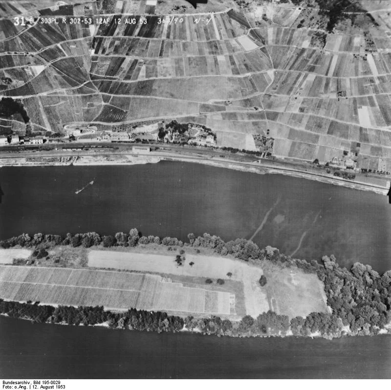
Lorcher Werth has a layered modern history that combines local land use, a large-scale memorial plan, and a long-running ecological restoration story. In earlier decades the interior of the Großen Lorcher Werth housed a small vineyard, a drinking-water pumping station, and at times even a football pitch, reflecting how the flat island was repurposed for various practical uses despite its location in the active river channel.
In the mid-1920s, the islands were caught up in a much larger plan connected to the nearby Niederwalddenkmal above Rüdesheim. Architect Karl Wach designed a colossal 'Reichsehrenmal' for the dead of the First World War, envisioning a stadium capable of holding around 100,000 people and connected by a 'Heilige Straße' to a monumental stone sarcophagus on the island. The economic collapse of the late 1920s made the project impossible, the plans were quietly abandoned, and the islands returned to a quieter existence embedded in the working Middle Rhine.
In the more recent past, the islands were planted with hybrid poplars and black locust as managed forest stands. Over time, conservation managers re-evaluated these plantations as ecologically unsuitable for a Rhine floodplain, and a long-term program was set up to gradually remove them and encourage more natural Auwald and self-sustaining riverbank habitats.
Mid-twentieth-century aerial photographs of the Federal German Archives show both the larger and smaller Lorcher Werth before their full conversion into a protected area, providing a reference point for how substantially their character has shifted toward a protected floodplain landscape.
Lorcher Werth landscape and geographic character
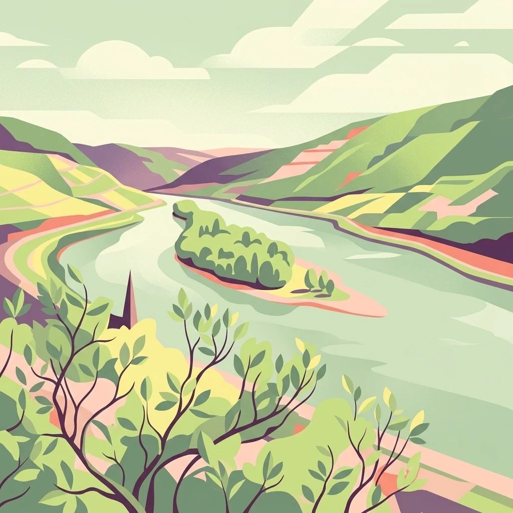
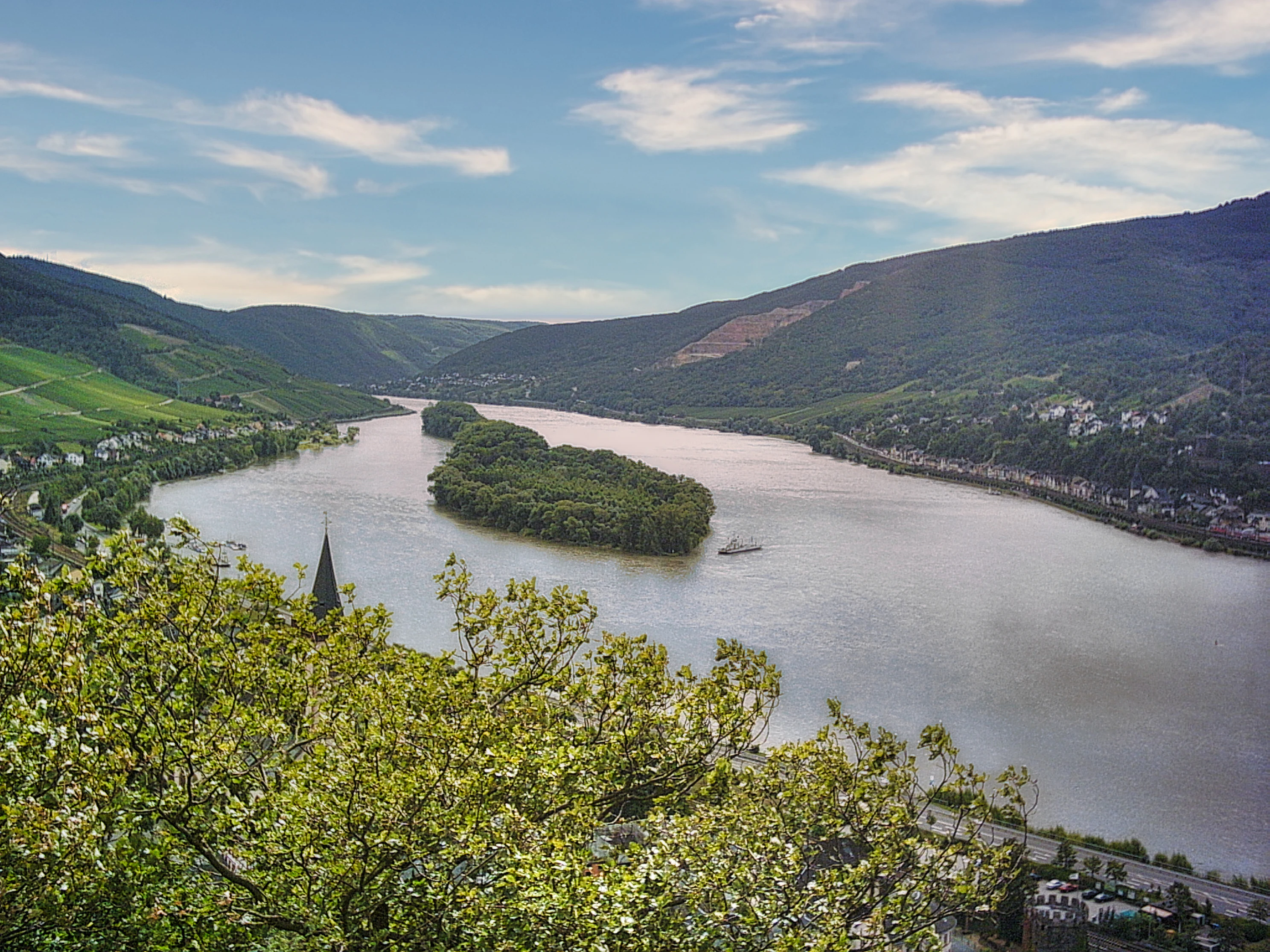
Lorcher Werth forms a low, elongated interruption in an otherwise steep and narrow river corridor. The islands sit in the Middle Rhine valley, where the surrounding hills rise sharply on both sides and are densely covered with vineyards, settlements, and forest. By contrast, the Werth itself is almost completely flat, with the highest point reaching only about 76 meters above sea level.
The two islands are linked by a guiding dam (Leitdamm) that influences how the main current and the narrower side channels divide around them. Their combined length is nearly two kilometers, with widths of up to around 150 meters, and at high water much of the surface is inundated. This creates a soft, dynamic landscape of sand and silt banks, shallow flooded zones, and low forest edges, very different from the rocky Rhine Gorge scenery that visitors usually associate with the Middle Rhine further upstream and downstream.
Lorcher Werth ecosystems, habitats, and plant life
Ecologically, Lorcher Werth is treated as a valuable floodplain island complex within a heavily engineered river. Its nature reserve and FFH status reflect the importance of its riverbank habitats and its developing floodplain forest.
Earlier generations of foresters planted the islands with hybrid poplars and black locust, both fast-growing species that were valued for timber but are not characteristic of natural Rhine floodplain forests. The current conservation objective is to gradually remove these planted trees and encourage a more natural Auwald, a classic softwood floodplain forest of willows, poplars, and alders, along with naturally structured river margins. The aim is to let the river itself shape the islands more, restoring a more authentic riparian character within the Middle Rhine corridor.
Lorcher Werth conservation status and protection priorities
Lorcher Werth carries a double layer of protection. It is designated as a Naturschutzgebiet under German nature conservation law, and it is simultaneously an FFH-Gebiet, a site listed under the European Union Habitats Directive, both of which place it in a tier of protections designed to maintain and restore valuable habitats.
Beyond legal designation, the site is unusual within the Upper Middle Rhine because it has been deliberately set aside from public access, reflecting a recognition that even small river islands can hold disproportionate ecological value when surrounded by intensively used riverbanks, vineyards, and shipping lanes. The long-term conservation aim is to shift the islands from their earlier role as a managed poplar and locust plantation into a more natural Auwald with self-sustaining shorelines, making Lorcher Werth a small but meaningful piece of floodplain restoration within the broader Middle Rhine UNESCO cultural landscape context.
Lorcher Werth cultural meaning and human context
Lorcher Werth sits just a few kilometers from the Niederwalddenkmal, one of the most recognizable national monuments in Germany, and was briefly imagined in the 1920s as the site of an even larger memorial to the First World War. The unrealized Reichsehrenmal project, with its planned stadium and 'Heilige Straße' to a stone sarcophagus on the island, is an interesting, if largely forgotten, episode of early Weimar-era memorial culture along the Rhine, halted by the economic crisis of the late 1920s.
More quietly, the islands reflect everyday regional land use, including the modest vineyard, water-pumping station, and football pitch that shaped the larger island in earlier decades. These traces anchor Lorcher Werth in the practical working landscape of the Middle Rhine, even as the islands themselves are now closed to entry and managed primarily for ecological restoration.
Top sights and standout views in Lorcher Werth
A protected Rhine island group combining national nature reserve status with European Habitats Directive protection.
Two flat, low-lying islands connected by a guiding dam in the Middle Rhine between Lorch and Niederheimbach, an uncommon configuration among the Middle Rhine's Werth islands.
An ongoing transformation from earlier hybrid poplar and black locust plantations into a more natural Auwald and naturally structured river shoreline.
Uninhabited and closed to public access, offering a quiet refuge for floodplain habitats within an otherwise intensively used Rhine cultural landscape.
A notable but unrealized 1920s memorial plan tied to the nearby Niederwalddenkmal, remembered mainly through scattered historical references and archival aerial photographs.
Best time to visit Lorcher Werth
Lorcher Werth itself is a protected area closed to public access and cannot be entered by visitors, so there is no direct seasonal visiting experience on the island. For those interested in the surrounding Middle Rhine landscape between Lorch and Niederheimbach, late spring through early autumn typically offers the most stable weather, clearer river views, and the fullest expression of the valley's vineyard terraces and forested slopes, though winter and spring flood periods also shape the islands and are part of what defines the Werth's dynamic floodplain character.