Why Mahaba Island Protected Landscape and Seascape stands out
Mahaba Island Protected Landscape and Seascape is best known as a coastal Philippine reserve that combines a small, low-lying island with its surrounding sea into a single protected unit. Its defining features are mangrove forests dominated by Rhizophora (bakauan), pagatpat, and pototan species, an interior vegetation cover shaped by coconut palms, and a bird-dominated island wildlife community. The reserve also stands out as part of the broader Caraga region network of protected areas, sitting alongside better-known sites such as the Siargao Islands Protected Landscape and Seascape and the Agusan Marsh Wildlife Sanctuary. For visitors and researchers interested in Philippine coastal and marine conservation, Mahaba exemplifies the country's model of protecting entire islands together with their surrounding waters rather than focusing on terrestrial habitats alone.
Mahaba Island Protected Landscape and Seascape history and protected-area timeline
Mahaba Island Protected Landscape and Seascape was established through Proclamation 2152, issued by the Philippine government on December 29, 1991. The proclamation designated the entirety of Mahaba Island, together with its surrounding marine waters, as a protected area under the national framework for environment and natural resource management.
In 1992, the Philippine Congress enacted Republic Act 7586, the National Integrated Protected Areas System (NIPAS) Act, which established a unified legal framework for managing the country's protected areas. Mahaba Island was later recognized under Article 5d of this law, formally integrating it into the NIPAS system. This step anchored the island's protection status within the broader national strategy for biodiversity conservation, and aligned its management with the standards applied to other Philippine protected landscapes and seascapes.
The timing of the proclamation places Mahaba Island among a wave of protected-area designations issued in the Philippines during the early 1990s, when the government expanded its conservation portfolio across marine and island environments. Its continued recognition under NIPAS reflects its enduring role within the country's network of coastal and marine reserves.
Mahaba Island Protected Landscape and Seascape landscape and geographic character
The landscape of Mahaba Island Protected Landscape and Seascape is defined by extraordinarily low elevation and a strong marine influence. The highest point on the island itself is only about one meter above sea level, which means the terrain is essentially flat and coastal. This makes the island's topography more akin to a raised sand cay or low coral island than a typical inland landmass, and reinforces the importance of the surrounding sea in shaping the protected area's overall character.
The soils of the island are characterized as a combination of infertile sandy substrates and clay-like material. These conditions are unfavorable for most intensive agriculture but support vegetation adapted to nutrient-poor, well-drained coastal ground. The island's shoreline is fringed by mangroves, the most conspicuous landscape feature, dominated by species of Rhizophora (locally called bakauan), pagatpat, and pototan.
Inland from the mangroves, the vegetation shifts into sparse forest patches dominated by coconut palms. This interior coconut forest is not a dense tropical rainforest but rather a sparse, light-dominated cover typical of small Philippine islands where soil quality and exposure limit tree growth. Together, the mangrove fringe, the open coconut interior, and the surrounding marine waters describe a layered coastal landscape in which land and sea are functionally inseparable.
Mahaba Island Protected Landscape and Seascape ecosystems, habitats, and plant life
The protected area's ecological identity is shaped by the meeting of marine, mangrove, and low-island terrestrial habitats. Because the island is so flat and its soils are nutrient-poor, the richest biological communities are concentrated along the shoreline and in the sea. The mangrove fringe represents one of the most ecologically productive parts of the reserve, hosting both mangrove vegetation and the marine fauna that depend on these root systems for shelter and feeding grounds.
Further inland, the vegetation community is dominated by coconut palms rather than closed-canopy forest, giving the interior of the island a semi-open character. This vegetation type is well known across the Philippine archipelago and supports a particular set of plants and animals adapted to periodic disturbance, salt spray, and shallow soils.
The surrounding marine waters are an essential part of the reserve's ecological value. By including substantial sea area within its boundaries, the protected area gives formal recognition to coral, seagrass, and open-water habitats that may exist around the island. Although specific marine communities are not detailed in available sources, the design of the protected area clearly assumes a tight ecological linkage between mangrove, nearshore, and offshore environments.
Mahaba Island Protected Landscape and Seascape wildlife and species highlights
The wildlife of Mahaba Island is dominated by birds, which are the most visible group of animals on the island. The combination of mangrove habitat, open coconut interior, and adjacent marine waters creates conditions used by a wide range of bird species, including shorebirds that frequent the coast and seabirds that use the surrounding waters. This makes Mahaba Island an interesting site within the regional context of Philippine island birdlife.
Mangrove ecosystems such as those found on Mahaba Island typically support a diverse community of fish, crustaceans, and mollusks during their juvenile stages, even if these animals are not always obvious to casual visitors. The mangrove root systems serve as nursery habitat, while the adjacent marine waters extend these ecological connections outward.
Because the island's interior is dry, sandy, and largely covered by coconut palms rather than dense forest, mammal and large vertebrate diversity is expected to be limited. The wildlife profile of the reserve is therefore best understood through its bird populations and the marine fauna that benefit from the mangrove and seascape elements of the protected area.
Mahaba Island Protected Landscape and Seascape conservation status and protection priorities
Mahaba Island Protected Landscape and Seascape is important from a conservation perspective because it preserves a representative example of a low-lying Philippine island together with its surrounding marine environment under a single legal designation. The inclusion of marine waters within the reserve reflects the increasingly accepted understanding that island ecosystems cannot be effectively conserved without also managing the seas around them.
The reserve is part of the National Integrated Protected Areas System (NIPAS) established by Republic Act 7586, which provides the overarching framework for managing the country's protected landscapes and seascapes. Mahaba Island's status under Article 5d of the NIPAS Act gives it formal standing alongside better-known reserves such as the Siargao Islands Protected Landscape and Seascape and the Agusan Marsh Wildlife Sanctuary.
By protecting mangrove forests dominated by Rhizophora and related species, the park also contributes to broader coastal-conservation objectives such as shoreline stabilization, fisheries support, and biodiversity protection. Although the island's soils are infertile and its elevation minimal, these very qualities make it an important natural laboratory for understanding how low Philippine island ecosystems function and how they can be preserved as part of a national conservation network.
Top sights and standout views in Mahaba Island Protected Landscape and Seascape
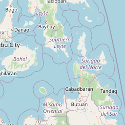
Mahaba Island is a compact but ecologically layered reserve where a flat, sandy island and a surrounding expanse of sea are protected together. Key highlights include the mangrove fringe dominated by bakauan, pagatpat, and pototan, the open coconut-palm interior forest, the bird-dominated island wildlife, and the protected marine waters that connect the island to the broader coastal ecosystem of Surigao del Norte. As one of the protected areas in the Caraga region, Mahaba Island also illustrates the Philippine approach of combining landscape and seascape protection in a single integrated reserve.
Best time to visit Mahaba Island Protected Landscape and Seascape
Mahaba Island Protected Landscape and Seascape lies in a tropical Philippine coastal setting, where weather and sea conditions shape the experience of visiting any small island reserve. The dry season months generally offer calmer seas, clearer skies, and easier access to island and marine habitats, making them a natural period for activities such as birdwatching along the coast and exploring the mangrove and nearshore environments. The wetter months bring heavier rain and rougher seas, which can make island landings and marine observation more difficult but may also enhance the lushness of vegetation and the activity of coastal wildlife.