
Mori Atlas logo
Nature reserveMahnerter Bachtal

Understanding the mapped landscape boundaries and habitat diversity of this vital Rhine-Ruhr nature reserve

Mahnerter Bachtal: A Protected Lowland Stream Valley and Ecological Corridor in Germany

Mahnerter Bachtal serves as a distinct ecological corridor within the heavily urbanized Mettmann district of North Rhine-Westphalia. The reserve protects a complex, narrow mosaic of lowland valley habitats ranging from alder-ash riparian forests and sedge marshes to mature beech and oak woodlands. By preserving these near-natural stream sections and wet-foot habitats, the area functions as a critical refuge for local flora and fauna, illustrating how protected landscapes maintain connectivity amidst intense metropolitan infrastructure.

stream valleyriparian forestbeech forestoak forestwet meadowssedge marsh
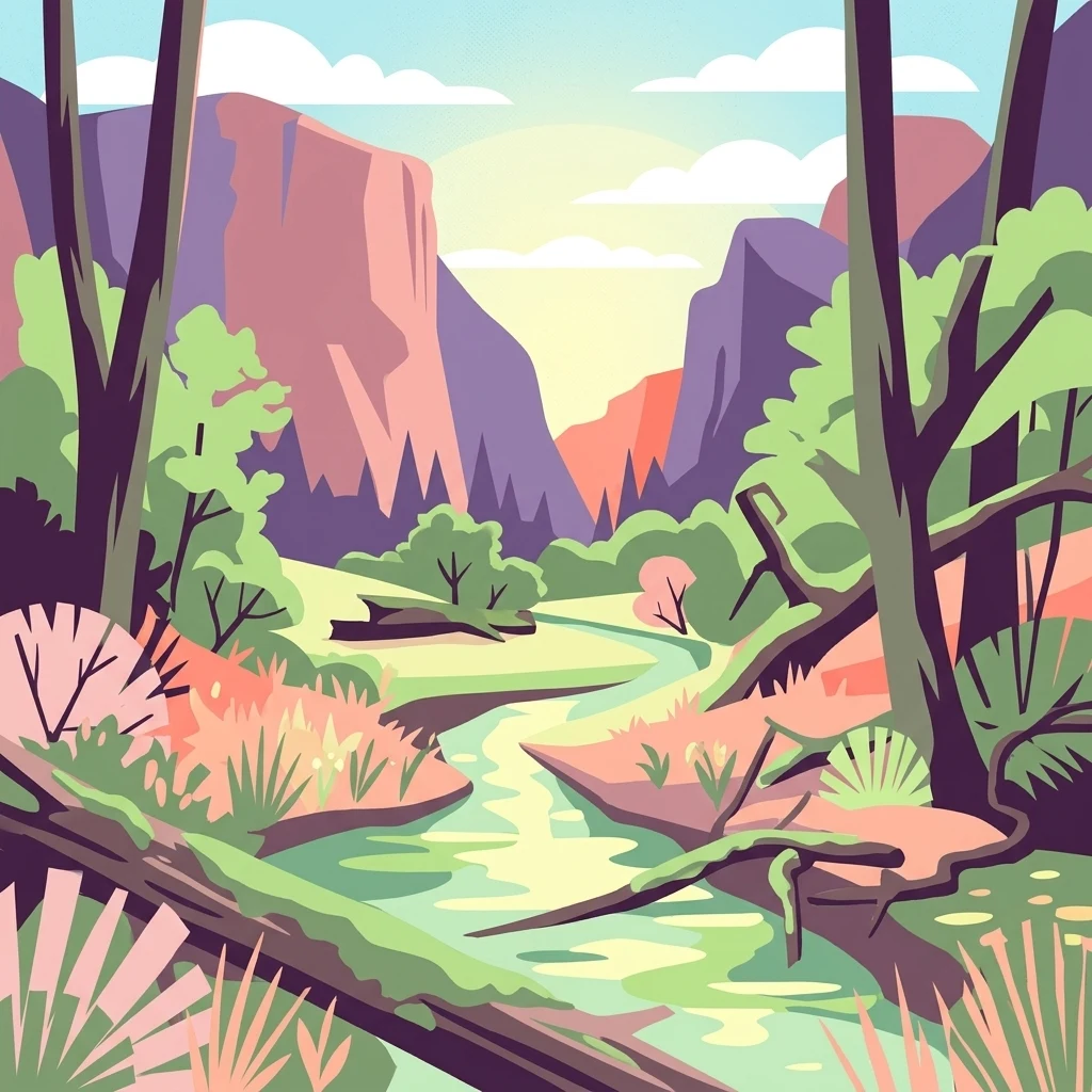
Digital illustration of a lush valley with a winding stream, framed by silhouetted trees in the foreground and steep cliffs under a sunrise sky.

Mahnerter Bachtal

Nature reserve

Park overview

Structured park overview, official facts, and landscape profile for Mahnerter Bachtal Nature Reserve

Mahnerter Bachtal Nature Reserve park facts, protected area profile, and essential visitor context

Review the core facts for Mahnerter Bachtal Nature Reserve, including designation, size, terrain, visitor scale, habitats, and operating context in one park-focused overview.

About Mahnerter Bachtal Nature Reserve

Mahnerter Bachtal is a narrow, elongated nature reserve in North Rhine-Westphalia that protects a small stream valley on the southern edge of the city of Erkrath. Although it occupies only about 28 hectares, the reserve is ecologically rich, framing the Mahnerter Bach with a varied sequence of wetlands, gallery forests, and broadleaved woodlands. Its location near the A 46 motorway and a suburban district makes it an unusual example of a functioning, near-natural valley ecosystem surviving within the Rhine-Ruhr metropolitan region.

The reserve is shaped by the contrast between its two halves. In the western section, forest clearly dominates. Sloping valley sides are covered with seminatural beech and oak-beech mixed woodland in which individual veteran trees reach roughly 120 centimetres in trunk diameter. Where the brook has cut down into the local bedrock, it exposes stony beds rich in characteristic bryophyte communities, and the surroundings carry a clear stream-valley atmosphere. In the eastern section the landscape opens into a more traditional mosaic of extensively grazed grassland, hedgerows, and small woods, still bearing the imprint of the historic cultural landscape.

Throughout the reserve, the Mahnerter Bach itself remains the central ecological thread. Some sections have been piped or straightened in the past and now show the legacy of those interventions, but other reaches are genuinely close to natural. The brook is lined by alder and ash gallery woods, and in the western part of the reserve these trees frame a sizeable sedge marsh and tall-herb fen. Near the centre of the area stands the historic Mahnertermühle inn and mill, above which a formerly managed millpond has silted up, become overgrown, and now holds an additional wet woodland character with a small spring brook feeding into it.

Landslides, seepage lines, and small lateral valleys create additional micro-relief within the reserve. On one steep, shaded rock and slope section near the mill, the rare hart's-tongue fern grows, although it is increasingly pressed by invasive Japanese knotweed. Sandy and gravelly brook beds, deadwood in the forests, ivy on floodplain trees, and patches of wet meadow and reed bed round out the habitat diversity within this very confined space.

Quick facts and research context for Mahnerter Bachtal Nature Reserve

Mahnerter Bachtal is a formally designated nature reserve classified under IUCN Category IV, focused on habitat and species management. It carries the official German designation ME-040 and is listed in the World Database on Protected Areas under WDPA ID 164546.

The reserve lies south-east of the Erkrath-Hochdahl district, just north of the A 46 motorway and east of the A 46/A 535 interchange Haan-West. The boundary is fixed by the Wuppertal to Solingen railway line in the east and the district road K 16 to the west. It is part of the landscape plan of the Mettmann district and administered by the lower landscape authority of the Mettmann district (Untere Landschaftsbehörde).

Protection and recognition

Documented conservation records and official protected area designations

Mahnerter Bachtal Protection Status and International Recognition Data

Mahnerter Bachtal holds documented protected area status within global conservation databases alongside registered geographic identifiers. Official records compile administrative tracking details and management framework data without implying external awards.

Protection details

WDPA ID
164546
Park context

Deeper park guide and search-rich context for Mahnerter Bachtal Nature Reserve

Mahnerter Bachtal Nature Reserve history, landscape, wildlife, and travel context

Explore Mahnerter Bachtal Nature Reserve through its history, landscape character, ecosystems, wildlife, conservation priorities, cultural context, and seasonal travel timing in a structured park guide built for atlas discovery and search intent.

Why Mahnerter Bachtal Nature Reserve stands out

Mahnerter Bachtal is best known for preserving a near-natural lowland stream valley within the densely populated Rhine-Ruhr metropolitan region. Despite its small size, the reserve maintains a finely textured mosaic of brook, alder swamp forest, litter meadows, sedge marsh, and beech-oak mixed forest that is rare in such a heavily urbanised setting. The reserve is also valued as an important bat hunting ground and as a refuge for breeding birds tied to the traditional open cultural landscape with hedgerows, small woods, and unimproved grassland. Its role as a small-scale east-west ecological corridor, squeezed between motorway, railway, and settlement, gives it disproportionate regional conservation significance.
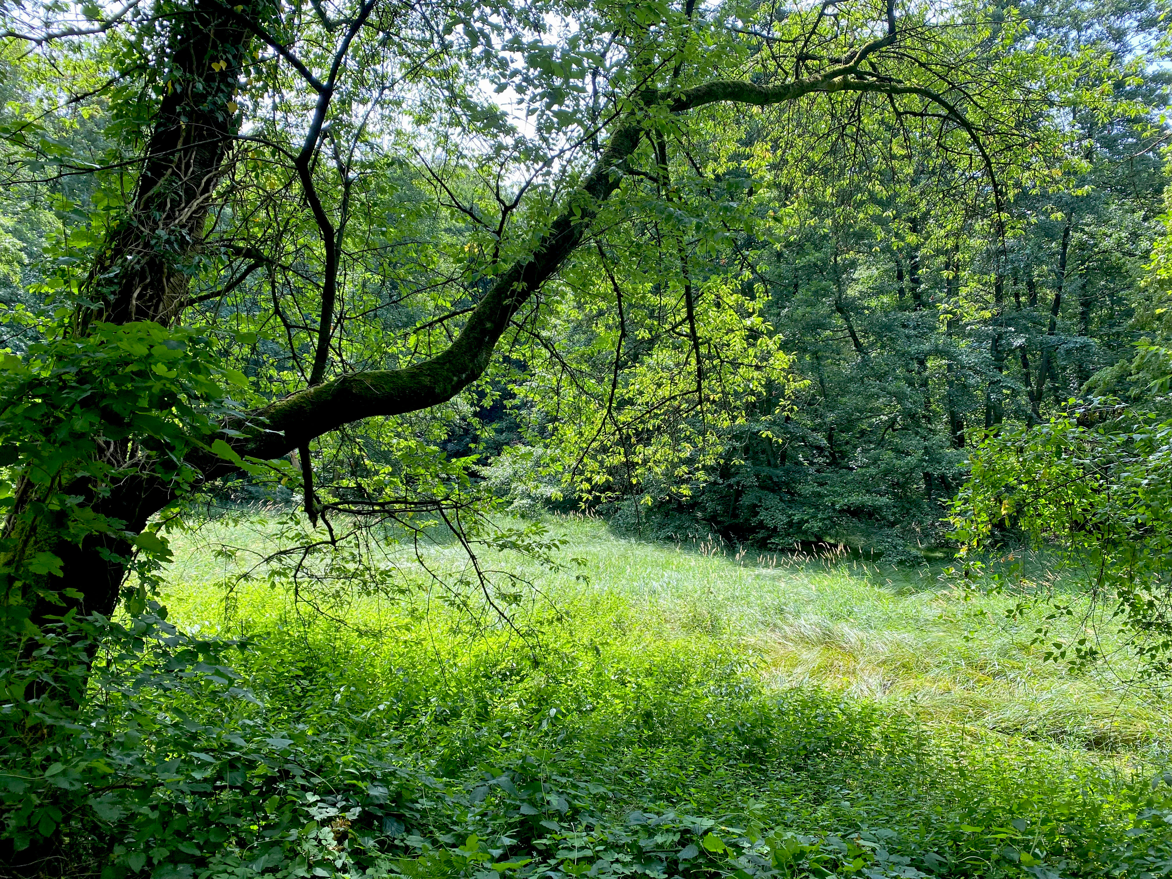
A vibrant green meadow surrounded by thick forest, with a large, low-hanging tree branch in the foreground providing shade.
A lush, green meadow bordered by dense forest within the Mahnerter Bachtal nature reserve.

Mahnerter Bachtal Nature Reserve history and protected-area timeline

Mahnerter Bachtal was first formally designated as a nature reserve in 1997. The protected area was subsequently incorporated into the landscape plan (Landschaftsplan) of Kreis Mettmann in 2012, which set out the longer-term framework for its management and protection.

Historically, the valley has been shaped by long-standing human use. The land around the Mahnerter Bach was once managed as grassland, and the river was in places piped, diverted, or forced into artificial channels to support that use. The old mill at the centre of the reserve, around which the Mahnertermühle inn later developed, is a reminder of this milling heritage, and the abandoned millpond above it now forms a small wetland within the site. Cattle are still used for relatively extensive grazing on parts of the valley today, sitting in the middle of a story that moves from intensive agricultural reshaping towards a gradually restored, nature-led valley landscape.

Mahnerter Bachtal Nature Reserve landscape and geographic character

The landscape of Mahnerter Bachtal is that of a narrow, sharply incised lowland valley in the Bergisches Land region. Elevations within the reserve range roughly from 99 to 149 metres above sea level, giving the valley a modest but clearly perceptible relief that creates distinct wet-foot and slope habitats. The Mahnerter Bach runs through the centre, sometimes hidden under heavy alder cover, sometimes exposed over sandy and stony beds where it has eroded into the local bedrock.

The western half of the reserve is the most wooded, with valley flanks dominated by mature sessile oak and beech mixed forests that include old individual trees with trunks up to roughly 120 centimetres in diameter. One short, steep section near the mill is geologically and botanically notable for exposing bedrock that supports characteristic stream bryophyte communities and rare ferns such as hart's-tongue fern. The eastern half of the reserve, by contrast, opens into a gently undulating agricultural landscape: small fields, extensive cattle pasture, hedgerows, and scattered copses, threaded by the brook and its tributary wet dells. North of the main axis there is at least one pronounced side valley, the Unten im Feld / Am Jungenbusch depression, which extends the habitat mosaic laterally beyond the brook corridor itself.
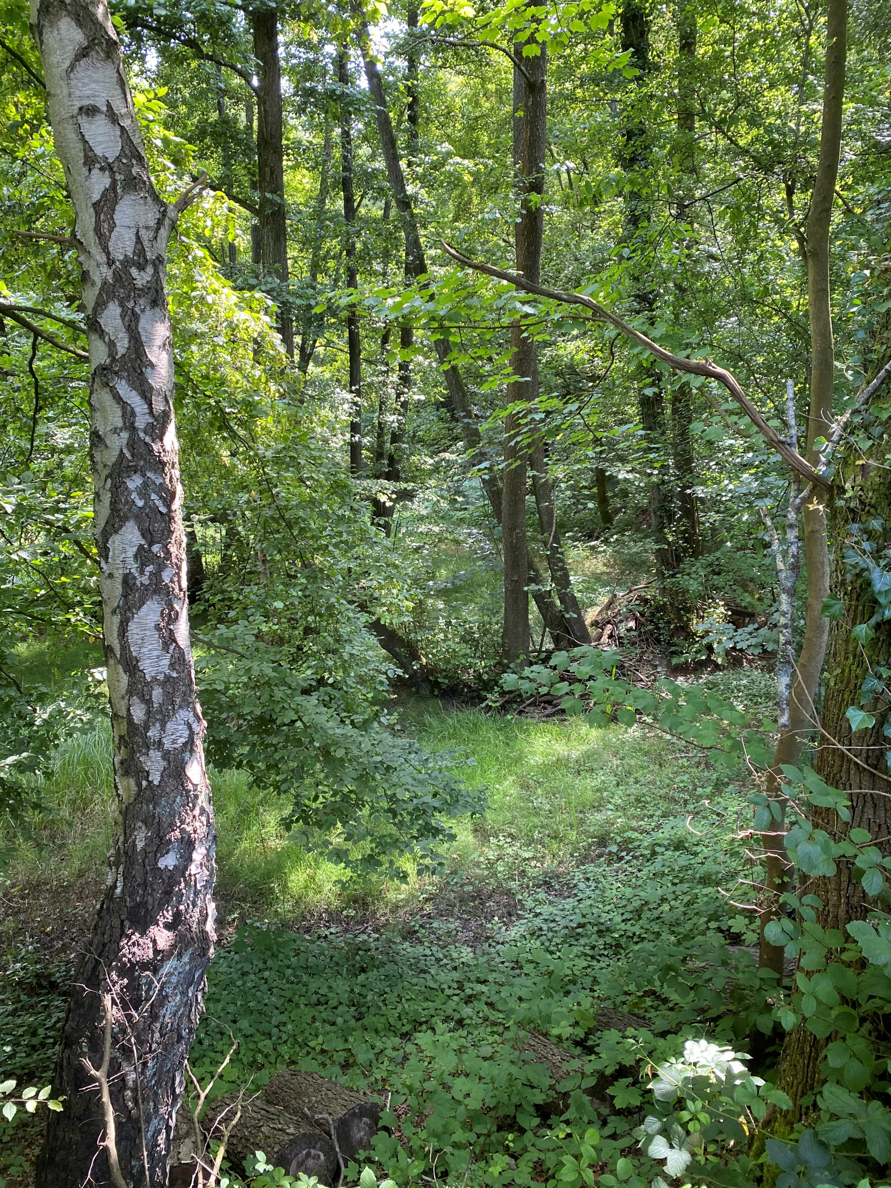
A dense green forest with a prominent birch tree in the foreground and dappled sunlight filtering through the canopy.
A lush, green riparian forest section within the Mahnerter Bachtal nature reserve.

Mahnerter Bachtal Nature Reserve ecosystems, habitats, and plant life

Ecologically, Mahnerter Bachtal functions as a small but unusually complete valley wetland complex. Its core is the near-natural Mahnerter Bach with its alder and ash bankside forests, which together form a textbook riparian habitat alongside sedge marsh, tall-herb fen, wet meadow, spring seepage areas, and small ponds.

The surrounding slopes support seminatural broadleaved forest that is unusual in its region. Hainstein-beach and oak-beach mixed woods with old trees, deadwood, and a continuous canopy are the dominant forest type, and the reserve's protected designation under IUCN Category IV recognises its role as a managed habitat and species area rather than as a strictly untouched wilderness.

The mix of meadow, hedges, small woodland patches, and flowing water produces a richly structured biotope mosaic in a small footprint. This mosaic is increasingly important in a regional landscape that is heavily fragmented by motorway, railway, fields, and suburban development.
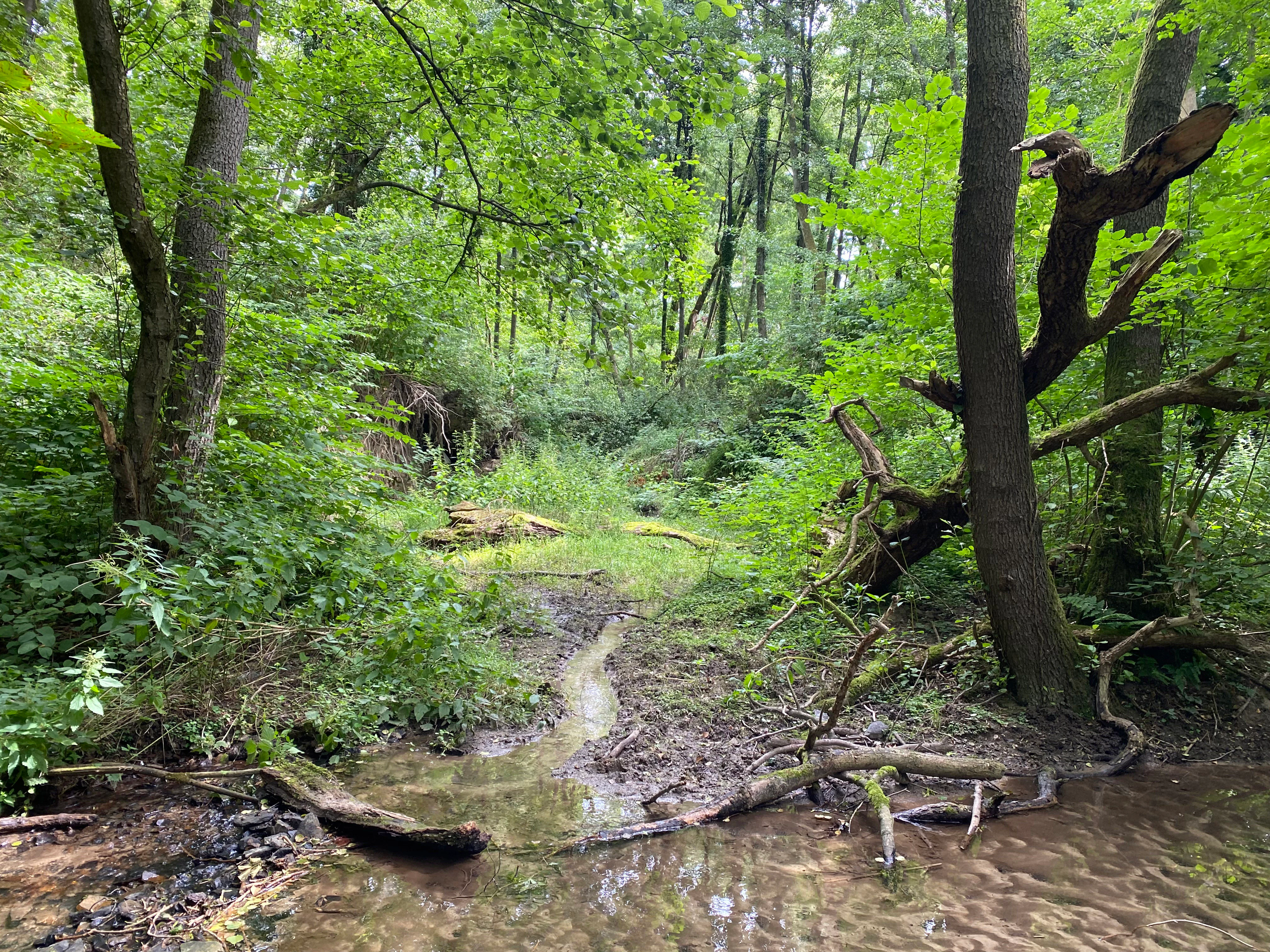
A small stream flowing through a dense, green deciduous forest with a fallen tree trunk in the foreground.
A shaded stream winding through the lush forest of Mahnerter Bachtal.

Mahnerter Bachtal Nature Reserve wildlife and species highlights

The reserve is of particular value for bat conservation. The combination of mature woodland, structurally rich edges, and a stream corridor provides a high-quality foraging area for several bat species of conservation concern, including common noctule (Großer Abendsegler) and other locally threatened species.

It is also an important breeding and foraging area for bird species tied to the open cultural landscape with hedgerow and grove structures, such as species typically associated with farmland dotted with trees, small copses, and unimproved grassland. Deadwood in the forests is highlighted as particularly important for insects and for the birds that depend on them. The floodplain forests, sedge beds, and wet meadows support a range of moisture-dependent fauna, although the reserve is smaller and more enclosed than a typical large-scale wilderness site and therefore favours species adapted to smaller valley habitats.

Invasive species are part of the local fauna story: Japanese knotweed, in particular, is expanding into the steep shaded rock habitat of the hart's-tongue fern and is recognised as a pressing management challenge for the reserve.
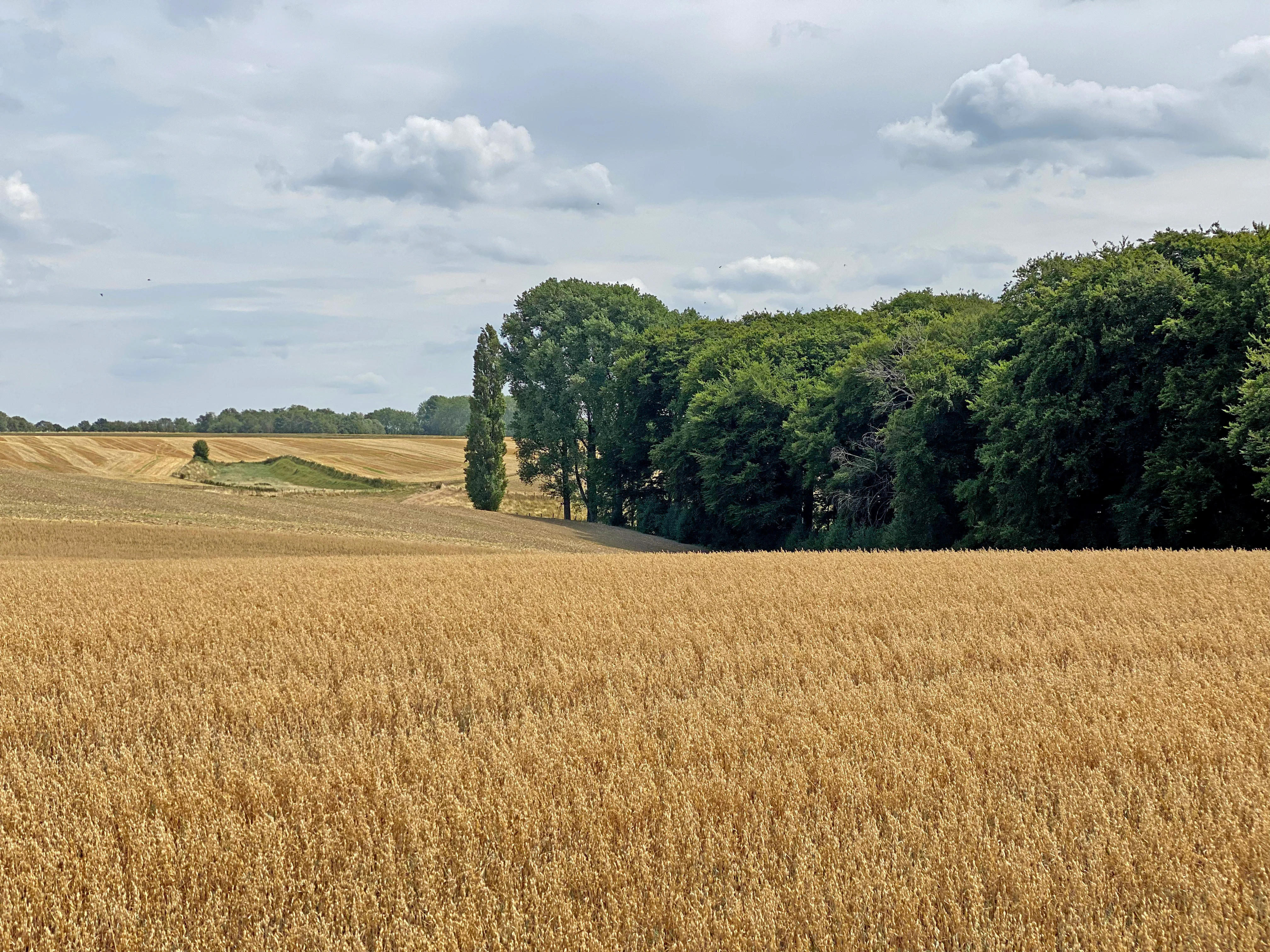
A wide view of a golden wheat field in the foreground, with a dense green forest and a tall, thin poplar tree in the midground under a cloudy sky.
A golden grain field bordering the forest edge in the Mahnerter Bachtal nature reserve.

Mahnerter Bachtal Nature Reserve conservation status and protection priorities

Mahnerter Bachtal is protected because of the unusually high habitat diversity it manages to compress into a very small area within one of Germany's most heavily settled regions. Its near-natural stream sections, protected wetland habitats, and richly structured biotope mosaic provide refuges for species that have largely disappeared from the wider surrounding landscape of roads, suburban development, and intensive farmland.

The reserve has clear regional importance for biotope connectivity, running broadly east to west through a landscape otherwise broken up by major transport corridors. By maintaining a continuous corridor of woodland, brook, and wet meadow, it enables movement and dispersal for bats and other valley-associated species across a heavily fragmented region.

Conservation objectives for the reserve centre on continuing to improve the structural quality of the brook, maintaining a near-natural and largely unmanaged approach to the woodland, and keeping grassland use extensive rather than intensive. The management plan explicitly discourages clearcutting and emphasises that existing damage from past channel straightening and piping should continue to recover through natural processes.

Mahnerter Bachtal Nature Reserve cultural meaning and human context

The valley carries a strong but understated cultural history. The name itself, and the central mill building (Mahnertermühle), reflect a long tradition of harnessing the small Mahnerter Bach for water power, milling, and the agricultural use of the valley floor. The legacy of that history is visible in the form of straightened or piped stream sections and a now-derelict millpond that has gradually reverted to wet woodland.

The surrounding cultural landscape, especially in the eastern part of the reserve, retains the pattern of small fields, cattle pasture, hedgerows, and isolated small woods that is characteristic of the Bergisches Land and of older central European mixed farming systems. Today, cattle are still used to graze parts of the valley extensively, providing a thread of continuity between past land use and present conservation management, although the share of flower-rich low-intensity grassland remains modest and is a target for gradual improvement.
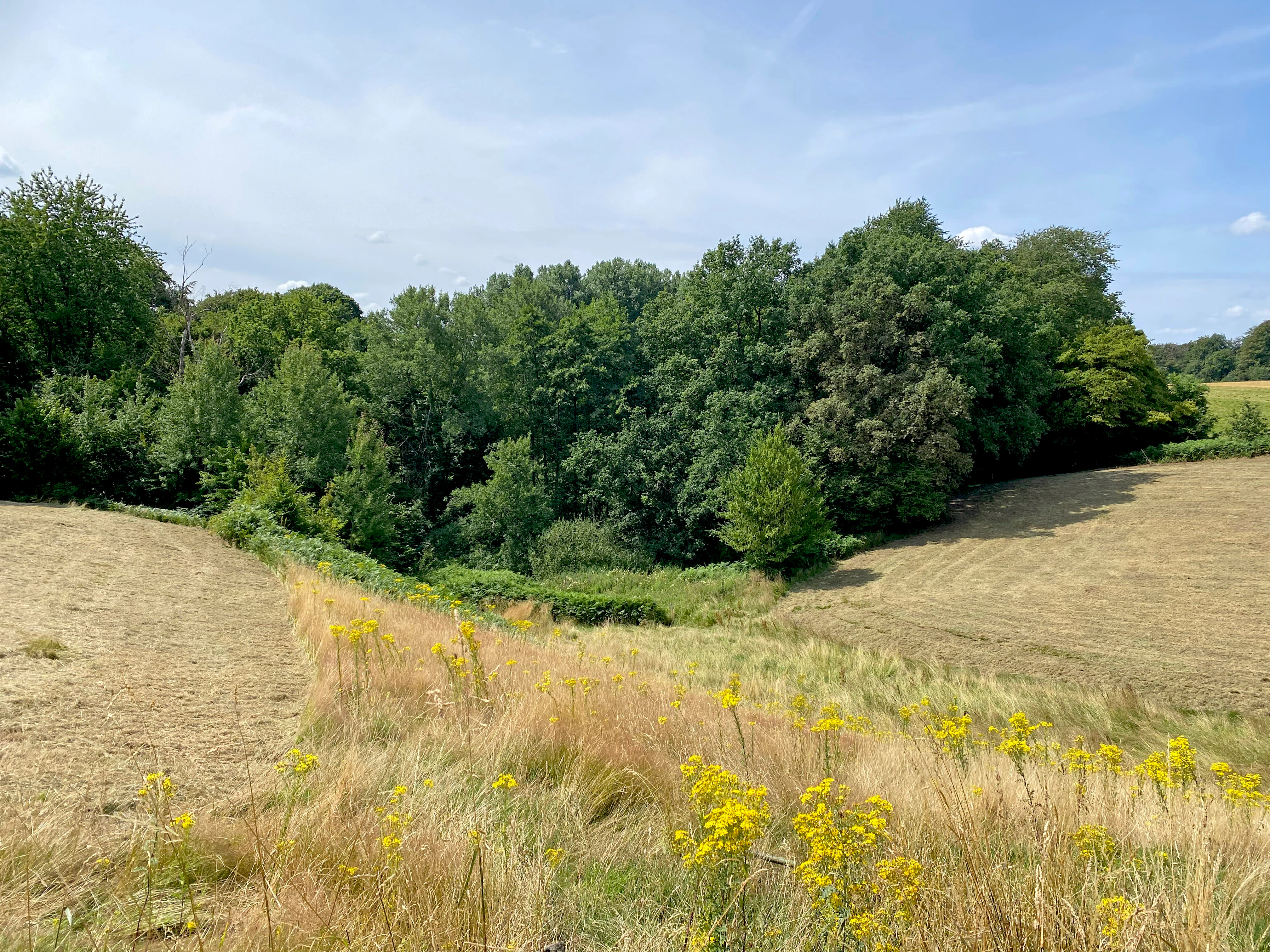
A view overlooking a meadow with harvested grass and yellow wildflowers in the foreground, leading to a dense line of trees in the background under a blue sky.
A meadow and forest edge in the Mahnerter Bachtal nature reserve.

Top sights and standout views in Mahnerter Bachtal Nature Reserve

A narrow yet habitat-rich valley reserve protecting near-natural stream sections, alder-ash gallery forest, beech-oak mixed forest with old trees, sedge marsh, wet meadows, and seepage zones within the densely populated Rhine-Ruhr region.
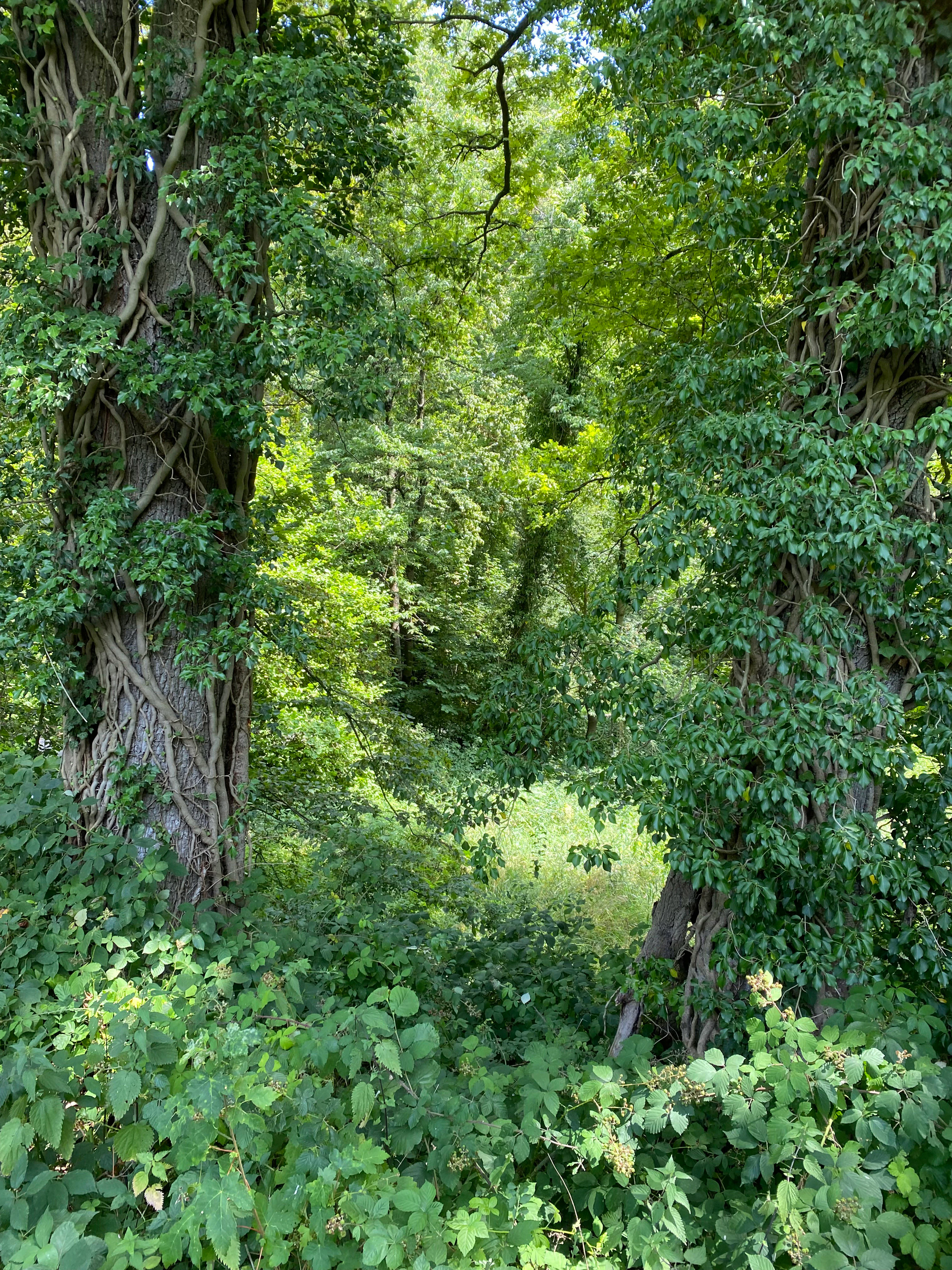
Two large, mature tree trunks heavily covered in climbing ivy stand in the foreground, framing a path into a lush, green riparian forest.
Ivy-covered trees frame a view of the dense riparian forest in Mahnerter Bachtal.

Best time to visit Mahnerter Bachtal Nature Reserve

The reserve can be visited year-round, but light, leafless conditions in late winter and early spring are particularly favourable for appreciating the valley relief, the brook's structure, and the wetland habitats. Spring and early summer are the most rewarding seasons for typical valley-floor flora such as marsh marigold, yellow flag iris, meadowsweet, and marsh yarrow in the wet meadows and sedge beds, while late spring and early summer are also a good period to look for bat activity at dusk in and around the woodland edge. Late summer and autumn offer a calmer atmosphere, with forest colour, fungoid interest in the beech-oak woods, and minimal visitor pressure; visitors should note that paths are deliberately routed to keep disturbance low, so it is best experienced as a quiet, observant walk rather than a high-traffic outing.

Monthly climate preview

Review measured monthly temperature swings and precipitation averages across the protected terrain

Mahnerter Bachtal Climate Normals and Long-Term Temperature Patterns

Long-term representative records reveal a steady annual progression of average minimum and maximum temperatures alongside consistent monthly precipitation values for Mahnerter Bachtal. Deeper monthly climate comparisons provide complete twelve-month statistical profiles derived from historical point measurements.
Annual mean10 °C
1 °C19 °C
Jan
Feb
Mar
Apr
May13°
Jun17°
Jul19°
Aug19°
Sep15°
Oct10°
Nov
Dec
Warmest month
July

19.2 °C

Coolest month
January

1.3 °C

Wettest month
December

2.6 mm/day

Driest month
April

1.6 mm/day

Park location guide

Geography guide, regional context, and park location map for Mahnerter Bachtal Nature Reserve

Mahnerter Bachtal Nature Reserve park geography, regions, and map view in Germany

Understand where Mahnerter Bachtal Nature Reserve sits in Germany through a broader geographic reading of the surrounding landscape, nearby location context, and its mapped position within the national park landscape.

How Mahnerter Bachtal Nature Reserve fits into Germany

Germany is a federal republic in Western and Central Europe with a population of over 83 million across sixteen constituent states. It is Europe's largest economy by nominal GDP and a major global exporter and importer. The capital is Berlin, and the country borders Denmark, Poland, Czech Republic, Austria, Switzerland, France, Luxembourg, Belgium, and the Netherlands.

Wider geography shaping Mahnerter Bachtal Nature Reserve in Germany

Germany is located in Western and Central Europe, spanning 357,022 km². It borders Denmark to the north, Poland and the Czech Republic to the east, Austria and Switzerland to the south, and France, Luxembourg, Belgium, and the Netherlands to the west. The country has coastlines on the Baltic Sea and North Sea to the north, with the Alps located in the southern region.

Map view of Mahnerter Bachtal Nature Reserve

Use this park location map to pinpoint Mahnerter Bachtal Nature Reserve in Germany, understand its exact geographic position, and read its mapped placement within the surrounding landscape more clearly.

Pigeon | © OpenStreetMap contributors

Location context for Mahnerter Bachtal Nature Reserve

North Rhine-Westphalia

Explore the visual character of riparian forests, stream valleys, and rare woodland habitats.

Mahnerter Bachtal Photos and Landscape Scenery: Visualizing the Protected Valley

Visual documentation of Mahnerter Bachtal reveals the intricate terrain, mature broadleaved woodlands, and winding stream corridors defining the protected valley. Examining these habitat photographs provides a clear understanding of regional conservation features and lowland ecology.

A vibrant green meadow surrounded by thick forest, with a large, low-hanging tree branch in the foreground providing shade.

A cluster of yellow iris flowers with long, blade-like green leaves growing in shallow water at the edge of a stream.

A dense green forest with a prominent birch tree in the foreground and dappled sunlight filtering through the canopy.

A small stream flowing through a dense, green deciduous forest with a fallen tree trunk in the foreground.

A wide view of a golden wheat field in the foreground, with a dense green forest and a tall, thin poplar tree in the midground under a cloudy sky.

A wide, outdoor landscape shot of a dry, grassy valley under a bright blue sky with scattered clouds. The foreground features yellow wildflowers and dry, golden grasses on a gentle slope. In the midground, the terrain dips into a small valley area with patches of green vegetation, leading to distant trees and a field on the horizon.

A view overlooking a meadow with harvested grass and yellow wildflowers in the foreground, leading to a dense line of trees in the background under a blue sky.

Two large, mature tree trunks heavily covered in climbing ivy stand in the foreground, framing a path into a lush, green riparian forest.

A small, shallow stream with a sandy bed flows through a dense, green forest with trees and shrubs overhanging the water.

A small stream flows through a lush, green forest with several fallen, moss-covered logs lying across the shallow, rocky waterbed.

Park atlas

Compare regional valley reserves, riparian woods, and connected wildlife corridors.

Explore Other Parks Near Mahnerter Bachtal and Surrounding Protected Landscapes

Browse protected areas near Mahnerter Bachtal to evaluate similar stream valleys, riparian forests, and lowland nature reserves across the surrounding region. Continuing the geographic comparison reveals broader habitat connectivity and regional conservation patterns beyond a single protected strip.
A horizontal watercolor painting of a calm stream flowing through a grassy valley with distant hills and scattered trees under a soft, pink-tinted sky.
Nature reserveKreis Mettmann
About 0.7 km away#1 closest

South

Hühnerbachtal Nature Reserve: Geography and Protected Landscape in Kreis Mettmann

Mapped stream valley ecosystems and local habitat connectivity.

Hühnerbachtal protects a unique valley mosaic in Germany, characterized by floodplain forests and steep wooded slopes. The reserve maintains a critical biotope network near Haan, offering a deep look into the regional geography and protected terrain of the Mettmann district.

Area
0.244 km²
Established
1997
IUCN
IV
Watercolor painting of a meandering stream flowing through a green meadow, with trees in the background.
Nature reserveNordrhein-Westfalen
About 2.6 km away#2 closest

Southwest

Hildener Stadtwald, Bereich Sandbach-Krebsbach Protected Nature Reserve and Wetland Geography

A mapped overview of the Bergische Heideterrasse riparian corridor.

Hildener Stadtwald, Bereich Sandbach-Krebsbach stands as an important nature reserve within the urbanised landscape of North Rhine-Westphalia. The area is characterized by its hydrologically dynamic sandy brooks, old-growth alder stands, and distinct microhabitats ranging from wet heath to dry oak-birch forests. This protected entity offers a clear look at the structural complexity of lowland mire ecosystems within a broader regional forest context.

Area
0.27 km²
Established
1938
IUCN
IV
Relief
Lowland
A horizontal watercolor illustration showing a landscape with sparse trees, grasses, and soft pastel colors representing a heathland habitat.
Nature reserveNordrhein-Westfalen
About 2.6 km away#3 closest

Southwest

Hildener Heide, östlich Taubenberg: Protected Nature Reserve and Heathland Atlas

Mapping the ecological landscape in Nordrhein-Westfalen

Hildener Heide, östlich Taubenberg is a distinct nature reserve in the Mettmann district, notable for its intact wet heath and bog asphodel populations. This protected area contributes to a wider forest and heath network across the Bergische Heideterrasse, showcasing how active conservation management shapes unique lowland terrain.

Area
2 km²
Established
1993
IUCN
IV
A soft watercolor painting of a small grove of trees standing near a body of water, featuring pale green and yellow tones.
Nature reserveNordrhein-Westfalen
About 3 km away#4 closest

South

Naturschutzgebiet Hildener Heide, südlich Sandberg: Protected Area and Landscape Atlas

Bog woodland and wet heathland geography in North Rhine-Westphalia.

Examine the topography and habitat mosaic of Naturschutzgebiet Hildener Heide, südlich Sandberg. This nature reserve serves as an important ecological anchor on the Bergische Heideterrasse, preserving rare wetland, alder bog forest, and heath vegetation within a compact and structurally diverse geographic footprint.

Area
0.08 km²
Established
1938
IUCN
IV
Relief
Lowland
Watercolor illustration showing a wide landscape with rolling hills in soft pink and purple tones, a line of green conifer and deciduous trees, and a grassy foreground with a winding path or stream
Nature reserveNordrhein-Westfalen
About 3.3 km away#5 closest

South

Hildener Heide, Schönholz Nature Reserve: Geography and Protected Area Context

A preserved mosaic of inland heath and bog forest habitats.

Hildener Heide, Schönholz provides a critical window into the rare wetland ecosystems of the Bergische Heideterrasse. This nature reserve in North Rhine-Westphalia retains a distinct mosaic of peat-moss-dominated bog woodland, wet heath, and alder-ash floodplain forest, offering a high density of threatened habitats within a protected geographic framework.

Area
0.36 km²
Established
1938
IUCN
IV
Relief
Lowland
A soft watercolor illustration of a calm stream winding through a wetland or bog area, with gentle hills in the background and a split tree trunk in the foreground.
Nature reserveNordrhein-Westfalen
About 3.4 km away#6 closest

Southwest

Hildener Stadtwald, Bereich Biesenbach: Protected Wetland and Heathland Geography

Nature reserve complex in the Mettmann district of Nordrhein-Westfalen

This compact nature reserve preserves a critical network of bog woodland and stream-fed alder swamp within the sand-dominated terrain of the Bergische Heideterrasse. The area demonstrates a clear transition between elevated dry forest margins and permanently wet peat moss communities, anchoring a wider regional system of protected heathland habitats.

Area
0.09 km²
Established
1938
IUCN
IV
Relief
Lowland
A watercolor painting showing a soft, peaceful landscape with light green rolling hills in the background, a flat plain in the middle ground, and grasses and wildflowers in the foreground under a pale, warm sky.
Nature reserveNordrhein-Westfalen
About 3.9 km away#7 closest

Northwest

Laubacher Steinbruch Nature Reserve: Mapped Geographic Overview and Protected Landscape Analysis

Calcareous habitats in the Neandertal valley, Germany

Laubacher Steinbruch is a distinct nature reserve characterized by a mosaic of sycamore maple forest, steep limestone cliffs, and dry scree fields. Situated within the Neandertal Natura 2000 site, it acts as a critical refuge for specialized plant communities and reptiles, forming an integral part of the regional conservation network in Nordrhein-Westfalen.

Area
0.06 km²
Established
1997
IUCN
IV
A watercolor painting showing a winding stream flowing through a green valley with soft hills and trees in the background.
Nature reserveKreis Mettmann
About 5.1 km away#8 closest

Northwest

Laubachtal Nature Reserve: Geographic Mapping of the Mettmann Wetland Corridor

A protected stream valley in Kreis Mettmann, Germany

Laubachtal functions as a critical 15 hectare nature reserve within the Mettmann district, preserving a mosaic of stream, pond, and wet meadow habitats. This protected area serves as an essential ecological corridor for amphibians and migratory birds, offering a focused look at small-scale conservation geography within the urban-edge environment of North Rhine-Westphalia.

Area
0.15 km²
Established
1997
IUCN
IV
Relief
Upland

Common questions about visiting, size, designation, and location context for Mahnerter Bachtal Nature Reserve

Mahnerter Bachtal Nature Reserve FAQs for park facts, access, geography, and protected area context

Find quick answers about Mahnerter Bachtal Nature Reserve, including protected-area facts, park geography, trail and visitor context, and how the park fits into its surrounding country and regional landscape.
MoriAtlas Explorer

Continue Your Protected Areas Search Across the Global Atlas

Deepen your exploration by continuing the structured search for national parks and protected areas worldwide. Utilize the comprehensive filtering capabilities to compare different conservation landscapes and refine your understanding of global park geography. Discover more about the distribution and characteristics of protected natural areas.

Global natural geography