
Why Majuro Atoll stands out
Majuro is best known as the capital and principal urban center of the Marshall Islands, set within one of the larger Pacific coral atolls. It is recognized for its wide blue lagoon encircled by narrow inhabited motus, its role as a regional political hub, and its position as one of the world's most active tuna transshipment ports. The atoll is also closely identified with the 2013 Majuro Declaration, a Pacific Islands Forum climate change agreement signed on the atoll.
Majuro Atoll history and protected-area timeline
Archaeological evidence from earth ovens at Laura village suggests that Majuro Atoll has been inhabited for at least 2,000 years, with radiocarbon dates indicating occupation around the 1st century AD by Austronesian peoples ancestral to modern Marshallese communities. In the 19th century the atoll became a focal point for Protestant missionary activity and the copra trade, with Protestant missionaries from the American Board of Commissioners for Foreign Missions establishing a church and school in 1869 and trading firms operating on the atoll by the mid-1870s.
Internal political conflict marked the late 19th century, when rival iroij Jebrik and Rimi fought for control of the atoll in the late 1870s and 1880s after their uncle Lerok's death. The conflict caused food shortages and disrupted copra production, and was eventually mediated by British naval commanders who attempted to impose peace and restrict the flow of weapons to the islanders. Majuro was claimed as part of the German Protectorate of the Marshall Islands in 1885, beginning a period of successive colonial administrations.
The Imperial Japanese Navy captured Majuro in 1914 during World War I, and the atoll was mandated to Japan by the League of Nations in 1920. The United States invaded Majuro on January 30, 1944, finding that Japanese forces had withdrawn to Kwajalein and Enewetak, leaving only a single warrant officer behind. The deep lagoon was then used as Naval Base Majuro, one of the largest anchorages in the Central Pacific, until it was surpassed by Ulithi. After the war Majuro became part of the Trust Territory of the Pacific Islands, and when the Marshall Islands broke away from the Federated States of Micronesia in 1978 and secured independence in 1986 under a Compact of Free Association, Majuro became the new national capital, replacing Jaluit. In 2013 the atoll gained further regional visibility as the site of the Majuro Declaration on climate change signed at the Pacific Islands Forum.
Majuro Atoll landscape and geographic character
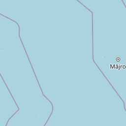
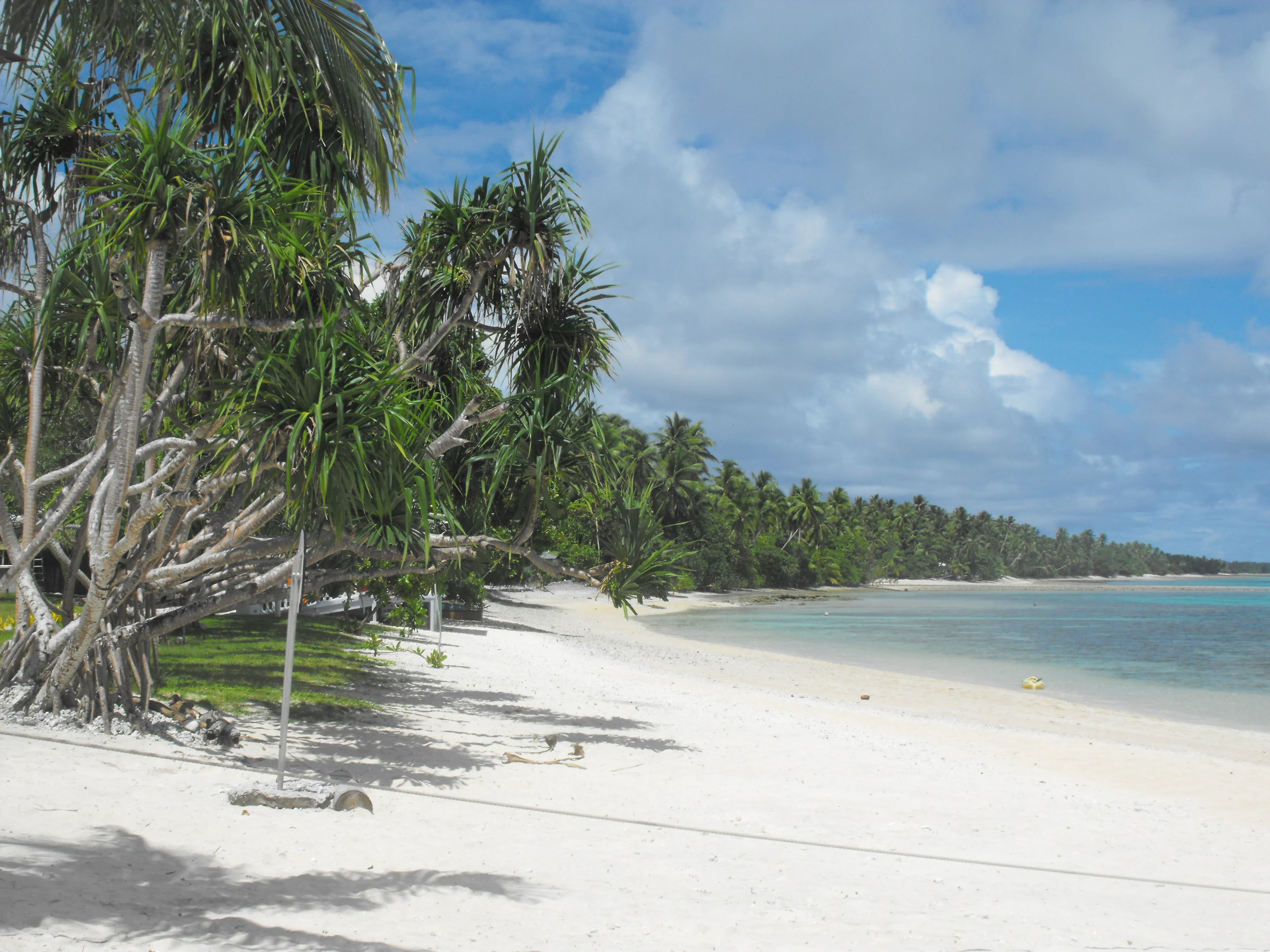
Majuro Atoll is a classic Pacific coral atoll, made up of over 60 narrow motus arranged in a roughly oval ring around a single large central lagoon. The land is extremely low-lying, with the highest elevation estimated at under 3 meters above sea level at Laura, on the western end of the atoll. Three of the islands cover more than half a square kilometer each, but the majority are small strips of land that follow the curving reef structure.
The dramatic contrast between the small land area and the enormous lagoon is one of Majuro's defining physical features. The lagoon covers roughly 295 square kilometers, channeled and sheltered by the surrounding reef and motus. This deep, sheltered body of water has historically made Majuro a natural harbor, supporting both traditional lagoon-side settlements and modern naval and commercial port activity.
Population and infrastructure are concentrated along the eastern edge of the atoll, where the Delap-Uliga-Djarrit urban core is built up across three connected motus. The western end remains less densely settled, with Laura serving as a growing residential area and home to the atoll's highest point and a popular beach. The thinness of the land, combined with the curvature of the atoll, gives Majuro its visual signature: a thin green ribbon of habitation set in a vast expanse of lagoon and ocean.
Majuro Atoll ecosystems, habitats, and plant life
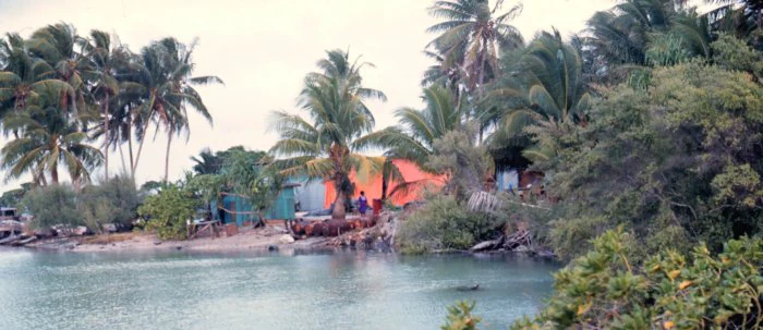
Majuro's natural environment is shaped primarily by its identity as a low-lying coral atoll within a tropical Pacific setting. The atoll supports vegetation typical of Marshall Islands motus, with coconut palms and coastal shrubs dominating the narrow land areas. These plant communities are adapted to salt spray, sandy or coralline soils, and the limited freshwater available on atoll land.
The surrounding marine environment is the more ecologically significant part of the atoll's natural system. The fringing reef, reef flats, and a broad network of lagoon habitats are part of the broader Micronesian coral reef ecosystem. The lagoon is not only a defining geographic feature but also an ecological space, supporting reef life, marine habitat variety, and the biological base for the atoll's fisheries. Coral atolls like Majuro are recognized for their ecological sensitivity, and sea-level and climate-related pressures on these systems have made the atoll a notable reference point in regional climate discussions.
The tropical trade wind climate governs daily and seasonal conditions, with steady trade winds interrupted by the movement of the Intertropical Convergence Zone, particularly during the warmer months. Rainfall is substantial, which on a narrow atoll translates into both the freshwater catchment that supplies the population and the storms and typhoon risk that occasionally affect coastal vegetation and reef structures.
Majuro Atoll wildlife and species highlights
As a Pacific coral atoll, Majuro's wildlife is heavily marine-oriented, tied to the reef ecosystem of the surrounding ocean and the lagoon. The atoll's reef flats and lagoon support reef fish and the broader tropical marine food webs that have long sustained Marshallese communities and now sustain commercial fisheries. The shallow lagoon and reef environment function as key habitat for a wide variety of tropical marine species associated with Micronesian coral reefs.
The narrow land areas of the atoll support typical atoll birdlife and coastal fauna adapted to small, low-lying islands. While the source material does not detail specific species inventories, the ecological pattern fits the broader picture of Marshall Islands atoll environments, where marine and seabird life dominate the biological profile. The lagoon and surrounding ocean, rather than the limited land area, are the primary habitat for the atoll's distinctive wildlife.
Majuro Atoll conservation status and protection priorities
Majuro has notable conservation significance because it embodies both the ecological value and the vulnerability of low-lying Pacific coral atolls. The atoll's reef and lagoon systems are part of the larger Micronesian coral reef network, which is internationally recognized for its biodiversity and productivity. The presence of one of the world's busiest tuna transshipment ports within the lagoon also highlights the link between marine resource use and the importance of sustainable management of these waters.
The atoll has become a prominent reference point in climate and ocean conservation conversations. Its hosting of the 2013 Majuro Declaration, signed by Pacific Islands Forum members to coordinate climate change adaptation and international aid, signals Majuro's role as a voice for vulnerable atoll nations. The very low elevation of the atoll, with its highest point measured in single-digit meters, makes it a tangible example of the stakes involved in sea-level rise and coastal protection across the Pacific.
Conservation interest in Majuro is therefore not only about biodiversity but also about the future habitability of low-lying atoll land. Water supply, coastal integrity, and reef health all intersect with the identity of the atoll, and its role as a national capital gives these conservation concerns a national and regional dimension rather than a purely local one.
Majuro Atoll cultural meaning and human context
Majuro is the cultural and political core of modern Marshall Islands identity. Its population is overwhelmingly Marshallese, with smaller communities of Filipino, I-Kiribati, American, Fijian, Chinese, and other Pacific and Asian residents reflecting both migration patterns and the country's regional connections. Marshallese remains the native language, anchoring the cultural life of the atoll alongside English, which is widely used in schools and government.
Christianity is the dominant religious tradition, with Protestant denominations playing a major role, alongside a Catholic minority centered on the Cathedral of the Assumption and a growing Ahmadiyya Muslim community whose first mosque opened in Majuro in 2012. The American Board of Commissioners for Foreign Missions established the first Protestant church and school here in 1869, giving the atoll a long missionary history that continues to mark its religious landscape. Education, including the College of the Marshall Islands and a University of the South Pacific presence, contributes to Majuro's role as the country's intellectual and civic center.
Atoll settlement patterns, traditional leadership structures involving iroij and iroijlaplap, and marine-based livelihoods all remain part of Majuro's cultural fabric even as the capital has modernized. Twin-town relationships across the Pacific, including links with Taipei, Kawai in Nara, Tarawa, Honiara, Nukuʻalofa, and others, also reflect Majuro's position as a hub of regional Pacific identity and diplomacy.
Top sights and standout views in Majuro Atoll
Majuro's standout features include its 64-island coral structure encircling a deep, sheltered lagoon of roughly 295 square kilometers, and its role as both national capital and a working atoll city. The Delap-Uliga-Djarrit urban core concentrates most of the population on the eastern edge, while the lagoon supports one of the world's busiest tuna transshipment operations and historically hosted a major United States forward naval base.
The atoll is also a focal point of regional climate diplomacy, particularly through the 2013 Majuro Declaration, and is recognized as a key example of how extremely low-lying Pacific atolls face environmental pressures. Its blend of Austronesian heritage, layered colonial and wartime history, and present-day status as the political and economic center of the Marshall Islands gives Majuro a distinctive profile among Pacific capitals.
Best time to visit Majuro Atoll
Majuro has a consistently warm tropical climate, with average temperatures year-round near 27°C and no strong seasonal swings. Conditions are dominated by trade winds, with the period from September to November generally the hottest and the rainiest due to the influence of the Intertropical Convergence Zone; typhoons are rare but can occur during this part of the year. Outside this wetter window, weather is typically warm and humid with steady breezes, while dry-season months tend to be slightly cooler and less rainy.
Window-wise, conditions characterized by the lowest rainfall, such as the early months of the year, will generally feel the most settled for time on the atoll, though temperature variation between seasons is small. Because the climate is so consistent, Majuro works as a year-round destination for travelers interested in lagoon environments, with the main variable being the level of rainfall rather than temperature.