
Mori Atlas logo
Protected landscapeMalheur National Forest

Tracing the ecological transition across the Blue Mountains and high desert corridors

Malheur National Forest: A Vast Protected Landscape and Geographic Landmark in Eastern Oregon

Malheur National Forest stands as a significant federal protected area in eastern Oregon, spanning more than 1.4 million acres across a varied topographic range. The forest captures a distinct ecological boundary where high desert sagebrush and juniper steppe shift into dense coniferous woodlands within the Blue Mountains. Rising from low valley floors to the 9,038 foot summit of Strawberry Mountain, the terrain offers a complex study in geological and biological diversity, including extensive old growth stands and vast wilderness areas.

national forestBlue Mountainseastern Oregonhigh desert transitionStrawberry Mountainsold growth forest
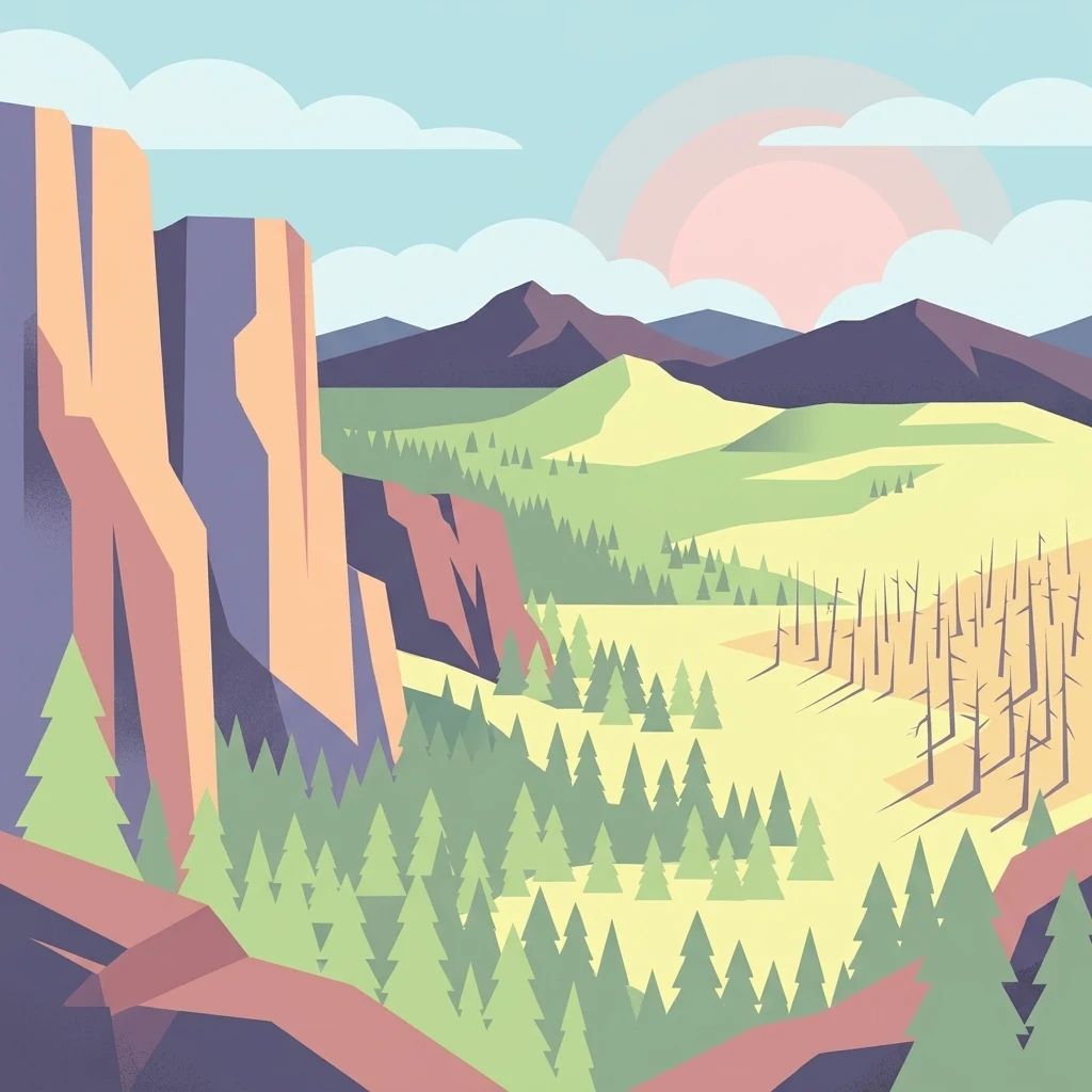
A digital illustration of a mountainous landscape at sunset, showing steep cliffs on the left, a pine forest in the valley, and a section of bare trees on the right.

Malheur National Forest

Protected landscape

Park overview

Structured park overview, official facts, and landscape profile for Malheur National Forest

Malheur National Forest park facts, protected area profile, and essential visitor context

Review the core facts for Malheur National Forest, including designation, size, terrain, visitor scale, habitats, and operating context in one park-focused overview.

About Malheur National Forest

Malheur National Forest is one of the largest national forests in Oregon and one of the most ecologically varied within the Blue Mountains ecoregion. It occupies a transition zone where the moisture-loving forests of the Pacific Northwest meet the drier Great Basin and sagebrush steppe landscapes that characterize much of interior eastern Oregon. This setting gives the forest an unusually broad ecological range, supporting everything from arid grasslands and juniper woodlands at the lower end to dense coniferous stands higher on the slopes of the Strawberry Mountains.

In practical terms, the forest serves a wide spectrum of roles. It is a working landscape managed for multiple uses, including timber production, cattle grazing, and historically, gold mining, while also providing habitat for wildlife, wilderness for non-motorized recreation, and scenic routes such as U.S. Route 395 and U.S. Route 26 that traverse its interior. The forest is divided into three ranger districts with administrative offices in John Day, Prairie City, and Hines, reflecting its geographic reach across multiple counties.

Ecologically, the forest holds particular significance. A 1993 Forest Service study estimated that the forest contained around 312,000 acres of old growth, an unusually large share of the total area and a resource that supports species dependent on mature forest structure. The forest's two designated wilderness areas, Strawberry Mountain Wilderness and Monument Rock Wilderness, lock in protections for the most rugged and ecologically sensitive terrain. Strawberry Mountain itself is the forest's highest peak at 9,038 feet, anchoring the central spine of the forest and giving it one of its most recognizable skylines.

One of the most extraordinary features of the forest lies not on the surface but beneath it. A single Armillaria ostoyae fungus, one of the world's most massive living organisms, spans approximately 2,200 acres on a ridgeline west of Clear Creek. This is the type of discovery that reinforces how much ecological complexity is concealed within the seemingly familiar terrain of the Blue Mountains, and it has helped put Malheur National Forest on the radar of scientists as well as travelers.

Quick facts and research context for Malheur National Forest

Malheur National Forest is located in eastern Oregon and centers on the Blue Mountains, particularly the Strawberry Mountains. It covers more than 1.4 million acres across four counties: Grant, Harney, Baker, and Malheur. The forest transitions from arid sagebrush and juniper at lower elevations up through ponderosa pine, lodgepole pine, true firs, and other mountain conifers.

The forest was established in 1908 through a presidential proclamation and is administered by the U.S. Forest Service. Management focuses on multiple uses including timber, grazing, recreation, and wilderness preservation, and the forest contains two designated wilderness areas along with a substantial amount of old growth forest. Its name comes from the Malheur River, derived from a French word meaning misfortune.

Protection and recognition

Documented management scope and official international recognition details

Malheur National Forest Protection Status and Terrestrial Designation Records

Malheur National Forest maintains a documented terrestrial protection status within its regional conservation framework. Official records compile management parameters and designated recognition sources for analytical park evaluation.

Protection details

Protection scope
Terrestrial
Transboundary protection
No
Park context

Deeper park guide and search-rich context for Malheur National Forest

Malheur National Forest history, landscape, wildlife, and travel context

Explore Malheur National Forest through its history, landscape character, ecosystems, wildlife, conservation priorities, cultural context, and seasonal travel timing in a structured park guide built for atlas discovery and search intent.

Why Malheur National Forest stands out

Malheur National Forest is best known for several standout features. It contains what is widely regarded as the largest organism by area in the Northern Hemisphere, an Armillaria ostoyae fungus covering roughly 2,200 acres on a ridgeline west of Clear Creek. It is also recognized for its extensive old growth forests, estimated at around 312,000 acres by a 1993 Forest Service assessment, and for two designated wilderness areas that protect its highest and most rugged terrain. Beyond these particular features, the forest is celebrated for the way it bridges two very different worlds: the dry, open sagebrush and juniper landscapes of the Intermountain West and the denser coniferous forests of Oregon's Blue Mountains. This ecological gradient, combined with elevations that climb nearly 5,000 feet from valley floors to the Strawberry Mountain summit, gives the forest an unusually varied landscape for the region.
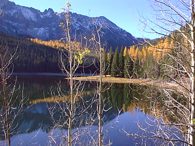
A calm lake reflects a mountain range and forest with autumn colors, viewed through bare tree branches in the foreground.
Strawberry Lake reflecting the surrounding mountains and autumn foliage in the Malheur National Forest.

Malheur National Forest history and protected-area timeline

Malheur National Forest was established through a presidential proclamation signed by Theodore Roosevelt on June 13, 1908. The name of the forest comes from the Malheur River, the name of which is taken from the French language, where it means misfortune. This French origin reflects the historical presence of French-Canadian trappers in the early 19th century, whose interactions with the landscape left lasting traces on regional place names.

From its earliest decades, the forest was developed as a multi-use landscape. Timber harvesting, livestock grazing, and mineral prospecting, particularly gold mining, all shaped how the land was used and how infrastructure was built. As management evolved, the U.S. Forest Service increasingly recognized the value of protecting certain high-value areas, leading to the eventual designation of two wilderness areas within the forest's boundaries and to growing awareness of the forest's old growth resource, formally assessed by the agency in 1993.

The forest's administrative structure has also evolved over time. It is currently organized into three ranger districts with offices in John Day, Prairie City, and Hines, a footprint that reflects the geographic scale of the area and its reach across Grant, Harney, Baker, and Malheur counties. This dispersed management approach has allowed the forest to balance industrial uses, recreation, and conservation across a vast and varied landscape.

Malheur National Forest landscape and geographic character

The landscape of Malheur National Forest is shaped by its position within the Blue Mountains of eastern Oregon, with the Strawberry Mountains forming a central east-west spine through the heart of the forest. Elevations stretch from roughly 4,000 feet along the lower valleys to 9,038 feet at the top of Strawberry Mountain, producing strong topographic variety over relatively short horizontal distances. This elevation range, combined with the underlying geology, gives the forest a layered look from one horizon to the next.

At the lower and drier end of the forest, the landscape shifts toward high desert influences. Sagebrush steppe, open grasslands, juniper woodlands, and scattered pine mark the transition between the wettest mountain forests and the much more arid country that surrounds the Blue Mountains. As elevation rises, pines, firs, and other conifers become denser, creating darker, denser forest cover on the higher slopes and ridges of the Strawberry Mountains. The contrast between arid valleys and forested high country is one of the forest's most striking visual characteristics.

Water and route lines also help shape the forest's geography. The Malheur River and its tributaries drain much of the area, and the forest is crossed by two major travel corridors: U.S. Route 395, which runs north to south, and U.S. Route 26, which runs east to west. These routes pass through canyons, forests, and open range land, offering a strong sense of the variety in terrain that a visitor encounters while crossing the forest.

Malheur National Forest ecosystems, habitats, and plant life

The ecological character of Malheur National Forest is shaped by its position at the meeting point between two major ecological regions. At lower elevations, the dominant vegetation reflects the dry Intermountain West, with sagebrush grasslands, juniper woodland, and scattered ponderosa pine standing out as the characteristic plant communities. These drier zones often feel more like high desert than forest, particularly in the southern and eastern portions of the area.

As elevation increases, the vegetation pattern shifts quickly. Ponderosa pine gives way to lodgepole pine and various fir species, and the canopy becomes denser and more continuous. Higher elevations of the Strawberry Mountains support cooler, moister forest types typical of the Blue Mountains ecosystem, including stands of old growth that remain ecologically important for species that depend on long-undisturbed forest conditions.

Wildlife habitat reflects this elevation and moisture gradient. The drier lower slopes and ranges support species associated with sagebrush steppe and juniper woodland, while the higher and more forested zones support species that depend on larger tracts of mature forest, including the densest areas associated with the forest's two wilderness areas. The combination of these ecosystems within a single administrative forest is one of the reasons Malheur National Forest stands out regionally for habitat diversity.

Malheur National Forest wildlife and species highlights

The wildlife of Malheur National Forest is diverse and tied closely to the forest's varied elevation and vegetation zones. The drier, lower portions support species commonly associated with sagebrush and juniper habitat, while the higher elevations of the Strawberry Mountains and other Blue Mountain ranges support wildlife more tied to dense coniferous forest and alpine environments. This ecological gradient gives the forest a wide range of habitat niches within its boundaries.

The substantial old growth component of the forest, on the order of 312,000 acres according to a 1993 Forest Service study, is particularly significant from a wildlife perspective. Old growth forests provide nesting sites, denning habitat, and forage resources for species that do not do well in younger, more disturbed forests. The two designated wilderness areas in the forest further concentrate protections around the most ecologically sensitive terrain.

The presence of the massive Armillaria fungus underlying parts of the forest is itself an indicator of the ecological complexity below the visible surface. While this organism is a pathogen of trees, it also creates long-term ecological dynamics in coniferous forests that other species depend on, contributing to the broader biological character of the forest landscape. Because detailed species-specific information was limited in the source material, more specific claims about individual species have been left out of this section.

Malheur National Forest conservation status and protection priorities

Malheur National Forest plays a significant conservation role in eastern Oregon because of its large size, ecological transition zone, and substantial old growth resource. Around 312,000 acres of the forest were estimated to be old growth by a 1993 Forest Service study, an unusually large share of the total forested landscape and an important consideration for species that depend on mature forest structure.

Wilderness designation provides an additional layer of conservation. The Strawberry Mountain Wilderness covers 68,700 acres, while the Monument Rock Wilderness covers 19,620 acres, with the latter straddling into the adjacent Wallowa-Whitman National Forest. Together, these wilderness areas protect the most rugged and sensitive high-elevation habitat in the forest from road building, logging, and motorized use.

Beyond formal protections, the forest's multiple-use management framework has conservation implications as well. Timber, grazing, mining, and recreation uses all shape ecological conditions, while the Forest Service's broader mandate recognizes that ecological values, including habitat, watershed function, and old growth preservation, are central to the long-term identity of the forest. The presence of the enormous Armillaria ostoyae individual is a striking example of why conserving the forest in its full ecological complexity matters at a global scale, not just locally.

Malheur National Forest cultural meaning and human context

The cultural context of Malheur National Forest is closely tied to the frontier history of eastern Oregon and to the broader patterns of settlement and resource use in the Blue Mountains region. The forest's name comes from the Malheur River, with 'malheur' derived from a French word meaning misfortune. This linguistic origin reflects the era of French-Canadian fur trappers who traveled through the region in the early 19th century, and whose presence left a lasting imprint on local place names.

After this early period of exploration, the area's economy was built around the kinds of land uses still reflected in the forest's management today. Logging, cattle ranching, and hard rock and gold mining all played major roles in drawing settlers to eastern Oregon in the late 19th and early 20th centuries. Theodore Roosevelt's 1908 establishment of the forest came during this broader period when the federal government was beginning to formalize the protection and management of remaining federal forest reserves, many of which later became national forests.

Modern communities, including John Day, Prairie City, Canyon City, and Hines, remain closely linked to the forest ecologically and economically. The forest has been part of a continuous rural working landscape for over a century, and cultural identity in many of these communities continues to be shaped by ties to the surrounding public lands.

Top sights and standout views in Malheur National Forest

Among Malheur National Forest's standout qualities are its enormous Armillaria ostoyae individual, the largest known organism by area in the Northern Hemisphere, and its approximately 312,000 acres of old growth forest, an unusually large share of its 1.4-million-acre footprint. Its two wilderness areas, Strawberry Mountain and Monument Rock, protect its most scenic and sensitive high country.

The forest also stands out for the way it captures the meeting point between dry Great Basin style landscapes and the wetter coniferous forests of the Blue Mountains, all within a single administrative unit. With elevations that climb from about 4,000 feet to the 9,038-foot summit of Strawberry Mountain, multiple ranger districts, and major travel corridors like U.S. Route 395 and U.S. Route 26, the forest combines ecological, scenic, and geographic variety at a substantial scale.

Best time to visit Malheur National Forest

Malheur National Forest spans a wide elevation range, so seasonal conditions vary significantly depending on where in the forest a visitor travels. Summer and early fall are typically the most accessible periods for higher elevations, when snow has melted off most roads and trails in the Strawberry Mountains and the two wilderness areas, while daytime temperatures at lower elevations can be hot. Spring and early summer bring greener vegetation and active wildlife, but weather at higher elevations can still shift rapidly.

Winter brings substantial snowfall to the higher elevations, especially in the Strawberry Mountains, and many forest roads become inaccessible to standard vehicles. For visitors interested in the forest's drier low-elevation landscapes, spring and fall generally offer more comfortable temperatures than the peak of summer. Because exact road and trail conditions can change from year to year, longer-term seasonal patterns are more important to keep in mind than any specific calendar window.
Monthly climate preview

Long-term representative monthly averages for temperature and precipitation

Malheur National Forest Climate Normals and Annual Temperature Rhythm

Representative coordinate records show measured annual temperature variations and monthly precipitation totals across the protected landscape from 1991 to 2020. Detailed weather by month profiles provide complete twelve-month normals for analyzing long-term climate patterns at this specific elevation.
Annual mean6 °C
-4 °C19 °C
Jan-4°
Feb-2°
Mar
Apr
May
Jun13°
Jul19°
Aug18°
Sep14°
Oct
Nov
Dec-4°
Warmest month
July

18.7 °C

Coolest month
December

-3.6 °C

Wettest month
December

2.2 mm/day

Driest month
August

0.4 mm/day

Park location guide

Geography guide, regional context, and park location map for Malheur National Forest

Malheur National Forest park geography, regions, and map view in United States of America

Understand where Malheur National Forest sits in United States of America through a broader geographic reading of the surrounding landscape, nearby location context, and its mapped position within the national park landscape.

How Malheur National Forest fits into United States of America

The United States of America is a federal presidential republic and one of the world's largest countries by area and population. It consists of 50 states across a vast territory spanning multiple time zones, with its capital in Washington, D.C. and largest city in New York City. The nation has a diverse economy, influential political system, and significant cultural and military presence globally.

Wider geography shaping Malheur National Forest in United States of America

The United States occupies a vast territory in North America, bordered by Canada to the north and Mexico to the south. The 48 contiguous states stretch from the Atlantic to the Pacific Ocean, while Alaska occupies the northwestern region and Hawaii is an archipelago in the Pacific. The country encompasses diverse terrain including the Rocky Mountains, Appalachian Mountains, Great Plains, and extensive river systems.

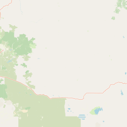
Map view of Malheur National Forest

Use this park location map to pinpoint Malheur National Forest in United States of America, understand its exact geographic position, and read its mapped placement within the surrounding landscape more clearly.

Pigeon | © OpenStreetMap contributors

Location context for Malheur National Forest

Oregon
Recorded earthquake history

Explore the Historical Earthquake Records for Malheur National Forest

Examine a catalogue of seismic events recorded near Malheur National Forest. This resource provides a clear view of historical earthquake data through the MoriAtlas mapping perspective, highlighting recorded epicenters and event details associated with this expansive eastern Oregon landscape.

Malheur National Forest Earthquake History

Catalogued events

6 events

Strongest magnitude

Magnitude 3.8

Most recent event

Jul 25, 2009

This history includes earthquakes recorded inside the park or within 50 km of its borders

Visual reference of Blue Mountains terrain, high desert transitions, and forest habitats

Malheur National Forest Photos, Landscape Scenery, and Protected Area Views

Visual documentation of Malheur National Forest reveals the dramatic transition from arid sagebrush basins to dense coniferous mountain slopes. Examining protected area photography provides a clearer understanding of regional topography, old growth zones, and high desert terrain.

A calm lake reflects a mountain range and forest with autumn colors, viewed through bare tree branches in the foreground.

A wide landscape view of a mountainous wilderness area featuring rocky ridges, a mix of green coniferous trees and dead standing timber, and rolling hills under a clear blue sky.

Park atlas

Discover surrounding Blue Mountain geography and adjacent protected areas in eastern Oregon

Parks Near Malheur National Forest and Related Protected Landscapes to Compare

Browsing parks near Malheur National Forest reveals connected ecological gradients across the Blue Mountains and adjacent high desert terrain. Expanding the geographic comparison highlights regional protected landscapes and comparable multi-use forest reserves.
Protected landscapeOregon
Park boundaries overlap#1 closest

Northeast

Wallowa-Whitman National Forest: A Geographic Overview of Northeastern Oregon Landscapes

Alpine wilderness, mountain ranges, and deep river gorges.

Wallowa-Whitman National Forest protects a vast, varied landscape of granite peaks, alpine meadows, and forested river canyons. This detailed overview covers the geographic significance of the Wallowa and Elkhorn mountains, the Hells Canyon corridor, and the surrounding wilderness regions within Oregon.

Area
9,682 km²
Established
1905
Visitors
505K annual
Relief
Mountain
Protected areaOregon
4.8 km away#2 closest

West

Ochoco National Forest: Mapping the Rugged Canyons and High Desert of Central Oregon

A vast protected area defined by rimrock plateaus and pine-forest watersheds.

Located in the heart of the Ochoco Mountains, this protected landscape offers a study in ecological contrast. From its dense ponderosa pine groves to the exposed volcanic ridges of the high desert, the forest acts as a critical habitat corridor for mule deer and elk, while protecting the headwaters of the North Fork Crooked River within a diverse, multi-terrain framework.

Area
3,444.01 km²
Established
1911
Visitors
575K annual
Relief
Mountain
A soft watercolor painting of a landscape featuring the Twin Pillars volcanic rock formations in the distance, set against rolling green hills and pine forests.
Wildlife reserveOregon
74 km away#3 closest

West

Mill Creek Wilderness: A Comprehensive Geographic Overview of Central Oregon Protected Land

Volcanic geology, canyon topography, and forest ecosystems in Oregon

Mill Creek Wilderness represents a significant protected unit within central Oregon, defined by its complex network of canyons and high-elevation plateaus. The area showcases a unique combination of old-growth ponderosa pine stands, lodgepole pine meadows, and striking volcanic plugs like the Twin Pillars. Its mapped terrain provides essential context for understanding the hydrology and geological evolution of the broader Ochoco mountain range.

Area
70.4 km²
Established
1984
IUCN
Ib
Relief
Mountain
A horizontal watercolor painting depicting a soft-focus mountain range in shades of purple and pink behind a green forest and a calm blue lake.
Wildlife reserveOregon
84 km away#4 closest

Northeast

Eagle Cap Wilderness: Map and Protected Area Overview in Northeastern Oregon

High elevation terrain, glacial valleys, and mountain ecosystems

Spanning over 350,000 acres, Eagle Cap Wilderness defines the high-altitude geography of the Wallowa Mountains. This protected area is characterized by sharp granite ridges, more than 60 named alpine lakes, and deeply carved U shaped glacial valleys. It acts as a primary water source for the region, hosting the headwaters of several major rivers while supporting diverse wildlife populations in a preserved backcountry environment.

Area
1,462.72 km²
Established
1940
IUCN
Ib
Relief
Mountain
Protected landscapeIdaho
95 km away#5 closest

East

Payette National Forest: Geographic Overview of Idaho's Rugged Mountain Wilderness

Protected granite landscapes and glacial basin geography

Encompassing a vast portion of central Idaho, Payette National Forest represents a significant protected wilderness corridor. The forest geography transitions from granite-based alpine peaks and deep river gorges to dense coniferous slopes, providing essential habitat and extensive trail connectivity throughout the Northern Rockies.

Area
9,419.55 km²
Established
1944
Relief
Mountain
Access
Access unknown
Protected landscapeOregon
About 102 km away#6 closest

North

Umatilla National Forest: A Comprehensive Atlas of Blue Mountains Protected Landscapes

Explore mountain terrain, wilderness areas, and river-carved geography

Spanning over one million acres, Umatilla National Forest encompasses a complex array of river-cut canyons, high-country ridges, and substantial old-growth woodlands. This protected landscape offers a deep look into the ecological and physical character of the Blue Mountains, from the remote reaches of the Wenaha-Tucannon Wilderness to the headwaters of the Umatilla River.

Area
5,694 km²
Established
1908
Visitors
703K annual
Relief
Mountain
A watercolor painting of a wide, rolling landscape with green hills, a winding path or river, and soft mountains in the background against a white background.
Protected landscapeUnited States of America
110 km away#7 closest

Northeast

Hells Canyon National Recreation Area: Geologic Boundaries and Snake River Corridor Atlas

Deep canyon terrain and archaeological heritage in the American Northwest

This protected landscape encompasses the profound depth of the Snake River gorge, featuring rugged basalt cliffs and diverse forested uplands. The area serves as a significant intersection of natural history and ancient cultural presence, providing a detailed look at the topographic complexity defining the Oregon and Idaho boundary region.

Area
2,641 km²
Established
1975
Relief
Mountain
Climate
Temperate
Wildlife reserveOregon
147 km away#8 closest

Southwest

Gearhart Mountain Wilderness: Protected Mountain Geography and Forest Atlas

High elevation terrain in the Fremont Winema National Forest

Spanning the border between Lake and Klamath counties, Gearhart Mountain Wilderness stands as a testament to the diverse mountain geography of south-central Oregon. The area features a complex mosaic of white fir, ponderosa pine, and pure lodgepole stands, set within a glacially sculpted landscape of cirques and ridges. This protected refuge serves as a key headwater source and mountain sanctuary, offering expansive vistas that span from the southern Cascades to the far horizon of the Oregon desert landscape.

Area
92.36 km²
Established
1943
IUCN
Ib
Relief
Mountain

Common questions about visiting, size, designation, and location context for Malheur National Forest

Malheur National Forest FAQs for park facts, access, geography, and protected area context

Find quick answers about Malheur National Forest, including protected-area facts, park geography, trail and visitor context, and how the park fits into its surrounding country and regional landscape.
MoriAtlas Explorer

Continue Your Protected Areas Search Across the Global Atlas

Deepen your exploration by continuing the structured search for national parks and protected areas worldwide. Utilize the comprehensive filtering capabilities to compare different conservation landscapes and refine your understanding of global park geography. Discover more about the distribution and characteristics of protected natural areas.

Global natural geography