
Mori Atlas logo
State or regional parkMara Provincial Park

Tracing the mapped boundaries and natural terrain of this key British Columbia day-use site

Mara Provincial Park: A Comprehensive Geographic Overview of the Protected Shuswap Lakefront

Mara Provincial Park sits as a focused protected area along the southern shore of Mara Lake within the Shuswap region of British Columbia. This geographic analysis outlines the park's function as a vital public boat launch and beach-focused landscape. The site preserves a unique lakeshore margin where forested benches meet the freshwater environment, serving as an essential point of entry for the broader Shuswap aquatic system.

lakefront parkday-use parkpublic boat launchsandy beachswimmingpicnicking
A stylized flat vector illustration of a forest landscape with a central waterfall flowing into a river with a large piece of driftwood in the foreground.

Mara Provincial Park

State or regional park

Park overview

Structured park overview, official facts, and landscape profile for Mara Provincial Park

Mara Provincial Park park facts, protected area profile, and essential visitor context

Review the core facts for Mara Provincial Park, including designation, size, terrain, visitor scale, habitats, and operating context in one park-focused overview.

About Mara Provincial Park

Mara Provincial Park is a compact lakeshore park in British Columbia's southern Interior, situated south of the town of Sicamous on the eastern side of Mara Lake. Despite its very small total area, the park plays an outsized practical role in the region's outdoor recreation because it provides the principal public boat launch on Mara Lake, in addition to swim-friendly beach frontage and day-use facilities.

The park was established in 1958 and has remained a day-use protected area rather than a wilderness reserve or backcountry destination. Its management focus is on intensive recreational use: visitors typically come for short visits to swim, picnic, or launch boats onto the lake rather than to hike long trails or stay overnight within the park. Seasonal service typically runs from spring through late September, while the park itself remains accessible in a more limited, unattended form during the colder months.

Within the broader Shuswap area, where multiple lakes and seasonal cabins shape the regional identity, Mara Provincial Park represents the lake-access anchor for Mara Lake itself. The presence of two creeks flowing into the lake through or near the park, both of which still support fish spawning, adds a small ecological dimension to what is primarily a recreation-oriented site. The park also preserves a kekuli pit, an earthwork feature associated with the Secwépemc (Shuswap) people, though this feature is considered only locally significant rather than nationally prominent.

Quick facts and research context for Mara Provincial Park

Mara Provincial Park is a BC Parks-managed day-use park established in 1958 on Mara Lake, south of Sicamous in British Columbia. Classified as an IUCN Category II protected area, the park covers about 5 hectares of lakeshore land devoted primarily to swimming, picnicking, and boating. It holds the only major public boat launch on Mara Lake and features sandy beaches, two creeks with fish-spawning activity, and a locally significant kekuli pit remnant. The park is open with services from May 1 to September 27, with the gate locked open in the off season.

Protection and recognition

Examine the terrestrial protection scope and documented conservation status for Mara Provincial Park

Mara Provincial Park Protection Status and Formal Protected Area Designation

Mara Provincial Park maintains a terrestrial protection scope within its designated boundaries. Review the documented conservation framework and associated recognition details structured for this protected area.

Protection details

Protection scope
Terrestrial
Transboundary protection
No
Park context

Deeper park guide and search-rich context for Mara Provincial Park

Mara Provincial Park history, landscape, wildlife, and travel context

Explore Mara Provincial Park through its history, landscape character, ecosystems, wildlife, conservation priorities, cultural context, and seasonal travel timing in a structured park guide built for atlas discovery and search intent.

Why Mara Provincial Park stands out

Mara Provincial Park is best known as a convenient, sandy-beach day-use destination on Mara Lake and as the only major public boat launch site on the lake. Its value lies less in size or scenic grandeur and more in being a reliable, accessible point of entry to one of the larger lakes in British Columbia's Shuswap system.
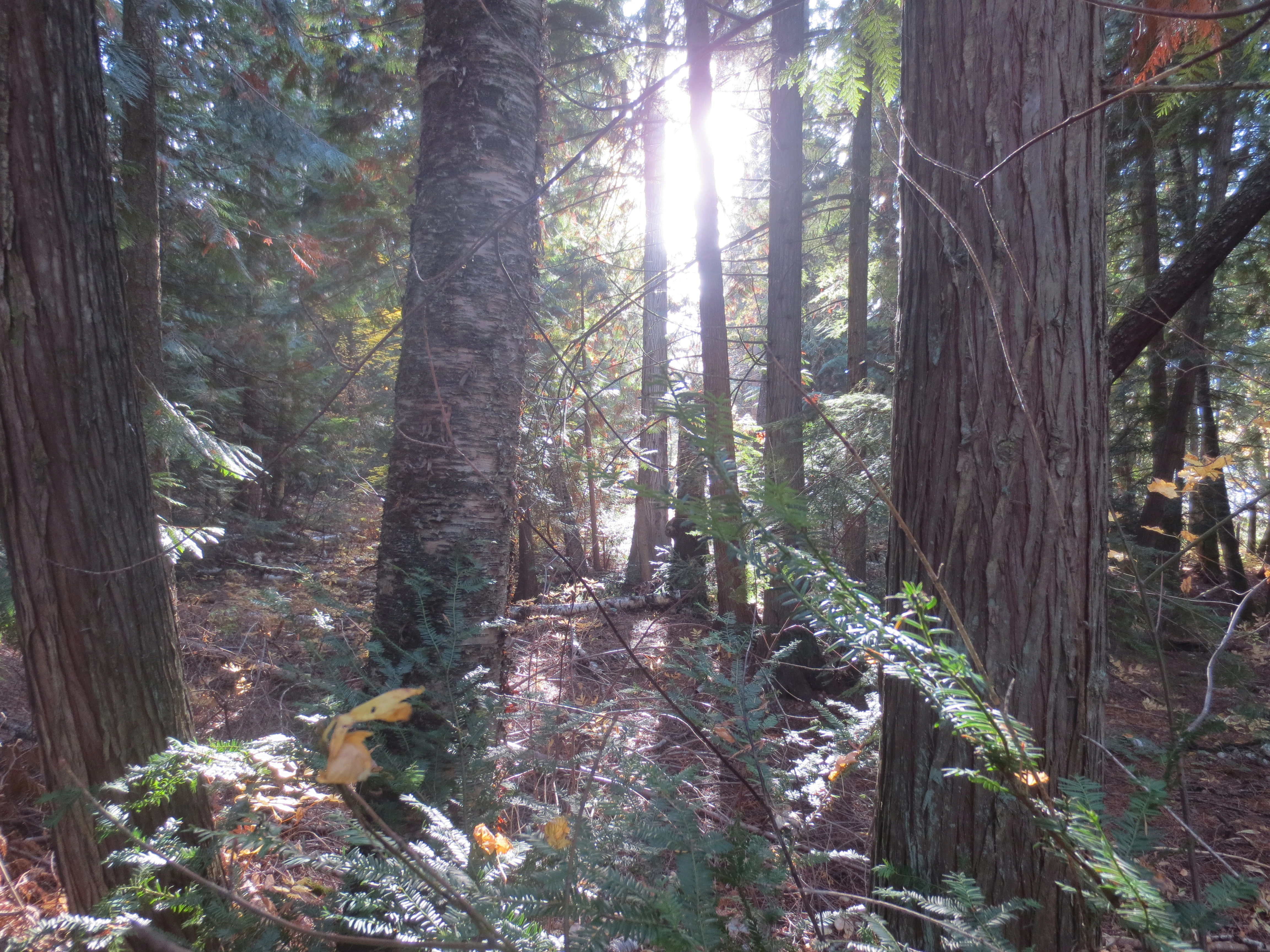
Sunlight rays streaming through tall coniferous trees in a dense forest setting.
Sunlight filtering through the canopy of a forested area in Mara Provincial Park.

Mara Provincial Park history and protected-area timeline

Mara Provincial Park was established in 1958 by the Province of British Columbia as a day-use recreation site on Mara Lake, south of Sicamous. Its creation was tied to the public need for accessible lakeshore and a functioning boat launch on a lake that was otherwise surrounded primarily by private cottage and cabin frontage.

Over the decades since its establishment, the park has retained its original day-use character rather than expanding into larger camping or backcountry facilities. The kekuli pit within the park points to older Indigenous use of the surrounding landscape before the park's protected designation, though the pit is recorded as a locally significant historical feature rather than a major heritage site.

Mara Provincial Park landscape and geographic character

Mara Provincial Park occupies a narrow strip of lakeshore along the southern portion of Mara Lake, in the lake-and-forested landscape that defines the Shuswap region. The terrain at the park is gently sloped toward the water, with sandy beach areas giving way to mixed interior forest typical of southern British Columbia.

Mara Lake itself is one of several large lakes in the Shuswap system, and the park's shoreline reflects the broader scenery of calm freshwater, forested benches, and gentle topography that characterizes much of the valley. Two small creeks enter the lake near or through the park, contributing shallow shoreline margins where fish spawning occurs seasonally.
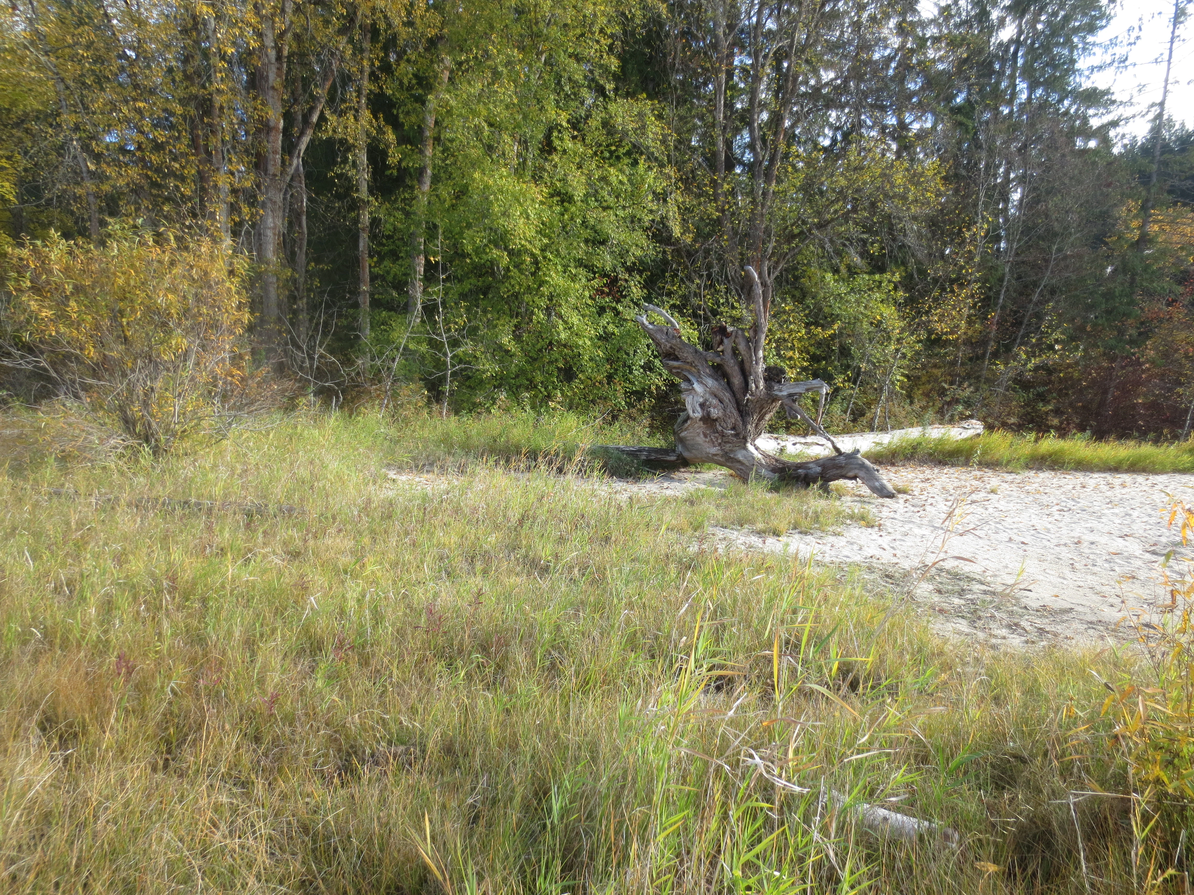
A sandy shoreline with tall grasses and a piece of driftwood, backed by a forest with autumn foliage.
A natural shoreline area with driftwood at Mara Provincial Park during the autumn.

Mara Provincial Park ecosystems, habitats, and plant life

Because the park is small and recreation-focused, its ecological footprint is limited in scale but includes a mix of sandy beach, riparian creek margins, mixed interior forest, and open lake water. These varied micro-habitats reflect the broader Shuswap landscape pattern, where lakes, creeks, and dry-belt forest converge.

The presence of fish-spawning creeks within or adjacent to the park gives it a small but real ecological function. The forest around the shoreline continues the dry, gently rolling woodlands typical of the southern Interior of British Columbia, supporting the kinds of terrestrial and aquatic transitions that make lake-edge environments productive habitats even in compact protected areas.

Mara Provincial Park wildlife and species highlights

Wildlife interest at Mara Provincial Park relates mainly to the lake itself and its tributary creeks. Fish spawning at the mouths of two creeks associated with the park indicates ongoing use of these shoreline margins by native freshwater species, while the lake supports the angling and general aquatic life typical of larger Shuswap-region lakes.

Overhead and along the shoreline, common interior species typical of lakeside habitats in British Columbia can be expected, including waterfowl associated with large freshwater lakes. The park's small size means that wildlife experience here is incidental to a visit focused on the beach or the boat launch, rather than a primary wildlife-watching destination.

Mara Provincial Park conservation status and protection priorities

Mara Provincial Park is protected under IUCN Category II, recognizing it as a formally designated and managed protected area. Its conservation significance lies less in scale and more in securing permanent public access to a stretch of Mara Lake shoreline, including the lake's primary public boat launch and associated sandy beaches.

The park also helps safeguard small but important ecological features, including fish-spawning creek mouths and a small area of lakeside forest, that might otherwise be vulnerable to private development along an increasingly populated lakeshore.

Mara Provincial Park cultural meaning and human context

The kekuli pit recorded within Mara Provincial Park is a reminder that the wider Shuswap landscape was used and modified by Secwépemc (Shuswap) people long before the establishment of the provincial park system. Such pits, sometimes associated with winter dwellings or ceremonial use, are found at various points in the region.

In addition to this older Indigenous context, the park sits within a region where modern lake culture, seasonal cabins, and outdoor recreation are central to local identity. Its role in providing shared public access to Mara Lake ties into that broader pattern of lake-oriented community life in the Shuswap.

Top sights and standout views in Mara Provincial Park

Mara Provincial Park's main highlight is its status as the only major public boat launch on Mara Lake, paired with sandy beaches that are well suited to swimming and family-style day use. The park is small in extent but functionally significant for anyone wanting to get onto Mara Lake without using private facilities.

Secondary points of interest include the fish-spawning creek mouths near the park, the lakeside forest setting, and the locally significant kekuli pit, which offers a small connection to the region's deeper Indigenous and historical landscape.

Best time to visit Mara Provincial Park

The most comfortable time to visit Mara Provincial Park is during the late spring and summer months, when the lake is warm enough for swimming, the beaches are in active use, and all services and the boat launch are fully available. The park's service period generally runs from May through late September, reflecting the broader seasonal rhythm of lakeside recreation in the southern Interior.

In the cooler shoulder seasons and winter, the lake scenery shifts toward quieter, more muted conditions. The park remains accessible with the gate locked open, but the experience becomes one of calm shoreline walks and autumn forest rather than swimming and boating.
Monthly climate preview

Long-term representative point measurements tracking monthly temperature and precipitation rhythm

Mara Provincial Park Climate Normals and Measured Annual Temperature Patterns

Historical data for Mara Provincial Park records monthly average temperatures spanning from sub-zero winter minimums to warm summer maximums alongside consistent daily precipitation rates. Examining the full twelve-month profile provides complete context for regional temperature ranges and precipitation variations across the protected coordinate.
Annual mean3 °C
-10 °C16 °C
Jan-9°
Feb-8°
Mar-3°
Apr
May
Jun12°
Jul16°
Aug16°
Sep11°
Oct
Nov-4°
Dec-10°
Warmest month
July

16.3 °C

Coolest month
December

-9.9 °C

Wettest month
November

3.4 mm/day

Driest month
August

1.3 mm/day

Park location guide

Geography guide, regional context, and park location map for Mara Provincial Park

Mara Provincial Park park geography, regions, and map view in Canada

Understand where Mara Provincial Park sits in Canada through a broader geographic reading of the surrounding landscape, nearby location context, and its mapped position within the national park landscape.

How Mara Provincial Park fits into Canada

Canada is a federal parliamentary constitutional monarchy spanning North America from the Atlantic to the Pacific and Arctic Oceans. With a population of over 41 million, it is officially bilingual in English and French at the federal level. The country gained independence from the United Kingdom through a gradual process culminating in 1982.

Wider geography shaping Mara Provincial Park in Canada

Canada occupies the northern portion of North America, sharing its longest international border with the United States. The country extends from the Atlantic Ocean to the Pacific Ocean and northward into the Arctic Ocean, giving it the longest coastline of any nation.

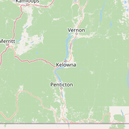
Map view of Mara Provincial Park

Use this park location map to pinpoint Mara Provincial Park in Canada, understand its exact geographic position, and read its mapped placement within the surrounding landscape more clearly.

Pigeon | © OpenStreetMap contributors

Location context for Mara Provincial Park

British Columbia

Explore photographic records of sandy beaches, forested benches, and aquatic habitats.

Mara Provincial Park Photos and Landscapes, Visualizing the Shuswap Shoreline

Visual documentation captures the narrow lakeshore terrain, sandy beach environments, and mixed interior forest settings defining Mara Provincial Park. Photographic collections illustrate the physical protected area character, freshwater margins, and regional Shuswap valley scenery without relying on descriptive labels.

Sunlight rays streaming through tall coniferous trees in a dense forest setting.

A view looking across the calm, grey water of Mara Lake towards a forested mountain ridgeline, with a pebbled beach, a small pool of water, and a piece of driftwood in the foreground.

A sandy shoreline with tall grasses and a piece of driftwood, backed by a forest with autumn foliage.

Park atlas

Discover other protected areas and lakefront reserves across the Shuswap region

Exploring Parks Near Mara Provincial Park and Surrounding Regional Landscapes

Visitors exploring Mara Provincial Park can browse nearby protected areas and adjacent lakefront reserves across the southern Interior. Comparing surrounding valley geography reveals broader regional patterns in freshwater conservation and valley ecosystems.
State or regional parkBritish Columbia
About 62 km away#1 closest

South

Kalamalka Lake Provincial Park and Protected Area: Mapped Geography and Regional Context

A conservation landscape of the North Okanagan valley

Kalamalka Lake Provincial Park and Protected Area preserves 978 hectares of essential grassland and lakeshore habitats in British Columbia. The area features a complex mosaic of open meadows and mixed forest stands, offering a detailed perspective on the ecological transitions found within the Okanagan Valley. Its geography is defined by the shimmering turquoise waters of Kalamalka Lake, reflecting the unique interplay between seasonal mineral shifts and the surrounding arid terrain.

Area
9.78 km²
Established
1975
IUCN
II
Relief
Upland
National parkBritish Columbia
About 66 km away#2 closest

Northeast

Mount Revelstoke National Park: Explore Protected Landscape Geography and Mapped Boundaries

British Columbia's National Park Atlas Entry

Delve into the protected landscape of Mount Revelstoke National Park, a critical national park located in British Columbia. This entry provides a detailed look at its mapped geographic extent and protected area identity, offering valuable context for regional atlas exploration. Understand the park's distinct contribution to the mapped natural landscapes of Canada.

Area
260 km²
Established
1914
IUCN
II
Visitors
775.2K annual
Protected landscapeBritish Columbia
About 84 km away#3 closest

South

Graystokes Provincial Park: Geographic Overview of British Columbia Protected Wilderness

Exploring the Okanagan Highland plateau and alpine wetland systems

Graystokes Provincial Park functions as a key protected landscape in the British Columbia interior. This backcountry expanse is defined by its rolling plateau terrain, encompassing alpine wetlands, meadows, and riparian habitats set against a backdrop of Engelmann spruce and subalpine fir forests.

Area
119.58 km²
Established
2001
Relief
Highland
Climate
Alpine
A horizontal watercolor illustration depicting gentle green hills, a small grove of trees, and a pale ground plane against a white background.
Protected areaBritish Columbia
About 101 km away#4 closest

West

Lac du Bois Grasslands Protected Area: Mapped Geography and Interior Plateau Landscapes

Exploring dryland ecosystems and native prairies in British Columbia.

Located in the Thompson-Nicola Regional District, this protected area spans over fifteen thousand hectares of rolling hills and elevated rocky benches. It remains a flagship example of interior plateau conservation, preserving a unique ecological gradient that stretches from arid sagebrush-covered terrain up into denser montane coniferous forest communities.

Area
157.12 km²
Established
1996
IUCN
II
Relief
Upland
National parkColumbia-Shuswap Regional District
About 101 km away#5 closest

Northeast

Glacier National Park: A National Park within Canada's Protected Landscape Atlas

Explore its mapped boundaries and regional geography.

Glacier National Park represents a significant protected area entity within the broader Canadian geography. This page offers an atlas-oriented perspective on its identity as a national park, focusing on its mapped geographic spread and role as a conservation landscape. Users can explore the park's place within the Columbia-Shuswap Regional District and understand its distinct contribution to the national protected area framework.

Area
1,349 km²
Established
1886
IUCN
II
Visitors
4M annual
State or regional parkBritish Columbia
About 110 km away#6 closest

West

Porcupine Meadows Provincial Park: Protected Interior Landscapes and Plateau Geography

High-elevation sub-alpine meadows on the Bonaparte Plateau

Porcupine Meadows Provincial Park serves as a critical protected area within the interior of British Columbia. The terrain is characterized by expansive sub-alpine meadows, boggy wetland complexes, and mature old growth forest stands. This remote high-elevation environment offers a unique look at the plateau geography situated west of the North Thompson River, highlighting the transition between alpine habitats and forest interior.

Area
27.04 km²
Established
1996
IUCN
II
Relief
Upland
A watercolor painting showing a soft landscape with rolling hills, a winding stream or lake, and grassy vegetation.
State or regional parkBritish Columbia
About 141 km away#7 closest

Southwest

Kentucky Alleyne Provincial Park: Glacial Landscapes and Interior Protected Areas

Mapping kettle lake geography in the British Columbia interior

Kentucky Alleyne Provincial Park preserves a compact, richly varied landscape of kettle lakes, eskers, and dry interior forest. Located in the Nicola region of British Columbia, this protected area offers a clear look at glacial landforms and sun-warmed Ponderosa pine woodlands, standing as a distinct geographic landmark within the Canadian interior range country.

Area
1.9 km²
Established
1981
IUCN
II
Relief
Upland
A watercolor illustration showing a river winding through a valley with soft colored hills, a sandy bank in the foreground, and sparse trees along the shore.
State or regional parkBritish Columbia
About 143 km away#8 closest

West

Juniper Beach Provincial Park: Geography and Protected Landscapes in British Columbia

Arid sagebrush steppe along the Thompson River corridor

Juniper Beach Provincial Park preserves a specialized pocket of desert ecology within British Columbia. Spanning 260 hectares, the area features a flat riverfront beach, steep bluffs, and open sagebrush slopes. This protected landscape offers a study in interior plateau geography, bridging the gap between riparian river systems and the dry, sun-exposed terrain of the Thompson Country.

Area
2.6 km²
Established
1989
IUCN
II
Relief
Lowland

Common questions about visiting, size, designation, and location context for Mara Provincial Park

Mara Provincial Park FAQs for park facts, access, geography, and protected area context

Find quick answers about Mara Provincial Park, including protected-area facts, park geography, trail and visitor context, and how the park fits into its surrounding country and regional landscape.
MoriAtlas Explorer

Continue Your Protected Areas Search Across the Global Atlas

Deepen your exploration by continuing the structured search for national parks and protected areas worldwide. Utilize the comprehensive filtering capabilities to compare different conservation landscapes and refine your understanding of global park geography. Discover more about the distribution and characteristics of protected natural areas.

Global natural geography