Mori Atlas logo
Protected areaMare de Dan Doutchi

A comprehensive look at the permanent freshwater basin and Sahelian terrain in Tahoua Region

Mare de Dan Doutchi: Examining the Geography and Protected Landscape of the Niger Wetland

Mare de Dan Doutchi represents a significant permanent freshwater wetland situated within the arid Sahelian plains of Niger. Located in the Tahoua Region, this protected area occupies a shallow basin fed by seasonal watercourses that channel rainfall from the Ader Doutchi plateau. The site serves as a vital ecological intersection for migratory bird populations and supports essential regional water resources for local agriculture and livestock.

Sahelian wetlandRamsar sitefreshwater lakemigratory birdsIullemmeden Basinsaline transition zone

Mare de Dan Doutchi

Protected area

Park overview

Structured park overview, official facts, and landscape profile for Mare de Dan Doutchi

Mare de Dan Doutchi park facts, protected area profile, and essential visitor context

Review the core facts for Mare de Dan Doutchi, including designation, size, terrain, visitor scale, habitats, and operating context in one park-focused overview.

About Mare de Dan Doutchi

Mare de Dan Doutchi is one of the most significant permanent freshwater bodies in central Niger, set in a sparsely populated stretch of the Sahel where the landscape gradually yields to the Sahara. The lake lies within the commune of Bagaroua in the Tahoua Region, southeast of the main town of Bagaroua and near the village of Dan Doutchi on its southeastern shore. Although the area is dry for much of the year, the lake itself acts as a year-round refuge for wildlife and a vital resource for the surrounding rural communities.

Hydrologically, the lake belongs to the Iullemmeden Basin system of seasonal valleys east of the Niger River. Its principal inflow and outflow is the Zourourou, also called the Keita valley, which begins on the Ader Doutchi plateau. Water levels fluctuate seasonally, but the lake has held an average surface area of around 1,780 hectares and an average depth of about 1.8 meters since the 1970s. This combination of persistent open water and surrounding floodplain in an arid environment gives the site an outsized ecological role for the region.

The area around the lake is dotted with small settlements that have grown around its resources, including the villages of Ambagoura, Kabimawa, Dinkim, Maraké, and Jiga, along with smaller hamlets. The relatively humid microclimate of the floodplain allows limited cultivation of crops such as cowpeas, cassava, sorghum, sweet potatoes, and onions, and the lake has become a hub for commercial fishing, with smoked and dried fish exported across the border into Nigeria. The lake’s Ramsar designation in 2005 recognized these ecological, hydrological, and livelihood values at the international level.

Quick facts and research context for Mare de Dan Doutchi

Mare de Dan Doutchi is a permanent freshwater lake in the Bagaroua commune, Tahoua Region, Niger, situated on the ecological boundary between the Sahel and the Sahara. It sits at about 270 meters above sea level with an average water area of roughly 1,780 hectares and an average depth of about 1.8 meters. The lake is fed and drained by the Zourourou valley, part of the dry-valley network of the Iullemmeden Basin east of the Niger River. Designated as a Ramsar wetland in 2005, the protected area covers about 38,250 hectares and is a regionally important wintering site for Palearctic and Afrotropical birds.

Protection and recognition

Documented terrestrial protection history and international Ramsar designation details

Mare de Dan Doutchi Protection Status and Ramsar Recognition

Mare de Dan Doutchi holds documented terrestrial protection status established in 2005 alongside official international Ramsar recognition sources. Review structured designation history and international records detailing the managed conservation scope for this protected landscape.

International recognition

Protection details

Protection scope
Terrestrial
Designated year
2005
Transboundary protection
No
Park context

Deeper park guide and search-rich context for Mare de Dan Doutchi

Mare de Dan Doutchi history, landscape, wildlife, and travel context

Explore Mare de Dan Doutchi through its history, landscape character, ecosystems, wildlife, conservation priorities, cultural context, and seasonal travel timing in a structured park guide built for atlas discovery and search intent.

Why Mare de Dan Doutchi stands out

Mare de Dan Doutchi is best known as a Sahelian Ramsar wetland of international importance, valued both for its birdlife and for its unusual origin. Before 1974 the depression held only a small seasonal pool in a wooded landscape; the catastrophic failure of the Keita dam upstream transformed it into one of the largest permanent lakes in central Niger. Today it stands out as an important wintering site for more than forty bird species and as a productive commercial fishery in an otherwise dry Sahelian setting.

Mare de Dan Doutchi history and protected-area timeline

The modern Mare de Dan Doutchi is a comparatively recent feature of the Sahelian landscape. Until July 1974, the depression contained only a small temporary pool set within a wooded environment. The lake’s present form is directly tied to the failure of the Keita dam upstream on the Zourourou during a period of exceptionally heavy rainfall, which released enough water downstream to fill the basin and convert the seasonal pool into a permanent lake. This transformation in 1974 mirrors the origins of two other Niger lakes, the Mare d’Akadané and the Mare de Tabalak, which also became permanent waterbodies in the 1970s.

In the decades that followed, the lake was gradually incorporated into the regional economy. Fish were stocked early on, supporting a commercial fishery that today produces an estimated one hundred tonnes annually, much of it processed by smoking, frying, or drying and exported to Nigeria. As surrounding communities adapted to the new permanent water source, the lake also became a focus for irrigated horticulture, livestock watering, and household use.

On 16 September 2005, the wetland complex around the lake was formally listed under the Ramsar Convention, covering approximately 38,250 hectares. The Ramsar designation recognized the lake’s importance for migratory waterbirds and its broader role as a Sahelian wetland of international significance, while also drawing attention to ongoing pressures such as sedimentation from erosion and water pollution from household and agricultural sources.

Mare de Dan Doutchi landscape and geographic character

Mare de Dan Doutchi occupies a shallow basin on the broad Sahelian plain of west-central Niger, at roughly 270 meters above sea level. The surrounding terrain marks the transition between the Sahel and the Sahara, characterized by sparse vegetation, exposed soils, and seasonal drainage lines. The lake itself is broad, shallow, and roughly seventeen square kilometers in mean extent, with an average depth of only about 1.8 meters.

The hydrological setting is shaped by the Zourourou, a seasonal valley that rises on the Ader Doutchi plateau and passes through the site as both the lake’s main inflow and outflow. The Zourourou is one of several dry valleys of the Iullemmeden Basin east of the Niger River, sharing its system with the Dallol Maouri, the Maggia, and the Tadiss. During the rainy season these valleys channel runoff into the lake, while in the dry season the basin relies on stored water and any residual seasonal flow.

Around the lake, narrow flooded margins and dune fringes create a zone of slightly more humid microclimate. Native woody plants such as gum arabic acacia, the ana tree, and the desert date grow alongside planted Eucalyptus, Prosopis juliflora, and neem trees that have been introduced to stabilize shore soils and local dunes. Despite the aridity of the wider region, this framing of open water, fringing vegetation, and Sahelian dunes gives the lake a strong visual identity within an otherwise dry landscape.

Mare de Dan Doutchi ecosystems, habitats, and plant life

The ecological character of Mare de Dan Doutchi is defined by the unusual presence of a large, permanent freshwater body within a deeply arid and seasonally dry landscape. The lake and its floodplain form a Sahelian wetland complex belonging to the Iullemmeden Basin system, where the combination of open water, seasonal inundation zones, fringing vegetation, and adjacent dunes creates a mosaic of distinct habitats.

In the flood-prone margins, grass cover is relatively dense and includes species such as Cenchrus biflorus and various Aristida grasses, while larger woody plants such as gum arabic acacia, ana tree, and desert date occupy the higher ground. To protect shorelines and stabilize dunes, additional plantings of red eucalyptus, Prosopis juliflora, gum arabic trees, and neem have been introduced, reshaping parts of the local vegetation cover in the decades since the lake formed.

The lake’s fish fauna reflects an early history of stocking. Catfish-like species including Bagrus bajad, the electric catfish, Synodontis schall, Chrysichthys auratus, and several Schilbe and Auchenoglanis species are present, alongside Nile tilapia, Zille’s tilapia, Nile perch, and various Alestes species. Together these groups sustain a productive fishery in an environment where natural freshwater habitat is otherwise scarce.

Mare de Dan Doutchi wildlife and species highlights

Mare de Dan Doutchi is best known in ecological terms as an important wintering and stopover site for birds. More than forty bird species have been recorded at the lake, drawing visitors from both the Palearctic and the Afrotropics. Roughly two thirds of the species recorded originate in the Palearctic, while about one third come from the Afrotropics, giving the site a notably international character for Sahelian birdwatching.

Species documented at the lake include the spotted redshank, the white stork, the Egyptian goose, the lesser kestrel, and the swallow-tailed kite, among others. The wetland’s combination of open water, shallow margins, fringing vegetation, and surrounding drylands supports a mix of wading birds, waterfowl, raptors, and passerines typical of Sahelian wintering sites.

Beyond birds, the lake’s fish populations are ecologically significant. The combination of native Sahelian fish species and stocked populations including catfish, tilapia, Nile perch, and Alestes has produced one of the more diverse freshwater fish communities in central Niger. This aquatic diversity, set against the surrounding drylands, makes the lake a notable concentration of wildlife in an otherwise arid region.

Mare de Dan Doutchi conservation status and protection priorities

The wetland complex around Mare de Dan Doutchi has been formally protected under the Ramsar Convention since 16 September 2005, when a site of approximately 38,250 hectares was designated as a Wetland of International Importance. The Ramsar listing recognized the lake as a critical Sahelian refuge for migratory waterbirds and as one of the few large permanent freshwater bodies in the region.

The conservation value of Mare de Dan Doutchi rests on several factors: its size and permanence in an arid setting, its importance as a wintering site for Palearctic and Afrotropical birds, its productive fisheries, and its role as a source of drinking water, livestock water, and irrigation for surrounding communities. By supporting both biodiversity and rural livelihoods at scale, the lake is regarded as a site where ecological and human interests are tightly intertwined.

Despite its protected status, the lake faces mounting environmental pressures. Sedimentation driven by soil erosion threatens to silt up the basin over time, while household waste and agricultural pesticide use have been identified as sources of water pollution. The presence of planted, sometimes invasive, woody species along the shores adds a further management dimension, balancing the need to stabilize dunes and shorelines with concerns about changes to native vegetation.

Mare de Dan Doutchi cultural meaning and human context

The Mare de Dan Doutchi sits within a sparsely populated Sahelian landscape where small rural communities have historically adapted to a dry and seasonal environment. The lake’s permanent water has reshaped local life since the mid-1970s, anchoring a network of villages that includes Dan Doutchi itself on the southeastern shore, together with Ambagoura, Kabimawa, Dinkim, Maraké, and Jiga, along with smaller hamlets such as Tchala and Maraké Takadamé.

Fishing is the defining economic and cultural activity tied to the lake, with much of the catch processed locally through smoking, frying, or drying and traded across the border into Nigeria. Fresh fish from Mare de Dan Doutchi is also sold in larger Nigerien cities, including Tahoua, Agadez, Maradi, and Niamey, linking this remote Sahelian waterbody to wider regional food systems.

The floodplain microclimate around the lake supports small-scale horticulture, allowing local farmers to grow cowpeas, cassava, sorghum, sweet potatoes, and onions in an area that would otherwise be limited to dryland cropping. This combination of fishing, livestock watering, irrigated gardening, and trade gives the lake a central place in the everyday cultural and economic fabric of the surrounding villages.

Top sights and standout views in Mare de Dan Doutchi

Mare de Dan Doutchi stands out as one of the largest permanent freshwater lakes in central Niger, formed in 1974 when the failure of the upstream Keita dam filled what had previously been a small seasonal pool. Today it supports a Ramsar-listed wetland of around 38,250 hectares, sheltering more than forty bird species from both the Palearctic and the Afrotropics.

Its dual role as a productive fishery, producing roughly one hundred tonnes of fish per year, and as a hub for irrigated agriculture and livestock watering makes it an unusually important economic and ecological resource within the Sahelian transition zone toward the Sahara. Despite ongoing concerns over sedimentation and pollution, the lake remains a flagship example of how a Sahelian wetland can sustain both biodiversity and rural livelihoods at scale.

Best time to visit Mare de Dan Doutchi

The character of a visit to Mare de Dan Doutchi is shaped strongly by the West African seasonal cycle. During and shortly after the rainy season, when the Zourourou valley feeds runoff into the basin, water levels are at their highest, shorelines and flood zones are most extensive, and vegetation around the lake is at its greenest. This period is generally the most rewarding for observing waterbirds and for appreciating the contrast between the lake and the surrounding drylands.

In the dry season, water levels recede and the surrounding landscape becomes more arid, with the lake standing out as a compact blue-green feature in an increasingly beige Sahelian setting. Cooler dry-season temperatures can make travel around the lake more comfortable, while concentrations of birdlife and fishery activity around the remaining open water remain a focus of interest throughout the year. Specific access logistics and site facilities are limited, so visits are best framed around general Sahelian travel conditions rather than fixed schedules.

Monthly climate preview

Long-term temperature and precipitation trends across the Tahoua Region landscape

Mare de Dan Doutchi Climate Normals and Monthly Weather Patterns

Representative coordinate records show average monthly temperatures peaking above forty degrees alongside marked shifts in precipitation from zero to nearly six millimeters daily. Reviewing the complete twelve-month sequence helps trace annual thermal rhythms and moisture distribution across this protected area.
Annual mean28 °C
23 °C34 °C
Jan23°
Feb26°
Mar30°
Apr33°
May34°
Jun32°
Jul29°
Aug27°
Sep28°
Oct29°
Nov26°
Dec23°
Warmest month
May

34.2 °C

Coolest month
January

22.7 °C

Wettest month
August

5.9 mm/day

Driest month
January

0 mm/day

Park location guide

Geography guide, regional context, and park location map for Mare de Dan Doutchi

Mare de Dan Doutchi park geography, regions, and map view in Niger

Understand where Mare de Dan Doutchi sits in Niger through a broader geographic reading of the surrounding landscape, nearby location context, and its mapped position within the national park landscape.

How Mare de Dan Doutchi fits into Niger

Niger is a landlocked West African country spanning approximately 1.27 million km², making it the largest landlocked country in the region and the second-largest landlocked nation in Africa. Over 80% of its territory lies in the Sahara Desert, with the population concentrated in clusters in the southern and western regions. The country gained independence from France in 1960 and has experienced multiple coups, most recently in 2023.

Wider geography shaping Mare de Dan Doutchi in Niger

Niger is located in West Africa and is landlocked, bordered by Libya (northeast), Chad (east), Nigeria (south), Benin and Burkina Faso (southwest), Mali (west), and Algeria (northwest). Over 80% of the country's land area lies in the Sahara Desert. The terrain is predominantly flat desert plains and sand dunes, with the Niger River flowing through the southwest corner near the capital Niamey.

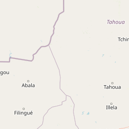
Map view of Mare de Dan Doutchi

Use this park location map to pinpoint Mare de Dan Doutchi in Niger, understand its exact geographic position, and read its mapped placement within the surrounding landscape more clearly.

Pigeon | © OpenStreetMap contributors

Location context for Mare de Dan Doutchi

Tahoua Region
Park atlas

Compare adjacent wetland reserves and regional conservation areas across the Sahel

Parks Near Mare de Dan Doutchi and Surrounding Protected Wetland Landscapes

Browse protected areas near Mare de Dan Doutchi to compare regional wetland habitats and arid ecosystems. Continuing into surrounding park geography reveals broader ecological patterns across the Iullemmeden Basin.
Protected areaTahoua Region
102 km away#1 closest

Northeast

Mare de Tabalak Protected Area: Geography and Wetland Landscape in Tahoua, Niger

Mapping a unique Sahelian freshwater ecosystem and seasonal floodplains

Mare de Tabalak serves as one of the most ecologically significant wetlands in Niger. This protected area, characterized by its permanent freshwater lake and vast seasonal floodplains, sits at the intersection of the Ader Doutchi plateaus and the Tadrès sand dunes. The site acts as a major hub for migratory bird populations and supports essential regional pastoral and agricultural livelihoods within the Tahoua landscape.

Area
7 km²
Established
2005
Relief
Lowland
Climate
Arid
A soft, light watercolor painting of a valley landscape with rolling green hills, distant purplish mountains, and patches of pink, yellow, and green vegetation.
Wildlife reserveNiger
151 km away#2 closest

Southwest

Dallol Bosso Wildlife Reserve: Geographic Atlas and Protected Landscape Context in Niger

A 350-kilometer seasonal wetland corridor and regional hydrologic system

Dallol Bosso stands as a major seasonal drainage corridor in western Niger. This wildlife reserve spans from the Malian border to the Niger River, offering a distinct study in Sahelian hydrology. Its alluvial soils and wetland characteristics support specific agricultural patterns, making it a focal point for understanding the human and natural geography of the Boboye region.

Area
8,921.22 km²
Established
2004
Relief
Lowland
Climate
Subtropical
Protected areaDosso Region
177 km away#3 closest

Southwest

Dallol Maouri Protected Area: Geographic Overview of Niger's Fossilized Wetland Valleys

Mapping seasonal pond systems and floodplain corridors in the Dosso Region

Dallol Maouri serves as a quintessential example of the ancient drainage systems found in the Iullemmeden Basin. As a Ramsar-listed protected area, it features a unique north to south orientation that fosters a rich transition between dryland Sahel and Sudanian savanna. The valley is defined by its seasonal mares, palm groves, and intricate network of koris tributaries that shape the geography of southwestern Niger.

Area
3,175.2 km²
Established
2004
Relief
Lowland
Climate
Subtropical
National parkNiger
252 km away#4 closest

Southwest

W National Park: Niger National Park, UNESCO World Heritage Site & Ramsar Wetland

Transborder savanna ecosystem and dramatic Niger River landscape.

W National Park in Niger offers a unique atlas view of a vast protected landscape defined by the Niger River's iconic W-shaped bend. As a UNESCO World Heritage Site and Ramsar Wetland, it protects crucial savanna plains, extensive floodplains, and rocky outcrops. This transborder conservation area is a vital habitat for West African wildlife, providing a rich context for geographic discovery and landscape exploration.

Area
10,000 km²
Established
1954
IUCN
II
Relief
Mixed relief
Protected areaDosso
260 km away#5 closest

Southwest

Feuchtgebiet am mittleren Niger: Protected Wetland Geography and River Floodplain Atlas

Geographic overview of floodplain terrain in Dosso, Niger

Feuchtgebiet am mittleren Niger preserves a vital mosaic of riverine channels, temporary ponds, and floodplain flats. This protected area stands as a distinctive aquatic corridor within the Sahel, characterized by diverse water-based habitats and seasonal vegetation shifts that define the regional geography of Dosso.

Area
521.8 km²
Established
2001
Relief
Lowland
Scope
Terrestrial
A soft, horizontal watercolor painting showing a green and tan landscape of trees and hills with a reflecting body of water in the foreground, set against a white background.
Nature reserveMaradi Region
About 277 km away#6 closest

East

Geschützter Wald von Madarounfa: Protected Woodland and Nature Reserve in the Maradi Region

Mapping the Sahel-Sudan transition landscapes of Niger.

Located in the Maradi Region, this nature reserve protects a rare mosaic of dryland vegetation, including acacia and tamarind groves on alluvial soils. The woodland functions as a critical environmental anchor within the surrounding agricultural plains, offering a window into the natural history of the Goulbi de Maradi river valley.

Area
8.3 km²
Established
1950
Relief
Lowland
Climate
Subtropical
A soft watercolor painting showing a winding river or lake flowing through a landscape with gentle green hills, clusters of trees, and a pale sky.
Nature reserveMaradi Region
About 277 km away#7 closest

East

Madarounfa Lake Nature Reserve: Geographic Overview of Niger's Premier Wetland

Seasonal wetlands and riparian habitats in Maradi Region

Madarounfa Lake functions as a pivotal natural feature in the Maradi Region, blending seasonal hydrological shifts with a distinct cultural identity. This protected area supports critical riparian woodland and waterbird populations, serving as an essential resource for the surrounding landscape. Its classification as a wetland of international importance highlights the environmental complexity of the Sahel-Sudanese transition zone.

Area
8.5 km²
Established
2019
Relief
Lowland
Scope
Terrestrial
Wildlife reserveDosso Region
279 km away#8 closest

Southwest

Feuchtgebiet am mittleren Niger II: Wetland Geography and Wildlife Reserve Boundaries

A seasonal floodplain corridor in the Dosso Region of Niger.

Feuchtgebiet am mittleren Niger II offers a clear view into the flood-pulse ecology of the middle Niger River. The reserve comprises a complex network of channels, ponds, and riverine woodlands that shift with the annual rains. This protected site in the Dosso Region acts as a crucial transboundary conservation area, showcasing the unique interaction between riparian forests, baobab groves, and seasonal aquatic terrain.

Area
385.55 km²
Established
2004
Relief
Lowland
Scope
Terrestrial

Common questions about visiting, size, designation, and location context for Mare de Dan Doutchi

Mare de Dan Doutchi FAQs for park facts, access, geography, and protected area context

Find quick answers about Mare de Dan Doutchi, including protected-area facts, park geography, trail and visitor context, and how the park fits into its surrounding country and regional landscape.
MoriAtlas Explorer

Continue Your Protected Areas Search Across the Global Atlas

Deepen your exploration by continuing the structured search for national parks and protected areas worldwide. Utilize the comprehensive filtering capabilities to compare different conservation landscapes and refine your understanding of global park geography. Discover more about the distribution and characteristics of protected natural areas.

Global natural geography