Mori Atlas logo
Natural monumentMarkův mlýn

Examining the ecological terrain and geographical boundaries of this unique Czech botanical reserve

Markův mlýn Natural Monument: A Deep Dive into the Protected Rock Steppe and River Landscapes

(Přírodní památka Markův mlýn)

Located within the Středočeský kraj region, Markův mlýn functions as a specialized natural monument preserving fragments of dry, sun-warmed rock steppe. This protected area, nestled in the valley of the Loděnice stream, features a mosaic of hillside meadows and water-influenced terrain that shelter rare plant communities. Through our mapped atlas data, you can examine the micro-landscapes that define this significant botanical site and understand its role within the wider regional geography.

rock steppedry grasslandbotanical reserveprotected plant speciespasqueflowerriver valley

Markův mlýn

Natural monument

Park overview

Structured park overview, official facts, and landscape profile for Markův mlýn Natural Monument

Markův mlýn Natural Monument park facts, protected area profile, and essential visitor context

Review the core facts for Markův mlýn Natural Monument, including designation, size, terrain, visitor scale, habitats, and operating context in one park-focused overview.

About Markův mlýn Natural Monument

Markův mlýn is a diminutive but ecologically focused protected area in central Bohemia. Although its total extent is only about 0.13 hectares, divided across two small locations near the historic Markov mlýn mill, it carries considerable botanical significance because of the dry steppe communities it shelters in an otherwise relatively mesic Central European landscape.

The reserve sits in a gently rolling stretch of the Loděnice river valley, where the stream and its old mill race have shaped a curved island of ground that, together with a nearby hillside meadow, forms the protected complex. The valley setting creates exposure to sun and a thin, poor substrate, conditions that have allowed species typical of warmer, drier climates to establish themselves here.

From a conservation standpoint, Markův mlýn is meaningful because it preserves a living example of the kind of habitat where Bohemia's rare steppe plants survive outside their main areas of occurrence. Its small size is not a weakness: it is precisely the kind of micro-refuge where fragmented dry-grassland species cling to existence in a modern agricultural and forested countryside.

Quick facts and research context for Markův mlýn Natural Monument

Markův mlýn is a tchèque přírodní památka (natural monument), classified as an IUCN Category III protected area. It was officially designated on 15 January 1987 by the former Okresní národní výbor Kladno, the district-level national committee that held nature conservation authority at the time.

The site lies in the Středočeský kraj (Central Bohemian Region), within Okres Kladno, on the cadastral territory of Unhošť. It sits in low foothills at elevations roughly between 310 and 330 meters above sea level, with a total area of only about 0.13 hectares split between two separate localities.

Park context

Deeper park guide and search-rich context for Markův mlýn Natural Monument

Markův mlýn Natural Monument history, landscape, wildlife, and travel context

Explore Markův mlýn Natural Monument through its history, landscape character, ecosystems, wildlife, conservation priorities, cultural context, and seasonal travel timing in a structured park guide built for atlas discovery and search intent.

Why Markův mlýn Natural Monument stands out

Markův mlýn is known above all for its very localized population of Pulsatilla pratensis subsp. bohemica, the Bohemian pasqueflower, a subspecies protected under Czech nature law. The reserve is significant in conservation circles as one of the small inland sites where rock-steppe vegetation has survived in the Bohemian landscape. The combination of unusually dry, thin-soil conditions and traditional low-intensity land use has allowed Mediterranean-style steppe flora to persist here far from any truly warm climate, sharing the habitat with other notable dry-grassland species such as Seseli osseum, Koeleria macrantha, and Centaurea triumfettii.
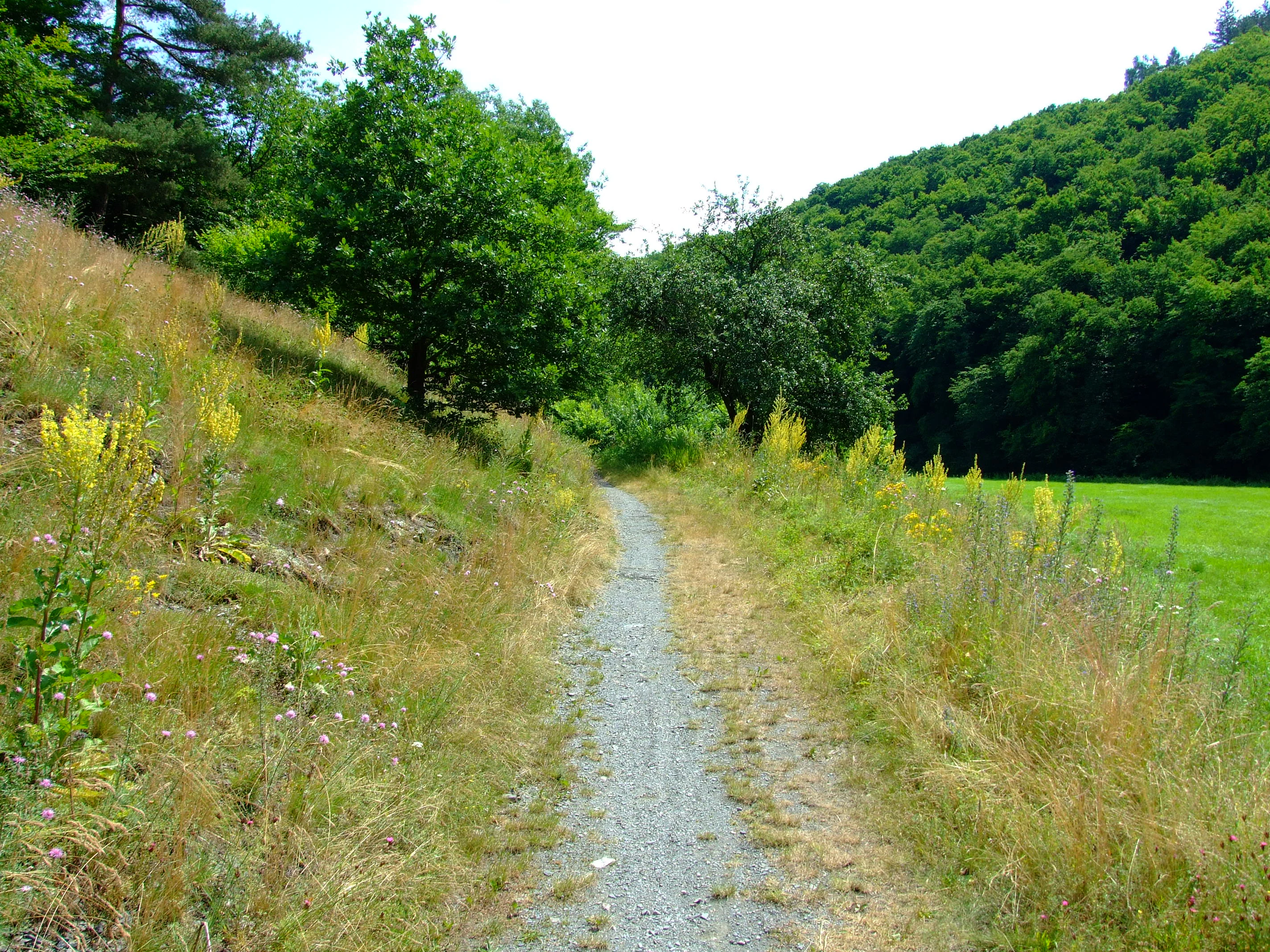
A narrow gravel trail passes between a grassy, wildflower-covered slope on the left and a dense green forest edge on the right.
A gravel trail winding through the grassy hillside of the Markův mlýn nature monument.

Markův mlýn Natural Monument history and protected-area timeline

Markův mlýn was formally declared a protected area on 15 January 1987 by the Okresní národní výbor Kladno, the district national committee that administered nature conservation in the Kladno area during the late socialist period. The designation was driven by concern for the locally significant populations of protected and rare plant species found on the small parcels of dry grassland near the old mill.

The two localities that make up the present-day natural monument already existed as ecologically distinct patches before formal protection: a hillside meadow immediately north of the former mill buildings, and an island-shaped parcel on the meander between the Loděnice stream and the historic mill race. Recognizing both as a single named monument consolidated their protection under a single administrative identity.

No further large-scale changes in status have been identified in the available sources; the site has remained a local-scale botanical refuge in the broader Central Bohemian protected-area network.

Markův mlýn Natural Monument landscape and geographic character

The landscape of Markův mlýn is shaped by the modest valley of the Loděnice stream, a Berounka tributary that cuts a shallow trough through the countryside north of Kladno. Elevations are low, between roughly 310 and 330 meters above sea level, and the terrain rolls gently rather than rising into true hills. The stream's meanders and the artificial mill race attached to the historic Markův mlýn create wetter zones along the watercourse, contrasting with the drier open ground that defines the protected localities.

The two component patches of the monument reflect this contrast. One is a sunny hillside meadow perched above the valley floor, about 200 meters north of the old mill, where thin soils and slope position keep conditions dry. The other is a small, almost island-like piece of land inside a meander of the Loděnice, bordered by both the natural stream channel and the mill race.

Together, these micro-landscapes form a tiny mosaic of open, sun-exposed, nutrient-poor surfaces embedded in a narrow stream valley, a combination that allows rock-steppe vegetation to coexist with wetland-edge shrubs such as hazel and buckthorn.

Markův mlýn Natural Monument ecosystems, habitats, and plant life

The nature of Markův mlýn is defined by dry grassland and rock-steppe plant communities, an unusual vegetation type for the relatively humid Central Bohemian landscape. The protected steppe patches are dominated by grasses and forbs adapted to thin soils, strong sunlight, and summer drought stress, and are surrounded by shrubs that mark the transition to the surrounding woodland and farmland.

The botanical character is shaped by the open, unmanaged nature of the two small localities, which have apparently remained free of intensive agriculture or afforestation. The proximity of the stream and old mill race adds a contrasting wet-element, influencing the edges of the protected patches where moisture-loving shrubs take hold.

Although the reserve is tiny, it captures a meaningful slice of the dry-grassland biogeography of Bohemia, preserving multiple species that in this region typically occur only as scattered relicts of once more extensive open habitats.

Markův mlýn Natural Monument wildlife and species highlights

Wildlife is not the primary focus of Markův mlýn; the monument is botanically rather than faunistically oriented. Its core significance lies in plant species and plant communities rather than in animal populations.

The open, dry character of the steppe patches would be expected to support typical grassland invertebrates such as butterflies, bees, and other pollinators that depend on the flowering plants of the site, while the stream corridor and mill race provide habitat for aquatic and waterside fauna along the Loděnice. However, the available sources do not document specific animal species, populations, or conservation-relevant fauna for this monument, so this section should not be over-interpreted.

Markův mlýn Natural Monument conservation status and protection priorities

The conservation value of Markův mlýn rests on its role in protecting rare dry-grassland flora in an area where such habitats are highly fragmented. Its declared purpose is the safeguarding of unique plant species and rock-steppe communities, including a strong presence of the Bohemian pasqueflower (Pulsatilla pratensis subsp. bohemica), a protected subspecies, and a smaller population of Gagea bohemica.

Because the reserve safeguards multiple species of conservation interest in a very small area, its role is essentially that of a botanical micro-refuge. The monument helps maintain gene pools and habitat continuity for steppe plants that, in the surrounding Central Bohemian countryside, have lost much of their original habitat to farming, forestry, and development.

The site is registered in the Czech nature conservation database under code 1018 and remains part of the national network of small-scale botanical monuments that together maintain biodiversity across fragmented landscapes.

Markův mlýn Natural Monument cultural meaning and human context

The cultural context of Markův mlýn is tied closely to its namesake, the historic Markův mlýn (Markův mill), a water-powered mill that once operated along the Loděnice stream. The mill race and the meander-shaped island ground that now form part of the protected area are direct legacies of this milling heritage, illustrating how traditional rural water use shaped landforms that subsequently became valuable for conservation.

The wider area around the monument is the small-town and agricultural countryside of the Unhošť area in the Kladno District, a region with deep roots in farming and small-scale water management. The hilltop and riverside settings near Chyňava place the site in a landscape long used by local communities, yet the small meadows and steppes have apparently escaped the more intensive forms of land use that altered surrounding areas, which is itself part of why their flora survived.

Top sights and standout views in Markův mlýn Natural Monument

Markův mlýn stands out for combining a very small footprint with an unusually high concentration of conservation-relevant steppe plants, anchored by its population of the Bohemian subspecies of the pasqueflower and supporting species such as Seseli osseum and Gagea bohemica.

It also offers an interesting compact example of how a historical mill landscape, with its meanders and mill races, can simultaneously create cultural heritage features and shelter ecologically valuable dry grassland. The site is therefore a useful illustration of protected-area design at the micro-scale in the Czech countryside.

Best time to visit Markův mlýn Natural Monument

Visit timing for Markův mlýn is most rewarding when its characteristic plants are in flower. Early spring favors the pasqueflower, which typically blooms before its feathery foliage fully develops, while the broader rock-steppe community of grasses and forbs reaches its visual peak in late spring and early summer when conditions are warm and dry. Autumn visits are less distinctive botanically but can still be pleasant along the Loděnice valley and its blue-marked hiking trail.

The site is exposed and open, so comfortable weather and good light are more important than any specific month. Given its very small size, a short stop along a broader walk in the Loděnice valley is the most natural way to experience it.

Monthly climate preview

Long-term temperature and precipitation patterns recorded at Markův mlýn

Markův mlýn Climate Normals and Monthly Weather Rhythm

Historical data records the annual temperature and precipitation rhythm across twelve measured monthly intervals at Markův mlýn. Examining the complete monthly climate profile reveals detailed thermal ranges and precipitation variations for this location.
Annual mean9 °C
-2 °C20 °C
Jan-2°
Feb-1°
Mar
Apr
May13°
Jun17°
Jul20°
Aug19°
Sep14°
Oct
Nov
Dec-1°
Warmest month
July

19.7 °C

Coolest month
January

-2.2 °C

Wettest month
June

2.6 mm/day

Driest month
February

1.1 mm/day

Park location guide

Geography guide, regional context, and park location map for Markův mlýn Natural Monument

Markův mlýn Natural Monument park geography, regions, and map view in Czechia

Understand where Markův mlýn Natural Monument sits in Czechia through a broader geographic reading of the surrounding landscape, nearby location context, and its mapped position within the national park landscape.

How Markův mlýn Natural Monument fits into Czechia

Czech Republic is a landlocked Central European country with a population of approximately 10.9 million people. The nation was established as an independent state on January 1, 1993, following the dissolution of Czechoslovakia. Its capital and largest city is Prague, with other major urban centers including Brno, Ostrava, Plzeň, and Liberec.

Wider geography shaping Markův mlýn Natural Monument in Czechia

The Czech Republic is a landlocked country in Central Europe. It is bordered by Germany to the west, Austria to the south, Poland to the northeast, and Slovakia to the southeast. The landscape is predominantly hilly, with the territory covering 78,871 square kilometers.

Map view of Markův mlýn Natural Monument

Use this park location map to pinpoint Markův mlýn Natural Monument in Czechia, understand its exact geographic position, and read its mapped placement within the surrounding landscape more clearly.

Pigeon | © OpenStreetMap contributors

Location context for Markův mlýn Natural Monument

Středočeský kraj

Visual reference collection highlighting rare rock steppe habitats and protected plant populations

Markův mlýn Photos and Landscape Scenery in Central Bohemia

Visual documentation of Markův mlýn captures the rare rock steppe habitats, dry grassland vegetation, and stream valley terrain defining the protected area. Photographic records provide clear visual context for understanding the botanical significance and landscape character of the reserve.

A narrow gravel trail passes between a grassy, wildflower-covered slope on the left and a dense green forest edge on the right.

Park atlas

Compare nearby regional reserves and connected valley habitats across Central Bohemia

Explore Other Parks Near Markův Mlýn and Surrounding Protected Landscapes

Visitors exploring Markův mlýn can browse adjacent protected areas and stream valley reserves to examine broader regional plant communities. Expanding the search helps contextualize localized rock steppe habitats within the wider Bohemian countryside.
Natural monumentStředočeský kraj
About 15 km away#1 closest

North

Vinařická hora Natural Monument: A Volcanic Geography and Protected Terrain Study

Key protected area and geological landmark in the Středočeský kraj region.

Vinařická hora is a compact, asymmetric hill serving as a vital natural monument for the study of Tertiary volcanic processes and dry-slope plant communities. Its abandoned quarries provide a clear stratigraphic record of ash and lava, while its summit offers panoramic views across the central Bohemian plateau. This site represents a convergence of deep geological history and specialized modern habitat preservation.

Area
0.684 km²
Established
1985
IUCN
III
Relief
Upland
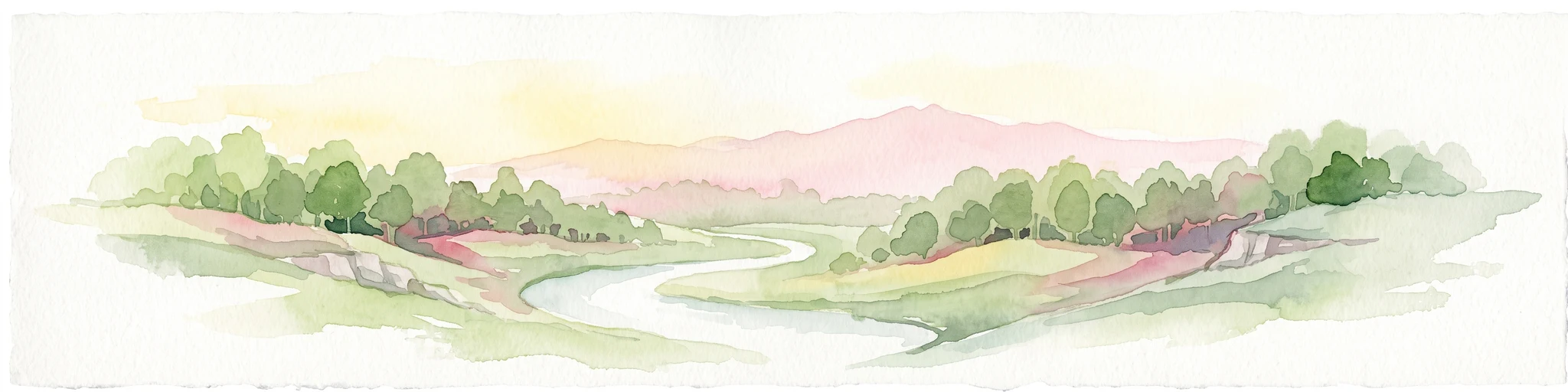
A horizontal watercolor painting showing a winding stream flowing through a lush, green valley with rolling hills and distant mountains under a soft light.
Natural monumentCentral Bohemian Region
About 15 km away#2 closest

Northwest

Smečenská rokle Natural Monument: Geological Gorge and Protected Landscape

Geological cross section in the Central Bohemian Region

Smečenská rokle is a compact natural monument featuring a deep erosional canyon cut into the marlstone plateau. The site offers a detailed stratigraphic view of Bohemian Cretaceous Basin sediments while preserving rare patches of scree and ravine forest within the broader agricultural environment of Central Bohemia.

Area
0.062 km²
Established
1987
IUCN
III
Relief
Upland
Natural monumentPrague
About 16 km away#3 closest

East

Zmrzlík Natural Monument: Geological Profile and Protected Landscape Map of Prague

Silurian stratotype sites and calcareous grassland ecosystems

Zmrzlík is a protected natural monument in Prague, defined by its rich Silurian geological sequences and fossil-bearing limestone deposits. The site offers a clear view into the Kopanina Formation, featuring distinct basaltic volcanic remains and rare xerothermic vegetation. This map-based resource details the terrain and ecological mosaic of the area, ranging from rocky ridges to the valleys of the Mlýnský potok.

Area
0.164 km²
Established
1988
IUCN
IV
Relief
Upland
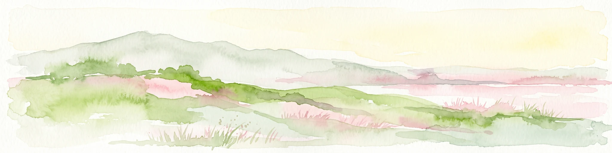
A wide watercolor painting showing a landscape of green hills, scattered trees, and distant pink and purple mountains under a pale sky.
Natural monumentStředočeský kraj
About 16 km away#4 closest

North

Smečno Natural Monument: A Protected Woodland Ecosystem in Středočeský Kraj

Geography and conservation mapping in the Czech Republic

Located in the Kladno District, Smečno Natural Monument preserves mature deciduous trees essential for the survival of the hermit beetle. The site acts as a geographical link between distinct landform units, offering a clear look at how small, cavity-rich forest patches maintain ecological connectivity within the broader Central Bohemian landscape.

Area
0.772 km²
Established
2012
IUCN
IV
Relief
Upland
Nature reservePraha 5
About 17 km away#5 closest

East

Prokopské údolí Nature Reserve: Geological Mapping and Protected Area Discovery

A limestone karst landscape situated within the Praha 5 district

Prokopské údolí is an essential protected nature reserve in Praha 5, featuring a deep limestone valley that serves as a globally significant site for Paleozoic fossils and karst geography. This protected landscape encompasses a range of habitats including rock steppes, thermophilic woodlands, and volcanic outcrops, providing a unique look at urban-adjacent nature conservation and historical limestone quarrying within the Czech Republic.

Area
1.71 km²
Established
1978
IUCN
III
Relief
Upland
Natural monumentPrague
About 17 km away#6 closest

East

Vidoule Natural Monument: Geological Profile and Protected Landscape Context in Prague

A table mountain remnant with exposed Cretaceous sandstone formations.

Vidoule stands as a significant natural monument in western Prague, defined by its flat-topped table mountain geometry and horizontal Cretaceous strata. The site offers a unique perspective on the regional geology of the Prague Plateau, where protected slopes guard rare dry grassland habitats and fossil-rich layers against a backdrop of dense urban development.

Area
0.087 km²
Established
1988
IUCN
III
Relief
Upland
Natural monumentPrague
About 17 km away#7 closest

East

Vizerka Natural Monument: Mapped Protected Landscapes and Rocky Terrain in Prague

A rare xerothermic steppe refuge on the edge of the Šárka Valley

Vizerka represents a compact yet significant natural monument located on the rocky slopes of the Šárecké údolí in Prague. Featuring exposed Proterozoic shale and shallow soils, this protected site serves as a vital island of thermophilic grasslands and shrubby terrain. It offers a fascinating look at relict warm-loving habitats and rare species survival within the dense geographical context of a European capital city.

Area
0.031 km²
Established
1988
IUCN
IV
Relief
Upland
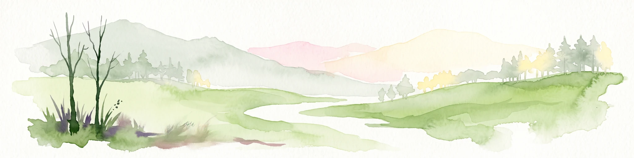
A horizontal watercolor illustration showing a soft, dreamy landscape with rolling green hills, light purple and yellow tones, a winding path or stream, and a lone bare tree in the foreground.
Protected landscapePraha
About 18 km away#8 closest

East

Přírodní park Šárka-Lysolaje: Protected Landscape Mapping and Geographic Identity in Praha

A dense mosaic of stream valleys and protected natural monuments near the heart of Praha

Examine the detailed geography of Přírodní park Šárka-Lysolaje, an extensive protected landscape in Praha that functions as a critical green corridor. Its terrain, defined by deeply incised stream valleys and steep forested slopes, hosts a unique concentration of smaller nature reserves and monuments, creating a coherent ecological framework directly adjacent to the urban metropolitan environment.

Area
10.05 km²
Established
1990
Climate
Temperate
Scope
Terrestrial

Common questions about visiting, size, designation, and location context for Markův mlýn Natural Monument

Markův mlýn Natural Monument FAQs for park facts, access, geography, and protected area context

Find quick answers about Markův mlýn Natural Monument, including protected-area facts, park geography, trail and visitor context, and how the park fits into its surrounding country and regional landscape.
MoriAtlas Explorer

Continue Your Protected Areas Search Across the Global Atlas

Deepen your exploration by continuing the structured search for national parks and protected areas worldwide. Utilize the comprehensive filtering capabilities to compare different conservation landscapes and refine your understanding of global park geography. Discover more about the distribution and characteristics of protected natural areas.

Global natural geography