
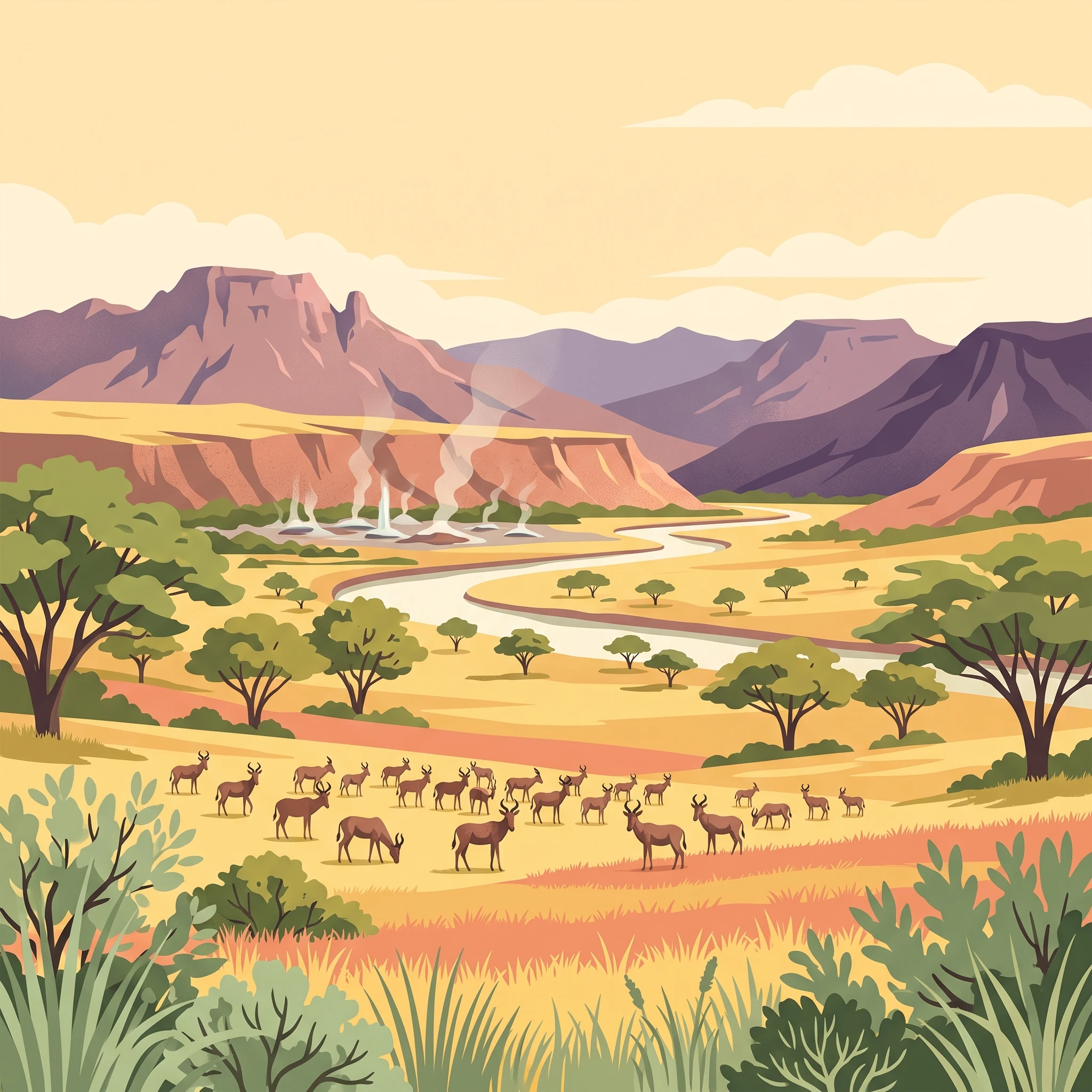
Trip Timing Basics
When to Visit Maze National Park: The Essential Timing Guide
Determining the best time to visit Maze National Park requires a careful balance between the accessibility of the park terrain and the specific biological cycles of the endangered Swayne's hartebeest. The primary timing trade-off is driven by the region's distinct rainfall patterns, which dictate both the ease of traversing the park's savanna landscapes and the visibility of its endemic wildlife. For most travelers, the period from December through February stands out as the most reliable window, offering lower precipitation levels and drier ground conditions that facilitate movement through the Gamo Gofa Zone and improve the clarity for spotting the hartebeest.
The Relationship Between Rainfall and Landscape Access
Maze National Park experiences a significant shift in environmental conditions that influences the visitor experience. During the drier months, which typically span from December to February, the reduced rainfall minimizes the risk of muddy trails and difficult access routes that can occur during the wetter phases of the year. This period also features lower humidity, which often makes exploring the open savanna and the unique Bilbo hot springs more comfortable for sustained outdoor activity. Conversely, the peak rainy season, marked by higher precipitation, transforms the terrain. While this leads to lush, vibrant vegetation, it complicates travel logistics and can restrict access to certain areas within the 210 square kilometer park. Understanding these cycles is essential, as the park's terrain, characterized by a transition between highland plateaus and lowland rift systems, reacts quickly to seasonal moisture.
Balancing Wildlife Observation with Environmental Conditions
The presence of the Swayne's hartebeest is a defining feature of the park, and timing your trip during the drier phase of the annual climate cycle increases the likelihood of consistent wildlife sightings. When the landscape is less overgrown due to reduced rainfall, these antelopes are often easier to locate within the deciduous broadleaf savanna. Travelers should also consider how daylight and temperature variability throughout the year affect their daily planning. While temperatures remain relatively consistent in their moderate range, the subtle shifts in wind and moisture levels across the seasons can impact the overall comfort of a safari experience. The goal for any visitor is to align their schedule with a period that minimizes these environmental hurdles, ensuring that the primary objective, whether it be spotting the park's signature species or witnessing the geological activity of the geothermal springs, is not hampered by significant weather-related interruptions.
Seasonal Outlook
Best Months to Visit Maze National Park at a Glance
The Arid Peak for Wildlife Viewing
For those prioritizing the sighting of Swayne's hartebeest, the period from December through February stands as the most reliable window. These months coincide with the lowest precipitation levels, often recording averages near or below 1.5 mm per day. The drier conditions thin out the savanna vegetation, which significantly improves visibility across the park's characteristic broadleaf landscapes. During this time, humidity remains at its annual low, typically dipping below 50 percent, making the 30-degree Celsius daytime peaks feel less oppressive than they might during the humid transition months. This window provides the most stable ground conditions for moving through the Gamo Gofa Zone toward the park boundary.
Transition Windows and Changing Landscapes
The months of March and November act as critical shoulder periods. March marks the beginning of the transition toward higher moisture levels as daily rainfall begins to climb toward 3 mm. Visitors arriving in this window may find the park landscape greener and more vibrant, though the tall grasses can begin to obscure ground-level wildlife. November offers a brief, cooler reprieve before the peak of the dry season, characterized by moderate temperatures and relatively manageable humidity. These transition periods require flexibility, as the local climate can be less predictable, and afternoon showers are increasingly likely compared to the starkly dry winter window.
High Rainfall Periods and Restricted Access
Between April and August, the park experiences its most significant wet phase, with precipitation regularly exceeding 4 mm per day and humidity levels frequently climbing above 75 percent. While the landscape is at its most lush, this season presents the most substantial challenges for travel. The increased moisture can impact the accessibility of paths and tracks within the park, potentially limiting the range of areas you can explore. May and April are particularly notable for their higher rainfall, which can transform the savanna into a challenging environment for vehicle movement. Travelers visiting during these months should anticipate that their activities may be limited to specific, well-maintained sections near the primary gate or park headquarters, as the broader terrain often becomes too soft for standard navigation.
Balancing Weather with Park Exploration
If your goal is to experience the unique geological features like the Bilbo hot springs, the drier months of December and January are generally preferable. Steaming geysers are often more atmospheric in the cooler, clearer morning air of the winter months. Because temperatures remain relatively moderate year-round due to the elevation of 1,000 to 1,200 meters, the primary trade-off is not extreme heat or cold, but rather the mobility constraints imposed by the rain. Always plan your visit with the understanding that weather patterns are variable and require verification of local conditions, especially when travelling into the more remote sections of the park during the wetter months of the year.
Annual Climate Overview
Temperature, Precipitation, and Climate Trends by Month at Maze National Park
Understanding the Annual Climate Rhythm
The climate of Maze National Park is shaped by its position in the Gamo Gofa Zone, situated at an elevation of approximately 1,600 meters. This altitude creates a unique environment that balances the high temperatures of the Ethiopian rift valley with the moderating effects of its mid-latitude plateau location. The annual cycle is characterized by a distinct contrast between the dry, sunny months of early winter and the more humid, rain-affected periods that peak toward the middle of the year. While these long-term climate normals represent the standard conditions observed between 1991 and 2020, they do not function as daily weather forecasts, and local conditions across the 210 square kilometers of the park can fluctuate based on specific terrain and localized weather events.
The Dry Season Contrast
From December through February, the park experiences its most stable and dry conditions. During this period, daytime maximums frequently reach into the low 30s Celsius, with January and February often marking the warmest part of the year. These months are defined by lower relative humidity levels, which often drop below 50 percent, and minimal precipitation. The drier air makes the heat feel more manageable for outdoor activities compared to the muggy conditions later in the year. Daylight hours during these months are at their annual minimum, providing slightly less time for exploration, but the trade-off is significantly clearer visibility and a lack of significant wind-driven rainfall.
Transition Phases and Rainfall Shifts
As the calendar moves into March and April, the climate undergoes a notable shift. March serves as a transition month where temperatures remain high, but the likelihood of precipitation begins to increase. By April and May, relative humidity climbs significantly, often exceeding 75 percent. This increase in moisture is coupled with a downward trend in daytime maximums, which drop from the early-year peaks into the mid-20s Celsius by June. The concentration of rainfall during this period is the most important factor for planning, as the influx of water transforms the savanna landscape and alters the accessibility of the park's internal roads and paths.
Mid-Year Stability and Cooling
June, July, and August represent the peak of the wetter season in terms of sustained humidity and consistent, albeit moderate, daily precipitation levels. During these months, the park experiences its lowest mean temperatures, with average daily means dropping toward 19 degrees Celsius. The daylight hours reach their maximum length, providing nearly 12.5 hours of light, yet this window is also when cloud cover is most frequent, which can obscure the dramatic views of the surrounding highlands like Mount Gughe. Wind speeds show a slight increase during this time, averaging above 2 meters per second, which can enhance the cooling effect in the park's exposed savanna areas.
Autumnal Drying Trends
Following the wetter months, September and October mark a gradual return to drier conditions. Humidity begins to trend downward from the mid-70s to the 60s, and the intensity of rainfall shifts. By November, the climate begins to mirror the early-year patterns, with declining precipitation and the start of the climb back toward the higher daytime temperatures that define the December and January peak. This late-year transition is often characterized by a return to clearer skies, making it a predictable lead-in to the subsequent dry season.
Seasonal Climate Patterns
Understanding the Dry and Rainy Seasons in Maze National Park
Defining the Annual Weather Rhythm
Maze National Park does not conform to a traditional four-season model. Instead, its climate is best understood through two primary phases: a distinct dry, warm season and a longer, more humid period characterized by variable precipitation. Because the park sits at an elevation of roughly 1,000 to 1,200 meters, it avoids the extreme cold found in Ethiopia's highest plateaus, but it remains sensitive to moisture patterns moving through the Gamo Gofa Zone.
The Dry Season: December to February
The most stable period for visiting occurs from December through February. During these months, the park experiences its lowest daily precipitation, often falling below 1.5 mm per day. Humidity levels reach their annual minimum, frequently dipping below 50 percent, which creates clear, crisp air ideal for wildlife viewing. This phase is characterized by warmer daily maximums that often climb above 30 degrees Celsius, providing consistent sunshine. Travelers should note that while this period offers the most predictable weather, the landscape begins to dry out, which influences the distribution of wildlife, including the Swayne's hartebeest, as animals congregate near permanent water sources like the Maze River.
Transition to the Humid Phase: March and April
As the calendar shifts into March and April, the park enters a transitional window where humidity begins to climb significantly. March often retains some of the warmth and relatively lower moisture levels of the previous months, but it acts as a precursor to the wetter conditions that arrive in April. Once April begins, precipitation normals jump noticeably, with daily averages exceeding 7 mm. Humidity levels rise sharply toward 70 percent, and the intensity of the sun can feel tempered by increased cloud cover. This period is less about a total shutdown of activities and more about a shift in environmental comfort. Visitors during this time may find the park greener and more vibrant, but they must be prepared for the logistical challenges that accompany higher rainfall in the savanna terrain.
The Cool, Wet Period: May to September
The mid-year period from May through September represents the most humid and temperate phase. During these months, mean temperatures drop, often hovering near 19 to 20 degrees Celsius. Humidity remains persistently high, frequently staying above 75 percent. While this is not a period of constant torrential rain, the cumulative precipitation keeps the ground saturated, which can affect the state of tracks and paths throughout the 210-square-kilometer reserve. This season is marked by lower daily maximum temperatures, rarely exceeding 27 degrees Celsius, making it a cooler alternative to the heat of the early year, provided visitors are equipped to handle the moisture.
The November Transition
November serves as a brief but crucial window of stabilization. As the lingering effects of the humid season fade, humidity levels drop and precipitation begins to decrease toward the dry season lows. This month acts as the primary buffer, allowing the park to dry out before the start of the next peak wildlife viewing cycle. It is a transitional time where temperatures are mild and the landscape begins to settle, marking the final stage before the cycle resets in December.
Seasonal Experiences
What Visiting Maze National Park Is Like Throughout the Year
Visiting Maze National Park offers a distinct seasonal rhythm where the landscape shifts from arid savanna to a more lush, moisture-rich environment. Because the park acts as a critical refuge for the endangered Swayne's hartebeest, understanding how the environment dictates movement and visibility is essential for planning a productive visit.
Wildlife Viewing During the Dry Cycle
The dry months from December through February provide the most stable ground conditions for traversing the savanna habitat where the Swayne's hartebeest congregate. During this window, lower relative humidity and minimal precipitation contribute to clearer conditions for movement. As the primary savanna vegetation begins to thin compared to the peak of the rainy season, the hartebeest often remain more visible against the landscape. Travelers focusing on these endemic antelopes should prioritize this period, as the lack of seasonal rain reduces the difficulty of navigating the park interior, allowing for more predictable access to established viewing areas.
Geothermal Features and Geological Exploration
The Bilbo hot springs serve as a consistent year-round attraction, but their appeal and the ease of reaching them change significantly with the weather. During the drier months, the area surrounding the steaming vents remains firm, allowing for easier approaches to the geyser sites. While the springs maintain their activity regardless of the season, the elevated humidity during the wetter months from April to August can make the surrounding terrain more challenging to walk across. Visitors interested in the geological significance of the site may find that the dry months offer a more straightforward experience, especially when combined with visits to the Wonja stone caves. The caves, which offer a unique historical perspective on the Gamo Gofa Zone, are best accessed when paths are dry and less prone to the muddy conditions that can follow heavy rainfall.
Navigating the Landscape by Season
The park experiences a distinct shift in environmental character as the rainfall increases. In the months of April, May, and June, the rise in precipitation influences the overall park experience, often limiting the ability to explore the more remote savanna reaches. While the landscape undergoes a transformation with increased greenery, these conditions are less conducive to traditional wildlife tracking or sustained outdoor walking. The transition into the cooler, wetter months requires visitors to be prepared for fluctuating ground stability. Unlike the peak of the dry season, where the primary objective is observation and exploration, the wetter months are defined by the necessity of careful movement. The increased wind speeds sometimes noted in the middle of the year do not necessarily clear the skies as they might in other regions, meaning that the logistical challenges of rain often outweigh the aesthetic changes to the flora. Travelers should rely on their planned itinerary to balance the desire for solitude against the practical constraints imposed by the Gamo Gofa Zone climate.
Visitor Priorities
Optimizing Your Maze National Park Trip by Specific Interests and Activities
Planning for Drier Conditions and Wildlife Tracking
For travelers prioritizing consistent wildlife sightings, particularly the endangered Swayne's hartebeest, the period from December through February offers the most stable environmental conditions. During these months, precipitation levels remain at their annual minimums, often dipping below 1.5 mm per day. This lack of significant rainfall results in drier ground, which facilitates easier navigation across the park's savanna habitat. The lower relative humidity, which averages between 44% and 57% during this window, contributes to clearer visibility across the open grasslands. The primary trade-off for this period is the warmer daytime peak, where temperatures frequently rise above 30°C. Visitors should prepare for these dry, warm conditions by focusing their tracking activities during the cooler early morning and late afternoon hours when animal movement is generally more frequent.
Seeking Milder Temperatures and Comfortable Walking Conditions
If your primary goal is to minimize exposure to peak afternoon heat while exploring the park's terrain, consider the period from June through August. While these months are characterized by increased precipitation compared to the winter dry season, they also bring lower daytime maximum temperatures, which consistently hover around 25°C to 26°C. The increased cloud cover and humidity, which climbs toward 78%, provide a cooling effect that many find more comfortable for traversing the landscape. The trade-off here is the higher likelihood of rainfall, which can make field conditions muddy and may require more robust footwear and waterproof gear. This timing is better suited for visitors who prioritize moderate temperatures over the need for completely dry trails.
Balancing Daylight and Accessibility
Visitors hoping to maximize their time outdoors should note that daylight hours in the Gamo Gofa Zone remain relatively consistent throughout the year, varying only slightly from roughly 11.6 hours in December to 12.4 hours in June. Consequently, day length is rarely a decisive factor for timing a trip to this region. Instead, the real trade-off centers on the transition months of March and November. March offers a gradual increase in warmth before the onset of heavier seasonal rains, while November provides a drying window after the mid-year humid period. Choosing these shoulder months allows for a compromise between the extreme heat of the dry peak and the restricted, damp conditions of the rainy season, though travelers should always verify local road status, as regional precipitation patterns can be unpredictable even outside the primary wet phase.
Logistics and Access
Seasonal Access and Operational Planning for Maze National Park
Navigating Access to the Gamo Gofa Zone
Maze National Park is situated approximately 460 kilometers southwest of Addis Ababa, positioning it as a significant transit from the highland plateau toward the lower-lying rift valley systems. The park occupies a distinct ecological transition zone, and travel to this region often requires navigating both paved main arteries and less predictable rural roads. Because the park infrastructure and its surrounding road networks are subject to local maintenance cycles and climatic impact, visitors should confirm current road conditions with regional transport authorities or your accommodation provider shortly before departure. Planning for potential delays is essential, especially when traveling during periods where rainfall is more frequent.
Seasonal Impact on Park Navigation
Regional rainfall patterns play a decisive role in the physical accessibility of the park trails. While the dry season from December through February typically offers the most stable ground conditions for vehicle transit, the wetter months of April through August can introduce significant challenges. During these months, increased precipitation can affect the surface quality of secondary tracks within the 210 square kilometer protected area. Since the terrain is varied, ranging from savanna landscapes to steeper slopes near the boundary of Mount Gughe, wet weather may limit access to specific remote sections of the park. Travelers should never assume that a route is navigable based on seasonal climate averages alone, as localized weather events can quickly alter conditions. Always verify with park management regarding any seasonal vehicle restrictions or temporary trail closures before planning your excursion.
Official Park Coordination and Documentation
As a protected area managed by the Ethiopian Wildlife Conservation Authority, all visitors are expected to coordinate their arrival through established channels. There is no evergreen rule regarding permit requirements or entrance fees that remains fixed for long periods, so you must verify the latest administrative instructions, entry permit procedures, and visitor center operating status directly with the Authority or official park offices. This verification process should happen well in advance of your trip, as documentation requirements can change. While the park is a vital sanctuary for the Swayne's hartebeest, the management of these populations and the surrounding habitat remains a priority, and access to certain zones may be restricted to protect this endangered species or facilitate conservation research. Checking for the most current rules ensures you remain in compliance with all local regulations and do not unintentionally disrupt the habitat of the local wildlife.
Safety and Preparation
Seasonal Weather Hazards and Packing Tips for Maze National Park
Navigating Thermal Shifts and Humidity in the Gamo Gofa Zone
Preparation for a visit to Maze National Park requires a clear understanding of how the park's savanna environment responds to seasonal shifts. While daytime temperatures can reach into the low 30s Celsius from January through March, evenings consistently drop to around 11 to 15 degrees. This diurnal swing is a defining characteristic of the region. Travelers should plan for layered clothing that can be adjusted as the sun moves across the sky. Breathable, light-colored fabrics are generally preferred for midday activity, while a medium-weight fleece or jacket is essential for early morning game drives and late evening hours when the temperature dips after sunset.
Humidity levels fluctuate significantly alongside the rain, impacting both personal comfort and equipment maintenance. During the wetter months, particularly from April through September, humidity levels often climb above 75 percent. This increase in moisture requires proactive management of electronics, lenses, and sensitive documents, which can be susceptible to damp conditions. Utilizing dry bags or specialized moisture-resistant gear is a practical measure for any period involving higher precipitation, ensuring that your equipment remains protected during transit across the park's diverse terrain.
Managing Exposure and Sun Safety
The park's elevation, which averages around 1,600 meters, plays a role in how visitors experience the sun throughout the year. Even during the cooler months, the ultraviolet index remains high. Protection against the sun is a year-round necessity, not just a seasonal consideration. Broad-brimmed hats and polarized sunglasses are important, as the open savanna landscapes offer limited natural shade, especially when searching for Swayne's hartebeest in the heat of the afternoon. Since weather conditions can change quickly in the Gamo Gofa Zone, it is vital to check localized weather forecasts immediately before your departure, as historical climate trends provide context but cannot predict the specific conditions of a single day.
Essential Field Conduct and Local Guidance
Safety in the park is fundamentally linked to local logistics and guided participation. Regardless of the month, access to the park’s interior requires the presence of a licensed tour guide. Beyond navigation, these guides provide critical communication with local communities and interpret current environmental conditions that might not be apparent to outsiders. Always follow their lead regarding where it is safe to walk or park. If you are visiting during transition months when rain may be unpredictable, defer to official park alerts regarding road viability. These local experts are your most reliable source for real-time safety updates, including any necessary adjustments to your planned itinerary based on current ground conditions.
Finalizing Your Visit
How to Choose the Right Time to Visit Maze National Park
Balancing Climate Realities and Your Travel Goals
Choosing when to visit Maze National Park requires a clear assessment of your personal travel priorities against the predictable rhythms of the Gamo Gofa Zone. The primary trade-off remains between the dry, accessible conditions that favor wildlife observation and the cooler, wetter months that fundamentally alter the landscape and accessibility of the park. If your goal is to maximize the visibility of the Swayne's hartebeest, the dry months between December and February offer the most stable ground conditions and clearer, less humid air. During this window, lower precipitation levels facilitate easier transit within the park, allowing for a more reliable experience when visiting the Bilbo hot springs and navigating the savanna.
Conversely, if you prefer cooler temperatures for trekking and are less concerned with seasonal rainfall, the middle of the year may offer a different experience. While the months from June through August bring increased humidity and persistent rain, they also result in lower daily maximum temperatures compared to the peak of the dry season. Travelers prioritizing climate comfort over terrain access should recognize that these wetter periods often complicate movement across the park's soil-based network. Choosing this period necessitates a higher tolerance for mud and potential logistical delays that are rarely encountered during the peak of the dry season.
Making Your Final Decision
Your final decision should reflect a realistic evaluation of your own comfort levels and core interests. There is no universally superior month to visit, as the park offers distinct environmental characteristics depending on the time of year. A trip during the transition months of March or November provides a middle ground, blending some of the drier stability with changing weather patterns that may lead to more varied daily conditions. Regardless of your chosen window, remember that monthly climate averages serve as a baseline for understanding trends rather than a guarantee of specific weather for your trip.
Before finalizing your travel arrangements, you must verify the latest road conditions and park access status with the Ethiopian Wildlife Conservation Authority or your local tour operator. Because current operational capacity and infrastructure maintenance can shift, relying on real-time updates is just as important as choosing a date based on historical climate normals. Ensure that your plan allows for flexibility and that you have consulted with professionals who understand the specific seasonal realities of the Gamo Gofa region. By aligning your expectations with these proven environmental patterns and securing current information, you can make an informed choice that best suits your travel itinerary.