Mori Atlas logo
Protected landscapeMcClellan Creek National Grassland

A detailed look at the restored shortgrass prairie and riparian terrain of this Texas National Grassland.

McClellan Creek National Grassland: Mapping the Protected Landscapes of the Texas Panhandle

McClellan Creek National Grassland preserves a unique portion of the Texas Panhandle, representing a significant soil restoration effort within the southern Great Plains. This protected landscape centers on the riparian corridor of McClellan Creek and its associated reservoir, offering an expansive view of the semi-arid plains. The site provides essential context for understanding the ecological recovery of grasslands that were once heavily altered by agricultural use.

national grasslandshortgrass prairierestored grasslandsoil conservationgreat plainstexas panhandle

McClellan Creek National Grassland

Protected landscape

Park overview

Structured park overview, official facts, and landscape profile for McClellan Creek National Grassland

McClellan Creek National Grassland park facts, protected area profile, and essential visitor context

Review the core facts for McClellan Creek National Grassland, including designation, size, terrain, visitor scale, habitats, and operating context in one park-focused overview.

About McClellan Creek National Grassland

McClellan Creek National Grassland sits in the southern part of Gray County, on the dry rolling plains of the Texas Panhandle. Although modest in size, the grassland plays an important role in the country's National Grassland network because its lands were specifically purchased to reverse severe soil erosion and restore prairie character that had been lost to misuse earlier in the 20th century. The surrounding landscape has long been shaped by wind-deposited soils, periodic drought, and the deep imprint of Dust Bowl-era land degradation, all of which give the area its characteristic shortgrass and mixed-grass prairie potential.

Administratively, McClellan Creek belongs to a network of National Grasslands managed by the U.S. Forest Service that spans the southern Great Plains. It is administered together with Cibola National Forest and the Black Kettle, Kiowa, and Rita Blanca National Grasslands, drawn from shared headquarters in Albuquerque, New Mexico. Day-to-day ranger operations are carried out through the combined Black Kettle and McClellan Creek Ranger District, which has offices in Cheyenne, Oklahoma. This shared management structure connects McClellan Creek to a much larger regional conservation effort that covers grasslands in Texas, Oklahoma, and New Mexico.

Ecologically, the grassland is centered around McClellan Creek and the small reservoir, McClellan Lake, created along the creek. The water and its immediate riparian fringe create a habitat oasis that contrasts with the surrounding shortgrass uplands, supporting wildlife patterns typical of mixed land use adjoining ranch and range country. The grassland's significance is therefore twofold: as a piece of the broader story of soil and grassland restoration on the southern plains and as a concentrated patch of grassland and woodlands centered on a small but ecologically valuable creek corridor.

Quick facts and research context for McClellan Creek National Grassland

Located in southern Gray County, Texas, within the Panhandle region of the Great Plains. Administered by the U.S. Forest Service as one of the National Grasslands, with management shared with the Black Kettle, Kiowa, and Rita Blanca National Grasslands under common headquarters in Albuquerque, New Mexico. The grassland is part of the combined Black Kettle and McClellan Creek Ranger District, with district offices in Cheyenne, Oklahoma. Comprised primarily of restored shortgrass prairie surrounding McClellan Lake, an impoundment of McClellan Creek.

Park context

Deeper park guide and search-rich context for McClellan Creek National Grassland

McClellan Creek National Grassland history, landscape, wildlife, and travel context

Explore McClellan Creek National Grassland through its history, landscape character, ecosystems, wildlife, conservation priorities, cultural context, and seasonal travel timing in a structured park guide built for atlas discovery and search intent.

Why McClellan Creek National Grassland stands out

McClellan Creek National Grassland is best known as a soil-restoration grassland in the Texas Panhandle, where land purchased for conservation was rehabilitated from a badly eroded condition toward a more natural shortgrass prairie state. It is also closely associated with the Meers-named McClellan Creek and its reservoir, McClellan Lake, which together define the grassland's compact but distinctive setting. The site stands out among National Grasslands for its small footprint and its proximity to the historic McClellan Creek site of late 19th-century military action on the southern plains.
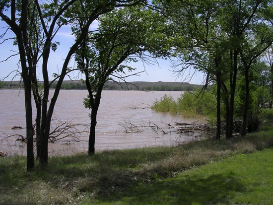
A view from the grassy shoreline looking out over a calm, muddy-toned lake surrounded by trees and distant rolling plains.
A view of the shoreline and waters of Lake McClellan within the McClellan Creek National Grassland.

McClellan Creek National Grassland history and protected-area timeline

The grassland traces its origins to a land-acquisition effort aimed at repairing badly eroded land on the southern Great Plains. Purchased for the federal conservation system, the property was managed to restore a more natural grassland condition from a starting point of significant soil degradation, a recurring problem across the region following the Dust Bowl era and decades of intensive agricultural pressure.

The grassland is named after McClellan Creek, a watercourse historically identified with late 19th-century events on the southern plains, including the November 1874 engagement commonly associated with Colonel Frank Baldwin's charge against Grey Beard's band along the creek. This earlier association gives the creek and the surrounding land a deeper place in regional frontier-era history than its present-day conservation role would suggest.

In February 2006, the entire national grassland was swept by wildfires that broke out as part of the much larger Interstate 40 fire complex, which burned roughly 750,000 acres across parts of the Texas and Oklahoma Panhandles. The fire consumed nearly all of the grassland's wooded growth, leaving the area with a dramatically altered post-fire landscape. Following this burn, the grassland has continued to be managed as a small but persistent component of the regional U.S. Forest Service grassland and forest program.

McClellan Creek National Grassland landscape and geographic character

The landscape of McClellan Creek National Grassland is defined by the gently rolling, semi-arid plains of the Texas Panhandle, characteristic of the southern Great Plains. Elevations vary modestly across the site, and the surrounding terrain reflects the wind-deposited soils and arid-to-semiarid climate that shape much of the regional scenery. Shortgrass and mixed-grass prairie vegetation dominates the open uplands, giving the area an open, sweeping appearance with long sightlines and a comparatively quiet, expansive feel.

The most prominent local landscape feature is McClellan Lake, a small reservoir impounded on McClellan Creek. The lake and its associated creek corridor create a localized break in the surrounding plains, offering a combination of open water, fringing riparian habitat, and, before the 2006 fire, a notable stand of trees along the watercourse. After the fire, much of the wooded cover was lost, leaving an even more open prairie character around the impoundment.

McClellan Creek National Grassland ecosystems, habitats, and plant life

Ecologically, the grassland belongs to the southern shortgrass and mixed-grass prairie system, a vegetation type adapted to the region's limited rainfall, periodic drought, and wind-exposed topography. The site represents a vegetation recovery and soil conservation restoration, intended to return heavily altered land toward a working shortgrass prairie state rather than maintaining an intensively cultivated or heavily grazed landscape.

The creek corridor and McClellan Lake introduce a stronger mesic edge into an otherwise dry upland mosaic. This narrow riparian environment, with its mix of open water, shoreline vegetation, and former tree cover, supports a noticeably different set of habitat conditions than the surrounding plains. The combination of restored upland grass cover and the linear riparian zone along McClellan Creek gives the grassland a layered ecological character despite its very small footprint.

McClellan Creek National Grassland wildlife and species highlights

The wildlife profile of McClellan Creek National Grassland reflects its position at the meeting point of southern Great Plains shortgrass prairie habitat and a localized riparian zone along McClellan Creek and McClellan Lake. Grassland-associated species typical of the surrounding Texas Panhandle landscape, including grassland birds, small mammals, and predators that follow them, are part of the area's broader faunal community, while the creek and reservoir support water-oriented and shoreline-associated fauna in small but ecologically meaningful numbers.

The 2006 Interstate 40 fire significantly altered the structure of the woodland component along the creek and reservoir, removing much of the canopy that previously provided additional nesting and cover habitat for a wider range of species. Wildlife use of the grassland continues to reflect this changed habitat structure, with open-ground and grassland-adapted species dominating the post-fire landscape and the water's edge retaining its role as a focal point for wildlife activity in the surrounding plains.

McClellan Creek National Grassland conservation status and protection priorities

McClellan Creek National Grassland's conservation significance lies primarily in its role as a restoration-driven grassland property rather than a large wilderness-style preserve. The land was assembled specifically to address severe erosion on damaged plains, reflecting a federal conservation strategy that emphasized rehabilitation of abused cropland and overgrazed range back toward a functioning shortgrass condition. Its management within the National Grassland system ties it to broader regional programs designed to stabilize soils, maintain perennial grass cover, and reduce wind and water erosion across the southern plains.

The 2006 wildfire that swept the entire property presented both a setback and a renewed focus for the grassland, dramatically simplifying its structure by removing most of the wooded component and leaving a shortgrass- and shrub-dominated landscape. Continued administration through the Black Kettle and McClellan Creek Ranger District keeps the grassland tied to active federal land management, which since the fire has included monitoring vegetation recovery and maintaining the grassland's role in the regional conservation system rather than active replanting of former woodlands.

McClellan Creek National Grassland cultural meaning and human context

The cultural context of McClellan Creek National Grassland is tied to the broader settlement, agricultural, and frontier history of the Texas Panhandle. The surrounding region endured the extreme land-use stress that produced the Dust Bowl in the 1930s, and the grassland's origin as purchased, damaged land speaks directly to that era of soil crisis and federal response. The creek itself carries earlier associations, being identified with significant events of the Red River Wars era on the southern plains, including the 1874 engagement at McClellan's Creek, so the landscape remains a place where 19th-century frontier military history, 20th-century agricultural decline, and modern federal conservation all overlap.

Top sights and standout views in McClellan Creek National Grassland

A federally administered National Grassland restored from badly eroded land in the Texas Panhandle. Centered on the impoundment of McClellan Creek, providing a small but ecologically meaningful riparian and reservoir core within the surrounding plains. Managed jointly with Cibola National Forest and several other National Grasslands from Albuquerque, with field operations through the Black Kettle and McClellan Creek Ranger District in Cheyenne, Oklahoma. A rare small-scale National Grassland with a notable 19th-century frontier history in its creek's name and a dramatic post-2006 wildfire landscape shaped by the broader Interstate 40 fire complex.

Best time to visit McClellan Creek National Grassland

On the southern plains, late spring and early fall tend to offer the most comfortable conditions for visiting McClellan Creek National Grassland, with milder temperatures and the grass cover either greening up or holding late-season color. Summer visits can be very hot, dry, and exposed, with limited shade after the 2006 fire reduced much of the previous tree cover, while winter visits typically bring cool temperatures, occasional snow, and a more open feel across the shortgrass landscape. Wildlife viewing tends to focus on the creek corridor and McClellan Lake, where water-oriented activity is most concentrated regardless of season.
Monthly climate preview

Long term temperature ranges and monthly precipitation records from representative coordinates

McClellan Creek National Grassland Climate Normals and Annual Weather Patterns

Historical climate data for McClellan Creek National Grassland charts measured shifts in average monthly temperatures alongside recorded daily precipitation volumes. Detailed twelve month normals provide complete reference metrics for analyzing long term meteorological trends across the protected landscape.
Annual mean16 °C
3 °C29 °C
Jan
Feb
Mar11°
Apr16°
May21°
Jun26°
Jul29°
Aug28°
Sep23°
Oct16°
Nov
Dec
Warmest month
July

28.7 °C

Coolest month
January

3.4 °C

Wettest month
June

2.8 mm/day

Driest month
January

0.6 mm/day

Park location guide

Geography guide, regional context, and park location map for McClellan Creek National Grassland

McClellan Creek National Grassland park geography, regions, and map view in United States of America

Understand where McClellan Creek National Grassland sits in United States of America through a broader geographic reading of the surrounding landscape, nearby location context, and its mapped position within the national park landscape.

How McClellan Creek National Grassland fits into United States of America

The United States of America is a federal presidential republic and one of the world's largest countries by area and population. It consists of 50 states across a vast territory spanning multiple time zones, with its capital in Washington, D.C. and largest city in New York City. The nation has a diverse economy, influential political system, and significant cultural and military presence globally.

Wider geography shaping McClellan Creek National Grassland in United States of America

The United States occupies a vast territory in North America, bordered by Canada to the north and Mexico to the south. The 48 contiguous states stretch from the Atlantic to the Pacific Ocean, while Alaska occupies the northwestern region and Hawaii is an archipelago in the Pacific. The country encompasses diverse terrain including the Rocky Mountains, Appalachian Mountains, Great Plains, and extensive river systems.

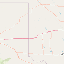
Map view of McClellan Creek National Grassland

Use this park location map to pinpoint McClellan Creek National Grassland in United States of America, understand its exact geographic position, and read its mapped placement within the surrounding landscape more clearly.

Pigeon | © OpenStreetMap contributors

Location context for McClellan Creek National Grassland

Texas
Recorded earthquake history

Explore Recorded Seismic Activity for McClellan Creek National Grassland

Trace the history of recorded seismic events identified near the boundaries of McClellan Creek National Grassland. This MoriAtlas catalogue provides a clear look at historical magnitudes and epicentres in the Texas Panhandle, helping to build a deeper geographic understanding of the region.

McClellan Creek National Grassland Earthquake History

Catalogued events

4 events

Strongest magnitude

Magnitude 3.4

Most recent event

Feb 15, 1997

This history includes earthquakes recorded inside the park or within 50 km of its borders

Visual reference of shortgrass prairie terrain and riparian habitats across the Texas Panhandle

McClellan Creek National Grassland Photos and Landscape Scenery

Visual documentation captures the rolling shortgrass prairie terrain, open reservoir waters, and restored riparian corridors defining the protected landscape. Photographic reference reveals the distinctive ecological character of the southern Great Plains environment.

A view from the grassy shoreline looking out over a calm, muddy-toned lake surrounded by trees and distant rolling plains.

A wide view of a sandy, barren landscape with charred, leafless trees and shrubs scattered across rolling hills, with a section of barbed wire fence in the foreground.

Park atlas

Compare regional grassland terrain and connected conservation landscapes across the southern plains

Explore Parks Near McClellan Creek National Grassland and Surrounding Protected Areas

Browsing other protected areas near McClellan Creek National Grassland reveals broader patterns of shortgrass prairie restoration and regional geography. Continuing past individual reserves helps connect solitary conservation sites to wider ecological and terrain networks across the southern plains.
A watercolor illustration of a landscape with a central lake reflecting soft pink hues, surrounded by green rolling hills and pine forests under a hazy sky.
Protected areaTexas
80 km away#1 closest

Northwest

Lake Meredith National Recreation Area: An Atlas Guide to Texas Panhandle Canyon Landscapes

Geography of the Canadian River reservoir and High Plains terrain

Analyze the topography of Lake Meredith National Recreation Area, where the Canadian River has sculpted deep canyons through the flat Texas High Plains. The site serves as a vital protected area for both water-based recreation and the preservation of arid, canyon-rim habitats near the Alibates Flint Quarries.

Area
182.02 km²
Established
1990
Visitors
1.3M annual
Relief
Upland
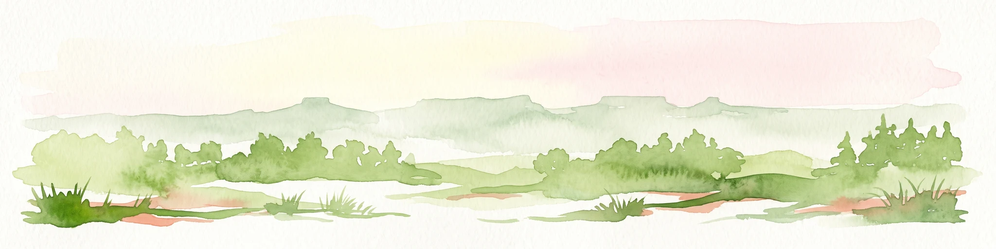
A horizontal watercolor painting depicting a soft-toned, misty prairie landscape with rolling green hills, patches of tall grass, and distant hazy ridgelines under a pale sky.
Wildlife reserveUnited States of America
91 km away#2 closest

Northeast

Black Kettle National Grassland: Protected Prairie Geography and Regional Map Context

A restored mixed-grass ecosystem in the southern Great Plains

Spanning scattered parcels in Oklahoma and Texas, Black Kettle National Grassland functions as a representative sample of restored southern plains prairie. The terrain consists of sandy soils, rocky red hills, and leafy draws along the Washita River headwaters. This protected area preserves a complex ecological and historical landscape that defines the character of the southern Great Plains, now managed for habitat restoration and natural resource protection.

Area
126.61 km²
Established
1960
Relief
Upland
Climate
Temperate
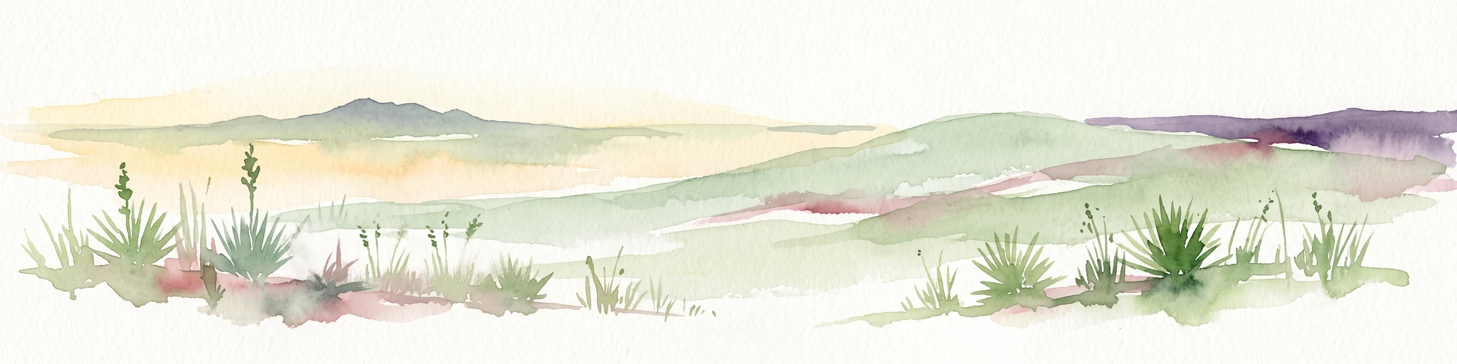
A horizontal watercolor painting showing a soft, stylized view of open, rolling grassland under a hazy sky, with yucca-like plants in the foreground.
Wildlife reserveTexas
170 km away#3 closest

Northwest

Rita Blanca National Grassland: Protected Shortgrass Prairie Geography and Map

Mapping the mosaic of federal lands in the Texas Panhandle

Rita Blanca National Grassland offers a detailed look at restored shortgrass prairie ecosystems within the southern Great Plains. The area consists of intermixed federal and private land parcels that define the regional geography of the Texas and Oklahoma borderlands. This protected landscape provides habitat for pronghorn, prairie dogs, and raptors across a semi-arid, gently sloping terrain.

Area
376.31 km²
Established
1960
Relief
Upland
Climate
Arid
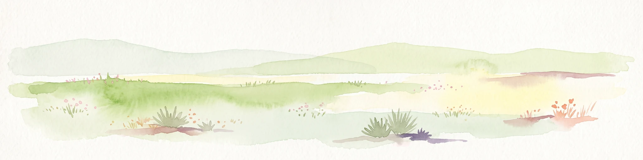
A pale, soft watercolor illustration of a wide, open prairie with gentle rolling hills in the background, low shrubs, and grasses in the foreground.
Protected areaKansas
213 km away#4 closest

North

Cimarron National Grassland: Mapping the Largest Protected Area in Kansas

Shortgrass prairie geography and historical riparian landscapes

Spanning over 100,000 acres in southwestern Kansas, Cimarron National Grassland serves as a major ecological refuge within the Great Plains. The protected area features a unique terrain characterized by sand sagebrush uplands, cottonwood-forested bottomlands, and the winding course of the Cimarron River. This mapping data highlights the intersection of modern wildlife conservation and the remnants of the historic Santa Fe Trail.

Area
437.77 km²
Established
1960
Relief
Upland
Climate
Arid
A horizontal watercolor illustration of a wide, open prairie landscape featuring soft green hills, sparse shrubs, and grasses against a pale background.
Protected landscapeNew Mexico
225 km away#5 closest

West

Kiowa National Grassland: Protected Landscapes, Canyon Terrain, and Prairie Geography

Northeastern New Mexico shortgrass prairie and river canyon systems.

Kiowa National Grassland represents a distinctive protected landscape within the southwestern Great Plains, featuring a mix of rolling steppe, pinyon-juniper woodland, and the deep gorges of the Canadian River Canyon. This area offers significant insight into the regional geography of New Mexico, where historic Santa Fe Trail corridors and seasonal playa lakes define the local terrain and ecosystem.

Area
554.95 km²
Established
1960
Relief
Upland
Climate
Temperate
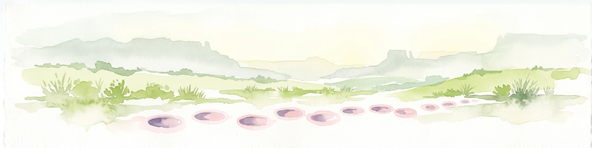
A wide watercolor painting showing a green grassy plain with distant hills and a row of purple circular shapes in the foreground.
Protected areaColorado
236 km away#6 closest

Northwest

Comanche National Grassland: Geographic Atlas of Southeastern Colorado Protected Plains

Exploring canyon systems and prairie landscape boundaries

Spanning across Baca, Otero, and Las Animas counties, Comanche National Grassland represents a distinctive protected landscape of shortgrass prairie and deep canyon networks. The region is marked by the dramatic Purgatoire River and Carrizo Creek systems, offering a rich study in semi-arid topography, riparian corridors, and fossil-rich geological formations within the Colorado plains.

Area
1,793.09 km²
Established
1960
Relief
Upland
Climate
Temperate
Watercolor painting of soft, rolling green hills and scattered trees against a pale, light-filled sky.
Protected landscapeWise County
345 km away#7 closest

Southeast

Lyndon B. Johnson National Grassland: Atlas and Geographic Landscape Overview

Protected prairie and multiple-use terrain in Wise County

Examine the geographic layout and regional importance of Lyndon B. Johnson National Grassland, a federal protected area in northern Texas. The land offers a unique look at the convergence of open Great Plains prairie and the wooded Cross Timbers, serving as both a working ranching landscape and a preserved natural environment within easy reach of the Dallas-Fort Worth metropolitan area.

Area
82.19 km²
Relief
Lowland
Climate
Temperate
Access
Easy access
Watercolor painting of a flowing river with a small waterfall and forested banks against a soft, hilly background.
National parkOklahoma
About 364 km away#8 closest

East

Chickasaw National Recreation Area: Geography and Protected Land Map Overview

Explore spring-fed creek corridors and reservoir landscapes in Oklahoma.

Understand the dual landscape of Chickasaw National Recreation Area, where narrow, spring-fed creek valleys contrast with the expansive shoreline of Lake of the Arbuckles. This record highlights the park's distinct transition from historic CCC-designed infrastructure to the surrounding prairie and forested hill terrain in Murray County.

Area
40.06 km²
Established
1902
Visitors
1.5M annual
Relief
Upland

Common questions about visiting, size, designation, and location context for McClellan Creek National Grassland

McClellan Creek National Grassland FAQs for park facts, access, geography, and protected area context

Find quick answers about McClellan Creek National Grassland, including protected-area facts, park geography, trail and visitor context, and how the park fits into its surrounding country and regional landscape.
MoriAtlas Explorer

Continue Your Protected Areas Search Across the Global Atlas

Deepen your exploration by continuing the structured search for national parks and protected areas worldwide. Utilize the comprehensive filtering capabilities to compare different conservation landscapes and refine your understanding of global park geography. Discover more about the distribution and characteristics of protected natural areas.

Global natural geography