
Why Meerfelder Maar stands out
Meerfelder Maar is best known as one of the largest and most clearly formed maar lakes in the Eifel, a textbook example of a crater lake produced by a phreatomagmatic explosion. Its defining qualities are the dramatic bowl-shaped setting, the calm lake occupying roughly half of the original crater, and the mosaic of open water, seasonally flooded margins, and deciduous woodland that surrounds it. The site is also recognized for the depth of its sedimentary record, which has made the maar a reference locality for late glacial and early Holocene vegetation research in central Europe. Combined, these features give the park a strong identity as both a geological landmark and a protected wetland and forest habitat within the Eifel volcanic landscape.
Meerfelder Maar history and protected-area timeline
The history of Meerfelder Maar is closely tied to its dramatic geological origin. Studies of the lake sediments began in 1978, when scientists undertook core drilling to determine the age of the maar, and numerous further drillings have been carried out since. The results indicate that the maar has a minimum age of around 30,000 years and may in fact be around 40,000 years old, making it one of the older well-documented maars of the Eifel.
A more recent chapter of human intervention began in the period from 1877 to 1880, when the lake's water level was deliberately lowered to gain additional meadow and pasture land. The work, financed jointly by the state and the province at a cost of 12,000 gold marks, transformed parts of the lakebed into usable agricultural ground. In 1890, the village of Meerfeld commemorated this intervention by erecting a memorial column in acknowledgment of the support.
During the early twentieth century the lake drifted into a heavily nutrient-enriched, or polytrophic, state. By 1984 the water regularly became very turbid during the summer months, taking on a yellowish-brown coloration caused by cyanobacteria. In response, a deep-water drainage system was installed in 1982 to restore the lake. On 2 December 1985, the area around the maar, including its fluctuating wetland margins and the broadleaf woodland of the crater basin, was formally designated as a nature reserve under Rhineland-Palatinate law; the protection took effect in 1986 and remains in place today.
Meerfelder Maar landscape and geographic character
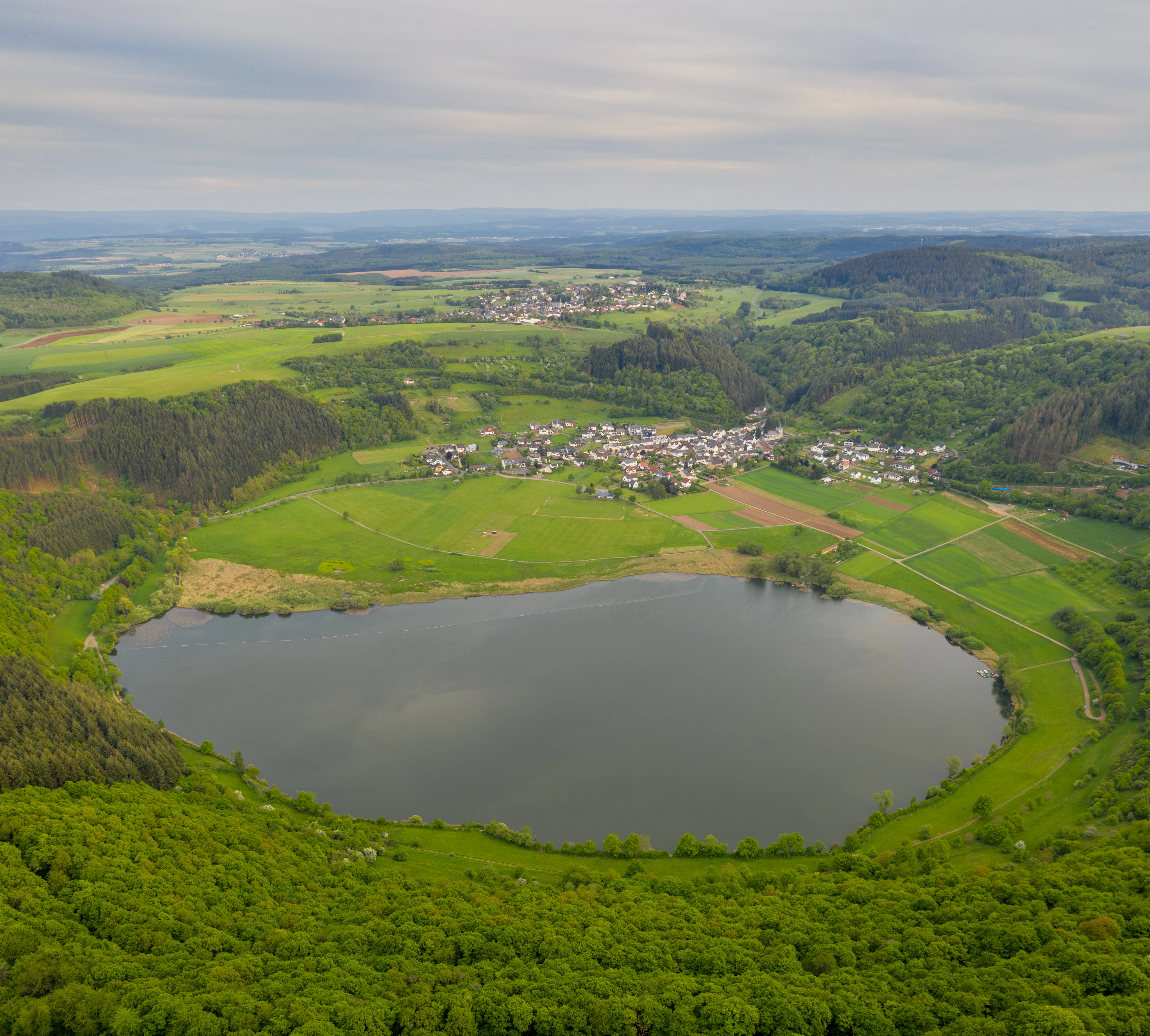
The landscape of Meerfelder Maar is dominated by a single large volcanic crater set within the rolling terrain of the Eifel. The overall crater extends about 1,400 meters from east to west and about 1,200 meters from north to south, and covers roughly 125 hectares, placing it among the larger maars of the Eifel volcanic field. The walls of the crater rise in a pronounced arc around the basin, with the highest point on the rim reaching about 515.9 meters above sea level on the northern side of the depression.
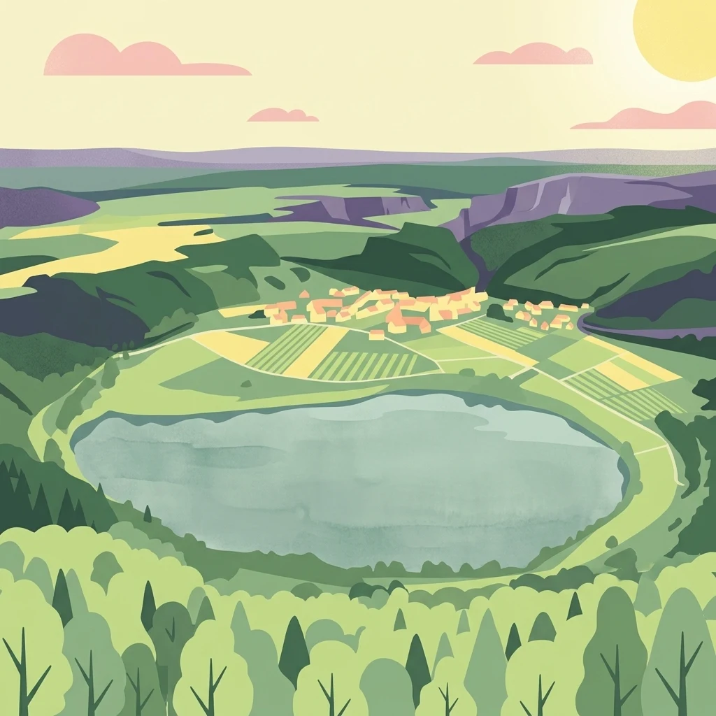
The floor of the crater is uneven. Roughly half of it is occupied by the lake, whose surface lies at about 336.6 meters above sea level, while the remainder forms gently sloping ground that transitions into the rising crater walls. This contrast between open water and surrounding vegetated slopes gives the basin a layered appearance, with water, marshy shore vegetation, meadows, and finally forested rim succeeding one another from the center outward.
Outside the immediate crater, the maar connects into the broader Eifel landscape of ridges, forests, and smaller volcanic features. The village of Meerfeld sits on the southern edge of the basin, still within the original hollow formed by the eruption, which provides a distinctive visual relationship between settlement and crater. On the northern rim, a 12-meter wooden observation tower known as the Landesblick gives visitors an elevated vantage point over the entire depression, emphasizing the funnel-like geometry that defines the place.
Meerfelder Maar ecosystems, habitats, and plant life
Meerfelder Maar supports a layered ecological system that mirrors its topographic structure. At the center is the open water of the lake, with its submerged and floating vegetation and roughly fifteen resident fish species. The fish stocks are accessible to visitors through angling permits issued in local restaurants, indicating that the lake is also managed as a recreational fishery.
Around the lake, the shoreline has developed into a zone of progressive natural silting and wetland formation. Floating and emergent aquatic plants form wide bands along the water's edge, while the shallow seasonal margins shift between open water and waterlogged ground depending on the season. These variable moisture conditions, described locally as wechselfeuchte Ränder, or fluctuating-wetland margins, are one of the key ecological features protected by the reserve.
The interior slopes of the crater and the rim itself are clothed in deciduous forest. Together with the wetland margins, this woodland gives the reserve a mosaic character of open water, reed beds, marshy ground, and broadleaf forest within a single enclosed basin. This combination of aquatic, marsh, and forest habitats within a small geographic area is central to the nature conservation value of the site.
Meerfelder Maar wildlife and species highlights
The wildlife profile of Meerfelder Maar is shaped by the close coexistence of lake, wetland, and forest habitats within the crater walls. The lake hosts a thriving fish community of around fifteen species, providing the basis for local angling. The shoreline vegetation of reedmace, common reed, club-rush, water lilies, hemlock, and yellow flag iris supports the breeding and feeding of water-associated invertebrates, amphibians, and waterfowl that depend on the interface between open water and emergent plants.
The deciduous forest that rings the basin adds a second ecological layer. Broadleaf trees along the crater walls provide nesting sites, shelter, and feeding habitat for woodland birds and small mammals typical of central European low mountain forests. Because the crater concentrates such different habitat types within a relatively small area, the overall species turnover at the site is higher than would be expected from the landscape alone, making the reserve a useful local stronghold for both wetland and forest fauna of the Eifel.
Meerfelder Maar conservation status and protection priorities
Meerfelder Maar has been protected as a nature reserve since 2 December 1985, with the legal ordinance taking effect in 1986. Protection covers the maar itself together with its seasonally fluctuating margins and the broadleaf forest stands inside the crater, reflecting recognition that the conservation value of the site lies as much in the surrounding wetland and woodland as in the lake.
The designation falls within the broader framework of habitat and species management areas, indicating that active management is part of the reserve's purpose rather than purely passive protection. Earlier interventions already illustrate this management orientation: the 1982 installation of a deep-water drainage system was undertaken to combat the lake's polytrophic state and recurring cyanobacterial blooms, and ongoing attention to the silting process continues to shape how the wetland margin evolves. The annual layering of sediments in the lake has also given the site scientific conservation value as a reference record for late glacial and early Holocene climate and vegetation history, an importance that complements its present-day ecological role.
Meerfelder Maar cultural meaning and human context
The cultural identity of Meerfelder Maar is closely interwoven with the village of Meerfeld, which lies on the southern lip of the crater, still within the original volcanic depression. This unusual placement, with a settlement sitting inside an ancient explosion hollow, is one of the defining visual and social features of the area. The late nineteenth-century decision to lower the lake level for agricultural use, and the commemorative column erected by the community in 1890, document the long relationship between the inhabitants and the water body that shapes their surroundings.
In a wider sense, the maar stands within the cultural landscape of the Eifel, a region characterized by its low mountain scenery, scattered volcanic features, and dispersed villages. The Eifel volcanic field forms a regional network of maars and related craters, and Meerfelder Maar is one of the most prominent of these. The presence of a wooden observation tower on the northern rim, the management of the lake for local angling, and the scientific tradition of sediment research all reflect how the site is woven into both local life and broader regional identity.
Top sights and standout views in Meerfelder Maar
Meerfelder Maar combines a clearly legible volcanic crater with a protected mosaic of lake, wetland, and forest within the Eifel. Its sheer size, with an overall basin of roughly 125 hectares and a lake reaching 17 meters at its deepest point, sets it apart from many smaller maars in the region. The 12-meter Landesblick observation tower offers a panoramic vantage point over this combined landscape, while the annually layered sediments preserved in the lake bed give the site scientific importance well beyond its regional setting. The juxtaposition of the village of Meerfeld on the crater's southern edge with the open water and forested rim on the other sides gives visitors a single, integrated view of geology, ecology, and settlement in one place.
Best time to visit Meerfelder Maar
The character of Meerfelder Maar shifts clearly with the seasons, and each period brings out a different aspect of the landscape. Spring and early summer are when the wetland margins come alive, with reeds, water lilies, and yellow flag iris in full growth and water levels visibly moving along the fluctuating shoreline. Summer is the most visually lush period, and also the time when the lake historically experienced its strongest algal blooms before restoration, although water conditions today are more stable. Late summer and early autumn bring stable water levels and warm, calm lake surfaces that emphasize the contrast between the open water and the forested crater walls. Winter, with bare trees on the rim and quieter lake conditions, reveals the crater's pure geological shape more clearly than at any other time of year.