
Mori Atlas logo
Protected landscapeMendocino National Forest

Analyzing the roadless terrain, river canyons, and wilderness areas of this California reserve

Mendocino National Forest: A Remote Protected Landscape in the California Coast Ranges

Mendocino National Forest stands as a distinctive protected landscape within the northern California Coast Ranges, defined by its rugged mountain ridges and relative lack of major paved roads. This expansive area encompasses roughly 913,000 acres, featuring four designated wilderness zones, geothermal springs, and the Lake Pillsbury basin. As a critical refuge for reintroduced tule elk, the terrain offers a unique look at ecologically intact forest reserves and steep, carved river corridors.

national forestCoast Rangeswilderness areastule elkLake Pillsburyold-growth forest
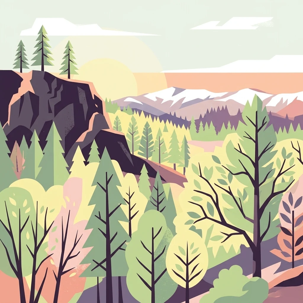
An illustration showing a mountain landscape with coniferous trees, a prominent rocky cliff on the left, and distant snow-capped peaks under a soft sun.

Mendocino National Forest

Protected landscape

Park overview

Structured park overview, official facts, and landscape profile for Mendocino National Forest

Mendocino National Forest park facts, protected area profile, and essential visitor context

Review the core facts for Mendocino National Forest, including designation, size, terrain, visitor scale, habitats, and operating context in one park-focused overview.

About Mendocino National Forest

Mendocino National Forest occupies a broad swath of the northern California Coast Ranges, covering roughly 913,000 acres across parts of Lake, Glenn, Mendocino, Tehama, Trinity, and Colusa counties. Its geography is defined by rugged mountain ridges, deep river canyons, conifer-covered slopes, and a network of lakes and hot springs that together create a varied and largely undeveloped natural setting.

What distinguishes Mendocino from most other national forests in California is its roadless character. No major paved road crosses the forest, and access is provided through a network of smaller forest highways and county roads. This has helped preserve a more wilderness-like atmosphere in many parts of the forest and has historically made it a destination for visitors seeking solitude, hiking opportunities, and remote camping experiences away from heavily traveled corridors.

Within its boundaries lie four designated wilderness areas. The largest is the Yolla Bolly-Middle Eel Wilderness, which extends well beyond the national forest proper. Snow Mountain Wilderness, Sanhedrin Wilderness, and Yuki Wilderness are wholly or primarily within Mendocino and were in part established or expanded through the Northern California Coastal Wild Heritage Wilderness Act of 2006. Together these wildernesses protect old-growth forests, steep canyons, and high mountain terrain typical of the inner Coast Ranges.

The forest's hydrology is shaped by the Eel River and its tributaries, including the Rice Fork and Middle Fork Eel River, along with Black Butte River and Stony Creek. Lake Pillsbury, the largest recreational lake in the forest at roughly 2,280 acres, serves as a focal point for boating, camping, and wildlife viewing and is central to the forest's tule elk population. Smaller lakes such as Letts Lake, Plaskett Lakes, Howard, Hammerhorn, Square, and Long Lakes provide additional recreation and access points to surrounding wilderness.

Quick facts and research context for Mendocino National Forest

Mendocino National Forest spans about 913,000 acres across the Coastal Mountain Range of northwestern California, crossing Lake, Glenn, Mendocino, Tehama, Trinity, and Colusa counties. It was established in 1907 as the Stony Creek Forest Reserve, later became Stony Creek National Forest, was renamed the California National Forest in 1908, and finally received its present name in 1932.

The forest is the only national forest in California without a major paved road entering it. It contains four wilderness areas, including Snow Mountain Wilderness and Yolla Bolly-Middle Eel Wilderness, and is one of two California national forests with established tule elk herds. Forest headquarters are in Willows, California, with ranger district offices in Covelo, Upper Lake, and Stonyford.

Protection and recognition

Documented conservation parameters and recognized management frameworks

Mendocino National Forest Protection Status and Terrestrial Area Scope

Mendocino National Forest maintains a defined terrestrial protection status within its designated administrative boundary. Verified records track official recognition details and management scope across the protected landscape.

Protection details

Protection scope
Terrestrial
Transboundary protection
No
Park context

Deeper park guide and search-rich context for Mendocino National Forest

Mendocino National Forest history, landscape, wildlife, and travel context

Explore Mendocino National Forest through its history, landscape character, ecosystems, wildlife, conservation priorities, cultural context, and seasonal travel timing in a structured park guide built for atlas discovery and search intent.

Why Mendocino National Forest stands out

Mendocino National Forest is especially known for its status as California's only roadless national forest and for the reintroduction of tule elk to the Lake Pillsbury Basin. These two qualities together define much of its identity: a remote mountain landscape that retains a sense of wilderness isolation rare in such a heavily populated state. The forest also stands out for its concentration of designated wilderness within the northern Coastal Ranges. Snow Mountain Wilderness, Yolla Bolly-Middle Eel Wilderness, Sanhedrin Wilderness, and Yuki Wilderness collectively protect large tracts of old-growth forest, steep river canyons, and high mountain terrain, reinforcing Mendocino's reputation as one of the more ecologically intact forest reserves in California.
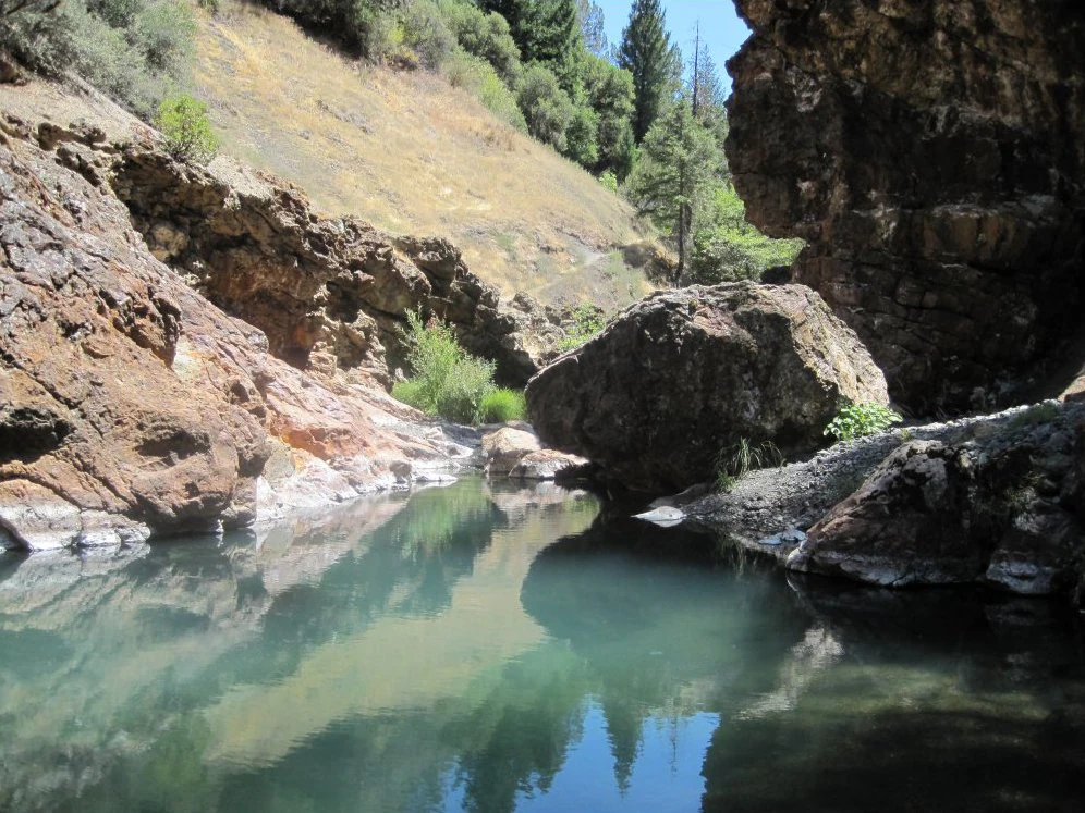
A small pool of teal-colored water nestled between steep, rocky canyon walls and sparse coniferous trees.
Crabtree Hot Springs, a natural geothermal feature within Mendocino National Forest.

Mendocino National Forest history and protected-area timeline

Mendocino National Forest traces its origins to the early conservation movement of the United States Forest Service. In 1905, Professor Lachie of the University of California, Berkeley conducted early surveys of public domain lands under the direction of Gifford Pinchot, then Chief of the U.S. Forest Service, to identify lands suitable for inclusion in a forest reserve. That same year, Congress transferred responsibility for forest reserves from the General Land Office in the Department of the Interior to the new Division of Forestry in the Department of Agriculture, which soon became the U.S. Forest Service.

President Theodore Roosevelt set aside the area on February 6, 1907, under the Forest Reserve Act of 1891, creating the Stony Creek Forest Reserve. One month later the reserve was incorporated into the national forest system as Stony Creek National Forest. Because of the difficulty of administering such a large tract, its northern portion was reassigned to what would become Trinity National Forest. The remaining boundaries were formally established by presidential executive order on July 2, 1908, and the forest was renamed California National Forest.

In 1932, President Herbert Hoover signed executive order 5885 renaming California National Forest to Mendocino National Forest, in order to avoid confusion between the state and a national forest sharing the same name. Since then, the forest has operated under its present identity, with headquarters in Willows and ranger districts in Covelo, Upper Lake, and Stonyford.

The forest has also played a notable role in the history of American wildland fire. The Rattlesnake Fire of 1953, in which one Forest Service employee and 14 volunteer firefighters died, prompted major changes in firefighter training and strategy. Decades later, the 2018 Mendocino Complex Fire and the 2020 August Complex Fire burned large portions of the forest, including the entire Snow Mountain Wilderness, marking some of the most significant wildfire events in California history.

Mendocino National Forest landscape and geographic character

The landscape of Mendocino National Forest is shaped by the northern section of the California Coast Ranges, a region of folded, often steep terrain that lies between the Pacific Ocean and the interior valleys of the state. Ridges, canyons, and isolated mountain peaks define much of the scenery, with elevations rising sufficiently in places to support conifer forests and, in higher areas, more open montane settings.

Key landforms include the Sanhedrin Mountains and Hull Mountain, both of which contribute to the forest's rugged profile. Lake Pillsbury, a large reservoir nestled among the surrounding ridges, is the most prominent aquatic feature and serves as a recreational anchor within the forest. Other lakes, including Letts Lake and Plaskett Lakes, occupy smaller basins in more remote parts of the forest and are connected to trail networks leading into wilderness.

Rivers have carved deep, sometimes narrow canyons through the underlying geology. The Eel River and its Rice Fork and Middle Fork, along with Black Butte River and Stony Creek, are among the defining waterways, and areas such as Crabtree Hot Springs add geothermal character to the forest. Because no major paved road traverses the forest, these river corridors and ridges retain a relatively unbroken, natural feel, reinforcing the forest's identity as one of California's least road-impacted landscapes.
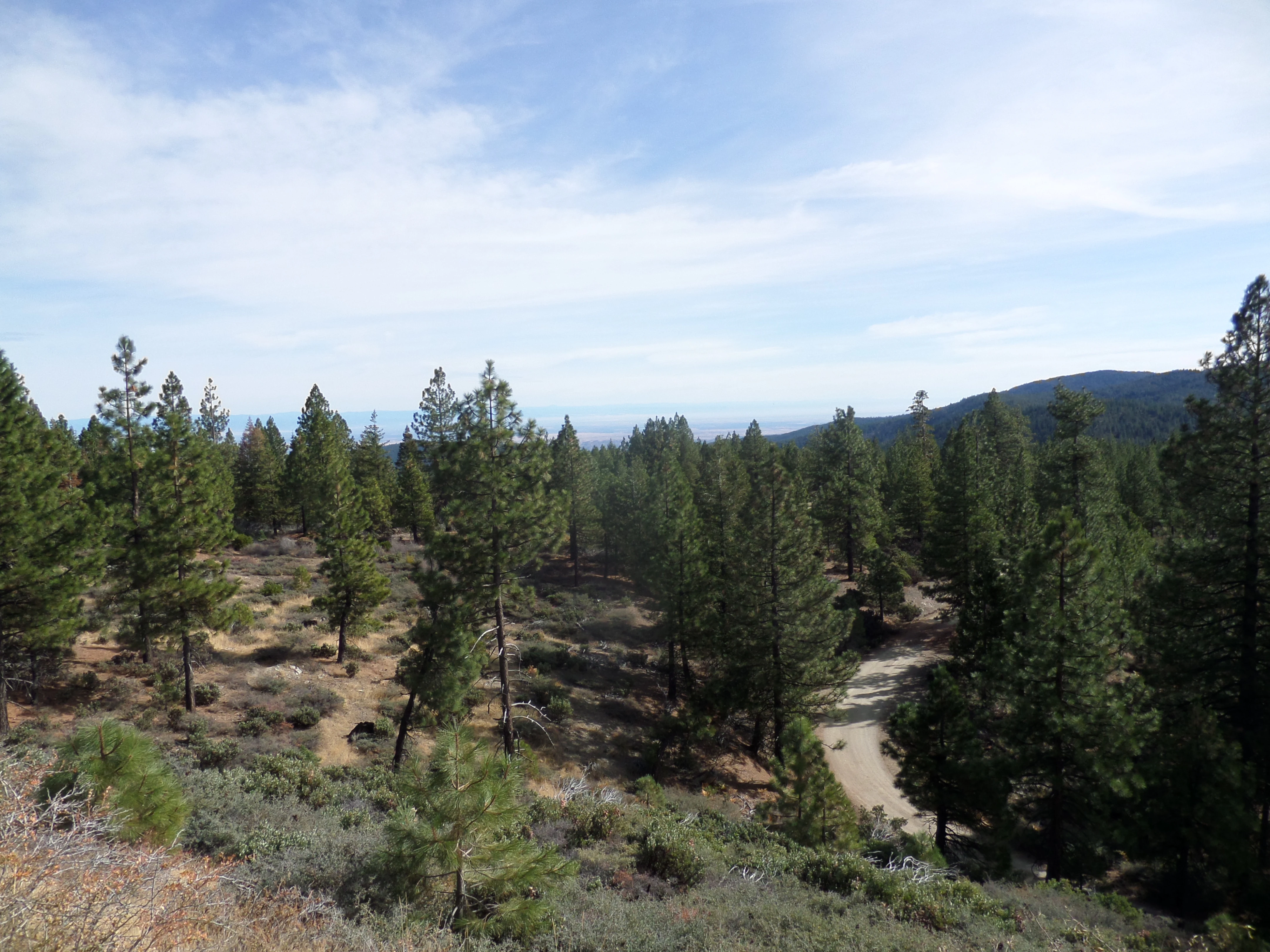
A dirt road winds through a pine forest in a hilly landscape under a blue sky.
A view of the forest terrain along Alder Springs Road in Mendocino National Forest.

Mendocino National Forest ecosystems, habitats, and plant life

The ecological character of Mendocino National Forest reflects its position in the northern California Coast Ranges, where maritime influence and elevation interact to produce a diverse mix of vegetation types. Coniferous forest is dominant across much of the terrain, with mixed stands of Douglas-fir, ponderosa pine, white fir, tanoak, and Pacific madrone shaping the canopy in different elevation zones and slope conditions.

An estimated 60,000 acres of old growth remain in the forest, representing a significant reservoir of mature conifer and hardwood habitat in a region where such forests have otherwise been heavily logged. These old-growth stands contribute to the forest's value for sensitive wildlife species, watershed stability, and natural ecosystem processes, and they are particularly concentrated in the wilderness areas where management prescriptions minimize disturbance.

Beyond the conifer forests, the forest's vegetation includes chaparral and oak woodland elements typical of the Coast Ranges, as well as meadow and riparian zones along rivers, creeks, and around the margins of lakes. The combination of forested slopes, open ridgetops, canyon bottoms, and lakeshore habitats creates a mosaic of ecological settings that supports varied wildlife communities and contributes to the forest's strong sense of natural diversity.
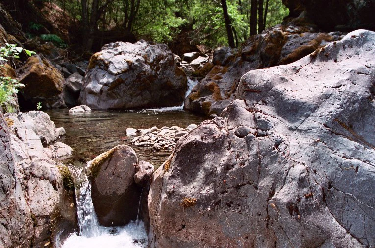
A small stream flowing over and around large, rugged gray rocks in a forested area.
Rattlesnake Creek flowing through a rocky section of Mendocino National Forest.

Mendocino National Forest wildlife and species highlights

Mendocino National Forest is ecologically significant as one of only two national forests in California with established populations of tule elk, one of the largest land mammals native to the state. Tule elk were hunted to near extinction during the California gold rush, and the Lake Pillsbury herd represents a successful reintroduction effort that began in the late 1970s when the California Department of Fish and Game released animals into the basin. The herd grew steadily over subsequent decades, with roughly 80 animals reported in 2007.

The elk occupy the north shore of Lake Pillsbury at the base of Hull Mountain, where they browse on wild clovers, native grasses, and seasonal foliage around the lake's edges. A regulated hunting season in September provides ongoing population management and ensures the herd remains ecologically balanced within the forest.

Beyond tule elk, the forest's varied terrain supports a wide range of terrestrial and aquatic wildlife typical of the northern Coast Ranges. Its wilderness areas, old-growth forests, river corridors, and lake systems collectively provide habitat for deer, black bear, mountain lions, a variety of bird species, and cold-water fish populations in rivers and streams. The combination of large undeveloped tracts and limited road access helps maintain wildlife habitat connectivity across the forest.
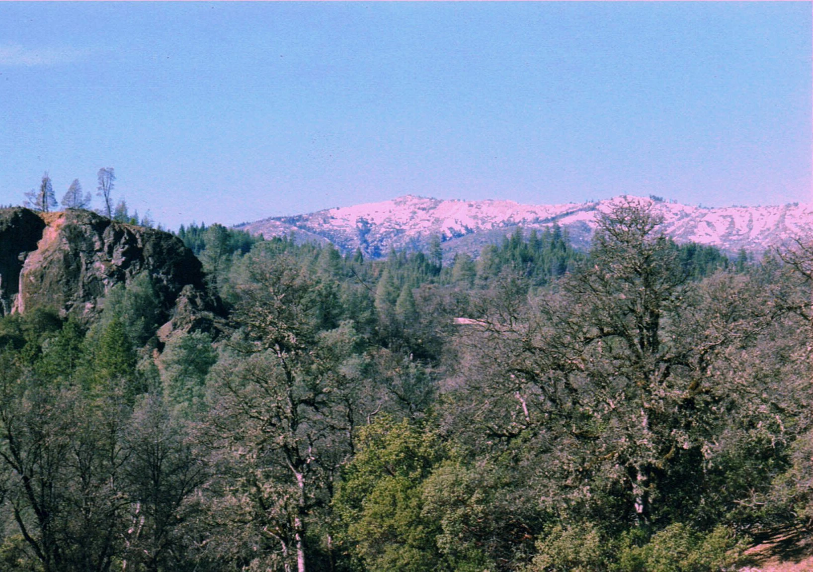
A wide scenic view of forested hillsides in the foreground leading to light-colored, rocky mountain peaks under a clear sky.
A view of the Sanhedrin Mountains within Mendocino National Forest, characterized by mixed evergreen forest and rugged terrain.

Mendocino National Forest conservation status and protection priorities

Conservation significance in Mendocino National Forest centers on its large blocks of relatively undisturbed habitat in an otherwise heavily modified state. The forest's four wilderness areas, including Snow Mountain Wilderness, Yolla Bolly-Middle Eel Wilderness, Sanhedrin Wilderness, and Yuki Wilderness, formally protect high-quality landscapes from road construction and most forms of development, providing refugia for old-growth forest, sensitive wildlife, and watershed integrity.

The estimated 60,000 acres of old-growth forest remaining in the forest are an important conservation resource, supporting ecological processes that have been lost in much of California's forested landscape. These stands, along with the forest's extensive river and lake systems, contribute to watershed health, carbon storage, and biodiversity across the northern Coast Ranges.

The reintroduction of tule elk to the Lake Pillsbury Basin is a major conservation milestone for the forest, restoring a native ungulate that was eliminated from most of its historic range. The forest has also been the site of significant wildfire events, including the 2018 Mendocino Complex Fire and the 2020 August Complex Fire, which burned roughly one-third of the forest's total area and prompted renewed attention to forest resilience, fuels management, and ecosystem recovery in the region.

Mendocino National Forest cultural meaning and human context

Mendocino National Forest occupies a region with deep connections to the indigenous and early settler history of northwestern California. The forest's establishment in 1907 under President Theodore Roosevelt reflects the broader Progressive Era movement to protect forest reserves in the American West, and its subsequent renaming history, from Stony Creek Forest Reserve to Stony Creek National Forest, California National Forest, and finally Mendocino National Forest, illustrates the evolving administrative identity of national forests in the early twentieth century.

The forest also played a role in the development of the U.S. Forest Service itself, with the early surveys conducted under Gifford Pinchot shaping the boundaries of the original reserve. More recently, the forest has become a focal point in conversations about wildland fire in North America, as events such as the 1953 Rattlesnake Fire, the 2018 Mendocino Complex Fire, and the 2020 August Complex Fire have each contributed to evolving understandings of firefighter safety, fire strategy, and the role of fire in California landscapes.

Top sights and standout views in Mendocino National Forest

Mendocino National Forest's most notable highlights include its standing as California's only roadless national forest, its four federally designated wilderness areas, and its population of reintroduced tule elk at Lake Pillsbury. The forest's extensive old-growth stands, large reservoir-centered recreation opportunities, and deeply carved river canyons further distinguish it from other national forests in the region.

Equally significant is the forest's role in the broader story of American wildland fire, having been the site of the 1953 Rattlesnake Fire tragedy and of the enormous 2018 Mendocino Complex and 2020 August Complex wildfire events. Together, these qualities make Mendocino a forest of unusually strong identity, combining ecological value, recreational appeal, and historical importance in a single landscape.

Best time to visit Mendocino National Forest

Mendocino National Forest's appeal shifts markedly with the seasons. Late spring through early fall offers the most accessible conditions for hiking, camping, boating on Lake Pillsbury, and exploring the forest's higher-elevation trails. Summer months bring warm, dry weather ideal for swimming, fishing, and viewing tule elk around the lake, though this same period also carries elevated wildfire risk and occasional smoke from regional fires.

Fall brings cooler temperatures, autumn color in riparian areas around lakes and streams, and the start of tule elk hunting season in mid-September. Winter in the higher elevations can bring snow, particularly around Snow Mountain and other high country, which limits access to some roads and trails but also creates opportunities for winter scenery in less-visited areas. Visitors planning a trip should weigh seasonal weather, fire conditions, and the specific recreation they hope to pursue, as the forest's varied terrain means conditions can differ significantly between lower canyons and higher ridges.

Monthly climate preview

Long-term representative temperature and precipitation averages across the year

Mendocino National Forest Climate Normals and Monthly Weather Patterns

Mendocino National Forest exhibits measured monthly temperatures ranging from 6.31 degrees to 27.73 degrees Celsius alongside recorded precipitation variations from 0.05 to 5.09 millimeters per day. Examining the complete twelve-month climate profile reveals structured meteorological shifts at the representative elevation point.
Annual mean16 °C
6 °C28 °C
Jan
Feb
Mar10°
Apr12°
May17°
Jun23°
Jul28°
Aug27°
Sep24°
Oct17°
Nov10°
Dec
Warmest month
July

27.7 °C

Coolest month
December

6.3 °C

Wettest month
December

5.1 mm/day

Driest month
July

0.1 mm/day

Park location guide

Geography guide, regional context, and park location map for Mendocino National Forest

Mendocino National Forest park geography, regions, and map view in United States of America

Understand where Mendocino National Forest sits in United States of America through a broader geographic reading of the surrounding landscape, nearby location context, and its mapped position within the national park landscape.

How Mendocino National Forest fits into United States of America

The United States of America is a federal presidential republic and one of the world's largest countries by area and population. It consists of 50 states across a vast territory spanning multiple time zones, with its capital in Washington, D.C. and largest city in New York City. The nation has a diverse economy, influential political system, and significant cultural and military presence globally.

Wider geography shaping Mendocino National Forest in United States of America

The United States occupies a vast territory in North America, bordered by Canada to the north and Mexico to the south. The 48 contiguous states stretch from the Atlantic to the Pacific Ocean, while Alaska occupies the northwestern region and Hawaii is an archipelago in the Pacific. The country encompasses diverse terrain including the Rocky Mountains, Appalachian Mountains, Great Plains, and extensive river systems.

Map view of Mendocino National Forest

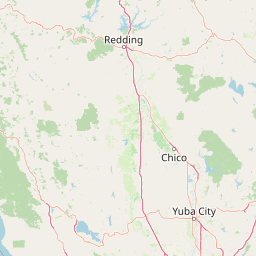
Use this park location map to pinpoint Mendocino National Forest in United States of America, understand its exact geographic position, and read its mapped placement within the surrounding landscape more clearly.

Pigeon | © OpenStreetMap contributors

Location context for Mendocino National Forest

California
Recorded earthquake history

Examine the Seismic History Recorded Near Mendocino National Forest

Browse the comprehensive catalogue of registered earthquakes that have occurred in proximity to Mendocino National Forest. This MoriAtlas dataset allows researchers and observers to analyze historical seismic activity and epicentre distribution within this vast northern California landscape.

Mendocino National Forest Earthquake History

Catalogued events

1,488 events

Strongest magnitude

Magnitude 5.6

Most recent event

Sep 10, 2026

This history includes earthquakes recorded inside the park or within 50 km of its borders

Visual reference guide to rugged mountain ridges, conifer forests, and remote wilderness terrain

Mendocino National Forest Photos and Landscape Scenery

Visual records capture the remote mountain ranges, deep river canyons, and old-growth habitats defining Mendocino National Forest. Photographic archives reveal the unique topography and protected ecosystems spanning California's only roadless federal forest reserve.

A small pool of teal-colored water nestled between steep, rocky canyon walls and sparse coniferous trees.

A large herd of Tule Elk grazing in an open grassy meadow with scattered trees and a mountain range in the background.

A dirt road winds through a pine forest in a hilly landscape under a blue sky.

A small stream flowing over and around large, rugged gray rocks in a forested area.

A wide scenic view of forested hillsides in the foreground leading to light-colored, rocky mountain peaks under a clear sky.

Park atlas

Compare adjacent mountain reserves and regional protected landscapes

Parks Near Mendocino National Forest and Surrounding Protected Areas

Browsing nearby national forests and protected areas reveals how surrounding regional terrain connects across the California Coast Ranges. Examining adjacent conservation landscapes provides valuable context for understanding broader mountain ecosystems and remote public lands.
A soft watercolor painting depicting a serene landscape with gentle green hills, a small forest, and a calm lake at sunrise or sunset.
Protected landscapeCalifornia
Park boundaries overlap#1 closest

North

Shasta, Trinity National Forest: Mapping the Protected Landscapes of Northern California

Volcanic peaks, expansive reservoirs, and rugged mountain wilderness

Spanning over two million acres, Shasta, Trinity National Forest represents a major protected landscape in Northern California. The geography includes the iconic Mount Shasta volcano and the complex shoreline of Shasta Lake, while hosting expansive wilderness areas and diverse terrain ranging from oak-forested foothills to alpine meadows.

Area
8,942.87 km²
Established
1954
Relief
Mountain
Climate
Temperate
Watercolor painting of a peaceful river landscape, featuring rolling green hills, dense trees, and distant soft-toned mountains.
Protected areaCalifornia
Park boundaries overlap#2 closest

North

Six Rivers National Forest: Exploring Protected River Valleys and Mountain Terrain in California

A regional protected area spanning California river systems

Six Rivers National Forest defines much of the rugged landscape in northwestern California. Named for the six major river drainages within its borders, the area features a unique combination of coastal forests, deep river canyons, and high-country ridges that offer significant insight into the region's broader geographic and ecological character.

Area
3,875.2 km²
Established
1947
Relief
Mountain
Climate
Mediterranean
Protected landscapeCalifornia
54 km away#3 closest

North

Whiskeytown, Shasta, Trinity National Recreation Area: Geographic and Protected Landscape Overview

Mapped terrain across northern California reservoir units

Investigate the environmental character of Whiskeytown, Shasta, Trinity National Recreation Area, spanning from the expansive waters of Shasta Lake to the forested ridges of the Whiskeytown unit. This atlas entry details the interplay between large-scale reservoir management, riparian habitats, and the transition from Mediterranean chaparral to high-elevation conifer forests in California.

Area
99,588 km²
Established
1965
IUCN
V
Visitors
1.5M annual
Marine protected areaCalifornia
66 km away#4 closest

South

Greater Farallones National Marine Sanctuary: Protected Marine Geography and Atlas Data

Essential marine protected area off the coast of California.

Greater Farallones National Marine Sanctuary protects a vital network of oceanic habitats off California, including sandy beaches, tidal flats, subtidal reefs, and open ocean waters. This marine protected area serves as a critical link in the Pacific coast's network of conservation landscapes, offering a deep look at the geographic connectivity between coastal estuaries and offshore continental shelf environments.

Area
8,530 km²
Established
1981
Relief
Lowland
Climate
Mediterranean
Wildlife reserveCalifornia
68 km away#5 closest

Northeast

Ishi Wilderness Wildlife Reserve: Mapping the Volcanic Canyons of the Cascade Foothills

Geographic atlas of protected northern California wilderness and cultural landscapes.

Ishi Wilderness represents a crucial protected area in northern California, where volcanic geology meets a deep-rooted cultural history. Explore the mapped ridgelines, river canyons, and diverse oak woodland habitats that define this unique wildlife reserve and its role within the Cascade foothills.

Area
167.29 km²
Established
1984
IUCN
Ib
Relief
Mountain
A wide watercolor illustration showing a calm body of water surrounded by green hills, conifer trees, and reeds in the foreground.
Protected landscapeCalifornia
68 km away#6 closest

Northeast

Lassen National Forest: Mapped Geography and Protected Landscapes of Northern California

Volcanic terrain and expansive old growth ecosystems

Lassen National Forest represents a vast protected landscape in Northern California, defined by its severe volcanic geology and resilient conifer forests. This atlas entry provides essential geographic context regarding the forest boundaries, the volcanic rim of Mount Tehama, and the intricate river systems shaping the region. Explore the terrain, from accessible lava tubes to the wilderness areas preserved within this significant mountain corridor.

Area
4,331.53 km²
Established
1905
Relief
Mountain
Climate
Temperate
Nature reserveHumboldt County
About 81 km away#7 closest

Northwest

King Range Wilderness Nature Reserve: Exploring California Coastal Mountains and Terrain

Mapped protected landscapes along the Humboldt County North Coast

King Range Wilderness protects a unique vertical ecosystem spanning from the Pacific Ocean tide line to high inland elevations. This nature reserve, located in Humboldt County, serves as a significant geographic landmark for its steep topography, including Douglas-fir forests, estuarine habitats, and undisturbed coastal reaches that represent a substantial portion of California's undeveloped shoreline.

Area
172 km²
Established
2006
IUCN
Ib
Relief
Mountain
Protected landscapeCalifornia
84 km away#8 closest

East

Plumas National Forest: Mapped Geography and Protected Landscape Features in California

Exploring the Sierra Nevada watershed and wilderness terrain

Plumas National Forest serves as a critical protected landscape in northern California, anchoring the headwaters of the Feather River system. This atlas entry details the forest's rugged canyons, high elevation mountain lakes, and significant old growth conifer stands that define its role within the northern Sierra Nevada ecosystem.

Area
4,640 km²
Established
1907
Relief
Mountain
Climate
Mediterranean

Common questions about visiting, size, designation, and location context for Mendocino National Forest

Mendocino National Forest FAQs for park facts, access, geography, and protected area context

Find quick answers about Mendocino National Forest, including protected-area facts, park geography, trail and visitor context, and how the park fits into its surrounding country and regional landscape.
MoriAtlas Explorer

Continue Your Protected Areas Search Across the Global Atlas

Deepen your exploration by continuing the structured search for national parks and protected areas worldwide. Utilize the comprehensive filtering capabilities to compare different conservation landscapes and refine your understanding of global park geography. Discover more about the distribution and characteristics of protected natural areas.

Global natural geography