
Trip Timing Orientation
When is the Best Time to Visit Mercantour National Park?
Choosing the best time to visit Parc national du Mercantour requires an appreciation for the park’s dramatic verticality and its unique position between the Mediterranean coast and the high-altitude peaks of the Southern Alps. Because the park features elevations that shift rapidly from valley floors to craggy summits, weather patterns are rarely uniform. The most popular periods for high-altitude exploration typically fall between July and August, when warmer daytime temperatures and the retreat of snow from upper trails make accessing remote landmarks like the Vallée des Merveilles both feasible and safer for standard hikers. However, this window represents a compromise: these months also coincide with peak visitation, potentially crowding narrow paths and demanding earlier starts to avoid the afternoon thunderstorms that can build rapidly in mountainous terrain.
Balancing Alpine Access with Environmental Reality
For travelers prioritizing mild weather for sustained activity, the transition periods of late spring and early autumn offer a distinct alternative to the height of summer. During late September and early October, the air cools and the risk of summer electrical storms diminishes, creating stable conditions for long-distance treks. While daylight hours begin to shorten significantly by late autumn, the clarity of the air in the Maritime Alps often provides exceptional views. Travelers choosing these shoulder periods must accept a higher degree of uncertainty regarding snow levels at higher altitudes. Even in late June, high-mountain passes may retain significant snowpack from the previous winter, which can complicate navigation or render specific sectors of the park inaccessible to those without appropriate equipment and expertise.
The Influence of Mediterranean Proximity
Unlike more northern Alpine ranges, the geography here is influenced by the proximity of the Mediterranean. This contributes to a climate that can swing from warm, sun-drenched valley conditions to freezing temperatures at high altitudes within the same day. Understanding that the best months to go depend heavily on your target elevation is vital. While valley-based explorations can remain pleasant well into late October, the window for reaching the park’s most iconic summits and high-altitude lakes remains constricted by the winter snow cycle. Because climate normals demonstrate significant temperature drops as early as September and October, visitors should anticipate a sharp departure from the warmth experienced in the lowlands. Planning for a visit involves matching your activity level to these seasonal rhythms, ensuring that equipment and expectations align with the high-altitude, variable environment that defines this landscape throughout the year.
Seasonal Planning
Best Periods for Visiting Mercantour National Park
Selecting the right timeframe for a visit to this park requires balancing the desire for high-altitude accessibility against the reality of Alpine climate shifts. While summer provides the broadest access to remote areas like the Vallée des Merveilles, shoulder seasons offer distinct benefits for those willing to navigate more variable conditions. ### Peak High-Altitude Access: July and August The summer months represent the most stable period for hikers intending to reach high-elevation terrain. Data shows that these months experience the lowest daily precipitation and the highest mean temperatures of the year, frequently exceeding 30 degrees Celsius in the valleys. This is the primary window for those prioritizing mountain passes and the extended daylight hours required for long-distance trekking. However, travelers should note that the higher elevation reaches of the park remain subject to localized thunderstorms and rapid temperature drops even in the height of summer, necessitating versatile packing regardless of the heat in nearby Mediterranean coastal areas. ### The Transitional Appeal of Late Spring and Early Autumn The shoulder months of May, June, September, and October serve as distinct transition periods. Late spring, particularly May, offers a striking visual contrast as flora emerges and lower valleys green, though snow frequently persists on north-facing slopes and higher ridges. Travelers visiting during this time must anticipate that certain trail segments may remain blocked by lingering snow, requiring careful route planning and flexibility. Conversely, September and October bring a cooling trend. While daylight hours decrease significantly compared to June and July, the autumn months are often characterized by clearer visibility and more moderate temperatures that are well-suited for wildlife spotting. Visitors during this period trade the reliable access of mid-summer for a quieter experience, though they must prepare for the rapid onset of autumn precipitation and sub-freezing night temperatures at altitude. ### Winter Constraints and Low-Altitude Focus From November through April, the park undergoes a significant shift. The climate data reflects this with consistent sub-zero overnight temperatures and an increase in precipitation that manifests as snow at altitude. During these months, the focus of any visit naturally narrows to the lower valley floors and surrounding villages. Those planning a trip in winter should move away from the expectation of mountain-pass hiking and instead frame their visit around the cultural and ecological character of the lower terrain. Access to the interior of the park during this time is governed by winter road conditions and specific avalanche risks, making this period suitable only for visitors who are experienced with cold-weather mountain environments and who are prepared to verify local safety bulletins daily.
Annual Climate Overview
Mercantour National Park Weather and Climate by Month
Understanding the climate of Mercantour National Park requires recognizing its position as a transitional zone between the Mediterranean basin and the high Alps. The data provided reflects long-term normals collected at an elevation of approximately 1,275 meters. These figures serve as a statistical foundation for interpreting the annual progression of weather, but they are not local forecasts. Because of the extreme vertical relief within the park, visitors should anticipate that temperatures and precipitation levels will vary significantly depending on whether one is in a sun-drenched valley floor or a shadowed, high-altitude pass.
The Shift from Winter Cold to Spring Awakening
January and February represent the coldest phase of the year, characterized by average minimums frequently dipping below -9 degrees Celsius. During these months, the air is typically dry, but the cold is persistent, and the limited daylight, ranging from roughly 9 to 10 hours, keeps the valleys in shade for long periods. As the calendar progresses into March and April, the park experiences a noticeable increase in daytime highs. By April, average maximums climb toward 19 degrees Celsius, providing the first signs of the transition toward spring. While this period shows an increase in precipitation compared to the depth of winter, the lengthening daylight hours provide more opportunities for lower-altitude activity.
Transition to Summer Stability and Heat
From May through June, the climate undergoes a rapid transformation. Average temperatures accelerate, with mean readings rising from around 11 degrees Celsius in May to over 16 degrees Celsius by June. This period sees the most significant increase in daylight, peaking at over 15 hours in June. One of the most critical patterns to note is the drop in relative humidity as the season progresses. Humidity levels, which hover near 80 percent in the winter months, steadily decline to approximately 60 percent by June, contributing to the drier, crisper conditions that define the early summer start. This transition is essential for trail clearance, as the warming trend typically begins to diminish the lingering snowpack in the mid-mountain zones.
The Peak Summer Environment
July and August serve as the most climatically stable period of the year. These months record the lowest precipitation levels, often dipping near or below 1 millimeter per day on average, and the lowest humidity values, frequently falling to around 53 to 55 percent. Daytime temperatures are warmest during this window, with maximums consistently exceeding 30 degrees Celsius at the sample elevation. While the air is generally drier and clearer, the intensity of solar radiation at high altitudes is significant. Visitors during these months benefit from predictable weather patterns, though the combination of high temperatures and lower humidity requires a proactive approach to hydration and sun protection during long mountain excursions.
Autumnal Cooling and Increased Moisture
By September, the climate begins a cooling trend that marks the end of the high-mountain hiking season. Mean temperatures drop from the high teens to approximately 13 degrees Celsius, and the return of autumn brings a marked increase in precipitation. October and November show the highest monthly precipitation averages, reflecting a shift in atmospheric circulation that can bring instability. Daylight also diminishes rapidly, falling back toward 9 hours by November. These months are characterized by greater variability; while clear, crisp days can occur, the likelihood of cold snaps and increased moisture means that conditions become less predictable for those planning to reach the park's more remote, high-altitude sectors.
Seasonal Conditions
Mercantour National Park Climate Phases and Annual Weather Transitions
Defining the Alpine-Mediterranean Climate Rhythm
Mercantour National Park does not adhere to a standard four-season calendar. Its identity is forged by the tension between cold, high-altitude alpine zones and the proximity to the Mediterranean coast, creating a distinct annual rhythm defined more by moisture and accessibility phases than by fixed solar equinoxes. Visitors should interpret the year through three primary environmental phases: the dormant winter, the volatile spring transition, and the stable alpine summer, followed by the cooling autumn descent.
The Dormant Winter and Early Spring Thaw
From December through March, the park experiences its coldest phase. During these months, the low-altitude valleys serve as the primary focus for activity as high-altitude passes remain under consistent snow cover and temperatures frequently drop well below freezing, particularly at night. This period is characterized by high relative humidity levels, which often hover near 80 percent, contributing to the persistence of snowpack at elevation. The transition into April and May marks a period of significant meteorological volatility. As temperatures begin to climb,mean temperatures rise from roughly 3.5 degrees Celsius in March to over 11 degrees in May,the melting process accelerates. This creates unpredictable conditions where lower trails may be clear while upper reaches remain treacherous or impassable. Visitors arriving during these months should anticipate mud, swollen streams from snowmelt, and the persistent risk of localized late-season storms.
The Stable Alpine Summer Window
June through August represents the park’s most climatically stable period, providing the necessary conditions for accessing the highest reaches of the massif, including the Vallée des Merveilles. By June, mean temperatures reach approximately 16 degrees Celsius, rising to their annual peak of over 19 degrees in July. The most critical environmental shift here is the significant reduction in precipitation. July records the lowest daily rainfall of the year, often below 1 millimeter per day on average, which coincides with the highest levels of daylight, reaching nearly 15 hours. This is the only reliable window for high-altitude exploration without the near-constant threat of freezing night temperatures. The drier air, with relative humidity dipping toward 53 percent in July, provides excellent visibility, though visitors should remain aware that the high UV intensity and rapid, localized weather shifts typical of alpine environments remain a constant factor despite the broader seasonal stability.
The Autumnal Cooling Transition
September acts as a bridge between the summer peak and the onset of winter. While daytime temperatures remain pleasant, often averaging above 13 degrees, the rapid loss of daylight and the return of higher humidity levels signal the approaching closure of high-altitude routes. October brings a distinct shift: average nighttime temperatures fall back below freezing, and precipitation frequency increases, moving from the dry summer lows toward the higher values observed in November. This period is defined by the hardening of the landscape as the park prepares for the return of the dormant winter phase, effectively ending the window for high-altitude trekking and shifting the park’s character back toward the sheltered valleys and lower elevations.
Seasonal Experiences
What Visiting Mercantour National Park Is Like Throughout the Year
Accessing the Valley of Marvels and High-Altitude Petroglyphs
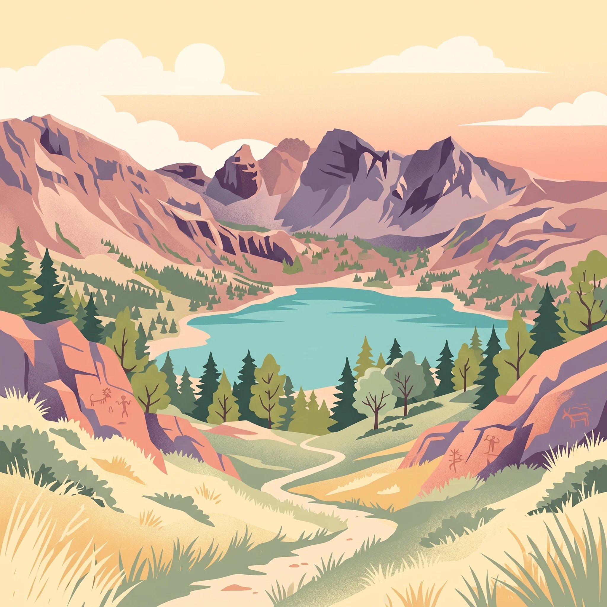
The Vallée des Merveilles, famous for its dense concentration of prehistoric engravings, is fundamentally a summer-focused destination. Because the site sits at a significant elevation near Mont Bégo, the archaeological trails are often covered by snow until late June or even early July. Visiting during the peak of July and August is the only reliable way to ensure these rock faces are exposed and the surrounding high-altitude passes are clear of dangerous snow accumulation. During these months, the stable weather and longer daylight hours provide the necessary window for long, exposed treks into the heart of the site. Attempting to reach these engravings outside of the high summer season requires specialized mountaineering skills and an understanding of winter alpine hazards, as snow cover frequently obscures the prehistoric markings.
Seasonal Rhythm of Alpine Lakes and Mountain Trails
Experiences such as visiting Lake Allos or traversing segments of the GR 5 and GR 52 long-distance trails are dictated by the rapid transition from the thaw to the stable alpine window. In late spring, specifically May and June, visitors often encounter lingering snow patches and high water levels in mountain streams, which can turn simple paths into challenging, technical treks. While these months offer increased daylight and blooming mountain flora, they are not suited for hikers looking for easy access to glacial basins like Lake Allos. The prime window for these water-feature-focused hikes aligns with the period of lower humidity and reduced precipitation from mid-July through August, when soil stability improves and the trails are free of ice.
Wildlife Watching in Transition Zones
The presence of iconic fauna, including the ibex and the chamois, is a constant element of the park’s identity, but observation opportunities shift significantly with the seasons. During the height of the summer, these animals often move to higher elevations to escape the midday heat of the lower valleys. Hikers exploring the high-altitude meadows in July and August may encounter these species at their summer grazing grounds, though their movement is independent of human schedules. Conversely, the cooler transition months of September and October, while characterized by higher precipitation and shorter days, often provide a quieter environment for wildlife observation as the crowds of summer depart and the animals begin to shift their range downward in anticipation of the cold. Always remember that wildlife encounters are subject to local conservation regulations and the natural behavior of the animals, which should never be disturbed or approached for the sake of photography.
Visitor Priorities
Optimizing Your Mercantour National Park Visit by Interest
Balancing High-Altitude Accessibility and Stable Conditions
For travelers focused on reaching the highest elevations, such as the trails surrounding the Vallée des Merveilles, the window between July and August provides the most reliable access. During these months, daily maximum temperatures reach their peak, averaging above 30 degrees Celsius at the mid-mountain climate sampling points, which typically coincides with the minimum snow cover of the year. The trade-off for this accessibility is higher visitor density and the necessity of managing heat during lower-elevation sections of the hike. Travelers prioritizing these specific landscapes should target this period to avoid the logistical risks associated with lingering spring snow, which can persist on high passes well into late June.
Choosing Cooler Temperatures for Physical Activity
If your primary goal is to hike with lower physical strain caused by heat, September presents a distinct alternative to the summer peak. As the average maximum temperature drops toward 26 degrees Celsius and daylight hours begin to contract, the intensity of solar radiation decreases. This window offers a more temperate environment for long-distance treks, such as the GR 5 or GR 52. The compromise here is the increased probability of early autumn weather patterns, as precipitation levels begin to rise compared to the arid conditions of July. Hikers choosing September must be prepared for colder nights, as average minimum temperatures drop toward 3 degrees Celsius, necessitating more robust gear than that required during the summer window.
Navigating the Drier Periods for Longer Excursions
Travelers who prioritize dry weather for multi-day itineraries should look toward the period spanning from June through August. Climate data indicates that precipitation reaches its lowest monthly average during July, at less than one millimeter per day. This consistency is essential for those planning excursions to remote areas where shelter is limited and trail conditions are sensitive to rainfall. The sacrifice for this stability is the limited availability of high-altitude solitude, as this timeframe represents the most popular period for park exploration. Those seeking the driest possible conditions must reconcile the benefit of stable, clear days with the necessity of competing for limited infrastructure and accommodation in the more accessible valleys.
Selecting for Extended Daylight and Alpine Exploration
For those whose priority is maximizing time on the trail during a single day, the stretch from June through early July provides the most extensive daylight hours, peaking at over 15 hours. This is particularly advantageous for high-elevation hikes like the ascent of Mont Mounier, where long distances and significant elevation gain require early starts and long days. The primary compromise during this period is the risk of the spring thaw, which can render higher-altitude paths unstable or impassable. While these months offer the longest windows of light, the environmental conditions remain significantly more variable than they are in the late summer, requiring visitors to balance the benefit of extended daylight against the risks of unpredictable terrain.
Access and Operations
Seasonal Access and Practical Planning for Mercantour National Park
Access to Mercantour National Park relies heavily on the interplay between its high-altitude topography and the seasonal climatic transitions described in earlier chapters. Because the park spans several distinct valleys and rugged ranges, reaching specific trailheads and interior locations is rarely a static endeavor. Travelers must anticipate that physical access routes, particularly mountain passes and high-elevation roads, often remain restricted by lingering snow well into late spring, while official park management may implement temporary transit rules depending on the season and local conditions.
Navigating Seasonal Transit Patterns
Transportation networks serving the park are highly sensitive to the calendar. During the summer peak, transit options such as regional bus lines or local shuttles often expand to accommodate hikers targeting high-elevation trailheads. Conversely, winter services are typically reconfigured to prioritize access to ski stations and valley-based winter sports areas rather than deep-wilderness trekking routes. Because these bus networks and shuttle frequencies are subject to annual adjustments, travelers should never assume that a service reported in historical records remains current. Always verify the latest schedules, booking requirements, and specific service stops through official regional transit authorities or the park's own visitor advisory channels before finalizing your logistics.
Understanding Permits and Controlled Access
Certain areas within the park, particularly those of significant archaeological or ecological sensitivity like the Vallée des Merveilles, may be subject to specific management policies. While the park is open to the public, these policies can include rules regarding group sizes, designated trail use, or restrictions during peak visitation periods to protect the petroglyphs and local wildlife. It is critical to distinguish between general access and specific activity-based requirements. If you are planning an expedition that involves guided tours, research activities, or movement within protected zones, you must consult the park administration to determine if a permit is required or if specific access windows are in effect for your target dates.
Infrastructure and Facility Availability
Visitors should prepare for the reality that high-altitude mountain infrastructure is not designed for year-round, unrestricted access. Mountain huts, visitor centers, and parking areas near trailheads frequently operate on seasonal schedules, often closing completely when hazardous conditions or low visitation volumes make them unsustainable. Planning a trip requires a two-step approach: first, evaluate your target timing based on the seasonal climate phases discussed previously; second, confirm the operational status of the specific facilities and roads you intend to use. Never rely on broad seasonal assumptions for essential logistical details, as local authorities may adjust facility opening and closing dates based on real-time weather assessments and safety evaluations.
Safety and Preparation
Weather, Safety, and Seasonal Preparation in Mercantour National Park
Managing Thermal Variability in High Alpine Terrain
Preparation for a visit to the park requires recognizing the stark contrast between protected valley floors and exposed high-altitude peaks. Long-term climate normals demonstrate that mean temperatures fluctuate significantly as elevation increases, even during the peak summer months. Visitors should be prepared for rapid thermal shifts, where a warm, sunny morning in a valley village can transition into freezing temperatures and high winds upon reaching a mountain pass. Because these shifts occur irrespective of the season, dressing in layers is essential for maintaining comfort and safety. Light, breathable clothing for sun exposure must be balanced against the need for wind-resistant and insulating layers, as clear skies at lower altitudes can mask severe weather patterns waiting at higher elevations.
Preparing for Seasonal Precipitation and Trail Conditions
Rainfall patterns in the region are not uniform, and precipitation levels often increase significantly during the transition months of autumn. While summer months like July and August historically see the lowest precipitation, the mountainous geography frequently generates localized storms that develop with little warning. Preparing for these conditions involves more than checking an annual average, as weather at 1,200 meters provides little indication of the moisture levels, mud, or lingering snow patches encountered at higher, more remote sites. Hikers must ensure their gear can manage sudden wetting, as trail surfaces can become treacherous following rainfall. Before venturing onto trails, it is necessary to consult current mountain weather forecasts and, if available, local bulletins concerning the stability of the terrain, as early-season snowmelt or late-season storms can fundamentally alter the safety profile of a route.
Daylight Considerations and Route Timing
Daylight hours provide the most predictable element of planning, peaking in June and July and shortening significantly by late autumn. This variation dictates the realistic window for travel on high-altitude trails, where the risk of being caught in darkness increases sharply once autumn begins. Effective preparation involves aligning daily activity goals with the available light, as mountain travel is notably slower than walking on flat terrain. Readers should remember that elevation gain, rather than total distance, remains the primary metric for estimating the time required for a hike. Choosing a route that matches individual fitness and experience levels is a critical safety step, as the ability to move efficiently through the landscape is the best defense against unpredictable mountain conditions. For the most up-to-date information on trail status, potential seasonal closures, and safety advisories, always refer to the official park website or contact local visitor centers before starting your trek.
Trip Synthesis
How to Choose the Right Time to Visit Mercantour National Park
Choosing the best time to visit Mercantour National Park requires reconciling your primary activity goals with the inherent volatility of a high-altitude alpine environment. The most reliable window for accessing the park's remote interior, including the Vallée des Merveilles and its high-elevation petroglyphs, is firmly concentrated in the midsummer months of July and August. During this period, the snowpack has typically retreated from mountain passes, providing the most consistent trail conditions for long-distance hiking and wilderness exploration. If your priority is reaching these craggy summits or traversing the most elevated plateaus, this stable summer interval offers the highest probability of accessible, clear-weather days.
For travelers seeking a different pace, the shoulder seasons of May, June, September, and October present distinct trade-offs. While these months often provide cooler temperatures and significantly lighter visitor traffic, they bring a higher degree of uncertainty regarding trail access. During late spring, remnants of winter snow can obscure paths and block high-mountain routes, even as the lower valleys experience pleasant, warming conditions. Conversely, early autumn can offer crystalline air and stable, mild weather, yet shorter daylight hours and the increasing risk of early season snowstorms mean that flexibility is essential. Choosing these periods requires accepting that your planned route may be impassable or that conditions can shift rapidly within a single day.
Ultimately, the decision rests on your comfort with unpredictability and your specific interest in the park's diverse landscapes. If you favor the security of open trails and established infrastructure, plan your trip during the peak summer months. If you prefer solitude, cooler air, and are prepared to adapt your itinerary based on current conditions, the transitional shoulder months provide a compelling alternative. Regardless of your choice, remember that climate normals serve as a long-term guide rather than a forecast for your specific dates. Before you finalize your travel plans, you must verify the latest trail status reports, seasonal facility operating hours, and current weather alerts issued by the park authorities. This proactive verification is the only way to manage the inherent risks of mountain travel in the Southern Alps and ensure your visit aligns with the reality of the season.