
Mori Atlas logo
National parkNationalpark Mols Bjerge

Mapping the dramatic dead-ice hills, Bronze Age burial mounds, and coastal terrain of Denmark

Nationalpark Mols Bjerge: Analyzing the Glacial Topography and Protected Landscapes of Central Jutland

Nationalpark Mols Bjerge represents a significant protected landscape in Central Jutland, defined by an expressive glacial morphology rare in the region. The terrain consists of a complex mosaic of dead-ice hills, dry valleys, and coastal cliffs that overlook the bays of Aarhus and Ebeltoft. Beyond its geological significance, the area is marked by a dense concentration of Bronze Age burial mounds, such as Stabelhøje and Agri Baunehøj, which serve as historical monuments and vantage points across the surrounding farmland and sea horizon.

dead-ice morainebronze age moundsglacial hillsdry valleysheathlanddry grassland
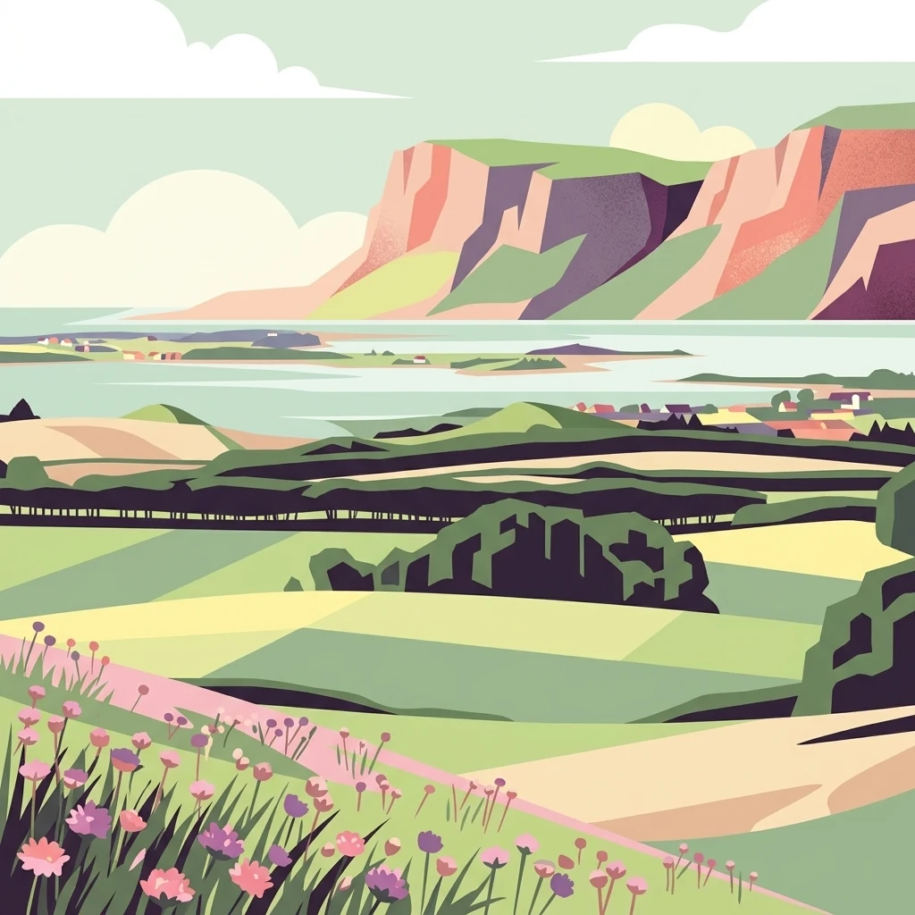
A flat-style digital illustration showing a hilly landscape with meadows, wildflowers in the foreground, and distant cliffs overlooking a bay.

Nationalpark Mols Bjerge

National park

Park overview

Structured park overview, official facts, and landscape profile for Mols Bjerge National Park

Mols Bjerge National Park park facts, protected area profile, and essential visitor context

Review the core facts for Mols Bjerge National Park, including designation, size, terrain, visitor scale, habitats, and operating context in one park-focused overview.

About Mols Bjerge National Park

Mols Bjerge National Park is a protected landscape area on the southern part of Djursland, the large eastern peninsula of Jutland, Denmark. Although Denmark as a whole is known for its flat terrain, this part of Djursland is unusually hilly. The relief was created by glacial processes during the last ice age, when blocks of dead ice were buried in glacial deposits and left deep depressions when they melted. The resulting landscape is a patchwork of steep, rounded hills, dry valleys, basin mires, heathlands, coastal meadows, and pockets of woodland. This subtle but consistent micro-topography creates a mosaic of microclimates unusual at this latitude.

The park is organized around a contrast between cultivated and uncultivated land. Large areas remain in active agricultural use, while the protected core consists of uncultivated hills and heath that have been kept open and grazed over centuries. This long history of grazing has helped maintain dry grassland habitats with specialized plant communities, particularly on warm, sun-exposed south-facing slopes. The protected and unprotected zones together form a unified landscape in which natural systems and human land use interact.

A second defining feature is the rich prehistoric heritage embedded in the terrain. The hills are dotted with burial mounds from the Bronze Age, many positioned deliberately on hilltops with commanding views. Sites such as Stabelhøje, made up of two large mounds at roughly 135 and 133 meters elevation near the village of Agri, illustrate how prehistoric communities shaped and incorporated the landscape. The burial mounds are not isolated monuments but integral parts of how the park looks and feels from both within and from the surrounding plains and sea.

The park's position between several bays of the Kattegat gives it a strong coastal identity. Aarhus Bay lies to the west, with Knebel Vig and Egens Vig indenting the coastline, while Ebeltoft Vig lies to the east. The Helgenæs peninsula, a hilly peninsula forming the southernmost part of Djursland, is included within or borders the park and contributes additional views, slopes, and coastline. From elevated points in the park, it is often possible to look across both bay and farmland, reinforcing the sense of open horizon that distinguishes this part of Denmark.

Quick facts and research context for Mols Bjerge National Park

Mols Bjerge National Park is located on the southern part of Djursland, the easternmost large peninsula of Jutland in Denmark. The park encompasses a hilly landscape shaped by glacial activity, including dead-ice moraine terrain, dry valleys, heathlands, coastal meadows, and steep coastal slopes along surrounding bays.

The area is one of the most physically varied landscapes in Denmark, marked by pronounced elevation changes in a country otherwise known for flat terrain. It combines working farmland with protected uncultivated land, and includes significant prehistoric heritage, including Bronze Age burial mounds that function as both archaeological sites and viewpoints. The park is bordered by the Helgenæs peninsula and several bays of the Kattegat sea area, including Aarhus Bay, Knebel Vig, and Ebeltoft Vig.

Protection and recognition

Review documented protected area recognition and administrative scope

Nationalpark Mols Bjerge Protection Status and Conservation Data

Nationalpark Mols Bjerge protection status details outline the administrative framework governing the protected landscape. Verified conservation records provide clear reference points for understanding regional environmental management.

Protection details

Transboundary protection
No
Park context

Deeper park guide and search-rich context for Mols Bjerge National Park

Mols Bjerge National Park history, landscape, wildlife, and travel context

Explore Mols Bjerge National Park through its history, landscape character, ecosystems, wildlife, conservation priorities, cultural context, and seasonal travel timing in a structured park guide built for atlas discovery and search intent.

Why Mols Bjerge National Park stands out

The park is best known for its unexpectedly hilly, glacially shaped terrain, which stands out sharply in the generally low Danish landscape. These dead-ice hills and associated dry valleys create a micro-topography that supports unusual habitats, including dry grasslands, heaths, and distinctive flora adapted to south-facing slopes. Equally distinctive is the strong presence of prehistoric cultural heritage. The park contains several of Denmark's most recognizable Bronze Age burial mounds, including Stabelhøje, Agri Baunehøj, Trehøje, and Ellemandsbjerg. These mounds serve both as cultural monuments and as elevated viewpoints with broad vistas over the surrounding farmland, bays, and coastlines, making the park a place where natural relief and ancient human history are tightly linked.
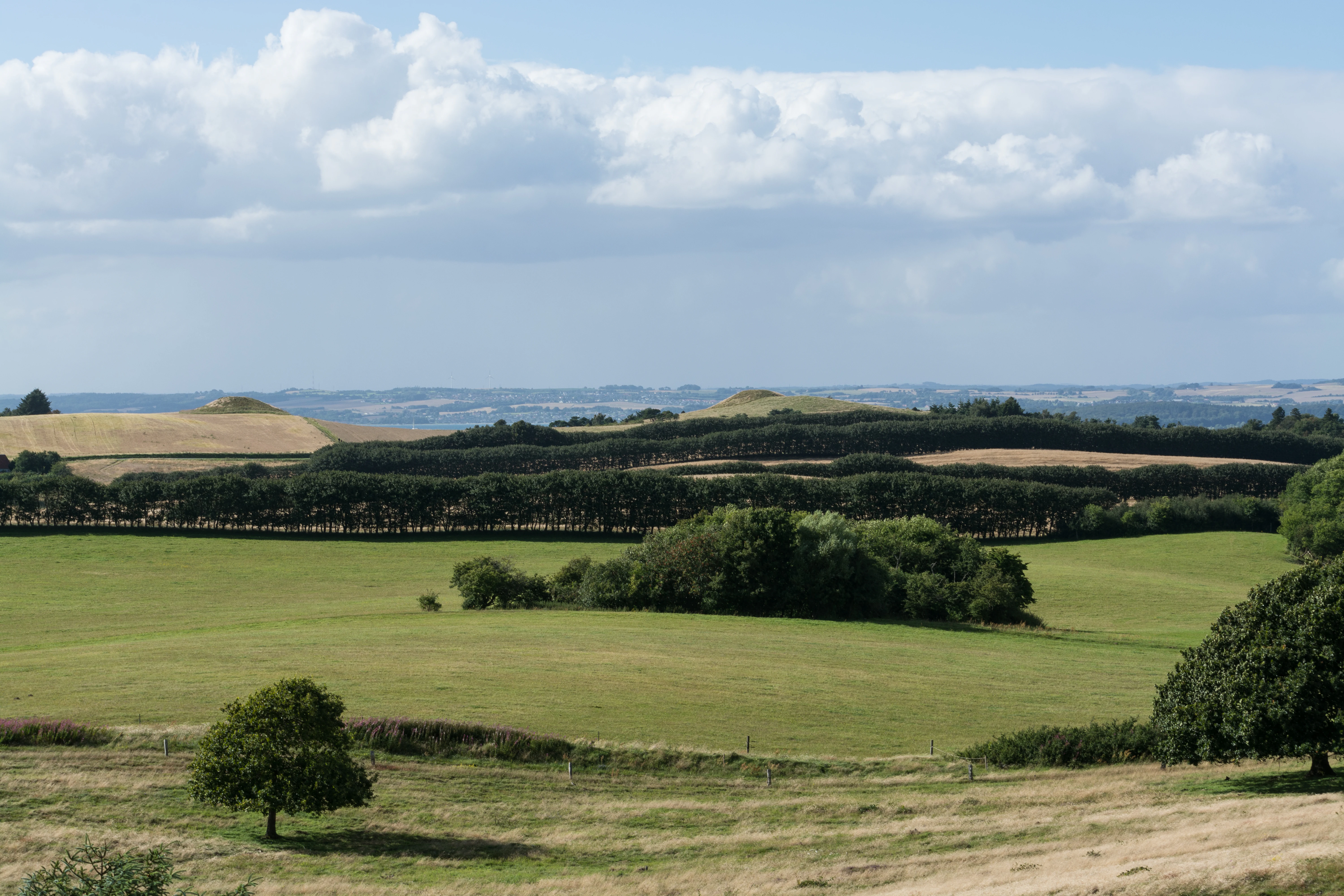
A wide, scenic view of the Danish countryside featuring rolling green hills, a tree-lined hedgerow, and small, rounded mounds in the distance under a partly cloudy blue sky.
The rolling hills and distinctive Bronze Age burial mounds of Stabelhoje within Nationalpark Mols Bjerge.

Mols Bjerge National Park history and protected-area timeline

The landscape of Mols Bjerge was shaped primarily by glacial activity during the last ice age, when the retreating ice left behind dead-ice moraines and an irregular pattern of hills and depressions. This geological foundation set the stage for later patterns of human settlement and land use, including extensive grazing that helped keep the hills open.

The prehistoric cultural layer is profound. The area contains a high density of Bronze Age burial mounds, reflecting a culture that built large collective monuments on hilltops and ridgelines. Source materials describe an organized prehistoric culture in which roughly 100 to 150 burial mounds were constructed annually during part of the earlier Bronze Age across Denmark, indicating strong communal ritual life. Some of the larger mounds, including Stabelhøje, are estimated to contain hundreds of thousands of stacked turfs, representing substantial communal labor.

In the modern era, the Mols area was historically used for agriculture and seasonal grazing, with open landscapes maintained for livestock. The significance of the landscape was increasingly recognized in the twentieth and early twenty-first centuries, eventually leading to the formal establishment of Mols Bjerge as a Danish national park. The national park designation brought together the protection of geology, habitats, and prehistoric monuments into a single coherent management framework, building on earlier heritage and conservation efforts by museums and national authorities.

Mols Bjerge National Park landscape and geographic character

The landscape of Mols Bjerge is defined by glacial morphology that is unusually expressive for Denmark. The terrain consists of rounded hills, often reaching above 100 meters in elevation, set among broader agricultural plains. The hills are typically steep, with dry, sun-exposed south-facing slopes, and more shaded north-facing sides. Between the hills run dry valleys and basin mires where water collects in shallow depressions. Together these features create strong horizontal and vertical variation in a compact area.

Coastal landscapes form an important part of the park. The sea-facing edges of the park transition into slopes and cliffs that overlook Aarhus Bay, Knebel Vig, Egens Vig, and Ebeltoft Vig. The Helgenæs peninsula extends the hilly character of the interior southward and adds a peninsula-shaped landform with its own coastal fringe. From many high points within the park, the visual transition from inland hill to open sea is unusually direct for a Danish setting.

The placenames of prominent viewpoints, including Stabelhøje, Agri Baunehøj, Trehøje, and Ellemandsbjerg, mark the highest points in the park. These locations provide 360-degree vistas across the southern Djursland farmland, the curving bays, and the distant Jutland coast around Aarhus. The differential in elevation is significant enough that, on clear days, viewers can see the contrast between inland terrain and the sea horizon.
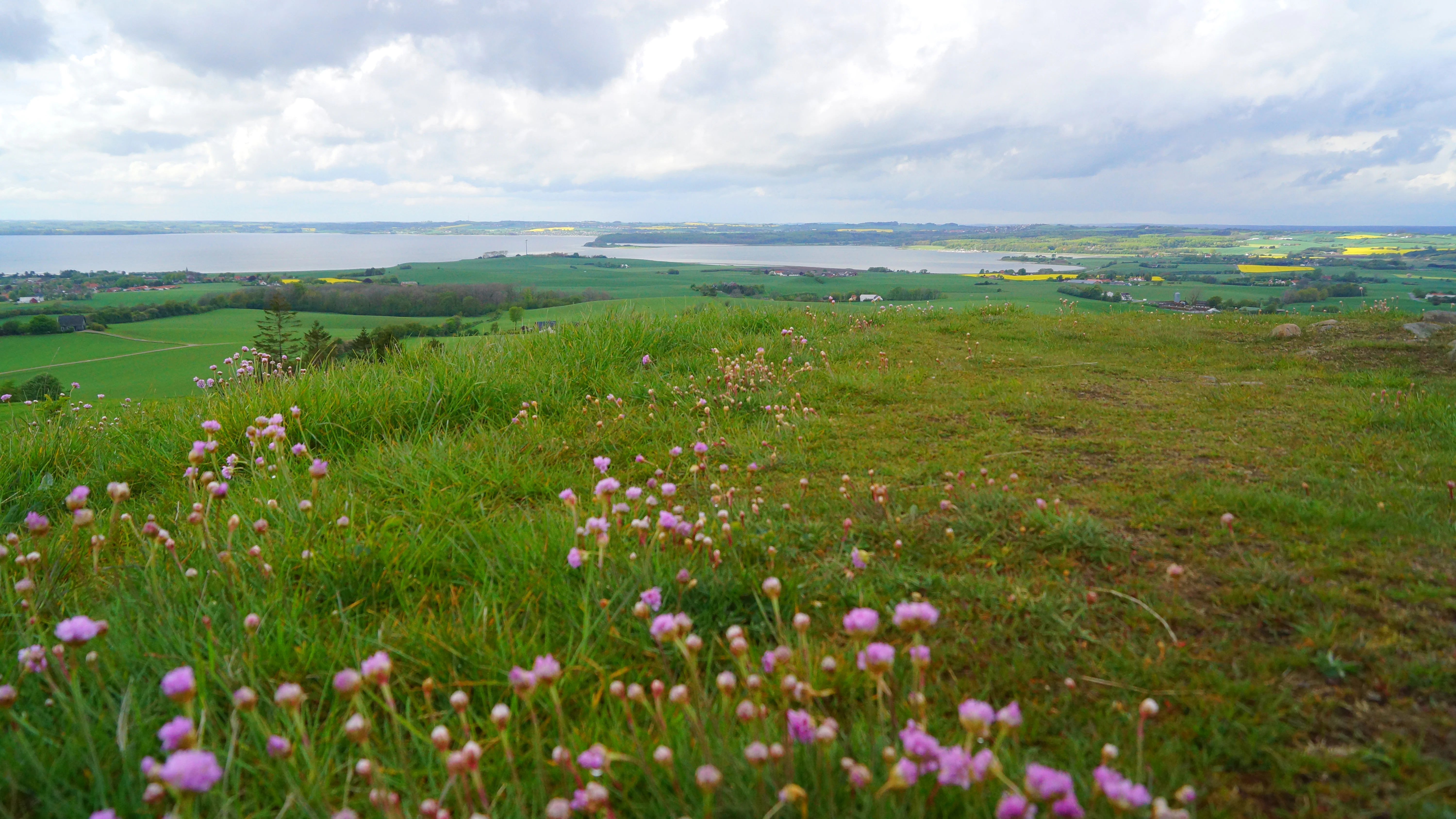
A high-angle landscape shot from a grassy hilltop featuring small pink wildflowers in the foreground, with green fields, rolling hills, and a body of water under a cloudy sky in the background.
A scenic view from the Stabelhoje hills, overlooking the rolling green landscape and coastal waters of Mols Bjerge National Park.

Mols Bjerge National Park ecosystems, habitats, and plant life

The varied terrain of Mols Bjerge creates a fine-grained mosaic of habitats. Dry, south-facing slopes support heat- and drought-tolerant plant communities, including specialized grassland and heath vegetation. North-facing slopes and sheltered depressions retain moister conditions and support different plant assemblages. This contrast in microclimate over short distances gives the park a botanical diversity that is greater than its overall size would suggest.

Dry grasslands, heaths, meadows, and grazed open landscapes dominate the protected core of the park. These open habitats have been maintained historically through grazing and lack of intensive cultivation. Basin mires and wet depressions add wetland elements to the habitat mix, while pockets of woodland occur in less exposed locations. The continuous interweaving of open and semi-open habitats is one of the park's defining ecological features.

Where cultivated farmland meets uncultivated hills, transitional habitats develop, including field margins, hedges, and remnant dry grassland patches. These transitions support species and ecological processes that depend on the interface between open cultivated land and wild habitat. The park's ecological character is therefore not purely defined by wilderness but by the simultaneous presence of open agricultural land and protected natural areas.

Mols Bjerge National Park wildlife and species highlights

The open, mosaic habitats of Mols Bjerge support a range of typical Danish lowland and coastal wildlife adapted to grassland, heath, and edge environments. Grazed landscapes provide habitat for invertebrates associated with dry grasslands, which in turn support birdlife that depends on these open conditions. The mix of open hills and adjacent farmland creates feeding and nesting opportunities for birds typical of Danish cultural landscapes.

Coastal proximity adds seabirds and shorebirds to the wildlife profile. The bays around the park provide feeding areas for waterbirds, while inland water features such as basin mires attract wetland-associated species. The continuous presence of varied habitats over a relatively small area gives the park a rich seasonal and daily fauna, with different groups dominant at different times of year.

Because the park combines protected and agricultural land, it also functions as a landscape for species that need access to multiple habitat types. The interaction between open hills, woodland patches, wetland depressions, and surrounding farmland allows movement and resource use across the park rather than restricting wildlife to isolated core zones.

Mols Bjerge National Park conservation status and protection priorities

Mols Bjerge National Park was established to protect an integrated landscape in which glacial geomorphology, dry and open habitats, and prehistoric monuments occur together. The conservation rationale rests on the idea that the value of the area lies not just in individual species or single habitats but in the combination of landforms, open habitats, and cultural heritage as a coherent whole.

A central conservation challenge is maintaining the open character of the hills. Many of the most valuable habitats in the park, including dry grasslands and heaths, depend on continued grazing or other low-intensity management to prevent encroachment by shrubs and trees. The national park framework supports this through coordinated land management and grazing traditions that have shaped the area for centuries.

The park also serves as a reference area for understanding how cultural landscapes can be maintained over long periods. The visible continuity between Bronze Age burial mounds and modern grazing land illustrates long-term human shaping of the terrain. Protecting this layered landscape is a key conservation goal, alongside more conventional objectives such as habitat protection, species conservation, and public access to nature and heritage.

Mols Bjerge National Park cultural meaning and human context

Mols and Djursland have a long cultural history rooted in the interplay between land and sea. Because glacial hills rise directly above productive lowland and bays, the area has supported farming, fishing, and seasonal grazing for millennia. Villages such as Agri and others in the Mols area have grown within this dual landscape, using both inland and coastal resources.

The Bronze Age heritage is the most visible cultural layer. The density of burial mounds, including the prominent Stabelhøje, Agri Baunehøj, Trehøje, and Ellemandsbjerg, indicates a community-oriented prehistoric culture with shared ritual and religious practices. These mounds were positioned deliberately on hilltops, suggesting that the landscape itself carried cultural meaning and was intentionally engaged with through monument-building.

In the modern era, the cultural identity of Mols is tied to its landscape distinctiveness within Denmark. The hills have been celebrated as a special natural and historical environment, and local institutions such as Naturhistorisk Museum Aarhus have been active in both scientific research and public communication about the area. The establishment of the national park reflects and reinforces this regional identity, connecting local heritage with national-level conservation and public engagement.

Top sights and standout views in Mols Bjerge National Park

Mols Bjerge offers a combination of features rare within Denmark: pronounced glacial hills, dry valleys, heaths, coastal slopes, and a high density of Bronze Age burial mounds that double as viewpoints. This blended identity, where geology, ecology, and cultural monuments converge, is the park's strongest single quality.

From viewpoints such as Stabelhøje, Agri Baunehøj, Trehøje, and Ellemandsbjerg, sweeping vistas extend across the southern Djursland farmland, the bays of Aarhus and Ebeltoft, and across the Helgenæs peninsula. The park's protected uncultivated hills sit within a larger working agricultural and coastal landscape, creating an unusually layered visual environment. The result is a national park that is as much about reading the landscape as a continuous cultural-natural system as it is about any single species or monument.

Best time to visit Mols Bjerge National Park

Mols Bjerge has a temperate climate typical of eastern Jutland, with mild summers and cool winters. Late spring and early summer are particularly favorable for experiencing the open hills, when grassland vegetation is active and wildflowers are visible on south-facing slopes. These months also tend to offer clearer long-distance views across the bays.

Summer provides the warmest conditions and the longest daylight hours for exploring the broader park on foot or by bicycle, while the coastal edges are pleasant for shorter visits. Autumn brings changes in color across the heaths and meadows and can produce especially clear visibility across the sea toward the Jutland coast. Winter visits offer quieter conditions and stark, open views of the hills, though weather along the coast can be changeable and some viewpoints are more exposed to wind.


Monthly climate preview

Long-term monthly temperature and precipitation averages for Central Jutland

Nationalpark Mols Bjerge Climate Normals and Annual Temperature Rhythm

Representative coordinate records show average temperatures ranging from winter lows near negative three degrees to summer maximums approaching twenty-three degrees alongside steady precipitation distribution. Examining complete monthly climate normals helps trace long-term meteorological patterns across the park geography.
Annual mean9 °C
2 °C17 °C
Jan2°
Feb2°
Mar3°
Apr6°
May11°
Jun15°
Jul17°
Aug17°
Sep14°
Oct10°
Nov7°
Dec3°
Warmest month
August

17.5 °C

Coolest month
February

1.5 °C

Wettest month
August

2.5 mm/day

Driest month
April

1.3 mm/day

Park location guide

Geography guide, regional context, and park location map for Mols Bjerge National Park

Mols Bjerge National Park park geography, regions, and map view in Denmark

Understand where Mols Bjerge National Park sits in Denmark through a broader geographic reading of the surrounding landscape, nearby location context, and its mapped position within the national park landscape.

How Mols Bjerge National Park fits into Denmark

Denmark is a constitutional monarchy and Nordic country in Northern Europe. It is the southernmost of the Scandinavian countries, bordering Germany to the south, Norway to the north, and Sweden to the southwest. The country consists of the Jutland peninsula and an archipelago of islands, with Copenhagen as its capital and largest city. Denmark has a population of over 6 million and is characterized by flat, arable land, sandy coasts, and a temperate climate.

Wider geography shaping Mols Bjerge National Park in Denmark

Denmark occupies the Jutland peninsula and roughly 406 islands in Northern Europe. It is situated between the North Sea to the west and the Baltic Sea to the east. The country borders Germany to the south and is connected to Sweden via the Øresund Bridge. Denmark is predominantly flat terrain with low elevation, the highest point being Møllehøj at 170.86 meters.

Map view of Mols Bjerge National Park

Use this park location map to pinpoint Mols Bjerge National Park in Denmark, understand its exact geographic position, and read its mapped placement within the surrounding landscape more clearly.

Pigeon | © OpenStreetMap contributors

Location context for Mols Bjerge National Park

Central Jutland

Visual reference for dead-ice hills, coastal slopes, and protected habitats

Nationalpark Mols Bjerge Photos and Glacial Landscape Scenery

Photographic records capture the dramatic glacial topography, dry valleys, and coastal vistas defining Nationalpark Mols Bjerge. Visual analysis of terrain and habitats reveals the complex character of this protected landscape across eastern Jutland.

A wide, scenic view of the Danish countryside featuring rolling green hills, a tree-lined hedgerow, and small, rounded mounds in the distance under a partly cloudy blue sky.

A wide, elevated landscape view featuring rolling green fields, patches of yellow crops, forests, and a large body of water in the background under a cloudy sky.

A high-angle landscape shot from a grassy hilltop featuring small pink wildflowers in the foreground, with green fields, rolling hills, and a body of water under a cloudy sky in the background.

Park atlas

Compare surrounding coastal terrain and glacial landscapes across Denmark

Exploring Parks Near Nationalpark Mols Bjerge And Regional Protected Areas

Browsing nearby national parks and protected landscapes provides essential geographic context for the glacial hills and coastal vistas found around Nationalpark Mols Bjerge. Extending the regional comparison allows visitors to examine related terrain features and protected habitats across the wider peninsula.
Watercolor illustration showing rolling hills, a lake, pink flowering trees, and distant mountains
National parkDenmark
Mapped location lies within the park boundary#1 closest

South

Mols Bjerge National Park: Glacial Geography and Protected Terrain in Central Jutland

Mapping the coastal cliffs and rolling heathland of Denmark

Mols Bjerge National Park protects a sweeping mosaic of glacial hills, woodlands, and coastal zones on the Djursland peninsula. With a landscape shaped by ancient ice sheets, the park offers a detailed view into Denmark's geological history, preserved ancient barrows, and rich botanical diversity along the Kattegat sea.

Area
180 km²
Established
2009
IUCN
II
Relief
Upland
Nature reserveRegion Midtjylland
About 6 km away#2 closest

Southwest

Tved Kær Nature Reserve: Protected Coastal Habitat Geography in Region Midtjylland

Exploring lime-rich fens and coastal cliff terrain.

Tved Kær represents a compact but ecologically dense protected area in Denmark, known for its rare calcareous fen and seepage vegetation. Situated near the village of Tved, this nature reserve integrates coastal cliffs and raised seabed to form a distinct habitat mosaic within the Mols peninsula, serving as a vital site for rare orchid species and lime-rich soil preservation.

Area
0.06 km²
Established
1981
Relief
Lowland
Climate
Temperate
Nature reserveRegion Midtjylland
About 8.7 km away#3 closest

East

Stubbe Sø Nature Reserve: A Geographic Exploration of Djursland Protected Landscapes

Mapping the wetlands, forest fringes, and mire systems of eastern Jutland.

Stubbe Sø is a central protected feature within the landscape of eastern Jutland, comprising a large shallow lake surrounded by alder-birch shorelines and coniferous plantations. This nature reserve offers deep insight into the glaciated terrain and wetland mosaic of the Djursland peninsula, providing an essential geographic reference for understanding local conservation habitats and regional waterbird migration corridors.

Area
7.78 km²
Established
1963
Relief
Lowland
Climate
Temperate
A horizontal watercolor illustration showing a calm coastal bay with grassy banks, winding water channels, and rolling hills in the background under a soft yellow sky.
Protected areaRegion Midtjylland
About 9.6 km away#4 closest

South

Natura 2000-område nr. 51 Begtrup Vig og kystområder ved Helgenæs Geography and Maps

Coastal grasslands and marine habitats in Region Midtjylland

Examine the complex terrain of Natura 2000-område nr. 51 Begtrup Vig og kystområder ved Helgenæs, an expansive protected area characterized by its diverse coastal cliff systems and large calcareous grasslands. This site documents the evolution of the Kattegat shoreline through its unique recurved spits and lifted seabed formations, providing a window into the natural landscape history of the Helgenæs peninsula.

Area
17.71 km²
Established
2011
Relief
Lowland
Climate
Temperate
Watercolor painting of a calm coastal bay with soft, layered green hills in the distance and a pale shoreline in the foreground.
Protected areaDenmark
About 10 km away#5 closest

South

Begtrup Vig Protected Area: Glacial Terrain and Coastal Geography in Denmark

Coastal landscape and regional protected area mapping

Begtrup Vig is a distinct coastal bay defined by its glacial history, stretching across the southern Djursland peninsula in Denmark. Within the broader Mols Bjerge national park framework, the area features varied topography including stony shores, sandy coves, and pastoral meadows. This record provides a focused look at the environmental boundaries and geographic significance of this protected habitat, bridging natural terrain with the regional landscape context.

Relief
Upland
Scope
Mixed
Water
Water-dominated
Season
Year-round
A soft watercolor painting showing a panoramic view of trees, water, and marshy land, rendered in a muted color palette.
Nature reserveRegion Midtjylland
About 22 km away#6 closest

North

Eldrup Skov og søer og moser i Løvenholm Skov: Geographic Map and Protected Landscape

An ecologically layered nature reserve in Region Midtjylland

This protected area unit unites five distinct parcels, including Gjesing Mose and Løvenholm Langsø, to preserve a rare slice of Danish forest and peatland. Use this mapping resource to understand the transition from dense broadleaf woodland to open raised bog habitats. The area represents a primary example of habitat restoration and conservation, showcasing how small, fragmented ecosystems retain their ecological integrity within a larger forest complex.

Area
1.55 km²
Established
2011
Relief
Lowland
Climate
Temperate
Watercolor painting depicting a gentle, rolling green landscape leading to a distant blue sea under a pale sky.
Protected areaRegion Midtjylland
About 26 km away#7 closest

South

Nordby Bakker Protected Area: Glacial Moraine and Grasslands in Region Midtjylland

Coastal cliffs, dunes, and rare calcareous ecosystems

Nordby Bakker preserves one of the largest continuous dry grassland complexes in Denmark, set upon a prominent glacial terminal moraine. Located at the northern tip of Samsø, this protected area features a unique synthesis of coastal dunes, beach ridges, and inland lakes that support a distinct array of rare plant and insect species within the central Kattegat region.

Area
6.28 km²
Relief
Upland
Climate
Temperate
Scope
Mixed
A wide watercolor illustration of a lake surrounded by green trees and rolling hills, with a small tree and pink flowers in the foreground.
Nature reserveAarhus Kommune
About 27 km away#8 closest

West

Brabrand Sø Nature Reserve: Mapped Geography of an Aarhus Glacial Tunnel Valley

Protected freshwater wetlands and urban green corridors in Denmark

Brabrand Sø represents a rare, shallow freshwater lake and wetland complex located at the edge of the Aarhus urban fabric. This nature reserve, formed within a post-glacial tunnel valley, remains a cornerstone of the regional landscape through its integration of bird habitats, drinking-water protection, and open meadow terrain. The area offers a profound look at how peri-urban green infrastructure sustains both ecological health and geological character in the Aarhus Kommune region.

Area
1.54 km²
Established
1959
Relief
Lowland
Climate
Temperate

Common questions about visiting, size, designation, and location context for Mols Bjerge National Park

Mols Bjerge National Park FAQs for park facts, access, geography, and protected area context

Find quick answers about Mols Bjerge National Park, including protected-area facts, park geography, trail and visitor context, and how the park fits into its surrounding country and regional landscape.
MoriAtlas Explorer

Continue Your Protected Areas Search Across the Global Atlas

Deepen your exploration by continuing the structured search for national parks and protected areas worldwide. Utilize the comprehensive filtering capabilities to compare different conservation landscapes and refine your understanding of global park geography. Discover more about the distribution and characteristics of protected natural areas.

Global natural geography