

Mori Atlas logo
Protected landscapeMount Hood National Forest

Analyzing the volcanic terrain, alpine lake basins, and forested ridgelines of the Cascade Range.

Mount Hood National Forest: Mapped Geography and Protected Landscapes in Oregon Cascades

Mount Hood National Forest serves as a prominent protected landscape in northwestern Oregon, defined by the towering stratovolcano of Mount Hood and expansive old-growth conifer forests. The geography stretches across six distinct river canyons and high-elevation alpine zones that characterize the broader Cascade Range. This atlas record documents the forest boundaries, volcanic ridges, and glacial water features that define this significant regional protected area.

Cascade Rangenational forestOregonvolcanic landscapealpine lakesold-growth forest

Mount Hood National Forest

Protected landscape

Park overview

Structured park overview, official facts, and landscape profile for Mount Hood National Forest

Mount Hood National Forest park facts, protected area profile, and essential visitor context

Review the core facts for Mount Hood National Forest, including designation, size, terrain, visitor scale, habitats, and operating context in one park-focused overview.

About Mount Hood National Forest

Mount Hood National Forest occupies a central stretch of Oregon's Cascade Range, anchored by Mount Hood, a stratovolcano that is the highest point in the state. The forest lies roughly sixty miles east of Portland, extending from the dramatic cliffs and waterfalls of the Columbia River Gorge southward across forested mountains, high lakes, and steep river valleys. It provides a continuous transition from low-elevation river country to alpine terrain around the volcano.

The forest is administered as part of the National Forest System and organized into four ranger districts: Barlow, Clackamas River, Hood River, and Zigzag. Forest headquarters are located in Sandy, Oregon, which sits at the foot of Mount Hood. The forest spans parts of seven Oregon counties, reflecting its broad footprint across the Cascade landscape.

Mount Hood National Forest is notable for combining ecological richness with deep recreational and cultural value. It contains extensive stands of old-growth Douglas fir, eight designated wilderness areas covering several hundred thousand acres, and well-known historic features including Timberline Lodge and segments of the Barlow Road, the final overland stretch of the Oregon Trail. A portion of the Pacific Crest Trail also crosses the forest along the flanks of Mount Hood.

The forest has long played a role in regional debates about land management, including a 1940 proposal to convert it into a national park and more recent campaigns to protect it from logging and off-road vehicle impacts. Its accessibility from Portland and its variety of landscapes make it one of the most heavily used national forests in the United States, supporting activities that range from hiking and skiing to berry picking and mushroom collecting.

Quick facts and research context for Mount Hood National Forest

Mount Hood National Forest is in Oregon, United States, east of Portland and the Willamette Valley. Established as a national forest on July 1, 1908, it has evolved through several name and boundary changes since its earlier incarnation as the Bull Run Forest Reserve of 1892.

Centered on Mount Hood, the state's tallest stratovolcano, the forest spans more than a million acres of Cascade Range terrain and ranks among the most-visited national forests in the country. It is administered by the U.S. Forest Service from headquarters in Sandy, Oregon, and is organized into four ranger districts.

Protection and recognition

Examine the documented conservation designation and management scope for this protected landscape.

Mount Hood National Forest Protection Status and International Recognition

Mount Hood National Forest holds a structured profile detailing official protection status, management scope, and international recognition records. Conservation tracking data provides clear insight into the governance history and administrative boundaries governing this forested mountain region.

Protection details

Transboundary protection
No
Park context

Deeper park guide and search-rich context for Mount Hood National Forest

Mount Hood National Forest history, landscape, wildlife, and travel context

Explore Mount Hood National Forest through its history, landscape character, ecosystems, wildlife, conservation priorities, cultural context, and seasonal travel timing in a structured park guide built for atlas discovery and search intent.

Why Mount Hood National Forest stands out

Mount Hood National Forest is best known for the towering, glacier-clad Mount Hood at its center, which lends the forest its identity and draws mountaineers, skiers, and sightseers from across the Pacific Northwest. It is also recognized for its extensive old-growth Douglas fir forests, its numerous alpine lakes such as Lost Lake and Trillium Lake, and its long stretch of forested Cascade Range scenery running from the Columbia River Gorge south toward Mount Jefferson. The forest's concentration of wilderness areas, historic trails, and the iconic Timberline Lodge further cement its reputation as a defining Pacific Northwest landscape.
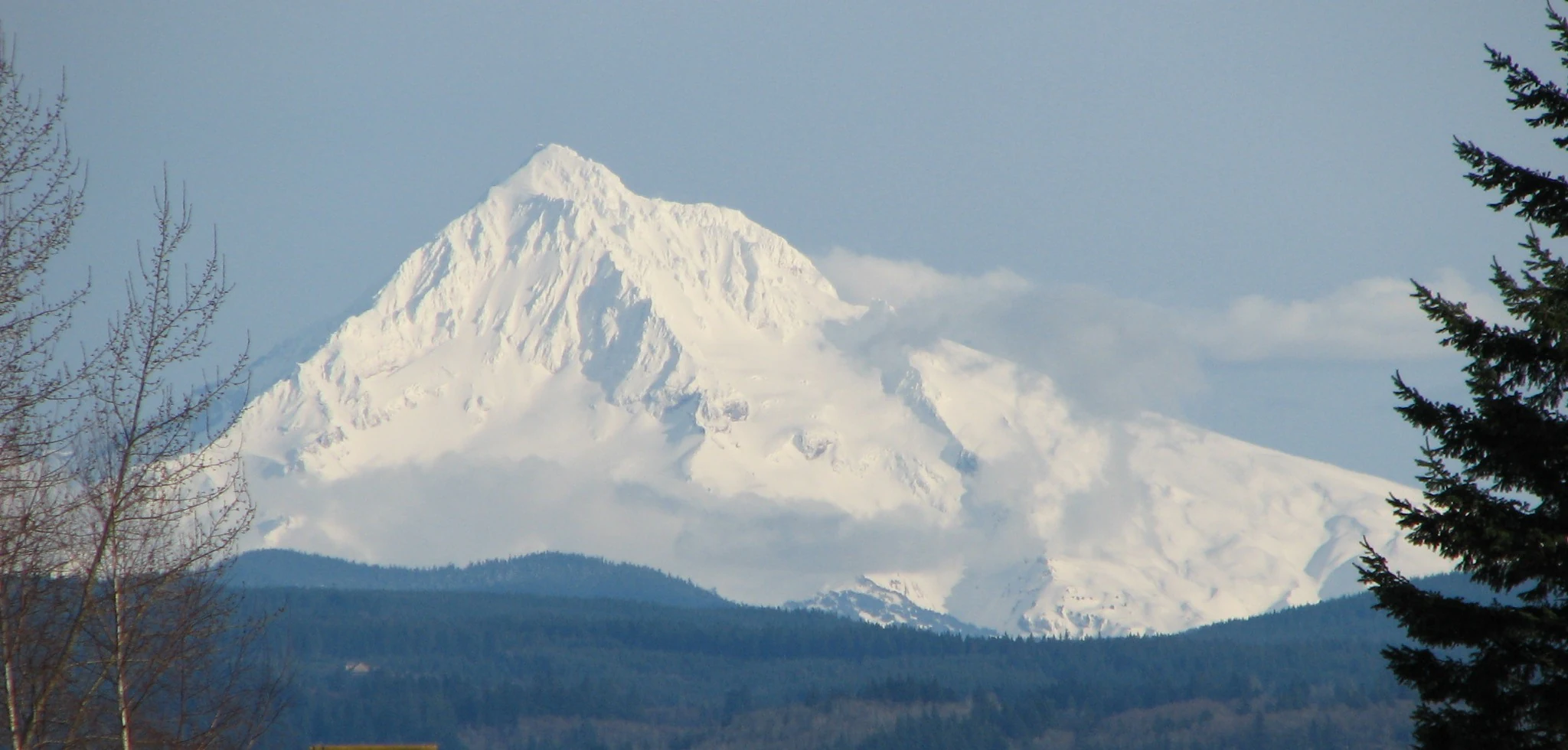
Mount Hood photograph
A 2006 photograph of Mount Hood in Oregon, USA, taken by Moribunt

Mount Hood National Forest history and protected-area timeline

Mount Hood National Forest traces its origins to the Bull Run Forest Reserve, which was first established in 1892 and expanded in 1893. The reserve was merged in 1908 with part of the Cascade National Forest to form the Oregon National Forest, an enormous early forest unit that stretched from the Columbia River to the South Fork of the Santiam River.

In 1911, with the creation of the Santiam National Forest, the southern border of the Oregon National Forest was redrawn northward to the divide between the Santiam and Clackamas rivers. The name was changed once more in 1924, when it became Mount Hood National Forest, firmly tying the administrative unit to the iconic volcanic peak at its center.

In 1940, the area was under consideration for designation as Mount Hood National Park, though the proposal never materialized. Decades later, opposition to logging in the forest revived broader efforts to secure stronger protection for the area, a movement that continues to shape its management. In 2009, the Mount Hood National Recreation Area was established within the forest to recognize and elevate its recreational significance. The forest was also honored in 2010 with its own coin under the America the Beautiful Quarters program.

Mount Hood National Forest landscape and geographic character

Mount Hood National Forest spans a long, wide swath of the Oregon Cascades, with the stratovolcano Mount Hood rising prominently from its center. The terrain ranges from steep river canyons along the Columbia to rounded, forested ridges and high alpine country around the volcano's flanks.

The forest includes extensive conifer forests dominated by Douglas fir, scenic lakes such as Trillium, Lost, Burnt, and Timothy, and numerous streams and reservoirs fed by snowmelt. At its southern end, the Olallie Scenic Area forms a lightly roaded lake basin beneath the slopes of Mount Jefferson, providing a quiet, primitive counterpart to the busier high-country around Mount Hood itself.

Volcanic origin shapes much of the scenery, with glacial features, lava flows, and sharp ridgelines combining with dense forests and deep river valleys. The elevation gradient and varied geology create a landscape where waterfalls, meadows, and glacial views appear within short distances of one another.
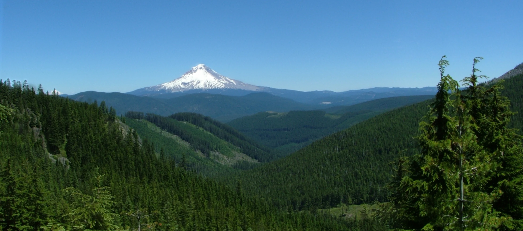
Mount Hood National Forest
View of Mount Hood National Forest from a vantage point south of the mountain near Little Crater Lake campground, Oregon.

Mount Hood National Forest ecosystems, habitats, and plant life

Mount Hood National Forest preserves a substantial portion of the montane and subalpine ecosystems typical of the Oregon Cascades. Its lower elevations are clothed in coniferous forests, while higher elevations transition into alpine and subalpine zones shaped by volcanic terrain and glacial activity.

Old-growth Douglas fir stands are among the forest's most significant ecological features, representing a remnant of the once-vast old-growth forests that characterized the Cascade Range. A 1993 Forest Service study estimated the old-growth extent within the forest at hundreds of thousands of acres, underscoring its importance for forest-dependent species and ecosystem integrity.

The forest also supports a mosaic of wetlands, lakes, riparian corridors along rivers such as the Clackamas and Hood, and high mountain meadows. These habitats create varied conditions across the landscape and contribute to the overall biodiversity of the central Cascades, while also feeding watersheds that extend beyond the forest boundaries.

Mount Hood National Forest wildlife and species highlights

Mount Hood National Forest supports a full range of Cascade wildlife, drawn to its combination of dense forests, alpine meadows, rivers, and high-country lakes. The forest's old-growth stands provide important habitat for species associated with mature coniferous forests.

Lakes and streams scattered across the forest sustain populations of fish and aquatic species, while the surrounding forests and meadows support mammals and birds typical of the Pacific Northwest. The wilderness areas within the forest offer protected conditions for wildlife sensitive to disturbance, including species found in higher elevations on the flanks of Mount Hood.

Game species, songbirds, and raptors are commonly associated with the forest's varied elevations, and the seasonal migrations between low and high habitats shape the wildlife calendar across the year. The forest's mixture of habitats, ranging from river valleys to alpine slopes, helps maintain ecological diversity in this part of the Cascades.

Mount Hood National Forest conservation status and protection priorities

Mount Hood National Forest carries significant conservation value as one of the largest forested landscapes in Oregon's Cascades and as a stronghold of old-growth Douglas fir habitat. A 1993 Forest Service study identified several hundred thousand acres of old growth within the forest, an unusually high figure among national forests in the region.

Eight federally designated wilderness areas lie within the forest, covering a substantial share of its total area and offering some of the highest levels of habitat protection available on federal land. The Mount Hood Wilderness in particular contains the peak and upper slopes of the volcano itself, protecting fragile alpine environments.

Conservation efforts in the forest have included organized campaigns opposed to logging and off-road vehicle use, led by groups working to build public support for stronger protections. The 2009 establishment of the Mount Hood National Recreation Area represented a formal recognition of the forest's recreational and ecological importance, adding another layer of management focus inside the broader national forest system.

Mount Hood National Forest cultural meaning and human context

Mount Hood National Forest carries strong cultural associations as the mountain framing views from Portland and as the setting for several important chapters in Oregon's settler history. Timberline Lodge, built in 1937 high on Mount Hood, sits within the forest and serves as both a national historic landmark and an enduring symbol of Pacific Northwest recreation.

The forest also contains segments of the Old Oregon Trail, including the Barlow Road, the final overland stretch used by wagon trains descending from the Cascades into the Willamette Valley. This historic route gives the forest tangible ties to the broader story of westward migration and settlement in Oregon.

In more recent decades, the forest has been the focus of community organizing around conservation, with nonprofit-led hikes and campaigns shaping public dialogue about its future. Mount Hood itself holds deep significance as a defining landmark of Oregon's identity, appearing on everything from roadside signs to the 2010 America the Beautiful quarter.

Top sights and standout views in Mount Hood National Forest

Mount Hood National Forest's signature highlights revolve around the volcano itself, with the snow-capped stratovolcano providing a dramatic backdrop for nearly every activity and viewpoint in the area. Timberline Lodge, perched high on the slopes of Mount Hood, is one of the forest's most recognizable cultural landmarks and a key destination year-round.

The forest's network of alpine lakes; including Trillium, Lost, Burnt, and Timothy; offers classic Cascade scenery, while old-growth Douglas fir stands showcase the ecological richness of the region. Eight designated wilderness areas, the Mount Hood National Recreation Area, and a portion of the Pacific Crest Trail underscore its appeal to hikers and backcountry travelers seeking solitude in the Cascades.

Best time to visit Mount Hood National Forest

Mount Hood National Forest offers distinct experiences depending on how visitors engage with its varied elevations. High-country areas around the mountain are most accessible and scenically rewarding from late spring through early fall, when snow has melted from roads and trails and alpine lakes and meadows are at their most vibrant.

Winter transforms the upper forest into a recreation zone of its own, with skiing and snow sports centered on the flanks of Mount Hood and the facilities around Timberline Lodge. Lower-elevation forests along rivers and toward the Columbia River Gorge can be visited throughout much of the year, with the changing seasons of deciduous trees adding variety to the scenery. Visitors interested in wildflowers, lakes, and high-country vistas generally find the warmer months most rewarding, while those drawn to snow-based recreation will want to focus on the winter season.
Monthly climate preview

Long-term representative measurements of temperature and precipitation for Mount Hood National Forest

Mount Hood National Forest Climate Normals and Monthly Weather Patterns

Historical climatology data reveals the measured annual temperature range and precipitation rhythm sampled at a representative coordinate in Mount Hood National Forest. Examining the complete monthly profile provides detailed insight into long-term averages across all twelve months.
Annual mean8 °C
1 °C17 °C
Jan
Feb
Mar
Apr
May11°
Jun13°
Jul17°
Aug17°
Sep14°
Oct
Nov
Dec
Warmest month
August

17.5 °C

Coolest month
December

0.6 °C

Wettest month
December

7.7 mm/day

Driest month
July

0.5 mm/day

Park location guide

Geography guide, regional context, and park location map for Mount Hood National Forest

Mount Hood National Forest park geography, regions, and map view in United States of America

Understand where Mount Hood National Forest sits in United States of America through a broader geographic reading of the surrounding landscape, nearby location context, and its mapped position within the national park landscape.

How Mount Hood National Forest fits into United States of America

The United States of America is a federal presidential republic and one of the world's largest countries by area and population. It consists of 50 states across a vast territory spanning multiple time zones, with its capital in Washington, D.C. and largest city in New York City. The nation has a diverse economy, influential political system, and significant cultural and military presence globally.

Wider geography shaping Mount Hood National Forest in United States of America

The United States occupies a vast territory in North America, bordered by Canada to the north and Mexico to the south. The 48 contiguous states stretch from the Atlantic to the Pacific Ocean, while Alaska occupies the northwestern region and Hawaii is an archipelago in the Pacific. The country encompasses diverse terrain including the Rocky Mountains, Appalachian Mountains, Great Plains, and extensive river systems.

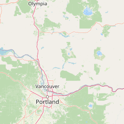
Map view of Mount Hood National Forest

Use this park location map to pinpoint Mount Hood National Forest in United States of America, understand its exact geographic position, and read its mapped placement within the surrounding landscape more clearly.

Pigeon | © OpenStreetMap contributors

Location context for Mount Hood National Forest

Oregon
Natural feature types

Examine the Natural Landscape Features of Mount Hood National Forest

Investigate the detailed geography of Mount Hood National Forest by browsing its cataloged natural features. MoriAtlas helps users identify and locate specific landmarks, ranging from high-altitude volcanic sites to lower-elevation river canyons across this expansive region.
Recorded earthquake history

Browse the Historical Earthquake Catalogue for Mount Hood National Forest

Examine the historical record of seismic activity associated with Mount Hood National Forest through our detailed event database. This resource provides clear documentation of past regional earthquakes, organized by date, magnitude, and epicentre proximity for focused geographic study.

Mount Hood National Forest Earthquake History

Catalogued events

79 events

Strongest magnitude

Magnitude 5.6

Most recent event

Oct 7, 2022

This history includes earthquakes recorded inside the park or within 50 km of its borders

Visual exploration of alpine terrain, old growth forests, and volcanic scenery

Mount Hood National Forest Photos, Landscapes, and Scenery Views

Visual documentation captures the diverse terrain, alpine lakes, and glacier-clad stratovolcano defining Mount Hood National Forest. Examining these protected area images reveals the ecological character and striking vertical relief shaping the Oregon Cascades.

Mount Hood photograph

Old-growth Douglas-fir forest in Bull Run watershed

Mount Hood National Forest

Park atlas

Compare regional geography, adjacent mountain reserves, and connected wilderness areas.

Explore Parks Near Mount Hood National Forest and Surrounding Protected Landscapes

Browse nearby national parks and protected areas to compare regional geography across the Cascade Range. Continuing past Mount Hood National Forest reveals adjacent wilderness landscapes and connected mountain terrain.
Wildlife reserveOregon
Park boundaries overlap#1 closest

Northwest

Mark O. Hatfield Wilderness: An Atlas of Basalt Canyons and Cascade Mountain Terrain

Protected rugged wilderness located in Oregon

Spanning from the Columbia River Gorge to the slopes of Mount Hood, the Mark O. Hatfield Wilderness preserves an array of forest stands, hanging meadows, and steep ridgelines. The area serves as a critical geographic hub within the Cascade Range, offering detailed insight into the volcanic geology and drainage systems that shape this iconic portion of Oregon.

Area
266.37 km²
Established
1984
IUCN
Ib
Relief
Mountain
Protected landscapeOregon
Park boundaries overlap#2 closest

South

Mount Hood National Recreation Area: Oregon Protected Landscape and Regional Geography

A three-unit recreational forest landscape in the Cascade Range.

Spanning over 34,000 acres, this protected landscape frames the lower volcanic slopes and forested drainages around Mount Hood. The area integrates river corridors, wilderness boundaries, and subalpine terrain, offering a clear view of the complex topography that defines the Cascade Range in northern Oregon.

Area
139.8 km²
Established
2009
Relief
Mountain
Climate
Temperate
Wildlife reserveOregon
Park boundaries overlap#3 closest

West

Mount Hood Wilderness: Atlas of Volcanic Peaks and Glacial Geography in Oregon

High-altitude protected landscapes and forest ecosystems

This protected area captures the dramatic character of the Cascade Range through its signature volcanic terrain, ancient forests, and high-alpine ridges. Covering a vast vertical range, the wilderness offers a study in geologic forces, featuring active glaciers, deep basaltic canyons, and meadows that define the mountain's northern and western slopes.

Area
262 km²
Established
1964
IUCN
Ib
Visitors
10K annual
Wildlife reserveOregon
Mapped location lies within the park boundary#4 closest

Southwest

Roaring River Wilderness: Geography and Protected Area Atlas of Oregon

Ancient forest corridors and alpine lake landscapes

Roaring River Wilderness is a federally protected landscape in Oregon, defined by steep, tree-covered ridges and the vigorous Roaring River. This wilderness preserves a dense mosaic of old-growth conifers, high-elevation alpine lakes like Serene and Shellrock, and important salmon-spawning waters within the broader Mount Hood National Forest geography.

Area
148 km²
Established
2009
IUCN
Ib
Relief
Mountain
Protected landscapeOregon
Park boundaries overlap#5 closest

South

Willamette National Forest: Geography and Protected Landscapes of the Central Oregon Cascades

Mapped terrain, old-growth forests, and protected wilderness boundaries.

Explore the expansive territory of Willamette National Forest, a primary protected area extending over 100 miles along Oregon's Cascade Range. This region features volcanic peaks exceeding 10,000 feet, extensive old-growth Douglas-fir stands, and a dense network of Wild and Scenic rivers, providing a detailed look at the geographic character and ecological heritage of the Pacific Northwest.

Area
6,790.75 km²
Established
1933
Visitors
1.7M annual
Relief
Mountain
Protected landscapeWashington
0.5 km away#6 closest

North

Gifford Pinchot National Forest: Geographic Overview of Washington's Volcanic Cascade Protected Lands

Mapping volcanic peaks, deep river canyons, and old-growth wilderness corridors

Gifford Pinchot National Forest represents a major protected expanse in the Washington Cascades, characterized by a complex volcanic topography that includes active craters, cinder cones, and rugged lava fields. This atlas entry details the forest's primary geographic features, from the high-elevation alpine terrain of the Goat Rocks to the river-carved valleys of the Lewis and Cowlitz systems, providing essential context on this integral Pacific Northwest protected landscape.

Area
5,347.95 km²
Established
1908
Visitors
1.8M annual
Relief
Mountain
Wildlife reserveWashington
26 km away#7 closest

North

Indian Heaven Wilderness: Volcanic Plateau Geography and Protected Cascade Landscapes

Volcanic peaks, high-elevation lakes, and expansive meadows in Washington.

Indian Heaven Wilderness encompasses a broad volcanic plateau in the southern Washington Cascades, famous for its dense concentration of lakes, ponds, and volcanic landforms. The area features a complex mosaic of cinder cones, shield volcanoes, and subalpine forests, offering a unique geographic perspective on the Pacific Northwest. Delve into the protected boundaries and mapped terrain of this significant wilderness area.

Area
84.1 km²
Established
1984
Visitors
8K annual
Relief
Mountain
Wildlife reserveOregon
30 km away#8 closest

Southwest

Middle Santiam Wilderness: Geographic Atlas and Protected Landscape Overview of the Oregon Cascades

Old-growth forest basins and volcanic landmarks in the Willamette National Forest.

Middle Santiam Wilderness represents a distinct segment of the central Oregon Cascades. The area is defined by its substantial old-growth coniferous forests, including 450-year-old Douglas-fir and western hemlock stands, alongside the striking 4,965-foot volcanic plug known as Chimney Peak. This map-focused record traces the river-cut valleys and high-ridge topography that shape this protected habitat.

Area
34.57 km²
Established
1984
IUCN
Ib
Relief
Mountain

Common questions about visiting, size, designation, and location context for Mount Hood National Forest

Mount Hood National Forest FAQs for park facts, access, geography, and protected area context

Find quick answers about Mount Hood National Forest, including protected-area facts, park geography, trail and visitor context, and how the park fits into its surrounding country and regional landscape.
MoriAtlas Explorer

Continue Your Protected Areas Search Across the Global Atlas

Deepen your exploration by continuing the structured search for national parks and protected areas worldwide. Utilize the comprehensive filtering capabilities to compare different conservation landscapes and refine your understanding of global park geography. Discover more about the distribution and characteristics of protected natural areas.

Global natural geography