Why Mount Isarog National Park stands out
Mount Isarog National Park is best known as the sole refuge of multiple endemic rodent species that occur nowhere else in the world. The Isarog shrew-rat (Archboldomys luzonensis), the Isarog striped rat (Chrotomys gonzalesi), and the Isarog snout rat (Rhynchomys isarogensis) are all confined to the forested slopes of this single mountain, making the park a globally significant site for mammalian endemism on Luzon. It is also recognized for its complete altitudinal forest zonation on one volcanic massif. A gradient that runs from parang grasslands and lowland rainforest at the base, through tall montane forest at mid-elevations, and into a low-growing mossy summit forest above roughly 1,500 meters, compresses a remarkable range of tropical habitats into a single protected landscape.
Mount Isarog National Park history and protected-area timeline
Mount Isarog National Park was established on July 20, 1938, through Presidential Proclamation No. 238, originally covering an area of 9,971 hectares that encompassed the entire Mount Isarog volcano. This early proclamation places the park among the older formally protected areas in the Philippines, reflecting recognition during the late colonial and early independence period that the volcano and its forests had exceptional value.
For decades after its establishment, the park operated under the original 1938 framework, focused primarily on protecting the volcanic landscape. Like many older Philippine national parks, its on-the-ground management and enforcement varied through the latter half of the twentieth century, as priorities shifted and resources for protected-area administration remained limited.
A turning point came on June 20, 2002, when Mount Isarog was re-evaluated through Proclamation No. 214, in line with the National Integrated Protected Areas System established by Republic Act 7586, the NIPAS Act. Under the revised framework, the area was formally redesignated as Mount Isarog Natural Park, with the protected zone expanded to roughly 101 square kilometers. This re-evaluation was not just a change in name or category; it placed the park within a more comprehensive national system that defined core, buffer, and multiple-use zones and clarified the institutional arrangements for managing protected areas.
The shift from national park to natural park also reflected a broader change in how Philippine conservation policy conceptualizes such sites. Rather than treating Mount Isarog primarily as a scenic reserve, the new classification emphasized the biodiversity values of the mountain and integrated the park into a national strategy for protecting unique habitats and species, including the endemic mammals that were by then recognized as scientifically important.
Mount Isarog National Park landscape and geographic character
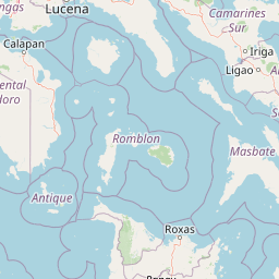
The landscape of Mount Isarog National Park is shaped almost entirely by the volcano it surrounds. Mount Isarog is a roughly conical stratovolcano that rises from the surrounding plains of Camarines Sur, and the protected area spans from low foothills up through the forested slopes to the summit region. Elevations range from about 150 meters at the lower edges to close to 2,000 meters at the peak, producing a steep and clearly zoned terrain.
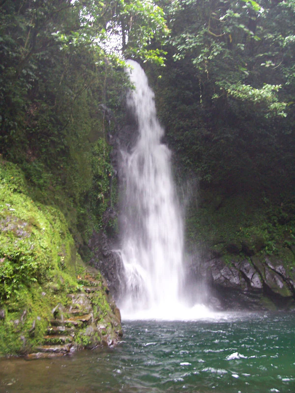
At lower elevations the terrain is a mix of rolling foothills, valley systems, and patches of grassland interspersed with forest stands. As elevation increases, slopes become steeper and ravines more frequent, and above the mid-elevations the forest canopy rises onto a more rugged volcanic profile. Drainage channels carved by past eruptions and long-term erosion cut into the flanks of the mountain, and several valleys host waterfalls and permanent streams; the most prominent of these is the Malabsay Falls in the southeastern part of the park.
The upper slopes and summit have a markedly different character. Cooler temperatures, persistent cloud cover, and shallow volcanic soils produce a landscape of shorter trees, abundant mosses, and a more open structure. This high-elevation zone resembles classic tropical cloud-forest terrain and gives the mountain a profile that visibly changes as it climbs, from tall continuous forest at lower elevations to a more windswept, dwarfed forest at the highest reaches.
Mount Isarog National Park ecosystems, habitats, and plant life
Ecologically, Mount Isarog National Park is defined by altitudinal vegetation zonation across a single volcanic mountain. From the base upward, vegetation shifts through parang grasslands mingled with heath-like shrubs and lowland rainforest up to around 1,000 meters, transitions into taller montane forest between roughly 900 and 1,500 meters, and gives way to a low, mossy, stunted mountain forest as it approaches the summit.
The parang vegetation at lower elevations is a characteristic Philippine formation consisting of grassland dotted with hardy shrubs and scattered trees, often maintained by past disturbance and the volcanic substrate. Above it, the lowland rainforest includes typical tropical tree species associated with Luzon forests, with relatively high biodiversity in the canopy layer. Mid-elevations are dominated by montane forest with denser, taller trees and a more continuous canopy, while the uppermost zone reflects the cool, wet conditions typical of high tropical mountains, with shorter trees, abundant mosses, and more open spacing.
This layered habitat structure supports distinct ecological communities at different elevations. Insect, bird, mammal, and plant assemblages differ between the lowland, montane, and summit zones, which is one reason isolated tropical mountains like Mount Isarog are recognized as disproportionately important for biodiversity per unit area.
The hydrology associated with the volcano also shapes the park's nature. Waterfalls and perennial streams in the forested valleys, together with the sulfate-rich hot springs at Hiwacloy, reflect the active geological setting while sustaining both terrestrial habitats within the park and downstream water resources in the densely settled lowlands of Camarines Sur.
Mount Isarog National Park wildlife and species highlights
Mount Isarog's most distinctive wildlife feature is its complement of endemic mammals, particularly rodents restricted to the mountain itself. The Isarog shrew-rat (Archboldomys luzonensis), the Isarog striped rat (Chrotomys gonzalesi) of the Luzon striped rat family, and the Isarog snout rat (Rhynchomys isarogensis) are all known only from Mount Isarog. Very little is documented about the natural history of these species, and their very limited ranges give the park outsized importance for mammal conservation on Luzon.
Beyond these flagship mammals, the park's altitude and forest cover support broader Luzon montane fauna, including endemic birds of the island and a range of small mammals, reptiles, and insects typical of Bicol mountain ecosystems. The continuity of forest from low elevations up through montane and summit zones allows species adapted to different altitudinal bands to persist in close proximity.
For birdlife, Mount Isarog is recognized within conservation planning as an Important Bird Area, reflecting the presence of forest-dependent species that rely on the remaining natural habitat of southern Luzon. While specific bird inventories from the park are not extensively detailed in available documentation, the combination of lowland and montane forest on a single mountain supports a richer avifauna than would be expected for a uniform landscape of comparable size.
In overall terms, the wildlife profile of the park is defined less by individual charismatic species than by the unusual concentration of range-restricted endemics. That concentration is what distinguishes Mount Isarog within the broader Philippine biodiversity context, and it is the main reason the park is treated as a conservation priority despite its relatively limited physical size.
Mount Isarog National Park conservation status and protection priorities
Mount Isarog National Park's conservation importance is rooted primarily in its endemic species, especially the rodent fauna restricted to the mountain's forested habitats. Because these mammals occur nowhere else, the persistence of their populations is wholly dependent on the continued integrity of Mount Isarog's forests. Any large-scale loss of habitat within the park would almost certainly lead to the global loss of these species, giving the protected area a level of conservation stakes that exceeds its physical extent.
The reassessment of the park in 2002 under the National Integrated Protected Areas System recognized this biodiversity value formally. Aligning the park with NIPAS standards strengthened the management framework for conserving forest cover, regulating land use, and integrating the park into national biodiversity priorities rather than treating it simply as a scenic reserve.
The limited development of tourism infrastructure has, somewhat incidentally, supported conservation outcomes by keeping visitor pressure on the forest relatively low. The few known visitor sites, chiefly the Malabsay Falls and the Hiwacloy hot springs, are localized and have not driven widespread habitat conversion. At the same time, the surrounding lowlands of Camarines Sur are heavily populated and largely agricultural, which positions the park as one of the largest remaining forest refuges for native wildlife in the southern Luzon landscape.
Maintaining forest continuity, especially on the mid- and upper slopes where the endemics are most likely to persist, remains the central conservation challenge. Edge effects from surrounding land use, any future expansion of tourism or infrastructure, and broader pressures on Philippine upland forests all pose potential threats to the integrity of the habitats the park was originally designed to protect.
Top sights and standout views in Mount Isarog National Park
Mount Isarog National Park's standout qualities include its complete protection of an entire large stratovolcano on Luzon, its three-tier forest zonation from lowland rainforest to mossy summit forest, and its exceptional concentration of endemic mammal species. Few protected areas of comparable size anywhere in the Philippines combine such a complete altitudinal gradient with so many species found only within their boundaries.
The park also stands out as one of the older formally gazetted national parks in the country, and its 2002 reclassification as a Natural Park reflects an evolution in how Philippine conservation frameworks treat mountain ecosystems. Its proximity to populated areas of Camarines Sur, including the city of Naga, also gives it a regional identity role as a defining natural landmark of the Bicol Region.
Best time to visit Mount Isarog National Park
The climate of Mount Isarog follows the general pattern of southern Luzon, with a distinct dry season and a wet season that affects both accessibility and the visual character of the landscape. The drier months, broadly between December and May, generally offer more reliable trail conditions for hiking, for visiting the waterfall areas at mid-elevations, and for travel into the interior of the park. At higher elevations the forest remains cool and frequently misty throughout the year, giving the upper zones a persistent cloud-forest atmosphere regardless of season.
Wildlife observation tends to be most productive in the cooler morning hours, when bird activity and movement of small mammals peak on Luzon mountains. Travelers interested in lush, saturated green landscapes and strong waterfall flow often prefer the wetter months, when vegetation is at its most vivid and streams run highest, while those prioritizing trail conditions and clearer views from mid-elevations usually favor the drier period.