Mori Atlas logo
Wildlife reserveMount Nutt Wilderness

Examining the rugged volcanic peaks, sheltered riparian springs, and desert terrain of the Black Mountains.

Mount Nutt Wilderness: Mapping the Volcanic Canyons and Protected Desert Landscapes of Arizona

Mount Nutt Wilderness represents a protected landscape within the central Black Mountains of Arizona. This wilderness area features a complex topography of steep mesas, narrow desert canyons, and prominent volcanic plugs that anchor the surrounding Mohave Desert terrain. Beyond the arid rocky slopes, scattered springs provide rare riparian habitats that support desert bighorn sheep and local vegetation.

desert wildernessvolcanic plugsBlack MountainsMohave CountyArizonaBureau of Land Management

Mount Nutt Wilderness

Wildlife reserve

Park overview

Structured park overview, official facts, and landscape profile for Mount Nutt Wilderness

Mount Nutt Wilderness park facts, protected area profile, and essential visitor context

Review the core facts for Mount Nutt Wilderness, including designation, size, terrain, visitor scale, habitats, and operating context in one park-focused overview.

About Mount Nutt Wilderness

Mount Nutt Wilderness occupies a striking position in Arizona's Black Mountains, a rugged desert range that rises along the western side of the Colorado River corridor in the northwestern part of the state. The wilderness sits centrally within that range, capturing a representative slice of the high desert terrain that defines much of Mohave County. Although the area is relatively close to Bullhead City, it remains a quiet and undeveloped place, characterised by deep canyons, broad mesas, and isolated rock formations that have been weathered out of the surrounding volcanic geology.

At the heart of the wilderness stands Mount Nutt itself, a peak that climbs to 5,216 feet and gives the protected area its name. Around it spreads a maze of canyons and mesas, punctuated by volcanic plugs, the hardened remnants of ancient volcanic activity that now stand as prominent landmarks within the wilderness. Despite being set in a hot, arid part of the Southwest, the area's canyons also shelter several springs, and around these the typical Sonoran-Mojave vegetation gives way to cottonwoods, willows, and oaks.

This blend of steep, exposed rock and scattered moist pockets makes the wilderness ecologically distinct from the broader desert surroundings. The setting supports a small but important population of desert bighorn sheep, which use the rocky terrain for movement and shelter and rely on the springs and their associated vegetation for sustenance. While the wilderness does not have major visitor infrastructure, its two established trails, the Cave Spring Trail and the Twin Springs Trail, provide a means to explore both the upland volcanic scenery and the spring-fed vegetation corridors that anchor the area's natural character.

Quick facts and research context for Mount Nutt Wilderness

Mount Nutt Wilderness is a Bureau of Land Management wilderness in Mohave County, Arizona, situated in the central Black Mountains. It covers roughly 28,080 acres and lies in the heart of the Mojave-side desert landscape west of the Colorado River. The area was designated in 1990 through the Arizona Desert Wilderness Act and is classified as IUCN Category Ib, reflecting its protected wilderness character.

The terrain is dominated by desert canyons, steep mesas, and volcanic plugs, with Mount Nutt itself rising to 5,216 feet. Springs scattered through the canyons sustain cottonwood, willow, and oak growth, as well as a resident population of desert bighorn sheep. Recreational access is centred on the Cave Spring Trail and the Twin Springs Trail.

Park context

Deeper park guide and search-rich context for Mount Nutt Wilderness

Mount Nutt Wilderness history, landscape, wildlife, and travel context

Explore Mount Nutt Wilderness through its history, landscape character, ecosystems, wildlife, conservation priorities, cultural context, and seasonal travel timing in a structured park guide built for atlas discovery and search intent.

Why Mount Nutt Wilderness stands out

Mount Nutt Wilderness is best known for its rugged volcanic desert scenery and its combination of dry mountain terrain with surprising spring-fed riparian pockets. The volcanic plugs and steep-sided mesas of the central Black Mountains give the area a distinctive, fortress-like character, while springs in the lower canyons allow cottonwoods, willows, and oaks to grow far from any major river system. This juxtaposition of arid rock and small, lush spring habitats also supports one of the area's signature wildlife species, the desert bighorn sheep, making the wilderness a recognised piece of bighorn habitat in the region.

Mount Nutt Wilderness history and protected-area timeline

Mount Nutt Wilderness was formally established in 1990 when Congress passed the Arizona Desert Wilderness Act, which set aside several desert landscapes in Arizona for long-term protection. Before its designation, the area was part of the public lands managed by the federal government in the Black Mountains, used primarily for grazing, dispersed recreation, and other low-impact activities.

The 1990 act brought the area into the National Wilderness Preservation System and assigned its management to the Bureau of Land Management, an agency already familiar with the surrounding desert lands. Under BLM stewardship, Mount Nutt has remained a small, lightly regulated wilderness, with protection focused on preserving its wilderness character rather than developing recreational infrastructure. No major subsequent redesignations have altered its boundaries or its core mission of conserving the area's rugged desert landscape and its associated wildlife habitat.

Mount Nutt Wilderness landscape and geographic character

The landscape of Mount Nutt Wilderness is a textbook example of rugged high desert topography. The terrain is built from the weathered slopes of the central Black Mountains, where erosion has carved a complex maze of canyons, benches, and cliff-bordered mesas down through the volcanic and sedimentary rock. The result is a deeply incised landscape of shadows and sun, with narrow drainages cutting between exposed ridges and broad upland flats.

One of the most distinctive elements of the scenery is the presence of volcanic plugs, which are the resistant cores of ancient volcanic activity that now stand as steep, fortress-like rock formations above the surrounding slopes. These plugs create abrupt vertical relief and give the wilderness much of its visual identity, contrasting with the gentler, layered mesas and the deeply cut canyons they overlook.

Mount Nutt itself anchors the area, rising to 5,216 feet at its summit and serving as the high point of the wilderness. Below the main ridge lines and across the canyon floors, the elevation drops sharply toward the desert basin, establishing a vertical range that, while not dramatic on a global scale, is significant for a region defined by low-lying desert terrain. The result is a landscape that feels both enclosed and far-reaching, with the higher volcanic formations providing long views across the surrounding Mohave Desert.

Mount Nutt Wilderness ecosystems, habitats, and plant life

Ecologically, Mount Nutt Wilderness belongs to the desert ecosystems of the American Southwest, with vegetation patterns shaped sharply by water availability. Across most of the area, the plant community reflects classic Mojave and Sonoran desert character, dominated by drought-adapted species able to survive in the rocky, sun-baked conditions of the canyons and mesas.

The genuinely distinctive ecological feature of the wilderness, however, is its network of springs, which support a sharply different plant community in an otherwise arid setting. Around these springs grow cottonwoods, willows, and oaks, creating pockets of dense, leafy vegetation that contrast strongly with the open desert above. These spring-fed communities act as small refuges of humidity and shade, and they are the focal points of the area's ecological richness.

The interplay between arid uplands and watered canyons creates a habitat mosaic that is unusually varied for a desert wilderness of this size. Plants, animals, and ecological processes all respond to this contrast, with species often moving between the open desert and the sheltered, moister canyon bottoms according to season, water availability, and cover requirements. This muted but real ecological diversity is one of the defining features of the Mount Nutt environment.

Mount Nutt Wilderness wildlife and species highlights

The wildlife profile of Mount Nutt Wilderness is shaped by the same themes that define its ecology: a backdrop of harsh desert terrain punctuated by scattered, spring-fed pockets of vegetation. Among the area's mammals, the desert bighorn sheep stands out as the most emblematic species, with a small resident population using the rugged canyon walls and the spring-fed vegetation zones as both habitat and water sources.

Beyond bighorn sheep, the area supports much of the broader desert fauna typical of northwestern Arizona's mountain and canyon environments. Smaller mammals, reptiles, and birds make use of the varied terrain, frequently moving between the exposed uplands and the shaded, vegetation-rich canyons. The springs themselves, with their cottonwoods, willows, and oaks, are particularly important for birdlife, providing nesting sites, cover, and reliable water in an otherwise dry landscape.

Wildlife viewing in Mount Nutt Wilderness tends to be focused less on large mammals and more on understanding how desert species navigate between terrain types. The bighorn sheep are the headline attraction, but the broader assemblage of canyon wildlife, from raptors riding the thermals above the volcanic plugs to smaller desert species in the mesquite and scrub below, is what gives the wilderness its full ecological character.

Mount Nutt Wilderness conservation status and protection priorities

Mount Nutt Wilderness is conserved primarily through its protected wilderness designation, which has been in place since 1990. By placing the area in the National Wilderness Preservation System and entrusting it to the Bureau of Land Management, the Arizona Desert Wilderness Act ensured that its rugged desert landscape would be managed to preserve its wilderness character rather than developed for resource extraction or large-scale recreation.

From a conservation perspective, the area's significance lies in the combination of its representative Black Mountains desert habitat and its more specialised spring-fed environments. The canyons, mesas, and volcanic plugs preserve a substantial block of undisturbed desert terrain, while the springs and their associated cottonwood, willow, and oak growth represent concentrated biodiversity hotspots within that broader landscape. These spring environments also support the area's bighorn sheep population, linking the wilderness's habitat value directly to a regionally important species.

Continued BLM stewardship focuses on keeping the area largely undeveloped, maintaining its primitive and unconfined character, and protecting the natural processes that shape its canyons and vegetation. In this way, Mount Nutt Wilderness functions both as a piece of intact desert landscape and as a refuge for the wildlife, plant communities, and ecological contrasts that depend on the area remaining wild.

Mount Nutt Wilderness cultural meaning and human context

Mount Nutt Wilderness sits in a part of northwestern Arizona long associated with desert travel, grazing, and proximity to the Colorado River corridor. The Black Mountains historically formed a significant barrier in the region's geography, visible from settlements such as Bullhead City and the broader Laughlin, Nevada area across the river. The wilderness itself does not carry a widely documented cultural narrative of indigenous habitation or large-scale historical settlement in the same way that some neighbouring protected areas do, but it belongs to a wider landscape that contains petroglyphs, historic travel routes, and ranching heritage typical of the Mojave Desert region.

Recreational and human use of the area has remained light, in keeping with its wilderness character, and the Black Mountains in general are valued locally as a backdrop and as a place of dispersed outdoor activity rather than as a centre of dense visitation.

Top sights and standout views in Mount Nutt Wilderness

The standout qualities of Mount Nutt Wilderness revolve around its rugged volcanic topography and its contrast between dry uplands and spring-fed canyons. The volcanic plugs and steep-sided mesas give the landscape a fortress-like character unusual in the surrounding low desert, while the presence of cottonwoods, willows, and oaks around scattered springs provides unexpected pockets of greenery that anchor both the area's scenery and its wildlife value.

Equally important is the area's role as habitat for desert bighorn sheep, which depend on exactly this combination of rocky escape terrain and spring-fed vegetation. The two principal trails, the Cave Spring Trail and the Twin Springs Trail, link these defining elements together, allowing visitors to move between the stark volcanic uplands and the sheltered, watered canyons that account for much of the wilderness's character.

Best time to visit Mount Nutt Wilderness

Mount Nutt Wilderness is best experienced during the cooler months, when the desert heat of lower elevations is less of an obstacle to meaningful time on the trails. Late autumn, winter, and early spring bring milder daytime temperatures, sharper visibility across the canyons and volcanic plugs, and more comfortable conditions for exploring the spring-fed vegetation corridors around Cave Spring and Twin Springs. Wildlife activity, including the movement of desert bighorn sheep between rocky terrain and water sources, can be more visible during these cooler seasons as animals concentrate around available water.

Summer visits are possible but demand caution, as temperatures in this part of the Mohave Desert rise sharply and water sources become limited. Most visitors planning to experience the wilderness as a real landscape, rather than a brief roadside stop, prefer the months when the canyons reveal their layered geology and riparian pockets without the intensity of summer heat.
Monthly climate preview

Long-term representative monthly averages for temperature and precipitation

Mount Nutt Wilderness Climate Normals and Annual Temperature Rhythm

Mount Nutt Wilderness records documented multi-year climate normals tracking sustained shifts between cooler winter minimums and elevated summer maximum temperatures. Reviewing the comprehensive monthly breakdown provides deeper analytical context for long-term regional weather patterns.
Annual mean20 °C
8 °C32 °C
Jan
Feb11°
Mar14°
Apr18°
May24°
Jun29°
Jul32°
Aug32°
Sep28°
Oct21°
Nov14°
Dec
Warmest month
July

32.4 °C

Coolest month
December

8.2 °C

Wettest month
February

1.1 mm/day

Driest month
June

0.1 mm/day

Park location guide

Geography guide, regional context, and park location map for Mount Nutt Wilderness

Mount Nutt Wilderness park geography, regions, and map view in United States of America

Understand where Mount Nutt Wilderness sits in United States of America through a broader geographic reading of the surrounding landscape, nearby location context, and its mapped position within the national park landscape.

How Mount Nutt Wilderness fits into United States of America

The United States of America is a federal presidential republic and one of the world's largest countries by area and population. It consists of 50 states across a vast territory spanning multiple time zones, with its capital in Washington, D.C. and largest city in New York City. The nation has a diverse economy, influential political system, and significant cultural and military presence globally.

Wider geography shaping Mount Nutt Wilderness in United States of America

The United States occupies a vast territory in North America, bordered by Canada to the north and Mexico to the south. The 48 contiguous states stretch from the Atlantic to the Pacific Ocean, while Alaska occupies the northwestern region and Hawaii is an archipelago in the Pacific. The country encompasses diverse terrain including the Rocky Mountains, Appalachian Mountains, Great Plains, and extensive river systems.

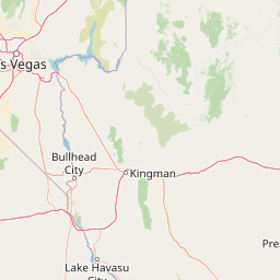
Map view of Mount Nutt Wilderness

Use this park location map to pinpoint Mount Nutt Wilderness in United States of America, understand its exact geographic position, and read its mapped placement within the surrounding landscape more clearly.

Pigeon | © OpenStreetMap contributors

Location context for Mount Nutt Wilderness

ArizonaMohave County
Recorded earthquake history

Explore the Historical Earthquake Records Associated with Mount Nutt Wilderness

Review documented seismic history for the region surrounding this desert protected area. The MoriAtlas catalogue provides event dates, magnitude, and epicentre distance data, helping you trace historical activity patterns in the Black Mountains and beyond.

Mount Nutt Wilderness Earthquake History

Catalogued events

3 events

Strongest magnitude

Magnitude 3.2

Most recent event

Jan 5, 2008

This history includes earthquakes recorded inside the park or within 50 km of its borders

Park atlas

Compare adjacent desert landscapes and regional protected terrain

Other Parks Near Mount Nutt Wilderness and Surrounding Protected Areas

Browsing other parks near Mount Nutt Wilderness reveals broader geological patterns across the surrounding desert region. Protected areas throughout the Black Mountains share similar volcanic terrain, rugged canyons, and desert bighorn habitats.
A watercolor painting showing a soft-toned landscape with a winding river in the foreground, a forested middle ground, and rolling mountains in the distance.
Protected landscapeUnited States of America
10 km away#1 closest

North

Lake Mead National Recreation Area: Desert Reservoir and Protected Landscape Atlas

United States protected geography and reservoir terrain

Spanning the lower Colorado River, Lake Mead National Recreation Area represents a unique convergence of desert ecosystems and large-scale water management. Its geography includes extensive reservoir shorelines, deep canyon corridors, and volcanic basin terrain that provide a foundational look at the arid environments of the American Southwest. The area remains a significant study of how engineered water features alter and interact with complex desert landscapes.

Area
6,053.31 km²
Established
1936
IUCN
V
Visitors
6.4M annual
Wildlife reserveArizona
About 43 km away#2 closest

North

Mount Tipton Wilderness: Protected Mountain Geography in Northwestern Arizona

High desert ridgelines and summit forest ecosystems

Mount Tipton Wilderness protects a striking segment of the Cerbat Mountains, characterized by its elevation-driven transition from arid desert lowlands to cooler, forested peaks. This rugged Arizona landscape features narrow spine ridges and the notable rock formations of the Cerbat Pinnacles, offering a preserved backcountry environment for those exploring the region's mountain geology and desert ecosystems.

Area
124.5 km²
Established
1990
IUCN
Ib
Relief
Mountain
Wildlife reserveNevada
About 61 km away#3 closest

Northwest

Ireteba Peaks Wilderness: Protected Desert Mountains and Lake Mohave Reservoir Shoreline

Mapping the Eldorado Mountains within southern Nevada desert protected areas.

Spanning the southern Eldorado Mountains and the northern shores of Lake Mohave, Ireteba Peaks Wilderness represents a critical Mojave Desert protected area. This landscape integrates rugged, rocky ridgelines with arid desert slopes and reservoir inlets. Its geographic character, shaped by both federal wilderness designation and proximity to the Avi Kwa Ame National Monument, preserves a vital slice of Nevada desert terrain and native ecological habitat.

Area
132.51 km²
Established
2002
IUCN
Ib
Relief
Mountain
National parkArizona
95 km away#4 closest

Northeast

Grand Canyon National Park: Arizona National Park Protected Landscape & Geography

Explore mapped boundaries and regional atlas context.

Grand Canyon National Park stands as a premier national park, showcasing a unique protected landscape within Arizona's diverse geography. This detailed entry focuses on the park's specific geographic identity, its mapped boundaries, and its significance within the regional atlas. Discover the contours of this protected area and its place in the natural terrain of the American Southwest.

Area
4,926.08 km²
Established
1919
IUCN
II
Visitors
4.9M annual
Wildlife reserveNevada
About 102 km away#5 closest

Northwest

Jimbilnan Wilderness: Geographic Overview and Protected Desert Landscape in Nevada

Mapping the canyons, washes, and plateaus of the Black Mountains

Jimbilnan Wilderness offers a dense mosaic of Mojave Desert habitats within a compact protected footprint. Located in Clark County, this Nevada wildlife reserve features a transition from deep, rocky canyons carved into the Black Mountains to wide desert washes and benches near Lake Mead. The area is notable for its botanical diversity, including rare milkvetch and buckwheat, serving as a critical link between upland desert systems and the lacustrine environment of the reservoir.

Area
76.4 km²
Established
2002
IUCN
Ib
Relief
Mountain
Watercolor painting of a calm lake surrounded by green forests and distant mountain ridges.
Protected areaArizona
112 km away#6 closest

East

Prescott National Forest: Geographic Overview of Arizona Protected Landscapes and Wilderness

Regional geography and protected terrain map of the Bradshaw Mountains

Spanning over one million acres, Prescott National Forest represents a defining outdoor landscape in Arizona. The terrain transitions from high desert chaparral to dense ponderosa pine forests, featuring eight distinct wilderness areas, rugged canyon systems, and essential watershed corridors that shape the regional ecology near Prescott.

Area
5,100 km²
Established
1908
Relief
Mountain
Climate
Temperate
Wildlife reserveClark County
About 113 km away#7 closest

North

Jumbo Springs Wilderness: Geographic Profile and Protected Landscape Atlas

A rugged desert preserve in Clark County, Nevada

Jumbo Springs Wilderness preserves a dense concentration of desert geology within a compact footprint. Users can analyze the protected boundaries, which feature Precambrian metamorphic formations and granitic domes that rise above arid drainages. This area functions as a critical desert refuge near the Lake Mead reservoir, providing a distinct look at the transition between rocky mountain slopes and water-influenced desert microhabitats.

Area
18.74 km²
Established
2002
IUCN
Ib
Relief
Upland
Watercolor painting showing a soft landscape with rolling hills in the background and a grassy plain with sparse trees and water in the foreground.
Wildlife reserveUnited States of America
About 114 km away#8 closest

South

Riverside Mountains Wilderness: Mapping the Desert Peaks and Protected Landscapes of California

A rugged desert wildlife reserve within the Lower Colorado River Valley

Riverside Mountains Wilderness features a tightly woven mosaic of dry drainages, rocky slopes, and sheltered canyon pockets. Situated in Riverside County, California, this protected area showcases a striking transition between steep mountain crags and open desert flats, providing a meaningful look at the Sonoran and Colorado Desert ecosystems along the Colorado River corridor.

Area
97.14 km²
Established
1994
Relief
Mountain
Climate
Arid

Common questions about visiting, size, designation, and location context for Mount Nutt Wilderness

Mount Nutt Wilderness FAQs for park facts, access, geography, and protected area context

Find quick answers about Mount Nutt Wilderness, including protected-area facts, park geography, trail and visitor context, and how the park fits into its surrounding country and regional landscape.
MoriAtlas Explorer

Continue Your Protected Areas Search Across the Global Atlas

Deepen your exploration by continuing the structured search for national parks and protected areas worldwide. Utilize the comprehensive filtering capabilities to compare different conservation landscapes and refine your understanding of global park geography. Discover more about the distribution and characteristics of protected natural areas.

Global natural geography