
Mori Atlas logo
Wildlife reserveMount Shasta Wilderness

Analyzing the geological boundaries and alpine ecosystems surrounding a massive Northern California stratovolcano

Mount Shasta Wilderness: An Official Atlas of Protected Volcanic Landscapes and Glacial Terrain in California

Mount Shasta Wilderness encompasses over 38,200 acres of protected land dominated by the colossal Mount Shasta stratovolcano. This atlas provides a detailed look at the park, covering its volcanic cones, complex glacial systems, and transition from high-elevation conifer forests to raw alpine ridges. Use this structured geographic record to understand the boundaries and terrain that define one of the most prominent peaks in California.

volcanic landscapealpine wildernessglaciersconifer forestmountaineeringbackpacking
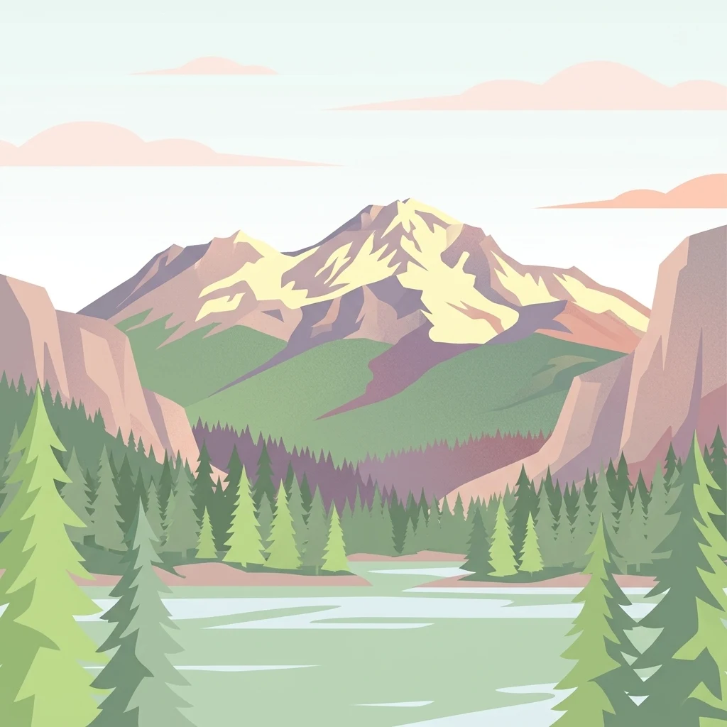
A flat-style digital illustration depicting a snow-capped mountain peak towering over a lush forest and a still lake in the foreground.

Mount Shasta Wilderness

Wildlife reserve

Park overview

Structured park overview, official facts, and landscape profile for Mount Shasta Wilderness

Mount Shasta Wilderness park facts, protected area profile, and essential visitor context

Review the core facts for Mount Shasta Wilderness, including designation, size, terrain, visitor scale, habitats, and operating context in one park-focused overview.

About Mount Shasta Wilderness

Mount Shasta Wilderness is a federally protected area that captures one of the most striking volcanic landscapes in the western United States. Located in northern California's Siskiyou County and nested within the larger Shasta-Trinity National Forest, the wilderness forms a protective buffer around Mount Shasta, a towering isolated stratovolcano whose traditional summit height is listed around 14,162 feet, with modern surveys placing it slightly lower or higher depending on the source. Regardless of the precise number, the peak is one of only two summits in California exceeding 14,000 feet outside the Sierra Nevada, the other being White Mountain Peak far to the east in the Great Basin.

The mountain's massive scale defines the character of the entire wilderness. With a base diameter of about 17 miles, Mount Shasta often generates its own weather patterns, and its steep flanks rise through a sequence of ecological zones, from conifer forests to bare rock and ice. The secondary cone of Shastina, sitting roughly one mile west of the main summit, adds another volcanic landmark and reflects the geological complexity of the area.

Geologically, the wilderness is a living archive of volcanic processes. Several glaciers radiate from the summit, the most notable being the Wintun Glacier, famously the lowest-elevation glacier in California at around 9,100 feet. Andesite and basalt lava flows mark the northern slopes, while hot springs, waterfalls, and rugged outcrops give the terrain a varied and dramatic appearance.

Ecologically, the wilderness spans a striking range of vegetation communities. Lower elevations feature mixed conifer forests of white fir, Douglas-fir, sugar pine, and incense cedar, along with stands of pure red fir dominated by the Shasta red fir species distinctive to the region. Sugar pine and other conifers contribute to the forested character, while the lava flows on the northeastern flank support mountain mahogany and juniper. Underbrush includes manzanita species, tanoak, chinquapin, and snowbrush, and from 8,000 feet upward the forests transition into krummholz forms of whitebark pine as elevations approach timberline.

The wilderness also has cultural and historical resonance. The Sierra Club operates the private Horse Camp parcel within the area, anchored by the Shasta Alpine Lodge, a shelter built in 1923 from local volcanic rock and Shasta red fir. This base camp has long served climbers, school groups, and visitors exploring the mountain, blending early conservation history with ongoing recreational use. Designation of the wilderness itself in 1984, through the California Wilderness Act, formalized federal protection of the area's most sensitive landscapes.

Quick facts and research context for Mount Shasta Wilderness

Mount Shasta Wilderness covers roughly 38,200 acres in Siskiyou County, northern California, and lies within the Shasta-Trinity National Forest. It was formally designated as wilderness through the 1984 California Wilderness Act and is administered by the U.S. Forest Service as an IUCN Category Ib protected area.

The park's defining feature is Mount Shasta, a towering stratovolcano that exceeds 14,000 feet and ranks among the highest peaks in the contiguous United States. The wilderness also contains the smaller volcanic cone of Shastina, four major glaciers, three smaller glaciers, hot springs, lava flows, and extensive conifer forest.

Its ecological significance includes prime stands of Shasta red fir and other conifers, fragile high-elevation habitats, and rare species such as Shasta owl's clover, a plant once believed extinct and rediscovered near the mountain.

Protection and recognition

Examine the terrestrial protection scope and documented designation framework.

Mount Shasta Wilderness Protection Status and Geographic Recognition Profile

Mount Shasta Wilderness maintains a documented terrestrial protection scope across its mountain terrain and surrounding natural landscapes. Structured records assemble official designation details, management boundaries, and international recognition sources where available for comparative conservation analysis.

Protection details

Protection scope
Terrestrial
Transboundary protection
No
Park context

Deeper park guide and search-rich context for Mount Shasta Wilderness

Mount Shasta Wilderness history, landscape, wildlife, and travel context

Explore Mount Shasta Wilderness through its history, landscape character, ecosystems, wildlife, conservation priorities, cultural context, and seasonal travel timing in a structured park guide built for atlas discovery and search intent.

Why Mount Shasta Wilderness stands out

Mount Shasta Wilderness is best known for Mount Shasta itself, one of the tallest and most visually prominent volcanoes in the western United States. The mountain is a massive isolated stratovolcano with a base diameter of roughly 17 miles, dominating the surrounding landscape of northern California. The wilderness is also recognized for its glacial and volcanic features. The Wintun Glacier on the mountain is the lowest-elevation glacier in California at around 9,100 feet, while lava flows composed of andesite and basalt on the northern flank and the secondary cone of Shastina illustrate the area's active geological history. Equally distinctive is the transition from dense conifer forest to alpine zones, with Shasta red fir stands, mixed conifer forests, and high-elevation whitebark pine forming krummholz communities. The combination of summit views, glaciated terrain, and forested slopes sets the wilderness apart from many other federally protected landscapes in the state.
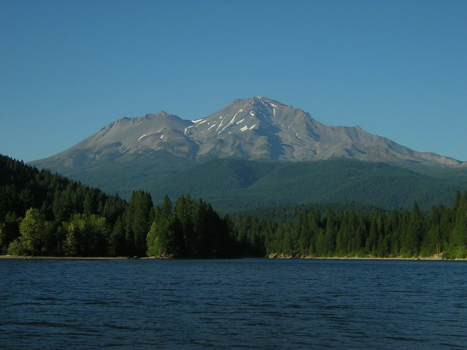
A wide view of the large, snow-dusted peak of Mount Shasta rising above a dense pine forest and the dark blue water of a lake.
Mount Shasta viewed across the waters of Lake Siskiyou.

Mount Shasta Wilderness history and protected-area timeline

Mount Shasta Wilderness was formally established in 1984 when the U.S. Congress passed the California Wilderness Act, setting aside the area for permanent federal protection. The designation brought the mountain and its surrounding high country under the National Wilderness Preservation System and placed management responsibility with the U.S. Forest Service as part of the Shasta-Trinity National Forest.

The environmental background for protection was shaped by a complicated land-use history. While large portions of the mountain remained pristine, other zones had experienced intensive logging and road-building in earlier decades. Congressional action in 1984 was meant to ensure that the most ecologically important and scenic parts of the landscape would remain undeveloped, even as surrounding forests continued under multiple-use management.

Earlier human history on the mountain was already significant. The Sierra Club had established its Horse Camp parcel decades before the formal wilderness designation, building the Shasta Alpine Lodge in 1923 from volcanic rock harvested on-site and timber from the surrounding Shasta red fir forest. The Olberman Causeway, a stone walkway constructed by the camp's first caretaker in the 1920s, became part of the site's character. Horse Camp operated for many years as a base for summit expeditions and as a destination for educational visits from Siskiyou County schools.

In more recent decades, the wilderness has also become famous through rare botanical discoveries. The rediscovery of Shasta owl's clover in 1996, previously thought extinct, drew renewed scientific attention to the unique flora of the slopes and surrounding sagebrush country above the Shasta Valley. Together, these events mark the wilderness as both a protected landscape and a continuing focus for conservation science.

Mount Shasta Wilderness landscape and geographic character

The landscape of Mount Shasta Wilderness is shaped almost entirely by the dominance of Mount Shasta itself. The mountain is a massive stratovolcano whose elevation exceeds 14,000 feet, towering over the surrounding terrain of northern California. Its broad base spans roughly 17 miles in diameter, creating a solitary peak that defines the regional skyline and influences local climate and weather.

Alongside the main peak sits the volcanic cone of Shastina, rising to about 12,270 feet, formed after the retreat of ice-age glaciers. Together, Mount Shasta and Shastina form a twin volcanic profile that has shaped drainage patterns, soil composition, and ecological zones across the wilderness.

Glacial features are central to the landscape. Four major glaciers and three smaller ones radiate from the summit, the most prominent being the Wintun Glacier, which begins around 9,100 feet, the lowest-elevation glacier in the state. Their presence extends the alpine character unusually far down the mountain. The northern flank carries extensive lava flows composed of andesite and basalt, adding stark volcanic surfaces to the otherwise forested slopes.

Beyond the high country, the wilderness includes waterfalls, isolated hot springs, deep canyons, and rugged ridges carved by past glacial activity. These features combine with old-growth and recovering forest stands to create a landscape where volcanic geology, glacial sculpting, and conifer forests intersect in unusually close proximity.

Mount Shasta Wilderness ecosystems, habitats, and plant life

Mount Shasta Wilderness protects an unusually compressed sequence of ecological zones, ranging from conifer forest to alpine ice. The lower and middle slopes support mixed conifer forests dominated by Shasta red fir, white fir, Douglas-fir, sugar pine, and incense cedar. Pure red fir stands, a defining vegetation type for the region, are well represented throughout the protected area.

At higher elevations, the composition changes. Western white pine and, near timberline, whitebark pine appear in krummholz form, the wind-stunted growth shape that marks the transition into the alpine zone. The lava flows on the northeastern flank support distinct vegetation communities of mountain mahogany and juniper, a contrast to the conifer-dominated forests elsewhere on the mountain.

Understory plants contribute substantially to habitat diversity. Pinemat manzanita, greenleaf manzanita, tanoak, chinquapin, and snowbrush are typical of the mid-elevation forests, while summer brings wildflowers such as Shasta lily, miner's lettuce, showy phlox, and mountain violet to the open meadows and slopes.

One of the most striking ecological aspects of the wilderness is the presence of rare plant species. Mt. Shasta arnica, Siskiyou Indian paintbrush, and Shasta owl's clover are among the notable rarities. The rediscovery of Shasta owl's clover in 1996 highlighted the botanical importance of surrounding high-elevation sagebrush and meadow habitats, adding scientific weight to the area's conservation value.

Mount Shasta Wilderness wildlife and species highlights

Wildlife in Mount Shasta Wilderness is shaped by the wide range of habitats available, from low-elevation forests to alpine ridges and exposed volcanic terrain. Black bears are commonly encountered across the mountain's forested zones, while coyotes, mule deer, and various species of ground squirrels inhabit the more open and mixed habitats.

Raptors are a striking presence in the wilderness. Golden eagles, prairie falcons, and red-tailed hawks all nest and hunt on the mountain, taking advantage of the open ridges, lava flows, and updrafts along the steep slopes. The mix of cliffs, meadows, and forest edges provides excellent conditions for these raptor species.

Although the biodiversity of Mount Shasta is not as celebrated as that of California's coastal or desert parks, the elevation gradient fosters a meaningful overlap of species typical of the broader Klamath-Siskiyou region. Larger mammals can be elusive, while smaller wildlife, including squirrels and a variety of songbirds, remain active in the more productive habitats. The relatively undisturbed sections of forest and the high-elevation alpine zones together support animal communities typical of northern California's volcanic landscapes.

The presence of reliable water sources, including the mountain's glaciers, snowfields, and scattered hot springs, sustains wildlife through the drier summer months, particularly in mid- and high-elevation habitats.

Mount Shasta Wilderness conservation status and protection priorities

Mount Shasta Wilderness holds substantial conservation significance as a federally protected wilderness within California's system of natural reserves. Its 1984 designation under the California Wilderness Act insulated the mountain's most sensitive ecological zones from future logging, road construction, and development. Less than half of the mountain is roadless overall, but the wilderness itself protects contiguous tracts of pristine forest and high-elevation terrain that had been impacted by historical logging elsewhere on the broader national forest.

The conservation value of the area is closely tied to its geology. Active volcanic processes continue to shape the landscape, and the glaciers and snowfields serve as important indicators of climate patterns in the region. The Wintun Glacier, in particular, holds scientific interest as the lowest-elevation glacier in California, while the surrounding lava flows, hot springs, and periglacial features provide research opportunities across multiple disciplines.

Botanical conservation is another cornerstone of the area's importance. The presence of rare and endemic species, including Mt. Shasta arnica, Siskiyou Indian paintbrush, and the Shasta owl's clover rediscovered in 1996, adds an additional layer of ecological significance. These discoveries have reinforced the importance of strict protection for the upper slopes and surrounding sagebrush habitats, where fragile species persist in low numbers.

Management by the U.S. Forest Service emphasizes minimal-impact wilderness practices, including permit requirements, group size limits, restrictions on campfires, and policies such as requiring human waste to be packed out. These regulations aim to preserve the area's character and ecological integrity for long-term scientific, recreational, and wilderness values.

Mount Shasta Wilderness cultural meaning and human context

Mount Shasta occupies an unusual cultural position, blending indigenous significance, early mountaineering history, and modern conservation identity. The mountain's prominence has made it a defining landmark for communities in northern California and southern Oregon, shaping regional identity and attracting generations of visitors.

The Sierra Club's long-standing presence at the mountain has contributed another cultural layer. The Horse Camp parcel, including the Shasta Alpine Lodge built in 1923 from local volcanic rock and Shasta red fir, has long functioned as a gathering point for climbers, conservationists, and educational groups. The Olberman Causeway, constructed in the 1920s, represents an early conservation-era effort to harmonize human use with the alpine environment.

Educational outreach remains an active tradition. Horse Camp, staffed during the climbing season from May to September, has historically hosted elementary school trips from Siskiyou County, introducing new generations to the mountain's history, ecology, and climbing routes. This blend of conservation, outdoor education, and recreational climbing reflects the broader American tradition of linking wilderness protection with accessible outdoor experience.

Top sights and standout views in Mount Shasta Wilderness

Mount Shasta Wilderness is anchored by Mount Shasta, a colossal stratovolcano and one of only two California peaks above 14,000 feet outside the Sierra Nevada. The mountain's size, isolation, and glacial system, including the Wintun Glacier at around 9,100 feet, the lowest-elevation glacier in the state, give the wilderness a uniquely dramatic alpine profile.

The area's volcanic and botanical richness further elevate its significance. Lava flows on the northeastern flank, the secondary cone of Shastina, hot springs, and stands of Shasta red fir combine with rare plant species, including the rediscovered Shasta owl's clover, to create a scientifically valuable landscape. The cultural touchstones of the Sierra Club's Horse Camp and the historic Shasta Alpine Lodge add depth to the wilderness's identity as both a protected natural area and a focal point of conservation heritage.

Best time to visit Mount Shasta Wilderness

Summer remains the most accessible season for visiting Mount Shasta Wilderness, particularly from June through July, when hiking routes are still snow-covered but more manageable. This period is often considered ideal for summit attempts, as the higher elevations retain firm snow that aids travel while temperatures are relatively mild at lower trailheads.

The wilderness also draws visitors in winter and spring, when snow transforms the mountain into a destination for cross-country skiing, snowshoeing, and ski mountaineering. The mountain's size and elevation create significant weather variability, and visitors should be prepared for rapidly changing conditions regardless of season. Late summer and early fall bring drier conditions and broader access to lower trails, though routes above timberline still pose hazards from loose rock and shifting snow.

Regardless of season, the cool northern California climate keeps summer temperatures moderate compared to much of California. Visitors come for the combination of long Alpine days, wildflower season in mid-summer, and the dramatic scenery of glaciers and volcanic terrain that remain dominant features throughout the year.

Monthly climate preview

Long-term monthly temperature and precipitation patterns sampled at representative terrain

Mount Shasta Wilderness Climate Normals and Annual Temperature Rhythm

Recorded baseline measurements outline a steady progression of average temperatures and daily precipitation across twelve distinct monthly intervals. Exploring the comprehensive climate record reveals complete multi-year normals and detailed monthly variations for Mount Shasta Wilderness.
Annual mean9 °C
0 °C21 °C
Jan
Feb
Mar
Apr
May10°
Jun15°
Jul21°
Aug21°
Sep17°
Oct10°
Nov
Dec
Warmest month
July

21 °C

Coolest month
December

-0.4 °C

Wettest month
December

5.2 mm/day

Driest month
August

0.2 mm/day

Park location guide

Geography guide, regional context, and park location map for Mount Shasta Wilderness

Mount Shasta Wilderness park geography, regions, and map view in United States of America

Understand where Mount Shasta Wilderness sits in United States of America through a broader geographic reading of the surrounding landscape, nearby location context, and its mapped position within the national park landscape.

How Mount Shasta Wilderness fits into United States of America

The United States of America is a federal presidential republic and one of the world's largest countries by area and population. It consists of 50 states across a vast territory spanning multiple time zones, with its capital in Washington, D.C. and largest city in New York City. The nation has a diverse economy, influential political system, and significant cultural and military presence globally.

Wider geography shaping Mount Shasta Wilderness in United States of America

The United States occupies a vast territory in North America, bordered by Canada to the north and Mexico to the south. The 48 contiguous states stretch from the Atlantic to the Pacific Ocean, while Alaska occupies the northwestern region and Hawaii is an archipelago in the Pacific. The country encompasses diverse terrain including the Rocky Mountains, Appalachian Mountains, Great Plains, and extensive river systems.

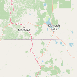
Map view of Mount Shasta Wilderness

Use this park location map to pinpoint Mount Shasta Wilderness in United States of America, understand its exact geographic position, and read its mapped placement within the surrounding landscape more clearly.

Pigeon | © OpenStreetMap contributors

Location context for Mount Shasta Wilderness

CaliforniaSiskiyou County
Recorded earthquake history

Explore the Recorded Earthquake History for Mount Shasta Wilderness

Access a detailed catalogue of historical seismic events associated with the Mount Shasta Wilderness landscape. This record set allows for the review of recorded magnitude, depth, and epicentre distance data, providing essential geographic context for the region.

Mount Shasta Wilderness Earthquake History

Catalogued events

93 events

Strongest magnitude

Magnitude 4.6

Most recent event

Jan 26, 2012

This history includes earthquakes recorded inside the park or within 50 km of its borders

Visual exploration of alpine terrain, conifer forests, and protected volcanic environments

Mount Shasta Wilderness Photos: Scenery, Glaciers, and Volcanic Landscapes

Examine authentic field photography capturing the towering stratovolcano, rugged lava flows, and sprawling alpine ecosystems of Mount Shasta Wilderness. Detailed visual records illuminate the glacial formations, timberline transitions, and unique geological character defining northern California's protected high country.

A wide view of the large, snow-dusted peak of Mount Shasta rising above a dense pine forest and the dark blue water of a lake.

Park atlas

Compare regional alpine terrain and volcanic formations across northern California.

Other Parks Near Mount Shasta Wilderness and Surrounding Protected Landscapes

Browse nearby national forests and protected areas that share the rugged volcanic character of Mount Shasta Wilderness. Expanding your geographic comparison reveals broader ecological patterns across the regional landscape.
A soft watercolor painting depicting a serene landscape with gentle green hills, a small forest, and a calm lake at sunrise or sunset.
Protected landscapeCalifornia
Park boundaries overlap#1 closest

Southwest

Shasta, Trinity National Forest: Mapping the Protected Landscapes of Northern California

Volcanic peaks, expansive reservoirs, and rugged mountain wilderness

Spanning over two million acres, Shasta, Trinity National Forest represents a major protected landscape in Northern California. The geography includes the iconic Mount Shasta volcano and the complex shoreline of Shasta Lake, while hosting expansive wilderness areas and diverse terrain ranging from oak-forested foothills to alpine meadows.

Area
8,942.87 km²
Established
1954
Relief
Mountain
Climate
Temperate
Protected landscapeCalifornia
40 km away#2 closest

North

Butte Valley National Grassland: Geographic Overview and Protected Landscape Mapping

High-desert sagebrush steppe in Northern California

Butte Valley National Grassland is a singular protected landscape in northern California, known for its expansive sagebrush steppe and dry lakebed terrain. Centered in the Klamath River basin, the grassland provides an essential high-desert habitat framed by the dramatic volcanic presence of the Cascade Range and Mount Shasta. This atlas entry details the geography, soil composition, and mountain-framed boundaries of this unique protected area.

Area
74.56 km²
Established
1991
Relief
Upland
Climate
Temperate
A wide watercolor illustration showing a calm body of water surrounded by green hills, conifer trees, and reeds in the foreground.
Protected landscapeCalifornia
41 km away#3 closest

Southeast

Lassen National Forest: Mapped Geography and Protected Landscapes of Northern California

Volcanic terrain and expansive old growth ecosystems

Lassen National Forest represents a vast protected landscape in Northern California, defined by its severe volcanic geology and resilient conifer forests. This atlas entry provides essential geographic context regarding the forest boundaries, the volcanic rim of Mount Tehama, and the intricate river systems shaping the region. Explore the terrain, from accessible lava tubes to the wilderness areas preserved within this significant mountain corridor.

Area
4,331.53 km²
Established
1905
Relief
Mountain
Climate
Temperate
Protected landscapeCalifornia
41 km away#4 closest

East

Modoc National Forest: Protected Landscape and Warner Mountains Geography

High desert volcanic terrain in northeastern California

Modoc National Forest encompasses a massive expanse of volcanic plateaus and rugged mountain ridges in the northeastern corner of California. This protected area offers significant geographic variety, transitioning from arid sagebrush basins to lush, high-elevation conifer forests. It serves as a vital natural landscape, home to the South Warner Wilderness and large stands of old-growth timber, reflecting the unique geologic history of the regional lava flows.

Area
6,695.09 km²
Established
1904
Relief
Mountain
Access
Moderate access
Protected landscapeCalifornia
58 km away#5 closest

West

Marble Mountain Wilderness: Exploring Protected Mountain Landscapes in Northern California

Klamath Mountains Wilderness and Alpine Geography

Spanning hundreds of thousands of acres, Marble Mountain Wilderness offers a dense concentration of subalpine fir, deep glacial lakes, and steep drainage basins. This northern California protected landscape provides an atlas of rugged ridges and marble-toned peaks that represent one of the most ecologically diverse backcountry areas in the region.

Area
978.3 km²
Established
1964
IUCN
Ib
Relief
Mountain
An artistic watercolor illustration showing a line of green evergreen trees in the foreground with hazy, distant mountains in the background against a light, neutral sky.
Protected landscapeOregon
72 km away#6 closest

Northwest

Rogue River, Siskiyou National Forest: Mapped Geography and Protected Area Overview

Tracing volcanic peaks and river-carved mountain terrain in Oregon

Spanning nearly 7,300 square kilometers, the Rogue River, Siskiyou National Forest acts as a crucial ecological anchor in the Pacific Northwest. This overview details its unique mountain geography, the extensive wilderness tracts within its boundaries, and the river systems that define its mountainous character.

Area
6,973.46 km²
Established
2004
Visitors
915K annual
Relief
Mountain
Protected landscapeCalifornia
81 km away#7 closest

South

Whiskeytown, Shasta, Trinity National Recreation Area: Geographic and Protected Landscape Overview

Mapped terrain across northern California reservoir units

Investigate the environmental character of Whiskeytown, Shasta, Trinity National Recreation Area, spanning from the expansive waters of Shasta Lake to the forested ridges of the Whiskeytown unit. This atlas entry details the interplay between large-scale reservoir management, riparian habitats, and the transition from Mediterranean chaparral to high-elevation conifer forests in California.

Area
99,588 km²
Established
1965
IUCN
V
Visitors
1.5M annual
A watercolor painting of soft, layered mountain ridges and forests in muted green, yellow, and red tones, presented in a wide, horizontal format against a white background.
Protected landscapeCalifornia
About 84 km away#8 closest

West

Klamath National Forest; Protected Landscape Geography and Mapped Wilderness Boundaries

Diverse mountain terrain in Northern California

Klamath National Forest represents a significant protected area in Northern California, encompassing a vast, rugged landscape that bridges the Klamath Mountains and the Cascade Range. Its terrain is characterized by deeply incised river valleys, exposed rocky summits, and an intricate mosaic of coniferous forests. This geographic detail provides essential context on the forest's role as a major site for wilderness protection and ecological study in the Pacific Northwest.

Area
7,033 km²
Established
1905
Relief
Mountain
Climate
Temperate

Common questions about visiting, size, designation, and location context for Mount Shasta Wilderness

Mount Shasta Wilderness FAQs for park facts, access, geography, and protected area context

Find quick answers about Mount Shasta Wilderness, including protected-area facts, park geography, trail and visitor context, and how the park fits into its surrounding country and regional landscape.
MoriAtlas Explorer

Continue Your Protected Areas Search Across the Global Atlas

Deepen your exploration by continuing the structured search for national parks and protected areas worldwide. Utilize the comprehensive filtering capabilities to compare different conservation landscapes and refine your understanding of global park geography. Discover more about the distribution and characteristics of protected natural areas.

Global natural geography