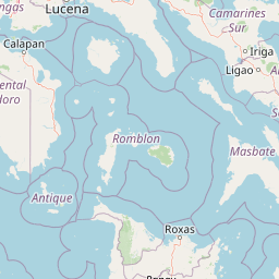
Why Mulanay Watershed Forest Reserve stands out
The reserve is best known as one of the older provincial watershed forest reserves in Quezon, designated in 1938 to protect forest cover around the headwaters of the Cawayan Creek. It is also recognized for preserving fragments of lowland tropical rainforest in a region where agricultural expansion has narrowed the extent of intact forest. Its inclusion among the initial entries of the NIPAS Act further cements its role as part of the formal Philippine protected area system in the CALABARZON region.
Mulanay Watershed Forest Reserve history and protected-area timeline
The Mulanay Watershed Forest Reserve traces its origin to 21 July 1938, when it was formally established as a watershed forest reserve under the early Philippine forestry and conservation framework. At that time, watershed reserves were a key tool used to protect forested headwaters supplying streams and rivers, particularly in agricultural provinces where sediment runoff and deforestation posed risks to downstream farming and water supplies. The selection of the Bondoc Peninsula site around the Cawayan Creek reflected this watershed-first conservation logic.
Decades after its original designation, the reserve was incorporated into the broader statutory structure of the Philippines' protected area system as an initial component entry under the National Integrated Protected Areas System Act, commonly known as the NIPAS Act and numbered as Republic Act 7586. This formal recognition placed the reserve within the national registry of protected landscapes and gave it standing alongside the country's national parks and other legislated reserves. In the CALABARZON region, the Mulanay reserve belongs to a cluster of watershed reserves and protected landscapes in Quezon province. Continued management of the area falls under the Philippines' Department of Environment and Natural Resources, with regional implementation through the DENR Calabarzon office and oversight from the Protected Areas and Wildlife Bureau.
Mulanay Watershed Forest Reserve landscape and geographic character
The landscape of the Mulanay Watershed Forest Reserve is shaped by the rolling topography of the Bondoc Peninsula in southern Quezon. The terrain is composed of low hills and shallow valleys rather than dramatic peaks, with the highest elevations inside the reserve reaching only about 147 meters above sea level. This gentle relief gives the area a softly contoured profile, where forested ridges interlock with narrow stream channels and small catchment basins.
The reserve's defining landscape feature is the Cawayan Creek watershed. Drainage from the protected hills flows outward through this creek system and ultimately reaches the Tayabas Bay, the broad body of water west of the Bondoc Peninsula. The combination of low elevation, dense vegetation cover, and proximity to the coast gives the area a distinctly tropical lowland character rather than a montane or highland one. Soils and slopes in the reserve influence how sediment moves during the heavy monsoon rains, which is the central reason why protecting forest cover here was considered important for downstream water quality.
Mulanay Watershed Forest Reserve ecosystems, habitats, and plant life
Ecologically, the Mulanay Watershed Forest Reserve preserves a fragment of lowland tropical rainforest within the Bondoc Peninsula region. The vegetation reflects the typical species mix of Philippine lowland forest systems, with evergreen canopy cover, multi-layered understory, and tree species adapted to year-round warmth and high humidity. Although the reserve is small, the surrounding region is recognized for its biological richness, and the protected forest offers habitat continuity in an area otherwise affected by clearing for agriculture and settlement.
The wet, humid climate supports consistent forest productivity, with the driest stretch from November to April preventing any extended drought stress on vegetation. Riparian zones along the Cawayan Creek add a different habitat element to the reserve, with streamside species able to colonize the moister corridors between hills. Together, the forested ridges and stream-side habitats form a small but ecologically meaningful network within the broader landscape matrix of southern Quezon.
Mulanay Watershed Forest Reserve wildlife and species highlights
Although detailed species inventories for the reserve itself are limited in available documentation, the broader Bondoc Peninsula and Quezon lowland forests are known for a wide spectrum of Philippine flora and fauna. Forest cover of the type preserved in the Mulanay Watershed Forest Reserve typically supports native bird species, small mammals, reptiles, amphibians, and invertebrates characteristic of lowland Philippine rainforest.
The reserve's role in supporting wildlife is closely tied to its function as a protected forest fragment. Even modest patches of lowland rainforest like this one can serve as refuges for species sensitive to habitat disturbance, particularly birds and forest-dependent insects and small vertebrates. The riparian corridors along the Cawayan Creek add value for amphibians and other moisture-associated wildlife, while the surrounding agricultural matrix means dispersal into and out of the reserve is an important ecological consideration for long-term species persistence.
Mulanay Watershed Forest Reserve conservation status and protection priorities
The conservation significance of the Mulanay Watershed Forest Reserve rests on three converging factors: its age, its watershed function, and its place in the NIPAS legal framework. Designated in 1938, it predates most of the modern Philippine national park system and reflects an early emphasis on watershed protection as a conservation priority. Its central hydrological role, safeguarding the headwater forest of the Cawayan Creek and downstream water quality in Tayabas Bay, gives it ongoing practical importance for local communities and agricultural users in Quezon.
Its inclusion as an initial component area under the NIPAS Act of 1992 anchored the reserve within the contemporary Philippine protected area system and brought it under the management framework overseen by the Department of Environment and Natural Resources, including the regional Calabarzon office and the Protected Areas and Wildlife Bureau. In regional context, it belongs to a network of watershed reserves and protected landscapes distributed across CALABARZON, complementing areas such as the Alabat, Binahaan River, Calauag, and Lopez watershed reserves in nearby parts of Quezon. The principal conservation challenge facing the reserve is the same one confronting many small Philippine watershed reserves: maintaining forest cover and ecological integrity in the face of agricultural expansion, settlement pressure, and the limited buffer between protected forest and surrounding land use.
Top sights and standout views in Mulanay Watershed Forest Reserve
The Mulanay Watershed Forest Reserve stands out as one of the older watershed reserves in the CALABARZON region, with a designation history reaching back to 1938. Its modest but ecologically meaningful footprint of lowland rainforest on the Bondoc Peninsula serves a dual role: protecting biodiversity typical of Philippine lowland forests and safeguarding the upper catchment of the Cawayan Creek that drains into Tayabas Bay.
Equally notable is its status as an initial entry under the NIPAS Act, which places it within the formal national protected area system managed by the Department of Environment and Natural Resources. For visitors, researchers, and regional conservation planning, the reserve illustrates how small, watershed-focused protected areas remain a foundational layer of Philippine conservation alongside the country's larger national parks.
Best time to visit Mulanay Watershed Forest Reserve
There is no sharply defined tourist season for the Mulanay Watershed Forest Reserve, but the driest period, generally running from November through April, tends to offer more comfortable conditions for outdoor movement, observation, and any lowland forest visits. During these months, rainfall is reduced, forest trails and streamside areas are generally more accessible, and humidity is somewhat lower than during the peak monsoon months.
The wetter months bring heavier rains, more saturated ground, and increased humidity, which can make hiking and extended outdoor exploration more difficult but also support lush vegetation conditions and high faunal activity. For a primarily watershed-focused reserve, visiting during or shortly after the rainy season can highlight the importance of forest cover in regulating stream flow, while the drier period is more typical for general lowland forest experience.