
Mori Atlas logo
Nature reserveMulligans Flat Woodland Sanctuary

Examining the geographic boundaries and restoration significance of this Canberra woodland refuge

Mulligans Flat Woodland Sanctuary: A Protected Nature Reserve and Ecological Landscape Map

Mulligans Flat Woodland Sanctuary represents a critical protected woodland reserve located within the Gungahlin district of the Australian Capital Territory. This area serves as a primary outdoor laboratory for the restoration of critically endangered white box, yellow box, and Blakely's red gum grassy woodlands. The sanctuary geography encompasses undulating valleys framed by volcanic and quartz ridges, providing essential habitat connectivity within the broader regional landscape.

woodland sanctuarygrassy woodlandendangered eucalyptsfox-proof reservespecies reintroductionoutdoor laboratory
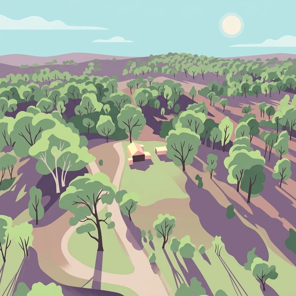
A digital illustration showing an aerial, stylized view of an open woodland with scattered eucalyptus trees, soft rolling hills, and a small building in the center.

Mulligans Flat Woodland Sanctuary

Nature reserve

Park overview

Structured park overview, official facts, and landscape profile for Mulligans Flat Woodland Sanctuary

Mulligans Flat Woodland Sanctuary park facts, protected area profile, and essential visitor context

Review the core facts for Mulligans Flat Woodland Sanctuary, including designation, size, terrain, visitor scale, habitats, and operating context in one park-focused overview.

About Mulligans Flat Woodland Sanctuary

Mulligans Flat Woodland Sanctuary is a nature reserve and active restoration site situated in the Gungahlin district in the north of Canberra, Australian Capital Territory. Managed by the ACT Government together with the Woodlands and Wetlands Trust, the sanctuary sits within the Canberra Nature Park system and operates alongside its sister reserves, Goorooyarroo Nature Reserve and the Throsby Offsets.

The landscape is a mosaic of remnant eucalypt woodland, native grassland and a substantial dam, encircled by an extensive predator-proof fence. The original woodland has been heavily reduced across its range, and the survival of large old growth eucalypts, including Blakely's red gum and yellow box, makes this a relatively intact example of a vegetation community that is now listed as critically endangered nationally. The sanctuary draws researchers, students and community volunteers who take part in long-running experiments in ecosystem repair.

Beyond its scientific role, Mulligans Flat is a welcoming local landscape with walking, running and cycling trails, a self-guided cultural tour, and ongoing programs delivered by traditional owners and conservation partners. Its identity sits at the intersection of cultural heritage, endangered woodland recovery, urban proximity and some of Australia's most closely watched wildlife reintroductions.

Quick facts and research context for Mulligans Flat Woodland Sanctuary

Mulligans Flat Woodland Sanctuary lies in north Canberra within the Australian Capital Territory and is part of the broader Canberra Nature Park system. It is classified as an IUCN Category IV protected area (habitat and species management area).

The reserve protects roughly 12.5 square kilometres of grassy woodland and was the first Australian woodland reserve to successfully eradicate foxes, cats and rabbits behind its predator-proof fence. Along with adjacent reserves it safeguards the largest remaining connected patch of white box-yellow box-Blakely's red gum woodland in Australia, a vegetation type listed as critically endangered under national environmental law.

Protection and recognition

Terrestrial protected area framework established in the year 2011

Mulligans Flat Woodland Sanctuary Protection Status and Designation History

Mulligans Flat Woodland Sanctuary holds a documented terrestrial protection status established in 2011. Structured records detail the official designation history and management scope for this protected area.

Protection details

Protection scope
Terrestrial
Designated year
2011
Transboundary protection
No
Park context

Deeper park guide and search-rich context for Mulligans Flat Woodland Sanctuary

Mulligans Flat Woodland Sanctuary history, landscape, wildlife, and travel context

Explore Mulligans Flat Woodland Sanctuary through its history, landscape character, ecosystems, wildlife, conservation priorities, cultural context, and seasonal travel timing in a structured park guide built for atlas discovery and search intent.

Why Mulligans Flat Woodland Sanctuary stands out

Mulligans Flat is best known as a fenced, ecologically intensive restoration site for the endangered white box, yellow box and Blakely's red gum grassy woodland of southeastern Australia. The reserve protects habitat for the golden sun moth, the striped legless lizard, the superb parrot and more than 150 species of wildflowers. It is also recognised as a pioneering outdoor laboratory for species reintroductions. The eastern bettong, bush-stone curlew and eastern quoll, all locally extinct in the Canberra region for decades, have been brought back here through careful, tested translocation methods developed in partnership with the ANU Fenner School.
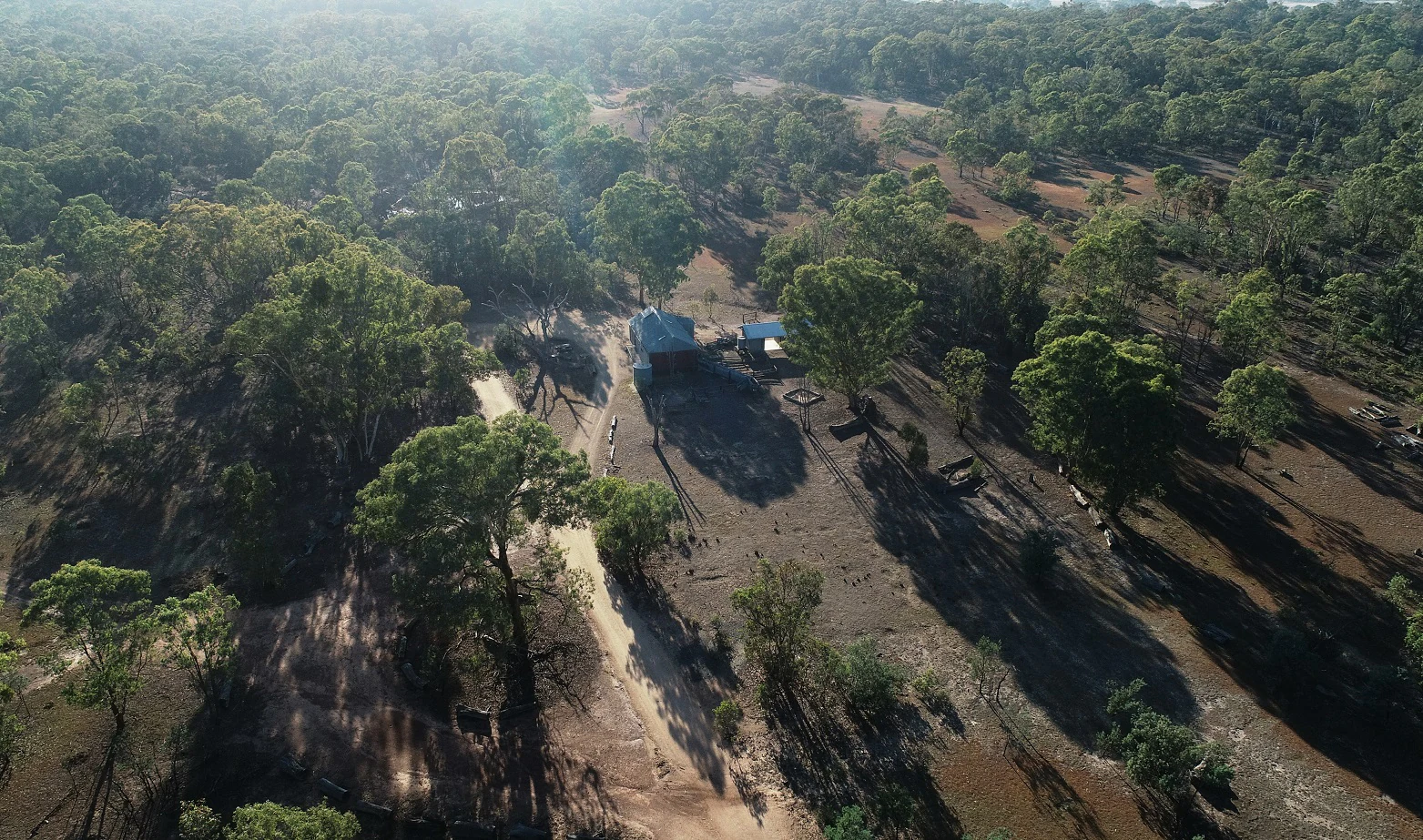
Aerial drone shot looking down onto a small wooden building in a clearing surrounded by Australian woodland.
An aerial view of the historic woolshed set within the grassy woodlands of Mulligans Flat.

Mulligans Flat Woodland Sanctuary history and protected-area timeline

The land that is now Mulligans Flat lies on Ngunnawal country. Before widespread clearing, the valley held a chain of ponds linked by inconsistent channels, supporting a diversity of plants, animals and human use. Stone artefacts, tree scarring and an old songline along the Old Coach Road survive as evidence of long Aboriginal connection to this landscape, and contemporary traditional owners continue to take part in caring for country through ranger programs and educational sessions at the reserve.

In the nineteenth and twentieth centuries the area was used as freehold and then leasehold grazing land, but the pressure applied here was lighter than in many comparable areas near Canberra. By the early 1990s its unusually intact woodland habitat was recognised as critical for several threatened species, including many of the rare woodland birds documented by the Canberra Ornithologists Group.

In 1992 seven environmental groups asked the federal Minister for the Environment to protect the area from urban expansion. Mulligans Flat Nature Reserve was formally established in 1994 under Canberra Nature Park. Protection expanded when Goorooyarroo Nature Reserve was added in 2004 and the Throsby Offsets in 2014. Community engagement deepened with the founding of the Friends of Mulligans Flat in 2011, and a major scientific partnership, the Mulligans Flat-Goorooyarroo Woodland Experiment, was begun by the ACT Government, CSIRO and the Australian National University. A fox-proof fence was built across more than eleven kilometres in 2008 and 2009, introduced predators were removed, and the first reintroductions of locally extinct mammals and birds began in the 2010s. In 2018 the fenced area was expanded to roughly 1253 hectares, nearly tripling the protected footprint.

Mulligans Flat Woodland Sanctuary landscape and geographic character

Mulligans Flat occupies a gently undulating valley on the northern edge of Canberra. Its surface is shaped by a volcanic ridge along the eastern side and a fault-driven quartz ridge to the west, both of which once supplied stone for Aboriginal tool-making and trade.

The vegetation is dominated by eucalypt woodland with native grasses beneath. Roughly half a dozen species of gum grow across the reserve, most prominently yellow box and Blakely's red gum, both now nationally threatened, alongside other remnant eucalypts. Between them, open native grassland, scattered wildflowers and a chain of seasonal wetland areas lead down to a large central dam.

The sanctuary is enclosed by more than eleven kilometres of predator-proof fencing, with smaller internal fences creating kangaroo and bettong exclosures. Walking, running and cycling trails cross the woodland, linking the reserve with the neighbouring Goorooyarroo and Throsby landscapes, and the older quarry sites and natural ridges are still visible in the topography today.

Mulligans Flat Woodland Sanctuary ecosystems, habitats, and plant life

The vegetation community protected here is the white box, yellow box and Blakely's red gum grassy woodland with derived native grassland, a vegetation type that has been reduced to a small fraction of its original extent across southeastern Australia. Together with Goorooyarroo, the sanctuary protects the largest remaining connected patch of this critically endangered woodland in the country.

Around 150 species of wildflowers have been documented in the reserve, supported by the shade and habitat structure of mature eucalypts. Old yellow box and Blakely's red gum trees in particular provide vital nesting hollows for declining woodland birds, while the grassy understorey supports invertebrates such as the golden sun moth and small reptiles like the striped legless lizard.

The dam and the chain of seasonal pools add a wetland dimension to an otherwise dry woodland environment, supporting frogs, waterbirds and aquatic invertebrates that knit the terrestrial and aquatic layers of the sanctuary together. Restoration work, including the addition of coarse woody debris on the ground, has measurably increased invertebrate numbers and, by extension, food for reintroduced mammals.

Mulligans Flat Woodland Sanctuary wildlife and species highlights

Mulligans Flat supports one of the richest woodland fauna assemblages of any reserve of its size in the region. Its eucalypts and grassy understorey shelter more than a hundred wildflower species, rare moths such as the golden sun moth, and reptiles such as the striped legless lizard, while older gum trees act as nest hollows for the vulnerable superb parrot and other declining woodland birds.

The sanctuary is unusual for the deliberate return of mammals and birds that disappeared from the ACT and adjacent New South Wales decades ago. Eastern bettongs, absent from the mainland for roughly eighty years, were reintroduced in 2012, followed by bush-stone curlews in 2014, eastern quolls in 2016 and 2017, and brown treecreepers along with New Holland mice through subsequent translocation and captive breeding efforts.

Other woodland species, including kangaroos and a wide suite of smaller marsupials and reptiles, benefit from the predator-proof fence and the gradual recovery of the understorey. Researchers regularly monitor how the reintroduced animals interact with each other and with the restored habitat, providing one of the clearest pictures anywhere in Australia of how a whole woodland community can be rebuilt.

Mulligans Flat Woodland Sanctuary conservation status and protection priorities

Conservation at Mulligans Flat is built around three linked goals: protecting what remains of a nationally threatened woodland, removing the pressures that caused its decline, and rebuilding the species that should live there. The reserve was classified as an IUCN Category IV protected area, a habitat and species management area, in 2011, formalising its role as an intensive recovery site rather than a wilderness reserve.

The habitat it protects, the white box-yellow box-Blakely's red gum woodland with derived native grassland, is listed as critically endangered under the Commonwealth Environment Protection and Biodiversity Conservation Act 1999 and as endangered in New South Wales. Only an estimated 30 percent of the original eucalypt woodland is thought to remain across its range, so the intact old growth at Mulligans Flat carries conservation significance well beyond its local setting.

Key management actions include the multi-kilometre fox-proof fence, the eradication of rabbits, cats and red foxes, exclusion fencing for kangaroos and bettongs, weed control, restoration planting and the long-term reintroduction program run with the ANU Fenner School. The partnership with CSIRO and the Australian National University has effectively turned the reserve into an outdoor laboratory, where each reintroduction is carefully monitored and used to refine translocation tactics for similar projects elsewhere in Australia.

Mulligans Flat Woodland Sanctuary cultural meaning and human context

Mulligans Flat lies on Ngunnawal country, in a landscape that holds a long Aboriginal history. Stone artefacts, tree scarring, and the nearby songline along Old Coach Road show that the valley was used for hunting, gathering, tool-making and trade well before European clearing arrived.

The traditional resources of the flat were shaped by a series of ponds and seasonal channels that supported a wide range of plants and animals, providing food and materials for the local community. Quartz and stone from the volcanic and fault ridges were shaped into tools that moved through regional trade networks.

In the contemporary era, traditional owners take part in managing the reserve through the ACT Parks and Conservation Service Aboriginal Ranger Program and through the Traditional Owners Aboriginal Corporation, which runs educational sessions in the sanctuary. A welcome to country is part of the self-guided walking tour app, anchoring the reserve in the continuing cultural relationship between the Ngunnawal people and this country.

Top sights and standout views in Mulligans Flat Woodland Sanctuary

Mulligans Flat is a fenced, ecologically intensive restoration site in north Canberra that protects the largest remaining connected patch of the nationally critically endangered white box-yellow box-Blakely's red gum woodland.

Its predator-proof fence made it the first Australian woodland reserve to clear foxes, cats and rabbits, opening the way for the return of eastern bettongs, bush-stone curlews, eastern quolls and other locally extinct species. The reserve combines rare woodland habitat, cultural heritage of the Ngunnawal people, and a long-running research partnership with the ANU and CSIRO, all within easy reach of central Canberra.

Best time to visit Mulligans Flat Woodland Sanctuary

The sanctuary is open year round and the woodland has a different character in every season. Spring is typically the most rewarding time for visitors interested in wildflowers and active birdlife, when roughly 150 species of native flowers come into bloom and woodland birds are most visibly busy around nesting hollows in the older eucalypts.

Summer brings warmer, drier conditions, higher dam levels and good reptile activity, while autumn softens the light across the grassy understorey and surfaces the colour of the yellow box and Blakely's red gum canopies. Winter is the coolest and quietest period, with crisper tracks, calmer weather for cycling and walking, and easier wildlife observation in the more open leaf litter. Visiting early in the morning generally offers the best chance to see woodland birds and any recently released mammals without heat stress.

Monthly climate preview

Long-term monthly temperature and precipitation patterns across the sanctuary terrain

Mulligans Flat Woodland Sanctuary Climate Normals and Annual Temperature Rhythm

Mulligans Flat Woodland Sanctuary exhibits a recorded annual climate cycle spanning from warm summer maximums to sub-zero winter minimums alongside steady precipitation. Examining the complete twelve-month record provides detailed monthly averages for temperature and rainfall across the protected coordinates.
Annual mean13 °C
5 °C21 °C
Jan21°
Feb20°
Mar17°
Apr13°
May
Jun
Jul
Aug
Sep
Oct13°
Nov16°
Dec19°
Warmest month
January

21.5 °C

Coolest month
July

5.4 °C

Wettest month
February

2.5 mm/day

Driest month
April

1.2 mm/day

Park location guide

Geography guide, regional context, and park location map for Mulligans Flat Woodland Sanctuary

Mulligans Flat Woodland Sanctuary park geography, regions, and map view in Australia

Understand where Mulligans Flat Woodland Sanctuary sits in Australia through a broader geographic reading of the surrounding landscape, nearby location context, and its mapped position within the national park landscape.

How Mulligans Flat Woodland Sanctuary fits into Australia

Australia is a constitutional monarchy and federal parliamentary democracy comprising six states and ten territories. With a population of nearly 28 million, it is one of the world's most urbanised countries, with most people concentrated on the eastern seaboard. The country has a high Human Development Index and is known for its cultural diversity, ancient Aboriginal heritage, and unique wildlife.

Wider geography shaping Mulligans Flat Woodland Sanctuary in Australia

Australia occupies the entire Australian continent, the island of Tasmania, and numerous smaller islands. It is the world's flattest and driest inhabited continent, featuring vast deserts in the interior (the Outback), tropical rainforests along the eastern coast, and a coastline bordering the Indian and Pacific Oceans.

Map view of Mulligans Flat Woodland Sanctuary

Use this park location map to pinpoint Mulligans Flat Woodland Sanctuary in Australia, understand its exact geographic position, and read its mapped placement within the surrounding landscape more clearly.

Pigeon | © OpenStreetMap contributors

Location context for Mulligans Flat Woodland Sanctuary

Australian Capital Territory
Recorded earthquake history

Review Recorded Earthquake Activity Near Mulligans Flat Woodland Sanctuary

Explore a structured archive of seismic events mapped in relation to Mulligans Flat Woodland Sanctuary. This MoriAtlas resource provides historical data on recorded earthquake epicentres to offer context for the regional landscape of the Australian Capital Territory.

Mulligans Flat Woodland Sanctuary Earthquakes

Catalogued events

7 events

Strongest magnitude

Magnitude 3.7

Most recent event

Apr 19, 2012

This history includes earthquakes recorded inside the park or within 50 km of its borders

Visual exploration of endangered eucalypt woodland terrain and habitats

Mulligans Flat Woodland Sanctuary Photos: Landscapes and Protected Scenery

Examine high-resolution park imagery to reveal the undulating valleys, native grasslands, and volcanic ridges defining the reserve. Visual documentation provides clear insight into protected woodland habitats and active conservation environments.

Aerial drone shot looking down onto a small wooden building in a clearing surrounded by Australian woodland.

Park atlas

Discover connected woodland reserves and surrounding conservation landscapes in the Canberra region

Explore Parks Near Mulligans Flat Woodland Sanctuary and Regional Protected Areas

Browsing other protected areas near Mulligans Flat Woodland Sanctuary reveals a wider network of endangered grassy woodlands and connected regional habitats. Comparing these nearby nature reserves provides essential geographic context for understanding southeastern Australian conservation terrain.
Marine protected areaAustralia
About 13 km away#1 closest

South

Australian Whale Sanctuary: Mapping the Scale of Australia's Marine Protected Area Jurisdictions

Oceanic landscape, maritime boundaries, and cetacean conservation zones.

Discover the expansive geographic reach of the Australian Whale Sanctuary, an oceanic conservation zone that encompasses the entire Australian exclusive economic zone. This protected landscape is defined by its immense scale, stretching across varied marine environments to provide a continuous refuge for whales and dolphins. Gain perspective on the sanctuary's role as both a legal framework and a massive, interconnected maritime atlas.

Established
1999
Access
Access unknown
Scope
Marine
Water
Water-dominated
Nature reserveAustralian Capital Territory
About 14 km away#2 closest

South

Jerrabomberra Wetlands Nature Reserve: Protected Area Atlas and Geographic Landscape Overview

A vital wetland network on the Molonglo River floodplain.

Located in the Australian Capital Territory, Jerrabomberra Wetlands Nature Reserve comprises a unique concentration of permanent and ephemeral wetlands formed along ancient river courses. This protected area represents an essential habitat for migratory species and illustrates the intersection of urban geography, floodplain terrain, and intentional conservation efforts within the capital region.

Area
1.74 km²
Established
1990
Relief
Lowland
Climate
Temperate
National parkNew South Wales
23 km away#3 closest

West

Brindabella National Park: A Protected Mountain Landscape in New South Wales' Australian Alps

Discover its mapped terrain and regional geographic context.

Brindabella National Park offers a unique perspective on the mountainous terrain of the Brindabella Range, forming a vital protected area within the Australian Alps. Located in New South Wales, its landscape features rugged ridgelines and diverse subalpine vegetation, recognized for its national environmental significance. This park serves as a key destination for understanding protected area geography and the mapped context of Australia's high country.

Area
184.54 km²
Established
1996
IUCN
II
Relief
Mountain
National parkAustralian Capital Territory
26 km away#4 closest

Southwest

Namadgi National Park: Protected Landscape and Geographic Context in Australian Capital Territory

Explore the mapped boundaries and regional geography of this national park.

Namadgi National Park is a designated national park situated in the Australian Capital Territory. This dedicated page offers detailed information on its protected status, geographic features, and its role within the regional landscape atlas of Australia. Dive into the mapped terrain and understand the park's environmental significance and its contribution to the conservation landscape of the Australian Capital Territory.

Area
1,060.95 km²
Established
1984
IUCN
II
Relief
Mountain
National parkNew South Wales
37 km away#5 closest

Southeast

Tallaganda National Park: New South Wales Protected Area and Geographic Atlas Entry

Explore mapped boundaries and natural landscape context.

Tallaganda National Park serves as a vital protected landscape within the state of New South Wales, offering users a deep dive into its specific geographic identity and mapped territory. As a national park, its protected boundaries are crucial for understanding its role in regional geography and conservation. This detail page provides the foundation for atlas-style exploration, focusing on the park's unique landscape characteristics and its place within Australia's network of protected areas.

Access
Moderate access
Scope
Terrestrial
Water
Minor water
Forest
Mostly forested
Nature reserveAustralian Capital Territory
About 38 km away#6 closest

Southwest

Tidbinbilla Nature Reserve Protected Area: Landscape and Geographic Context

A vital conservation valley in the Australian Capital Territory

Tidbinbilla Nature Reserve functions as a significant ecological anchor on the fringe of the Australian Capital Territory. Defined by the contrast between deep valley basins and steep escarpments, this nature reserve integrates long-standing Aboriginal heritage with ongoing conservation programs for native wildlife in a rugged bushland environment.

Area
54.5 km²
Established
1971
IUCN
II
Relief
Mountain
Nature reserveNew South Wales
44 km away#7 closest

West

Wee Jasper Nature Reserve: Protected Woodland Geography and Ecological Mapping in New South Wales

Explore the forest terrain and conservation landscape of this Southern Tablelands reserve.

Wee Jasper Nature Reserve provides a focused look at how slope aspect and drainage shape forest plant communities. Located near the Goodradigbee River corridor in New South Wales, this reserve protects a high concentration of rare flora within a compact, strictly managed geographic boundary.

Area
6.3 km²
Established
1979
IUCN
Ia
Relief
Upland
Watercolor painting showing mountains, fields, and a river
National parkNew South Wales
44 km away#8 closest

Southwest

Kosciuszko National Park: Australia's Highest Alpine Terrain and Mapped Protected Landscape

Discover unique glacial landscapes and geographic context in New South Wales.

Kosciuszko National Park represents the pinnacle of Australia's alpine geography, preserving the continent's only true alpine ecosystems. This extensive national park in New South Wales features dramatic glacial landforms, including its namesake Mount Kosciuszko, Australia's highest peak. Users can explore the park's mapped boundaries, surrounding natural terrain, and unique landscape features for a comprehensive understanding of this significant protected area.

Area
6,900 km²
Established
1944
IUCN
II
Visitors
3.3M annual

Common questions about visiting, size, designation, and location context for Mulligans Flat Woodland Sanctuary

Mulligans Flat Woodland Sanctuary FAQs for park facts, access, geography, and protected area context

Find quick answers about Mulligans Flat Woodland Sanctuary, including protected-area facts, park geography, trail and visitor context, and how the park fits into its surrounding country and regional landscape.
MoriAtlas Explorer

Continue Your Protected Areas Search Across the Global Atlas

Deepen your exploration by continuing the structured search for national parks and protected areas worldwide. Utilize the comprehensive filtering capabilities to compare different conservation landscapes and refine your understanding of global park geography. Discover more about the distribution and characteristics of protected natural areas.

Global natural geography