
Mori Atlas logo
Wildlife reserveMunds Mountain Wilderness

Examine the rugged sandstone terrain and high-elevation woodland ecosystems bordering Sedona

Munds Mountain Wilderness Protected Landscape and Geographic Mapping in Arizona

Munds Mountain Wilderness stands as a protected wilderness area within the Coconino National Forest, defining the dramatic backdrop above the Sedona valley. This region preserves an essential transitional zone between the arid canyon country of Oak Creek and the forested elevations of the Mogollon Rim. Explore the intricate network of ridges, canyon edges, and mesa tops that characterize this significant Arizona landscape.

wilderness areaCoconino National ForestSedonared rock countrypinyon-juniper woodlandArizona cypress
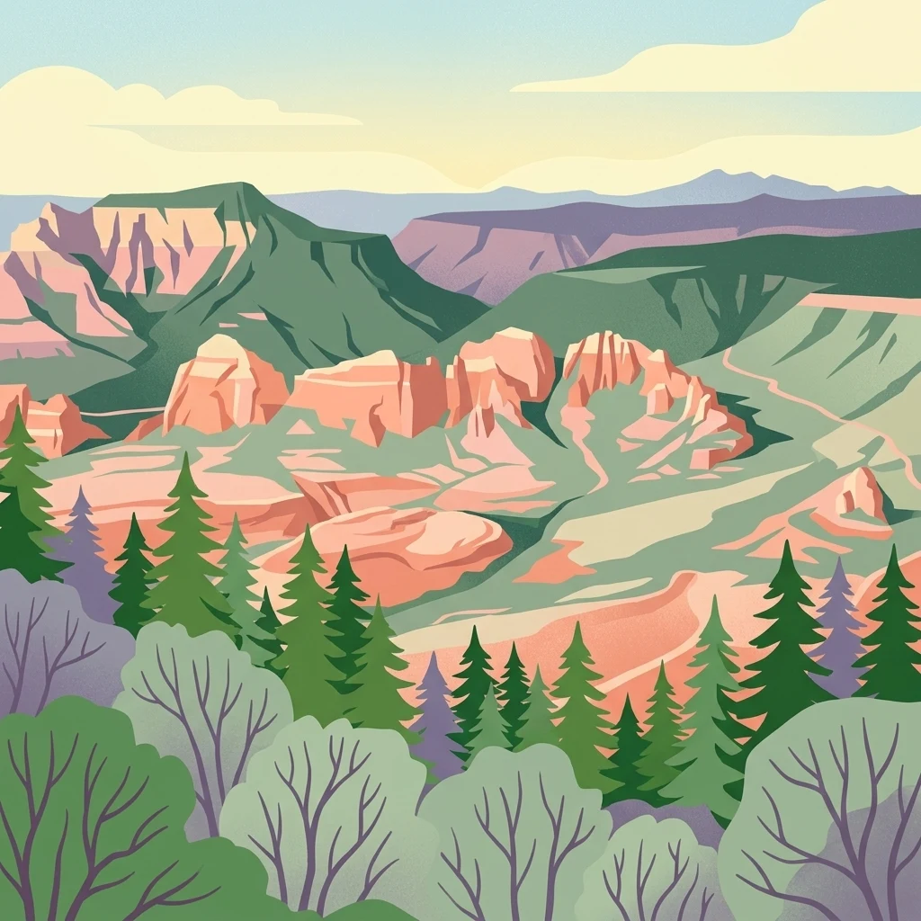
A stylized illustration showing a vast desert canyon with orange red rock cliffs, mesas, and green conifer trees in the foreground.

Munds Mountain Wilderness

Wildlife reserve

Park overview

Structured park overview, official facts, and landscape profile for Munds Mountain Wilderness

Munds Mountain Wilderness park facts, protected area profile, and essential visitor context

Review the core facts for Munds Mountain Wilderness, including designation, size, terrain, visitor scale, habitats, and operating context in one park-focused overview.

About Munds Mountain Wilderness

Munds Mountain Wilderness occupies a strategically located slice of Arizona's Red Rock country, forming a natural wild barrier just east of downtown Sedona. The wilderness rises above the famous red sandstone formations that have made Sedona a global destination, providing elevated vantage points from which the surrounding buttes, spires, and canyonlands unfold in classic Southwestern scenery. From its ridges, visitors gaze out across Bell Rock, Courthouse Butte, Sycamore Pass, and Woods Canyon, landmarks that are integral to the visual identity of the Sedona region.

Despite its proximity to one of Arizona's most heavily visited small cities, the wilderness retains a sense of remoteness through its network of trails and varied topography. The 10.4-mile Hot Loop Trail connects key overlooks and traverses Horse Mesa, while the 6.5-mile Jacks Canyon Trail winds through more secluded canyon terrain near Oak Creek. The steep Munds Mountain Trail links these systems together, offering the most commanding views of the surrounding landscape and serving as the principal route for hikers seeking the wilderness's highest reward, a sweeping aerial perspective of Sedona's iconic rock formations.

Managed by the U.S. Forest Service as part of the Coconino National Forest, the wilderness preserves a section of the Coconino landscape that is both ecologically representative and visually distinctive. The terrain shifts between exposed sandstone ridges, vegetated slopes, and canyon edges along Oak Creek, producing the kind of habitat diversity that defines central Arizona's transition zone between the Sonoran Desert lowlands and the higher Mogollon Rim forests. This blend of elevation, geology, and accessible wild country makes the wilderness an important component of the broader Sedona-area protected landscape.

Quick facts and research context for Munds Mountain Wilderness

Munds Mountain Wilderness is a federally designated wilderness of about 18,150 acres within the Coconino National Forest in Arizona. It lies in Coconino and Yavapai counties, immediately southeast of Sedona, and is bordered on one side by Arizona State Route 179 and on the other by Interstate 17. The area was officially established as a wilderness in 1984 and is administered by the U.S. Forest Service under a high level of protection consistent with its IUCN category Ib designation.

The wilderness straddles the topographic boundary between the Munds Mountain and Sedona quadrangles, and its terrain includes high overlooks above Oak Creek Canyon as well as elevated mesas and forested slopes. It supports a mix of Sonoran-style and Mogollon Rim-associated plant communities, including pinyon pine, juniper, oaks, Arizona cypress, and high-desert shrubs, supporting typical Arizona upland wildlife such as Gambel's quail, desert cottontails, and black-tailed jackrabbits.

Protection and recognition

Terrestrial protected area conservation scope and official designation records

Munds Mountain Wilderness Protection Status and Recognition Data

Munds Mountain Wilderness maintains a defined terrestrial protection scope within the broader protected area network. Official records compile available designation details and administrative recognition frameworks without external attribution.

Protection details

Protection scope
Terrestrial
Transboundary protection
No
Park context

Deeper park guide and search-rich context for Munds Mountain Wilderness

Munds Mountain Wilderness history, landscape, wildlife, and travel context

Explore Munds Mountain Wilderness through its history, landscape character, ecosystems, wildlife, conservation priorities, cultural context, and seasonal travel timing in a structured park guide built for atlas discovery and search intent.

Why Munds Mountain Wilderness stands out

Munds Mountain Wilderness is best known for the dramatic panoramic views it offers of the red rock formations around Sedona, especially Bell Rock and Courthouse Butte, framed by the wilderness's high ridges and canyon edges. The area is widely recognized as one of the most accessible wilderness backdrops to the Red Rock Scenic Byway corridor, with trails such as the Hot Loop and Munds Mountain Trail drawing visitors who want to experience Sedona's famous geology from above. The wilderness is also valued for its representation of Arizona's high-elevation pinyon-juniper and oak woodland ecosystems, sitting at a transitional zone where Mogollon Rim forests blend with the warmer canyon environments of Oak Creek. This combination of iconic scenery and characteristic upland vegetation defines the wilderness's identity.
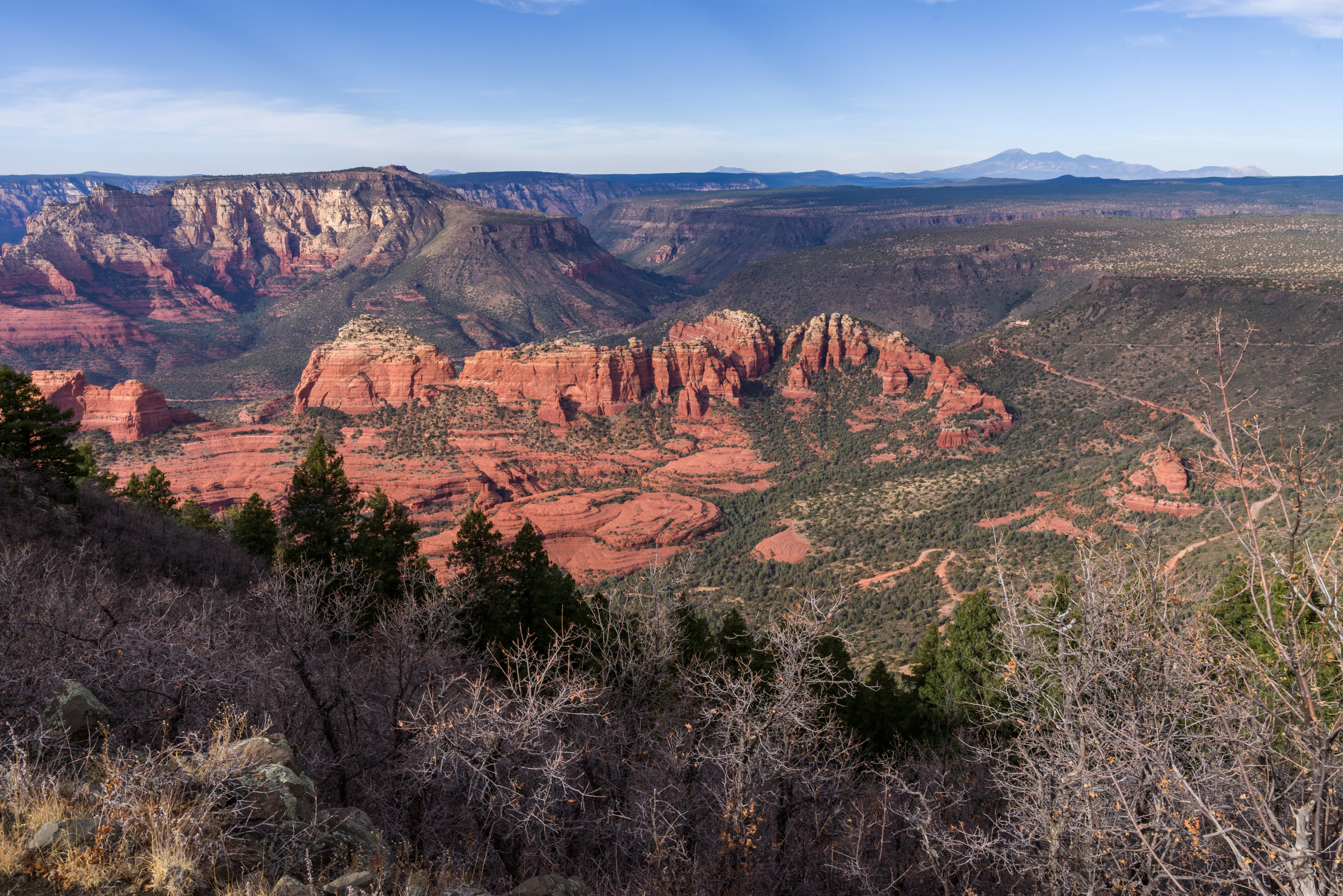
A wide, high-angle landscape shot looking over a rugged, red rock canyon terrain with sparse coniferous forest, under a clear blue sky.
Panoramic view of red rock formations and canyons within Munds Mountain Wilderness.

Munds Mountain Wilderness history and protected-area timeline

Munds Mountain Wilderness was formally established in 1984 as part of the federal wilderness preservation system, recognizing the area's ecological and scenic value within the Coconino National Forest. Its designation placed the rugged country rising east of Sedona under a higher level of protection than ordinary national forest land, restricting road construction and most mechanical use while preserving the area's character for future generations.

As part of the Coconino National Forest, the wilderness shares in the longer history of that forest's development, which originally combined ranger districts and land management traditions stretching back to the early twentieth century. The 1984 designation, however, marks the moment when the area's wild qualities were formally protected, separating it from the more heavily developed recreation corridors that surround it along State Route 179 and Interstate 17. Since that time, the wilderness has continued to serve as a preserved backdrop to the rapidly growing popularity of Sedona as a travel and outdoor recreation destination.

Munds Mountain Wilderness landscape and geographic character

The landscape of Munds Mountain Wilderness is shaped by the dramatic transition from the red sandstone canyon country of Sedona to the higher forested terrain that climbs toward the Mogollon Rim. Elevations within the area support broad mesa tops, steep slopes, and rugged canyon edges, including a long frontage above Oak Creek Canyon, one of Arizona's most scenic river-cut gorges. Trails such as Jacks Canyon and Hot Loop traverse these landforms, alternating between sunny, exposed ridges and shaded, vegetated hollows.

From the higher points of the wilderness, the geology of the wider Sedona region unfolds as a layered panorama. Bell Rock, Courthouse Butte, Sycamore Pass, and Woods Canyon are all visible from overlooks along the trail system, each contributing a distinctive silhouette to the surrounding scenery. The combination of sandstone buttes, layered cliffs, and forested high ground gives Munds Mountain its characteristic Southwestern character, presenting the visual identity of Sedona from a wilder, more elevated perspective.

Munds Mountain Wilderness ecosystems, habitats, and plant life

Ecologically, Munds Mountain Wilderness occupies a transitional zone where vegetation typical of the Mogollon Rim meets plant communities more characteristic of northern Arizona's warmer canyon country. The dominant forest type is pinyon-juniper woodland, with substantial stands of Arizona cypress and oaks adding structural variety to the canopy. Lower, drier slopes and exposed openings support desert shrub vegetation, including desert sagebrush, catclaw acacia, false palo verde, and banana yucca, a ground layer that reflects the arid Southwest character of the area.

This blend of woodland and dry-slope vegetation creates a mosaic of habitats across the wilderness, providing niches for both forest-associated and more open-country species. The varying exposure and elevation across the terrain mean that hikers move through visibly different plant communities over relatively short distances, a hallmark of the Red Rock region's ecological richness. These habitat patterns help sustain the wildlife and contribute to the natural diversity that the wilderness was designated to protect.

Munds Mountain Wilderness wildlife and species highlights

Wildlife in Munds Mountain Wilderness reflects the broader character of Arizona's central highlands and red rock country. Mammals commonly associated with the area include desert cottontails and black-tailed jackrabbits, both well adapted to the dry slopes and shrubby openings that dominate much of the wilderness. Birds typical of pinyon-juniper woodland and scrub are also present, with Gambel's quail being a characteristic upland game species of the region.

The combination of cliffs, canyons, mesas, and wooded slopes provides varied cover and foraging conditions for a wider range of species, supporting both residential wildlife and seasonal visitors that move through the Sedona landscape. While the wilderness's elevational range and habitat diversity favor a broader faunal community than its small footprint might suggest, the most distinctive wildlife associations are those tied to the open pinyon-juniper country and the dry canyon-edge environments that define the area.

Munds Mountain Wilderness conservation status and protection priorities

The conservation significance of Munds Mountain Wilderness lies in its formal protection of a substantial block of wild land at the edge of one of Arizona's most heavily visited landscapes. Designated in 1984 and managed by the U.S. Forest Service, the wilderness carries a high level of protection that shields its soils, vegetation, and wildlife habitats from road building, motorized recreation, and most forms of development. Its IUCN category Ib status reflects its legal standing as a wilderness area within the global system of protected-area categories.

Beyond the legal designation, the wilderness has conservation value because of its position in the landscape. It buffers a portion of the Sedona-area scenic corridor, protects an ecological transition between canyon lowlands and higher Mogollon Rim forests, and maintains continuous habitat between Oak Creek Canyon and surrounding national forest lands. This combination of scenic and ecological preservation gives the wilderness an outsized conservation role relative to its size, preserving the wild character of a region otherwise dominated by resort towns, highways, and residential development.

Munds Mountain Wilderness cultural meaning and human context

Munds Mountain Wilderness sits within a broader cultural landscape that has long been tied to the natural beauty of the Sedona area. Long before modern tourism, the red rock country around the wilderness was important to Indigenous communities of northern Arizona, and the visually distinctive buttes, mesas, and canyon edges that the wilderness protects remain closely associated with the regional identity of the Verde Valley and greater Sedona area.

In the contemporary era, the wilderness has become part of the experience of visiting Sedona itself, with its trails and viewpoints often featured in regional hiking guides and scenic driving recommendations. The juxtaposition of a designated wilderness immediately adjacent to a city famous worldwide for its scenery creates a distinctive local culture of outdoor recreation, where residents and visitors routinely move between town amenities and rugged natural surroundings within minutes.

Top sights and standout views in Munds Mountain Wilderness

Among the strongest draws of Munds Mountain Wilderness are the unobstructed views it provides of Sedona's signature red rock landmarks, including Bell Rock, Courthouse Butte, and the Sycamore Pass area, seen from above rather than from the valley floor. The Hot Loop Trail and the more strenuous Munds Mountain Trail offer two different ways to access these vistas, with the latter connecting to Jacks Canyon Trail for extended routes through canyon-edge terrain.

Equally notable is the wilderness's representation of central Arizona's pinyon-juniper and oak woodland habitat, set against a backdrop of canyon country that visually anchors the Sedona experience. The combination of relatively short trail access from the city, sweeping geological views, and ecologically representative upland vegetation gives the wilderness a focused but distinctive character that sets it apart from other protected areas in the Coconino National Forest.

Best time to visit Munds Mountain Wilderness

Munds Mountain Wilderness can be enjoyed across much of the year, but spring and fall tend to offer the most comfortable conditions for hiking. Spring brings mild temperatures, blooming high-desert vegetation, and clear views before the intense summer heat settles over the canyons. Autumn brings equally pleasant daytime temperatures and, in some years, golden light across the red rock formations that increases the visual drama of the overlook vistas. Summer visits are possible but often best planned for early mornings, when the exposed ridges and sandstone terrain absorb heat throughout the rest of the day. Winter can offer crisp air and excellent visibility, though shorter days and occasional cold snaps require planning around shorter daylight windows.
Monthly climate preview

Track long-term temperature ranges and monthly precipitation averages across the protected terrain.

Munds Mountain Wilderness Climate Normals and Annual Weather Patterns

Historical climate data for Munds Mountain Wilderness records the measured monthly progression of average temperatures and daily precipitation at a representative coordinate. Reviewing the complete twelve-month profile provides detailed context on long-term meteorological normals across the protected landscape.
Annual mean12 °C
1 °C23 °C
Jan
Feb
Mar
Apr10°
May15°
Jun21°
Jul23°
Aug22°
Sep19°
Oct12°
Nov
Dec
Warmest month
July

23.1 °C

Coolest month
December

1.1 °C

Wettest month
August

2.3 mm/day

Driest month
June

0.3 mm/day

Park location guide

Geography guide, regional context, and park location map for Munds Mountain Wilderness

Munds Mountain Wilderness park geography, regions, and map view in United States of America

Understand where Munds Mountain Wilderness sits in United States of America through a broader geographic reading of the surrounding landscape, nearby location context, and its mapped position within the national park landscape.

How Munds Mountain Wilderness fits into United States of America

The United States of America is a federal presidential republic and one of the world's largest countries by area and population. It consists of 50 states across a vast territory spanning multiple time zones, with its capital in Washington, D.C. and largest city in New York City. The nation has a diverse economy, influential political system, and significant cultural and military presence globally.

Wider geography shaping Munds Mountain Wilderness in United States of America

The United States occupies a vast territory in North America, bordered by Canada to the north and Mexico to the south. The 48 contiguous states stretch from the Atlantic to the Pacific Ocean, while Alaska occupies the northwestern region and Hawaii is an archipelago in the Pacific. The country encompasses diverse terrain including the Rocky Mountains, Appalachian Mountains, Great Plains, and extensive river systems.

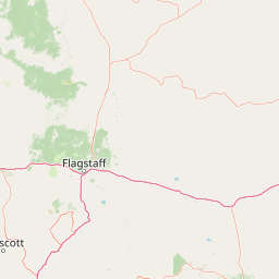
Map view of Munds Mountain Wilderness

Use this park location map to pinpoint Munds Mountain Wilderness in United States of America, understand its exact geographic position, and read its mapped placement within the surrounding landscape more clearly.

Pigeon | © OpenStreetMap contributors

Location context for Munds Mountain Wilderness

Arizona
Recorded earthquake history

Examine the Historical Seismic Records for Munds Mountain Wilderness

Review the recorded history of seismic events associated with Munds Mountain Wilderness. Use this data to explore regional earthquake patterns, including epicentre proximity and event magnitudes within the Sedona landscape, as provided by official geological archives.

Munds Mountain Wilderness Earthquake History

Catalogued events

12 events

Strongest magnitude

Magnitude 4.7

Most recent event

Apr 7, 2021

This history includes earthquakes recorded inside the park or within 50 km of its borders

Explore protected area views, red rock formations, and high-desert terrain.

Munds Mountain Wilderness Photos and Landscape Scenery Visual Guide

Visual documentation captures the dramatic sandstone geology, rugged canyon edges, and high-elevation pinyon-juniper woodlands defining the protected landscape. Examining these field photographs reveals the distinct transitional topography and panoramic vistas characteristic of the central Arizona region.

A wide, high-angle landscape shot looking over a rugged, red rock canyon terrain with sparse coniferous forest, under a clear blue sky.

Park atlas

Compare nearby protected areas and regional wilderness zones across central Arizona

Explore Other Parks Near Munds Mountain Wilderness and Surrounding Landscapes

Continue browsing protected areas near Munds Mountain Wilderness to discover adjacent canyon environments and upland forest reserves. Comparing regional park geography reveals broader geological patterns across the surrounding transition zones.
A watercolor painting showing a winding river flowing through a forested valley with gentle hills in the background.
Wildlife reserveArizona
2.3 km away#1 closest

Northwest

Red Rock-Secret Mountain Wilderness: A Geographic Overview of Arizona Protected Lands

Canyon landscapes and high mesa terrain in Arizona

Red Rock-Secret Mountain Wilderness serves as a significant protected block near Sedona, featuring a complex network of slot canyons, natural arches, and sandstone pinnacles. This wilderness area preserves the ecological transition from the high-elevation forested rim down into warmer, arid canyon bottoms, offering a deep look at the geology of the Colorado Plateau edge.

Area
191 km²
Established
1984
IUCN
Ib
Relief
Mountain
Watercolor painting of a calm lake surrounded by green forests and distant mountain ridges.
Protected areaArizona
21 km away#2 closest

West

Prescott National Forest: Geographic Overview of Arizona Protected Landscapes and Wilderness

Regional geography and protected terrain map of the Bradshaw Mountains

Spanning over one million acres, Prescott National Forest represents a defining outdoor landscape in Arizona. The terrain transitions from high desert chaparral to dense ponderosa pine forests, featuring eight distinct wilderness areas, rugged canyon systems, and essential watershed corridors that shape the regional ecology near Prescott.

Area
5,100 km²
Established
1908
Relief
Mountain
Climate
Temperate
A horizontal watercolor illustration showing a calm lake in the foreground, surrounded by grassy banks, evergreen trees, and rolling mountains in the distance under a pale sky.
Protected landscapeArizona
27 km away#3 closest

North

Kaibab National Forest: Protected Plateau Landscapes and Forested Geography in Arizona

High-elevation forest terrain bordering the Grand Canyon

Spanning over 1.6 million acres in Arizona, Kaibab National Forest is characterized by its split geographic configuration, with distinct sections flanking the North and South rims of the Grand Canyon. The terrain ranges from the high-altitude Kaibab Plateau to volcanic uplands near Williams, encompassing four designated wilderness areas and varied forest ecosystems that provide a critical buffer for the surrounding canyon country.

Area
6,500 km²
Established
1909
Relief
Mountain
Climate
Temperate
Protected landscapeArizona
38 km away#4 closest

South

Tonto National Forest: Understanding the Geography of an Expansive Protected Landscape

Exploring the vertical ecosystem gradients in Central Arizona

Spanning from arid Sonoran basins to the towering Mogollon Rim, Tonto National Forest offers a unique study in vertical geography and protected land management. This expansive territory provides a vital map of Southwest life zones, encompassing reservoir systems, rugged river canyons, and critical wilderness habitat that define the environmental identity of the region.

Area
11,627 km²
Established
1905
Visitors
5.9M annual
Relief
Mountain
Wildlife reserveArizona
40 km away#5 closest

South

Mazatzal Wilderness: Geographic Overview of Arizona's Expansive Protected Mountain Terrain

Mapping the ecological transition from desert canyon to forest ridge

Mazatzal Wilderness stands as an essential protected area in central Arizona, covering vast tracts of the Tonto and Coconino National Forests. The landscape is defined by the stark vertical contrast between the low-lying Verde River corridor and the high-elevation forests of the Mazatzal Mountains. This expansive wilderness remains a key study in regional topography and ecological zonation for those exploring the rugged backcountry of the southwestern United States.

Area
1,021.4 km²
Established
1964
IUCN
Ib
Relief
Mountain
A horizontal watercolor illustration showing rolling green hills and a treeline against a pale sky.
Wildlife reserveArizona
46 km away#6 closest

North

Kachina Peaks Wilderness; Geography and Protected Landscape Atlas of Arizona

High-altitude volcanic terrain and alpine ecosystems

Kachina Peaks Wilderness is a protected area in northern Arizona centered on the San Francisco Peaks. This geography includes the state's highest elevation at Humphreys Peak and a rare volcanic caldera known as the Inner Basin. The terrain transitions from dense mountain forests into an Arctic-Alpine zone, offering a distinct landscape for analyzing mountain evolution and high-elevation ecological patterns.

Area
75 km²
Established
1984
IUCN
Ib
Relief
Mountain
Wildlife reserveYavapai County
About 108 km away#7 closest

West

Juniper Mesa Wilderness: Geological Landscape and Protected Area Mapping

Essential protected land data in Yavapai County

Juniper Mesa Wilderness protects a rare sedimentary mesa capped by Tapeats sandstone, rising above a vast granite landscape in Yavapai County. This geographic survey highlights the canyon-cut topography and the shifting vegetation zones that characterize the Transition Zone ecology within the Prescott National Forest.

Area
29.97 km²
Established
1984
IUCN
Ib
Relief
Mountain
National parkArizona
123 km away#8 closest

North

Grand Canyon National Park: Arizona National Park Protected Landscape & Geography

Explore mapped boundaries and regional atlas context.

Grand Canyon National Park stands as a premier national park, showcasing a unique protected landscape within Arizona's diverse geography. This detailed entry focuses on the park's specific geographic identity, its mapped boundaries, and its significance within the regional atlas. Discover the contours of this protected area and its place in the natural terrain of the American Southwest.

Area
4,926.08 km²
Established
1919
IUCN
II
Visitors
4.9M annual

Common questions about visiting, size, designation, and location context for Munds Mountain Wilderness

Munds Mountain Wilderness FAQs for park facts, access, geography, and protected area context

Find quick answers about Munds Mountain Wilderness, including protected-area facts, park geography, trail and visitor context, and how the park fits into its surrounding country and regional landscape.
MoriAtlas Explorer

Continue Your Protected Areas Search Across the Global Atlas

Deepen your exploration by continuing the structured search for national parks and protected areas worldwide. Utilize the comprehensive filtering capabilities to compare different conservation landscapes and refine your understanding of global park geography. Discover more about the distribution and characteristics of protected natural areas.

Global natural geography