
Mori Atlas logo
National parkNationalpark Hunsrück-Hochwald

Mapped boundaries and protected landscape context within the Hunsrück mountain range

Nationalpark Hunsrück-Hochwald: A Geographic Profile of Germany's Upland Forest Wilderness

Nationalpark Hunsrück-Hochwald represents a vital shift toward wilderness conservation within the medium-altitude mountains of the Rhenish Slate range. Spanning vast beech forests across Rheinland-Pfalz, the protected area encompasses quartzite ridges, block fields, and slope bogs. This geography creates a continuous forest mosaic that supports diverse wildlife and preserves the integrity of Central European upland terrain.

beech forestlow mountain rangeupland forestquartzite landscapewilderness developmentslope bogs
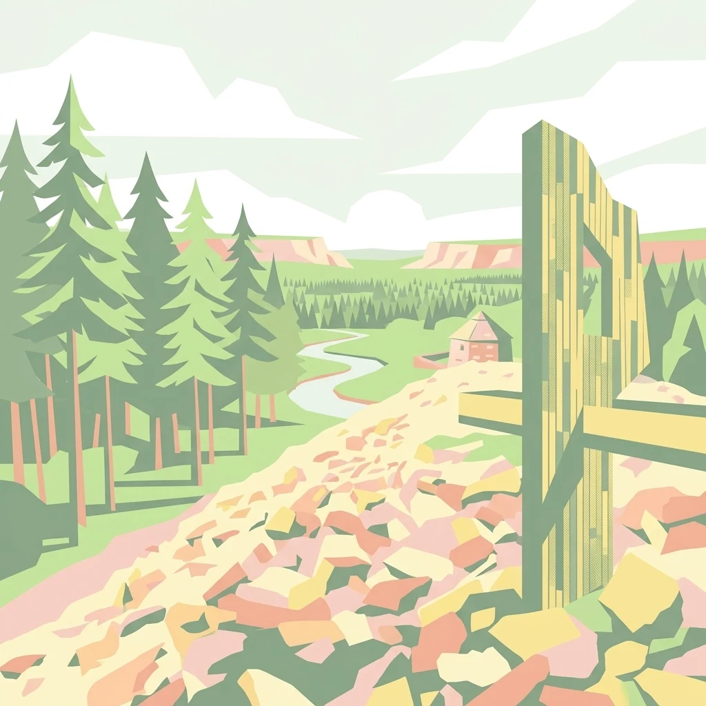
A graphic illustration showing a landscape with evergreen trees on the left, a winding river in the valley, and a rocky slope in the foreground with a stylized timber structure.

Nationalpark Hunsrück-Hochwald

National park

Park overview

Structured park overview, official facts, and landscape profile for Hunsrück-Hochwald National Park

Hunsrück-Hochwald National Park park facts, protected area profile, and essential visitor context

Review the core facts for Hunsrück-Hochwald National Park, including designation, size, terrain, visitor scale, habitats, and operating context in one park-focused overview.

About Hunsrück-Hochwald National Park

The Hunsrück-Hochwald National Park sits at the southwestern end of the Hunsrück, the broad low mountain range that runs between the Mosel, the Nahe, and the Saar in western Germany. Established in 2015 as a joint effort between Rhineland-Palatinate and Saarland, it protects a sizable piece of the region's surviving forested uplands and represents the latest step in Germany's slow expansion of its national park system into medium-altitude ranges dominated by beech forest.

The park's core area is the Hochwald, sometimes more fully called the Schwarzwälder Hochwald, and the adjoining Idarwald. Together they form one of the most heavily wooded compartments of the Hunsrück and one of the largest inland forest blocks remaining in this part of Germany. The Hochwald lies between roughly 400 and 700 meters above sea level along the southern flank of the Hunsrück and supports a distinctive mix of habitats shaped by quartzite bedrock, including acid-sensitive beech communities, damp ravine forests, and small spring-fed bogs along the lower slopes.

Beyond its forest landscapes, the park also buffers the cultural landscape that surrounds it. A surrounding management zone preserves traditionally used elements such as orchard meadows and dry meadows, which themselves can be biodiversity-rich, while supporting nature-friendly tourism, sustainable forestry, and village development in the wider region. The result is a national park where the wilderness core and the inhabited countryside are explicitly managed as a single connected system.

The park also plays a role in Germany's wider biodiversity strategy. The Hoch- and Idarwald are formally identified as a federal hotspot of biological diversity within the national program launched in 2011, recognizing both the area's high concentration of characteristic species and the unusually rich mosaic of forest, grassland, bog, and rocky habitats that the national park now protects in a formal conservation framework.

Quick facts and research context for Hunsrück-Hochwald National Park

Hunsrück-Hochwald is a German national park that spans parts of Rhineland-Palatinate and Saarland, covering around 10,000 hectares of forested uplands along the southwestern edge of the Hunsrück. It was established on 1 March 2015, inaugurated publicly over the Pentecost weekend of that year, and is the sixteenth national park in Germany.

Its territory covers two large forest areas, the Hochwald and the Idarwald, with the Hochwald portion reaching roughly 400 to 700 meters in elevation. The park is governed by an interstate treaty between Rhineland-Palatinate and Saarland, with about 75 percent of the area planned to develop toward wilderness within roughly thirty years. It lies within the Saar-Hunsrück Nature Park and is intersected by stages of the Saar-Hunsrück long-distance trail.

Protection and recognition

Documented terrestrial protection scope and designation framework

Nationalpark Hunsrück-Hochwald Protection Status and Recognition

Nationalpark Hunsrück-Hochwald maintains a defined terrestrial protection scope within its regional conservation framework. Documented protection status data outlines the management boundary and recognized conservation measures established for the terrain.

Protection details

Protection scope
Terrestrial
Transboundary protection
No
Park context

Deeper park guide and search-rich context for Hunsrück-Hochwald National Park

Hunsrück-Hochwald National Park history, landscape, wildlife, and travel context

Explore Hunsrück-Hochwald National Park through its history, landscape character, ecosystems, wildlife, conservation priorities, cultural context, and seasonal travel timing in a structured park guide built for atlas discovery and search intent.

Why Hunsrück-Hochwald National Park stands out

The park is best known for its large, contiguous stretches of beech forest on quartzite ridges, its quiet transition toward wilderness, and its role as a refuge for typical Central European forest wildlife in one of Germany's medium-altitude mountain landscapes. Although the Hunsrück is a relatively low and gentle upland range, its southwestern Hochwald section is unusually heavily forested and structurally rich, with beechwood on poor quartzite soils, block-field forests, oak woodlands on sunny slopes, and a network of small bogs and spring-fed meadows on the lower slopes. Recognizing this, the German federal biodiversity program lists the Hoch- and Idarwald as one of thirty national hotspots of biological diversity. The park is also closely associated with historically rare forest interiors where old trees and deadwood are accumulating once again after decades of timber use.
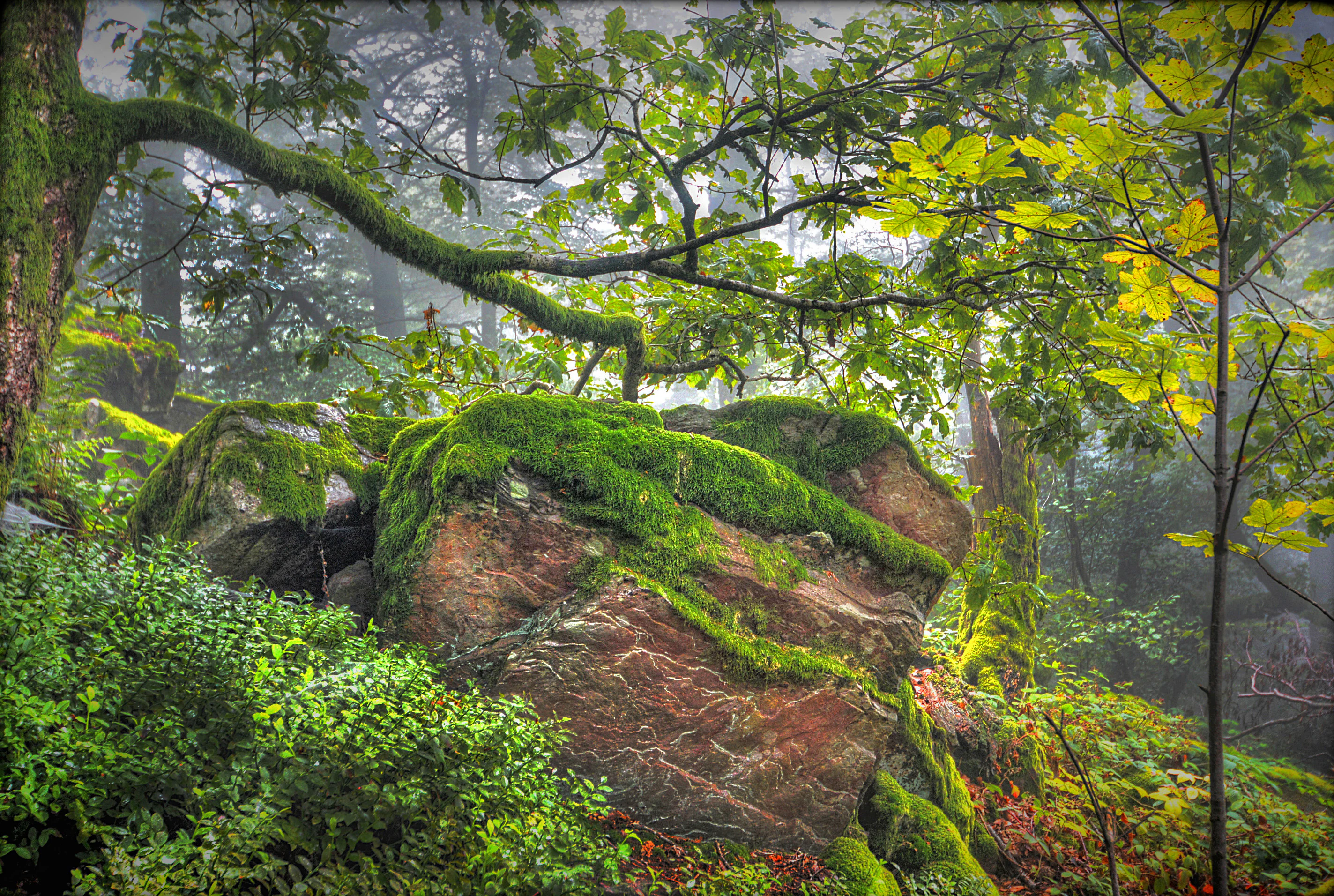
A large, moss-covered rock formation sits on a slight incline in a dense, fog-filled forest, with overhanging tree branches.
Mossy rock formations nestled within a misty, ancient forest in the Hunsrück-Hochwald area.

Hunsrück-Hochwald National Park history and protected-area timeline

The path to the Hunsrück-Hochwald National Park was a long political process. By 2013, most of the municipalities whose territory would fall within the proposed park had already agreed in principle to the concept. In 2014, the governments of Rhineland-Palatinate and Saarland agreed on the park's name and introduced enabling legislation that formalized an interstate treaty, the Nationalparkgesetz Hunsrück-Hochwald, governing the establishment and operation of the park across their shared border.

The park was officially founded on 1 March 2015 and opened with a public inauguration ceremony over the Pentecost weekend that year, becoming the sixteenth national park in Germany and the third in the Rhenish Slate Mountains and adjacent uplands after the Eifel and Kellerwald-Edersee parks. Even before formal establishment, an initial ten-person starter team based at the Birkenfeld forestry office began preparing park operations in February 2014, signaling that the process was envisioned as a smooth institutional handover rather than a sudden transformation.

Since its founding, the park has been administered by a dedicated national park office headquartered in Birkenfeld, with a branch office in Nonnweiler on the Saarland side. Governance is supported by a municipal national park assembly and a national park advisory council with representatives from nature conservation, land use, education, recreation, business, and science, ensuring that local communities and interest groups remain continually engaged in how the park develops.

Hunsrück-Hochwald National Park landscape and geographic character

The landscape of Hunsrück-Hochwald is shaped by its position as the high southwestern rim of the Hunsrück low mountain range. Elevation in the Hochwald portion lies roughly between 400 and 700 meters, and the terrain rolls in long forested ridges broken by deeply cut valleys, rocky outcrops, boulder fields, and a network of small streams. The Idarwald reaches its highest point at just over 766 meters, giving the park its most pronounced summits.

The underlying geology is dominated by Taunus quartzite, a hard, silica-rich rock that produces acidic, often thin soils. On these soils, the natural woodland is a beech forest with an understory adapted to nutrient-poor conditions. Steeper slopes and boulder-strewn landforms carry distinctive variants, including gorge and ravine forests, oak-dominated woodland on sun-exposed valley sides, and alder gallery forests along the small brooks. Quarzite boulders released by ice-age weathering form block fields like the Mörschieder Burr, which give the park some of its most striking geological scenery.

Around the wetter lower slopes, groundwater emerging along broad spring lines has created slope bogs and wet meadow complexes called Brücher. These mires, together with the streams that drain them, give the park a varied network of small wetland habitats scattered through an otherwise forest-dominated landscape. The cultural landscape ringing the wilderness core, including orchard meadows, dry meadows, and poor grasslands, completes the visual mosaic and reflects centuries of careful rural land use.
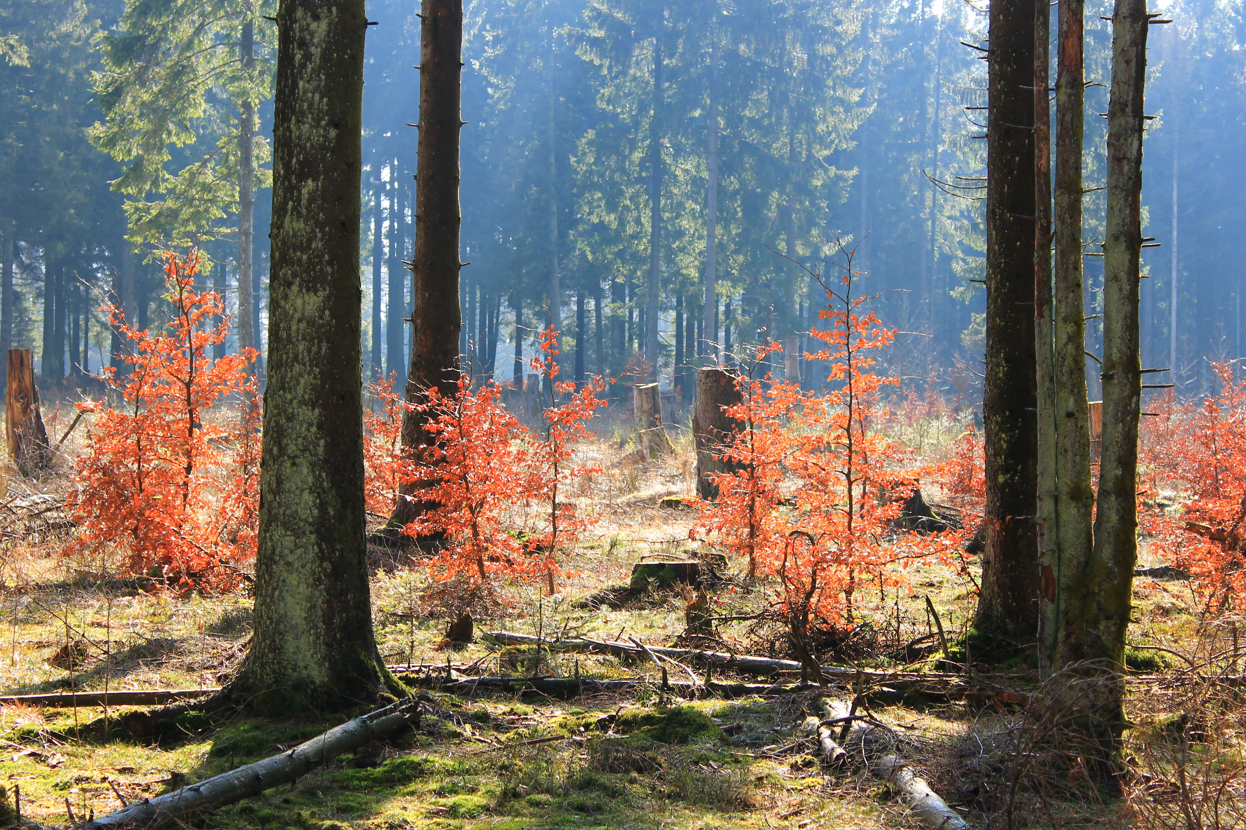
A forest scene in autumn featuring young trees with bright orange leaves and tall evergreen trees in the background, with mossy ground and fallen logs.
Autumn foliage on young beech trees in Hunsrück-Hochwald National Park.

Hunsrück-Hochwald National Park ecosystems, habitats, and plant life

Ecologically, the park represents one of the better-preserved examples of beech-dominated upland forest in the German medium mountains. The natural potential vegetation across much of the park is an acid-sensitive beech forest on quartzite, with special woodland communities occupying unusual sites: alder gallery forests along streams, block-field forests on boulder slopes, and oak woodland on dry, sun-exposed rocky hillsides.

Where slope conditions allow, the combination of low-intensity land use and natural drainage has produced a rich pattern of open habitats. These include hillside mires, wet meadows, dry meadows, mat-grass grasslands, and small transitional bogs growing around the many springs that seep from the lower slopes, alongside vivid displays of butterflies and other insects. The mixture of forest types and open habitats, closely interwoven rather than separated into large blocks, is one of the defining features of the park's biodiversity profile.
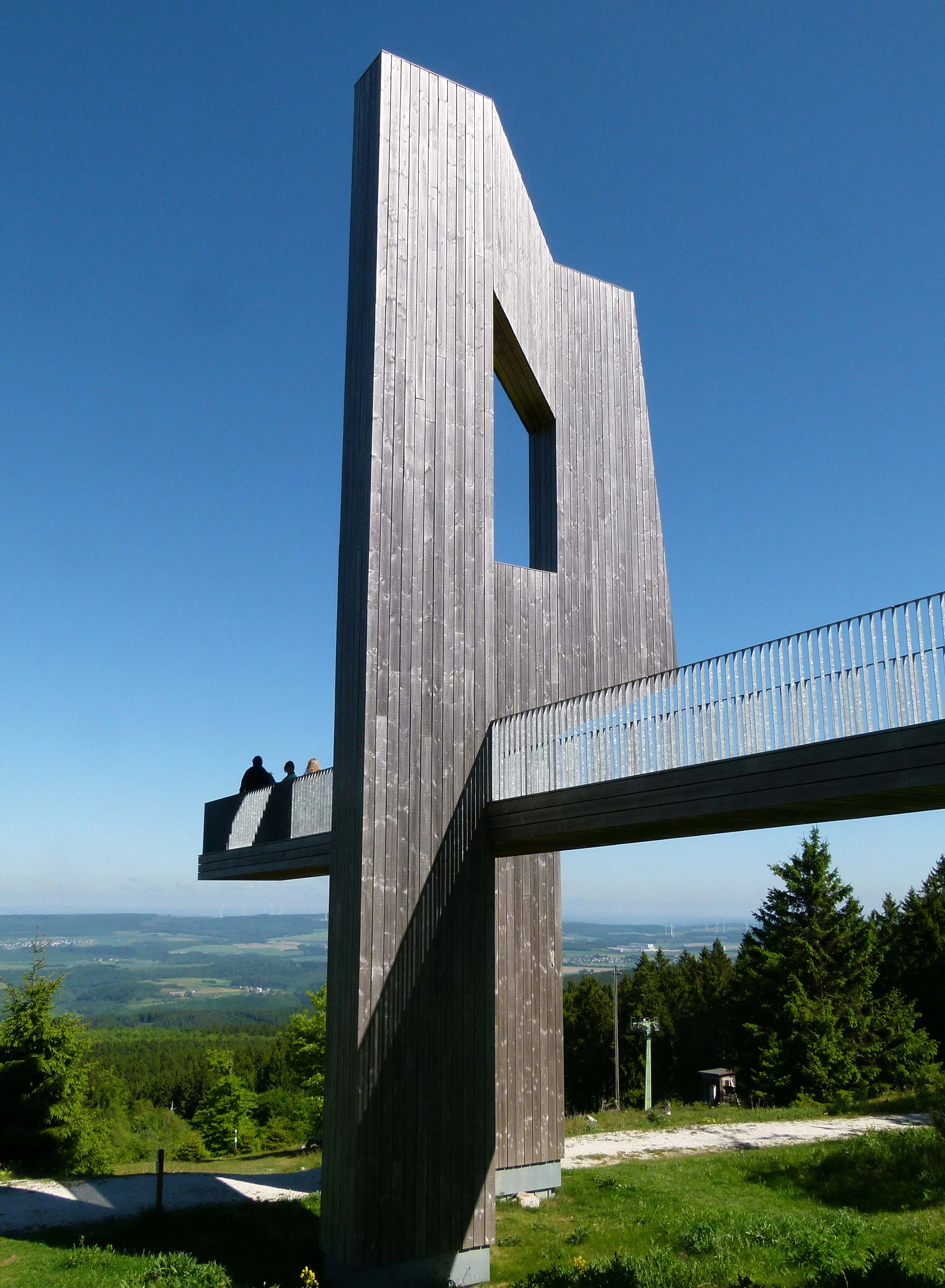
A tall, vertical wooden sculpture with a cut-out window, integrated with a metal-railed observation platform at the Erbeskopf mountain peak, overlooking a green forest valley under a clear blue sky.
The Windklang sculpture at the summit of Erbeskopf, the highest peak in Nationalpark Hunsrück-Hochwald.

Hunsrück-Hochwald National Park wildlife and species highlights

The park's forests and adjoining open habitats support a community of species typical of Central European medium-altitude woodland. Larger mammals of conservation interest include the European wildcat and red deer, both of which need large, quiet forest territories and are characteristic of the wider Hunsrück forests. Among birds, the park is particularly associated with woodland specialists such as the black woodpecker, grey-headed woodpecker, honey buzzard, and Eurasian pygmy owl, all of which depend on older, structurally diverse forests.

Bats are another notable group: the Bechstein's bat, a species strongly linked to mature broadleaf woodland, is specifically mentioned in conservation assessments of the area. In the more open and partly cultural landscape around the forest, insects including butterflies thrive in the dry meadows and grassland remnants. The wider wildlife value is enhanced by the gradual return of deadwood and old trees in the developing wilderness zones, which creates habitat for fungi, saproxylic insects, and cavity-nesting species over time.
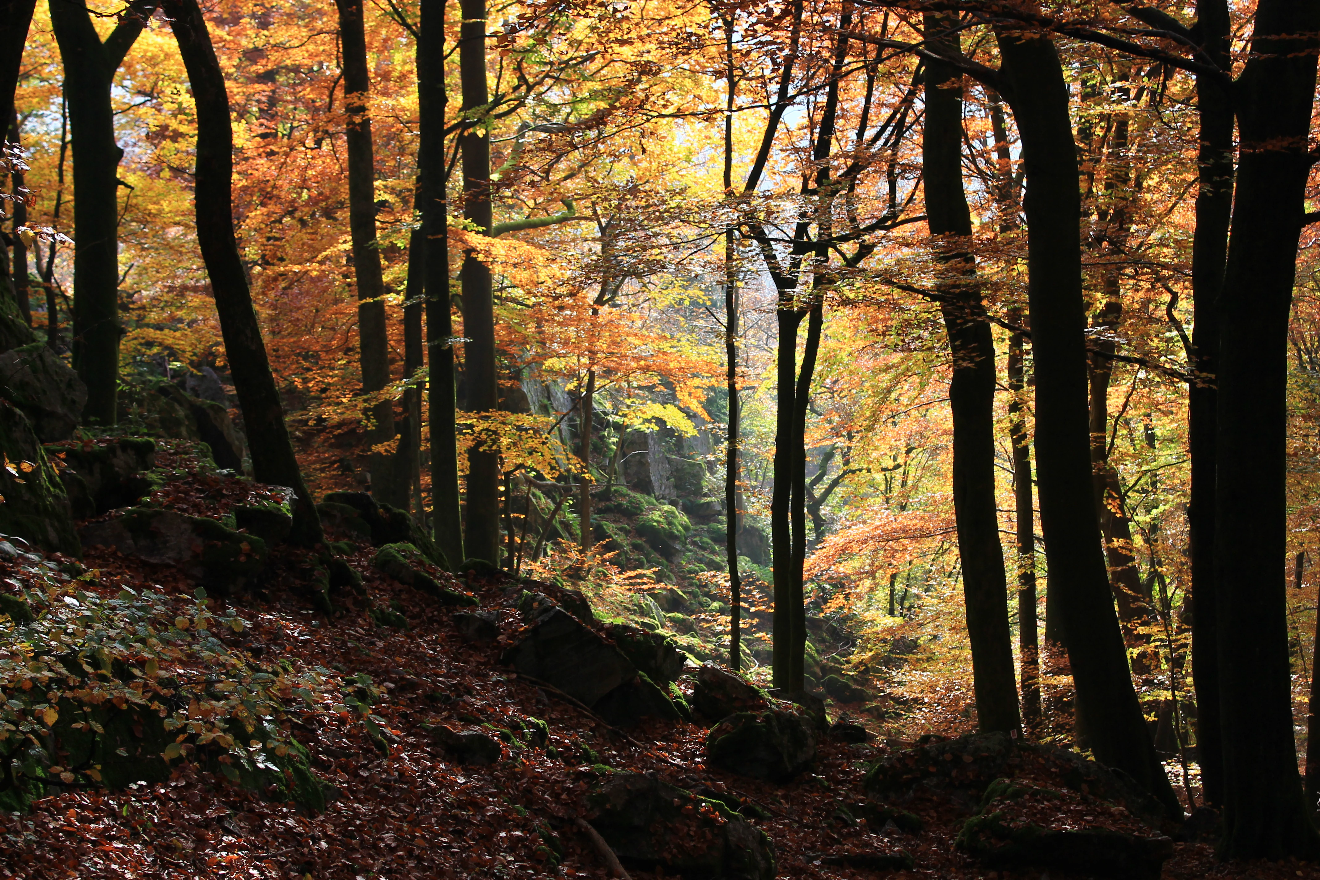
A dense forest during autumn with sunlight filtering through orange and yellow leaves, featuring moss-covered rocks on the forest floor and tall tree trunks.
Autumnal beech forest at the Luisenruhe site in Hunsrück-Hochwald National Park.

Hunsrück-Hochwald National Park conservation status and protection priorities

The Hunsrück-Hochwald National Park was created explicitly to allow large parts of the Hunsrück's remaining continuous forest to return to near-natural conditions. Under its founding law, around 75 percent of the park is designated as a nature zone, divided between areas that are already being left to natural processes and areas intended to become wilderness within roughly thirty years. The remainder forms a buffer and management zone, designed to absorb impacts between the wilderness core and the surrounding cultural landscape.

The park is formally part of Germany's federal biotope network and is intended to meet the IUCN's National Park category criteria. It is also designed to qualify as both an EU Bird Protection Area under the Birds Directive and a site under the EU Habitats Directive, giving its conservation role a clear international frame. At the national level, the Hoch- and Idarwald were designated as one of thirty federal hotspots of biological diversity, an explicit acknowledgement that the area combines an unusually dense concentration of characteristic species with a rich mosaic of forest, grassland, bog, and rocky habitats, including threatened species such as the hazel grouse in surviving coppice woodland.

Hunsrück-Hochwald National Park cultural meaning and human context

Although the park itself is a protected natural area, it sits within a long-inhabited region shaped by forestry, grazing, and small-scale agriculture. The presence of orchard meadows, dry meadows, and mat-grass grasslands around the forest reflects centuries of low-intensity land use that has left a distinctive cultural imprint on the landscape. Local communities have played a notable role in the park's creation: most municipalities agreed to the concept already in 2013, before the formal founding in 2015, and a municipal national park assembly continues to advise the park administration.

The region also carries deep historical traces unrelated to its modern conservation role. Celtic, Roman, and medieval remains such as the ringwall at Otzenhausen recall earlier uses of this strategically positioned ridge terrain. Today, the park's cultural role is closely tied to its function as a regional tourism anchor, intended both to draw visitors interested in nature and quiet outdoor recreation and to support sustainable regional development in the surrounding villages and small towns of the Hunsrück.
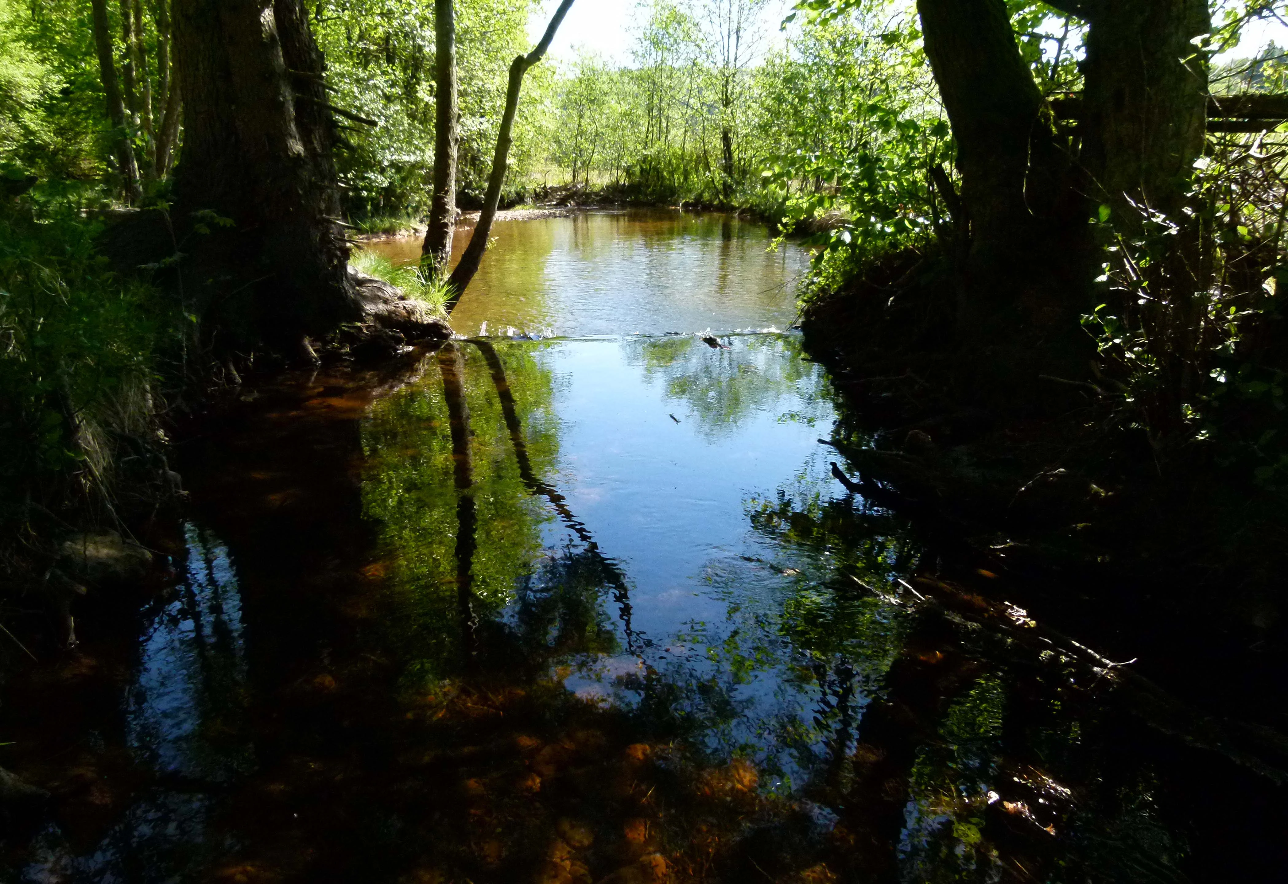
A peaceful, narrow stream flows through a lush, green forest, with trees framing the dark water and creating reflections on the surface.
The Traunbach river flows through a shaded section of Hunsrück-Hochwald National Park near Börfink.

Top sights and standout views in Hunsrück-Hochwald National Park

The Hunsrück-Hochwald stands out for its sheer concentration of forest in an otherwise living, working landscape, and for its commitment to letting that forest become wilder rather than just formally protected.

The Hochwald and Idarwald together form one of the largest inland forest blocks left in this corner of Germany, with old beech and mixed forest, regenerating beech under spruce, increasing deadwood, and a slowly recovering network of wildlife. Combined with the park's overlap with major long-distance hiking routes, its place within the Saar-Hunsrück Nature Park, and its recognized status as a federal hotspot of biological diversity, Hunsrück-Hochwald offers both a quiet wilderness atmosphere and an unusually complete picture of how a medium-altitude German forest landscape is allowed to return to its natural course.
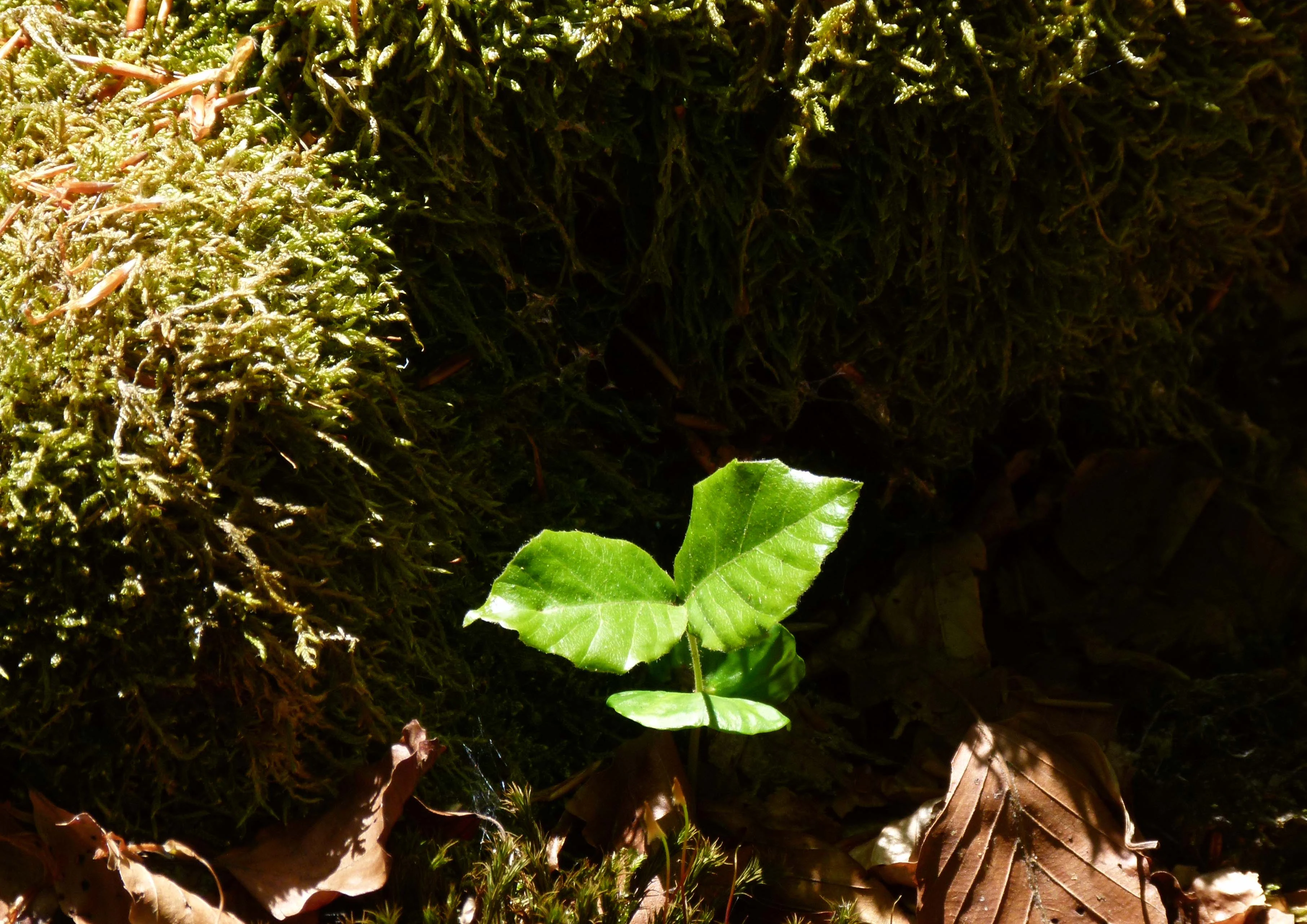
A bright green, young beech seedling with a few leaves sprouts from a dark, moss-covered patch on the forest floor.
A young beech sapling emerges from the mossy forest floor in Nationalpark Hunsrück-Hochwald.

Best time to visit Hunsrück-Hochwald National Park

The park's appeal changes meaningfully with the seasons, but it largely avoids the dramatic seasonal swings of alpine parks. Late spring and early summer bring fresh leaf-out in the beech forests and high insect activity, including the butterflies that thrive in the park's grassland clearings; summer offers long days and the deepest shade along the forest trails.

Autumn is arguably the most distinctive time to experience Hunsrück-Hochwald. Beech forests in this region turn rich copper and rust tones, mushroom and berry activity rises in the wetter Brücher bogs, and the cooler, damper air makes the block fields and rocky outcrops feel especially atmospheric. Winter tends to be quiet and contemplative: with relatively moderate elevations, deep snow is usually limited, but frost, mist in the valleys, and stark silhouettes of bare beech trees give the park a hushed, introspective character.

Monthly climate preview

Long-term temperature ranges and monthly precipitation patterns across representative terrain

Nationalpark Hunsrück-Hochwald Climate Normals and Annual Weather Rhythm

Representative coordinates record measured monthly temperature swings and precipitation averages across the protected landscape from 1991 to 2020. Examining the complete twelve-month climatology profile reveals detailed historical normals for thermal conditions and moisture distribution.
Annual mean9 °C
0 °C19 °C
Jan
Feb
Mar
Apr
May12°
Jun16°
Jul19°
Aug18°
Sep14°
Oct
Nov
Dec
Warmest month
July

18.6 °C

Coolest month
January

-0.2 °C

Wettest month
December

2.9 mm/day

Driest month
April

1.7 mm/day

Park location guide

Geography guide, regional context, and park location map for Hunsrück-Hochwald National Park

Hunsrück-Hochwald National Park park geography, regions, and map view in Germany

Understand where Hunsrück-Hochwald National Park sits in Germany through a broader geographic reading of the surrounding landscape, nearby location context, and its mapped position within the national park landscape.

How Hunsrück-Hochwald National Park fits into Germany

Germany is a federal republic in Western and Central Europe with a population of over 83 million across sixteen constituent states. It is Europe's largest economy by nominal GDP and a major global exporter and importer. The capital is Berlin, and the country borders Denmark, Poland, Czech Republic, Austria, Switzerland, France, Luxembourg, Belgium, and the Netherlands.

Wider geography shaping Hunsrück-Hochwald National Park in Germany

Germany is located in Western and Central Europe, spanning 357,022 km². It borders Denmark to the north, Poland and the Czech Republic to the east, Austria and Switzerland to the south, and France, Luxembourg, Belgium, and the Netherlands to the west. The country has coastlines on the Baltic Sea and North Sea to the north, with the Alps located in the southern region.

Map view of Hunsrück-Hochwald National Park

Use this park location map to pinpoint Hunsrück-Hochwald National Park in Germany, understand its exact geographic position, and read its mapped placement within the surrounding landscape more clearly.

Pigeon | © OpenStreetMap contributors

Location context for Hunsrück-Hochwald National Park

Rheinland-PfalzSaarland
Natural feature types

Examine the Natural Landscapes of Nationalpark Hunsrück-Hochwald

Continue geographic discovery by analyzing the unique landforms and wetland complexes identified within Nationalpark Hunsrück-Hochwald. The MoriAtlas collection enables a deeper look at the specific natural features that define the ecological character of the Hochwald and Idarwald ridges.
Recorded earthquake history

Explore Historical Earthquake Records for Nationalpark Hunsrück-Hochwald

Continue your study of the Hunsrück-Hochwald region by examining its documented seismic history. This catalogue provides a structured way to review historical earthquake records identified within the vicinity of the park boundaries. Explore event data through MoriAtlas to better understand the seismic landscape context surrounding this protected wilderness area.

Nationalpark Hunsrück-Hochwald Earthquake History

Catalogued events

178 events

Strongest magnitude

Magnitude 4.5

Most recent event

Sep 28, 2008

This history includes earthquakes recorded inside the park or within 50 km of its borders

Explore high-elevation beech forests, quartzite block fields, and protected upland scenery.

Nationalpark Hunsrück-Hochwald Photos and Landscapes: Visualizing Upland Wilderness

Visual documentation of Nationalpark Hunsrück-Hochwald reveals the dense upland forests, rocky ridge terrain, and slope bogs defining this German mountain environment. Examining these protected landscapes provides clear insight into regional wilderness recovery and woodland habitats.

A large, moss-covered rock formation sits on a slight incline in a dense, fog-filled forest, with overhanging tree branches.

A small green butterfly, the Green Hairstreak, resting on the tip of a green plant leaf with a blurred green background.

A forest scene in autumn featuring young trees with bright orange leaves and tall evergreen trees in the background, with mossy ground and fallen logs.

A tall, vertical wooden sculpture with a cut-out window, integrated with a metal-railed observation platform at the Erbeskopf mountain peak, overlooking a green forest valley under a clear blue sky.

A dense forest during autumn with sunlight filtering through orange and yellow leaves, featuring moss-covered rocks on the forest floor and tall tree trunks.

A large, fallen, moss-covered tree trunk and branches lying on the forest floor, surrounded by a dense green beech forest.

A peaceful, narrow stream flows through a lush, green forest, with trees framing the dark water and creating reflections on the surface.

A bright green, young beech seedling with a few leaves sprouts from a dark, moss-covered patch on the forest floor.

A modern two-story building with wood-paneled walls and a glass facade, situated in a sunny clearing with a tree in the foreground.

A large tree has fallen over in a dense forest, with its massive root system completely exposed and turned upwards, revealing earth and tangled roots.

A low-angle view looking upward into the dense green canopy of a deciduous forest, with sunlight filtering through the leaves.

A weathered wooden plank boardwalk stretches through a marshy bog area, passing by a large, dark tree stump in the foreground, with a forest in the background.

A young, spotted deer fawn lying down on the ground in a patch of sunlight.

A downward sloping field of large, mossy rocks bordered by dense green beech forest on both sides, with a distant horizon visible under a cloudy sky.

A wide, ancient stone wall made of loose rock, known as the Ringwall Otzenhausen, cutting through a dense green forest with a distant rolling landscape in the background.

A small, winding river flows through a bright green meadow in front of a hillside covered in dense, bare trees under a cloudy sky.

Park atlas

Compare adjacent upland forests and protected landscapes in the surrounding region.

Parks near Nationalpark Hunsrück-Hochwald and Regional Protected Areas

Browsing other protected areas near Nationalpark Hunsrück-Hochwald reveals broader ecological patterns across western German uplands. Comparing these nearby forest reserves provides valuable geographical context for medium-altitude mountain conservation landscapes.
Watercolor painting of a forested landscape with rolling hills and distant mountains under a pale sky
National parkSaarland
Park boundaries overlap#1 closest

Southwest

Hunsrück-Hochwald National Park: Saarland Protected Area Atlas and Landscape Context

Explore the mapped terrain and protected geography of this German national park.

Delve into the specific geography and protected landscape of Hunsrück-Hochwald National Park in Saarland. This detail page provides an atlas-centric view of the park's mapped boundaries, regional context, and its role as a national park. It serves as a foundational point for understanding the park's landscape features and its placement within the broader geographic atlas.

Area
100 km²
Established
2015
IUCN
II
Relief
Mountain
A horizontal watercolor illustration depicting rolling green hills, a forest, a winding river, and hazy distant mountains.
Nature reserveRhineland-Palatinate
Mapped location lies within the park boundary#2 closest

Northeast

Mörschieder Burr Nature Reserve: Geological Identity and Protected Forest Boundaries in Rhineland-Palatinate

A mapped quartzite summit within the Hunsrück forest landscape.

Spanning nearly 20 hectares, Mörschieder Burr preserves a rare expanse of vegetation-free scree slopes and Taunus quartzite outcrops in western Germany. The reserve acts as a geological anchor within the Idarwald forest, offering a concentrated look at the unique rocky terrain that defines this part of the Hunsrück-Hochwald National Park buffer zone.

Area
0.197 km²
Established
1940
Nature reserveSaarland
0.1 km away#3 closest

South

Wiesenkomplex bei Eisen Nature Reserve: Geography and Protected Habitat Mapping in Saarland

A mosaic of meadow and riparian stream ecosystems

Located in northern Saarland, Wiesenkomplex bei Eisen protects a mosaic of traditionally managed wet and semi-dry grasslands. The reserve, centered on the Krippbach stream, supports essential floodplain gallery forests and diverse meadow types. This mapping of four non-contiguous sites underscores the role of structured management in preserving remnant cultural landscape habitats within the region.

Area
0.9 km²
Established
2016
IUCN
IV
Relief
Lowland
Nature reserveRhineland-Palatinate
About 4.4 km away#4 closest

Northeast

Naturschutzgebiet Spring Nature Reserve: Protected Wetland and Headwater Landscape Geography

Mapped upland habitats in the Hunsrück, Rhineland-Palatinate

Naturschutzgebiet Spring protects a specialized wetland complex, featuring headwater streams and peatland formations within the Idarwald. This conservation area highlights the fragile, water-dependent ecology of the Hunsrück, providing a clear geographic view of preserved mire and swamp forest terrain within Rhineland-Palatinate.

Area
0.74 km²
Established
1988
Relief
Upland
Scope
Terrestrial
Nature reserveSaarland
6.7 km away#5 closest

Southwest

Wadrilltal Nature Reserve: Geographic Context and Mapped Protected Landscapes in Saarland

A protected stream valley habitat in the Hochwald region of Germany.

Wadrilltal represents a crucial nature reserve that shelters a near-natural stream valley system within the Saarland municipality of Wadern. The area preserves a structural diversity of wet meadows, montane mat-grass swards, and floodplain forests that form part of the Natura 2000 network. Gain geographic insight into the valley's slopes and river corridor, which extend across state boundaries to maintain significant regional biodiversity.

Area
1.67 km²
Established
2016
Scope
Terrestrial
Water
Major water bodies
Nature reserveSaarland
6.8 km away#6 closest

South

Südteil des Nohfeldener Rhyolith-Massivs: Saarland Nature Reserve and Volcanic Highland Terrain

Protected montane grasslands and rare bog woodland habitats.

This nature reserve protects 73 hectares of critical habitat within the Saarland uplands. Defined by the rhyolite massif geology between Losenberg and Leißberg, the protected area maintains rare montane mat-grass swards and fragile bryophyte communities. The site serves as a vital example of volcanic landscape conservation, highlighting the intersection of acidic silicate soils and specific ecological biodiversity in Germany.

Area
0.73 km²
Established
2017
IUCN
IV
Nature reserveSaarland
9.9 km away#7 closest

Southwest

Wiesenlandschaft bei Überroth: Nature Reserve Geography and Mapped Meadow Habitats

Essential protected land analysis in the Saarland region of Germany

Wiesenlandschaft bei Überroth functions as a core protected area for species-rich meadows in southwestern Germany. This detailed entry maps its two-part configuration and explains its role within the regional Saarland habitat network, providing a clear geographic perspective on its conservation status and semi-natural terrain characteristics.

Area
2.87 km²
Established
2015
IUCN
IV
Relief
Lowland
Protected areaRheinland-Pfalz
About 17 km away#8 closest

East

Truppenübungsplatz Baumholder: Protected Area and Geological Landmark in Rheinland-Pfalz

A vast military training ground and Natura 2000 ecological sanctuary.

Truppenübungsplatz Baumholder is a expansive protected landscape in Rheinland-Pfalz, functioning as both an active military installation and a preserved natural habitat. The terrain features a striking mix of dense deciduous forest, open firing corridors, and unusual volcanic geological remnants like rare lava flows and agate deposits. This site serves as a critical study in how restricted access shapes regional biodiversity.

Area
116 km²
Established
1937
Relief
Upland
Access
Highly restricted

Common questions about visiting, size, designation, and location context for Hunsrück-Hochwald National Park

Hunsrück-Hochwald National Park FAQs for park facts, access, geography, and protected area context

Find quick answers about Hunsrück-Hochwald National Park, including protected-area facts, park geography, trail and visitor context, and how the park fits into its surrounding country and regional landscape.
MoriAtlas Explorer

Continue Your Protected Areas Search Across the Global Atlas

Deepen your exploration by continuing the structured search for national parks and protected areas worldwide. Utilize the comprehensive filtering capabilities to compare different conservation landscapes and refine your understanding of global park geography. Discover more about the distribution and characteristics of protected natural areas.

Global natural geography