
Why Naturpark Lahn-Dill-Bergland stands out
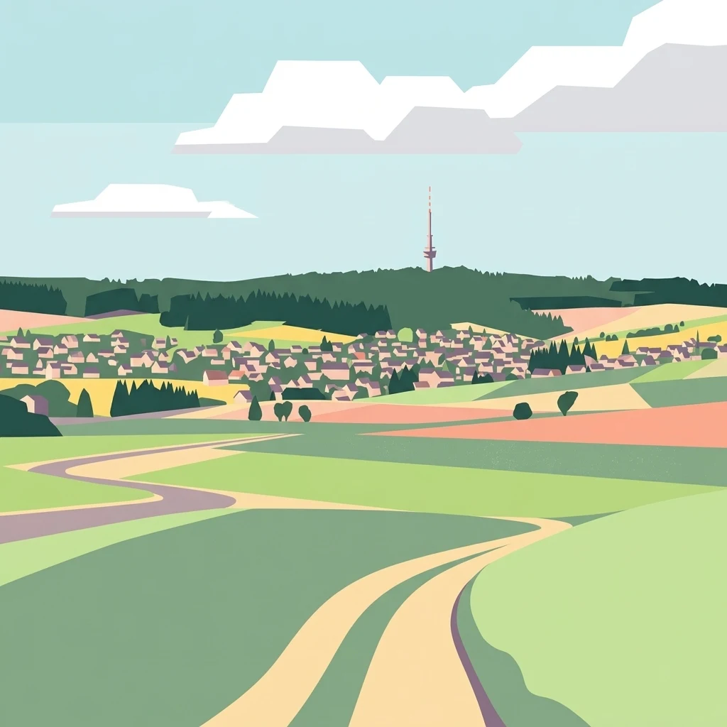
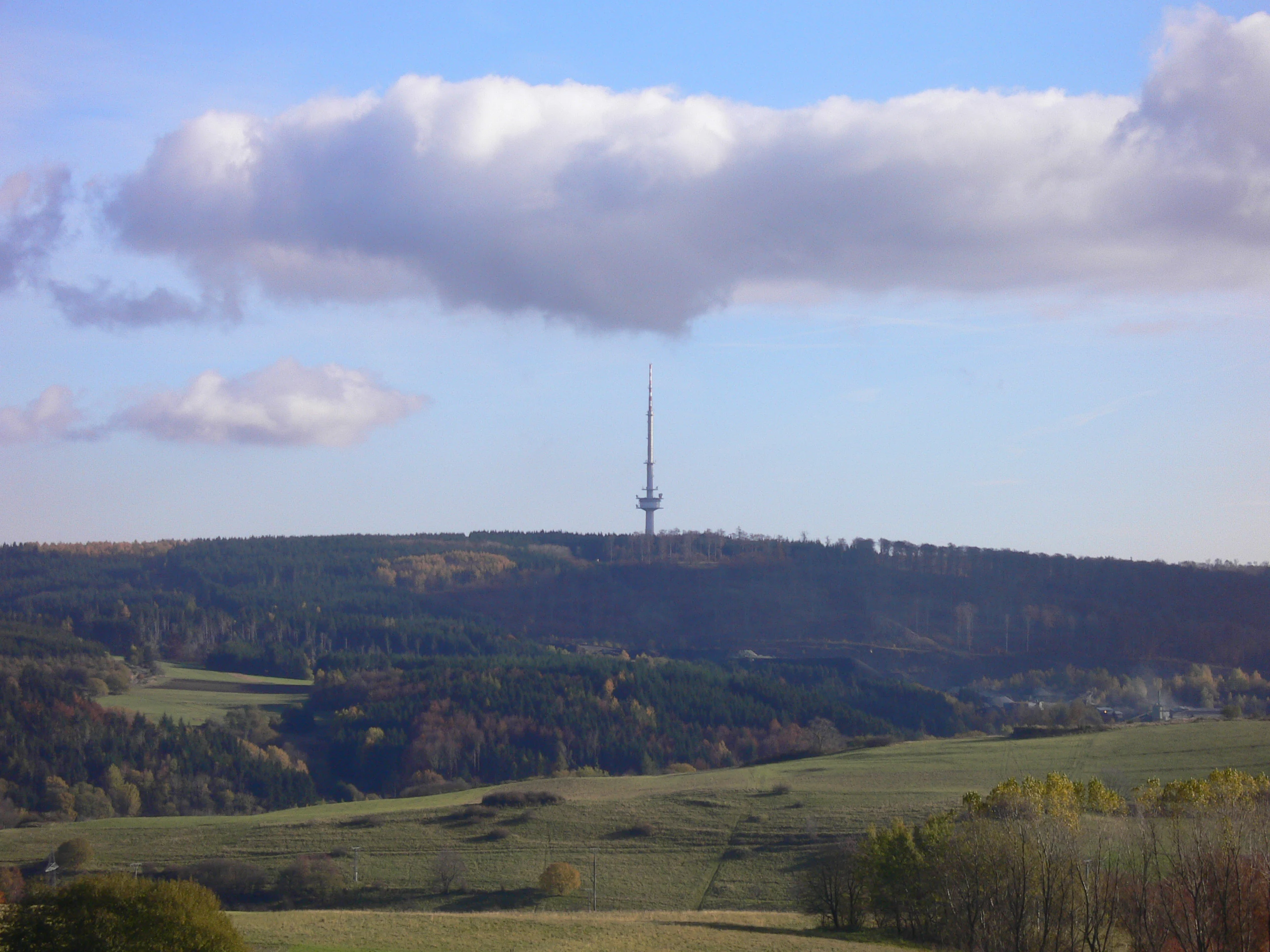
Naturpark Lahn-Dill-Bergland is best known for its Mittelgebirge character: a mosaic of wooded ridges, high plateaux, narrow river valleys, and small rural towns at the seam between the Westerwald and the Rothaargebirge. The park's highest points are the Jagdberg and the Sackpfeife, both around 675 meters high, which are considered outliers of the Rothaargebirge mass. Within the Gladenbacher Bergland itself, the Angelburg is the most prominent summit at 609 meters, and is closely associated with the park's identity due to the broadcasting tower on its peak. The park is also recognized for the distinctive natural sub-regions within it, including the Bottenhorner Hochflächen, the Schelder Wald, the Krofdorf-Königsberger Forst, the Hörre, and the Zollbuche, each contributing its own mix of forest cover, agricultural upland, and small valley settlements.
Naturpark Lahn-Dill-Bergland history and protected-area timeline
The underlying organizational body of the nature park, the Verein Region Lahn-Dill-Bergland e. V., was founded in 1996 by 14 towns and municipalities, together with numerous private individuals, businesses, and associations. Its original purpose was to promote coordinated rural regional development across the historical Biedenkopf and Dillkreis areas that were merged during the 1970s administrative reforms.
In October 2000, the Land of Hesse designated much of this territory as the Landschaftsschutzgebiet Lahn-Dill-Bergland, establishing a basic layer of landscape protection. In 2002, the region was accepted into the European Union's LEADER+ rural development programme, giving the Verein access to structured funding. Since March 2003, the Verein has operated a professional regional management office headquartered in Bad Endbach, supporting sustainable land use, village renewal, tourism, and cultural projects.
The most significant milestone came on 24 September 2007, when the area was officially recognized as the eleventh Naturpark in Hesse under the name Naturpark Lahn-Dill-Bergland, consolidating the region's protected-area identity. After 2014, when the municipality of Lohra left the association to join the Marburger Land region, the Verein stabilized at its current 18 member municipalities, with Breidenbach and Dietzhölztal joining later after a legislative amendment in 2017. Over the years, the Verein has also organized recurring Tag der Regionen events, including themed editions in 2003 on apples and in 2005 on bread, to strengthen community engagement with regional identity and rural development.
Naturpark Lahn-Dill-Bergland landscape and geographic character
The landscape of Naturpark Lahn-Dill-Bergland is a classic example of a German Mittelgebirge, a medium-altitude mountain region with deeply incised river valleys and forest-clad ridges. The park is anchored by the Gladenbacher Bergland, a varied highland of about 83,000 hectares whose many small sub-regions each bring distinct terrain to the overall character of the park.
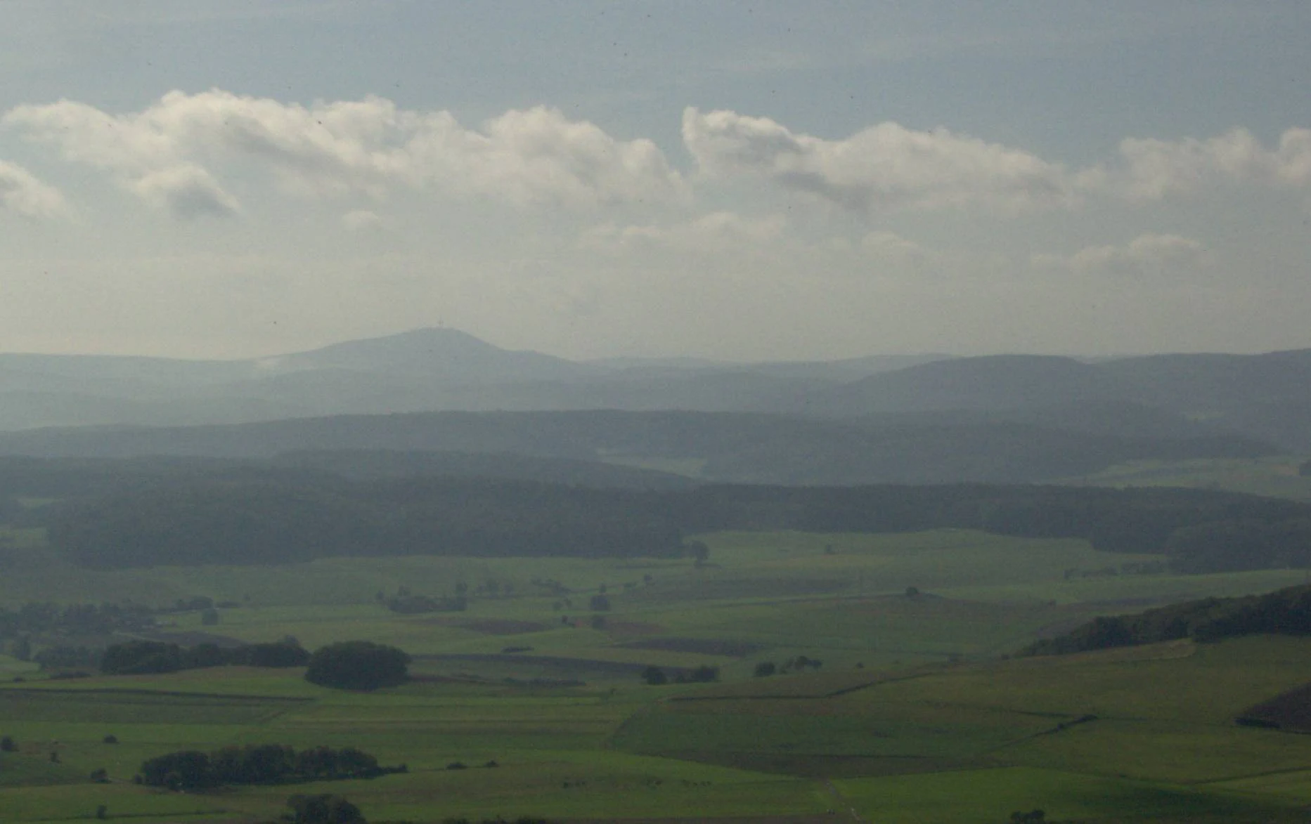
In the north and northwest, the terrain rises toward the Rothaargebirge, with prominent summits such as the Jagdberg, the Sackpfeife, and the Kompass defining the skyline. In the southwest, the slopes merge with the Hoher Westerwald and the basalt highland of the Oberwesterwald. The central part of the park is dominated by extensive high plateaux such as the Bottenhorner Hochflächen around 500 meters altitude, while the southeast transitions into lower rolling hill country around the Zollbuche and the Krofdorf-Königsberger Forst.
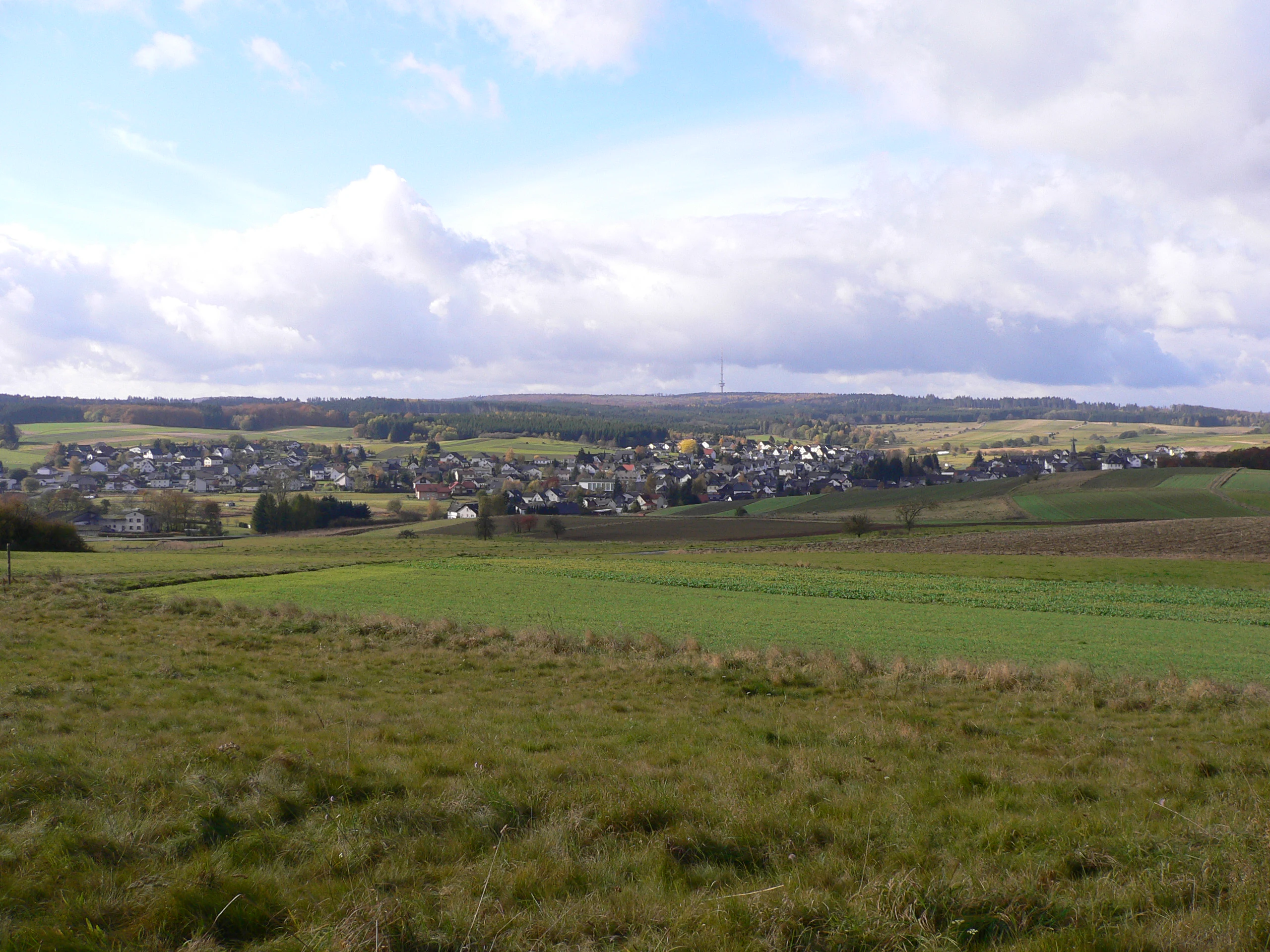
The river valleys of the Lahn and the Dill provide the scenic backbone of the park. The Lahn forms a broad northern and eastern arc, while the Dill cuts more aggressively westward through the Struth and the Dillta lsystem. Between these valleys lie dense, often continuous forest masses such as the Schelder Wald and the Schwarzenberg area, alternating with small villages, high pastures, and cultural uplands. The resulting visual character is one of layered wooded ridges and deeply set valleys, often viewed from lookout points such as the Rimberg, the Dünsberg, the Koppe, and the Angelburg with its broadcasting tower.
Naturpark Lahn-Dill-Bergland ecosystems, habitats, and plant life
The natural landscape of Naturpark Lahn-Dill-Bergland is shaped by forested uplands and a mixture of upland meadows, small valleys, and rocky outcrops. Large continuous woodland blocks, such as the Schelder Wald, the Krofdorf-Königsberger Forst, the Breidenbacher Grund around the Schwarzenberg, and the Hochflächen woodlands near Angelburg, dominate the more elevated terrain, while the river valleys host a finer mosaic of grassland, hedgerows, meadows, and riparian habitats.
Much of the area belongs to the natural region Gladenbacher Bergland, classified within the broader Westerwald and Süderbergland units. Geologically, the underlying rocks include ancient slates and greywacke typical of the Rheinisches Schiefergebirge, with volcanic basalt of the Hoher Westerwald intruding in the southwest. The basalt highlands and the deep slate valleys together produce the characteristic sequence of flat, dark uplands and sharply cut valleys that defines the region.
Ecologically, the park's position at the intersection of the Westerwald, the Rothaargebirge, and the Lahn-Dill river systems gives it a transitional character. Habitats range from montane beech and mixed forests on higher slopes to riverine communities along the Lahn and Dill, with interspersed highland meadows and the small-scale farmland typical of Hessen's rural Mittelgebirge. A small dedicated airfield near the Bottenhorner Hochflächen and the Angelburg broadcasting tower are local landmarks, but the bulk of the park remains a working agricultural-and-forest landscape shaped by centuries of rural land use.

Naturpark Lahn-Dill-Bergland wildlife and species highlights
Naturpark Lahn-Dill-Bergland's wildlife is best understood as the fauna of a forested Mittelgebirge with extensive high plateaux and well-wooded river valleys. The large, contiguous forest blocks such as the Schelder Wald, the Schwarzenberg area, and the Krofdorf-Königsberger Forst provide habitat for typical central German woodland species, including red deer, roe deer, and wild boar, alongside smaller forest mammals such as foxes and martens.
The varied topography, with uplands, cliff sections, and river valleys, also supports a rich bird community. Common forest and woodland-edge birds are well represented, while the river systems of the Lahn and Dill host water-associated species along their banks and tributaries. The semi-open cultural landscapes with meadows, hedges, and scattered orchards around villages add farmland and edge-of-habitat species to the mix, contributing to the overall biodiversity of the park.
Although the source material focuses on landscape and regional development rather than detailed species lists, the park's combination of large forested interiors, heterogeneous valley habitats, and transition zones between the Westerwald and the Rothaargebirge supports characteristic Central European upland biodiversity. Where specific species emphasis is desired, related regional topics such as the Lahn-Dill mining area and the broader Mittelhessen region provide useful additional context.
Naturpark Lahn-Dill-Bergland conservation status and protection priorities
As a recognized Naturpark in Hesse, Naturpark Lahn-Dill-Bergland serves as a framework for landscape and nature protection across a culturally shaped region. Much of its area was already designated in 2000 as the Landschaftsschutzgebiet Lahn-Dill-Bergland, providing the legal foundation for landscape preservation. The nature park designation in 2007 added a coordinated management and development layer on top of this preexisting protection.
The conservation focus of the park is not the protection of remote wilderness but the stewardship of a working rural landscape. The Verein Region Lahn-Dill-Bergland coordinates measures to maintain traditional land-use patterns, protect extensive forests, support sustainable agriculture, and conserve the visual and ecological character of valleys, high plateaux, and hill ridges. EU LEADER+ and successor funding has been used to support land management projects consistent with these goals.
The park also acts as a buffer between more strictly protected areas and high-intensity land use, helping maintain ecological continuity between the Westerwald, the Rothaargebirge, and the broader Hessian Mittelgebirge. In this way, the park functions both as a local heritage zone and as a contributor to regional biodiversity, working hand in hand with the surrounding natural area units described in the German systematic landscape classification.
Naturpark Lahn-Dill-Bergland cultural meaning and human context
The cultural context of Naturpark Lahn-Dill-Bergland is closely tied to the rural development history of western Mittelhessen. The park's territory follows the municipalities of the historical Biedenkopf district and Dillkreis, both of which were reorganized in the 1974 Hessian territorial reform. Many communities within the park, including Biedenkopf, Dillenburg, Gladenbach, Haiger, and Herborn, retain a strong identity rooted in this shared administrative and economic past.
The region carries a notable mining and industrial heritage through its connections to the Lahn-Dill mining district. Although mining is treated in a separate topic, it remains an important part of the cultural backdrop against which the nature park's rural villages and forested highlands are understood. Many visitors and residents encounter the park through a layered landscape where small farming settlements, former mining sites, and forested highlands coexist.
The Verein's annual Tag der Regionen events reflect this cultural dimension. Themed editions on apples in 2003 and on bread in 2005 highlight connections between local food, agricultural tradition, and community participation. The event alternates between communities in the Lahn-Dill-Kreis and the Landkreis Marburg-Biedenkopf, emphasizing cross-district solidarity. Together, these traditions and institutional practices give the nature park a strong human and cultural identity that complements its natural landscape values.
Top sights and standout views in Naturpark Lahn-Dill-Bergland
Among the park's most notable features are the Jagdberg and the Sackpfeife, both around 675 meters high, which mark the northern and northwestern edge of the park as Rothaargebirge outliers. The Angelburg, topped by the broadcasting tower, is one of the most recognizable landmarks within the Gladenbacher Bergland, with viewing points that survey the Lahn-Dill-Bergland as a whole.
The park's internal diversity is another highlight. Visitors can experience the high plateaux of Bottenhorn, the dense forests of the Schelder Wald and Breidenbacher Grund, the scenic side-valleys of the Krofdorf-Königsberger Forst with landmarks such as Burg Hohensolms, and the more rolling southeastern country of the Zollbuche. The lookout points at Rimberg, Dünsberg, and Koppe offer particularly wide views across this layered Mittelgebirge landscape.
What sets the park apart is not a single dramatic attraction but the overall combination: a working rural Mittelgebirge with continuous forest cover, identifiable summits, strong community identity across 18 municipalities, and a coordinated institutional framework that has been active since the late 1990s. This mix of landscape, regional cooperation, and cultural heritage defines Naturpark Lahn-Dill-Bergland as a notably complete example of the modern German Naturpark model.
Best time to visit Naturpark Lahn-Dill-Bergland
Naturpark Lahn-Dill-Bergland offers a distinctly seasonal character, shaped by its Mittelgebirge setting. Spring and early summer bring fresh green foliage to the forests and meadows, and the valley villages are at their most colorful, while early summer is generally favorable for hiking, cycling, and exploring the broader landscape.
Late summer and autumn are also a rewarding time, with the deciduous forest massifs of the Gladenbacher Bergland shifting through warm autumn colors. Harvest-themed events and the annual Tag der Regionen, traditionally held around Erntedanksonntag, often take place during this period and add a cultural layer to a visit.
Winter can be quieter, with snow occasionally settling on the higher plateaux and ridges of the Rothaargebirge edge and the Bottenhorner Hochflächen. Conditions vary by elevation, so visitors interested in winter scenery should be prepared for potentially snowy, often slippery conditions on higher trails. As with all open rural landscapes, weather and ground conditions can change quickly in this Mittelgebirge environment.