
Mori Atlas logo
Protected landscapeNaturpark Saale-Unstrut-Triasland

Examining the intersection of Triassic geological formations, medieval cultural heritage, and river valley terrain.

Naturpark Saale-Unstrut-Triasland: A Deep Dive into Central Germany's Protected River Landscapes

(Geo-Naturpark Saale-Unstrut-Triasland)

Naturpark Saale-Unstrut-Triasland forms a distinct protected corridor across Sachsen-Anhalt, characterized by its intricate mosaic of vine-covered slopes, traditional orchard meadows, and deep river-carved valleys. This geographic entity showcases a legacy of Triassic sedimentation that defines the present-day surface, bridging prehistoric archaeological significance with long-standing viticulture and Romanesque architectural history.

nature parkriver valleyTriassic geologywine regionvineyardsorchard meadows
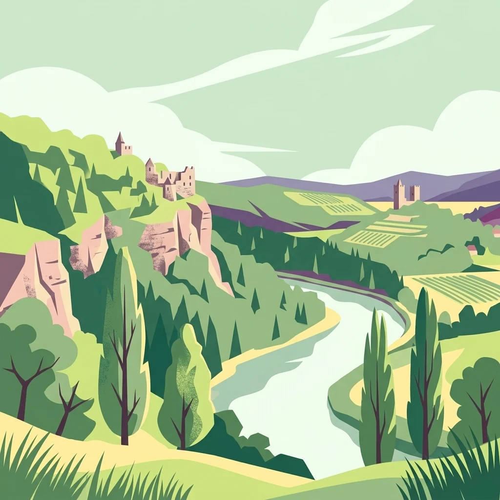
A flat-style digital illustration of a winding river flowing through a green valley with rocky cliffs, historic stone ruins, and terraced vineyards under a pale sky.

Naturpark Saale-Unstrut-Triasland

Protected landscape

Park overview

Structured park overview, official facts, and landscape profile for Saale-Unstrut-Triasland Nature Park

Saale-Unstrut-Triasland Nature Park park facts, protected area profile, and essential visitor context

Review the core facts for Saale-Unstrut-Triasland Nature Park, including designation, size, terrain, visitor scale, habitats, and operating context in one park-focused overview.

About Saale-Unstrut-Triasland Nature Park

The Saale-Unstrut-Triasland Nature Park lies in central Germany, embedded in the rolling terrain between the Saale and Unstrut rivers in the state of Sachsen-Anhalt. Its roughly 1,037 square kilometers span the Burgenlandkreis and the Saalekreis, with a few neighboring Thuringian municipalities included at the edges. From a physical geography perspective, the park is a textbook example of a river-shaped cultural landscape: the Unstrut rises in the Thuringian basin and flows northward to join the Saale near Naumburg, and both valleys cut deep through gently folded Muschelkalk and Buntsandstein bedrock laid down during the Triassic period.

This geological backbone defines the visual character of the park. Triassic limestone, shell-bearing marl, and reddish sandstone alternate at the surface, producing cliffs, terraced vineyards, dry grasslands, and orchards perched on south-facing slopes. The result is a landscape that feels both agricultural and mineralogical at once: neat rows of vines march up the hills, while weathered quarry faces and natural rock ledges remind visitors that the soils themselves are part of the area's identity.

The cultural layer is equally important. The Saale-Unstrut wine region, one of the smallest but historically vital German wine appellations, has shaped local land use for over a thousand years, and the park's mosaic of farmland, forest patches, river meadows, and villages is a direct outcome of this long coexistence between people and terrain. Castles such as the Rudelsburg and Saaleck crown the rocky bluffs above the Saale, while Romanesque churches, monasteries, and half-timbered villages fill the valleys.

Designated in 1991 and reconceived as a “Geo-Naturpark” in 2013, the protected area is explicitly dedicated to communicating the relationship between geology, ecology, viticulture, and cultural history. Long-distance walking and cycling routes such as the Via Regia and the Saale-Radweg pass through the park, and themed heritage routes including the Straße der Romanik and the Weinstraße Saale-Unstrut link its major sites into a coherent regional experience.

Quick facts and research context for Saale-Unstrut-Triasland Nature Park

Established in 1991, the Saale-Unstrut-Triasland Nature Park covers around 1,037 square kilometers in Sachsen-Anhalt, Germany, stretching across the Burgenlandkreis and Saalekreis districts with small extensions into Thuringia. Its administrative seat is in Nebra, and its nearest major town is Naumburg on the Saale.

The park's defining geographic framework is the valley system of the rivers Saale and Unstrut, which carve through sedimentary Triassic bedrock and create floodplain meadows, vineyard terraces, and extensive traditional orchard landscapes. In 2013, the park's name was officially extended to “Geo-Naturpark” to highlight the area's geological significance, including multi-million-year-old Triassic rock sequences and a range of karst and fossil features.

Protection and recognition

Examine the terrestrial protection scope and designation timeline for Naturpark Saale-Unstrut-Triasland.

Naturpark Saale-Unstrut-Triasland Protection Status and Designation History

Naturpark Saale-Unstrut-Triasland maintains a documented terrestrial protection scope established in 2013 with verified transboundary status. Review the official designation history and conservation framework supporting this protected area.

Protection details

Protection scope
Terrestrial
Designated year
2013
Transboundary protection
Yes
Park context

Deeper park guide and search-rich context for Saale-Unstrut-Triasland Nature Park

Saale-Unstrut-Triasland Nature Park history, landscape, wildlife, and travel context

Explore Saale-Unstrut-Triasland Nature Park through its history, landscape character, ecosystems, wildlife, conservation priorities, cultural context, and seasonal travel timing in a structured park guide built for atlas discovery and search intent.

Why Saale-Unstrut-Triasland Nature Park stands out

The park is best known for the intertwined Saale and Unstrut river valleys, one of the northernmost wine-growing regions in Europe, and a landscape dotted with Romanesque cathedrals, medieval castles, and traditional orchard meadows. The “Triasland” part of the name points to another defining trait: an exceptional Triassic-era geological record that has earned the protected landscape recognition as a “Geo-Naturpark.” Equally iconic within the park, and recognized far beyond it, is the site where the Nebra Sky Disc was unearthed on the Mittelberg near Nebra. The combination of wine terroir, Romanesque cultural heritage, prehistoric archaeology, and stratified Triassic rock formations gives the nature park an unusually broad identity that bridges geology, viticulture, and Central German cultural history.
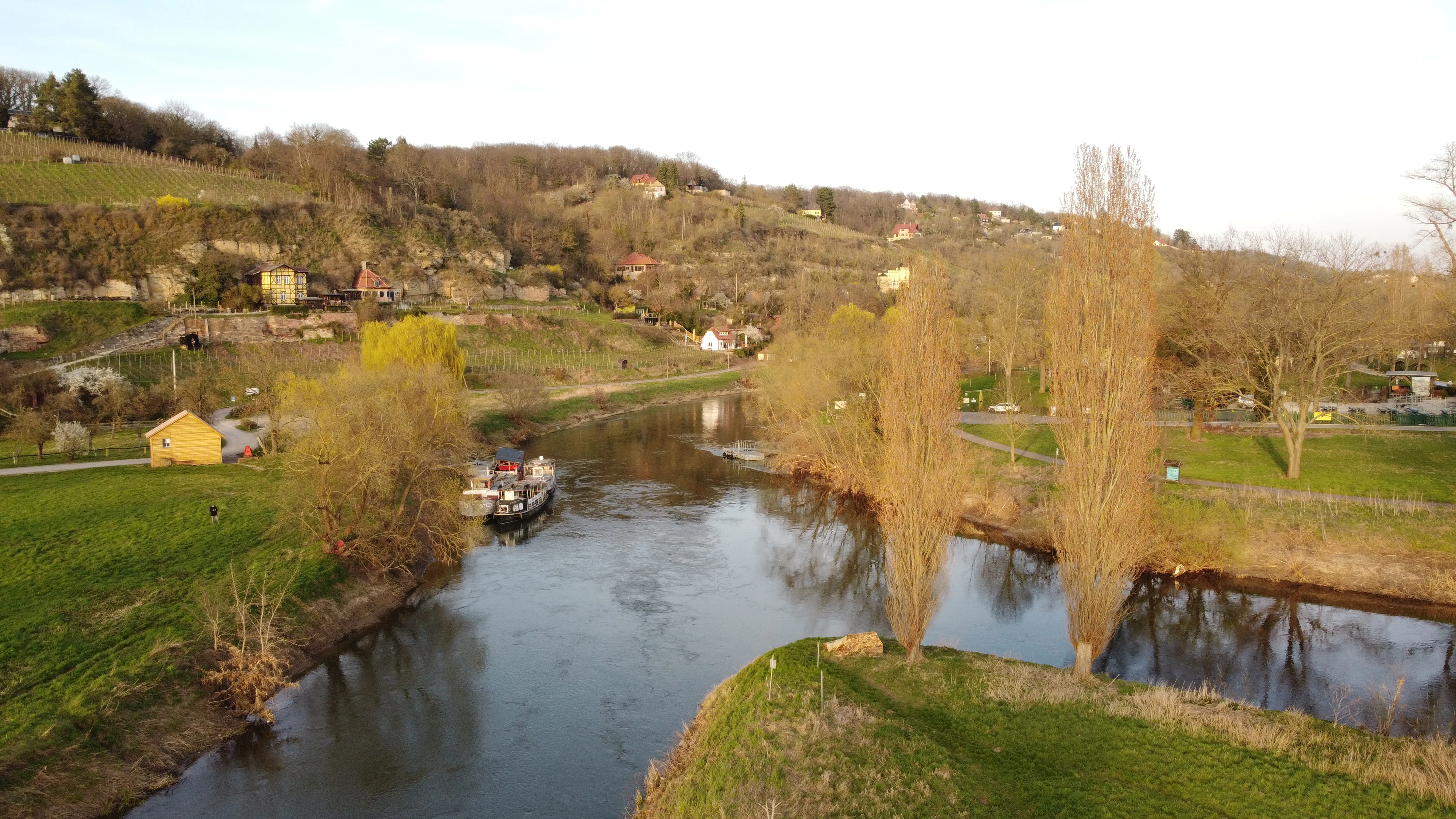
An aerial view of the confluence of two rivers in Germany, showing green banks, tall thin trees, a small boat docked, and hillsides in the background.
The confluence of the Unstrut and Saale rivers within the Naturpark Saale-Unstrut-Triasland.

Saale-Unstrut-Triasland Nature Park history and protected-area timeline

The Saale-Unstrut-Triasland Nature Park was formally established in 1991 as one of the designated nature parks of the former eastern German federal states, created in the period after reunification when regional heritage and natural sites were being recategorized under a unified national framework. Its initial remit was to protect and interpret a representative slice of the Saale and Unstrut river landscape and the cultural traditions that had grown up within it, particularly viticulture and orchard management.

For most of its first two decades the park was known simply as Naturpark Saale-Unstrut-Triasland. In 2013, its name was officially expanded to “Geo-Naturpark Saale-Unstrut-Triasland,” a change meant to foreground the area's distinctive Triassic geology and to align it with a broader national and European movement recognizing “geoparks” as both conservation frameworks and educational platforms. The renaming reflected decades of accumulating geological research and rising public interest in the region's fossil record, karst phenomena, and rock strata.

Over time, the park's identity has become increasingly intertwined with prehistoric and historical milestones of the wider region. The discovery of the Nebra Sky Disc on the Mittelberg near Nebra, first publicized in the early 2000s, placed the park's surrounding landscape on the international archaeological map, and the Goseck solar observatory adds a further prehistoric anchor. Medieval heritage, including the Rudelsburg, the Saaleck castle, and the Naumburg Cathedral, predates the park by many centuries but has become a central part of how the modern protected landscape presents itself.

Saale-Unstrut-Triasland Nature Park landscape and geographic character

The landscape of the Saale-Unstrut-Triasland Nature Park is built on the bones of its geology. The park sits in a region of Triassic sedimentary rocks laid down roughly 200 to 250 million years ago, and the present-day surface bears the marks of every layer. Lower slopes and valley bottoms expose reddish Buntsandstein sandstones, while the upper slopes and cliffs are dominated by the lighter Muschelkalk limestone that gives the area its pale, dry character.

Above this rocky base, the rivers have done the carving. The Unstrut meanders northward through a wide, gentle valley, and the Saale cuts a deeper, more dramatic gorge-like corridor through the park. Where they meet near Naumburg, the two river systems create an unusually varied terrain: flat floodplain meadows, steep vine-clad slopes, narrow side valleys with stream-cut gullies, and tabletop ridges that offer panoramic views over both valleys.

Land use mirrors the topography. Steep southern slopes are devoted almost entirely to vineyards, while gentler slopes and valley fringes carry extensive Streuobstwiesen, traditional orchard meadows with widely spaced fruit trees. Between these cultivated zones, patches of dry grassland, juniper heath, and mixed deciduous woodland preserve wilder fragments of the original landscape. Quarry faces, rock pavements, and natural stone exposures further remind visitors that the visible scenery is, quite literally, geological time written onto the modern surface.

Saale-Unstrut-Triasland Nature Park ecosystems, habitats, and plant life

Ecologically, the park is a mosaic landscape rather than a single uniform habitat, and the mix of dry slopes, river floodplains, orchards, and forest patches supports a wide range of plant and animal communities. The warm, south-facing Muschelkalk slopes create microclimates favorable to species that would not normally be expected this far north, and the combination of calcareous grassland and scrub at the forest margins gives the park a notably rich flora in certain zones.

The river corridors of the Saale and Unstrut add a completely different ecological register. Their floodplains and meadows provide wet grasslands and riparian woodland that contrast with the dry vineyards above, and both rivers are increasingly valued as connectivity corridors for aquatic life. Traditional orchard meadows, or Streuobstwiesen, are particularly important here: they straddle ecological and cultural value, supporting cavity-nesting birds, bats, and insects while preserving a centuries-old land-use tradition.

Forests cover meaningful portions of the park as well, with mixed deciduous stands on the sandstone and limestone soils, alongside more planted coniferous areas. The interplay between woodland, meadow, orchard, vineyard, and exposed rock gives the park much of its biological diversity, and the nature park's role is to keep all of these contrasting ecosystems functioning together rather than allowing any one to dominate.

Saale-Unstrut-Triasland Nature Park wildlife and species highlights

The variety of habitats within the park translates into a broad range of fauna. The dry, warm slopes and old orchard landscapes provide habitat for typical Central German woodland and grassland species, including deer, foxes, and badgers in the larger forest blocks, while smaller mammals such as hedgehogs and various bat species use the orchards and older buildings as refuges. Roe deer are particularly visible against the mosaic of field, meadow, and vineyard edges.

Birds benefit from the patchwork structure of the landscape. Streuobstwiesen and older deciduous trees host woodpeckers, owls, and a range of cavity-nesting songbirds, while the river corridors attract waterfowl, kingfishers, and herons along the Saale and Unstrut. Raptors including common buzzards can be seen hunting over the open slopes above the vineyards and along the woodland edges.

The rivers themselves carry their own fauna. Both the Saale and Unstrut support fish populations typical of central German lowland and middle-reach rivers, and their banks and adjacent meadows are important for amphibians and invertebrates. Although the park is not primarily known as a “big wildlife” destination, its mosaic structure gives it a quietly rich fauna that rewards patient observation, especially along the river corridors and in the older orchard landscapes.

Saale-Unstrut-Triasland Nature Park conservation status and protection priorities

Conservation in the Saale-Unstrut-Triasland Nature Park is fundamentally about maintaining a working cultural landscape rather than excluding human activity. The park's protected status is designed to safeguard the integrated ecosystem of vineyards, orchards, floodplain meadows, dry grassland, and forest that has co-evolved with human land use for centuries. Losing any one of these layers would weaken the whole, so managing grazing, mowing, orchard renewal, and river dynamics is central to the park's mission.

The 2013 renaming to “Geo-Naturpark” explicitly brought geological heritage into the conservation framework. This means fossil-bearing rock sequences, active and historic quarries, karst features, and the broader Triassic stratigraphy are now treated as protected natural heritage alongside the living ecosystems. Interpretive trails, visitor centers, and cooperation with educational institutions help communicate why protecting these rock exposures matters, both scientifically and aesthetically.

Equally important is the protection of the Saale and Unstrut river corridors, including their floodplains. The park supports efforts to maintain these as functional ecological corridors, with implications for water quality, flood regulation, and connectivity for fish and other aquatic wildlife. By framing its conservation remit so broadly, including geology, river systems, and cultural land use, the park positions itself as a holistic landscape-scale project rather than a strictly biological reserve.

Saale-Unstrut-Triasland Nature Park cultural meaning and human context

Cultural identity in the Saale-Unstrut-Triasland Nature Park is inseparable from wine. The Saale-Unstrut wine region is one of the most northerly quality wine regions in Europe and has shaped local agriculture, architecture, and social life since medieval monastic settlements first cultivated vines along the rivers. Vineyard terraces, winegrowers' houses pressed into hillsides, and traditional press houses remain part of the everyday working landscape, not just a tourist backdrop.

Religious and secular architecture adds another deep layer. Romanesque buildings figure prominently through themed routes such as the Straße der Romanik, with the Naumburg Cathedral, Kloster Pforta, and the Pfalz and Kloster Memleben among the most significant sites. Above the rivers, secular castles like Rudelsburg, Saaleck, Neuenburg, and Schloss Neu-Augustusburg speak to the medieval political geography of the region, while towns such as Naumburg, Freyburg, and Zeitz provide the urban counterpoint to the rural and natural landscape.

Prehistoric heritage adds a much older dimension. The Mittelberg near Nebra, where the famous Nebra Sky Disc was discovered, and the Goseck solar observatory place the region at the heart of European Bronze Age cosmology. The cultural context of the park is therefore unusually deep, ranging from prehistoric sky-watching sites through medieval monasteries and castles to a living wine culture that still defines village life today.

Top sights and standout views in Saale-Unstrut-Triasland Nature Park

The combined geological richness, wine-growing heritage, and medieval architecture make the Saale-Unstrut-Triasland Nature Park unusually varied for a single protected landscape. Within a compact area, visitors can move between Triassic rock exposures, working vineyards, river floodplains, and towns anchored by Romanesque cathedrals and hilltop castles, with prehistoric sky-disc and observatory sites adding an even older narrative frame.

The park's practical access is also a highlight: long-distance walking and cycling routes such as the Via Regia and the Saale-Radweg run straight through the territory, and themed roads like the Weinstraße Saale-Unstrut and the Straße der Romanik weave its most significant sites into clearly marked regional circuits.

Best time to visit Saale-Unstrut-Triasland Nature Park

Late spring through early autumn is generally the most rewarding period for visiting the Saale-Unstrut-Triasland Nature Park. Late spring brings the flowering of the traditional orchard meadows, when the meadows between widely spaced fruit trees turn into colorful meadows beneath blossoming canopies, and the riverside paths become especially pleasant for walking and cycling.

Summer and early autumn align with the rhythm of the wine region: vineyards are at their greenest in early summer, and the harvest season in early autumn brings visible activity to the slopes and occasional village festivals. Winter visits offer a quieter atmosphere and crisper views over the bare vineyards and castle silhouettes, though some outdoor interpretive sites and water-based activities are more limited in the colder months.

Monthly climate preview

Long-term representative point measurements tracking monthly temperature and precipitation cycles

Naturpark Saale-Unstrut-Triasland Climate Normals and Annual Temperature Rhythm

Naturpark Saale-Unstrut-Triasland exhibits measured annual temperature variations and precipitation rates across twelve representative sample points. Analyzing the complete monthly climate profile provides deep analytical insight into regional meteorological baselines.
Annual mean9 °C
-1 °C19 °C
Jan-1°
Feb
Mar
Apr
May13°
Jun17°
Jul19°
Aug19°
Sep14°
Oct
Nov
Dec
Warmest month
July

19.1 °C

Coolest month
January

-0.9 °C

Wettest month
July

2.6 mm/day

Driest month
April

1.3 mm/day

Park location guide

Geography guide, regional context, and park location map for Saale-Unstrut-Triasland Nature Park

Saale-Unstrut-Triasland Nature Park park geography, regions, and map view in Germany

Understand where Saale-Unstrut-Triasland Nature Park sits in Germany through a broader geographic reading of the surrounding landscape, nearby location context, and its mapped position within the national park landscape.

How Saale-Unstrut-Triasland Nature Park fits into Germany

Germany is a federal republic in Western and Central Europe with a population of over 83 million across sixteen constituent states. It is Europe's largest economy by nominal GDP and a major global exporter and importer. The capital is Berlin, and the country borders Denmark, Poland, Czech Republic, Austria, Switzerland, France, Luxembourg, Belgium, and the Netherlands.

Wider geography shaping Saale-Unstrut-Triasland Nature Park in Germany

Germany is located in Western and Central Europe, spanning 357,022 km². It borders Denmark to the north, Poland and the Czech Republic to the east, Austria and Switzerland to the south, and France, Luxembourg, Belgium, and the Netherlands to the west. The country has coastlines on the Baltic Sea and North Sea to the north, with the Alps located in the southern region.

Map view of Saale-Unstrut-Triasland Nature Park

Use this park location map to pinpoint Saale-Unstrut-Triasland Nature Park in Germany, understand its exact geographic position, and read its mapped placement within the surrounding landscape more clearly.

Pigeon | © OpenStreetMap contributors

Location context for Saale-Unstrut-Triasland Nature Park

Sachsen-Anhalt

Visualizing river valleys, limestone formations, and vineyard terrain.

Naturpark Saale-Unstrut-Triasland Photos and Landscape Scenery

Visual documentation of Naturpark Saale-Unstrut-Triasland reveals the intricate topography of carved river corridors, terraced hillsides, and ancient geological exposures. Examining these protected habitats provides direct insight into the physical character of the central German river valleys and their cultural landscapes.

An aerial view of the confluence of two rivers in Germany, showing green banks, tall thin trees, a small boat docked, and hillsides in the background.

Wide landscape view featuring two historic stone castles perched on forested hillsides with a valley in between.

Park atlas

Compare surrounding river valleys, geological formations, and nearby protected landscapes

Other Parks Near Naturpark Saale-Unstrut-Triasland and Regional Protected Areas

Browsing other parks near Naturpark Saale-Unstrut-Triasland reveals connected protected areas across central Germany and surrounding river corridors. Expanding the geographic comparison highlights regional terrain variations and related conservation landscapes.
Nature reserveThuringia
About 18 km away#1 closest

Southwest

Lohholz Nature Reserve: Protected Forest and Meadow Mosaic in Thuringia

Mapped deciduous woodlands and river valley meadow geography

Lohholz constitutes an isolated nature reserve in Thuringia, showcasing a distinct mosaic of broadleaf forest and traditional orchard meadows. The terrain slopes toward the Saale river valley, featuring varied grassland communities and a vital spring-fed brook. This protected area offers a look at forest preservation within a landscape predominantly utilized for agricultural purposes.

Area
0.304 km²
Established
1995
IUCN
IV
Relief
Upland
Nature reserveThuringia
About 28 km away#2 closest

Southwest

Windknollen Nature Reserve: Mapping Protected Limestone Landscapes in Thuringia

Examining the plateau geography and former training site boundaries

The Windknollen nature reserve occupies a distinct position on the Muschelkalk limestone plateau near Jena. Its protected status reflects an evolution from historical battlefield use to a formal conservation area within the National Natural Heritage framework. The terrain is defined by exposed; dry-adapted vegetation across 185 hectares of highland geography.

Area
1.851 km²
Established
1997
IUCN
IV
A soft watercolor painting of a green landscape with trees, rolling hills, and a body of water under a light sky.
Nature reserveThuringia
About 30 km away#3 closest

Southwest

Jenaer Forst Nature Reserve: Mapping the Protected Limestone Plateau and Forest Terrain

Protected nature reserve in Thuringia, Germany

Jenaer Forst is a 540 hectare nature reserve in Thuringia, characterized by dry calcareous woodland and active restoration work. The site is a study in landscape recovery, balancing forest management with the protection of orchid-rich habitats on its limestone plateau. This detailed atlas entry provides insights into the park boundaries, geological features, and ecological significance of this peri-urban forest zone.

Area
5.411 km²
Established
2008
IUCN
IV
A watercolor painting depicting a soft, rolling landscape with purple hills in the distance, green plains with clusters of trees in the middle, and pink wildflowers in the foreground.
Nature reserveKyffhäuserkreis
About 32 km away#4 closest

Northwest

Bottendorfer Hügel Nature Reserve: Mapped Geography and Protected Ridge Landscape

A rare steppe-grassland protected area in Kyffhäuserkreis, Thuringia

Discover the unique geography of the Bottendorfer Hügel, a compact gypsum-based cuesta ridge characterized by its open, tree-less steppe grasslands. Located in the Kyffhäuserkreis district, this nature reserve is recognized for its specialized heavy-metal-adapted plant communities and distinctive geological profile situated between the broader forested sandstone highland landscapes.

Area
1.316 km²
Relief
Upland
Climate
Temperate
Access
Easy access
Nature reserveThuringia
About 34 km away#5 closest

East

Phönix Nord Nature Reserve: Mapped Protected Area in the Altenburger Land of Thuringia

A restored post-mining mosaic of heath, scrub, and woodland

Phönix Nord preserves a unique post-mining landscape shaped by historic lignite extraction. This nature reserve in Thuringia features a mosaic of rewilded slopes and reclaimed mineral soils, managed as a vital habitat for native species. Through its distinct topography and conservation efforts, it stands as a key example of industrial renaturation in central Germany.

Area
1.672 km²
Established
2008
IUCN
IV
Relief
Lowland
A soft watercolor painting of layered green hills and forest under a pale sky, with a faded white background.
Protected landscapeThuringia
About 35 km away#6 closest

West

Hohe Schrecke: Protected Landscape Map and Geographic Overview of Thuringian Woodlands

Mapped beech forest ridges and central German terrain.

Hohe Schrecke is a low mountain ridge in central Germany defined by expansive, unfragmented beech forests and sandstone-based topography. The area features a coherent mosaic of mature woodland, stream-cut valleys, and dry grasslands. This overview provides a structured look at the park boundaries and regional geographic context that define this protected landscape in Thuringia.

Area
42.5 km²
Established
2004
Relief
Mountain
Climate
Temperate
Nature reserveThuringia
About 36 km away#7 closest

Southwest

Leutratal und Cospoth Nature Reserve: Mapping Calcareous Grasslands in Thuringia

A study of limestone slopes and orchid-rich habitats in central Germany

Leutratal und Cospoth serves as a prime example of protected Muschelkalk landscape in Thuringia. This reserve captures the complex transition between open grasslands, scrub, and beech forests within the middle Saale valley, offering deep insights into the region's unique geological and botanical heritage.

Area
5.829 km²
Established
1961
IUCN
IV
Relief
Upland
A horizontal watercolor illustration showing green rolling hills, distant light green ridges, and sparse trees against a white background.
Nature reserveThuringia
About 37 km away#8 closest

Southwest

Spitzenberg-Schießplatz Rothenstein-Borntal Nature Reserve and Saale Valley Geography

Protected forest and grassland terrain in Thuringia

Spitzenberg-Schießplatz Rothenstein-Borntal is a protected nature reserve in Thuringia, covering hundreds of hectares of forest slopes, plateaus, and open clearings. This reserve is recognized for its unusual structural diversity, ranging from closed valley woodland to sun-exposed semi-dry grassland, providing essential habitat within the middle Saale valley region.

Area
5.542 km²
Established
1961
IUCN
IV

Common questions about visiting, size, designation, and location context for Saale-Unstrut-Triasland Nature Park

Saale-Unstrut-Triasland Nature Park FAQs for park facts, access, geography, and protected area context

Find quick answers about Saale-Unstrut-Triasland Nature Park, including protected-area facts, park geography, trail and visitor context, and how the park fits into its surrounding country and regional landscape.
MoriAtlas Explorer

Continue Your Protected Areas Search Across the Global Atlas

Deepen your exploration by continuing the structured search for national parks and protected areas worldwide. Utilize the comprehensive filtering capabilities to compare different conservation landscapes and refine your understanding of global park geography. Discover more about the distribution and characteristics of protected natural areas.

Global natural geography