
Mori Atlas logo
Nature reserveNaturschutzgebiet Alemigsiefental

Understanding the valley geography, riparian woodlands, and spring-fed habitat of this protected German nature reserve

Naturschutzgebiet Alemigsiefental: A Protected Kerbtal Landscape and Stream Valley in Nordrhein-Westfalen

Naturschutzgebiet Alemigsiefental represents a significant protected riparian landscape within the Bergisches Land region of Germany. This nature reserve preserves a classic Kerbtal, characterized by a deeply incised V-shaped valley shaped by the Alemigssiefen stream. The area creates a vital ecological corridor, featuring a mosaic of wet meadows, spring-fed floodplains, and intact forest that supports local freshwater habitats.

stream valleyKerbtalwet meadowfloodplain forestriparian woodlandspring habitat
A flat-style digital illustration of a scenic valley, featuring a winding river in the foreground, dense evergreen forest, tall rocky cliffs in the background, a small waterfall, and a bright sun setting or rising behind clouds.

Naturschutzgebiet Alemigsiefental

Nature reserve

Park overview

Structured park overview, official facts, and landscape profile for Naturschutzgebiet Alemigsiefental

Naturschutzgebiet Alemigsiefental park facts, protected area profile, and essential visitor context

Review the core facts for Naturschutzgebiet Alemigsiefental, including designation, size, terrain, visitor scale, habitats, and operating context in one park-focused overview.

About Naturschutzgebiet Alemigsiefental

Naturschutzgebiet Alemigsiefental is a compact but ecologically distinctive protected area in the Bergisches Land, the rolling hill country east of Cologne. The reserve follows the course of the Alemigssiefen, a small stream that begins life as two separate Siefen heads south of Hähn and Hufe. These two spring arms converge and the combined watercourse then makes its way south through a narrow valley carved between the villages of Engeldorf and Unterbörsch, eventually linking up with the neighboring Dürschbachtal reserve near the hamlet of Klefhaus.

Although small in size, the reserve captures an unusually complete cross-section of Bergisches stream-valley ecology. The valley floor has shifted away from its earlier agricultural use, and what was once managed grassland now consists of moist tall herb communities, partially overgrown floodplain scrub, and surviving patches of Auwald, the softwood riparian forest that lines lowland streams. Where the valley narrows in the north, close to the spring sources, the landscape changes character again, with denser woodland and mossy forest floor typical of the upper catchment.

The reserve belongs to the regional network of flowing freshwater habitats in the Bergisches Land, and its protection is explicitly tied to safeguarding these small, clean watercourses and their surrounding wetland vegetation. By linking ecologically with the Dürschbachtal to the south, the area also functions as a step in a broader corridor of natural valley habitats that together maintain biodiversity across the broader rural landscape around Kürten.

Quick facts and research context for Naturschutzgebiet Alemigsiefental

The reserve lies in the Bergisches Land region of western Germany and covers roughly 10 hectares of valley landscape along the Alemigssiefen stream, a tributary of the Dürschbach. It is classified as IUCN Category IV and was formally designated in 1990 under the regional landscape plan for Kürten. The terrain ranges from about 130 to 240 metres in elevation and is administered by the lower landscape authority of Rheinisch-Bergischer Kreis.

Protection and recognition

Examine terrestrial protection status, management scope, and verified registry entries.

Naturschutzgebiet Alemigsiefental Protection Status and Designation Records

Terrestrial protection status, management scope, and official designation details for Naturschutzgebiet Alemigsiefental are compiled within structured registry records. Conservation tracking covers documented administrative entries and baseline environmental framework data without external recognition sources.

Protection details

Protection scope
Terrestrial
Transboundary protection
No
WDPA ID
162060
Park context

Deeper park guide and search-rich context for Naturschutzgebiet Alemigsiefental

Naturschutzgebiet Alemigsiefental history, landscape, wildlife, and travel context

Explore Naturschutzgebiet Alemigsiefental through its history, landscape character, ecosystems, wildlife, conservation priorities, cultural context, and seasonal travel timing in a structured park guide built for atlas discovery and search intent.

Why Naturschutzgebiet Alemigsiefental stands out

The reserve is especially known for its spring-fed Kerbtal landscape, where two small spring branches merge into the Alemigssiefen stream and flow south through a valley of wet meadows, marsh vegetation, and floodplain woodland. It stands out within the regional stream network of the Bergisches Land as a habitat for species tied to clean, undisturbed small watercourses.
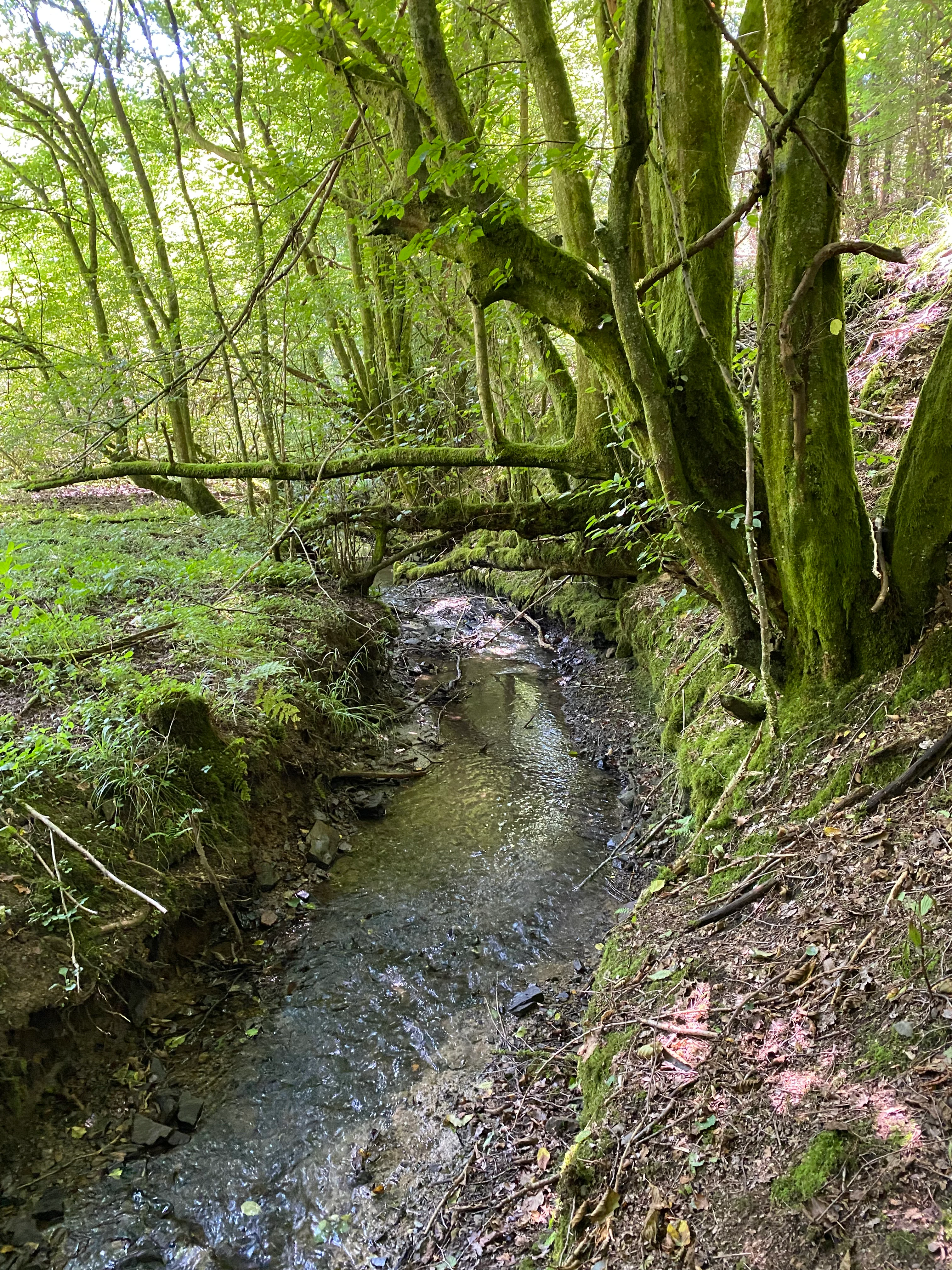
A small, narrow stream flowing between moss-covered tree trunks in a forest setting.
A small, shaded stream flowing through the lush, mossy woodland of the Alemigsiefental nature reserve.

Naturschutzgebiet Alemigsiefental history and protected-area timeline

The area was formally designated as a Naturschutzgebiet in 1990, under the framework of the landscape plan for the municipality of Kürten. Its establishment reflected growing awareness of the ecological value of the Bergisches Land's small stream valleys and the biodiversity they support, particularly as surrounding agricultural changes began to alter floodplain management and vegetation patterns.

Naturschutzgebiet Alemigsiefental landscape and geographic character

The protected area follows a classic Kerbtal, a steep-sided, narrow valley shape typical of the uplifted and deeply incised terrain of the Bergisches Land. The Alefigsiefen stream carves a gradually widening corridor through these slopes, changing from a tight, spring-dominated upper section to a more open floodplain landscape further downstream. Elevation across the reserve runs from roughly 130 metres along the lower reaches to about 240 metres near the headwaters, with an average around 185 metres, giving the valley a subtle but noticeable gradient that shapes both vegetation and water flow.

The valley sides are largely wooded, with beech forest dominating the mid-section of the stream and progressively moister, more shaded woodland near the spring heads. In contrast, the valley bottom is an alternating mosaic of wet grassland, marsh vegetation, reed beds, and patches of softwood floodplain forest, producing the visual and ecological richness that the reserve is intended to protect.
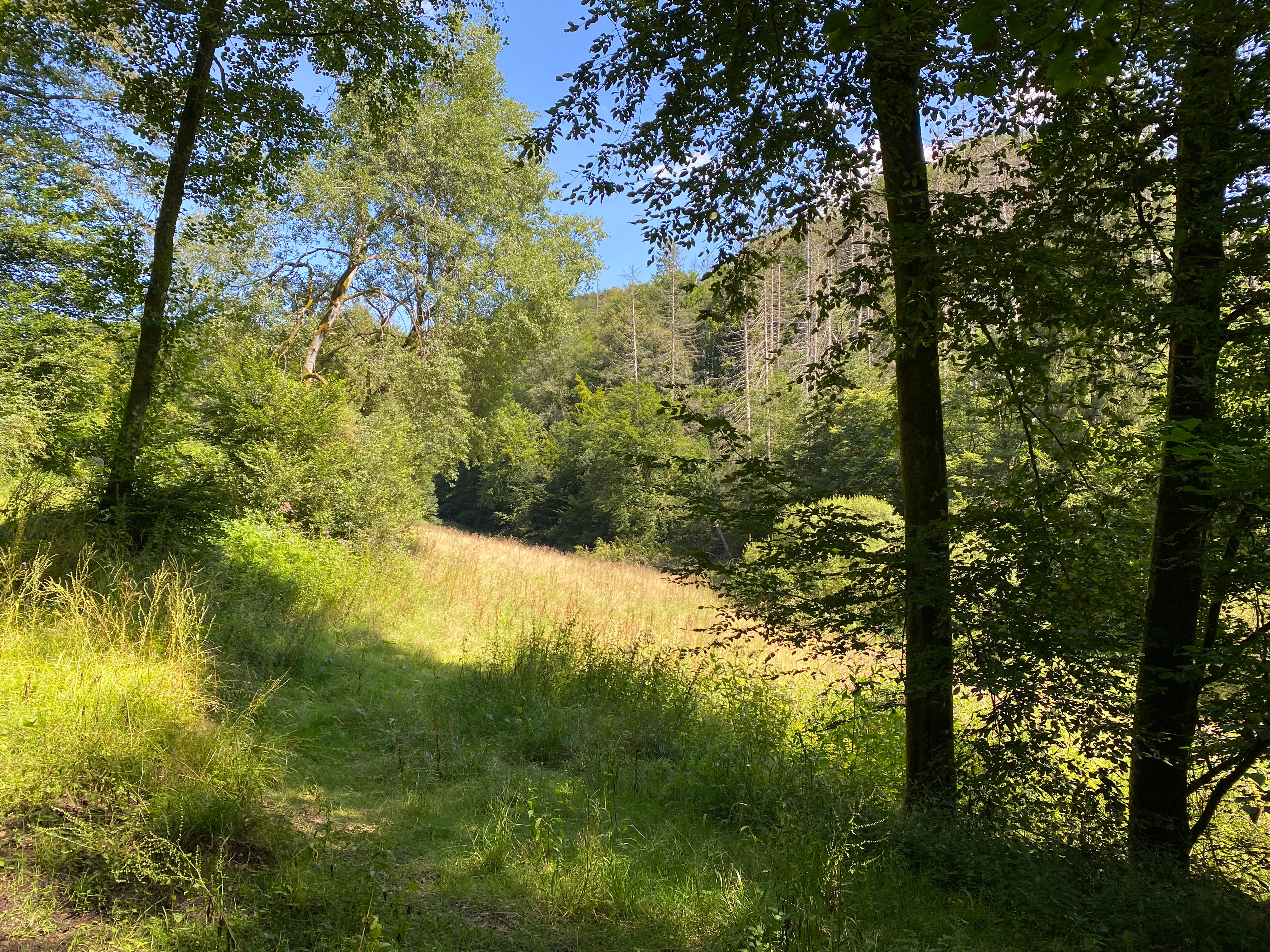
A view of a grassy meadow slope framed by trees, with a forested hillside in the background under a clear blue sky.
A sunlit wet meadow slope within the Alemigsiefental nature reserve.

Naturschutzgebiet Alemigsiefental ecosystems, habitats, and plant life

Ecologically, the reserve represents a textbook example of Bergisches Land valley-floor habitat complexity. The floodplain contains a patchwork of different vegetation types: wet meadows with varying degrees of moisture, sedge- and rush-rich marshy grassland, fallow wet areas, reed communities, and intact stretches of Auwald along the stream. Spring zones, small flush areas, and natural sections of the watercourse itself contribute further structural diversity.

At the higher, narrower end of the valley, the habitat shifts to a more forested character, with mature beech stands and a heavily mossed forest floor supporting ferns and other shade-loving species. Among the notable botanical features documented in the area are woodland angelica, which acts as a magnet for insects, and stands of marsh woundwort, both indicative of the persistent moisture and ecological continuity of the site. The combination of these habitats creates conditions that support an unusually broad range of plant communities within a very compact area.
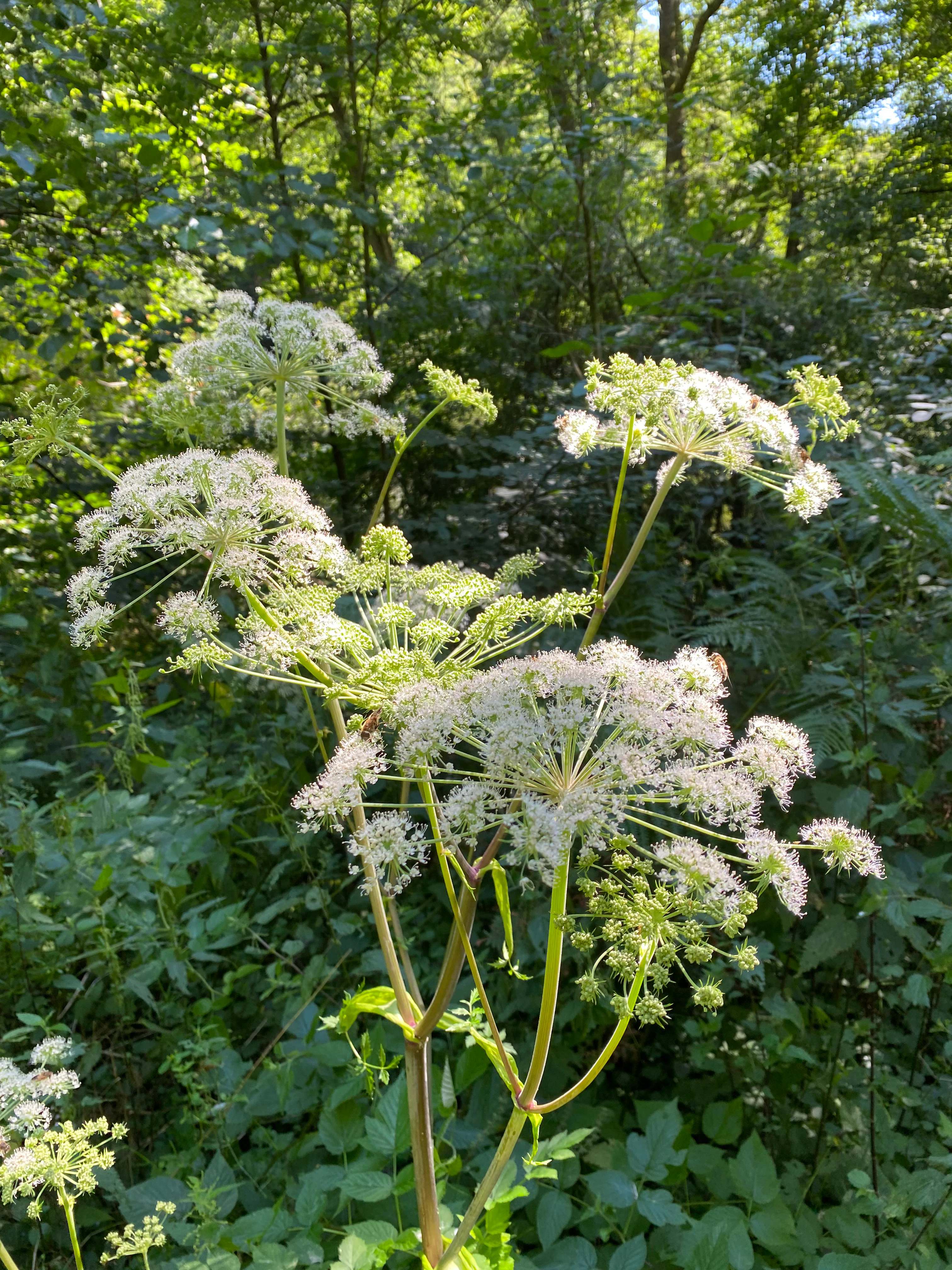
A close up view of white umbel flower clusters of Wild Angelica, Angelica sylvestris, growing against a backdrop of dense green forest foliage.
Wild Angelica blooms within the lush vegetation of the Alemigsiefental nature reserve.

Naturschutzgebiet Alemigsiefental wildlife and species highlights

The reserve serves as habitat for species associated with clean, undisturbed flowing waters and with intact wetland vegetation. Its significance lies less in the presence of single charismatic species and more in its function as a refuge for the broader community of organisms tied to small Bergisches streams and their accompanying floodplain vegetation. The marshy and wet meadow habitats, together with the wooded slopes, support a diverse insect fauna, which in turn provides feeding conditions for a wider range of animal life along the valley.
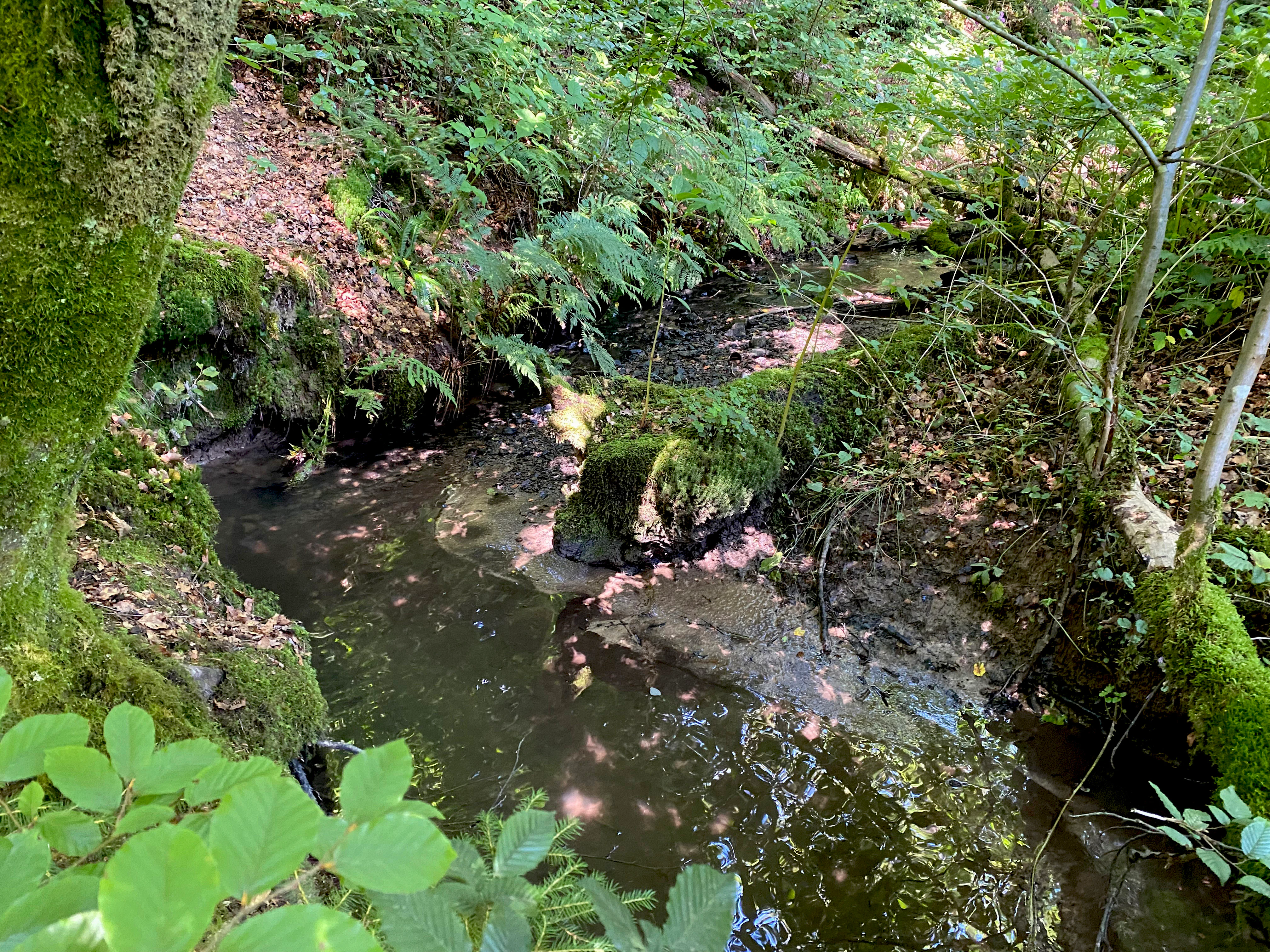
A small, dark-watered forest stream flows through a shaded, moss-covered woodland area with dense green ferns and foliage.
A tranquil section of a stream flowing through the lush vegetation of the Alemigsiefental nature reserve.

Naturschutzgebiet Alemigsiefental conservation status and protection priorities

Designated as an IUCN Category IV protected landscape, a habitat and species management area, the reserve's conservation mandate focuses on preserving a defined suite of protected biotopes. These include alder and ash floodplain woodland, swamp and marsh forest, swampy areas, reed beds, sedge- and rush-dominated wet meadows, spring zones, and natural or near-natural sections of flowing and standing freshwater.

Beyond the direct protection of these habitats, the reserve plays a role in regional biotope connectivity. It functions as a high-priority corridor element within the Bergisches Land stream network, linking ecologically with the adjacent Dürschbachtal reserve and helping sustain habitat continuity for plant and animal populations that depend on valley-floor environments. Land-use restrictions around the reserve are part of the management strategy, including prohibitions on storing or applying liquid manure on neighbouring land, which helps safeguard the water quality of the stream and its sensitive floodplain vegetation. A persistent management challenge is the spread of invasive Himalayan balsam and the encroachment of scrub following the abandonment of traditional grassland use.

Top sights and standout views in Naturschutzgebiet Alemigsiefental

The reserve's defining qualities are its compact yet structurally complete valley sequence, from two converging spring heads through beech forested slopes to a diverse floodplain of wet meadows, reeds, and softwood forest. Its role as part of a connected network of stream-valley reserves, linking directly with the Dürschbachtal, gives it significance well beyond its modest size. The combination of clean flowing water, intact spring zones, and a documented range of protected biotope types makes it a representative reference site for Bergisches Land valley ecology.
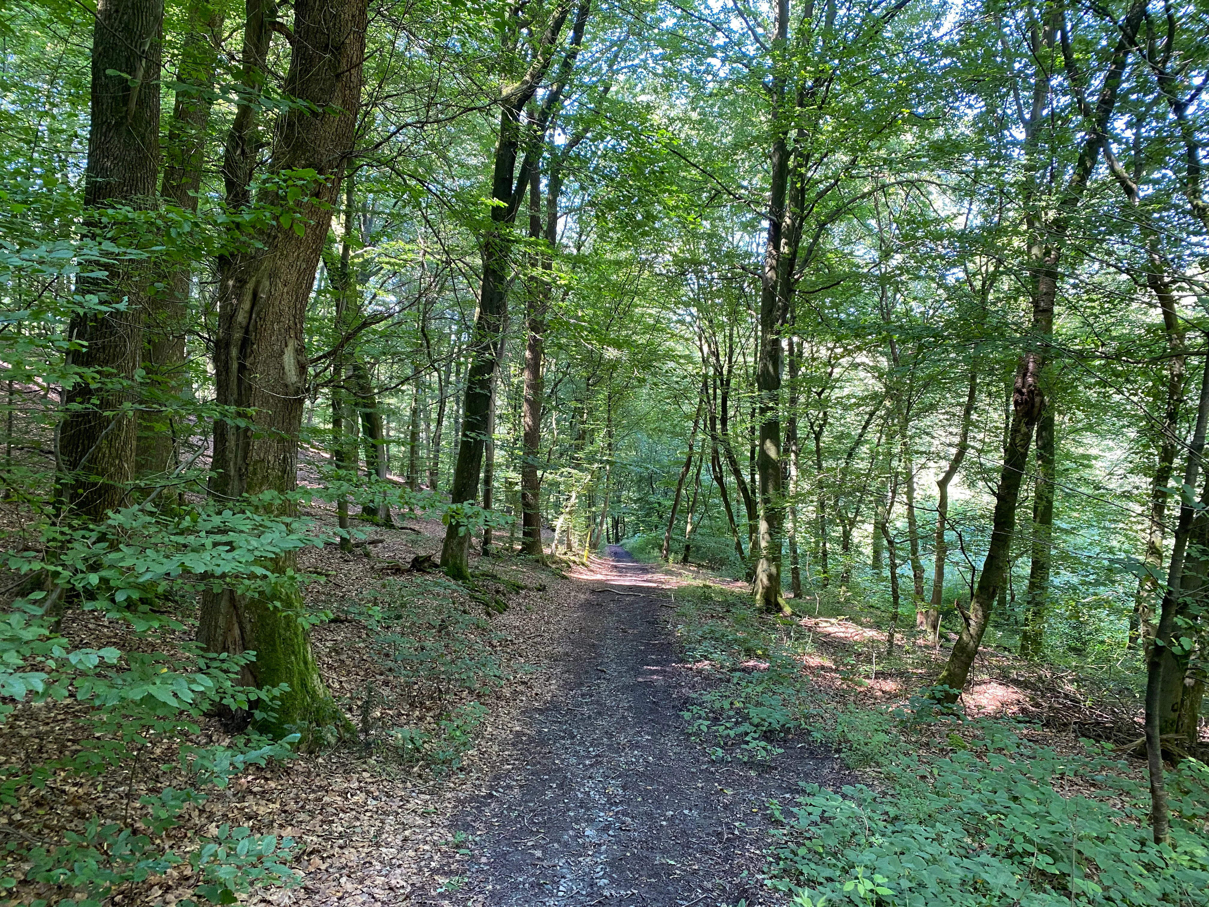
A dirt hiking trail leads through a sun-dappled, leafy green forest with tall trees and thick foliage.
A narrow trail winds through the dense deciduous forest of the Alemigsiefental nature reserve.

Best time to visit Naturschutzgebiet Alemigsiefental

The valley is most atmospheric in late spring and summer, when the floodplain tall herb communities and wet meadows are in full growth, woodland angelica is attracting insects along the stream, and the beech canopy above the mid-valley is in leaf. Early summer also tends to be the most visually expressive period for the marsh vegetation along the valley floor. The reserve remains accessible on foot throughout the year via the regional hiking trail network, but warmer months offer the richest experience of its botanical and ecological character.

Monthly climate preview

Long-term monthly temperature and precipitation rhythm for Nordrhein-Westfalen protected terrain

Naturschutzgebiet Alemigsiefental Climate Normals and Temperature Patterns

Representative coordinate records show measured monthly temperature variation from subzero winter minima to warm summer maximums alongside consistent precipitation throughout the year. Examining the full twelve-month profile provides complete historical averages for detailed climate comparison.
Annual mean9 °C
0 °C18 °C
Jan
Feb
Mar
Apr
May13°
Jun16°
Jul18°
Aug18°
Sep14°
Oct
Nov
Dec
Warmest month
July

18.3 °C

Coolest month
January

0.3 °C

Wettest month
December

3 mm/day

Driest month
April

1.8 mm/day

Park location guide

Geography guide, regional context, and park location map for Naturschutzgebiet Alemigsiefental

Naturschutzgebiet Alemigsiefental park geography, regions, and map view in Germany

Understand where Naturschutzgebiet Alemigsiefental sits in Germany through a broader geographic reading of the surrounding landscape, nearby location context, and its mapped position within the national park landscape.

How Naturschutzgebiet Alemigsiefental fits into Germany

Germany is a federal republic in Western and Central Europe with a population of over 83 million across sixteen constituent states. It is Europe's largest economy by nominal GDP and a major global exporter and importer. The capital is Berlin, and the country borders Denmark, Poland, Czech Republic, Austria, Switzerland, France, Luxembourg, Belgium, and the Netherlands.

Wider geography shaping Naturschutzgebiet Alemigsiefental in Germany

Germany is located in Western and Central Europe, spanning 357,022 km². It borders Denmark to the north, Poland and the Czech Republic to the east, Austria and Switzerland to the south, and France, Luxembourg, Belgium, and the Netherlands to the west. The country has coastlines on the Baltic Sea and North Sea to the north, with the Alps located in the southern region.

Map view of Naturschutzgebiet Alemigsiefental

Use this park location map to pinpoint Naturschutzgebiet Alemigsiefental in Germany, understand its exact geographic position, and read its mapped placement within the surrounding landscape more clearly.

Pigeon | © OpenStreetMap contributors

Location context for Naturschutzgebiet Alemigsiefental

Nordrhein-Westfalen

Visualizing the terrain, spring-fed streams, and protected habitats of the Bergisches Land reserve

Naturschutzgebiet Alemigsiefental Landscape Photos and Protected Valley Scenery

Examine detailed visual documentation of Naturschutzgebiet Alemigsiefental to understand its unique V-shaped valley terrain and riparian woodland habitats. Photographic records reveal the characteristic interplay of wet meadows, forested slopes, and freshwater streams across the protected landscape.

A small, narrow stream flowing between moss-covered tree trunks in a forest setting.

A close-up vertical shot of a Marsh woundwort plant with small purple flowers blooming on a spiked stem against a blurred green background.

A view of a grassy meadow slope framed by trees, with a forested hillside in the background under a clear blue sky.

A close up view of white umbel flower clusters of Wild Angelica, Angelica sylvestris, growing against a backdrop of dense green forest foliage.

A small, dark-watered forest stream flows through a shaded, moss-covered woodland area with dense green ferns and foliage.

A dense, green forest scene featuring dappled sunlight filtering through tall deciduous trees onto a small, low-lying stream and thick undergrowth.

A dirt hiking trail leads through a sun-dappled, leafy green forest with tall trees and thick foliage.

A close-up view of a sloping forest floor carpeted in green moss and various types of ferns, with dappled sunlight filtering through the trees.

A dirt hiking trail stretches into the distance, flanked by dense green deciduous trees and wildflowers under a clear blue sky.

A dirt hiking trail leads into a dense green forest, with a lone hiker visible in the distance.

A small, narrow stream flowing through a dense, mossy deciduous forest in the Alemigsiefental nature reserve.

A wide view of a valley in the Alemigsiefental nature reserve, featuring a foreground of green meadow, a wire fence, and a background of dense, deciduous woodland in early spring.

Park atlas

Compare regional stream valleys and protected natural areas across the Bergisches Land

Other Parks Near Naturschutzgebiet Alemigsiefental And Connected Protected Landscapes

Browsing other parks near Naturschutzgebiet Alemigsiefental reveals connected stream networks and similar valley reserves across the surrounding region. Comparing these protected landscapes highlights regional geography and provides broader context for local freshwater habitats.
Nature reserveNorth Rhine-Westphalia
About 1 km away#1 closest

East

Naturschutzgebiet Ölsiefental Protected Area and Stream Valley Map in North Rhine-Westphalia

Representative valley landscape with moist deciduous forest and spring mire habitats

Naturschutzgebiet Ölsiefental preserves a compact yet diverse mosaic of brook, swamp, and floodplain forest. This protected area in North Rhine-Westphalia follows the Ölsiefen stream from its source to the Sülz river, providing a valuable study of intact valley relief, wet meadow ecology, and historical coppice woodland management in the Bergisches Land region.

Area
0.05 km²
Established
1990
IUCN
IV
Nature reserveRheinisch-Bergischer Kreis
About 4.3 km away#2 closest

Northeast

Naturschutzgebiet Olpebachtal: Nature Reserve and Protected Stream Valley Geography

A protected landscape mosaic in Rheinisch-Bergischer Kreis

Naturschutzgebiet Olpebachtal protects a unique, near-natural section of the Olpebach stream valley. Characterized by wide floodplains, wet meadows, and narrow tributary ravines, the reserve functions as a critical habitat linkage within the rolling terrain of the Bergische Hochflächen. Its geography provides a clear window into the stream-floodplain systems that define the natural character of the broader region.

Area
0.251 km²
Established
1990
IUCN
IV
Nature reserveNordrhein-Westfalen
About 5.3 km away#3 closest

Northwest

Naturschutzgebiet Scherfbachtal: Protected Stream Valley and Spring Landscape Analysis

Regional protected geography in Nordrhein-Westfalen

Delve into the protected terrain of Naturschutzgebiet Scherfbachtal, which preserves a rare network of spring basins, wet meadows, and floodplain forests. This site exemplifies the ecological value of small, interconnected valley habitats within the wider Bergisches Land region of North Rhine-Westphalia, providing essential sanctuary for local stream-dependent ecosystems.

Established
2012
IUCN
IV
A soft watercolor painting of a pastoral landscape featuring a stream flowing through green meadows and gentle hills under a pale sky.
Nature reserveRheinisch-Bergischer Kreis
About 7 km away#4 closest

Northwest

Naturschutzgebiet Scherfbachtal (Odenthal) Protected Area and Stream Valley Map

A preserved riparian landscape in Rheinisch-Bergischer Kreis.

Naturschutzgebiet Scherfbachtal (Odenthal) represents a well-preserved nature reserve spanning five sections of the Scherfbach stream corridor. The area encompasses diverse ecosystems including near-natural meandering brooks, floodplain forests, and steep Siefen side valleys. This protected landscape is defined by its high habitat connectivity, providing a vital network of springs, marshy meadows, and mature woodlands within the Bergisches Land geography.

Area
1.053 km²
Established
1994
IUCN
IV
A horizontal watercolor painting showing a peaceful river valley with green meadows, trees on both sides, and soft rolling hills in the background under a warm sky.
Nature reserveRheinisch-Bergischer Kreis
About 9.5 km away#5 closest

Northwest

Naturschutzgebiet Pfengstbach: Protected Brook Valley and Meadow Landscape Analysis

Regional geography and natural valley terrain of Rheinisch-Bergischer Kreis

Analyze the structural integrity of the Naturschutzgebiet Pfengstbach brook valley, featuring a detailed look at its riparian woodland, seepage springs, and wet meadow distribution. This protected area offers a precise example of Bergisches Land valley morphology, where meadow floors and mixed deciduous slopes intersect within a significant Natura 2000-linked conservation corridor.

Area
18.6 km²
Established
1994
IUCN
IV
Relief
Upland
A soft watercolor illustration of a landscape with green forest tree lines in the foreground, wetland grasses, and pale rolling hills in the background against a white sky.
Nature reserveNordrhein-Westfalen
About 9.6 km away#6 closest

Southeast

Naturschutzgebiet Schlingenbachtal: Protected Stream Valley and Floodplain Geography

A vital riparian habitat reserve in Nordrhein-Westfalen, Germany

Naturschutzgebiet Schlingenbachtal protects a nearly complete stream-valley ecosystem, featuring an intricate network of wet meadows, alder carr, and forested slopes. By preserving the natural course of the Schlingenbach, the reserve functions as an essential node within regional habitat networks, offering a distinct study in riparian geography and forest land management.

Area
0.689 km²
Established
1988
IUCN
IV
A horizontal watercolor illustration depicting rolling hills, forest patches, and a soft, hazy valley against a white background.
Nature reserveNorth Rhine-Westphalia
About 11 km away#7 closest

North

Mausbachtal Nature Reserve in North Rhine-Westphalia: Protected Stream Valley and Forest Landscapes

Regional stream valley network and deciduous forest landscape

This protected area in the Oberbergischer Kreis offers a window into the Bergische Hochflächen topography. The reserve highlights a mosaic of near-natural beech forest, wet meadows, and floodplain woodland, forming an integral link in the regional stream network connected to the Große Dhünn.

Area
0.237 km²
Established
2013
IUCN
IV
Watercolor painting of a rolling landscape with soft green hills, forest patches, and a winding stream.
Nature reserveGermany
About 11 km away#8 closest

Northeast

Schwarzenbachtal Nature Reserve: Regional Protected Landscape and Stream Valley Atlas

A mapped overview of protected habitats in North Rhine-Westphalia

Schwarzenbachtal serves as a vital protected area in Germany, defined by its elongated brook valley and intricate transitions between wet meadows and dry grassland mosaics. As part of the Bergisches Land stream network, this nature reserve illustrates the ecological significance of small-scale valley landscapes and their role in regional conservation geography.

Area
0.082 km²
Established
2013
Relief
Upland
Climate
Temperate

Common questions about visiting, size, designation, and location context for Naturschutzgebiet Alemigsiefental

Naturschutzgebiet Alemigsiefental FAQs for park facts, access, geography, and protected area context

Find quick answers about Naturschutzgebiet Alemigsiefental, including protected-area facts, park geography, trail and visitor context, and how the park fits into its surrounding country and regional landscape.
MoriAtlas Explorer

Continue Your Protected Areas Search Across the Global Atlas

Deepen your exploration by continuing the structured search for national parks and protected areas worldwide. Utilize the comprehensive filtering capabilities to compare different conservation landscapes and refine your understanding of global park geography. Discover more about the distribution and characteristics of protected natural areas.

Global natural geography