
Mori Atlas logo
Nature reserveNaturschutzgebiet Kahle Pön bei Usseln

A rare Atlantic-Nordic botanical reserve preserved through traditional conservation grazing techniques

Naturschutzgebiet Kahle Pön bei Usseln: Mapping the Highland Heath Landscapes of Hessen

Naturschutzgebiet Kahle Pön bei Usseln preserves a distinct highland heath plateau located in the Hessian Upland near the border with North Rhine-Westphalia. This thirty-five hectare nature reserve maintains rare Atlantic-Nordic vegetation, including bilberry and arnica, through active management and conservation grazing with Heidschnucken sheep. The site forms a crucial part of a broader regional network of open heath ecosystems, characterized by its mosaic of peat-bog pockets and forest-free ridges that contrast sharply with surrounding wooded terrain.

highland heathBergheideAtlantic-Nordic vegetationnature reserveFFH siteUpland landscape
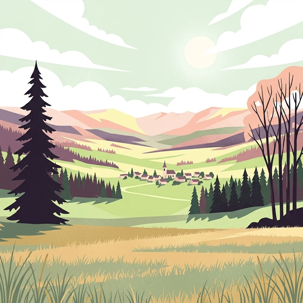
Stylized digital illustration of a valley with a small village in the distance, surrounded by rolling hills, spruce trees, and grassy meadows under a sunny sky.

Naturschutzgebiet Kahle Pön bei Usseln

Nature reserve

Park overview

Structured park overview, official facts, and landscape profile for Kahle Pön bei Usseln Nature Reserve

Kahle Pön bei Usseln Nature Reserve park facts, protected area profile, and essential visitor context

Review the core facts for Kahle Pön bei Usseln Nature Reserve, including designation, size, terrain, visitor scale, habitats, and operating context in one park-focused overview.

About Kahle Pön bei Usseln Nature Reserve

Kahle Pön bei Usseln occupies a ridge above the village of Usseln in Willingen, in the northern part of the Hessian Upland, where the landscape transitions into the Rothaargebirge of North Rhine-Westphalia. The name Kahle Pön refers to a formerly bare, or kahl, summit; the local dialect form Pön hints at the open, exposed character of the hilltop. Although modest in size, the reserve contains one of the better-developed examples of Bergheide, or highland heath, left in the area and is ecologically tied to other similar sites across the state border.

At the heart of the reserve, the highland heath habitat covers roughly half of the protected area. Although species-poor compared with lowland heaths, it includes typical dwarf shrub species, such as common heather, blueberry, cowberry, clubmoss, and arnica, that together define a plant community known as a Preiselbeer-Besenheide-Gesellschaft. The vegetation type is characteristic of cooler, moister, Atlantic-influenced upland climates and is a signature feature of the Upland's natural character.

The remaining half of the reserve is made up of grassland that, in many places, is used quite intensively. Remnants of matgrass swards, once indicators of long-ago grazing pressure, survive only in small patches. In the southwest, a compact lowland bog complex adds a second distinct ecological layer to the site, with brown sedge grassland, raised peat moss covers, and willow scrub. The total area is small, only about 35 hectares, but the juxtaposition of habitat types within a single protected perimeter is what gives Kahle Pön its particular conservation value.

The reserve lies close to the Hessian-North Rhine-Westphalian border and is in direct spatial and ecological contact with the neighbouring Kahle Pön reserve across the state line, as well as with other open heath sites in the Upland. Together these form a network of Atlantic-Nordic heath habitats that are exceptionally rare in this part of central Germany and are a focus of regional conservation management.

Quick facts and research context for Kahle Pön bei Usseln Nature Reserve

Kahle Pön bei Usseln is a designated nature reserve centered on a highland heath plateau south of Usseln in the municipality of Willingen, in the Waldeck-Frankenberg district of the German state of Hesse. The reserve covers roughly 35 hectares and was formally designated in 1987, primarily for its botanical significance. It carries the German nature reserve identifier 1635028 and is registered in the World Database on Protected Areas under WDPA ID 163969.

The site is also a European Fauna-Flora-Habitat area, listed as DE-4718-302, which aligns with the boundaries of the national nature reserve. It lies inside the Diemelsee Nature Park, and its southern boundary coincides with the state border between Hesse and North Rhine-Westphalia, where it borders the related Kahle Pön reserve on the other side of the line. The vegetation is classed as Atlantic-Nordic and is typical of the highland heaths, or Bergheiden, of the wider Upland region.

Protection and recognition

Examine official records, management scope, and documented designation data.

Naturschutzgebiet Kahle Pön bei Usseln Protection Status and Documentation

Protected area records for Naturschutzgebiet Kahle Pön bei Usseln compile available conservation statuses and administrative registry details. Systematic database entries provide verified baseline facts regarding designated regional boundaries.

Protection details

WDPA ID
163969
Park context

Deeper park guide and search-rich context for Kahle Pön bei Usseln Nature Reserve

Kahle Pön bei Usseln Nature Reserve history, landscape, wildlife, and travel context

Explore Kahle Pön bei Usseln Nature Reserve through its history, landscape character, ecosystems, wildlife, conservation priorities, cultural context, and seasonal travel timing in a structured park guide built for atlas discovery and search intent.

Why Kahle Pön bei Usseln Nature Reserve stands out

Kahle Pön is best known for being one of the well-preserved highland heath landscapes of the central German Upland, where Atlantic-Nordic plant communities such as crowberry-heather, bilberry, and arnica still survive on a former beech woodland plateau. The reserve demonstrates how centuries of grazing, sod cutting, and later abandonment created a distinctive open heath, and how modern conservation grazing with Heidschnucken sheep and goats has been used to bring it back. It is also valued for the small but ecologically interesting mix of habitats compressed into a compact area: acidic highland heath, intensively used grassland, and a small lowland bog, or Niedermoor, complex in the southwest corner with cottongrass, sedges, and peat mosses. The combination of protected status as both a national nature reserve and a European Habitats Directive site gives the location particular botanical and ecological weight in the region.
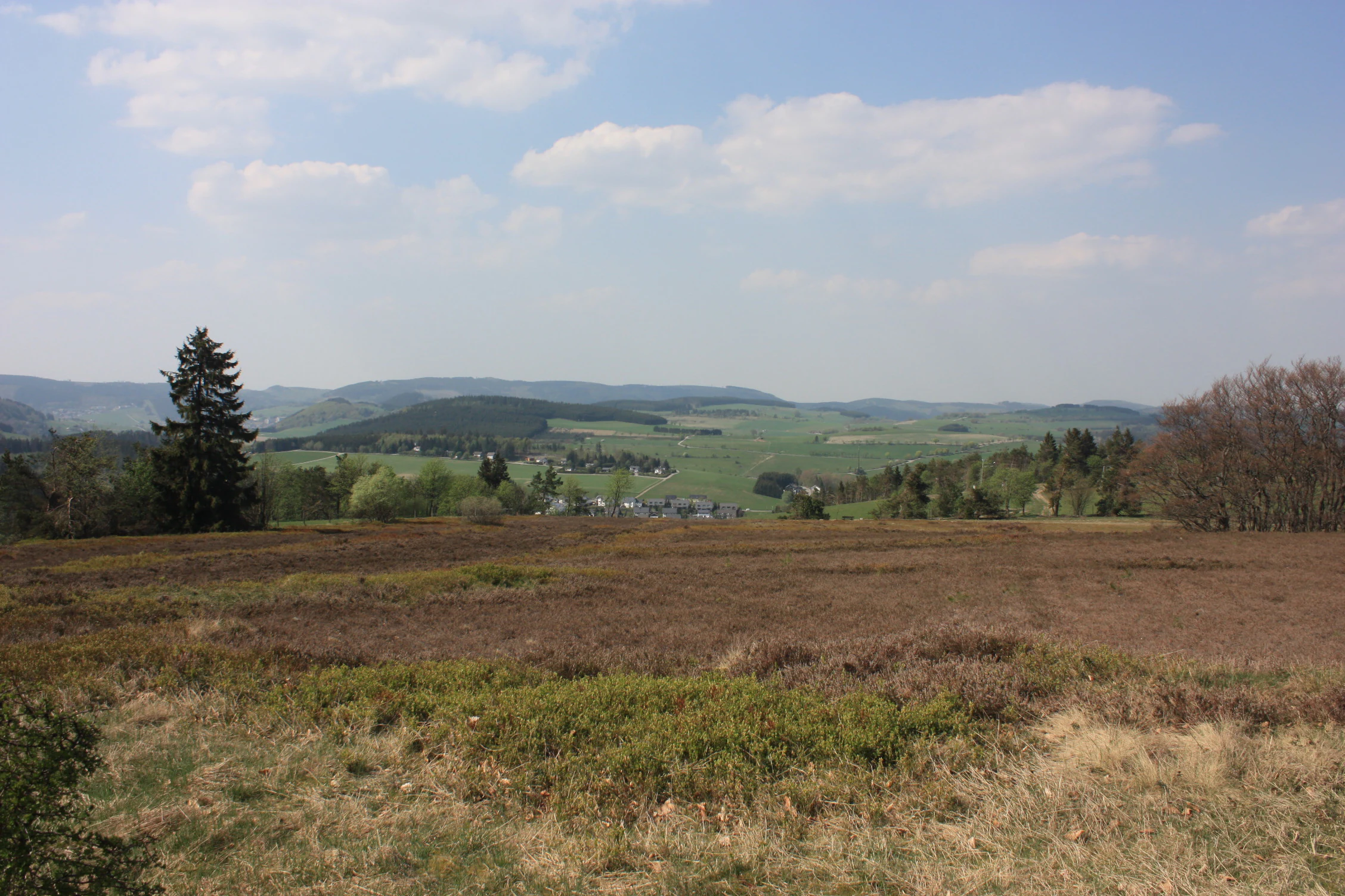
A wide, eye level landscape view of a brown and green heathland field in the foreground, with rolling hills and a small town in the distant valley under a cloudy sky.
A wide view of the heathland landscape in Naturschutzgebiet Kahle Pön bei Usseln.

Kahle Pön bei Usseln Nature Reserve history and protected-area timeline

The landscape of the Kahle Pön has been shaped by human activity for centuries. What is now an open highland heath originated as beech forest that was gradually cleared and converted through long-term grazing by cattle and the traditional practice of Plaggen, or sod cutting, in which small slices of turf were removed to use as bedding and field fertilizer. By the early twentieth century the hilltop had become essentially tree-free, and local herders used the open plateau as grazing land for cattle.

This traditional land use came to an end around the early 1950s, when herding on the Kahle Pön was abandoned. Without grazing, parts of the area were planted with spruce, and spruce also spread naturally into other sections by seed. The shift from open heath back to woodland threatened the very character of the landscape that had developed through past human activity.

In recognition of the area's botanical significance, the state of Hesse designated the Kahle Pön as a nature reserve in 1987. Since then the reserve has been managed actively to return it to an open heath condition. Encroaching spruce has been removed as part of ongoing care, while the open grassland and heath areas are grazed by Heidschnucken sheep, a traditional heath breed from the Lüneburg Heath region, along with goats, kept by the Bigger Josefsheim of the Josefs-Gesellschaft. To mimic the historical sod-cutting influence, specially developed cutting machines are also used on parts of the area to expose raw soil where heather species can regenerate. The reserve was also later recognized as a European Fauna-Flora-Habitat area, integrating it into the wider European ecological network.

Kahle Pön bei Usseln Nature Reserve landscape and geographic character

The Kahle Pön forms a relatively open hilltop and slope above Usseln in the Upland region, providing sweeping views across the village and toward the nearby Schneeberg and the ridge of the Dreis, including the Hoher Eimberg. The terrain is shaped by the underlying upland geology of Hesse and the gentle relief typical of the Waldeck-Frankenberg area, with a high plateau flanked by sloping edges.

The defining landscape feature is the open, formerly tree-free heathy plateau that gives the site its name. Today it appears as a mosaic of low heath vegetation, intensively used grassland, scattered woodland, and a small boggy hollow in the southwestern corner. The result is a varied but compact landscape where open and lightly wooded areas alternate within the small perimeter of the reserve.

The site's position, directly on the state border between Hesse and North Rhine-Westphalia, means that the protected landscape continues as a similar reserve on the other side of the line. Together with other highland heaths of the Upland, the Kahle Pön contributes to a broader open-heath landscape character that would otherwise be increasingly obscured by forest regrowth.

Kahle Pön bei Usseln Nature Reserve ecosystems, habitats, and plant life

Ecologically, Kahle Pön is defined by its highland heath, or Bergheide, and by the cool, moist Atlantic-Nordic conditions under which this vegetation develops. The flora of the heath is not particularly rich in species, but it includes a distinctive set of dwarf shrubs and herbs that mark this habitat type: common heather (Calluna vulgaris), bilberry, cowberry, clubmoss, and arnica. The plant community is described in plant sociological terms as a Preiselbeer-Besenheide-Gesellschaft.

Beyond the heath core, the reserve contains two further ecological elements. One is intensively used grassland, which forms much of the second half of the protected area; this has largely replaced the former species-rich Borstgras-Rasen, or matgrass swards, that historically indicated grazing pressure and that today survive only as small relict patches. The other is a compact lowland bog complex in the southwest, featuring brown sedge swards, raised peat moss layers, and willow thickets. This bog supports marsh-loving species such as cottongrass, marsh willowherb, yellow sedge, common sedge, and marsh valerian, adding an entirely different ecological signal to a relatively small site.

Because the reserve coincides with a European Habitats Directive site, DE-4718-302, the habitats and species it contains are considered important in a European context, not just a strictly regional one. The Atlantic-Nordic character of the vegetation connects the Kahle Pön to highland heath landscapes far to the north and west of Germany and underlines why it has been singled out for protection.

Kahle Pön bei Usseln Nature Reserve wildlife and species highlights

The wildlife of Kahle Pön reflects the mix of open heath, grassland, and bog on the small reserve. Bird surveys in 2002 recorded 46 breeding bird species, including notable heath and scrub-edge specialists. Among the more significant records are single breeding pairs of great grey shrike and red-backed shrike, alongside twelve territories of tree pipit and six territories of meadow pipit, reflecting the open, semi-structured landscape typical of heath habitats.

The invertebrate fauna of the reserve is also of conservation interest. Surveys recorded 68 butterfly species and 16 beetle species within the reserve boundaries. Among grasshoppers, the reserve is home to eight species, including the short-winged buzzard cricket, a species considered threatened in Germany that finds suitable warm, open conditions in the heath-grass mosaic.

The grazing animals themselves have become part of the ecological system. Heidschnucken sheep and goats, brought in by the Bigger Josefsheim since 1987, fulfill the same ecological role that traditional livestock once played in maintaining the open heath. By keeping grass and young trees short and by creating patches of bare ground, they help sustain the conditions needed for heath plants, breeding birds, and invertebrates associated with this landscape.

Kahle Pön bei Usseln Nature Reserve conservation status and protection priorities

Kahle Pön bei Usseln is significant from a conservation perspective because it represents a habitat type, highland heath with an Atlantic-Nordic vegetation character, that has become rare both in Hesse and in the wider central German uplands. The original process that created the heath was the centuries-long grazing and sod cutting of former beech woodland, and the protection of the resulting open landscape is regarded as a way of preserving the visible legacy of this long land-use history.

Formally, the reserve carries IUCN Category IV status, denoting a habitat and species management area, which reflects its focus on active conservation management rather than strict non-intervention. It carries the identifier 1635028 in Hesse and WDPA ID 163969 in the World Database on Protected Areas. Its boundaries are identical to those of the European Habitats Directive site DE-4718-302, the FFH-Gebiet Kahle Pön bei Usseln, ensuring that national and European conservation designations cover exactly the same ground.

Practical conservation work is centered on maintaining the open character of the heath. Encroaching spruce is removed, grasslands are kept open through grazing with Heidschnucken and goats, and mechanical sod-cutting tools are used to mimic the historical Plaggen technique, creating bare patches where heather species can regenerate. Because the reserve is in spatial and functional contact with other highland heaths, both within the Upland in Hesse and across the state border in North Rhine-Westphalia, it is treated as a key node in a wider regional conservation network for this habitat type.

Kahle Pön bei Usseln Nature Reserve cultural meaning and human context

Although the Kahle Pön is now framed primarily as an ecological site, the reserve has a strong cultural and land-use history that is still visible in its management. The open heath originated as beech forest that was gradually transformed through centuries of grazing by cattle herders and through the traditional Plaggen, or sod-cutting, practice that was once common across many parts of northern Germany. By the early twentieth century, the summit was essentially open pasture used by local herdsmen.

The language and naming around the reserve also reflect this regional culture. Kahle Pön itself is a dialect form in which Kahle means bare, and Pön refers to a kind of exposed, elevated place in local speech. Today's conservation grazing, undertaken by a social institution, the Bigger Josefsheim of the Josefs-Gesellschaft, links the modern management of the site to both local agricultural traditions and the region's social history, even as the work itself is framed as ecological habitat management.

Top sights and standout views in Kahle Pön bei Usseln Nature Reserve

One of the key highlights of Kahle Pön bei Usseln is the rare, almost intact Bergheide vegetation that gives the reserve its place in regional conservation, with communities of bilberry, cowberry, arnica, and heather developed on the old plateau above Usseln. A second is the fascinating situation at the state border: the reserve shares its name and habitat type with a sister site just across the line in North Rhine-Westphalia, making it part of a transboundary heath landscape. A third is the practical combination of conservation grazing with Heidschnucken sheep and goats and mechanical sod cutting, which keeps the open heath character alive in one of the more intensively forested regions of Germany.

Best time to visit Kahle Pön bei Usseln Nature Reserve

Because Kahle Pön is a botanical and ecological site rather than a developed visitor attraction, the most rewarding times to visit follow the rhythm of the heath landscape itself. Late summer and early autumn, when common heather is in bloom, is a particularly good period for experiencing the character of the Bergheide and for observing heath-associated insects. Late spring and early summer can be rewarding for birdlife, when breeding birds such as tree pipits, meadow pipits, and shrikes are active in the open, mosaic habitats. Cool, clear weather tends to suit the small site best, since the open plateau is exposed; underfoot, the mix of heath, grassland, and boggy ground can be wet after rain in any season.

Monthly climate preview

Long term temperature ranges and monthly precipitation patterns across representative terrain

Naturschutzgebiet Kahle Pön bei Usseln Climate and Average Temperatures

Representative coordinate records show measured monthly temperature variation alongside steady precipitation levels throughout the year. Examining the full twelve month climate profile reveals detailed thermal extremes and precipitation normals for geographic analysis.
Annual mean9 °C
0 °C18 °C
Jan
Feb
Mar
Apr
May12°
Jun15°
Jul18°
Aug18°
Sep14°
Oct
Nov
Dec
Warmest month
July

18 °C

Coolest month
January

-0.2 °C

Wettest month
July

2.6 mm/day

Driest month
April

1.7 mm/day

Park location guide

Geography guide, regional context, and park location map for Kahle Pön bei Usseln Nature Reserve

Kahle Pön bei Usseln Nature Reserve park geography, regions, and map view in Germany

Understand where Kahle Pön bei Usseln Nature Reserve sits in Germany through a broader geographic reading of the surrounding landscape, nearby location context, and its mapped position within the national park landscape.

How Kahle Pön bei Usseln Nature Reserve fits into Germany

Germany is a federal republic in Western and Central Europe with a population of over 83 million across sixteen constituent states. It is Europe's largest economy by nominal GDP and a major global exporter and importer. The capital is Berlin, and the country borders Denmark, Poland, Czech Republic, Austria, Switzerland, France, Luxembourg, Belgium, and the Netherlands.

Wider geography shaping Kahle Pön bei Usseln Nature Reserve in Germany

Germany is located in Western and Central Europe, spanning 357,022 km². It borders Denmark to the north, Poland and the Czech Republic to the east, Austria and Switzerland to the south, and France, Luxembourg, Belgium, and the Netherlands to the west. The country has coastlines on the Baltic Sea and North Sea to the north, with the Alps located in the southern region.

Map view of Kahle Pön bei Usseln Nature Reserve

Use this park location map to pinpoint Kahle Pön bei Usseln Nature Reserve in Germany, understand its exact geographic position, and read its mapped placement within the surrounding landscape more clearly.

Pigeon | © OpenStreetMap contributors

Location context for Kahle Pön bei Usseln Nature Reserve

Hessen

Visual exploration of upland heath terrain, Atlantic-Nordic vegetation, and protected habitats

Naturschutzgebiet Kahle Pön bei Usseln Photos and Landscape Scenery

Visual documentation of Naturschutzgebiet Kahle Pön bei Usseln reveals the open highland heath plateau, rare Atlantic-Nordic vegetation, and protected upland terrain. Examining these photographs allows researchers and visitors to understand the ecological character and landscape mosaic of this central German reserve.

A wide, eye level landscape view of a brown and green heathland field in the foreground, with rolling hills and a small town in the distant valley under a cloudy sky.

Park atlas

Compare nearby upland reserves, highland heaths, and connected conservation areas across the region

Other Parks Near Naturschutzgebiet Kahle Pön bei Usseln And Surrounding Protected Landscapes

Browse protected areas and regional nature reserves situated close to Naturschutzgebiet Kahle Pön bei Usseln. Comparing adjacent upland habitats provides a broader geographic view of central German conservation landscapes.
Nature reserveHochsauerlandkreis
About 2.1 km away#1 closest

East

Naturschutzgebiet Osterntal: Protected Valley Mosaic and Regional Geography

Explore nature reserve boundaries and ecological terrain in Hochsauerlandkreis.

Naturschutzgebiet Osterntal protects a distinct valley mosaic in the eastern Sauerland, featuring rare wet grasslands and nutrient-poor meadows. This nature reserve provides essential habitat connectivity within the broader European Bird Protection Area, showcasing the region's managed pastoral landscape and varied topography.

Area
0.064 km²
Established
2003
Relief
Upland
Climate
Temperate
Nature reserveHesse
About 2.3 km away#2 closest

North

Naturschutzgebiet Osterkopf bei Usseln: Protected Highland Heath and Upland Landscape

Hesse nature reserve with Atlantic-Boreal botanical features

Located in the Upland highlands of northern Hesse, this protected area features rare summit heath and species-rich mountain meadows. The reserve represents a functional link in the regional network of highland ecosystems, preserving specialized habitats characterized by mat-grass swards and an unusual northern vegetation profile.

Area
0.357 km²
Established
1982
IUCN
IV
Relief
Mountain
Nature reserveHochsauerlandkreis
About 2.7 km away#3 closest

South

Naturschutzgebiet Almecke: Geographic Atlas and Protected Landscape Overview

A preserved hedgerow mosaic in the Hochsauerlandkreis region.

Naturschutzgebiet Almecke is a significant nature reserve characterized by its formal inclusion in the European bird protection area network. The site offers a concentrated look at traditional cultural landscapes, specifically the interaction between steep valley topography, contour-following hedgerows, and dry upland pastures. This protected area serves as an essential case study in localized conservation geography and habitat structure within the wider Sauerland region.

Area
0.058 km²
Established
2003
Relief
Upland
Scope
Terrestrial
Nature reserveWaldeck-Frankenberg
About 3.5 km away#4 closest

West

Naturschutzgebiet Jägers Weinberg: Geographic Profile of a Protected Upland Wetland

A mapped nature reserve in the Waldeck-Frankenberg district of northern Hesse

Naturschutzgebiet Jägers Weinberg is a protected wetland landscape in northern Hesse, Germany. This area preserves a rare combination of raised bog and birch swamp forest, functioning as a vital botanical refuge in the Waldeck-Frankenberg district. Its mapped boundaries highlight a specialized ecological site that offers clear insights into the micro-topography and natural history of the local Upland terrain.

Area
0.254 km²
Established
1979
IUCN
IV
Relief
Upland
A watercolor-style digital illustration of a gentle, rolling green landscape with a winding path and distant hills on a white background.
Nature reserveWaldeck-Frankenberg
About 3.6 km away#5 closest

West

Naturschutzgebiet Grebensteine bei Willingen: Protected Forest and Rock Outcrop Atlas

Ecological mapping of the Itter valley gorge forest in Waldeck-Frankenberg

This nature reserve protects a rare, near-primary gorge forest (Schluchtwald) in northern Hesse. Its steep slopes are characterized by isolated rock outcrops, boulder-rich substrates, and springs that foster high botanical diversity. The site serves as a critical example of upland forest conservation within the larger protected landscape of the Rothaargebirge foothills and the Diemelsee Nature Park.

Area
0.157 km²
Established
1985
IUCN
IV
Relief
Mountain
A horizontal watercolor painting depicting a soft, pastel-colored landscape with rolling hills in the background, a line of trees in the midground, and a small winding stream or boggy area in the foreground.
Nature reserveHessen
About 3.9 km away#6 closest

West

Naturschutzgebiet Alter Hagen bei Willingen: Protected Nature Reserve and Wetland Atlas

Landscape and geographic overview in the Hessen region

Naturschutzgebiet Alter Hagen bei Willingen covers a significant floodplain system in the Hessen uplands. This nature reserve serves as a critical habitat for diverse butterfly communities and relict woodland flora, centered on the headwaters of the River Itter. Its mix of swamps, bogs, and beech-dominated forest makes it a key site for understanding the geography of protected mire ecosystems in Central Germany.

Area
1.436 km²
Established
1989
IUCN
IV
Relief
Upland
A pale, minimalist watercolor painting showing rolling green hills, meadows, and sparse trees against a soft, light background.
Nature reserveWaldeck-Frankenberg
About 4.8 km away#7 closest

East

Naturschutzgebiet Grotenberg bei Welleringhausen: Mapped Nature Reserve in Waldeck-Frankenberg

A preserved dry grassland landscape in the eastern Sauerland mountains.

This protected area represents a crucial remnant of silicate dry grassland in the Waldeck-Frankenberg district. Known for its diabase-rich volcanic substrate and successful habitat restoration through traditional Heidschnucken sheep grazing, the reserve offers a compact window into the upland ecology of the eastern Sauerland mountain region.

Area
0.198 km²
Established
1992
IUCN
IV
Nature reserveNorth Rhine-Westphalia
About 5.6 km away#8 closest

Southwest

Naturschutzgebiet Oberes Dittelsbachtal - Klokenbruch: Regional Protected Area Map

Sauerland brook valley and meadow landscape

This nature reserve protects 14 hectares of the upper Dittelsbach stream and surrounding damp grasslands. The landscape is defined by its compact valley form, spring-fed mires, and traditional grazing patches, serving as an important link for bird protection in the Medebacher Bucht region of North Rhine-Westphalia.

Area
0.139 km²
Established
2003
Scope
Terrestrial
Water
Major water bodies

Common questions about visiting, size, designation, and location context for Kahle Pön bei Usseln Nature Reserve

Kahle Pön bei Usseln Nature Reserve FAQs for park facts, access, geography, and protected area context

Find quick answers about Kahle Pön bei Usseln Nature Reserve, including protected-area facts, park geography, trail and visitor context, and how the park fits into its surrounding country and regional landscape.
MoriAtlas Explorer

Continue Your Protected Areas Search Across the Global Atlas

Deepen your exploration by continuing the structured search for national parks and protected areas worldwide. Utilize the comprehensive filtering capabilities to compare different conservation landscapes and refine your understanding of global park geography. Discover more about the distribution and characteristics of protected natural areas.

Global natural geography