
Mori Atlas logo
Nature reserveNaturschutzgebiet Oefter Tal

Analyzing the stream valley terrain and forest ecosystems of this protected landscape

Naturschutzgebiet Oefter Tal: A Protected Nature Reserve in the Lower Ruhr Region

Naturschutzgebiet Oefter Tal serves as a vital protected landscape in the southern Essen district of Nordrhein-Westfalen. This nature reserve preserves a deeply incised stream valley, where the Oefter Bach and its spring-fed tributaries meander through alder floodplain forests and beech woodlands. As a representative example of the lower Ruhr valley ecology, the site maintains critical habitat connectivity within a landscape otherwise shaped by intensive forestry and urban expansion.

stream valleybeech forestfloodplain forestAuwaldbrook ecosystemfreshwater habitat
A flat, stylized digital illustration of a green valley landscape with a cascading waterfall flowing into a river, surrounded by trees and mountains under a warm sky.

Naturschutzgebiet Oefter Tal

Nature reserve

Park overview

Structured park overview, official facts, and landscape profile for Naturschutzgebiet Oefter Tal

Naturschutzgebiet Oefter Tal park facts, protected area profile, and essential visitor context

Review the core facts for Naturschutzgebiet Oefter Tal, including designation, size, terrain, visitor scale, habitats, and operating context in one park-focused overview.

About Naturschutzgebiet Oefter Tal

Naturschutzgebiet Oefter Tal is a compact but ecologically rich protected area in the southern Essen district of Heidhausen, in the German state of North Rhine-Westphalia. The reserve follows the deeply cut valley of the Oefter Bach, a small stream that, together with numerous spring-fed tributaries, drains southward toward the Ruhr river. This small catchment forms the geographic backbone of the nature reserve and defines both its landscape shape and its habitat structure.

The valley landscape combines several distinct habitat types in close proximity. Along the streambed, near-natural channels of the Oefter Bach and its tributaries meander through a corridor of alder-dominated floodplain forest, locally known as Auwald. These wet woodlands are remnants of the more extensive valley forests that once followed the Ruhr's tributary streams. On the surrounding slopes, regionally characteristic beech woodland takes over, producing a typical gradient from wet valley bottom to drier forested hillside that defines much of the lower Ruhr region.

The nature reserve was established in 1992 in response to the pressure that intensive forestry and the urban surroundings of southern Essen placed on remaining valley habitats. Its designation recognized the area as a representative example of the near-natural brook valleys that connect the higher Bergisches Land with the Ruhr floodplain. The official NRW assessment describes the combination of near-natural streams, springs, floodplain forest remnants, and beech woodland as highly representative and therefore worthy of protection, and emphasizes the area's importance for the regional biotope network of lower Ruhr stream valleys.

Although small at roughly 31 hectares, the reserve plays a meaningful role in local conservation because it anchors a node within the broader system of near-natural tributaries descending toward the Ruhr. Within this regional landscape, the Oefter Tal serves as a refuge for the plants and animals associated with native deciduous forest, running freshwater, and natural stream dynamics, while also functioning as a connective corridor between larger forest patches in the southern Essen area and the broader ecological web of the lower Ruhr valley.

Quick facts and research context for Naturschutzgebiet Oefter Tal

Naturschutzgebiet Oefter Tal is classified as an IUCN Category IV Habitat/Species Management Area and is officially listed under the NRW nature reserve identifier E-010 and WDPA ID 164919. It lies within the city of Essen in North Rhine-Westphalia, Germany, and at roughly 31 hectares is a relatively compact reserve. The protected area sits at elevations between about 64 and 129 meters above sea level and is administered by the Untere Landschaftsbehörde, the local landscape authority. The site was formally designated in 1992 to safeguard the stream system and the surrounding forest against the backdrop of intensive forestry in southern Essen.

Protection and recognition

Review documented terrestrial protection scope and official designation records.

Naturschutzgebiet Oefter Tal Protection Status and Conservation Data

Terrestrial protection status for Naturschutzgebiet Oefter Tal is cataloged through verified global databases and conservation frameworks. Official records assemble documented management scope and international recognition data for natural area research.

Protection details

Protection scope
Terrestrial
Transboundary protection
No
WDPA ID
164919
Park context

Deeper park guide and search-rich context for Naturschutzgebiet Oefter Tal

Naturschutzgebiet Oefter Tal history, landscape, wildlife, and travel context

Explore Naturschutzgebiet Oefter Tal through its history, landscape character, ecosystems, wildlife, conservation priorities, cultural context, and seasonal travel timing in a structured park guide built for atlas discovery and search intent.

Why Naturschutzgebiet Oefter Tal stands out

The reserve is best known for its near-natural Oefter Bach and its associated gallery of alder-dominated floodplain forest, complemented by regionally typical beech woodland on the valley slopes. These elements together create a representative cross-section of the brook valley habitats that characterize the lower Ruhr region. The area is also notable for its spring-fed tributaries and patches of deadwood-rich forest, both of which support the area's ecological value.
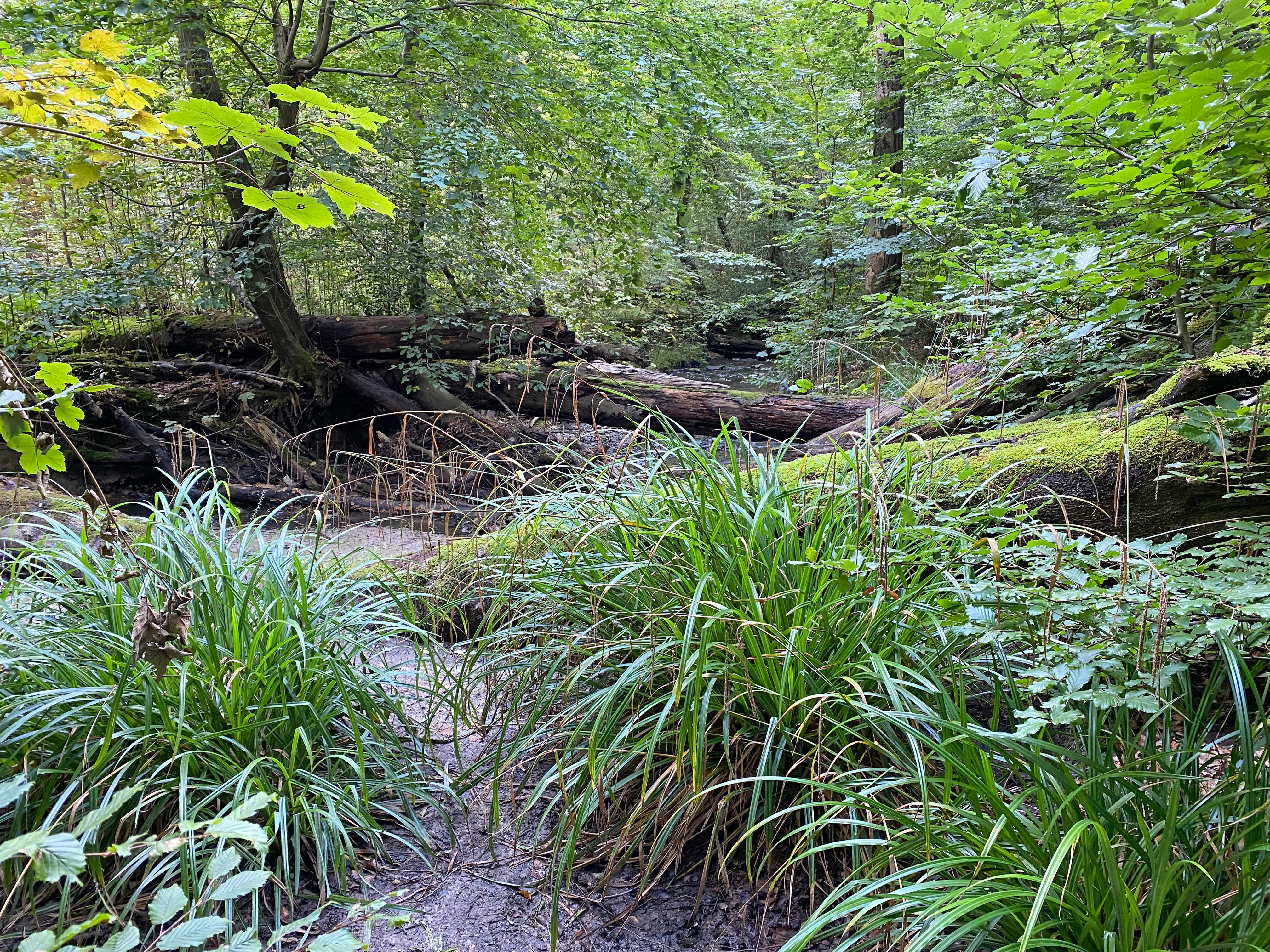
A small stream flowing through a dense, green deciduous forest with fallen logs and lush grasses in the foreground.
A shaded stream segment within the dense woodland of the Oefter Tal nature reserve.

Naturschutzgebiet Oefter Tal history and protected-area timeline

The Oefter Tal was formally designated as a Naturschutzgebiet in 1992, after years during which its valley forests and stream corridors were increasingly affected by the intensive forestry practices typical of the heavily wooded southern outskirts of Essen. Its designation reflected a regional effort to safeguard the last near-natural stream valley remnants in the lower Ruhr area. The reserve has since been managed by the Untere Landschaftsbehörde, the lower landscape authority responsible for protected sites within its administrative district.

Naturschutzgebiet Oefter Tal landscape and geographic character

The reserve occupies a deeply incised section of the Oefter Bach valley on the southern edge of Essen. Its terrain rises from approximately 64 meters at the lower end to about 129 meters at the upper edge, with an average elevation near 97 meters. The valley floor is defined by the meandering channel of the Oefter Bach and a network of small tributary brooks descending from the surrounding slopes, giving the landscape an intricate, often steep-sided profile.

Small patches of former fish ponds near Hausmann mark subtle historical imprints on the valley floor. Totholz accumulations, natural meanders, and stretches of stone-strewn streambed along the Oefter Bach reinforce the sense of a near-natural valley system. Together, these features create a recognizable transition between the wooded Bergisches Land-type terrain of the upper slopes and the broader Ruhr lowland into which the brook ultimately flows.
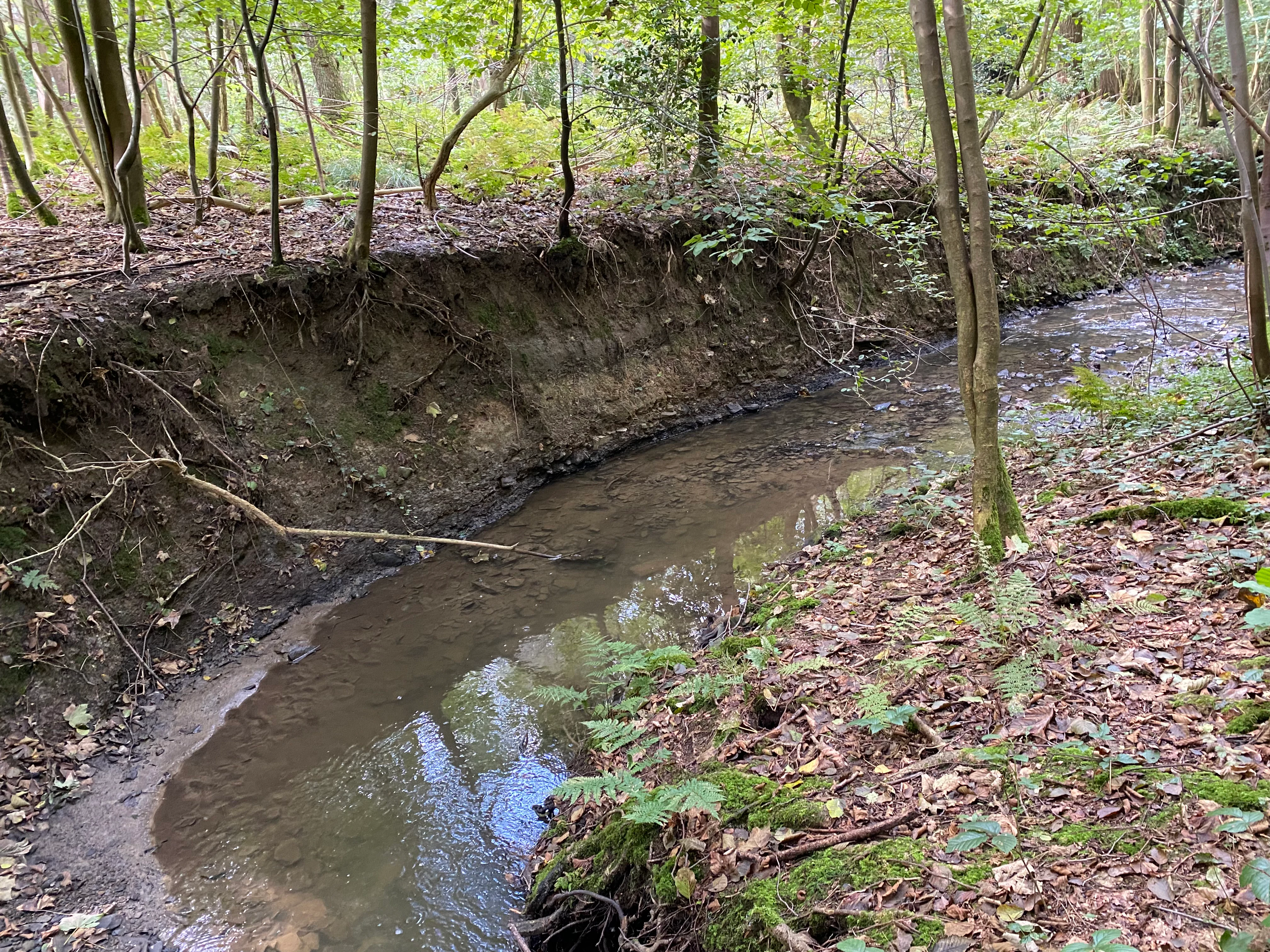
A narrow stream winding through a forest with a muddy, eroded embankment on the left and a mossy, leaf-covered bank on the right.
A small stream flowing through the forested landscape of Naturschutzgebiet Oefter Tal.

Naturschutzgebiet Oefter Tal ecosystems, habitats, and plant life

Ecologically, the reserve is defined by a close interweaving of aquatic and forest habitats. The Oefter Bach and its spring-fed tributaries form the hydrological foundation of the area, while strips of alder-dominated Auwald line the streambed. Small floodplain forest remnants survive along parts of the valley, creating a wet, shaded habitat corridor that contrasts with the drier beech forests covering the slopes above.

The wooded portions of the reserve reflect beech woodland typical of the regional natural area, with species-rich herb layers in the understorey. Totholz is a recurring feature in and along the brook, supporting the structural complexity of the forest floor and providing habitat for fungi, invertebrates, and other woodland species. The combination of running water, springs, floodplain forest fragments, and beech woodland is considered highly representative of the natural area and is the primary reason for the site's protected status.
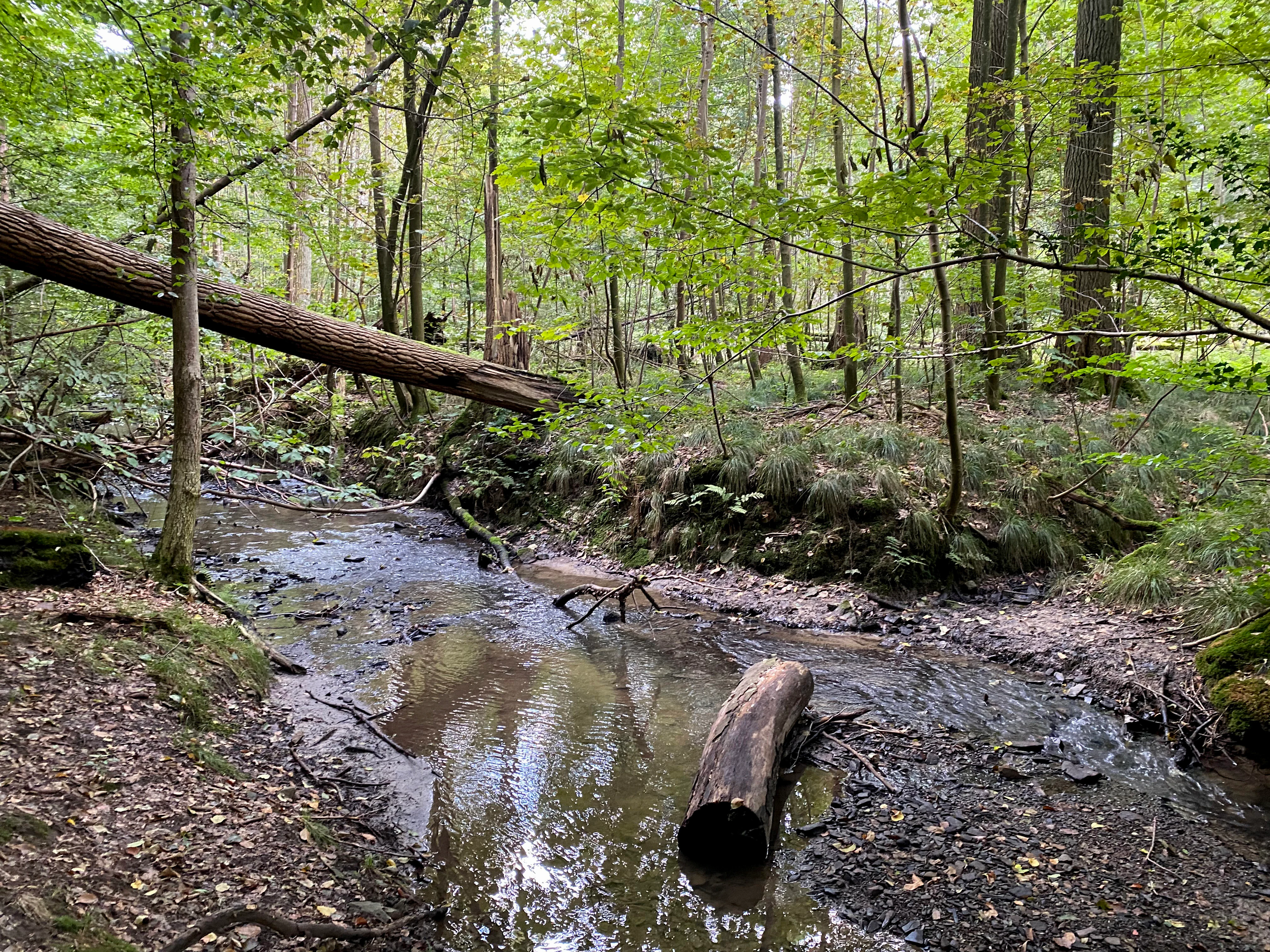
A small stream winds through a dense deciduous forest with a fallen tree trunk stretching across it.
A small stream flowing through the forested landscape of Naturschutzgebiet Oefter Tal.

Naturschutzgebiet Oefter Tal conservation status and protection priorities

Oefter Tal is recognized by the North Rhine-Westphalia nature conservation authorities as a highly representative example of the near-natural brook valley landscapes that once characterized the lower Ruhr region. The combination of natural streams, springs, floodplain forest remnants, and regionally typical beech woodland is explicitly cited as the basis for its classification as an IUCN Category IV Habitat/Species Management Area. Its official protection goal is the long-term conservation of the brook system and adjoining forest patches in an area otherwise shaped by intensive forestry.

Beyond its local significance, the reserve is valued as an important component of the wider network of near-natural stream valleys within the lower Ruhr valley, contributing to regional biotope connectivity. Within this broader corridor system, small protected valleys such as Oefter Tal collectively support the continuity of forest and freshwater habitats across an otherwise heavily urbanized and managed landscape.

Top sights and standout views in Naturschutzgebiet Oefter Tal

The reserve's strongest features are its near-natural stream channels along the Oefter Bach, its alder-dominated floodplain forest remnants, and the surrounding beech woodlands typical of the region. The site stands out for the close integration of running water, springs, and valley forest within a small area, offering a representative cross-section of lower Ruhr valley ecology.

In a region dominated by urban development and managed forests, the Oefter Tal provides a relatively undisturbed refuge for native deciduous woodland and freshwater habitats. Its designation in 1992 and its inclusion in the regional network of protected stream valleys underline its importance for both local habitat preservation and broader biotope connectivity in the lower Ruhr area.
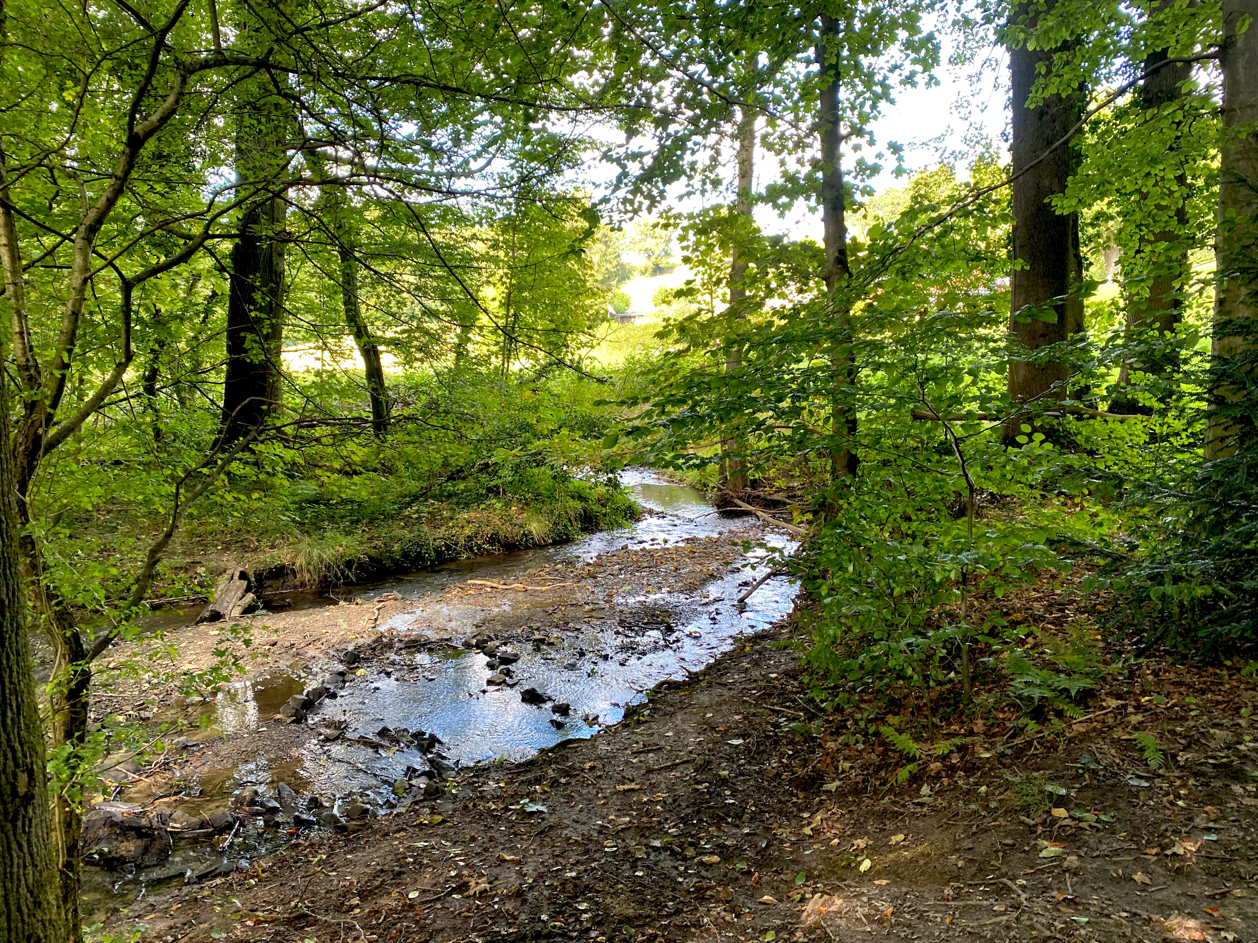
A small, shallow stream winds through a deciduous forest with sunlight filtering through the canopy onto the water and muddy bank.
A peaceful section of the Oefter Bach stream flowing through the lush, wooded terrain of the Oefter Tal nature reserve.

Best time to visit Naturschutzgebiet Oefter Tal

Oefter Tal can be visited year round, but the experience of its deciduous woodland changes clearly with the seasons. Spring brings fresh leaf growth in the beech canopy and active flows through the Oefter Bach fed by snowmelt and spring rains. Summer offers dense, shaded forest cover along the valley, with cooler, humid conditions near the stream.

Autumn displays typical seasonal color in the beech and alder stands, while winter reveals the valley's structural skeleton, with bare branches making the meanders of the Oefter Bach and the deadwood along the streambed especially visible. Because the terrain is steep and the paths can be wet, footwear suited to uneven, damp forest ground is advisable throughout the year.

Monthly climate preview

Long-term monthly temperature and precipitation data for Naturschutzgebiet Oefter Tal

Naturschutzgebiet Oefter Tal Climate Normals and Temperature Patterns

Representative coordinate measurements track the annual progression of average minimum and maximum temperatures alongside monthly precipitation rates for Naturschutzgebiet Oefter Tal. Access the complete twelve-month climatology profile to examine detailed historical averages across every seasonal transition.
Annual mean10 °C
1 °C19 °C
Jan
Feb
Mar
Apr
May13°
Jun16°
Jul19°
Aug18°
Sep15°
Oct10°
Nov
Dec
Warmest month
July

18.6 °C

Coolest month
January

1.5 °C

Wettest month
December

2.8 mm/day

Driest month
April

1.6 mm/day

Park location guide

Geography guide, regional context, and park location map for Naturschutzgebiet Oefter Tal

Naturschutzgebiet Oefter Tal park geography, regions, and map view in Germany

Understand where Naturschutzgebiet Oefter Tal sits in Germany through a broader geographic reading of the surrounding landscape, nearby location context, and its mapped position within the national park landscape.

How Naturschutzgebiet Oefter Tal fits into Germany

Germany is a federal republic in Western and Central Europe with a population of over 83 million across sixteen constituent states. It is Europe's largest economy by nominal GDP and a major global exporter and importer. The capital is Berlin, and the country borders Denmark, Poland, Czech Republic, Austria, Switzerland, France, Luxembourg, Belgium, and the Netherlands.

Wider geography shaping Naturschutzgebiet Oefter Tal in Germany

Germany is located in Western and Central Europe, spanning 357,022 km². It borders Denmark to the north, Poland and the Czech Republic to the east, Austria and Switzerland to the south, and France, Luxembourg, Belgium, and the Netherlands to the west. The country has coastlines on the Baltic Sea and North Sea to the north, with the Alps located in the southern region.

Map view of Naturschutzgebiet Oefter Tal

Use this park location map to pinpoint Naturschutzgebiet Oefter Tal in Germany, understand its exact geographic position, and read its mapped placement within the surrounding landscape more clearly.

Pigeon | © OpenStreetMap contributors

Location context for Naturschutzgebiet Oefter Tal

Nordrhein-Westfalen

Visual reference for stream valleys, floodplain forests, and protected habitats

Naturschutzgebiet Oefter Tal Photos and Valley Landscape Scenery

Visual records reveal the intricate terrain, winding brook channels, and dense beech woodlands defining Naturschutzgebiet Oefter Tal. Protected habitats and natural stream corridors emerge clearly through detailed photography of the lower Ruhr region.

A small stream flowing through a dense, green deciduous forest with fallen logs and lush grasses in the foreground.

A view of a small, green pond covered in algae and duckweed, framed by overhanging forest trees with a fallen log in the water.

A narrow stream winding through a forest with a muddy, eroded embankment on the left and a mossy, leaf-covered bank on the right.

A small stream winds through a dense deciduous forest with a fallen tree trunk stretching across it.

A small, quiet stream flows through a dense, green deciduous forest with a leaf-covered forest floor.

A small, shallow stream winds through a deciduous forest with sunlight filtering through the canopy onto the water and muddy bank.

A small, shallow stream winds through a lush, green deciduous forest in the Oefter Tal nature reserve, with a large fallen log crossing over part of the water.

A small stream flows over dark stones, passing under a fallen, mossy tree trunk in a dense green forest.

A small, narrow stream flowing over a rocky bed through a lush, green, deciduous forest valley.

Park atlas

Compare surrounding valley terrain and regional protected areas in North Rhine Westphalia.

Parks Near Naturschutzgebiet Oefter Tal and Related Protected Landscapes

Browse other parks near Naturschutzgebiet Oefter Tal to examine similar stream valley reserves and protected woodland habitats across the lower Ruhr region. Comparing adjacent natural areas reveals broader geographic patterns in regional biotope connectivity and forest conservation.
Nature reserveNordrhein-Westfalen
About 6.6 km away#1 closest

South

Hofermühle Süd Nature Reserve: Mapped Protected Landscapes and Quarry Geography

Examining limestone quarry terrain and riparian zones in Nordrhein-Westfalen.

Explore the distinct geology of Hofermühle Süd, where a reclaimed limestone quarry meets the meandering Anger creek. This protected nature reserve in Nordrhein-Westfalen provides a vital study in secondary succession, showcasing thin calcareous soils, rare flora, and essential wetland habitats within a small but topographically varied site.

Area
0.166 km²
Established
1984
IUCN
IV
Relief
Lowland
A horizontal watercolor illustration of a calm stream flowing through a wetland with green trees and grasses along the banks.
Nature reserveNordrhein-Westfalen
About 8.5 km away#2 closest

West

Hummelsbach Nature Reserve: Mapped Protected Brook and Floodplain Landscape in Nordrhein-Westfalen

Protected sandy stream and alder woodland mosaic

Located in the Mettmann district of Nordrhein-Westfalen, Hummelsbach preserves a near-natural sandy brook and alder floodplain forest. This reserve functions as an essential ecological bridge between rolling hill forests and lowland floodplains, providing a concentrated look at specialized habitats within a mosaic of meadows and wet woodland.

Area
0.13 km²
Established
1984
IUCN
IV
A watercolor illustration of a gentle winding stream flowing through a lush green valley at dawn or dusk.
Nature reserveNordrhein-Westfalen
About 10 km away#3 closest

Southwest

Schwarzbachtal bei Götzenberg: Nature Reserve and Protected Landscape in North Rhine-Westphalia

Mapped stream valley, floodplain, and forest geography

Schwarzbachtal bei Götzenberg is an ecologically rich nature reserve located near Ratingen in the Mettmann district. The protected area features a well-preserved stretch of the Schwarzbach stream, old-growth beech stands, and complex wetland mosaics including reedbeds and ponds, providing essential habitat within a suburban landscape.

Area
0.54 km²
Established
1984
IUCN
IV
Relief
Lowland
A watercolor painting showing a wide, panoramic landscape of a gently curving path or stream, green forests, and soft rolling hills in the background, with wildflowers in the foreground.
Nature reserveNordrhein-Westfalen
About 11 km away#4 closest

North

Schönebecker Schlucht: Protected Stream Valleys and Geographic Map in Nordrhein-Westfalen

A rare urban nature reserve with diverse floodplain ecosystems.

Schönebecker Schlucht sits as a compact, protected landscape within the Ruhr region. The area features converging stream valleys and near-natural alder woodland that contrast with the surrounding urban geography. Examine the mapping of these steep-sided ravines, the riparian corridors, and the ecological significance of this protected habitat fragment in the state of Nordrhein-Westfalen.

Area
0.093 km²
Established
1989
IUCN
IV
Relief
Lowland
A soft watercolor painting of a valley scene featuring green hills in the distance, marshy vegetation, and a winding stream, rendered in light pink and green tones on a white background.
Nature reserveNordrhein-Westfalen
About 12 km away#5 closest

North

Hexbachtal Nature Reserve: Geography and Protected Landscape Analysis in Nordrhein-Westfalen

Essential green corridor and floodplain forest network

Hexbachtal serves as a crucial protected area and green corridor within the highly urbanized Ruhr region of Germany. The site features a diverse range of habitats including wet meadows, ancient floodplain forests, and a meandering stream system. Beyond its ecological function, the valley is recognized as a landmark of regional planning and successful landscape conservation, illustrating the interaction between natural floodplains and metropolitan growth.

Area
0.042 km²
Established
2005
IUCN
IV
Relief
Upland
A watercolor painting showing a winding stream flowing through a green valley with soft hills and trees in the background.
Nature reserveKreis Mettmann
About 13 km away#6 closest

South

Laubachtal Nature Reserve: Geographic Mapping of the Mettmann Wetland Corridor

A protected stream valley in Kreis Mettmann, Germany

Laubachtal functions as a critical 15 hectare nature reserve within the Mettmann district, preserving a mosaic of stream, pond, and wet meadow habitats. This protected area serves as an essential ecological corridor for amphibians and migratory birds, offering a focused look at small-scale conservation geography within the urban-edge environment of North Rhine-Westphalia.

Area
0.15 km²
Established
1997
IUCN
IV
Relief
Upland
Watercolor painting of a calm pond with cattails in the foreground and rolling hills in the background.
Nature reserveNorth Rhine-Westphalia
About 15 km away#7 closest

Southwest

Naturschutzgebiet Pillebachtal, Dernkamp und Gallberg: Protected Landscape and Geography

Nature reserve in North Rhine-Westphalia, Germany

An urban-adjacent nature reserve, this area provides a mapped look at the transition between mature beech forest stands and moist wetland corridors along the Pillebach stream. It serves as a study in ecological structure, featuring reed beds, meadow springs, and gallery woodlands that offer a protected refuge within the Rhine-Ruhr metropolitan region.

Area
0.745 km²
Established
1996
IUCN
IV
A watercolor painting showing a soft, peaceful landscape with light green rolling hills in the background, a flat plain in the middle ground, and grasses and wildflowers in the foreground under a pale, warm sky.
Nature reserveNordrhein-Westfalen
About 15 km away#8 closest

South

Laubacher Steinbruch Nature Reserve: Mapped Geographic Overview and Protected Landscape Analysis

Calcareous habitats in the Neandertal valley, Germany

Laubacher Steinbruch is a distinct nature reserve characterized by a mosaic of sycamore maple forest, steep limestone cliffs, and dry scree fields. Situated within the Neandertal Natura 2000 site, it acts as a critical refuge for specialized plant communities and reptiles, forming an integral part of the regional conservation network in Nordrhein-Westfalen.

Area
0.06 km²
Established
1997
IUCN
IV

Common questions about visiting, size, designation, and location context for Naturschutzgebiet Oefter Tal

Naturschutzgebiet Oefter Tal FAQs for park facts, access, geography, and protected area context

Find quick answers about Naturschutzgebiet Oefter Tal, including protected-area facts, park geography, trail and visitor context, and how the park fits into its surrounding country and regional landscape.
MoriAtlas Explorer

Continue Your Protected Areas Search Across the Global Atlas

Deepen your exploration by continuing the structured search for national parks and protected areas worldwide. Utilize the comprehensive filtering capabilities to compare different conservation landscapes and refine your understanding of global park geography. Discover more about the distribution and characteristics of protected natural areas.

Global natural geography