
Mori Atlas logo
Nature reserveNaturschutzgebiet Orlebachtal

Discover the geomorphic features and ecological floodplain mosaic of this Sauerland foothills nature reserve

Naturschutzgebiet Orlebachtal Protected Landscape and Meandering Stream Valley Geography

Naturschutzgebiet Orlebachtal preserves a textbook low mountain stream valley, where the Orlebach creates a dynamic series of meanders, undercut banks, and slip-off slopes. This compact 15-hectare protected area in Nordrhein-Westfalen showcases an intact riparian alder corridor alongside a complex mosaic of wet, moist, and dry grassland meadows. The site functions as a regional model for small-scale valley ecology, sustaining clean-water aquatic life and essential habitat for breeding birds within the Märkischer Kreis district.

low mountain stream valleymeandering streamriparian woodlandfloodplain meadowswet grasslandnature reserve
A stylized flat vector illustration of a sunny mountain valley featuring a waterfall, green meadows, and trees in the foreground.

Naturschutzgebiet Orlebachtal

Nature reserve

Park overview

Structured park overview, official facts, and landscape profile for Orlebachtal Nature Reserve

Orlebachtal Nature Reserve park facts, protected area profile, and essential visitor context

Review the core facts for Orlebachtal Nature Reserve, including designation, size, terrain, visitor scale, habitats, and operating context in one park-focused overview.

About Orlebachtal Nature Reserve

The Orlebachtal Nature Reserve is a compact, ecologically rich nature protection area in the Hönne region of North Rhine-Westphalia. It lies within the municipal area of Balve, east and southeast of Schloss Wocklum, and forms part of the network of protected stream valleys that characterize the Märkischer Kreis. Although small at roughly 15 hectares, the reserve is unusually representative of the natural character of low mountain valleys in this part of Germany, where streams cut through narrow valleys and create complex patterns of floodplain, slopes, and woodland.

Geomorphologically, the protected area encompasses a section of a sohlental, a valley in which the stream has shaped both the floor and the base of the surrounding slopes. The Orlebach winds through the reserve with strongly pronounced meander loops, producing undercut banks, slip-off slopes, riverbank collapses, and deep scour pools. These dynamic small-scale landforms are central to the reserve's character and ecological value, because they continually renew habitats along the watercourse and keep the stream morphology varied and natural.

Ecologically, the reserve combines several distinct habitat types in a very small area. The floodplain is dominated by grassland, including wet grassland, moist grassland, and species-poor lean pasture. Alder-dominated riparian woodland lines much of the brook, providing shade, structural diversity, and habitat continuity along the stream. On the valley slopes, traditionally managed lean meadows and pastures harbor meadow flowers, bedstraw, bird's-foot trefoil, yarrow, harebell, hawkweed, sweet vernal grass, and tormentil. The result is a tightly interwoven mosaic where aquatic, wetland, grassland, and woodland habitats meet within a few hundred meters.

The reserve also has a strong conservation and cultural-landscape dimension. Until 1994, the valley was grazed intensively by horses. After 1994, the site became part of the Märkischer Kreis cultural landscape program and was grazed with cattle at a stocking rate of about two livestock units, with mowing followed by late-summer grazing from 2000 onward. This shift in management was designed to maintain the structure and species composition of the floodplain meadows and to protect the breeding and feeding habitats of characteristic valley species.

A 6.3 kilometer nature experience trail, the Orlebachtal Naturerlebnisweg, runs through the protected area between Balve and the Sorpesee, linking visitors to the broader Hönne landscape. The reserve adjoins the Burgberg Wocklum nature protection area and lies close to Schloss Wocklum, situating the natural area within a wider cultural and recreational landscape.

Quick facts and research context for Orlebachtal Nature Reserve

Orlebachtal Nature Reserve is located east of Schloss Wocklum in the town of Balve, within the Märkischer Kreis district of North Rhine-Westphalia in western Germany. It was first designated in 1989 under the Balve-Mittleres-Hönnetal landscape plan and redesignated in 2015 following the second amendment of that plan. The reserve protects a roughly 15 hectare section of the meandering Orlebach and its associated floodplain habitats, and forms part of the protected natural areas around the Hönne valley system near the Sorpesee.

Protection and recognition

Documented terrestrial protection scope and conservation designation records

Naturschutzgebiet Orlebachtal Protection Status and Recognition

Naturschutzgebiet Orlebachtal features a defined terrestrial protection scope within the regional conservation network. The structured records outline documented protection status and available designation history for the protected area.

Protection details

Protection scope
Terrestrial
Park context

Deeper park guide and search-rich context for Orlebachtal Nature Reserve

Orlebachtal Nature Reserve history, landscape, wildlife, and travel context

Explore Orlebachtal Nature Reserve through its history, landscape character, ecosystems, wildlife, conservation priorities, cultural context, and seasonal travel timing in a structured park guide built for atlas discovery and search intent.

Why Orlebachtal Nature Reserve stands out

The reserve is most notable for a textbook example of a low mountain stream valley with well-developed meanders, undercut and slip-off slopes, and actively eroding riverbanks. The combination of a clean, oxygen-rich brook, intact alder riparian woodland, and a floodplain mosaic of wet, moist, and species-poor grassland makes it a compact showcase of small-stream valley ecology in the Sauerland foothills. It is also known for its cultural landscape value. Long-term grazing and mowing management since the early 1990s has maintained threatened grassland communities, including flat-sedge, wood club-rush, brooklime, marsh forget-me-not, and floating sweet-grass in the wetter zones, and rarer meadow species such as greater burnet and Harz bedstraw on the hillside lean pastures.
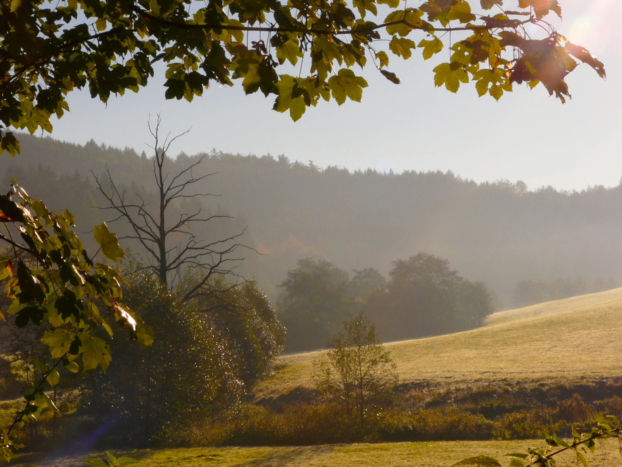
A hazy, sunlit view of a rural valley with rolling grassland, a mix of dense forest, and a lone bare tree in the middle ground, framed by overhanging maple branches.
Morning light over the meadows and forest of the Orlebachtal nature reserve.

Orlebachtal Nature Reserve history and protected-area timeline

The Orlebachtal was first formally designated as a nature protection area on 18 December 1989 by the district council of the Märkischer Kreis as part of the landscape plan Nr. 2 Balve-Mittleres-Hönnetal. Its original designation name reflected its location east of Schloss Wocklum: Naturschutzgebiet Orlebachtal östlich von Wocklum, Stadt Balve.

In 2015, the reserve was redesignated under the second amendment to that same landscape plan, with the simplified name Orlebachtal. The redesignation formalised continued protection under the updated planning framework and tightened certain management rules, including restrictions on mowing and grazing timing and limitations on hunting installations.

An earlier landscape change shaped the valley long before protected status. Until 1980, native crayfish were still recorded in the Orlebach, indicating a historically cleaner and more natural watercourse. By 1994, long-standing intensive horse grazing had shaped the floodplain meadows, and that year the valley was incorporated into the Märkischer Kreis cultural landscape program, marking a turning point in how the meadows were managed and shifting the focus from purely agricultural use to a balance between agriculture and nature conservation.

Orlebachtal Nature Reserve landscape and geographic character

The Orlebachtal reserve captures a classic low mountain stream valley, locally referred to as a sohlental, in which the stream valley floor and the base of the slopes form a single natural unit. The Orlebach traces pronounced meander loops through this floor, generating a small-scale but highly dynamic topography of undercut banks on the outer curves, slip-off slopes on the inner curves, and active bank collapses. Pools scoured out by the current add further relief to the streambed.

Surrounding the floor, the valley slopes rise toward the wooded plateau above, much of which lies outside the protected area. From the slopes, the eye looks down onto the curving brook, the riparian alder strip, and the patchwork of floodplain meadows. The interplay between watercourse, floodplain, riparian woodland, and slope gives the Orlebachtal its characteristic sense of enclosure and visual depth, and is a key reason the valley is regarded locally as one of the most attractive meandering valleys in the wider region.

Although the protected area is only about 15 hectares, the tight packing of landforms creates considerable landscape diversity. Wet, moist, and drier grassland occur side by side, separated by the alder-lined brook and by subtle changes in slope and soil moisture. This visual and structural diversity, combined with the active geomorphic processes along the brook, defines the reserve's landscape identity.

Orlebachtal Nature Reserve ecosystems, habitats, and plant life

Ecologically, Orlebachtal represents a textbook low mountain stream valley ecosystem. The Orlebach itself is cold, clean, and oxygen-rich, supporting a small but characteristic community of stream animals. Brown trout, brook lamprey, and bullhead inhabit the water, alongside the river nerite snail, an indicator of good water quality. Aquatic insects include the two-striped demoiselle and the beautiful demoiselle, both dragonflies associated with clean, well-oxygenated brooks.

The vegetation mirrors this habitat diversity. Broad bands of alder fringe the Orlebach, forming a continuous riparian corridor and providing the structural backbone of the valley ecosystem. In the wet and moist grasslands of the floodplain, communities include flat-sedge, wood club-rush, marsh forget-me-not, brooklime, and floating sweet-grass. Where the slopes rise into lean, nutrient-poor pasture, the flora shifts toward traditional meadow species such as common knapweed, Harz bedstraw, bird's-foot trefoil, yarrow, round-leaved harebell, small hawkweed, sweet vernal grass, and tormentil. In the water itself, common water-crowfoot forms submerged and floating populations.

Together, these habitats form a tightly interconnected mosaic. The clean water sustains the riparian woodland and aquatic fauna, the woodland stabilises the banks and shades the brook, and the open grasslands sustain meadow flora and the open-country birdlife of the slopes. The result is a small, but unusually complete, example of stream valley ecology in the Sauerland region.

Orlebachtal Nature Reserve wildlife and species highlights

Although the reserve is compact, it supports a notably diverse range of river, wetland, and grassland species. The clean water of the Orlebach is a key driver, hosting brown trout, brook lamprey, bullhead, river nerite snails, and two species of demoiselle dragonfly, the two-striped demoiselle and the beautiful demoiselle. Crayfish, once a natural part of this community, were still present in 1980 but have since been lost, reflecting broader pressures on small-stream fauna.

The brook and its banks attract several characteristic bird species. Kingfishers, dippers, and grey wagtails breed along the watercourse, while the open and semi-open slopes and meadows provide breeding habitat for red-backed shrikes. The valley's combination of alder riparian woodland, tall hedgerows, and open grassland creates the mosaic structure these species rely on.

The grasslands, particularly the wet meadows and the hillside lean pastures, harbour a rich flora that underpins much of the reserve's invertebrate life, even if the fauna is less prominent in public descriptions of the site than the birds and fish.

Orlebachtal Nature Reserve conservation status and protection priorities

The Orlebachtal was designated under the Balve-Mittleres-Hönnetal landscape plan specifically to preserve and develop a low mountain stream valley with well-developed meanders, riparian woodland, and wet, moist, and lean grassland as habitat for rare and endangered animal and plant species. A second stated purpose was the protection of the valley's landscape beauty and distinctive character.

Conservation management rests on a tightly defined set of rules. Mowing of the hay meadows is not allowed before 15 June, protecting ground-nesting birds and allowing key meadow plants to set seed. Grazing is restricted to a maximum stocking rate of two livestock units per hectare per year, and winter grazing between 1 November and 30 April is prohibited. New hunting installations and habitat interventions such as high seats, game feeding areas, supplementary feeding, and artificial breeding structures are normally forbidden, with narrow exceptions for open raised hides and emergency winter feeding under North Rhine-Westphalia regulations.

Equally important is the long-term land management regime. After centuries of use as horse pasture, the valley entered the Märkischer Kreis cultural landscape program in 1994 and has since been managed with low-intensity cattle grazing, and from 2000 with a mowing-plus-late-summer-grazing regime. This cultural-landscape approach is now central to maintaining the endangered grassland communities that give the valley its ecological value.

Orlebachtal Nature Reserve cultural meaning and human context

The Orlebachtal sits within a landscape shaped by centuries of agricultural and forestry use, and by the cultural heritage of the Hönne region. The valley is closely associated with Schloss Wocklum and the adjoining Burgberg Wocklum reserve, placing the protected natural area within a setting where historic estates, woodland, and traditional countryside meet. Until 1994, the valley was grazed intensively by horses, and the transition to low-intensity cattle grazing marked a deliberate shift toward a cultural landscape approach that recognises both biodiversity and traditional land use.

The reserve is also part of a broader regional network of protected natural areas in the Märkischer Kreis, including the Balver Wald, Bollenberg, Löhen, Burgberg Wocklum, and Hönnetal reserves, all situated within or near the town of Balve. This clustering of small, ecologically distinct reserves reflects the region's strong local tradition of grassroots nature protection and landscape planning in South Westphalia.

Top sights and standout views in Orlebachtal Nature Reserve

Among the reserve's most distinctive features are a thoroughly meandering brook with active undercut and slip-off slopes on the Orlebach, an intact alder riparian corridor, and a floodplain mosaic where wet, moist, and species-poor grassland sit side by side. The water quality supports brown trout, brook lamprey, bullhead, and two species of demoiselle dragonfly, while kingfishers, dippers, and grey wagtails breed along the stream. Knapweed, bedstraw, harebell, and tormentil on the slope meadows complete one of the most representative small-scale meandering valley ecosystems in the Märkischer Kreis.

Best time to visit Orlebachtal Nature Reserve

Visually and ecologically, the Orlebachtal is most rewarding from late spring through summer, when the hay meadows are in flower, the alders are fully leafed, and the brook is at its most active. The summer mowing-and-aftermath grazing regime means the open floodplain is most attractive in early summer, before the first cut, and again in late summer and early autumn when cattle return to the aftermath. Winter and early spring visits offer quieter conditions and clearer views of the meander structure, although floodplain vegetation is dormant and management rules restrict grazing between November and April. The site is not a high-altitude or weather-sensitive destination and is broadly accessible year-round along the Orlebachtal Naturerlebnisweg when conditions are suitable, with no special seasonal access window documented in the source material.

Monthly climate preview

Long-term representative point measurements tracking monthly temperature and precipitation variation

Naturschutzgebiet Orlebachtal Climate Normals and Annual Temperature Rhythm

Representative coordinate records show average temperatures ranging from sub-zero winter minimums to warm summer maximums alongside consistent year-round precipitation rates. Examining the full twelve-month profile provides complete historical climate normals and monthly weather variations for this protected area.
Annual mean9 °C
0 °C18 °C
Jan
Feb
Mar
Apr
May12°
Jun16°
Jul18°
Aug18°
Sep14°
Oct
Nov
Dec
Warmest month
July

18.2 °C

Coolest month
January

0.3 °C

Wettest month
December

2.7 mm/day

Driest month
April

1.7 mm/day

Park location guide

Geography guide, regional context, and park location map for Orlebachtal Nature Reserve

Orlebachtal Nature Reserve park geography, regions, and map view in Germany

Understand where Orlebachtal Nature Reserve sits in Germany through a broader geographic reading of the surrounding landscape, nearby location context, and its mapped position within the national park landscape.

How Orlebachtal Nature Reserve fits into Germany

Germany is a federal republic in Western and Central Europe with a population of over 83 million across sixteen constituent states. It is Europe's largest economy by nominal GDP and a major global exporter and importer. The capital is Berlin, and the country borders Denmark, Poland, Czech Republic, Austria, Switzerland, France, Luxembourg, Belgium, and the Netherlands.

Wider geography shaping Orlebachtal Nature Reserve in Germany

Germany is located in Western and Central Europe, spanning 357,022 km². It borders Denmark to the north, Poland and the Czech Republic to the east, Austria and Switzerland to the south, and France, Luxembourg, Belgium, and the Netherlands to the west. The country has coastlines on the Baltic Sea and North Sea to the north, with the Alps located in the southern region.

Map view of Orlebachtal Nature Reserve

Use this park location map to pinpoint Orlebachtal Nature Reserve in Germany, understand its exact geographic position, and read its mapped placement within the surrounding landscape more clearly.

Pigeon | © OpenStreetMap contributors

Location context for Orlebachtal Nature Reserve

Nordrhein-Westfalen

Visualizing the low mountain stream valley, riparian woodlands, and meandering floodplain habitats

Naturschutzgebiet Orlebachtal Photos, Landscapes, and Protected Scenery

Visual documentation captures the meandering stream channels, alder-lined riparian corridors, and dynamic valley floor landforms of the reserve. Detailed photography illustrates the protected habitats and intimate low mountain topography characteristic of the Sauerland foothills.

A hazy, sunlit view of a rural valley with rolling grassland, a mix of dense forest, and a lone bare tree in the middle ground, framed by overhanging maple branches.

Park atlas

Compare nearby regional stream valleys and protected landscapes across the Sauerland foothills.

Exploring Parks Near Naturschutzgebiet Orlebachtal and Adjacent Protected Areas

Browsing other parks near Naturschutzgebiet Orlebachtal reveals a broader network of protected stream valleys and low mountain landscapes across the region. Examining adjacent protected areas allows for meaningful comparison of floodplain habitats, riparian woodlands, and regional conservation geography.
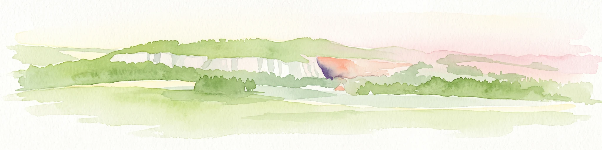
A watercolor illustration depicting a wide valley with green hills, white limestone rock formations, and a small reddish cave entrance.
Protected landscapeNordrhein-Westfalen
About 2.9 km away#1 closest

Northwest

Hönnetal Protected Landscape: Mapping the Karst Valley and Limestone Cliffs of Nordrhein-Westfalen

A deep dive into the geology, conservation, and physical terrain of the Hönne river valley.

The Hönnetal stands as one of Central Europe's most striking karst landscapes, characterized by white limestone cliffs rising 60 meters above the riverbed. This protected area within Nordrhein-Westfalen represents a critical intersection of ancient geological processes, including dense cave networks and unique beech forests, alongside a historic civic conservation movement that preserves its defining natural boundaries.

Area
1.442 km²
Established
1920
Relief
Upland
Climate
Temperate
A watercolor painting depicting a soft-focus landscape with rolling green hills, a small pond or marshy water feature in the foreground, and distant hazy hills in the background.
Nature reserveHochsauerlandkreis
About 4.9 km away#2 closest

East

Naturschutzgebiet Piepenbruch: Protected Spring-Fed Grassland in Hochsauerlandkreis

A localized nature reserve protecting rare wet meadow ecosystems

Naturschutzgebiet Piepenbruch serves as a textbook example of a small-scale, high-value nature reserve. The site provides a critical refuge for rush vegetation and moisture-dependent wildflowers, acting as an important ecological buffer within the broader Flasmecketal landscape protection area of the Hochsauerlandkreis.

Area
0.023 km²
Established
2019
IUCN
IV
Relief
Upland
A soft watercolor illustration depicting rolling green hills, dense forest patches, and a winding stream flowing through a grassy meadow.
Protected landscapeGermany
About 5.3 km away#3 closest

North

Luerwald und Bieberbach Protected Landscape: Regional Forest Map and Habitat Overview

A major continuous woodland reserve in North Rhine-Westphalia, Germany.

Spanning the landscape between Neheim and Menden, Luerwald und Bieberbach functions as a critical Special Protection Area. The terrain features extensive beech and oak woodlands intersected by the Bieberbach stream, creating an important haven for woodland species and maintaining a large, undisturbed environmental mosaic across the northern Sauerland.

A horizontal watercolor painting depicting a soft-toned landscape with a winding river, grassy banks, and distant rolling hills in light pastel colors.
Protected landscapeMaerkischer Kreis
About 7.4 km away#4 closest

West

Landschaftsschutzgebiet Balve Mittleres Hönnetal Protected Landscape and Map

Regional geography and forested valley terrain in Maerkischer Kreis

Covering roughly 4,745 hectares, this protected landscape is defined by its extensive beech and spruce woodlands alongside the Hönne river. The area highlights the unique proximity between traditional forest and agricultural zones and residential edges. This atlas entry details the topographic profile and land use patterns found across this distinctive German protected territory.

Area
47.457 km²
Established
1989
Relief
Upland
Climate
Temperate
Nature reserveNorth Rhine-Westphalia
About 8 km away#5 closest

Southeast

Naturschutzgebiet Schla Nature Reserve: Geographic Profile and Protected Forest Landscape

Limestone hilltop woodland in North Rhine-Westphalia

Naturschutzgebiet Schla serves as a representative example of calcareous oak-hornbeam forests in the Hochsauerlandkreis. This small, 3.4-hectare nature reserve preserves ancient, 200-year-old oaks and a specialized geophyte-rich herb layer. Its hilltop position, characterized by thin limestone soils and proximity to an abandoned quarry, creates a unique microclimate that supports forest biodiversity and research into habitat connectivity in rural Germany.

Area
0.034 km²
Established
1993
Relief
Upland
Scope
Terrestrial
Nature reserveNorth Rhine-Westphalia
About 8.1 km away#6 closest

North

Naturschutzgebiet Schakenberg: Protected Beech Forest Landscape and Regional Geography

A rare calcareous woodland reserve in the Hachener Kuppenland

Naturschutzgebiet Schakenberg safeguards a near-natural Waldmeister-Buchenwald forest on a limestone hilltop. This protected area acts as a crucial ecological anchor within the Luerwald and Bieberbach Natura 2000 network, showcasing the distinct hilly topography and forest biodiversity characteristic of the eastern Sauerland.

Area
0.022 km²
Established
1998
Relief
Upland
Climate
Temperate
Nature reserveHochsauerlandkreis
About 8.7 km away#7 closest

Southeast

Naturschutzgebiet Schatthangwald Röhre Protected Nature Reserve in Hochsauerlandkreis

Geographic overview of limestone forests and karst cave systems

Spanning 5.6 hectares, Naturschutzgebiet Schatthangwald Röhre illustrates a dense concentration of calcareous habitats. The area features a complex intersection of beech forest, abandoned limestone quarry floors, and significant subterranean features within the Röhr river valley context.

Area
0.056 km²
Established
1993
Relief
Upland
Scope
Terrestrial
Nature reserveHochsauerlandkreis
About 9.1 km away#8 closest

North

Naturschutzgebiet Oelinghauser Bruch: Nature Reserve and Protected Brook Valley Map

Detailed geographic overview of Hochsauerlandkreis floodplain forest and valley terrain.

Naturschutzgebiet Oelinghauser Bruch acts as a vital refugium for floodplain and brook-side communities. This nature reserve, situated north of Oelinghausen in the Hochsauerlandkreis region, contains a sharp Kerbtal landform and rare alder-ash wet woodland. The area demonstrates active forest restoration and ecological connectivity across its varied slopes and narrow valley floor.

Area
0.098 km²
Established
1998
Relief
Upland
Climate
Temperate

Common questions about visiting, size, designation, and location context for Orlebachtal Nature Reserve

Orlebachtal Nature Reserve FAQs for park facts, access, geography, and protected area context

Find quick answers about Orlebachtal Nature Reserve, including protected-area facts, park geography, trail and visitor context, and how the park fits into its surrounding country and regional landscape.
MoriAtlas Explorer

Continue Your Protected Areas Search Across the Global Atlas

Deepen your exploration by continuing the structured search for national parks and protected areas worldwide. Utilize the comprehensive filtering capabilities to compare different conservation landscapes and refine your understanding of global park geography. Discover more about the distribution and characteristics of protected natural areas.

Global natural geography