
Mori Atlas logo
Nature reserveNaturschutzgebiet Pfengstbach

Mapping the protected meadow floor, riparian corridors, and valley slopes of the Pfengstbach stream

Naturschutzgebiet Pfengstbach Nature Reserve: A Bergisches Land Brook Valley Landscape Analysis

Naturschutzgebiet Pfengstbach represents a characteristic Sohlental valley within the Rheinisch-Bergischer Kreis, defined by its meandering brook, steep forested slopes, and meadow floor. This protected area functions as a vital link in the broader Dhünn valley ecological corridor, supporting specialized species dependent on clean headwaters and natural groundwater dynamics. Explore the topographic profile, soil-moisture variations, and historical land-use patterns that shape this protected corridor within the Bergisches Land region.

brook valleymeadow valleyriparian woodlandBergisches Landstream habitatwet meadow
A flat-style digital illustration of a scenic valley with a waterfall flowing from a cliff, surrounded by evergreen forests, green hills, and a flower-filled meadow in the foreground under a gentle sun.

Naturschutzgebiet Pfengstbach

Nature reserve

Park overview

Structured park overview, official facts, and landscape profile for Pfengstbach Nature Reserve

Pfengstbach Nature Reserve park facts, protected area profile, and essential visitor context

Review the core facts for Pfengstbach Nature Reserve, including designation, size, terrain, visitor scale, habitats, and operating context in one park-focused overview.

About Pfengstbach Nature Reserve

Pfengstbach Nature Reserve (Naturschutzgebiet Pfengstbach) occupies the narrow, meandering valley of the Pfengstbach brook as it flows westward through the municipality of Odenthal toward its confluence with the Dhünn river near Altenberg. Situated in the Bergisches Land, a hilly transitional region between the Lower Rhine Plain and the uplands of central Germany, the reserve captures a characteristic stretch of near-natural countryside that has largely been spared from heavy agricultural or industrial development.

The valley's defining feature is its classic Bergisches profile: a broad, flat valley floor used traditionally as grassland, framed by steep, forested slopes. Where the slopes meet the brook, small spring-fed side valleys, locally known as Siepen, introduce additional moisture and structural diversity, while naturally structured banks of alder, hornbeam, and crack willow create transitional wetland woodland along the watercourse.

Ecologically, the reserve functions as a key segment within the larger Dhünn system. Its direct upstream-downstream link with the Natura 2000 site 'Dhünn und Eifgenbach' means that fish and lamprey migrating along the Dhünn network pass through the protected Pfengstbach, while invertebrates like the Gestreifte Quelljungfer reproduce in its clean upper headwaters. The result is a tightly defined conservation corridor that supports both local biodiversity and broader European habitat connectivity.

From a human perspective, the area is integrated into the cultural landscape of Odenthal. Historic watermills once operated along the Pfengstbach and its tributaries, traces of which still shape the valley; old mill ponds now harbor wetland plants such as bur-reed, water mint, and marsh hedge-nettle. The long-distance Bergischer Weg traces the valley from Altenberg to Scheuren, pairing the ecological story of the brook with the monastic and rural history of the region.

Quick facts and research context for Pfengstbach Nature Reserve

Pfengstbach Nature Reserve lies within Odenthal in the Rheinisch-Bergischer Kreis of North Rhine-Westphalia and was officially established in 1994 under the designation GL-027 in the state's nature conservation register. The reserve is classified as an IUCN Category IV habitat and species management area and is embedded in the regional landscape plan known as the Landschaftsplan Mittlere Dhünn, administered by the lower landscape authority of Rheinisch-Bergischer Kreis.

The reserve is closely tied to the larger FFH (Flora-Fauna-Habitat) site 'Dhünn und Eifgenbach', giving the small brook valley a meaningful role in both regional and European ecological connectivity. It is also crossed by the Bergischer Weg, a long-distance trail that links the historic Altenberg monastery with the surrounding communities of Odenthal.

Protection and recognition

Documented terrestrial protection metrics and recognized conservation scope

Naturschutzgebiet Pfengstbach Protection Status and Management Scope

Terrestrial protection status for Naturschutzgebiet Pfengstbach compiles official designation records and management scope into a structured overview. Conservation metrics outline the administrative framework supporting this protected landscape without relying on unverified international frameworks.

Protection details

Protection scope
Terrestrial
Transboundary protection
No
WDPA ID
164996
Park context

Deeper park guide and search-rich context for Pfengstbach Nature Reserve

Pfengstbach Nature Reserve history, landscape, wildlife, and travel context

Explore Pfengstbach Nature Reserve through its history, landscape character, ecosystems, wildlife, conservation priorities, cultural context, and seasonal travel timing in a structured park guide built for atlas discovery and search intent.

Why Pfengstbach Nature Reserve stands out

Pfengstbach Nature Reserve is best known for the structural integrity of its near-natural brook habitat, where a meandering stream runs through a meadow valley framed by wooded slopes and diverse riparian vegetation. It is a textbook example of a Bergisches Land Sohlental: the combination of grassy valley floor, steep forested underslopes, and naturally structured banks distinguishes the area from more intensively used lowland streams nearby. The reserve is also recognized for hosting the European brook lamprey (Lampetra planeri) and for supporting the reproduction of the Gestreifte Quelljungfer, a dragonfly dependent on clean spring-fed headwaters. These species are central to the area's conservation identity and explain its direct connection to the broader Natura 2000 network along the Dhünn.
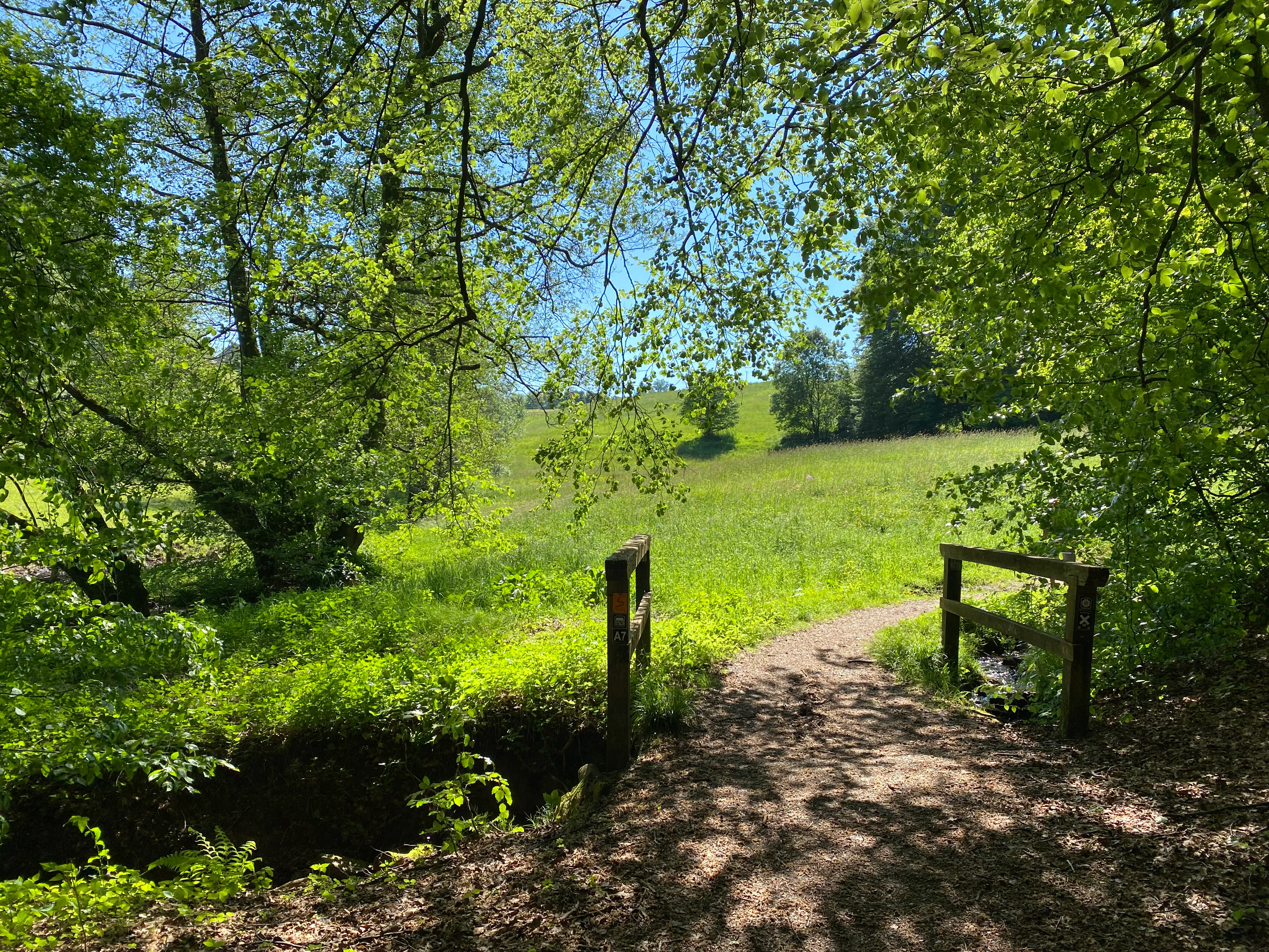
A dirt hiking trail leads across a small wooden footbridge over a stream, surrounded by lush green trees and an open meadow in the background under a blue sky.
A small footbridge crossing the Pfengstbach stream along a hiking trail within the nature reserve.

Pfengstbach Nature Reserve history and protected-area timeline

The area that today forms the Pfengstbach Nature Reserve has been shaped over centuries by small-scale agricultural use, brook management, and the operation of watermills along the Pfengstbach and its side streams such as the Backesberger Bach. The presence of former mill ponds and bridge crossings in deeper historical sections of the valley reflects this long cultural use of the watercourse.

In 1994, the valley was formally protected through the declaration of the Naturschutzgebiet Pfengstbach, registered under the designation GL-027 in the nature conservation information system of North Rhine-Westphalia. The designation was carried out under the framework of the Landschaftsplan Mittlere Dhünn and placed under the responsibility of the Untere Landschaftsbehörde of the Rheinisch-Bergischer Kreis.

The timing of the designation was closely tied to growing awareness of the importance of near-natural brook habitats for species such as the European brook lamprey and sensitive dragonfly species. Subsequent landscape planning updates for Odenthal, including a 2017 draft of the municipal landscape plan, reference the reserve and reaffirm its role as a core element of regional habitat connectivity, particularly through its direct linkage to the Natura 2000 site 'Dhünn und Eifgenbach'.

Pfengstbach Nature Reserve landscape and geographic character

The landscape of Pfengstbach Nature Reserve is shaped by a classic Bergisches Land valley system: a relatively flat valley floor of around 18 hectares given over largely to meadows, bordered by steep underslopes clothed in mixed deciduous forest. The Pfengstbach brook itself runs in a narrow, up to two-meter-wide sandy-gravelly bed that meanders through this valley floor, occasionally widening where side streams enter the main channel.

Where the steep valley sides meet the brook, the terrain becomes more structurally complex, with shallow groundwater zones, seepage springs, and small side valleys creating an irregular pattern of moist and drier microhabitats. Historic mill features remain visible in the landscape; a former mill pond on the Backesberger Bach, for instance, still defines a small wetland basin within the broader valley.

In the upper reaches of the valley near Unterbreidbach and Oberbreidbach, the natural hardwood slopes give way in places to spruce pole forests that reach down to the edge of the brook, introducing a more managed forest character to that section of the reserve. Overall, the topography, hydrology, and traditional grassland use combine to produce a strongly contrasting and ecologically rich valley profile.
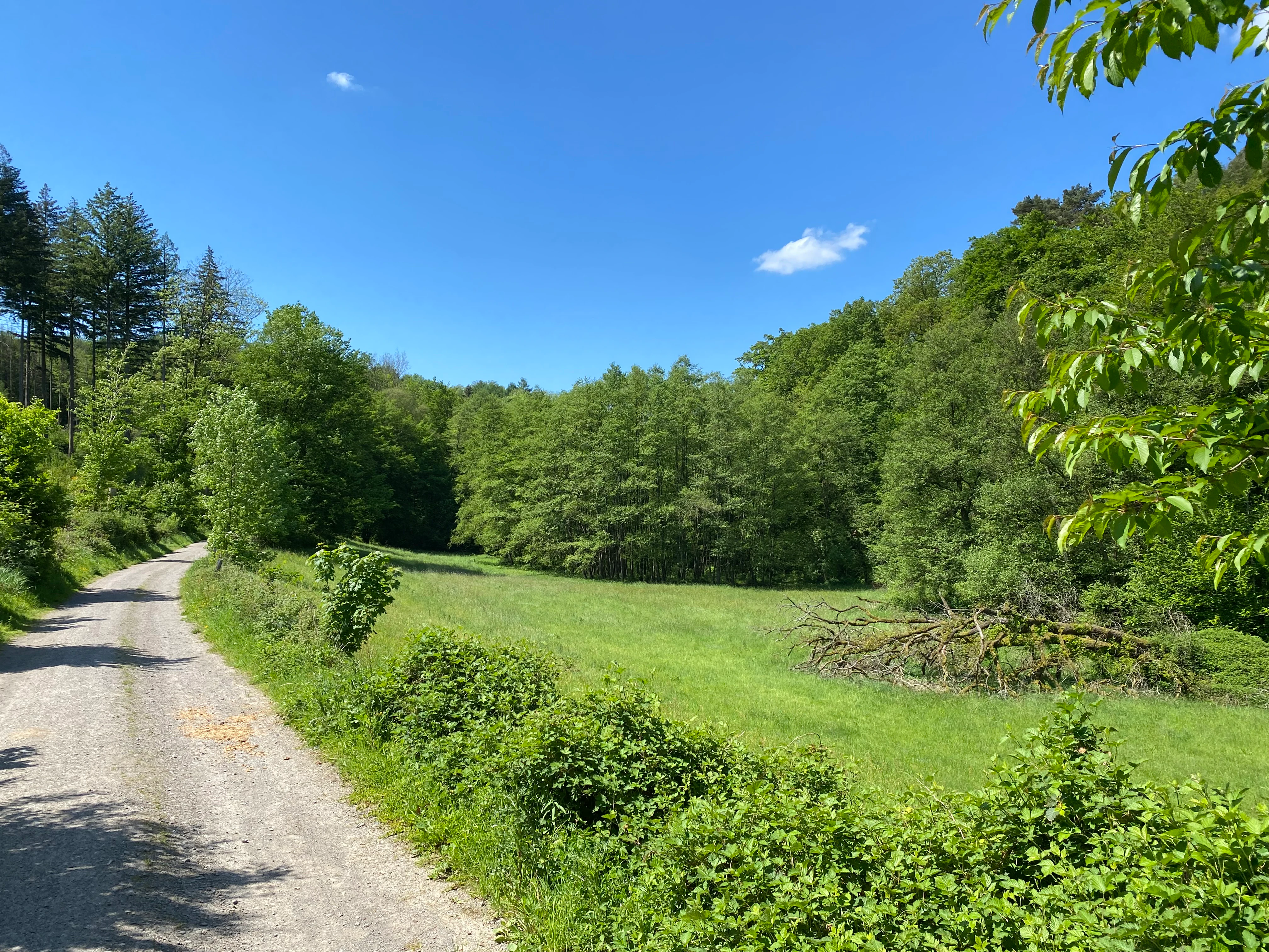
A gravel trail leads along the edge of a vibrant green meadow toward a dense deciduous forest under a clear blue sky.
A rural gravel path bordering a lush green meadow and forest in the Pfengstbach nature reserve.

Pfengstbach Nature Reserve ecosystems, habitats, and plant life

Ecologically, the reserve is defined by the interaction of stream, meadow, spring, and forest habitats within a compact valley. The brook corridor itself is one of the more species-rich elements, lined by naturally structured bands of hornbeam, alder, and crack willow, with characteristic herbaceous vegetation along the banks and a near-natural sandy-gravelly substrate that supports the brook's specialized fauna.

Above the brook, the steep slopes carry old oak and hornbeam woodland with a diverse shrub and herb layer. Where seepage water emerges, wet meadow communities, spring flora, and small alder swamp woodlands create fine-scale habitat mosaics. In the upper valley, these near-natural stands are interrupted by areas of spruce pole forest, which form a different, more uniform forest character.

In the meadow zones along the lower valley, wet and moist grasslands with diverse herbaceous species coexist with the aquatic vegetation of former mill ponds, where plants such as bur-reed, water mint, and marsh hedge-nettle flourish. The combination of mature deciduous forest, flowing water, seepage habitat, traditional meadows, and small wetland basins gives the reserve an unusually high density of distinct ecological niches for its size.
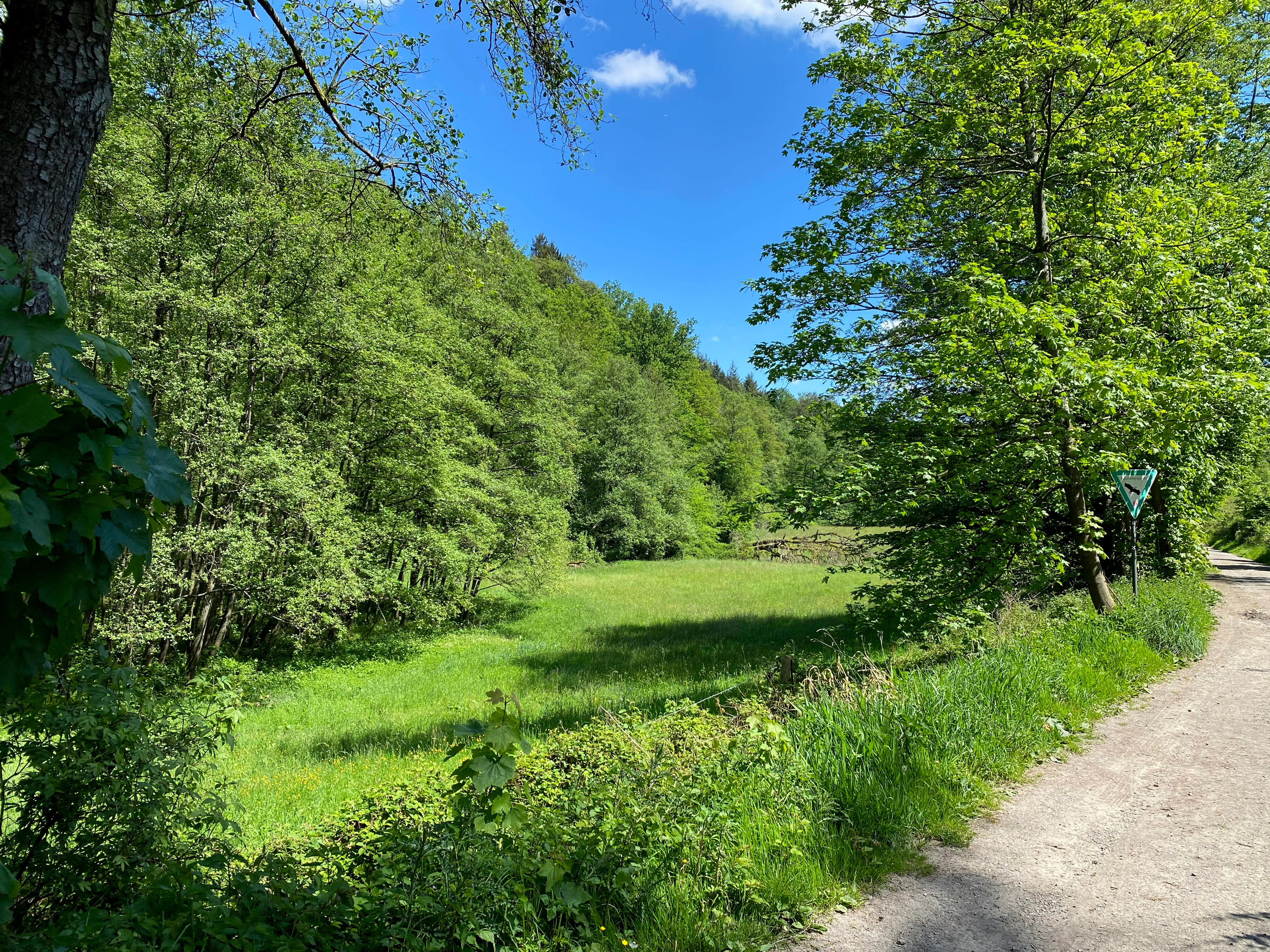
A dirt hiking trail runs along the right side of a sunlit green meadow, bordered by dense deciduous forest under a clear blue sky.
A view of the lush, green valley floor and surrounding woodlands within the Pfengstbach nature reserve.

Pfengstbach Nature Reserve wildlife and species highlights

Wildlife interest in Pfengstbach Nature Reserve is strongly focused on species tied to clean, structurally rich brook habitats. The European brook lamprey (Lampetra planeri) is among the most important species here; its presence in the Pfengstbach is one of the principal reasons for including the reserve's brook system within the broader Dhünn Natura 2000 protection framework.

The reserve's upper headwaters also support the reproduction of the Gestreifte Quelljungfer, a dragonfly species that depends on undisturbed spring-fed sections of the brook. The presence of this species underscores the high water quality and structural integrity of the stream margins in the upper valley.

The mix of mature oak-hornbeam forest, moist meadows, seepage zones, and old mill ponds provides habitat for a wide variety of associated fauna as well, including woodland and meadow birds, amphibians breeding in the small ponds and damp woodland margins, and invertebrates of the wet meadow and stream-side vegetation. The diversity of habitat types across a relatively small area contributes to a notably rich faunal community for a reserve of this size.
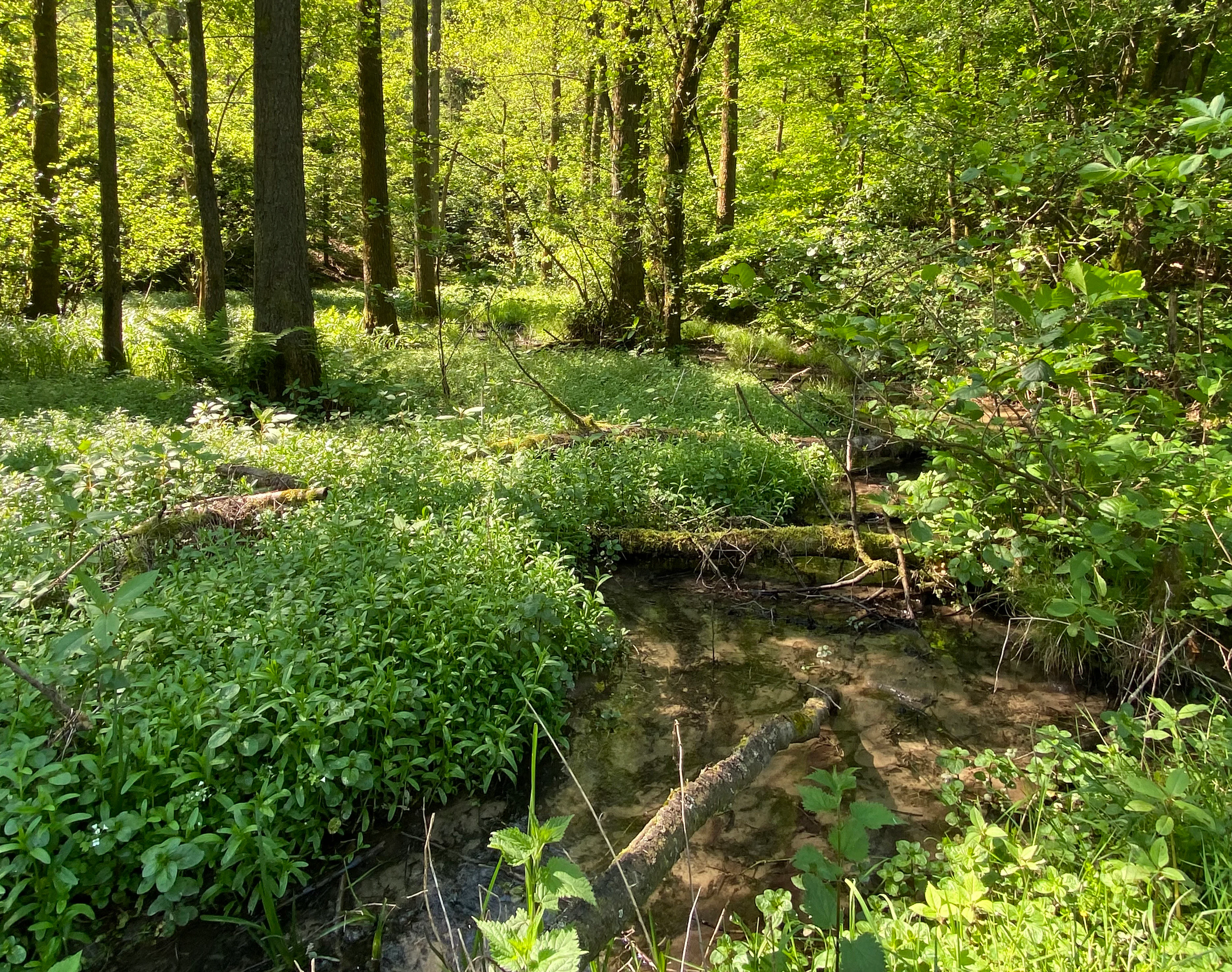
A small stream flowing through a lush, green woodland area with dense ground vegetation and fallen logs in the water.
A tranquil section of the Backesberger Bach stream within the Pfengstbach Nature Reserve.

Pfengstbach Nature Reserve conservation status and protection priorities

From a conservation perspective, Pfengstbach Nature Reserve represents a small but strategically placed segment of a much larger ecological network. By directly connecting to the FFH site 'Dhünn und Eifgenbach', the reserve functions as a protected link for migratory fish, lampreys, and other aquatic species that move along the Dhünn system, giving it relevance for the European Natura 2000 network rather than just local protection.

Within the regional landscape, the reserve is a core component of the Landschaftsplan Mittlere Dhünn and is administered by the Untere Landschaftsbehörde of Rheinisch-Bergischer Kreis. Its protection objectives explicitly target the maintenance and restoration of a near-natural meadow valley, the conservation of a fine-scale mosaic of wet meadows, seepage springs, structured forest edges, and shrubs, and the safeguarding of habitats for endangered animal and plant species.

The implication of these objectives is a long-term commitment to preserving the valley's traditional land use, particularly extensive grassland management, alongside the protection of natural forest succession on the slopes. Such a combination is unusually demanding for a small protected area and reflects the high ecological value that the regional authorities place on this brook valley as part of the broader Dhünn catchment.

Pfengstbach Nature Reserve cultural meaning and human context

The cultural context of the reserve is closely intertwined with the history of the Dhünn catchment and the monastery of Altenberg. Historic watermills operated along the Pfengstbach and its tributaries, including the Backesberger Bach, and the remains of a former mill pond are still visible as a wetland feature within the protected landscape. These traces illustrate how local communities historically harnessed the brook's modest flow for milling and small-scale industry.

Since its 1994 designation, the valley has also taken on an educational role. The Bergischer Weg, a long-distance trail that links Altenberg monastery with Scheuren and other parts of Odenthal, runs through the reserve and operates as both a forest and cultural educational path, with interpretive panels covering local wildlife, tree species, and the monastic life of the Altenberg Cistercians. The reserve thereby links ecological conservation with the regional heritage identity of the Bergisches Land.
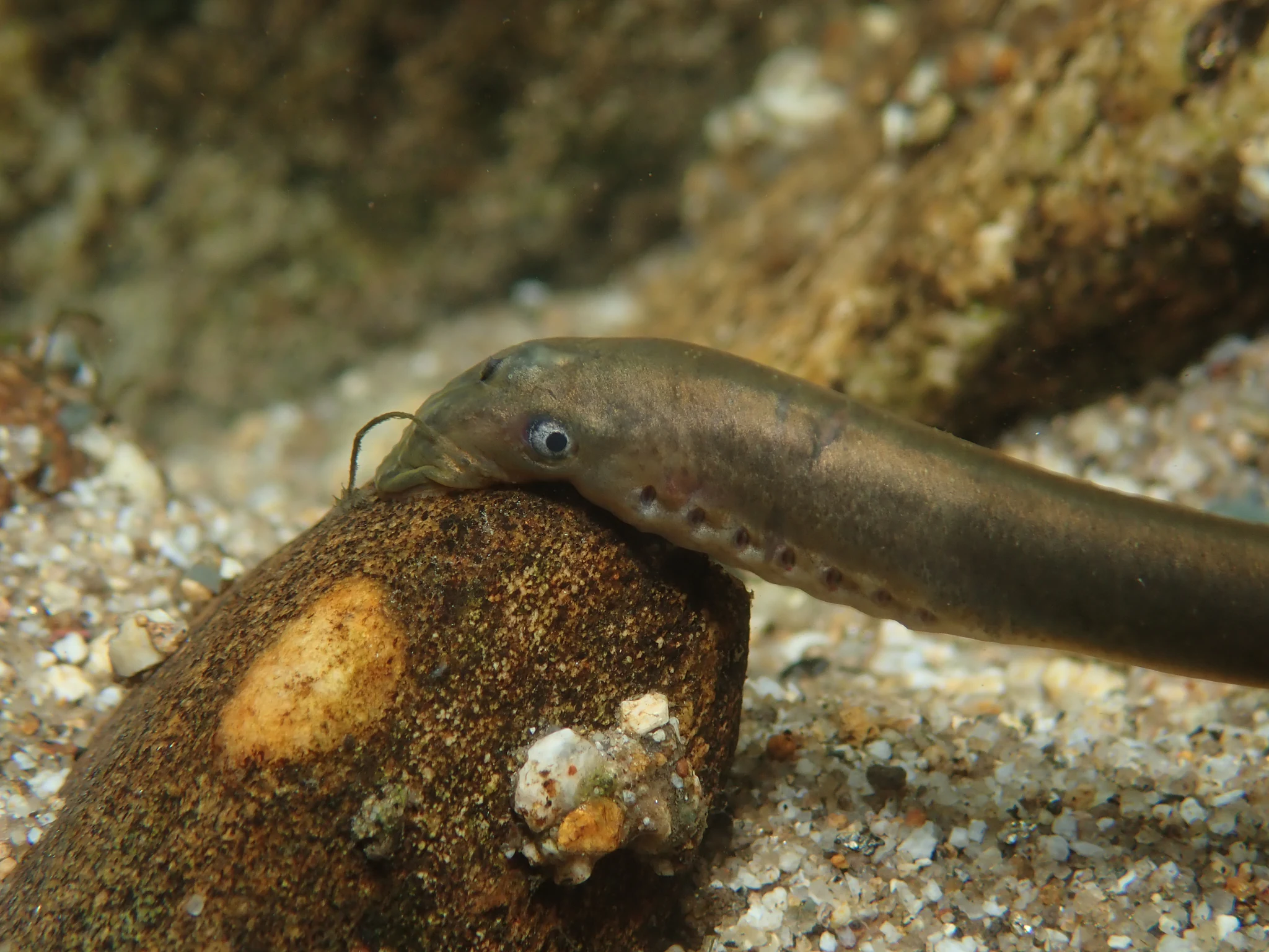
A close-up view of a European brook lamprey resting on a small, smooth, dark stone in a sandy and gravelly streambed.
A European brook lamprey (Lampetra planeri) resting on a stone in a stream bed.

Top sights and standout views in Pfengstbach Nature Reserve

Pfengstbach Nature Reserve stands out for the combination of a near-natural Bergisches Land meadow valley, a structurally diverse brook habitat, and close integration with a European Natura 2000 site along the Dhünn. Its ecological profile is unusually rich for its size: even-aged spruce forests in the upper valley contrast with old oak-hornbeam stands, riparian alder and willow corridors, seepage springs, wet meadows, and former mill ponds, all concentrated within a single protected corridor.

Another distinguishing quality is the way the reserve ties natural and cultural heritage together. The Bergischer Weg turns the valley into a walking and learning landscape where visitors encounter not only rare species such as the brook lamprey and the Gestreifte Quelljungfer but also the ponds and mills of the historical Adendorf and Altenberg cultural landscape.
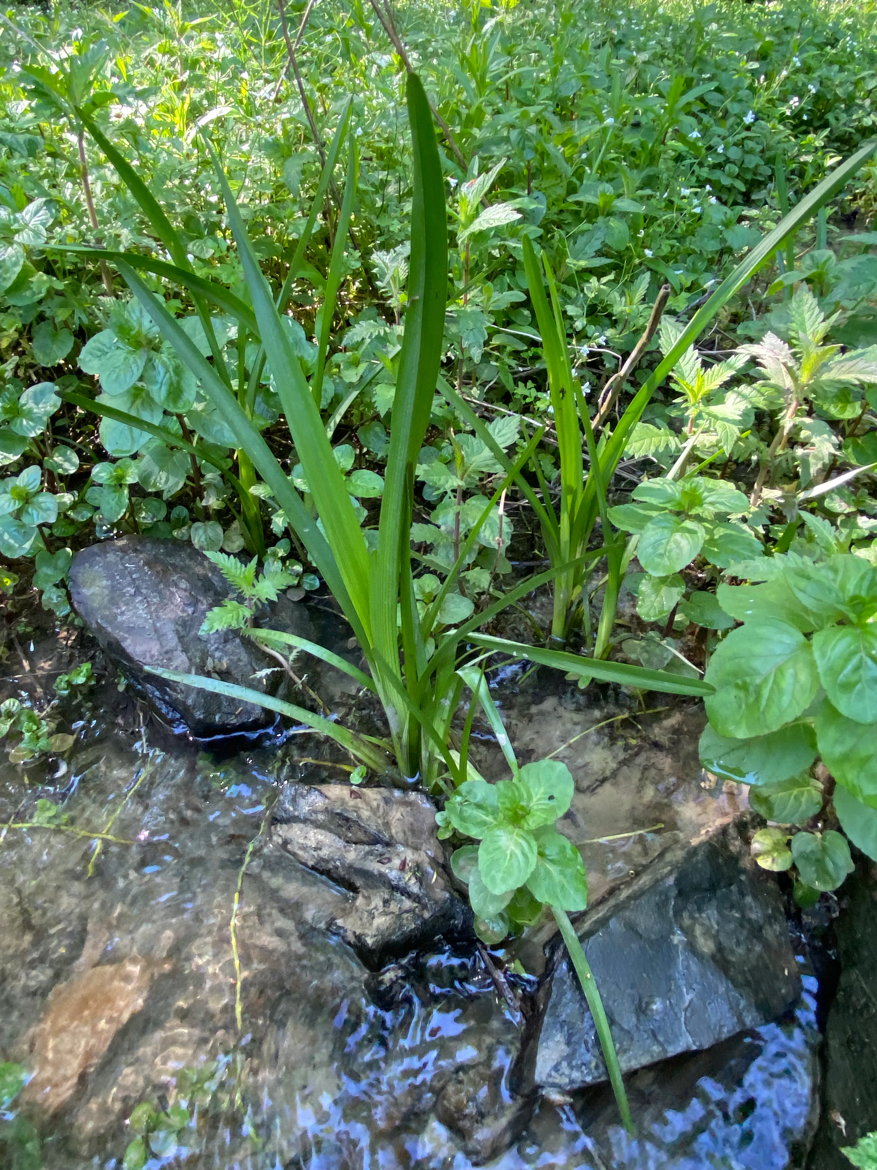
A close-up view of green, sword-shaped leaves and various small broadleaf plants growing directly out of shallow, clear water near dark, wet stones.
Riparian vegetation including bur-reed and mint growing in a shallow pond within the Pfengstbach Nature Reserve.

Best time to visit Pfengstbach Nature Reserve

The Pfengstbach valley can be experienced meaningfully at any time of year, with each season offering a different impression. Spring is particularly notable as woodland and meadow vegetation regenerate and seepage flows along the slopes are at their most active; dragonflies and other brook fauna become increasingly visible as the water warms through late spring and early summer.

Summer showcases the full meadow flora of the valley floor, when moist grassland and the aquatic plants in the former mill ponds reach their peak, and the forest canopy along the slopes provides continuous shade along the walking routes. Autumn brings richer colors in the mixed oak, hornbeam, and alder stands and cooler, clear brook conditions that are favorable for observing the stream habitat itself. Winter visits offer a quieter, reduced-vegetation perspective on the valley's geological and hydrological structure, particularly the meanders of the Pfengstbach and the small side valleys along the slopes.

Monthly climate preview

Long-term monthly temperature averages and precipitation distribution records

Naturschutzgebiet Pfengstbach Climate Normals and Temperature Patterns

Historical climate records for Naturschutzgebiet Pfengstbach reveal measured annual temperature shifts alongside consistent monthly precipitation rates across the representative coordinate. Detailed twelve-month climate normals provide complete statistical context for evaluating long-term environmental patterns across the protected terrain.
Annual mean10 °C
1 °C19 °C
Jan
Feb
Mar
Apr
May13°
Jun17°
Jul19°
Aug19°
Sep15°
Oct10°
Nov
Dec
Warmest month
July

19.2 °C

Coolest month
January

1.3 °C

Wettest month
December

2.6 mm/day

Driest month
April

1.6 mm/day

Park location guide

Geography guide, regional context, and park location map for Pfengstbach Nature Reserve

Pfengstbach Nature Reserve park geography, regions, and map view in Germany

Understand where Pfengstbach Nature Reserve sits in Germany through a broader geographic reading of the surrounding landscape, nearby location context, and its mapped position within the national park landscape.

How Pfengstbach Nature Reserve fits into Germany

Germany is a federal republic in Western and Central Europe with a population of over 83 million across sixteen constituent states. It is Europe's largest economy by nominal GDP and a major global exporter and importer. The capital is Berlin, and the country borders Denmark, Poland, Czech Republic, Austria, Switzerland, France, Luxembourg, Belgium, and the Netherlands.

Wider geography shaping Pfengstbach Nature Reserve in Germany

Germany is located in Western and Central Europe, spanning 357,022 km². It borders Denmark to the north, Poland and the Czech Republic to the east, Austria and Switzerland to the south, and France, Luxembourg, Belgium, and the Netherlands to the west. The country has coastlines on the Baltic Sea and North Sea to the north, with the Alps located in the southern region.

Map view of Pfengstbach Nature Reserve

Use this park location map to pinpoint Pfengstbach Nature Reserve in Germany, understand its exact geographic position, and read its mapped placement within the surrounding landscape more clearly.

Pigeon | © OpenStreetMap contributors

Location context for Pfengstbach Nature Reserve

Nordrhein-WestfalenRheinisch-Bergischer Kreis

Visualizing the brook valley, meadow habitats, and protected terrain of Bergisches Land

Naturschutzgebiet Pfengstbach Photos and Landscape Scenery

Visual documentation of Naturschutzgebiet Pfengstbach reveals the intricate topography of its near-natural brook valley and meandering stream channels. Detailed photography captures the transition from grassy valley floors to steep forested slopes, illustrating key protected habitats.

A dirt hiking trail leads across a small wooden footbridge over a stream, surrounded by lush green trees and an open meadow in the background under a blue sky.

A view looking into a bright green, grassy clearing framed by a canopy of mature, leafy trees in a forest.

A gravel trail leads along the edge of a vibrant green meadow toward a dense deciduous forest under a clear blue sky.

A dirt hiking trail runs along the right side of a sunlit green meadow, bordered by dense deciduous forest under a clear blue sky.

A small stream flowing through a lush, green woodland area with dense ground vegetation and fallen logs in the water.

A sunny, green grassy valley with mature deciduous trees and a small stream hidden in the vegetation.

A close-up view of a European brook lamprey resting on a small, smooth, dark stone in a sandy and gravelly streambed.

A close-up view of green, sword-shaped leaves and various small broadleaf plants growing directly out of shallow, clear water near dark, wet stones.

A small, clear stream winds through a green, deciduous forest in the Pfengstbach valley, with trees leaning over the water and a muddy bank visible.

A cluster of pink, fringed ragged robin flowers growing in a sunny, green grassy meadow.

Park atlas

Compare adjacent protected landscapes, brook reserves, and regional habitats.

Exploring Parks Near Naturschutzgebiet Pfengstbach and Surrounding Valleys

Browsing other protected areas near Naturschutzgebiet Pfengstbach reveals wider patterns in Bergisches Land valley geography and stream conservation. Comparing these neighboring reserves helps place individual meltwater valleys into a broader regional network of protected landscapes.
A soft watercolor painting of a pastoral landscape featuring a stream flowing through green meadows and gentle hills under a pale sky.
Nature reserveRheinisch-Bergischer Kreis
About 2.9 km away#1 closest

South

Naturschutzgebiet Scherfbachtal (Odenthal) Protected Area and Stream Valley Map

A preserved riparian landscape in Rheinisch-Bergischer Kreis.

Naturschutzgebiet Scherfbachtal (Odenthal) represents a well-preserved nature reserve spanning five sections of the Scherfbach stream corridor. The area encompasses diverse ecosystems including near-natural meandering brooks, floodplain forests, and steep Siefen side valleys. This protected landscape is defined by its high habitat connectivity, providing a vital network of springs, marshy meadows, and mature woodlands within the Bergisches Land geography.

Area
1.053 km²
Established
1994
IUCN
IV
Nature reserveNordrhein-Westfalen
About 4.3 km away#2 closest

Southeast

Naturschutzgebiet Scherfbachtal: Protected Stream Valley and Spring Landscape Analysis

Regional protected geography in Nordrhein-Westfalen

Delve into the protected terrain of Naturschutzgebiet Scherfbachtal, which preserves a rare network of spring basins, wet meadows, and floodplain forests. This site exemplifies the ecological value of small, interconnected valley habitats within the wider Bergisches Land region of North Rhine-Westphalia, providing essential sanctuary for local stream-dependent ecosystems.

Established
2012
IUCN
IV
Nature reserveNordrhein-Westfalen
About 9.1 km away#3 closest

Northwest

Wupperhang mit Henkensiepen und Hüscheider Bachtal Protected Area and Geographic Atlas

Forested river valleys and slopes in Nordrhein-Westfalen

Investigate the detailed geography of Wupperhang mit Henkensiepen und Hüscheider Bachtal, a nature reserve showcasing prime Hainsimsen beech forest and riparian habitats. The area represents a key ecological corridor along the Wupper River, featuring rugged side valleys, calcareous springs, and diverse floodplain vegetation that defines this protected woodland segment of the Bergisches Land.

Area
34.65 km²
Established
1985
IUCN
IV
A horizontal watercolor painting depicting a soft landscape with distant rolling hills, mid-ground green forests, and a foreground area of wetland and water.
Nature reserveNordrhein-Westfalen
About 9.5 km away#4 closest

Southeast

Naturschutzgebiet Alemigsiefental: Nature Reserve Geography and Protected Valley Landscapes

Protected riparian habitat in the Bergisches Land of Germany

Examine the mapped boundaries and natural terrain of Naturschutzgebiet Alemigsiefental. This nature reserve in Nordrhein-Westfalen protects an essential stream corridor, wet meadows, and floodplain forests, serving as a critical habitat within the regional network of protected watercourses.

Area
0.101 km²
Established
1990
IUCN
IV
Relief
Upland
Nature reserveRheinisch-Bergischer Kreis
About 10 km away#5 closest

East

Naturschutzgebiet Olpebachtal: Nature Reserve and Protected Stream Valley Geography

A protected landscape mosaic in Rheinisch-Bergischer Kreis

Naturschutzgebiet Olpebachtal protects a unique, near-natural section of the Olpebach stream valley. Characterized by wide floodplains, wet meadows, and narrow tributary ravines, the reserve functions as a critical habitat linkage within the rolling terrain of the Bergische Hochflächen. Its geography provides a clear window into the stream-floodplain systems that define the natural character of the broader region.

Area
0.251 km²
Established
1990
IUCN
IV
Nature reserveNorth Rhine-Westphalia
About 10 km away#6 closest

Southeast

Naturschutzgebiet Ölsiefental Protected Area and Stream Valley Map in North Rhine-Westphalia

Representative valley landscape with moist deciduous forest and spring mire habitats

Naturschutzgebiet Ölsiefental preserves a compact yet diverse mosaic of brook, swamp, and floodplain forest. This protected area in North Rhine-Westphalia follows the Ölsiefen stream from its source to the Sülz river, providing a valuable study of intact valley relief, wet meadow ecology, and historical coppice woodland management in the Bergisches Land region.

Area
0.05 km²
Established
1990
IUCN
IV
A horizontal watercolor illustration depicting rolling hills, forest patches, and a soft, hazy valley against a white background.
Nature reserveNorth Rhine-Westphalia
About 11 km away#7 closest

East

Mausbachtal Nature Reserve in North Rhine-Westphalia: Protected Stream Valley and Forest Landscapes

Regional stream valley network and deciduous forest landscape

This protected area in the Oberbergischer Kreis offers a window into the Bergische Hochflächen topography. The reserve highlights a mosaic of near-natural beech forest, wet meadows, and floodplain woodland, forming an integral link in the regional stream network connected to the Große Dhünn.

Area
0.237 km²
Established
2013
IUCN
IV
Nature reserveNordrhein-Westfalen
About 11 km away#8 closest

West

Wupperinsel Nature Reserve: Mapped Protected Landscapes in Nordrhein-Westfalen

Riparian woodland, floodplain islands, and meadow habitats.

Discover the geographic role of Wupperinsel as a designated nature reserve within the Wupper River corridor. This site features a rare Glatthafer meadow, mature poplar lines, and mixed-woodland groves that provide essential habitat connectivity. Analyze the protected island boundaries and the layered floodplain terrain that characterize this significant ecological fragment in urban Germany.

Area
0.054 km²
Established
1987
IUCN
IV

Common questions about visiting, size, designation, and location context for Pfengstbach Nature Reserve

Pfengstbach Nature Reserve FAQs for park facts, access, geography, and protected area context

Find quick answers about Pfengstbach Nature Reserve, including protected-area facts, park geography, trail and visitor context, and how the park fits into its surrounding country and regional landscape.
MoriAtlas Explorer

Continue Your Protected Areas Search Across the Global Atlas

Deepen your exploration by continuing the structured search for national parks and protected areas worldwide. Utilize the comprehensive filtering capabilities to compare different conservation landscapes and refine your understanding of global park geography. Discover more about the distribution and characteristics of protected natural areas.

Global natural geography