
Mori Atlas logo
Nature reserveNaturschutzgebiet Schmittwassertal

Analyzing the mapped boundaries, brook corridors, and calcareous grassland ecosystems of this Westphalian nature reserve.

Naturschutzgebiet Schmittwassertal: A Detailed Geographic Atlas of a Protected Nature Reserve in Nordrhein-Westfalen

Naturschutzgebiet Schmittwassertal is a distinct 53.6-hectare nature reserve situated within the Paderborn district of Nordrhein-Westfalen. This protected area acts as a crucial ecological corridor, linking the Glasebruch and Sauertal reserves through a network of narrow stream valleys including the Schmittwasser and Glasebach. The landscape is characterized by a tightly compressed mosaic of alder-lined brooks, damp meadows, and species-rich calcareous grassland slopes that define this unique section of the Westphalian lowland.

nature reservestream valleylowland brookalder woodlandwet meadowdry grassland
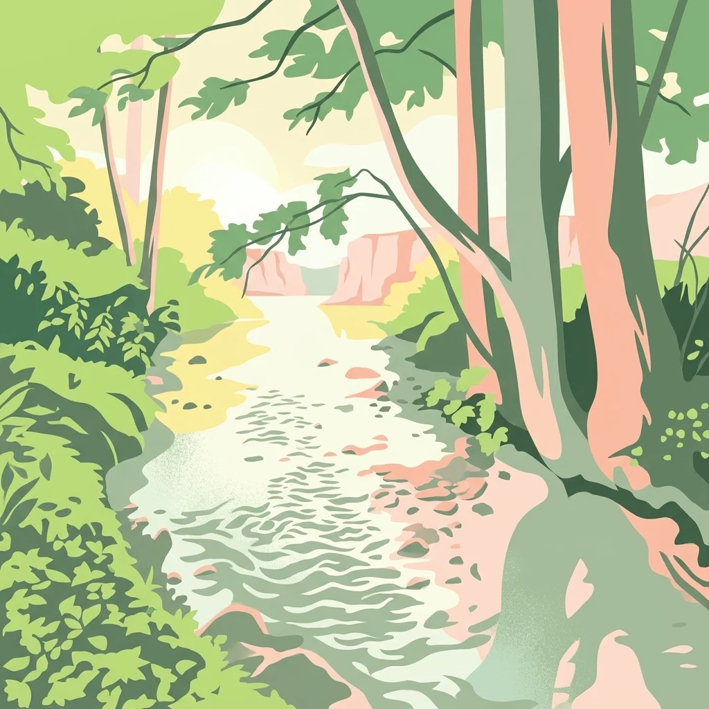
A stylized flat vector illustration of a forest stream flowing between trees and foliage toward a distant rocky valley.

Naturschutzgebiet Schmittwassertal

Nature reserve

Park overview

Structured park overview, official facts, and landscape profile for Schmittwassertal Nature Reserve

Schmittwassertal Nature Reserve park facts, protected area profile, and essential visitor context

Review the core facts for Schmittwassertal Nature Reserve, including designation, size, terrain, visitor scale, habitats, and operating context in one park-focused overview.

About Schmittwassertal Nature Reserve

Naturschutzgebiet Schmittwassertal is a compact but ecologically varied nature reserve on the eastern edge of the Westphalian landscape, protecting a stretch of small brooks and their surrounding grassland in the Paderborn district. Although it covers only about 53.6 hectares and is split into four separate sections, the reserve plays an important role in the local network of protected watercourse valleys.

The setting lies south of the village of Herbram, within the cadastral district of Asseln, and follows the Schmittwasser stream as well as parts of the Glasewasser between the Singermühle mill and Herbram. From there the reserve continues along the Glasebach toward Iggenhausen. Two neighboring reserves extend this corridor: the Glasebruch reserve lies directly to the east, while the Sauertal reserve near Iggenhausen picks up the protection westward. This continuity means that Schmittwassertal is less an isolated fragment and more a middle link in a longer chain of protected lowland brooks surrounded by traditional meadow country.

The habitats the reserve protects reflect this transitional setting. Flowing waters are bordered by brook-aligned alder groves (Erlengehölze), while flatter floodplain areas hold damp meadow and wet grassland. Where the slopes become steeper, the character changes abruptly, because thin, drier soils support nutrient-poor Borstgrasrasen and well-drained Kalkhalbtrockenrasen, two habitat types that are typically associated with much more open and rural low-mountain landscapes. This direct contrast between wet brook habitats and dry calcareous grassland within walking distance of one another is one of the reserve's defining qualities.

The reserve's protection framework is unusually explicit about its management goals. The 2014 landscape plan identifies issues that must be progressively addressed, including the restoration of ecological continuity along the brooks after the expiration of existing permits for the in-stream fish pond systems. Agricultural land within the reserve is intended to be managed extensively as meadow, mowed pasture or pasture. Expanding shrub cover on dry grassland and extensively used pasture should be removed, and spruce stands on groundwater-influenced or otherwise ecologically significant sites are to be converted. Together, these measures aim to keep the mosaic of brook, alder grove, wet meadow and dry grassland habitats intact while gradually improving their ecological quality.

Quick facts and research context for Schmittwassertal Nature Reserve

Schmittwassertal Nature Reserve lies in the town of Lichtenau, Paderborn district, North Rhine-Westphalia, in western Germany. It covers approximately 53.6 hectares across four separate sections and was designated as a formal nature reserve in 2014 through the Lichtenau landscape plan.

The protected area is centered on the Schmittwasser stream and adjacent stretches of the Glasewasser and Glasebach, combining small lowland brooks, alder-lined banks, damp meadows and steep slopes with species-rich dry grassland. It is one of several linked stream-valley reserves around Lichtenau, sitting between the Glasebruch reserve to the east and the Sauertal reserve to the west.

Protection and recognition

Documented terrestrial protection scope and international recognition records

Naturschutzgebiet Schmittwassertal Protection Status and Recognition

Terrestrial protection status and designation details provide clear administrative context for Naturschutzgebiet Schmittwassertal. Official records outline management scope and recognized conservation frameworks across the protected area.

Protection details

Protection scope
Terrestrial
Transboundary protection
No
Park context

Deeper park guide and search-rich context for Schmittwassertal Nature Reserve

Schmittwassertal Nature Reserve history, landscape, wildlife, and travel context

Explore Schmittwassertal Nature Reserve through its history, landscape character, ecosystems, wildlife, conservation priorities, cultural context, and seasonal travel timing in a structured park guide built for atlas discovery and search intent.

Why Schmittwassertal Nature Reserve stands out

Schmittwassertal is best known for its small, ecologically rich lowland stream valleys, particularly the alder woodland that fringes the Schmittwasser and Glasebach. The reserve stands out for the close coexistence of flowing water habitats, damp meadow communities and unusually species-rich grassland types on the adjacent slopes. A second defining feature is the calcareous character of some of the slopes, where thin, dry soils support Borstgrasrasen and Kalkhalbtrockenrasen, semi-dry limestone grassland communities that are otherwise rare in the surrounding Paderborn landscape. Together, the brook, the wet meadows and the dry grassland create a tightly compressed mosaic of habitat types within a very small area.
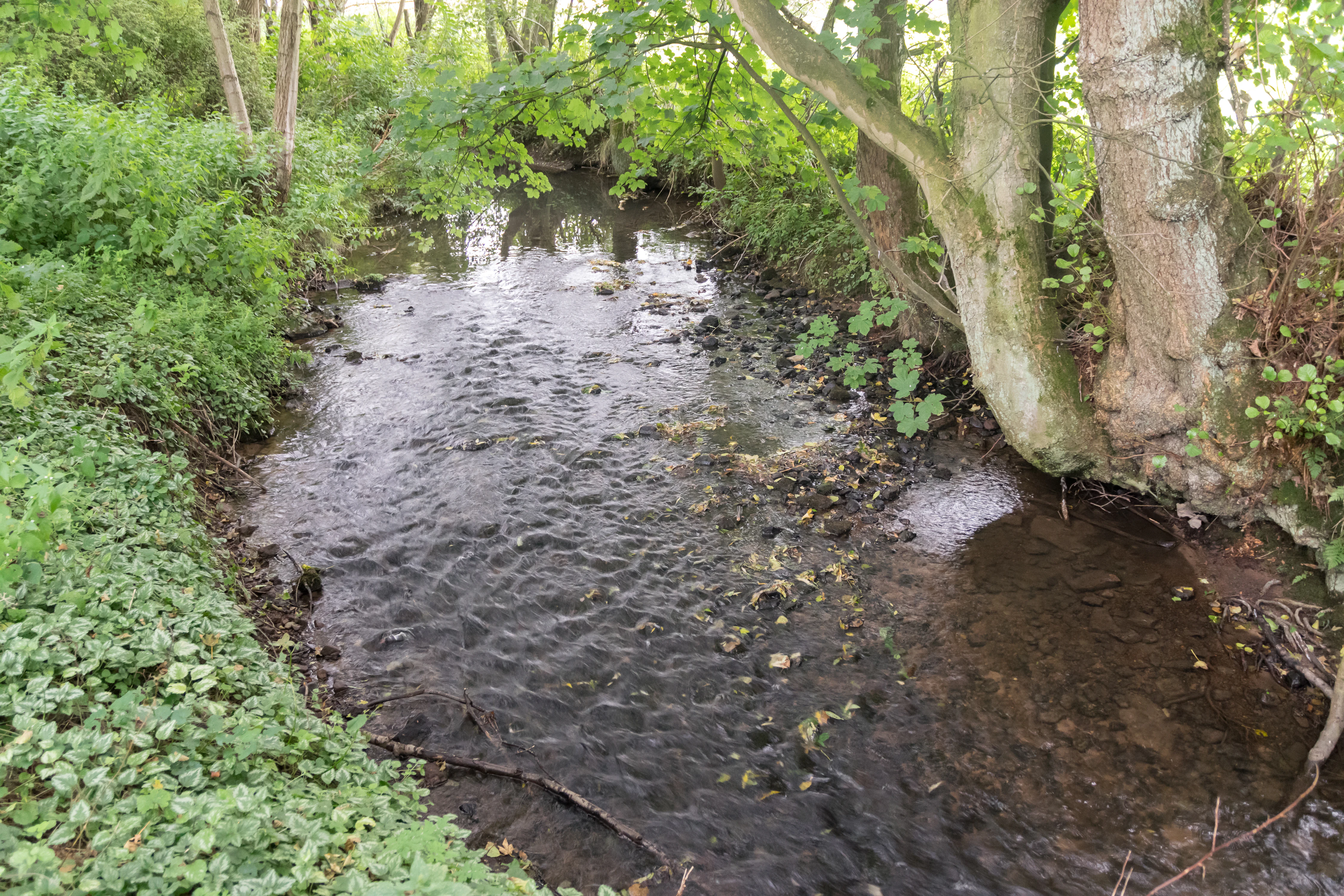
A small, clear stream winds through a lush, forested area with thick vegetation on the banks.
A small, shaded stream flowing through the Naturschutzgebiet Schmittwassertal.

Schmittwassertal Nature Reserve history and protected-area timeline

The Schmittwassertal reserve has a relatively short formal history. Its present-day boundaries and conservation status date from 2014, when the Paderborn district council adopted the Lichtenau landscape plan and, through that plan, designated the area around the Schmittwasser, parts of the Glasewasser and the Glasebach as a Naturschutzgebiet.

The reserve was established not as a completely new concept but as one element in a broader restructuring of nature protection around the town of Lichtenau. The 2014 scheme recognized the importance of the existing small brooks and their associated grassland habitats and gave them a unified statutory framework. Before 2014, much of the same land was used traditionally as meadow, pasture and fish ponds, but without the consolidated protection that the reserve now provides.

The published landscape plan remains the primary reference document for the reserve, and its detailed conservation objectives effectively serve as the working history of the area's transition into formal protection.

Schmittwassertal Nature Reserve landscape and geographic character

Schmittwassertal occupies a gently undulating to moderately steep section of the Westphalian lowland between Herbram and Iggenhausen. The defining landform is the shallow valley of the Schmittwasser and its continuation into the Glasewasser and Glasebach, narrow brook-cut corridors that shape both the relief and the ecology of the reserve.

The valley floors are flat and damp, supporting wet meadow and stream-side habitats, while the transitions onto the surrounding land include steeper slopes. On these slopes, thin soils and a calcareous influence give rise to dry, species-rich grassland. The result is a compressed mosaic in which watercourse, wet meadow and dry grassland lie extremely close to one another, sometimes within a single hillside.

The reserve also lies close to inhabited areas, bordering village settlement zones directly. This juxtaposition of small-scale agricultural landscape, scattered villages and protected stream valley gives Schmittwassertal its particular character: a small but tightly organized piece of countryside shaped by both human land use and the natural drainage of the Schmittwasser system.

Schmittwassertal Nature Reserve ecosystems, habitats, and plant life

Ecologically, the reserve is defined by the interaction between its small lowland brooks and the contrasting grassland types that line them. The flowing waters of the Schmittwasser, Glasewasser and Glasebach form the hydrological backbone of the area, and the conservation plan explicitly aims at restoring their ecological continuity.

Along the brooks, alder-dominated gallery woodlands, Erlengehölze, occupy the narrow riparian zones. Where the valley floor widens, damp meadow and wet grassland communities take over, depending on the water regime of the soils. These wet habitats make up a significant portion of the four reserve sections.

A distinctive element of the reserve is the presence of calcareous and nutrient-poor dry grassland on the steeper slopes. Borstgrasrasen, a community dominated by matgrass typical of acid to moderately base-rich thin soils, occurs alongside Kalkhalbtrockenrasen, semi-dry calcareous grasslands that are particularly notable in this otherwise rural lowland setting. These dry grassland types are ecologically valuable because they support specialized flowering plants and invertebrate communities that cannot survive in more intensively used farmland.

Schmittwassertal Nature Reserve wildlife and species highlights

Detailed wildlife records are not a major focus of the source material, but the reserve's design gives clear indications of its faunal significance. The brook and its alder-lined banks provide habitat for stream-dwelling invertebrates, fish and amphibians, while the planned restoration of ecological continuity along the streams is explicitly intended to benefit these communities. The wet meadows and damp grasslands offer additional habitat for meadow-breeding birds and insect life.

The dry grassland slopes, especially the Borstgrasrasen and Kalkhalbtrockenrasen, are particularly important for invertebrates, including butterflies, wild bees and other pollinators that depend on open, species-rich vegetation. Maintaining these grasslands by removing invading shrubs is therefore a key conservation measure for the park's wildlife value.

The reserve also functions as part of a wider ecological corridor linking the Glasebruch reserve, Schmittwassertal and the Sauertal reserve, allowing wildlife movement along the connected brook system between Herbram, Asseln and Iggenhausen.

Schmittwassertal Nature Reserve conservation status and protection priorities

Schmittwassertal is a conservation-focused reserve built around small lowland brooks and a tight mosaic of meadow and dry grassland habitats. Its official status as a Naturschutzgebiet under North Rhine-Westphalia law gives the area statutory protection and binds land use within its boundaries to the conservation objectives laid out in the 2014 Lichtenau landscape plan.

The reserve's conservation significance is twofold. First, it protects a chain of small watercourses that would otherwise be vulnerable to hydrological disruption and fragmentation. Second, it conserves dry grassland communities, especially the semi-dry calcareous grasslands, that are rare and easily lost in intensively used agricultural landscapes.

A core conservation goal is the long-term ecological integrity of the streams themselves. Existing fish pond installations are intended to be dismantled or redesigned once current permits expire, in order to restore the natural connectivity of the brooks. At the same time, the reserve's management plan aims to keep its dry and wet grassland communities open, valuable and botanically rich, by promoting extensive agricultural use, controlling shrub encroachment and converting ecologically problematic spruce stands into more natural habitat.

Schmittwassertal Nature Reserve cultural meaning and human context

The surroundings of Schmittwassertal reflect a long tradition of small-scale rural land use in eastern Westphalia. The stream valleys have historically been used for water-powered mills such as the Singermühle, for fish ponds and for hay meadows, and these traditional uses are still visible in the structure of today's landscape, with old pond systems, scattered farmsteads and maintained meadows coexisting inside and next to the reserve.

The reserve's location directly bordering village settlement areas is itself part of its cultural context. Rather than separating nature from settlement, the protected area folds into the existing rural fabric of Herbram, Asseln and Iggenhausen, illustrating how small protected stream valleys in this region have long been shared spaces between farming communities and the broader countryside.

Top sights and standout views in Schmittwassertal Nature Reserve

A four-section, 53.6-hectare nature reserve around the Schmittwasser stream in the Paderborn district, designated in 2014 through the Lichtenau landscape plan. It forms a central link between the Glasebruch reserve to the east and the Sauertal reserve to the west, preserving a continuous corridor of protected lowland brooks.

The reserve combines extremely contrasting habitats in a compact area: alder-lined brook corridors, wet meadows on the valley floor and steep slopes carrying Borstgrasrasen and Kalkhalbtrockenrasen, semi-dry calcareous grasslands that are notable for this part of Westphalia. Active management is aimed at restoring the streams' ecological continuity, controlling shrub encroachment and removing ecologically problematic spruce stands.

Best time to visit Schmittwassertal Nature Reserve

Because Schmittwassertal is a grassland and stream-valley reserve rather than a high-mountain park, seasonal experience depends mainly on the flowering and grass growth in its meadows and on water levels in the brooks. Late spring and early summer are generally the most rewarding period to view the dry grassland slopes, when Kalkhalbtrockenrasen and Borstgrasrasen communities reach peak botanical diversity and pollinators are most active.

Summer brings lush growth in the wet meadows and full canopy in the alder galleries, while autumn gives strong contrast between the yellowing meadows, the still-green brook-side woodland and the bright fall colors along the brooks. Winter is typically quieter, but low water levels can make the small streams and their banks more visible, and the open dry grassland remains structurally interesting throughout the year. The reserve's small size and proximity to villages mean that daylight visits are most practical, but it is accessible year-round as an outdoor landscape rather than a visitor attraction in the conventional sense.

Monthly climate preview

Trace long-term monthly temperature averages and precipitation rhythms across the protected landscape

Naturschutzgebiet Schmittwassertal Climate Normals and Annual Weather Patterns

Representative coordinates record long-term monthly temperature swings alongside steady daily precipitation patterns across the protected landscape. Examining the full twelve-month profile reveals detailed climate normals and recorded weather variation for Naturschutzgebiet Schmittwassertal.
Annual mean9 °C
0 °C18 °C
Jan
Feb
Mar
Apr
May12°
Jun15°
Jul18°
Aug18°
Sep14°
Oct
Nov
Dec
Warmest month
July

18 °C

Coolest month
January

-0.2 °C

Wettest month
July

2.6 mm/day

Driest month
April

1.7 mm/day

Park location guide

Geography guide, regional context, and park location map for Schmittwassertal Nature Reserve

Schmittwassertal Nature Reserve park geography, regions, and map view in Germany

Understand where Schmittwassertal Nature Reserve sits in Germany through a broader geographic reading of the surrounding landscape, nearby location context, and its mapped position within the national park landscape.

How Schmittwassertal Nature Reserve fits into Germany

Germany is a federal republic in Western and Central Europe with a population of over 83 million across sixteen constituent states. It is Europe's largest economy by nominal GDP and a major global exporter and importer. The capital is Berlin, and the country borders Denmark, Poland, Czech Republic, Austria, Switzerland, France, Luxembourg, Belgium, and the Netherlands.

Wider geography shaping Schmittwassertal Nature Reserve in Germany

Germany is located in Western and Central Europe, spanning 357,022 km². It borders Denmark to the north, Poland and the Czech Republic to the east, Austria and Switzerland to the south, and France, Luxembourg, Belgium, and the Netherlands to the west. The country has coastlines on the Baltic Sea and North Sea to the north, with the Alps located in the southern region.

Map view of Schmittwassertal Nature Reserve

Use this park location map to pinpoint Schmittwassertal Nature Reserve in Germany, understand its exact geographic position, and read its mapped placement within the surrounding landscape more clearly.

Pigeon | © OpenStreetMap contributors

Location context for Schmittwassertal Nature Reserve

Nordrhein-Westfalen

Visual reference of valley terrain, alder groves, and calcareous grassland habitats

Naturschutzgebiet Schmittwassertal Landscape Photos and Protected Area Scenery

Visual documentation captures the varied terrain and protected habitats across Naturschutzgebiet Schmittwassertal, highlighting the close proximity of winding streams and dry grassland slopes. Examining these detailed landscape photographs provides a clearer understanding of the ecological mosaic and distinctive environmental character preserved within the reserve.

A small, clear stream winds through a lush, forested area with thick vegetation on the banks.

Park atlas

Compare adjacent stream valleys and connected regional habitats

Parks Near Naturschutzgebiet Schmittwassertal and Surrounding Protected Areas

Browsing other parks near Naturschutzgebiet Schmittwassertal reveals connected stream corridors and protected lowland landscapes across the Paderborn district. Comparing nearby reserves provides deeper geographic context for the local watershed network and regional habitat types.
Watercolor illustration of rolling green and pink-tinted hills with scattered small trees against a white background.
Nature reserveNordrhein-Westfalen
About 10 km away#1 closest

Southeast

Kalktriften Willebadessen Nature Reserve: Mapped Geography and Protected Limestone Grasslands

Protected calcareous slopes within the Nethe valley region

Kalktriften Willebadessen encompasses a unique Muschelkalk limestone ridge in the Weser Uplands. This protected nature reserve provides a essential habitat for threatened flora and fauna, thriving within an open, sun-baked landscape that contrasts sharply with the surrounding forests. The site serves as a key example of how historical agricultural practices sustain biodiversity, featuring varied terrain from steep southern spurs to panoramic valley overlooks.

Area
1.12 km²
Established
2003
IUCN
IV
Relief
Upland
A soft watercolor painting of a serene landscape featuring a small pond in the foreground with gentle hills and trees in the background.
Protected landscapeKreis Paderborn
About 12 km away#2 closest

Southwest

Landschaftsschutzgebiet Büren: A Detailed Look at the Protected Rural Mosaic of Kreis Paderborn

Mapped protected landscapes in the German Westphalian countryside

Landschaftsschutzgebiet Büren spans a wide, undulating terrain in the Kreis Paderborn district, characterized by its durable structure of woodland patches, hedgerows, and headwater springs. The area serves as a key case study in maintaining semi-natural ecological features within an active, working agricultural landscape. Access detailed geographic context on the patterns of this regional protected area and its role in the Westphalian landscape.

Area
142.95 km²
Established
1974
Relief
Mixed relief
Scope
Terrestrial
A horizontal watercolor painting showing a soft landscape with a winding stream, grassy meadows, and distant forested hills under a pale sky.
Nature reserveGermany
About 12 km away#3 closest

South

Marschallshagen und Nonnenholz mit oberem Altenautal Protected Nature Reserve Map

Ecological landscape and forest geography in the Paderborn district

Covering approximately 1,943 hectares, this nature reserve is a major component of the regional conservation framework. The landscape creates a layered mosaic of closed beech forest, near-natural running water, and floodplain woodland, serving as a significant site for European bird protection programs.

Area
19.43 km²
Established
2002
A soft watercolor painting depicting a meandering stream through a grassy valley with rolling, tree-covered hills in the background.
Nature reserveNorth Rhine-Westphalia
About 13 km away#4 closest

South

Schwarzbachtal (PB): A Protected Stream Valley Landscape in North Rhine-Westphalia

Mapped nature reserve and valley habitat geography

Spanning over 200 hectares in the Paderborn district, Schwarzbachtal (PB) is a core nature reserve that protects the delicate stream valley landscape of the Schwarzbach. This area serves as a significant example of long-term conservation management in North Rhine-Westphalia, offering structured insight into regional habitat patterns and valley topography.

Area
2.206 km²
Established
2014
IUCN
IV
Nature reserveNorth Rhine-Westphalia
About 14 km away#5 closest

West

Ziegenberg Nature Reserve: Geographic Overview and Protected Area Boundaries

Riparian landscapes and calcareous slopes in the Paderborn region

Ziegenberg offers a distinct look at the intersection of calcareous hillside forests and moist stream environments in Germany. The reserve protects a concentrated diversity of habitats ranging from orchid-rich woodland to alluvial streamside corridors, serving as an important ecological link within the Paderborn district's natural geography.

Area
0.028 km²
Established
1984
IUCN
IV
Nature reserveNordrhein-Westfalen
About 14 km away#6 closest

Northwest

Lippeniederung zwischen Bad Lippspringe und Mastbruch: A Protected Floodplain Landscape

Nature reserve geography and river valley conservation in Paderborn, Germany.

Lippeniederung zwischen Bad Lippspringe und Mastbruch encompasses a specialized floodplain corridor along the Lippe river. This site highlights the importance of managing small-scale riverine meadows and aquatic transition zones within the broader, heavily used agricultural geography of North Rhine-Westphalia.

Area
1.59 km²
Established
1966
IUCN
IV
Relief
Lowland
A watercolor painting showing a green landscape with a winding river and distant hills under a light pink sky.
Protected landscapeKreis Paderborn
About 14 km away#7 closest

Northwest

Landschaftsschutzgebiet Fließgewässer und Auen: Regional Protected Landscape Overview

Riverine floodplain corridors and valley habitats in Paderborn

This protected landscape in Kreis Paderborn sustains essential habitat connectivity along river valleys including the Lippe and Beke. Its design features a fragmented network of sixteen sub-areas, showcasing how floodplain vegetation, wet meadows, and riparian corridors function within an urban-adjacent environment.

Area
9.583 km²
Established
1999
Relief
Lowland
Scope
Terrestrial
Nature reservePaderborn
About 14 km away#8 closest

West

Ziegenberg Nature Reserve: Protected Landscape Geography and Paderborn River Corridors

Mapping the forest ridges and floodplains of Paderborn district.

Discover the geographic composition of Ziegenberg, a nature reserve in Paderborn that blends riparian meadows with stony forest ridges. This protected site demonstrates the complex relationship between municipal expansion, river hydrology, and conservation within the German landscape.

Area
0.81 km²
Established
1980
Relief
Upland
Climate
Temperate

Common questions about visiting, size, designation, and location context for Schmittwassertal Nature Reserve

Schmittwassertal Nature Reserve FAQs for park facts, access, geography, and protected area context

Find quick answers about Schmittwassertal Nature Reserve, including protected-area facts, park geography, trail and visitor context, and how the park fits into its surrounding country and regional landscape.
MoriAtlas Explorer

Continue Your Protected Areas Search Across the Global Atlas

Deepen your exploration by continuing the structured search for national parks and protected areas worldwide. Utilize the comprehensive filtering capabilities to compare different conservation landscapes and refine your understanding of global park geography. Discover more about the distribution and characteristics of protected natural areas.

Global natural geography