
Why Neckartal mit Seitentälern von Rottweil bis Aistaig stands out
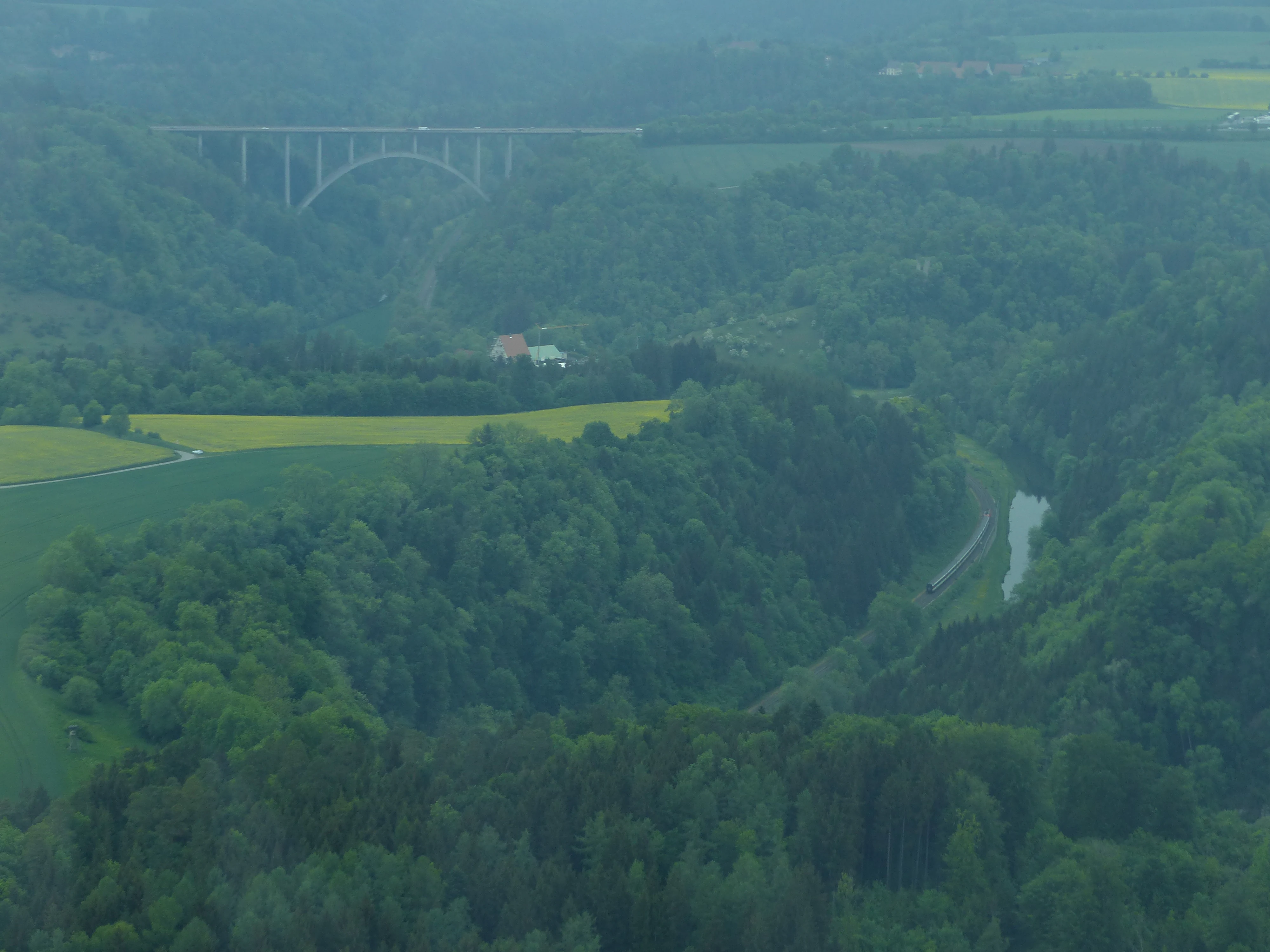
The protected area is most notable for the deeply entrenched, partly canyon-like meander of the Neckar river between Rottweil and Aistaig. The river loops through approximately twenty bends along this stretch, cutting up to 140 meters down through Keuper and Muschelkalk bedrock and producing a striking sequence of cliffs, slopes, and incised tributary valleys along the plateau edge. Equally characteristic are the rock outcrops and elevated ridge positions that host several castles and castle ruins, linking the landscape to centuries of regional history. The combination of geological incision, hydrological meandering, and cultural-historical features on the cliff edges gives this section of the Neckar valley a particularly distinctive visual and ecological identity.
Neckartal mit Seitentälern von Rottweil bis Aistaig history and protected-area timeline
The protected landscape was formally established by ordinance of the Landratsamt Rottweil on February 1, 1953, as one of the designations applied to the Neckar valley in this district. The ordinance covered the stretch of the Neckar valley between Rottweil and the Aistaig district north of Oberndorf am Neckar together with the major side valleys descending into it.
The protection designation reflects a long-standing recognition of this section of the Neckar valley as a regionally important landscape, both for its scenic meandering character and for the cultural-historical features along its slopes, which include several castles and castle ruins perched on rocks and ridge positions. In later decades the area was integrated into a broader European conservation framework through the FFH designation Neckartal zwischen Rottweil und Sulz, which covers much of the same valley and links its landscape protection to habitat and species conservation under the Habitats Directive. The protected area's position within Landkreis Rottweil has also kept it part of a larger mosaic of landscape and nature protection zones in the district.
Neckartal mit Seitentälern von Rottweil bis Aistaig landscape and geographic character
The defining geomorphological feature of the protected area is the deeply entrenched meandering course of the Neckar through Keuper and Muschelkalk bedrock. Between Rottweil and Aistaig the river cuts up to 140 meters into the surrounding terrain and executes approximately twenty bends, producing alternating sequences of convex slope spurs and concave undercut slopes. In places the valley walls are steep enough to evoke a canyon-like character, particularly where Muschelkalk benches form resistant cliff lines.
The plateau edge onto which the valley is incised belongs to the natural region of the Obere Gäue, an elevated, relatively level landscape that has been dissected by the Neckar and its tributaries. Several side streams descend from this plateau into the main valley, cutting their own narrow valleys and breaking up the otherwise smooth plateau edge. On the resulting rock outcrops, ridge ends and elevated spurs stand several castles and castle ruins, occupying the visually commanding positions of the valley.
The combination of canyon-like meander loops, steep slope sections with exposed rock, and notched tributary valleys gives this stretch of the Neckar valley a richly varied topography within a relatively short longitudinal distance. From the valley floor, the sequence of bends produces constantly changing vistas of cliff, slope, and plateau, which is the core of the protected area's landscape character.
Neckartal mit Seitentälern von Rottweil bis Aistaig ecosystems, habitats, and plant life
In ecological terms, the protected area functions primarily as a valley-axis ecosystem set within an otherwise agricultural plateau landscape. The slopes of the Neckar valley and its side valleys support a mosaic of deciduous forest, shrub, rock and grassland habitats that contrasts with the open farmland of the surrounding Obere Gäue plateau. Valley slopes with their varied aspect and exposure are typical habitat for warm-loving, light-rich plant communities associated with Muschelkalk and Keuper substrates.
The protected landscape also overlaps with the larger FFH area Neckartal zwischen Rottweil und Sulz, which specifically recognizes the valley's habitat value under the European Habitats Directive. Within the protected landscape, several more strictly protected nature reserves are embedded: Neckarburg, Schlichemtal, Kälberhalde, Mittlere Bollerhalde and Brandhalde. These reserves protect specific sections with particularly valuable habitat, such as rocky slopes, halde (slope) woodland and valley-bottom sections.
Together, the landscape protection area, the FFH designation and the embedded nature reserves form a layered protection structure that maintains habitat continuity along the Neckar valley. The two area-based natural monuments within the landscape, Höhinger Halde and Käppeleshalde, contribute additional local-scale habitat protection on characteristic halde woodland sites.
Neckartal mit Seitentälern von Rottweil bis Aistaig wildlife and species highlights
While the source material does not enumerate specific species lists for the protected area, the landscape itself clearly supports habitat types typical of incised river valleys in southwestern Germany. Steep, rocky slopes and rocky outcrops of Muschelkalk and Keuper commonly host reptiles such as wall lizards, and exposed cliff areas provide nesting sites for cliff-nesting birds. The mosaic of forest, scrub and open slope creates a diversity of structural niches for woodland and edge species along the valley.
The river corridor of the Neckar itself adds an aquatic and riparian dimension, supporting fish, aquatic invertebrates and birds associated with flowing water and riverside vegetation. Tributary valleys and the broader slope mosaic provide further habitat diversity for small mammals, woodland birds and insect communities. The integrated FFH and nature-reserve designations indicate that habitat quality for protected species groups has been a recognized consideration in the area's conservation management.
Neckartal mit Seitentälern von Rottweil bis Aistaig conservation status and protection priorities
The protected area has a clearly layered conservation significance. Its base status as a Landschaftsschutzgebiet under German law provides protection for the scenic and landscape character of the Neckar valley between Rottweil and Aistaig, including its slopes, rock features, and side valleys. This is complemented by the broader environmental recognition given by the FFH site Neckartal zwischen Rottweil und Sulz, which acknowledges the valley's habitat value at the European level under the Habitats Directive.
Within this framework, several strictly protected nature reserves are embedded in the landscape: Neckarburg, Schlichemtal, Kälberhalde, Mittlere Bollerhalde and Brandhalde. These reserves protect specific site-level features that are considered particularly important for habitats or species. In addition, area-based natural monuments (flächenhafte Naturdenkmale) including Höhinger Halde and Käppeleshalde add finer-grained protection for characteristic woodland slopes within the overall landscape.
The conservation logic of the area thus combines broad landscape preservation, valley-axis habitat protection under the Habitats Directive, and stricter site-level protection for the most valuable local features. This stacking of designations enhances the long-term protection of both the scenic and ecological character of the Neckar valley and its side valleys.
Neckartal mit Seitentälern von Rottweil bis Aistaig cultural meaning and human context
The cultural dimension of the protected area is most evident in its castles and castle ruins. The numerous rock outcrops and ridge positions along the Neckar valley between Rottweil and Aistaig carry several castles and castle ruins, which reflect the historical strategic and administrative importance of controlling this section of the Neckar river. These structures dominate the upper edge of the valley and are part of the visual identity of the protected landscape.
The protected area also lies within a region of long-established settlement, as evidenced by the historic town of Rottweil and the older market town of Oberndorf am Neckar, both of which are among the municipalities whose territory falls within the protected zone. The valley itself has functioned for centuries as a transport and settlement corridor along the Upper Neckar, and the resulting interplay of valley-floor villages, slope woodland, agricultural plateau and fortified high points forms the broader cultural setting of the protected landscape.
Top sights and standout views in Neckartal mit Seitentälern von Rottweil bis Aistaig
A standout feature of this protected landscape is the sequence of approximately twenty Neckar meanders between Rottweil and Aistaig, cut up to 140 meters into Keuper and Muschelkalk bedrock. The combination of canyon-like cliffs, dissected plateau edge and incised tributary valleys produces a particularly varied valley topography within a compact stretch of river.
Equally distinctive is the cultural layering on the valley's rock outcrops and ridges, where several castles and castle ruins mark the elevated positions above the river. The integration of the protected landscape with the FFH site Neckartal zwischen Rottweil und Sulz and with embedded nature reserves such as Neckarburg, Schlichemtal, Kälberhalde, Mittlere Bollerhalde and Brandhalde further strengthens its conservation significance and makes it a key link in the network of protected Neckar valley sections in Landkreis Rottweil.
Best time to visit Neckartal mit Seitentälern von Rottweil bis Aistaig
Because the protected area is a long, linear section of a river valley, its visual appeal changes with season and weather. Late spring and early summer typically bring fresh green foliage to the valley slopes, while autumn brings warm color contrast between deciduous woodland, rocky outcrops and the agricultural plateau above. Clear weather conditions, whether in summer or winter, tend to reveal the canyon-like geometry of the meanders and the layered profile of Keuper and Muschelkalk most clearly.
Visitors interested in the castles and castle ruins along the ridge will find that these high points are most accessible and most photogenic outside of the snowier winter months, while the valley floor is generally usable year-round along existing paths and roads. The protected landscape is best approached as a year-round scenic and ecological destination rather than tied to a narrow seasonal window.