
Mori Atlas logo
Nature reserveNerother Kopf

A double volcanic cinder cone landscape marked by ancient geological formations and protected beech forests

Nerother Kopf Nature Reserve: Exploring Volcanic Landscape and Geography in Rhineland-Palatinate

Nerother Kopf stands as a prominent volcanic landmark within the Vulkaneifel region of Rhineland-Palatinate, defined by its distinctive double cinder cone structure. This nature reserve maps the intersection of geological history, medieval heritage, and ecological preservation, featuring beech-covered ridges alongside historical quarry sites. The landscape offers a clear study of Eifel terrain, where ancient volcanic activity meets current protected area boundaries.

volcanic landscapecinder coneextinct volcanoVulkaneifelEifel mountainsnature reserve
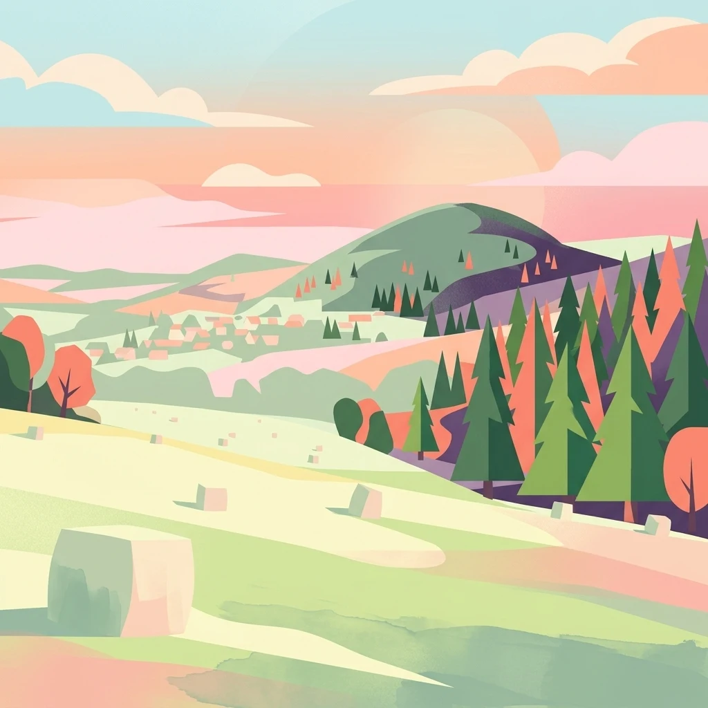
A stylized vector illustration of a hilly volcanic landscape at sunrise with a foreground field, coniferous forest, and distant rounded peak.

Nerother Kopf

Nature reserve

Park overview

Structured park overview, official facts, and landscape profile for Nerother Kopf

Nerother Kopf park facts, protected area profile, and essential visitor context

Review the core facts for Nerother Kopf, including designation, size, terrain, visitor scale, habitats, and operating context in one park-focused overview.

About Nerother Kopf

Nerother Kopf occupies a distinctive place within the Volcanic Eifel, one of Germany's most recognizable volcanic landscapes. The mountain's origin as an extinct cinder cone, or Schlackenkegel, gives it a characteristically conical outline that rises clearly above the surrounding terrain of the Gerolsteiner Land. Despite its modest elevation, its isolated profile and the presence of a protected nature reserve around the beech-forested northern summit make it a focal point for visitors exploring the eastern Eifel.

The landscape around Nerother Kopf reflects the layered history of the region. The northern peak is covered by beech forest that softens the volcanic shape and partly conceals one of the mountain's most distinctive cultural features, the ruined Freudenkoppe Castle. This medieval stronghold, built between 1337 and 1340, is today a protected monument and a popular stop along local hiking routes. Near the summit, the Mühlsteinhöhle adds a separate layer of interest; its name reflects former milling-stone activity, and the cave itself has cultural significance as the founding site of the Nerother Wandervogel movement on New Year's Eve of 1919/1920.

The broader setting combines dense woodland on the protected northern summit with a more open, unforested southern peak that has been worked for basalt extraction for many years. From the summit and its trails, visitors can look out over the small villages of Neroth, Neunkirchen, Pützborn, and Oberstadtfeld, as well as the valley of the Kleine Kyll, which flows past the western foot of the mountain at Neroth. The Eifelsteig, one of the region's premier long-distance hiking trails, runs directly over the summit, integrating Nerother Kopf into a wider network of Volcanic Eifel walking routes, maars, and protected areas.

Quick facts and research context for Nerother Kopf

Nerother Kopf is a double volcanic cinder cone near the village of Neroth in the Landkreis Vulkaneifel, Rhineland-Palatinate, Germany, and lies within the Vulkaneifel Nature Park. The northern summit reaches 651.7 m above sea level and is surrounded by a designated nature reserve, while a slightly lower southern summit lies around 450 m to the south. The mountain belongs to the broader Volcanic Eifel region of the Eifel mountains and is associated with volcanic activity roughly 700,000 years ago.

Protection and recognition

Terrestrial conservation scope and official designation records for Nerother Kopf.

Nerother Kopf Protection Status and International Recognition Data

Nerother Kopf maintains a documented terrestrial protection scope within its designated conservation framework. Official records compile management parameters and international recognition status to support structured park research.

Protection details

Protection scope
Terrestrial
Transboundary protection
No
Park context

Deeper park guide and search-rich context for Nerother Kopf

Nerother Kopf history, landscape, wildlife, and travel context

Explore Nerother Kopf through its history, landscape character, ecosystems, wildlife, conservation priorities, cultural context, and seasonal travel timing in a structured park guide built for atlas discovery and search intent.

Nerother Kopf history and protected-area timeline

Nerother Kopf's history is unusually rich for a single Eifel summit, shaped by overlapping geological, medieval, and modern cultural chapters. The volcano itself is estimated to be around 700,000 years old, part of the broader volcanic activity that shaped the Volcanic Eifel region of western Germany. This deep geological origin forms the physical foundation on which all later layers of the mountain's history were built.

In the medieval period, the strategic value of the northern summit was recognized, and between 1337 and 1340 the castle Freudenkoppe was constructed there. The castle eventually fell into ruin, but its remains are now a protected monument and one of the most recognizable historic features of the mountain, partially hidden under the surrounding beech forest.

A more recent and culturally distinctive chapter opened on New Year's Eve of 1919/1920, when the Nerother Wandervogel, a notable German youth hiking movement, was founded inside the Mühlsteinhöhle near the summit. This event gives the mountain a place in twentieth-century German cultural history and remains closely associated with the identity of the surrounding village and region. In the modern era, the area around the northern summit was designated a nature reserve, reflecting both its geological and ecological significance, while the southern summit has continued to be used for basalt extraction for many years.

Nerother Kopf landscape and geographic character

The landscape of Nerother Kopf is shaped by its volcanic origin and by the contrast between its two summits. The northern peak, at 651.7 m above sea level, rises as a softly rounded cone clothed in beech forest, while the lower southern peak lies roughly 450 m to the south and is largely open ground. This double-cone structure is a direct expression of the underlying geology, formed as a cinder cone from an extinct volcano whose activity dates back around 700,000 years.

The mountain rises within the eastern fringes of the Gerolsteiner Land, part of the broader Volcanic Eifel landscape. To the west, the valley of the Kleine Kyll runs through the village of Neroth at the foot of the mountain, while the small surrounding communities of Neunkirchen, Pützborn, and Oberstadtfeld define the human scale of the landscape. The southern summit has long been worked for basalt, producing a visible quarry edge visible from the northern peak, especially in winter conditions like the snow line that appears in standard photographs of the area.

Above the woods and the quarry, the mountain is integrated into the wider Volcanic Eifel through protected areas and long-distance routes. The Vulkaneifel Nature Park surrounds the mountain, the protected nature reserve encases the northern summit's beech woodland, and the Eifelsteig trail crosses the summit directly. Together, the geological foundation, the forest cover, the quarry footprint, and the surrounding village landscapes give Nerother Kopf its distinctive Volcanic Eifel character.

Nerother Kopf ecosystems, habitats, and plant life

Nerother Kopf is a small but ecologically meaningful element within the Vulkaneifel Nature Park, with its core protected zone defined by the beech-forested slopes of the northern summit. The woodland environment supports the kind of mixed deciduous habitat typical of the Eifel uplands and contributes to the continuity of forest cover across the eastern Gerolsteiner Land, linking the mountain with surrounding protected areas and walking corridors.

Because the southern summit has been extensively quarried for basalt over many years, its open, more disturbed character contrasts with the closed forest of the northern peak. This juxtaposition of intact woodland and active extraction terrain is part of the mountain's distinctive profile and influences local habitat patterns, microclimate, and land-use history. The mountain is best understood ecologically not as a single uniform ecosystem but as a mosaic shaped by volcanic geology, forest cover, quarry activity, and its position within the broader Volcanic Eifel network of maars, protected forests, and nature reserves.

Nerother Kopf conservation status and protection priorities

The conservation significance of Nerother Kopf is formally anchored in the designation of the nature reserve 'Nerother Kopf', which protects the beech-forested area around the northern summit. This designation reflects the value attributed to the mountain's woodland cover, its role within the Vulkaneifel Nature Park, and its position alongside other protected areas of the Landkreis Vulkaneifel, such as the Ernstberg, the Gerolsteiner Dolomiten, and the Duppacher Maar.

Beyond formal protection, the mountain serves as a conservation-relevant link in the eastern Volcanic Eifel's network of habitats and long-distance trails. Its inclusion as a direct crossing point on the Eifelsteig reinforces its role as a connecting landscape element, while the contrast between untouched beech forest on the northern summit and a long-standing quarry on the southern peak illustrates how conservation and resource extraction coexist within the Volcanic Eifel. This layered situation gives the site both ecological and land-management importance within the region's broader conservation framework.

Nerother Kopf cultural meaning and human context

Nerother Kopf carries a layered cultural identity shaped by the village of Neroth at its foot, the medieval Freudenkoppe Castle on its northern summit, and the early twentieth-century origins of the Nerother Wandervogel youth movement in the Mühlsteinhöhle. The name of the mountain is directly tied to the village below, a typical pattern in the Eifel where peaks historically functioned as landmarks, lookout points, and sites of local fortifications.

The castle ruins, built between 1337 and 1340, represent the medieval defensive landscape of the Volcanic Eifel, where smaller noble seats often occupied prominent volcanic summits. Their survival as a protected monument partially hidden under the beech forest reinforces the sense of an inhabited, historically layered mountain rather than an untouched wilderness. The cave's role as the founding site of the Nerother Wandervogel adds a distinctly modern cultural layer, connecting the mountain to German youth movement history and to local traditions of hiking and outdoor culture that continue to define the region today.

Top sights and standout views in Nerother Kopf

Nerother Kopf stands out as a compact but remarkably diverse Volcanic Eifel site, where an extinct cinder cone carries both natural and cultural landmarks within a short distance. The combination of the ruined Freudenkoppe Castle, the Mühlsteinhöhle cave, the protected beech forest of the northern summit, and the sweeping views across the Gerolsteiner Land and the Kleine Kyll valley make the mountain a rewarding stop for hikers exploring the eastern Eifel.

Its direct integration into the Eifelsteig and its position inside the Vulkaneifel Nature Park give it a clear role as a connecting point between larger Volcanic Eifel attractions, including maars and other protected areas of the Landkreis Vulkaneifel. The visible basalt quarry on the southern summit adds a contrasting industrial edge to the otherwise forested profile and makes the mountain an unusually vivid illustration of how geological history, medieval heritage, and modern land use intersect in the Volcanic Eifel.

Best time to visit Nerother Kopf

Nerother Kopf can be visited year-round, but the seasons strongly shape its atmosphere. Late winter and early spring highlight the conical volcanic outline of the mountain, when snow accentuates the contrast between the forested northern summit and the visibly quarried southern peak, as shown in classic views from the west. This is also the season when Freudenkoppe Castle is most easily spotted from a distance through the bare beech canopy.

Late spring and summer bring full leaf cover back to the beech forest, which once again conceals the castle ruins and gives the protected nature reserve around the northern summit its deep green character. These months are well suited to walkers seeking shaded longer routes, while autumn offers strong color contrast across the beech woodland. For visitors interested in combining the summit with the wider Eifelsteig or nearby maars of the Vulkaneifel, the warmer months are particularly convenient, while cooler seasons can reward those interested in geological and cultural visibility from lower trails.

Monthly climate preview

Track measured temperature ranges and daily precipitation averages across the year.

Nerother Kopf Climate Normals and Long-Term Monthly Weather Profiles

Long-term NASA Power climatology data reveals the measured temperature and precipitation rhythm across twelve recorded months at a representative coordinate in Nerother Kopf. Reviewing the complete monthly profile provides deeper analytical context on thermal variations and precipitation patterns without relying on live forecasts.
Annual mean9 °C
0 °C18 °C
Jan
Feb
Mar
Apr
May12°
Jun16°
Jul18°
Aug18°
Sep14°
Oct
Nov
Dec
Warmest month
July

18.2 °C

Coolest month
January

-0.3 °C

Wettest month
December

2.5 mm/day

Driest month
April

1.6 mm/day

Park location guide

Geography guide, regional context, and park location map for Nerother Kopf

Nerother Kopf park geography, regions, and map view in Germany

Understand where Nerother Kopf sits in Germany through a broader geographic reading of the surrounding landscape, nearby location context, and its mapped position within the national park landscape.

How Nerother Kopf fits into Germany

Germany is a federal republic in Western and Central Europe with a population of over 83 million across sixteen constituent states. It is Europe's largest economy by nominal GDP and a major global exporter and importer. The capital is Berlin, and the country borders Denmark, Poland, Czech Republic, Austria, Switzerland, France, Luxembourg, Belgium, and the Netherlands.

Wider geography shaping Nerother Kopf in Germany

Germany is located in Western and Central Europe, spanning 357,022 km². It borders Denmark to the north, Poland and the Czech Republic to the east, Austria and Switzerland to the south, and France, Luxembourg, Belgium, and the Netherlands to the west. The country has coastlines on the Baltic Sea and North Sea to the north, with the Alps located in the southern region.

Map view of Nerother Kopf

Use this park location map to pinpoint Nerother Kopf in Germany, understand its exact geographic position, and read its mapped placement within the surrounding landscape more clearly.

Pigeon | © OpenStreetMap contributors

Location context for Nerother Kopf

Rhineland-Palatinate

Explore detailed imagery of the double volcanic cinder cone, beech forests, and medieval castle ruins.

Nerother Kopf Photos and Landscape Scenery: Visualizing the Volcanic Eifel Protected Area

Visual records capture the distinctive double-cone terrain, ancient basalt quarries, and forested nature reserves that define the protected landscape. Examining these photographs provides a clearer understanding of the geological formations and ecological habitats shaping the mountain environment.

A wide, eye-level landscape photograph of a snow-covered hill and forest in the Eifel region of Germany during winter.

Park atlas

Compare surrounding Volcanic Eifel protected areas and nearby regional nature reserves

Other Parks Near Nerother Kopf and Connected Protected Landscapes

Browsing other parks near Nerother Kopf reveals connected geological formations and forested ridges across the Volcanic Eifel region. Extending your geographic comparison helps trace broader protected landscapes and regional conservation patterns beyond a single summit.
A horizontal watercolor illustration showing soft, rolling hills, patches of forest, and a grassy foreground in muted green and pink tones against a pale yellow sky.
Nature reserveRhineland-Palatinate
About 4.1 km away#1 closest

North

Ernstberg Nature Reserve: Volcanic Geology and Forested Terrain in Rhineland-Palatinate

A key protected geological monument in the West Eifel

Ernstberg is a major basalt stratovolcano within the Vulkaneifel region, characterized by its distinct crater wall and historic millstone quarries. The area functions as a protected nature reserve and FFH site, showcasing important geological features such as the rocky Martinswand. Explore the physical geography, mapped volcanic profile, and protected habitat context of this significant German natural monument.

Area
0.96 km²
Established
1978
Relief
Mountain
Climate
Temperate
A horizontal watercolor painting depicting a calm lake surrounded by rolling hills and soft greenery, with a purple-toned ridgeline in the distance.
Nature reserveRheinland-Pfalz
About 10 km away#2 closest

South

Meerfelder Maar Nature Reserve: Volcanic Basin and Protected Eifel Landscape Mapping

Detailed volcanic crater geography and lake basin analysis

Discover the geological structure and protected habitats of Meerfelder Maar. This classic Eifel crater lake spans roughly 125 hectares, combining open water with fringing wetlands and forested slopes to create a unique natural landmark in Rheinland-Pfalz.

Area
2.6 km²
Established
1985
IUCN
IV
Relief
Upland
A horizontal watercolor painting showing a soft, stylized landscape with rolling green hills, a winding path or stream, and a few trees on a white background.
Nature reserveRhineland-Palatinate
About 11 km away#3 closest

Southeast

Dürres Maar Nature Reserve: Mapped Volcanic Landscapes and Peatland Geography

A dry volcanic crater and transition bog in the Eifel.

Dürres Maar represents a quintessential dry maar landform defined by a circular tuff rim and a matured peat basin. Situated near Gillenfeld, the site acts as a geological monument and ecological record of long-term mire succession. Explore the map-based terrain and crater boundaries to understand how this volcanic remnant functions within the Vulkaneifel.

Relief
Upland
Climate
Temperate
Water
Major water bodies
A soft, painterly watercolor illustration depicting a calm lake framed by evergreen trees and rolling green hills.
Nature reserveRhineland-Palatinate
About 12 km away#4 closest

Southeast

Holzmaar Nature Reserve: Volcanic Crater Geography and Sediment Archive in Germany

A forest-enclosed maar lake in the Vulkaneifel region.

Holzmaar represents a significant volcanic maar site within Rhineland-Palatinate, defined by its circular basin, wetland-rich margins, and stream-fed hydrology. Recognized as a critical reference for paleoclimate research, its laminated sediment layers provide a detailed look at late-glacial European environmental history.

Area
0.068 km²
Relief
Upland
Climate
Temperate
Scope
Terrestrial
Protected areaRheinland-Pfalz
About 16 km away#5 closest

East

Ulmener Maar Protected Area: Mapping Crater Lakes and Eifel Volcanic History

Volcanic maar, medieval ruins, and meromictic lake geography

Ulmener Maar provides a rare glimpse into the volcanic evolution of the Eifel region. This protected area centers on a deep, meromictic crater lake cradled by a forested tuff ring, connected via historical tunnels to the older Jungferweiher maar. It serves as a vital point for understanding the interplay between geological youth and centuries of human settlement in Germany.

A soft watercolor painting of a rolling countryside landscape featuring green trees, pink flowering bushes, and a meadow under a bright, light-filled sky.
Nature reserveRhineland-Palatinate
About 17 km away#6 closest

West

Schönecker Schweiz Protected Area: An Atlas of the Eifel Limestone Basin Geography

Mapping the karst terrain, dolomite ridges, and submontane habitats of Rhineland-Palatinate.

Schönecker Schweiz stands as a defining example of the Prüm Kalkmulde, showcasing a dense network of steep slopes, plateau uplands, and narrow gorge valleys. This nature reserve serves as an essential refuge for rare calcareous flora and fauna, anchored by a geologically significant dolomite bedrock. The area is marked by striking landforms, including exposed rock faces, swallow holes, and stream meadows, which collectively provide a primary reference site for submontane limestone geography in western Germany.

Area
8.65 km²
Established
1991
Relief
Upland
Scope
Terrestrial
Nature reserveRhineland-Palatinate
About 20 km away#7 closest

West

Niesenberg bei Weinsheim Nature Reserve: Geography and Protected Area Overview

Dolomite hill and calcareous grassland in Rhineland-Palatinate

Niesenberg bei Weinsheim is a protected nature reserve located in the Eifel region of Germany, centered on a distinct dolomite hill. The reserve protects a fine-grained mosaic of semi-natural dry grasslands and pine stands that contrast sharply with the surrounding slate uplands. Its unique soil chemistry supports a specialized array of flora, making it an essential point of study for understanding the biodiversity of the Prüm Limestone Basin.

Area
0.085 km²
Established
1985
Relief
Upland
Climate
Temperate
Nature reserveRheinland-Pfalz
About 21 km away#8 closest

Northeast

Quiddelbacher Höhe / Nürburgring Nature Reserve: A Protected Highland Plateau in the Eifel

Explore the regional geography and conservation landscape of Rheinland-Pfalz

Quiddelbacher Höhe / Nürburgring protects a distinct highland plateau surface known for its rare vegetation and critical role in local ecological conservation. Situated near major transit corridors and the famous racing circuit, the site provides a quiet, open landscape contrast within the larger Ahrweiler region of Germany.

Area
0.27 km²
Established
2002
Relief
Upland
Climate
Temperate

Common questions about visiting, size, designation, and location context for Nerother Kopf

Nerother Kopf FAQs for park facts, access, geography, and protected area context

Find quick answers about Nerother Kopf, including protected-area facts, park geography, trail and visitor context, and how the park fits into its surrounding country and regional landscape.
MoriAtlas Explorer

Continue Your Protected Areas Search Across the Global Atlas

Deepen your exploration by continuing the structured search for national parks and protected areas worldwide. Utilize the comprehensive filtering capabilities to compare different conservation landscapes and refine your understanding of global park geography. Discover more about the distribution and characteristics of protected natural areas.

Global natural geography