Mori Atlas logo
Protected landscapeNeuffen auf Gemarkungen Neuffen und Kappishäusern

Mapping the escarpment terrain, beech woodlands, and traditional orchard mosaics

Neuffen auf Gemarkungen Neuffen und Kappishäusern: A Protected Landscape in Baden-Württemberg

(Landschaftsschutzgebiet "Neuffen auf Gemarkungen Neuffen und Kappishäusern")

The Neuffen auf Gemarkungen Neuffen und Kappishäusern protected landscape encompasses the diverse terrain bridging the Swabian Alb escarpment and the surrounding foreland in Baden-Württemberg. This area preserves a complex mosaic of steep hillside beech forests, terraced vineyards, and riparian corridors along the Steinach river. These mapped boundaries provide a critical link within the broader Biosphärengebiet Schwäbische Alb, safeguarding both natural habitats and historic hill silhouettes.

landscape protection areaSwabian Albbiosphere reservesteep slope forestsbeech woodlandtraditional orchards

Neuffen auf Gemarkungen Neuffen und Kappishäusern

Protected landscape

Park overview

Structured park overview, official facts, and landscape profile for Neuffen auf Gemarkungen Neuffen und Kappishäusern

Neuffen auf Gemarkungen Neuffen und Kappishäusern park facts, protected area profile, and essential visitor context

Review the core facts for Neuffen auf Gemarkungen Neuffen und Kappishäusern, including designation, size, terrain, visitor scale, habitats, and operating context in one park-focused overview.

About Neuffen auf Gemarkungen Neuffen und Kappishäusern

Neuffen auf Gemarkungen Neuffen und Kappishäusern is a Landkreis-level protected landscape in Baden-Württemberg, Germany, that captures one of the most visually striking transitions between the Swabian Alb plateau and its agricultural foreland. The protection designation of 10 August 1993 brought earlier partial protections under a single, contiguous framework and recognized the area as a unified landscape worthy of regional conservation.

The protected area is structured as two connected sub-areas that together fully enclose the town of Neuffen and the smaller associated settlement of Kappishäusern. This encircling geometry is significant because it preserves the visible setting of the Hohenneuffen, a steep castle-bearing hill that dominates the local skyline and is one of the iconic landmarks of the Schwäbische Alb tourism region. The Jusiberg, a former volcanic neck, adds a second prominent topographic feature on the opposite side of the landscape.

Ecologically, the area spans two natural regions, namely the Mittlere Kuppenalb on the uplifted Alb side and the Mittleres Albvorland on the lower transition zone. This transition gives the protected area unusual habitat diversity in a compact footprint. Steep slope woodlands, exposed rock-ledge vegetation, dry heat-loving heath communities, traditional vineyards, scattered fruit orchards, and the riparian corridor of the Steinach river all coexist within a short distance of each other.

Because the protected landscape lies entirely within the UNESCO-recognized Biosphärengebiet Schwäbische Alb and partly overlaps with the FFH area Alb zwischen Jusi und Teck, it functions as a local but well-integrated component of a much larger regional conservation network. The protection order explicitly cites habitat richness, the diversity of edge structures between habitats, and the presence of rare plant and animal species as reasons for the designation.

Quick facts and research context for Neuffen auf Gemarkungen Neuffen und Kappishäusern

Neuffen auf Gemarkungen Neuffen und Kappishäusern is a German Landschaftsschutzgebiet (protected landscape) located in Landkreis Esslingen, Baden-Württemberg, in the southwestern federal state tradition of systematic landscape protection. Designated on 10 August 1993 by order of the Landratsamt Esslingen, it supersedes earlier protective designations from 1939 and 1942 that had covered parts of the same area.

The site lies in the natural regions of the Mittlere Kuppenalb and Mittleres Albvorland and is ecologically connected to the larger Biosphärengebiet Schwäbische Alb. It is recognized both for its ecological value and for its role as a recreational landscape near the Hohenneuffen castle hill, the Jusi volcanic vent, and the Steinach river valley.

Protection and recognition

Documented terrestrial protection scope, 1993 designation year, and official recognition records

Neuffen auf Gemarkungen Neuffen und Kappishäusern Protection Status and Designation History

Neuffen auf Gemarkungen Neuffen und Kappishäusern maintains a documented terrestrial protection scope established in the designation year 1993. Conservation tracking indexes incorporate historical designation records and international recognition parameters without assuming external management outcomes.

Protection details

Protection scope
Terrestrial
Designated year
1993
Transboundary protection
No
WDPA ID
323195
Park context

Deeper park guide and search-rich context for Neuffen auf Gemarkungen Neuffen und Kappishäusern

Neuffen auf Gemarkungen Neuffen und Kappishäusern history, landscape, wildlife, and travel context

Explore Neuffen auf Gemarkungen Neuffen und Kappishäusern through its history, landscape character, ecosystems, wildlife, conservation priorities, cultural context, and seasonal travel timing in a structured park guide built for atlas discovery and search intent.

Why Neuffen auf Gemarkungen Neuffen und Kappishäusern stands out

The protected area is best known for safeguarding the varied countryside surrounding the Hohenneuffen and the Jusiberg, two of the most prominent landmark hills on the eastern Swabian Alb. These slopes blend steep hillside beech forests, open heath zones, terraced vineyards, extensive traditional orchards, and the wooded banks of the Steinach river. Equally distinctive is its role within a layered conservation system that connects it to the Biosphärengebiet Schwäbische Alb and the FFH area Alb zwischen Jusi und Teck. This network identity is central to how the landscape is understood, both as a self-contained protected zone and as a node in broader regional habitat preservation.

Neuffen auf Gemarkungen Neuffen und Kappishäusern history and protected-area timeline

The contemporary protected landscape was legally established on 10 August 1993, when the Landratsamt Esslingen issued a unified Verordnung covering the municipal territories of Neuffen and Kappishäusern. The new ordinance deliberately replaced parts of two earlier protective instruments: a 1942 order by the Landratsamt Nürtingen on protecting landscape features in the former Landkreis Nürtingen, and a 1939 Württemberg state order on the landscape surrounding the Erkenbrechtsweiler Berghalbinsel with the Hörnle and Jusi.

The 1993 consolidation was not a redesign of protection but a clarification: by merging overlapping jurisdictions and updating the legal framework after Baden-Württemberg's administrative reforms, the region secured a single coherent instrument covering the territories around the Hohenneuffen and the Jusiberg. This streamlined approach allowed a more consistent set of conservation objectives to apply across the entire encircling landscape, rather than relying on fragmented older orders.

The choice of Namen in the official title reflects this municipal-administrative framing of the protection. By referring explicitly to the Gemarkungen (cadastral territories) of Neuffen and Kappishäusern, the protected area is anchored to a defined jurisdictional surface rather than to a single geographical landmark, even though landmarks like the Hohenneuffen, Jusi, and the Steinach valley remain central to its identity.

Neuffen auf Gemarkungen Neuffen und Kappishäusern landscape and geographic character

The protected landscape sits at the edge of the Swabian Alb escarpment, where the layered limestone plateau breaks down into the lower foreland toward the Neckar basin. The Hohenneuffen rises as a steep, isolated hill crowned by the ruins of a medieval castle, while the Jusi forms a softer but still prominent cone on the other side of the protected area, marking a former volcanic vent left behind after long erosion.

Between these hills the terrain drops into the Steinach valley, whose watercourse has carved a meandering band of riparian woodland and exposed gravel into the otherwise steep, terraced farmland. The slope flanks combine dry, sunny exposures with cooler shaded sections, supporting a noticeable gradient of vegetation types within short horizontal distances.

Orchards and vineyards continue the human shaping of the terrain. Traditional Streuobstwiesen occupy broad mid-slope belts, while terraced vineyards climb portions of the warmer flanks, particularly around the Hohenneuffen. The result is a mosaic in which natural rock, woodland, cultivated terraces, and small valley bottoms all coexist in a single, walking-scale landscape.

Neuffen auf Gemarkungen Neuffen und Kappishäusern ecosystems, habitats, and plant life

Because the protected area straddles the boundary between the Mittlere Kuppenalb and the Mittleres Albvorland, it combines an unusually broad spectrum of habitats within a relatively small footprint. On the Alb-facing flanks, layered limestone bedrock supports calcareous grasslands, dry heaths, and the open structures typical of the Schwäbische Alb upland margin.

Forests are dominated in many places by beech, especially on the steeper slope sections where the stands function as Hangbuchenwälder. These slope beech woods help stabilize soils, maintain humidity in spring zones, and provide shade that contrasts with the open heath and vineyard patches nearby. Freshwater influence is concentrated along the Steinach, whose intact Ufergehölz supports wetland-edge vegetation and acts as a green corridor between the two halves of the protected landscape.

The combination of dry slope habitats, moister valley woodland, traditional orchard meadows, and vineyard terraces creates a mosaic of edge structures, that is, transitions between very different habitat types, which is specifically cited in the protection order as essential for sustaining rare plant and animal communities in the area.

Neuffen auf Gemarkungen Neuffen und Kappishäusern wildlife and species highlights

The protected landscape's value for fauna lies more in the diversity of habitat niches than in any single flagship species. The interplay of extensive beech forest, exposed rocky slopes, dry heath patches, traditional orchards, vineyards, and the wooded Steinach corridor supports a varied community of birds, insects, and smaller mammals typical of the eastern Schwabian Alb.

The riparian vegetation along the Steinach is particularly important as a movement and feeding corridor within an otherwise dry, slope-dominated area. Orchards and hedgerow-rich farm margins offer nesting and foraging habitat for species strongly associated with traditional cultural landscapes, while the dry, sun-exposed slopes provide habitat for warmth-loving invertebrates and reptiles typical of calcareous grasslands.

Neuffen auf Gemarkungen Neuffen und Kappishäusern conservation status and protection priorities

The 1993 protection order explicitly aims at preserving the diversity, character, and beauty of the landscape around the Hohenneuffen and the Jusiberg. Rather than foregrounding a single species, it emphasizes the structural richness of the area: typical steep slopes, slope springs, slope beech woodland, heaths, vineyards, extensive traditional orchards, and the intact riparian forest along the Steinach river.

A second conservation objective is sustaining the area as accessible Erholungsraum for the local population, balancing recreational use with landscape protection. The order also seeks to prevent further fragmentation of the outer areas by limiting new small structures, enclosures, and Einsiedlungen that could degrade the visual and ecological coherence of the protected landscape.

In the wider conservation network, the protected landscape lies entirely within the Biosphärengebiet Schwäbische Alb, one of the large UNESCO-recognized biosphere reserves in Germany, and partially overlaps with the FFH-Gebiet Alb zwischen Jusi und Teck, a Natura 2000 site. This layered status means that local protection actively contributes to wider regional and European habitat preservation goals.

Neuffen auf Gemarkungen Neuffen und Kappishäusern cultural meaning and human context

The protected area wraps around settlements that have shaped the surrounding land for centuries. Neuffen and Kappishäusern are historic communities whose farming and viticultural traditions have produced the alternating bands of orchard, vineyard, and woodland that the protection order specifically seeks to preserve. The Hohenneuffen castle above the town is a defining element of regional identity, historically controlling traffic and trade along the edge of the Swabian Alb.

Traditional land-use practices, especially the maintenance of extensive Streuobstwiesen and terraced vineyards on the Alb slopes, remain part of the living cultural landscape. The protection framework treats these practices not as residual relics but as active components of the ecological mosaic that gives the area its distinctive character.

Top sights and standout views in Neuffen auf Gemarkungen Neuffen und Kappishäusern

Two prominent hills: the castle-bearing Hohenneuffen and the volcanic Jusiberg define the silhouette of the protected landscape. Together they create a rare compact arena in which steep karst-like escarpment landscapes, traditional vineyards, orchards, beech slope forests, and a small river valley all meet within a protected, walkable radius.

The protected area's layered conservation identity is a highlight in itself. As part of the Biosphärengebiet Schwäbische Alb and as a partial overlap zone with the FFH area Alb zwischen Jusi und Teck, it links local landscape protection with regional biosphere and European Natura 2000 frameworks.

Best time to visit Neuffen auf Gemarkungen Neuffen und Kappishäusern

The landscape around Neuffen shows strong seasonal contrasts that reflect its mix of woodland, heath, vineyard, and orchard. Spring brings fresh green growth to the slope beech forests and a colorful display in the extensive Streuobstwiesen, while the dry habitats along the Alb escarpment have their richest herbaceous display in late spring and early summer.

Autumn is typically the most visually distinctive period, when orchards and vineyards are at peak color and harvest, and when clear weather often offers the strongest views from and toward the Hohenneuffen and Jusi. Winter, when snow occasionally settles on the Alb plateau, can highlight the topography of the hills and the valley structure of the Steinach corridor most clearly.

Monthly climate preview

Long term temperature and precipitation measurements for Neuffen auf Gemarkungen Neuffen und Kappishäusern

Neuffen auf Gemarkungen Neuffen und Kappishäusern Climate Normals and Annual Weather Patterns

Representative coordinates track measured monthly temperature ranges and precipitation averages across the protected area from 1991 to 2020. Examining the complete twelve month profile reveals detailed seasonal shifts in local climate normals.
Annual mean8 °C
-1 °C18 °C
Jan-1°
Feb
Mar
Apr
May13°
Jun16°
Jul18°
Aug18°
Sep14°
Oct
Nov
Dec
Warmest month
July

18.2 °C

Coolest month
January

-1.1 °C

Wettest month
July

3.2 mm/day

Driest month
February

1.7 mm/day

Park location guide

Geography guide, regional context, and park location map for Neuffen auf Gemarkungen Neuffen und Kappishäusern

Neuffen auf Gemarkungen Neuffen und Kappishäusern park geography, regions, and map view in Germany

Understand where Neuffen auf Gemarkungen Neuffen und Kappishäusern sits in Germany through a broader geographic reading of the surrounding landscape, nearby location context, and its mapped position within the national park landscape.

How Neuffen auf Gemarkungen Neuffen und Kappishäusern fits into Germany

Germany is a federal republic in Western and Central Europe with a population of over 83 million across sixteen constituent states. It is Europe's largest economy by nominal GDP and a major global exporter and importer. The capital is Berlin, and the country borders Denmark, Poland, Czech Republic, Austria, Switzerland, France, Luxembourg, Belgium, and the Netherlands.

Wider geography shaping Neuffen auf Gemarkungen Neuffen und Kappishäusern in Germany

Germany is located in Western and Central Europe, spanning 357,022 km². It borders Denmark to the north, Poland and the Czech Republic to the east, Austria and Switzerland to the south, and France, Luxembourg, Belgium, and the Netherlands to the west. The country has coastlines on the Baltic Sea and North Sea to the north, with the Alps located in the southern region.

Map view of Neuffen auf Gemarkungen Neuffen und Kappishäusern

Use this park location map to pinpoint Neuffen auf Gemarkungen Neuffen und Kappishäusern in Germany, understand its exact geographic position, and read its mapped placement within the surrounding landscape more clearly.

Pigeon | © OpenStreetMap contributors

Location context for Neuffen auf Gemarkungen Neuffen und Kappishäusern

Baden-Württemberg
Park atlas

Compare adjacent protected landscapes and regional topography across the Swabian Alb.

Explore Other Parks Near Neuffen auf Gemarkungen Neuffen und Kappishäusern

Browsing protected areas near Neuffen auf Gemarkungen Neuffen und Kappishäusern reveals connected conservation networks and shared escarpment geography. Expanding the regional park comparison provides deeper context into neighboring valleys, beech forests, and hillside reserves.
Protected landscapeBaden-Württemberg
About 5.9 km away#1 closest

Northeast

Tiefenbachtal Protected Landscape: Geographic Boundaries and Regional Terrain Map

Swabian Alb foothill mosaic in the Esslingen district

Investigate the protected landscape of Tiefenbachtal, where gently rolling terrain and stream-cut valleys form a continuous ecological corridor. This record covers the physical geography, meadow and woodland composition, and the broader context of this site within the Baden-Württemberg pre-Alb landscape.

Area
0.35 km²
Established
1958
IUCN
V
Relief
Upland
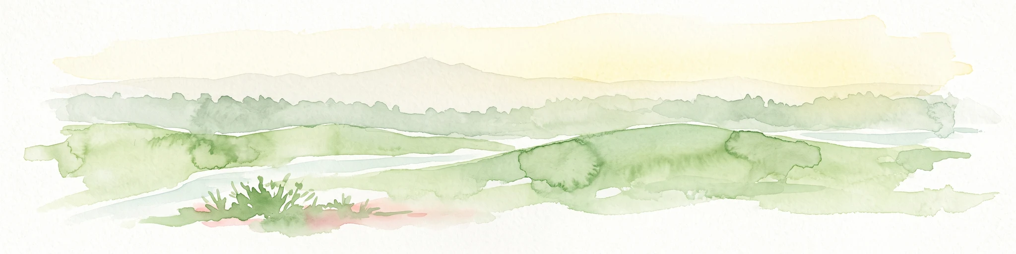
A pale watercolor landscape illustration showing rolling green hills and meadows under a soft yellow sky.
Protected landscapeBaden-Württemberg
About 6.8 km away#2 closest

Northeast

Owen Protected Landscape: A Geographic Analysis of Orchard Meadows and Teckberg Terrain

Baden-Württemberg protected area and regional landscape map

Examine the detailed landscape composition of the Owen protected area, a vital reserve in the Mittleres Albvorland. This atlas entry focuses on the interaction between traditional orchard meadow mosaics, hedgerows, and the abrupt topographical shift toward the Teckberg peak, providing a clear geographic context for this protected natural region.

Area
5.67 km²
Established
1974
IUCN
V
Protected landscapeBaden-Württemberg
About 11 km away#3 closest

Southeast

Wolfsschlucht Protected Landscape: Swabian Alb Gorge Geography and Regional Mapping

A key geotope within the central Swabian Alb mountain terrain.

Wolfsschlucht preserves a distinctive limestone gorge and ravine forest system within a compact 1.4 hectare area. Its geography highlights the intersection of karst landforms, steep valley relief, and layered conservation status, serving as a representative model of the central Swabian Alb's geological and ecological character in Baden-Württemberg.

Area
0.014 km²
Established
1955
IUCN
V
Protected landscapeBaden-Württemberg
About 12 km away#4 closest

North

Wendlingen am Neckar Protected Landscape: Regional Geography and Habitat Connectivity

A structured Swabian countryside mosaic in Baden-Württemberg

This protected area safeguards a unique, fragmented landscape comprising traditional orchard meadows and brookside woodland corridors. Located on the Filder plateau, it acts as a critical ecological refuge, maintaining the transition between settled zones and the natural terrain of the Mittleres Albvorland through long-standing landscape conservation measures.

Area
2.27 km²
Established
1992
IUCN
V
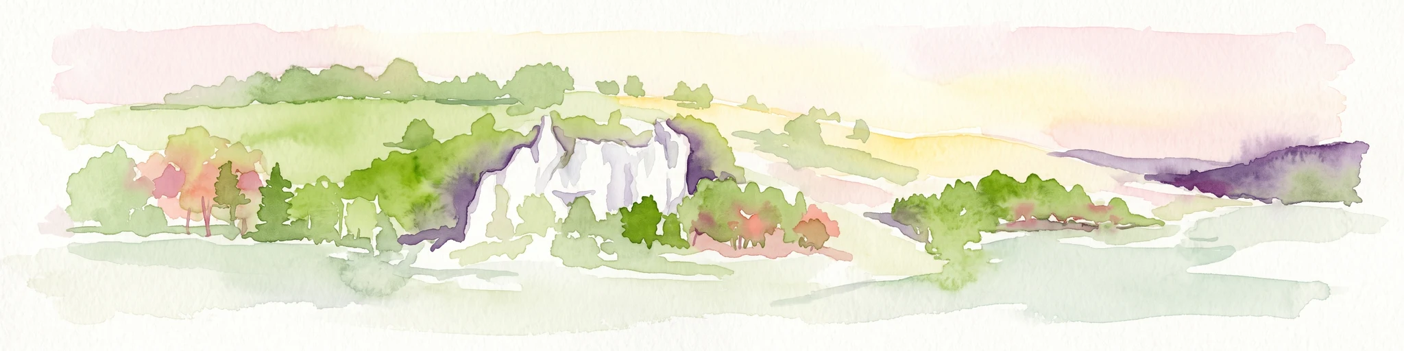
Watercolor painting of a rolling landscape featuring light green hills, patches of trees, and white rock outcrops against a soft, light-colored background.
Protected landscapeBaden-Württemberg
About 14 km away#5 closest

Southeast

Öde im Hartberg Protected Landscape and Geological Features of the Middle Swabian Alb

Juniper heathland and limestone outcrops in Baden-Württemberg

Situated at the mouth of the Fischburgtal, Öde im Hartberg is a significant protected area on the Middle Swabian Alb. The site preserves a unique mosaic of open heath and successional woodland, anchored by the Hartbergfels and Seeburger Nägelesfels limestone monuments. It offers a clear look at the geological and conservation landscape of this southwestern German region.

Area
0.101 km²
Established
1955
IUCN
V
A minimalist watercolor painting depicting a soft-focus landscape with rolling hills, distant ridgelines, and scattered trees across a meadow, rendered in muted greens, purples, and pinks on a white background.
Protected landscapeBaden-Württemberg
About 16 km away#6 closest

Northeast

Ohmden-Holzmaden Protected Landscape: Swabian Alb Foothill Mapping

A diverse mosaic of traditional orchards and stream valleys

Ohmden-Holzmaden encompasses a vital protected landscape in the Esslingen district, defined by the Trinkbach, Seebach, and Aubach valleys. This geography of traditional orchards, meadows, and hedgerows maintains an open, structured rural habitat that serves as a critical refuge within the broader Swabian Alb foothill region of Germany.

Area
3.111 km²
Established
1993
IUCN
V
Relief
Upland
Protected landscapeBaden-Württemberg
About 16 km away#7 closest

Northeast

Notzingen Protected Landscape: Mapping the Voralb Foothills and Swabian Alb Terrain

Regional protected area analysis in Landkreis Esslingen

Notzingen represents a coherent protected landscape composed of three parcels near the Swabian Alb foothills. The area is defined by a delicate intersection of stream-side riparian habitats and traditional Streuobstwiesen orchard meadows. This atlas-focused entry provides spatial context for understanding how these protected lands maintain the character of the southern German countryside.

Area
3.15 km²
Established
1989
IUCN
V
Relief
Upland
Protected landscapeBaden-Württemberg
About 17 km away#8 closest

North

Unteres Körschtal Protected Landscape: Geography and Mapped Boundaries in Baden-Württemberg

An ecological green corridor within the Swabian Keuper-Lias landscape

Unteres Körschtal protects the natural valley floor and adjacent slopes of the lower Körsch river. This landscape conservation area provides essential habitat and recreational space between the Filder plateau and the Neckar valley, standing as a primary example of regional geography in Germany.

Area
4.729 km²
Established
1978
IUCN
V

Common questions about visiting, size, designation, and location context for Neuffen auf Gemarkungen Neuffen und Kappishäusern

Neuffen auf Gemarkungen Neuffen und Kappishäusern FAQs for park facts, access, geography, and protected area context

Find quick answers about Neuffen auf Gemarkungen Neuffen und Kappishäusern, including protected-area facts, park geography, trail and visitor context, and how the park fits into its surrounding country and regional landscape.
MoriAtlas Explorer

Continue Your Protected Areas Search Across the Global Atlas

Deepen your exploration by continuing the structured search for national parks and protected areas worldwide. Utilize the comprehensive filtering capabilities to compare different conservation landscapes and refine your understanding of global park geography. Discover more about the distribution and characteristics of protected natural areas.

Global natural geography