
Why Niederstetten Protected Landscape stands out
The Niederstetten Protected Landscape is especially notable for its collection of near-natural flowing watercourses, deeply incised side valleys, and traditional dry-stone wall features (Steinriegel), all of which together give the protected area a distinctive and varied topographic identity. Its slopes carry a particularly diverse mosaic of land uses, which the designation specifically recognizes as ecologically valuable biotopes. Together, these slope habitats, streams, and structural elements form the core of what the protected landscape is intended to preserve.
Niederstetten Protected Landscape history and protected-area timeline
The Niederstetten Protected Landscape was formally designated on 14 October 1992, when the responsible authorities in Baden-Württemberg issued a regulatory ordinance establishing it as a Landschaftsschutzgebiet under the state's nature conservation framework. This designation brought nearly 1,800 hectares around the town of Niederstetten under formal landscape protection. As a Type V protected area, it joined the broader network of regional landscapes in the Main-Tauber-Kreis that have been recognized for their scenic, cultural, and ecological value through similar ordinances in the late 20th century. Detailed protection purposes were codified in its founding ordinance and continue to guide its management today.
Niederstetten Protected Landscape landscape and geographic character
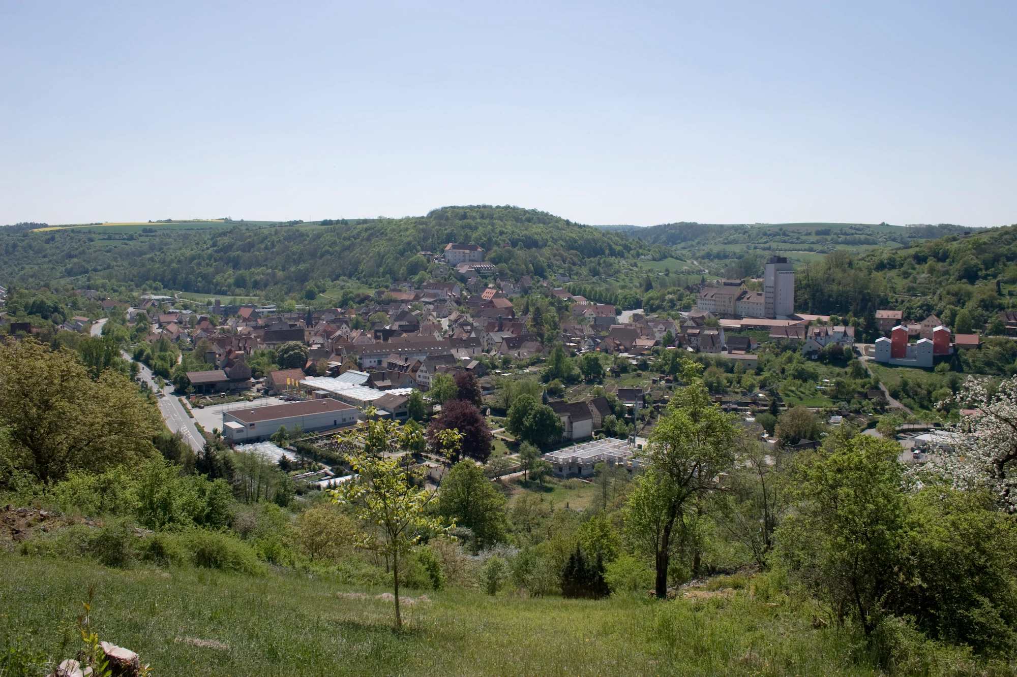
The landscape of the Niederstetten Protected Landscape reflects the varied terrain characteristic of the eastern Tauberland in northern Baden-Württemberg. The area features near-natural flowing streams that wind through the countryside, alongside side valleys and valleys (locally referred to as Klingen) where erosion has carved steep, narrow features into the surrounding terrain.
A defining visual and structural element of the protected area is the presence of traditional dry-stone walls, known locally as Steinriegel, which mark field boundaries and contribute to the cultural character of the landscape. These walls serve both practical agricultural functions and ecological roles as habitat structures for various small organisms.
Between these valley features and the agricultural slopes, the protected area encompasses a mosaic of land uses: cultivated fields, meadows, hedges, woodland patches, and grazing areas. This patchwork of open and structured habitats gives the protected area a distinctly varied topography and supports both scenic beauty and ecological complexity.
Niederstetten Protected Landscape ecosystems, habitats, and plant life
Ecologically, the Niederstetten Protected Landscape serves as an important compensatory and refuge area for a broad range of plant and animal species. The combination of near-natural streams, valley features, and structurally diverse slope habitats contributes to biodiversity across the protected territory.
The slopes in particular are highlighted as ecologically high-quality biotopes, owing to the mosaic of different land uses and transitions between open and wooded areas. These transitions support a range of edge habitats that benefit many species, while the streams and small valleys provide corridors for moisture-dependent flora and fauna.
By protecting the topographic variety and land-use mosaic together, the landscape ordinance aims to maintain ecological resilience in a region where agricultural intensification has historically reduced landscape diversity elsewhere.
Niederstetten Protected Landscape wildlife and species highlights
The protected landscape supports a wide range of native wildlife thanks to its combination of stream corridors, woodland patches, hedgerows, dry-stone wall structures, and varied slope habitats. Although the founding ordinance does not list specific species, it identifies the area as a refuge and retreat for plant and animal life, recognizing the high biodiversity value of the slope biotopes and the near-natural streams.
The mosaic of habitats provides living space and movement corridors for species associated with traditional Central European agricultural landscapes, including farmland birds, small mammals, amphibians in the valley streams, and invertebrates supported by the dry-stone wall structures and varied vegetation layers.
Niederstetten Protected Landscape conservation status and protection priorities
The Niederstetten Protected Landscape was established with three explicit conservation goals, as defined in its founding ordinance. The first focuses on preserving the diversity, character, and beauty of distinctive topographic features and landscape elements, with particular emphasis on near-natural streams, Klingen valleys, and the regional Steinriegel dry-stone wall systems.
The second goal addresses the function of the area as an ecological compensation zone, recognizing that varied slope habitats with their mosaic of land uses are particularly valuable biotopes worthy of conservation. By protecting these areas, the landscape aims to maintain habitat for a wide range of native species and to support regional biodiversity.
The third goal integrates the landscape into the recreational life of the region, securing it as a valuable space for public enjoyment. Together, these objectives reflect the multi-purpose nature of Germany's protected landscapes, which combine biodiversity conservation with cultural landscape preservation and public access.
Niederstetten Protected Landscape cultural meaning and human context
The Niederstetten Protected Landscape reflects the deep interplay between natural terrain and traditional human land use that characterizes much of the Hohenlohe and Tauberland regions. Features such as the Steinriegel dry-stone walls represent centuries of agricultural practice and are an integral part of the cultural identity of the area.
The recognition of these elements within the protected area's founding ordinance underscores how German landscape conservation integrates cultural heritage with ecological protection. The result is a protected area that preserves not only natural habitats but also the visible marks of the region's rural history and traditional land management.
Top sights and standout views in Niederstetten Protected Landscape
Among the Niederstetten Protected Landscape's most notable qualities are its near-natural streams and incised side valleys, which create both scenic value and ecological corridors. The traditional dry-stone walls scattered across the slopes form a structural hallmark of the area, providing habitat complexity alongside their cultural significance.
Equally distinctive is the protected area's mosaic pattern of land use across the slopes, recognized in its founding ordinance as ecologically high-quality biotope territory. The combination of these features makes the landscape an instructive example of how regional protected areas in Baden-Württemberg combine topographic preservation with biodiversity and recreational goals.
Best time to visit Niederstetten Protected Landscape
The Niederstetten Protected Landscape can be appreciated at any time of year, though spring and early summer tend to highlight its most biodiverse features, when wildflowers bloom along the slopes and the mosaic of meadow, hedge, and woodland is at its fullest. Autumn offers a contrasting appeal, with changing foliage and the traditional rural character of the landscape on full display.
The area's gentle terrain makes it well suited to relaxed walking and nature observation across the seasons. Visitors interested in the cultural features, particularly the Steinriegel dry-stone walls, will find them visible year-round, while stream and valley features are most appealing in spring when water flow is strongest.