
Mori Atlas logo
Nature reserveNaturschutzgebiet Oelingrather und Grunder Bachtal

Examining the meandering stream valleys and diverse meadow mosaics of Bergisches Land

Naturschutzgebiet Oelingrather und Grunder Bachtal: A Protected Kerbtal Landscape Atlas

Naturschutzgebiet Oelingrather und Grunder Bachtal represents a prime example of the classic Kerbtal landscape found in the Bergisches Land region of Nordrhein-Westfalen. This protected area encompasses two parallel, tightly incised stream valleys where natural springs, alder forests, and varied meadow ecosystems converge. The site offers a detailed look at regional valley conservation, illustrating the complex hydrological network and varied woodland slopes that define this distinct natural terrain.

stream valleyKerbtalBergisches Landwet meadowdeciduous forestbeech forest
A colorful digital illustration featuring a waterfall cascading between orange cliffs into a winding stream, framed by large tree trunks and lush vegetation in a stylized landscape.

Naturschutzgebiet Oelingrather und Grunder Bachtal

Nature reserve

Park overview

Structured park overview, official facts, and landscape profile for Oelingrather und Grunder Bachtal Nature Reserve

Oelingrather und Grunder Bachtal Nature Reserve park facts, protected area profile, and essential visitor context

Review the core facts for Oelingrather und Grunder Bachtal Nature Reserve, including designation, size, terrain, visitor scale, habitats, and operating context in one park-focused overview.

About Oelingrather und Grunder Bachtal Nature Reserve

Oelingrather und Grunder Bachtal is a small but ecologically rich nature reserve in the Remscheid area of North Rhine-Westphalia, Germany. Although it covers only about 22 hectares, it is widely regarded as a textbook example of the typical valley landscape that defines the Bergisches Land natural region to the north of the lower Rhine.

The reserve brings together two parallel stream valleys: the Oelingrather Bach to the west and the Grunder Bach to the east, each flowing south of its namesake village and separated geographically by the settlement of Grund. Both brooks follow the narrow, deeply incised profile classic to this part of Germany, with meandering channels, gravelly and loamy beds, and water mosses that thrive in cold, well-oxygenated flow. Small springs rise within the reserve, feeding these streams and supporting source-area flora that is now rare in more intensively used landscapes.

What distinguishes the site is the close association between water, meadow, and woodland within a confined valley cross-section. Near the streams, butterbur and tall herb communities dominate the banks; further out, wet meadows host marsh marigold stands and sedge-rich wet grassland, while the slopes are cloaked in mixed deciduous forest, mainly beech, beech-oak, and birch-oak types with scattered old trees. Smaller habitats, such as hedgerows, isolated shrubs, lean meadow on steeper slopes, and bracken- or neophyte-influenced patches, add to the structural complexity.

Standing waters also play a role. A pond near Kempkenholz is undergoing restoration, separating it from active stream influence and reopening habitat for aquatic plants such as water crowfoot, while southern ponds are remnants of older fish ponds now partly shaded by surrounding trees. Together, these different elements give the reserve an unusually dense concentration of habitat types for its modest size and make it a meaningful component of the wider network of protected Kerbtäler in the regional landscape.

Quick facts and research context for Oelingrather und Grunder Bachtal Nature Reserve

Oelingrather und Grunder Bachtal is a 22.2 hectare nature reserve located in the city of Remscheid in North Rhine-Westphalia, Germany. It was established in 2003 under the designation RS-012 and is managed by the Lower Landscape Authority (Untere Landschaftsbehörde) of the city of Remscheid as part of the Remscheid landscape plan. The reserve occupies elevations between roughly 190 and 280 metres above sea level, with an average of about 235 metres. It is classified as an IUCN Category IV Habitat/Species Management Area, reflecting its focus on targeted habitat and species management rather than strict wilderness protection.

The site is positioned in the Bergisches Land natural region and protects two narrow valleys centred on the Oelingrather Bach and the Grunder Bach, both tributaries in the broader Morsbach catchment. Habitat diversity is high for such a compact area and includes near-natural streams, sources, wet and nutrient-poor meadows, alder floodplain forest, mixed deciduous woodland with old trees, and small standing waters including former fish ponds and a renaturalised pond. The mix of near-natural valley structure and protected habitat types gives the reserve a recognized place in the regional network of protected Kerbtäler.

Protection and recognition

Explore terrestrial protection metrics and official conservation status details.

Naturschutzgebiet Oelingrather und Grunder Bachtal Protection Status and WDPA Records

Naturschutzgebiet Oelingrather und Grunder Bachtal maintains a documented terrestrial protection status within the global database under identifier 318906. Structured records outline the official conservation framework, management parameters, and verified international designations for this protected area.

Protection details

Protection scope
Terrestrial
Transboundary protection
No
WDPA ID
318906
Park context

Deeper park guide and search-rich context for Oelingrather und Grunder Bachtal Nature Reserve

Oelingrather und Grunder Bachtal Nature Reserve history, landscape, wildlife, and travel context

Explore Oelingrather und Grunder Bachtal Nature Reserve through its history, landscape character, ecosystems, wildlife, conservation priorities, cultural context, and seasonal travel timing in a structured park guide built for atlas discovery and search intent.

Why Oelingrather und Grunder Bachtal Nature Reserve stands out

The reserve is best known for its classic Kerbtal character: tightly incised stream valleys with naturally meandering courses, spring-fed sections, and a richly varied mosaic of wet meadow, nutrient-poor grassland, floodplain alder forest, and mixed deciduous woodland on the surrounding slopes. It is also recognized for the ecological quality of its small water features, including ecologically valuable natural springs, an actively renaturalised pond near Kempkenholz, and a cluster of older, partly shaded fish ponds that retain narrow natural shoreline zones. These elements, combined with the presence of protected species such as the Dobrósia spring snail, the noble crayfish, and water crowfoot, give the site a level of biological distinctiveness that is unusually high for an area of its size.
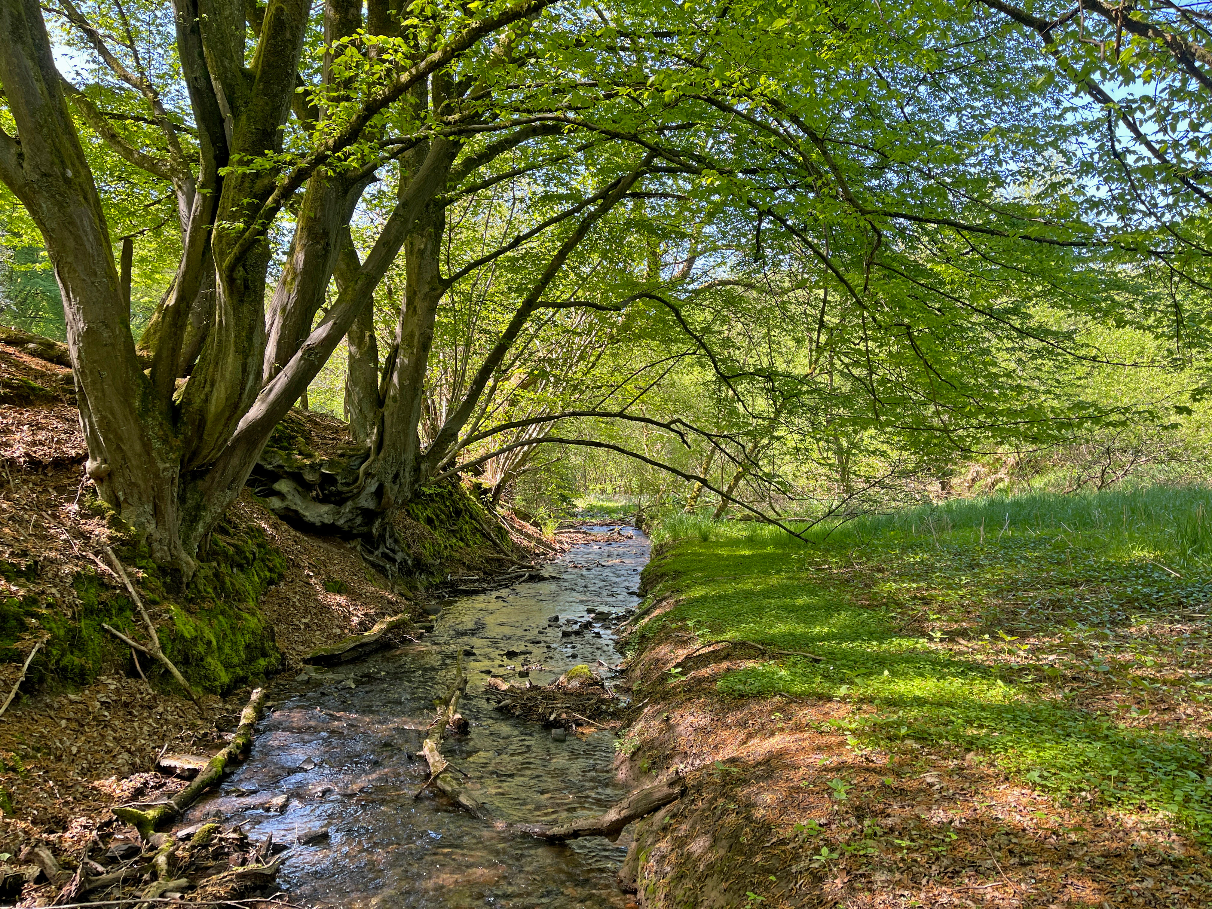
A small, shallow stream flowing through a shaded woodland valley with green trees overhead and grassy banks on a bright day.
The tranquil Grunder Bach stream flowing through the lush, wooded valley of the Oelingrather und Grunder Bachtal nature reserve.

Oelingrather und Grunder Bachtal Nature Reserve history and protected-area timeline

The reserve was formally designated in 2003 by the city of Remscheid as a Naturschutzgebiet under the designation RS-012. Its establishment was framed within the broader Remscheid landscape plan, and administration was assigned to the city's Untere Landschaftsbehörde, the responsible lower-level landscape authority.

Since designation, management of the site has focused on maintaining its near-natural valley structure, restoring hydrological features, and protecting its mosaic of habitat types. A particular intervention has been the separation and renaturalisation of a small standing water body near Kempkenholz in the northern part of the reserve, allowing it to re-establish as an independent wetland rather than a direct extension of the flowing stream.

Conservation management has included active measures to maintain open habitat and ecological quality, such as the successful reintroduction of heather vegetation following habitat care work in the northern sections of the reserve. The site has been recognized not just for its local protection value but also as a representative example of valleys in the wider Bergisches Land natural region.

Oelingrather und Grunder Bachtal Nature Reserve landscape and geographic character

The sitelandscape is dominated by the long, narrow outlines of two parallel Kerbtäler, the V-shaped valleys typical of the Bergisches Land. The Oelingrather Bach and the Grunder Bach cut through gently undulating terrain northwest of Remscheid, with valley floors only a few metres wide and slopes rising on either side to elevations between 190 and 280 metres above sea level.

Streams follow meandering courses along stony to loamy beds, flanked in places by alder gallery forest and patches of tall herbaceous vegetation. On the broader valley bottoms, the land opens into flat, agriculturally used meadows, while steeper hillsides and upper slopes support mixed deciduous woodland. The lower slopes carry wet meadow and sedge-rich grassland, with dry, nutrient-poor meadow appearing on sunnier, steeper inclines.

The combination of valley shape, water features, and surrounding woodland creates a clearly structured scene: flowing stream, narrow strip of bank vegetation, open meadow, and forested slope. This repeating cross-section along both valleys gives the reserve its coherent visual identity and ties it visually to the wider cultural landscape of the Bergisches Land.
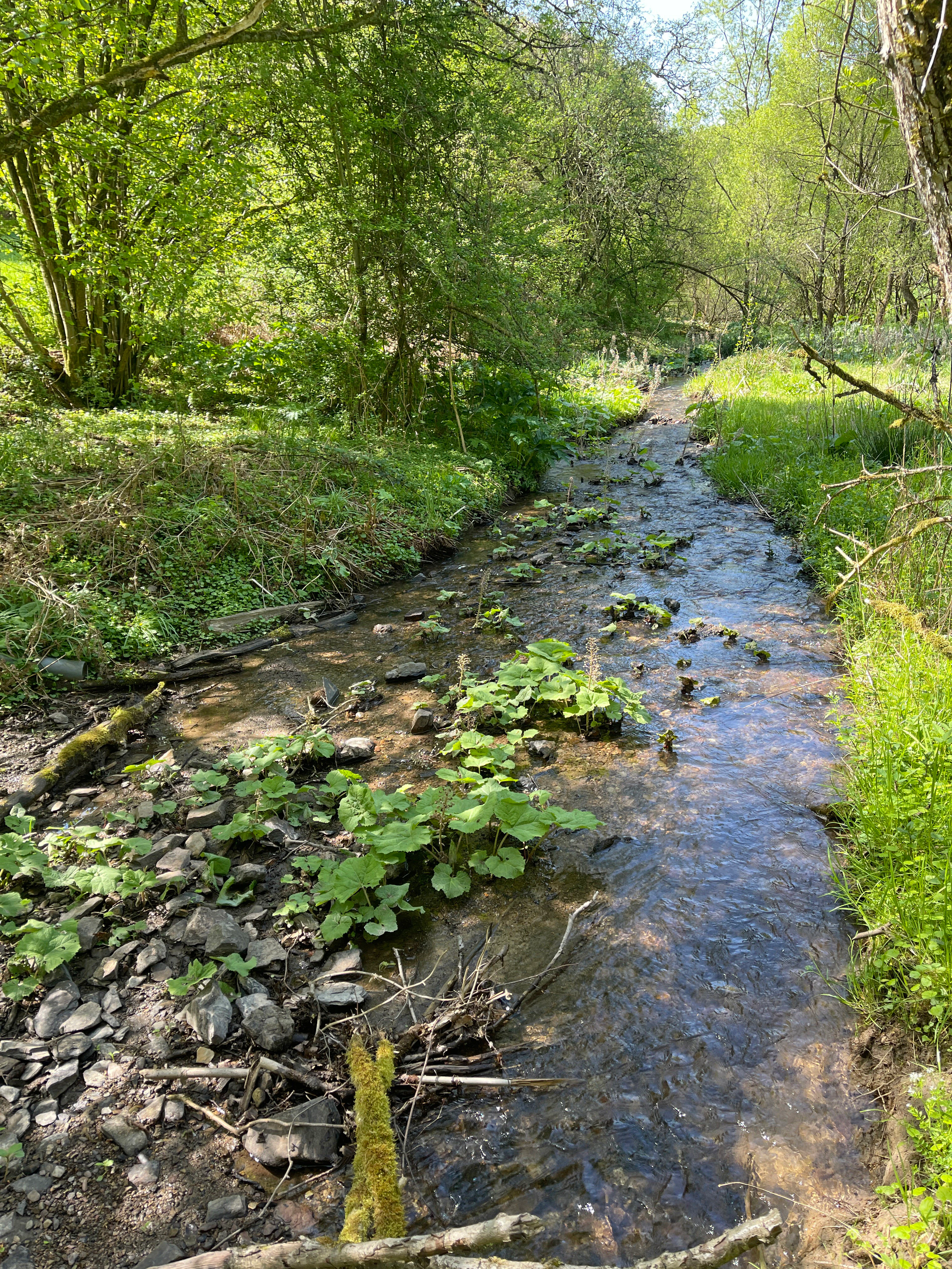
A small shallow stream with a rocky bed flowing through a lush green wooded area, with butterbur plants visible in the water.
Butterbur plants thriving along the rocky, sunlit bed of the Grunder Bach stream.

Oelingrather und Grunder Bachtal Nature Reserve ecosystems, habitats, and plant life

Ecologically, the reserve functions as a compact but unusually complete example of valley-floor ecology in the Bergisches Land. Its clearly defined gradient from stream edge to upper slope produces a stacked set of habitats: aquatic and amphibian communities along the brooks and source springs, tall herb and sedge communities along the margins, wet meadow and occasionally nutrient-poor grassland on flatter ground, and deciduous forest on the slopes and higher ground.

The streams themselves are at the heart of the system. Sources support characteristic spring vegetation, while the flowing sections host water mosses typical of clean, well-oxygenated water. Wet meadows carry marsh marigold, and narrow strips of robust tall herbs such as butterbur line the banks. Alder-dominated riparian woodland appears in places, particularly toward the Morsbach confluence, providing the wet, shaded conditions typical of valley floodplains.

On drier slopes and higher ground, mixed deciduous forests dominate: beech forest, beech-oak forest, and birch-oak forest are all represented, often age- and species-heterogeneous and enriched with old trees. Small open patches and former heath sections, now beginning to re-establish, contribute additional structural diversity. The reserve therefore reads ecologically as a layered, interconnected system rather than a collection of separate fragments.
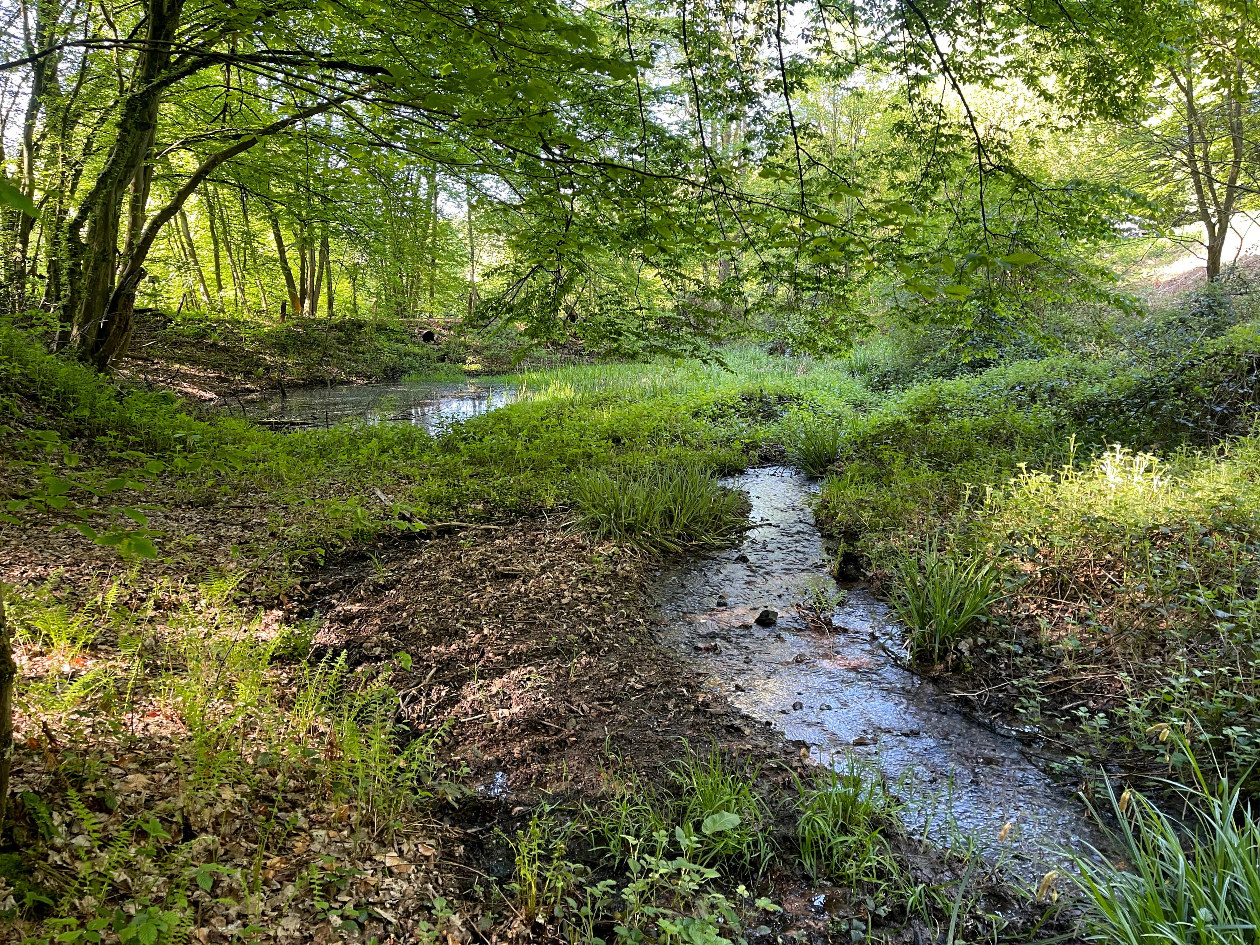
A small, shallow stream flows through a lush, green forest into a small pond, surrounded by vegetation and deciduous trees.
A small stream flowing into a renatured pond within the Oelingrather und Grunder Bachtal nature reserve.

Oelingrather und Grunder Bachtal Nature Reserve wildlife and species highlights

The reserve's wildlife value is closely tied to its high-quality freshwater habitats. Small streams and springs here support specialised aquatic species that depend on clean, well-oxygenated water, including Dobrósia spring snail, an inhabitant of intact spring environments, and the noble crayfish, an indicator species for high-quality freshwater systems. Aquatic plants in the flowing waters include water crowfoot, visible in the pond near Kempkenholz and characteristic of stable aquatic habitats.

Vegetation along the stream margins, including butterbur stands and tall herbaceous edges, supports insects associated with wet habitats, while the surrounding woodland with old trees provides nesting and roosting opportunities for typical Bergisches Land forest birds. Although the reserve is too compact to host large charismatic mammals, its undisturbed stream valleys and structural diversity are likely to support amphibian populations such as salamanders and frogs, as well as smaller forest-dwelling mammals typical of the broader region.
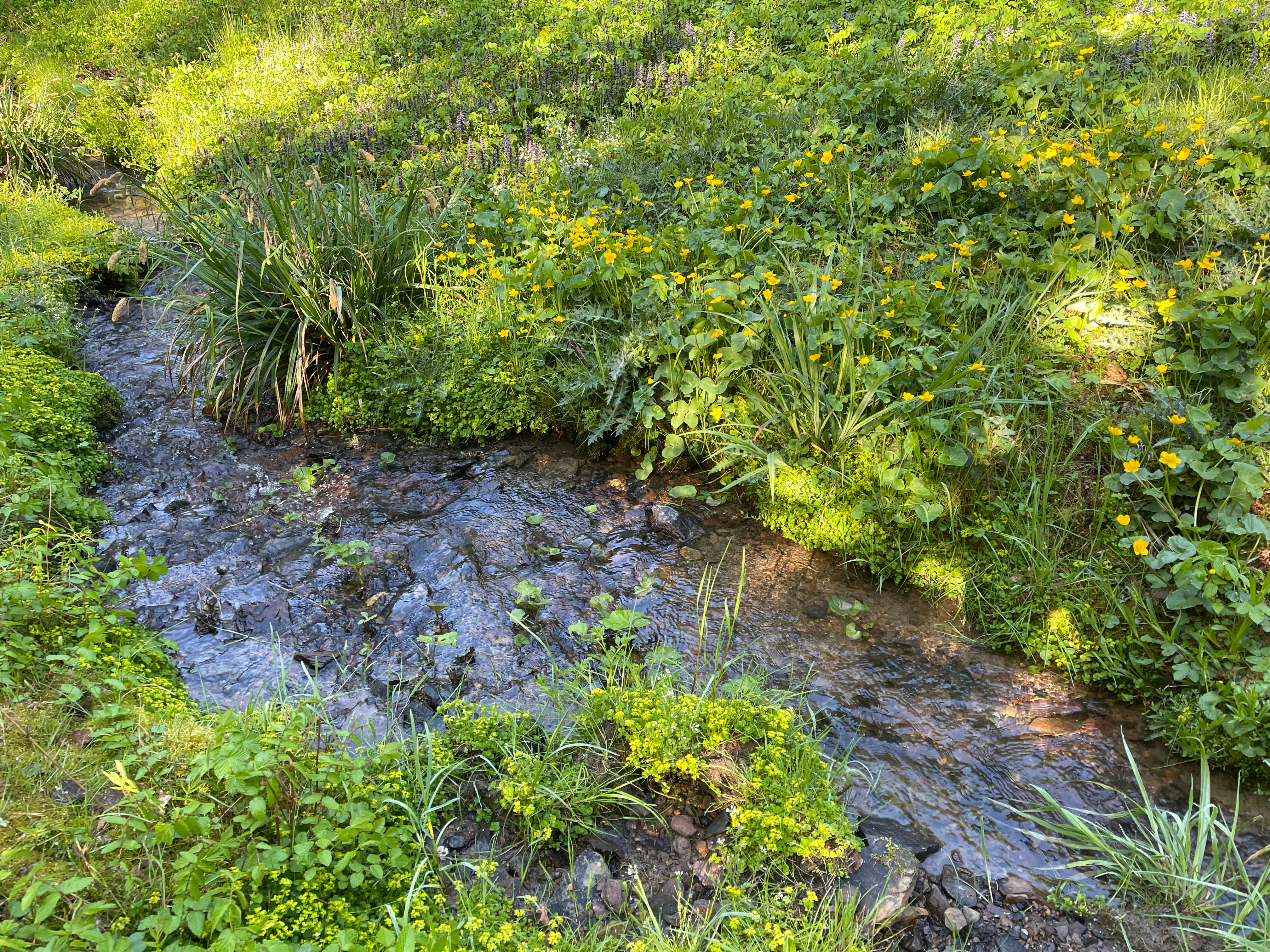
A small rocky stream flows through a grassy, green valley with vibrant yellow marsh marigolds and diverse vegetation on its banks.
A small, natural stream flows through a lush, spring-fed valley in the Oelingrather and Grunder Bachtal nature reserve, bordered by marsh marigolds and riparian vegetation.

Oelingrather und Grunder Bachtal Nature Reserve conservation status and protection priorities

Conservation significance lies in the reserve's role as a representative example of less-disturbed valley habitat within a heavily populated region of North Rhine-Westphalia. The presence of protected habitat types, including near-natural streams, spring areas, tall herb fringes, alder floodplain woodland, and nutrient-poor meadows, marks the site out as ecologically valuable well beyond its small footprint.

It is classified as an IUCN Category IV area, a Habitat/Species Management Area, which reflects that the reserve's role is not strict protection of wilderness but active, targeted management of key habitats and species. Management actions, including the renaturalisation of standing waters and the encouragement of heather re-establishment in the northern sections, illustrate the practical conservation work being undertaken.

Within the regional landscape, the reserve is regarded as a stepping-stone within a wider network of near-natural stream valleys, helping maintain connectivity for species that depend on valley habitats. Its ecological quality and protected species contributing to its recognition as a site of regional rather than purely local importance in the Bergisches Land.

Oelingrather und Grunder Bachtal Nature Reserve cultural meaning and human context

The reserve sits within a landscape shaped by long-standing rural land use. The two valleys carry names that reflect the villages whose watersheds they belong to, Oelingrath and Grund, and both settlements have traditional connections to the surrounding fields and meadows. The presence of agricultural grassland within the reserve reflects this pastoral heritage: the valley floors have historically been used for hay cutting and grazing, practices that have helped maintain the open meadow character that still defines parts of the site today.

Other small elements of cultural landscape history are also visible today. A woodland burial site and park-like relics near the central pond hint at the earlier use of part of the area for recreation or estate-style grounds, while traces of older fish ponds in the southern section point to a past tradition of small-scale fish cultivation. The reserve today thus blends active ecological management with surviving fragments of the region's rural and small-scale cultural landscape.
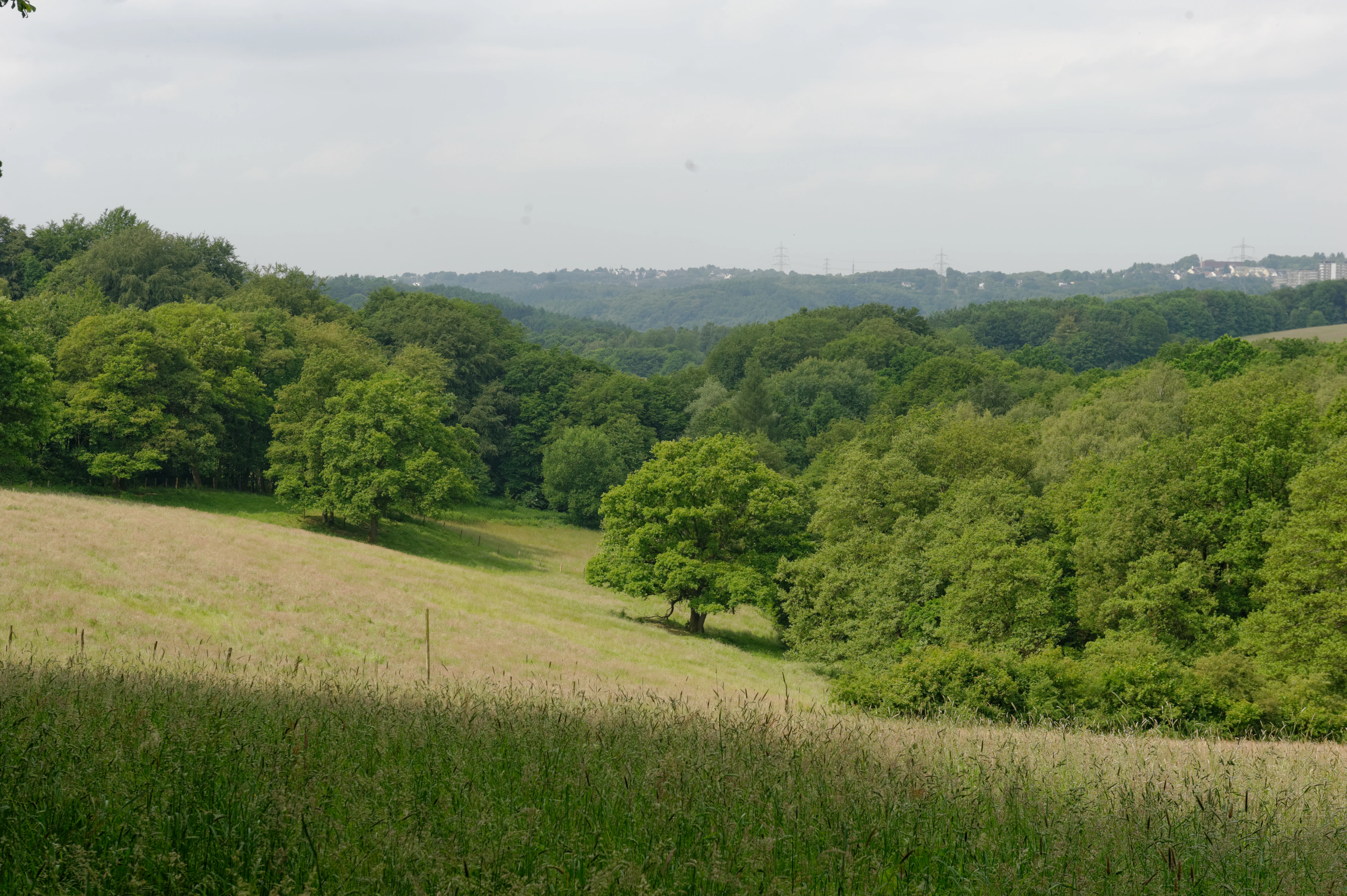
A green, rolling meadow landscape transitions into dense forest under a soft, overcast sky.
A view of the rolling meadows and forest edges within the Oelingrather und Grunder Bachtal nature reserve.

Top sights and standout views in Oelingrather und Grunder Bachtal Nature Reserve

Oelingrather und Grunder Bachtal rewards visitors with an unusually compact concentration of valley habitats typical of the Bergisches Land: meandering streams, spring-fed mossy sections, marshes of butterbur and marsh marigold, alder gallery forest, and deciduous woodland rising on either side. The reserve's two parallel valleys, the Oelingrather Bach and the Grunder Bach, allow this characteristic pattern to be appreciated in essentially unmodified form within easy reach of Remscheid.

A particular highlight is the combination of standing waters and flowing streams: a renaturalised pond near Kempkenholz, ecologically valuable springs, and partly shaded old fish ponds in the south each represent a different stage in the wider hydrological system. The presence of protected species, including Dobrósia spring snail, noble crayfish, and water crowfoot, marks the reserve as ecologically exceptional for its size and gives it a clear identity as a small but distinctively complete example of regional valley conservation.

Best time to visit Oelingrather und Grunder Bachtal Nature Reserve

The valley character of the reserve is attractive in any season, with the most vivid displays typically in late spring and early summer when marsh marigolds flower in the wet meadows and deciduous foliage on the slopes closes in overhead. At this time the streams run clear and the contrast between open valley floor and forested slopes is most pronounced.

Late summer into early autumn can also be rewarding, with mature grasses in the meadows and the onset of colour change in the beech, oak, and birch forests along the slopes. Winter visits have their own appeal: with reduced vegetation, the meandering stream channels, old fish ponds, and sharp Kerbtal profiles become visually prominent, and the reserve's quiet atmosphere is most easily appreciated for gentle walks.

Monthly climate preview

Long term temperature and precipitation measurements across the representative coordinate

Naturschutzgebiet Oelingrather und Grunder Bachtal Climate Normals and Weather by Month

Historical data records a measured annual temperature range from negative averages up to warm summer maximums alongside stable daily precipitation rates. Reviewing the complete twelve month profile clarifies the underlying meteorological rhythm mapped at this protected coordinate.
Annual mean10 °C
1 °C19 °C
Jan
Feb
Mar
Apr
May13°
Jun17°
Jul19°
Aug19°
Sep15°
Oct10°
Nov
Dec
Warmest month
July

19.2 °C

Coolest month
January

1.3 °C

Wettest month
December

2.6 mm/day

Driest month
April

1.6 mm/day

Park location guide

Geography guide, regional context, and park location map for Oelingrather und Grunder Bachtal Nature Reserve

Oelingrather und Grunder Bachtal Nature Reserve park geography, regions, and map view in Germany

Understand where Oelingrather und Grunder Bachtal Nature Reserve sits in Germany through a broader geographic reading of the surrounding landscape, nearby location context, and its mapped position within the national park landscape.

How Oelingrather und Grunder Bachtal Nature Reserve fits into Germany

Germany is a federal republic in Western and Central Europe with a population of over 83 million across sixteen constituent states. It is Europe's largest economy by nominal GDP and a major global exporter and importer. The capital is Berlin, and the country borders Denmark, Poland, Czech Republic, Austria, Switzerland, France, Luxembourg, Belgium, and the Netherlands.

Wider geography shaping Oelingrather und Grunder Bachtal Nature Reserve in Germany

Germany is located in Western and Central Europe, spanning 357,022 km². It borders Denmark to the north, Poland and the Czech Republic to the east, Austria and Switzerland to the south, and France, Luxembourg, Belgium, and the Netherlands to the west. The country has coastlines on the Baltic Sea and North Sea to the north, with the Alps located in the southern region.

Map view of Oelingrather und Grunder Bachtal Nature Reserve

Use this park location map to pinpoint Oelingrather und Grunder Bachtal Nature Reserve in Germany, understand its exact geographic position, and read its mapped placement within the surrounding landscape more clearly.

Pigeon | © OpenStreetMap contributors

Location context for Oelingrather und Grunder Bachtal Nature Reserve

Nordrhein-WestfalenRemscheid

Visual exploration of V-shaped stream valleys and protected woodland habitats

Naturschutzgebiet Oelingrather und Grunder Bachtal Photos and Scenery

Visual documentation captures the meandering stream courses and diverse wetland habitats of Naturschutzgebiet Oelingrather und Grunder Bachtal. Photographic records provide clear insight into the protected valley topography and native woodland character of the Bergisches Land region.

A small, shallow stream flowing through a shaded woodland valley with green trees overhead and grassy banks on a bright day.

A small, clear stream flows through a dense, green deciduous forest under bright daylight, with mature tree trunks in the foreground.

A small shallow stream with a rocky bed flowing through a lush green wooded area, with butterbur plants visible in the water.

A small, shallow stream flows through a lush, green forest into a small pond, surrounded by vegetation and deciduous trees.

A small rocky stream flows through a grassy, green valley with vibrant yellow marsh marigolds and diverse vegetation on its banks.

A large fallen willow tree stretches horizontally across a small, green-tinted pond surrounded by dense vegetation and riparian forest.

A green, rolling meadow landscape transitions into dense forest under a soft, overcast sky.

Park atlas

Compare adjacent valley reserves and regional protected habitats across the Bergisches Land terrain.

Parks near Naturschutzgebiet Oelingrather und Grunder Bachtal and Surrounding Protected Landscapes

Browse other protected areas and nearby stream valley reserves sharing similar regional geography and conservation traits. Comparing adjacent valley habitats provides deeper context into the broader network of natural landscapes surrounding Naturschutzgebiet Oelingrather und Grunder Bachtal.
A wide watercolor illustration showing a winding river flowing through a green valley with pink and purple flowers in the foreground and soft yellow hills in the background.
Nature reserveNordrhein-Westfalen
About 2.2 km away#1 closest

East

Leyerbachtal Nature Reserve: A Protected Valley and Industrial Heritage Site in Remscheid

An alluvial landscape and low-mountain stream corridor in Germany

Leyerbachtal serves as a vital protected corridor featuring a meandering brook, expansive gravel banks, and species-rich wet meadows. Located in the heart of the Bergisches Land, this nature reserve integrates high-value ecological habitats with the historic industrial remnants of Remscheid's water-powered past.

Area
0.151 km²
Established
2003
IUCN
IV
Nature reserveNordrhein-Westfalen
About 5.1 km away#2 closest

Southwest

Wupper und Wupperhänge südlich Müngsten Protected Nature Reserve and River Valley Geography

Mapped river slopes and protected forest landscapes in Nordrhein-Westfalen

This nature reserve protects a 2.8 kilometer stretch of the Wupper valley, defined by steep ravines, rocky slate outcrops, and ancient broadleaf forests. As an important habitat for local river-dependent flora and fauna, the area offers a structured look at low mountain landscape ecology and complex hydraulic stream networks in the Bergisches Land region.

Area
1.443 km²
Established
2003
IUCN
IV
A watercolor painting showing a soft, stylized landscape of a meadow with low rolling hills in the background.
Nature reserveNordrhein-Westfalen
About 5.7 km away#3 closest

South

Naturschutzgebiet Orchideenwiese bei Heintjeshammer: Regional Nature Reserve and Landscape Atlas

Examining meadow diversity and protected habitats in North Rhine-Westphalia

Spanning roughly 4.3 hectares on a hillside above the Eschbach valley, this nature reserve protects a rare assemblage of wetland, heathland, and wooded siefen habitats. It remains a key focus for understanding the distribution of species-rich grassland ecosystems that persist in the rolling topography of the Bergische Hochfläche.

Area
0.043 km²
Established
2000
IUCN
IV
Relief
Upland
Nature reserveNordrhein-Westfalen
About 7.8 km away#4 closest

East

Wilhelmsthaler und Haller Bachtal Nature Reserve: Bergisches Land Landscape and Map

A study of protected stream valleys and habitat mosaics in North Rhine-Westphalia.

Located in Remscheid, the Wilhelmsthaler und Haller Bachtal nature reserve protects a diverse array of interconnected stream-side and grassland habitats. This area demonstrates the ecological value of traditional valley landscapes in the Bergisches Land, providing essential connectivity for rare flora and local stream ecosystems through its unique relief and water corridors.

Area
0.103 km²
Established
2003
IUCN
IV
Relief
Upland
Nature reserveOberbergischer Kreis
About 8.9 km away#5 closest

East

Wupper bei Radevormwald: Protected River Valley and Riparian Woodland Geography

Nature reserve landscape in the Oberbergischer Kreis region

Wupper bei Radevormwald serves as a critical protected area within the Wupper river corridor, featuring a mosaic of beech-oak forests and floodplain alder stands. The reserve highlights the contrast between calm, impounded reaches and energetic, meandering water sections, providing an essential study of river valley morphology and natural recovery in the Bergisches Land.

Area
1.208 km²
Established
2003
IUCN
IV
Relief
Upland
A horizontal watercolor painting depicting a meandering stream flowing through open, green, and pink-toned marshy grasslands bordered by a distant treeline.
Nature reserveNordrhein-Westfalen
About 11 km away#6 closest

Northeast

Spreeler Bachtal Nature Reserve: Geography and Protected Valley Landscapes

An upland nature reserve in the Bergisches Land region of Germany.

This nature reserve centers on the meandering Spreeler Bach, a gravel-bedded stream defining a diverse protected area in North Rhine-Westphalia. The terrain includes wet meadows, spring-fed grassland, and managed deciduous forests on steeply rising valley slopes. It serves as a prime example of targeted habitat conservation within the larger slate landscapes of the Bergisches Land, straddling administrative boundaries between Radevormwald and Ennepetal.

Area
0.21 km²
Established
2019
IUCN
IV
A soft watercolor illustration of a green valley with a central stream or river winding through meadows towards distant hills.
Nature reserveOberbergischer Kreis
About 12 km away#7 closest

East

Leiverbachtal und Talhänge: Protected Stream Valley and Forest Habitat in Oberbergischer Kreis

Examining the geography of a Bergisches Land nature reserve

Leiverbachtal und Talhänge stands as a significant nature reserve within the Oberbergischer Kreis, defined by its near-natural meandering stream and diverse riparian ecosystem. The site offers a detailed look at floodplain meadows, slope forest transitions, and the ongoing shift toward broadleaf woodland within the German Mittelgebirg landscape.

Area
0.92 km²
Established
2006
IUCN
IV
Relief
Upland
Nature reserveNorth Rhine-Westphalia
About 14 km away#8 closest

Southeast

Wupperaue bei Westenbrücke Nature Reserve Landscape and Geographic Mapping

Protected riparian floodplain in the Oberbergischer Kreis

This nature reserve protects a vital 2.3 kilometer segment of the Wupper river valley. Its landscape is characterized by a mosaic of wet meadows, alder and willow stands, and riparian corridors, providing a crucial stepping-stone habitat within the Hückeswagen area of North Rhine-Westphalia.

Area
0.318 km²
Established
2013
IUCN
IV

Common questions about visiting, size, designation, and location context for Oelingrather und Grunder Bachtal Nature Reserve

Oelingrather und Grunder Bachtal Nature Reserve FAQs for park facts, access, geography, and protected area context

Find quick answers about Oelingrather und Grunder Bachtal Nature Reserve, including protected-area facts, park geography, trail and visitor context, and how the park fits into its surrounding country and regional landscape.
MoriAtlas Explorer

Continue Your Protected Areas Search Across the Global Atlas

Deepen your exploration by continuing the structured search for national parks and protected areas worldwide. Utilize the comprehensive filtering capabilities to compare different conservation landscapes and refine your understanding of global park geography. Discover more about the distribution and characteristics of protected natural areas.

Global natural geography