

Mori Atlas logo
Protected areaOstoja Masłowiczki

Mapping the post-glacial terrain, moraine forests, and diverse mire ecosystems of northern Poland.

Ostoja Masłowiczki: A Protected Landscape and Glacial Habitat Mosaic in Pomeranian Voivodeship

Ostoja Masłowiczki represents a significant protected area within the Bytów Lake District of the Pomeranian Voivodeship. This landscape features a complex mosaic of woodland, mire, and open-water ecosystems shaped by the last glaciation, including a distinct concentration of dystrophic and eutrophic lakes, active raised bogs, and mature beech and oak woodlands. Serving as a vital node in regional conservation, the site offers an essential look at the post-glacial geography and traditional habitat structures of northern Poland.

Natura 2000Site of Community ImportancePomeranian VoivodeshipBytów Lake Districtpost-glacial landscapemoraine forests
A digital illustration showing a vertical waterfall cascading down rocky cliffs, framed by evergreen trees and a rustic wooden fence in the foreground.

Ostoja Masłowiczki

Protected area

Park overview

Structured park overview, official facts, and landscape profile for Ostoja Masłowiczki

Ostoja Masłowiczki park facts, protected area profile, and essential visitor context

Review the core facts for Ostoja Masłowiczki, including designation, size, terrain, visitor scale, habitats, and operating context in one park-focused overview.

About Ostoja Masłowiczki

Ostoja Masłowiczki sits within the broader network of protected sites that Poland maintains as part of the European Natura 2000 framework. Although it does not carry the title of a national park, it functions as a significant conservation area in its own right, dedicated to preserving habitat types that are considered priorities or important features across the European Union. The site is administratively tied to the Pomeranian Voivodeship, and its territory is shared between the gminas of Miastko, Kołczygłowy, and Tuchomie, three local administrative units that together characterize the rural character of this part of northern Poland.

The physical setting of the area belongs to the Bytów Lake District, one of the mesoregions of the broader Pomeranian Lakeland. This region was shaped directly by the retreat of the last Scandinavian ice sheet, which left behind a rolling landscape of moraines, kettle hollows, and an irregular network of lakes and peat-filled depressions. The habitats recognized at Ostoja Masłowiczki reflect that inheritance. Natural lakes, both eutrophic and dystrophic, occupy the depressions; raised bogs and transitional mires occupy the poorly drained basins; and the higher moraine ground is cloaked in characteristic deciduous and mixed forest types.

What gives the site its particular value is the coexistence, within a single coherent area, of forest, mire, meadow, and lake habitats, each with its own ecological dynamics. Such mosaics are increasingly unusual in lowland Europe, where agricultural intensification and drainage have often simplified the landscape. Ostoja Masłowiczki therefore has relevance not only for the species and habitats it directly protects, but also for the broader connectivity of natural habitats across the Pomeranian Lakeland.

Its legal foundation is European rather than purely national. The site was added to the EU list by Commission Decision of 10 January 2011, which adopted the fourth updated list of sites of Community importance for the continental biogeographical region under the 1992 Habitats Directive. This date marks the formal recognition of the area as a Site of Community Importance, an early stage in the process that can culminate in designation as a Special Area of Conservation by the Member State.

Quick facts and research context for Ostoja Masłowiczki

Ostoja Masłowiczki is a Natura 2000 Site of Community Importance located in the Pomeranian Voivodeship of northern Poland. It was adopted by the European Commission in January 2011 as part of the fourth updated list of sites of Community importance for the continental biogeographical region. The site covers approximately 1,680 hectares within the Bytów Lake District mesoregion, an area shaped by glacial moraines. Protection focuses on natural forest, mire, lake, and meadow habitat types listed under the EU Habitats Directive.

Protection and recognition

Documented terrestrial protection scope, designation history, and Natura 2000 records

Ostoja Masłowiczki Protection Status and International Recognition Data

Ostoja Masłowiczki maintains a documented terrestrial protection status established in 2011 alongside official Natura 2000 recognition sources. Reviewing these verified designation details provides clear context on the administrative scope and recognized conservation framework governing the terrain.

International recognition

Protection details

Protection scope
Terrestrial
Designated year
2011
Transboundary protection
No
Park context

Deeper park guide and search-rich context for Ostoja Masłowiczki

Ostoja Masłowiczki history, landscape, wildlife, and travel context

Explore Ostoja Masłowiczki through its history, landscape character, ecosystems, wildlife, conservation priorities, cultural context, and seasonal travel timing in a structured park guide built for atlas discovery and search intent.

Why Ostoja Masłowiczki stands out

Ostoja Masłowiczki is best known for the diversity of protected natural habitats concentrated in a relatively compact area of moraine landscape. Its profile is built around classic Pomeranian glacial features: dystrophic and eutrophic lakes, raised bogs and transitional mires, species-rich lowland hay meadows, and a sequence of beech and oak-hornbeam forests that represent the regional woodland identity of the Bytów Lake District.
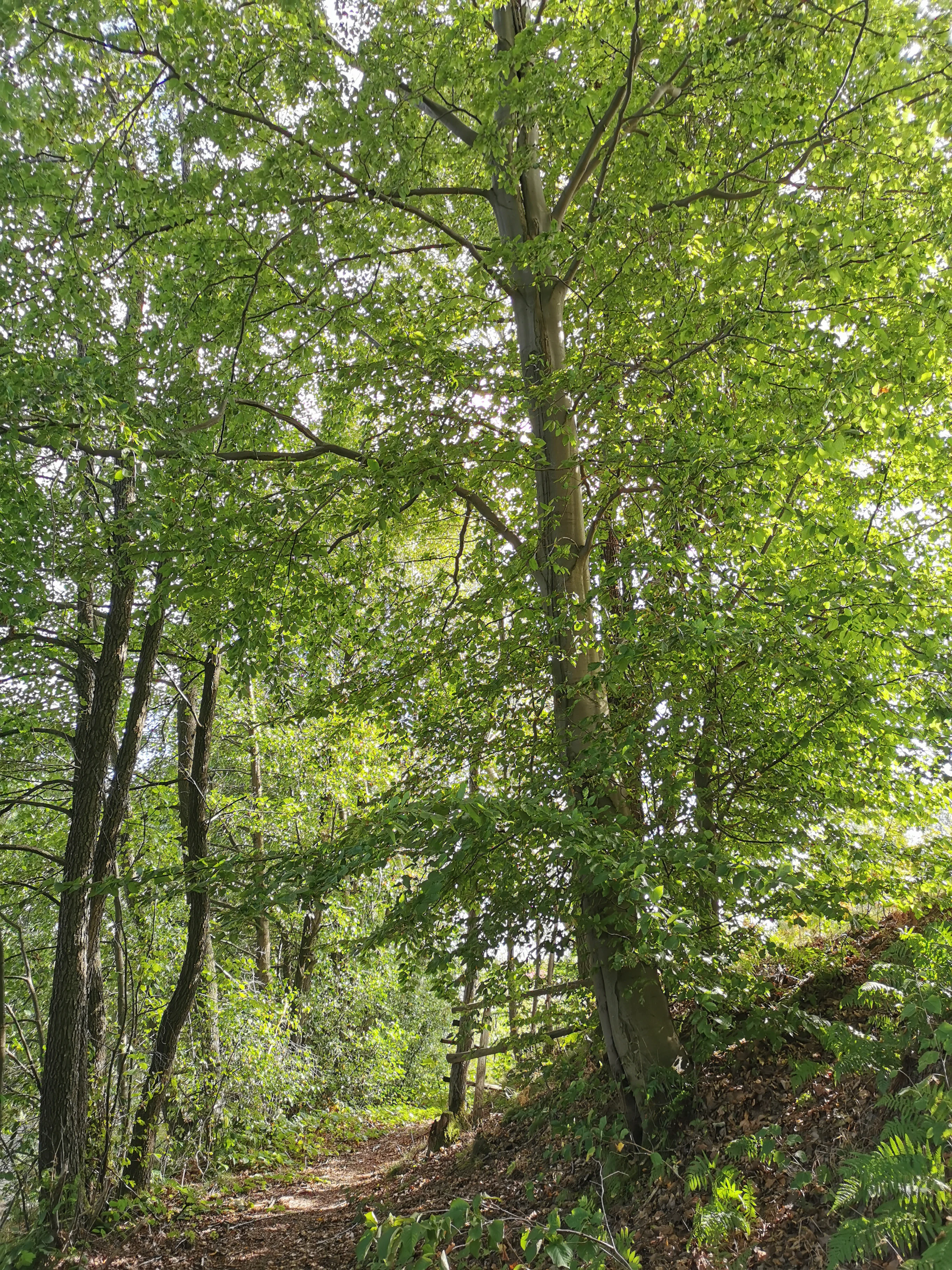
A dirt path leads through a lush green deciduous forest with tall trees and dappled sunlight.
A shaded forest trail winding through the woodland of Ostoja Masłowiczki.

Ostoja Masłowiczki history and protected-area timeline

The protected status of Ostoja Masłowiczki dates to 10 January 2011, when the European Commission adopted the fourth updated list of sites of Community importance for the continental biogeographical region. The decision, notified under document number C(2010) 9669 and published as Commission Decision 2011/64/EU, formalized the inclusion of the site in the Natura 2000 network on the basis of the Council Directive 92/43/EEC, the EU Habitats Directive.

This inclusion reflects a longer history of habitat recognition in the region: the Bytów Lake District had long been valued for its concentration of glacial lakes, mires, and deciduous forests. The 2011 decision translated that regional ecological value into formal European protection, binding the area to the conservation obligations of the Habitats Directive and aligning it with the wider Natura 2000 process that has been unfolding across Poland since the country's accession to the European Union.

Ostoja Masłowiczki landscape and geographic character

The landscape of Ostoja Masłowiczki belongs to the post-glacial pattern that defines the Bytów Lake District. Its terrain consists of moraine hills, sandy outwash plains, and a network of basins that have become lakes, peatlands, or wet meadows. This is rolling, forested countryside rather than mountainous or coastal terrain, and its visual character is determined by glacial deposition rather than by river erosion or tectonic uplift.

The lakes within the area include both eutrophic and dystrophic types. Eutrophic lakes tend to occupy basins with richer nutrient input and support more diverse aquatic and emergent vegetation, while dystrophic lakes are darker and more acidic, fed by water that has passed through peaty surroundings. The presence of both types within the same protected area indicates the variability of glacial basins and the different ecological communities that have developed in them.

Drier ground is dominated by forest. The site covers a representative range of deciduous forest types typical of the lowlands of northern Poland: impoverished and fertile beech forests on different soil types, sub-Atlantic and central European oak or oak-hornbeam forests, and wet alder-ash forests along stream margins and lake edges. Open ground, where it occurs, takes the form of lowland hay meadows of conservation interest, traditionally maintained by mowing.

Ostoja Masłowiczki ecosystems, habitats, and plant life

Ecologically, Ostoja Masłowiczki functions as a habitat mosaic rather than a single dominant ecosystem. Its natural value lies in the way woodland, mire, lake, and meadow habitats interlock across the moraine terrain, producing a varied environment where species associated with very different conditions can occur within close proximity.

The forest habitats include acidophilous beech forest of the Luzulo-Fagetum type, fertile beech forest of the Asperulo-Fagetum type, and sub-Atlantic and central European oak and oak-hornbeam forests of the Carpinion betuli group. Wet woodland is represented by alder-ash forests dominated by Alnus glutinosa and Fraxinus excelsior, which fringe watercourses and lake margins and act as buffers between aquatic and terrestrial habitats.

Open and semi-open habitats are equally central. Raised bogs and transitional mires represent the most sensitive peatland environments and depend on stable water levels; the dystrophic lakes and eutrophic lakes with Magnopotamion or Hydrocharition-type vegetation represent key aquatic habitats; and lowland hay meadows dominated by Alopecurus pratensis and Sanguisorba officinalis represent a habitat type closely tied to traditional agricultural management. Maintaining the balance among these habitat types is the principal ecological objective of the site.

Ostoja Masłowiczki wildlife and species highlights

The specific fauna of Ostoja Masłowiczki is not detailed in the source documentation, and the site's significance for wildlife is best understood through the habitat types it protects. The combination of lakes, peatlands, wet forests, and species-rich meadows supports the kinds of species associated with each of these environments across lowland Poland, including wetland birds, amphibians, and invertebrates tied to peatland and meadow habitats, as well as forest species linked to mature deciduous woodland.

Ostoja Masłowiczki conservation status and protection priorities

Ostoja Masłowiczki is valuable from a conservation perspective because it anchors, in a single area, a series of habitat types that the European Union considers important for the continental biogeographical region. Several of the habitats recognized within the site fall into categories that the Habitats Directive treats as priorities or as features requiring specific protection, including raised bogs, transitional mires, and certain types of lowland hay meadow.

The site also contributes to habitat connectivity in the Pomeranian Lakeland. By protecting a relatively large and varied block of natural habitats directly adjacent to and connecting with similar landscapes in the Bytów Lake District, it strengthens the network function of Natura 2000 across northern Poland. Its designation under the Habitats Directive binds national and local authorities to maintain the site's favorable conservation status, with implications for land use, water management, and forestry practices within its boundaries.

Ostoja Masłowiczki cultural meaning and human context

The cultural context of Ostoja Masłowiczki is closely tied to rural Pomeranian land use. The presence of lowland hay meadows of the Alopecurus pratensis and Sanguisorba officinalis type within the protected habitats indicates a long-standing tradition of small-scale mowing agriculture in the area, while the persistence of alder-ash forests and peatlands reflects the historical avoidance of these wetter, less productive grounds by intensive farming. The site thus preserves not only natural habitats but also traces of the traditional human relationship with this moraine landscape.

Top sights and standout views in Ostoja Masłowiczki

Ostoja Masłowiczki stands out primarily for the diversity of protected habitats concentrated within a relatively small post-glacial area. Its strongest features are the combination of dystrophic and eutrophic lakes, active raised bogs and transitional mires, and a sequence of beech and oak forests that together define the woodland and wetland identity of the Bytów Lake District. The site's formal Natura 2000 status and its location in a largely rural part of the Pomeranian Voivodeship give it additional significance as a node in the broader European network of protected habitats.

Best time to visit Ostoja Masłowiczki

The character of the landscape at Ostoja Masłowiczki shifts through the year in ways that reflect the climate of northern Poland. Spring and early summer are typically the most rewarding periods for experiencing the meadows and deciduous forests, when lowland hay meadows are at their most floristically diverse and the beech and oak woodlands are in fresh leaf. Summer brings full vegetation cover across the forests, mires, and lake margins, while autumn produces strong color in the deciduous stands and an active period for many woodland species. Winter offers a quieter view of the moraine terrain, with frozen lakes and bare woodland structure that emphasize the glacial shaping of the landscape. These patterns are general, since the source material does not provide specific seasonal guidance for visits.
Monthly climate preview

Long term representative point averages for monthly weather patterns in Ostoja Masłowiczki

Ostoja Masłowiczki Climate Normals, Annual Temperature and Precipitation Patterns

Ostoja Masłowiczki records measured long term monthly temperatures ranging from subzero winter minimums to warm summer maximums alongside consistent daily precipitation rates. Analyzing complete twelve month climate normals provides deeper quantitative context for the representative coordinate baseline.
Annual mean8 °C
-3 °C18 °C
Jan-3°
Feb-2°
Mar
Apr
May12°
Jun16°
Jul18°
Aug18°
Sep14°
Oct
Nov
Dec-1°
Warmest month
July

18.3 °C

Coolest month
January

-2.7 °C

Wettest month
July

2.8 mm/day

Driest month
April

1.3 mm/day

Park location guide

Geography guide, regional context, and park location map for Ostoja Masłowiczki

Ostoja Masłowiczki park geography, regions, and map view in Poland

Understand where Ostoja Masłowiczki sits in Poland through a broader geographic reading of the surrounding landscape, nearby location context, and its mapped position within the national park landscape.

How Ostoja Masłowiczki fits into Poland

Poland, officially the Republic of Poland, is a Central European country spanning from the Baltic Sea in the north to the Carpathian Mountains in the south. It borders Germany, Czech Republic, Slovakia, Ukraine, Belarus, Lithuania, and Kaliningrad Oblast. The country has a temperate climate, diverse landscapes, and is known for its rich history, cultural heritage, and strong economic position within the EU.

Wider geography shaping Ostoja Masłowiczki in Poland

Poland occupies 312,696 km2 in Central Europe, extending from the Baltic Sea coast in the north to the Sudetes and Carpathian Mountains in the south. It borders Germany to the west, Czech Republic and Slovakia to the south, Ukraine and Belarus to the east, and Lithuania and Kaliningrad Oblast to the northeast. The landscape includes lowland plains, uplands, and mountain ranges.

Map view of Ostoja Masłowiczki

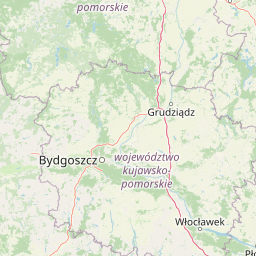
Use this park location map to pinpoint Ostoja Masłowiczki in Poland, understand its exact geographic position, and read its mapped placement within the surrounding landscape more clearly.

Pigeon | © OpenStreetMap contributors

Location context for Ostoja Masłowiczki

Pomeranian Voivodeship

Visual reference of post-glacial terrain, habitats, and forest environments

Ostoja Masłowiczki Photos and Landscape Scenery

Visual documentation of Ostoja Masłowiczki reveals the complex post-glacial terrain, moraine forests, and wetland habitats that define the Bytów Lake District. Examining protected-area photography provides a clearer understanding of local topography, glacial lakes, and woodland ecosystems.

A dirt path leads through a lush green deciduous forest with tall trees and dappled sunlight.

Park atlas

Compare regional post glacial terrain and connected habitats across Pomerania

Explore Parks Near Ostoja Masłowiczki and Surrounding Protected Landscapes

Browse nearby national parks and protected areas sharing the post glacial terrain of the Bytów Lake District. Comparing adjacent moraine forests and wetland reserves reveals the broader ecological connectivity of northern Poland.
A horizontal watercolor painting showing a tranquil lake scene with sparse trees on both shores and a soft light across the water.
Nature reservePomeranian Voivodeship
About 9.6 km away#1 closest

Southwest

Rezerwat przyrody Jezioro Smołowe: Geography of a Protected Polish Lobelia Lake

Mapped softwater habitats in the Pomeranian Lakeland.

Located in the Bytów Lakeland, Rezerwat przyrody Jezioro Smołowe is a small, post-glacial lake recognized for its high water purity and specialized aquatic vegetation. As a core component of the local Brda river headwater complex, this reserve represents a critical ecological site for softwater lake conservation, supported by a managed buffer zone that protects its natural catchment.

Area
0.371 km²
Established
1976
Scope
Terrestrial
Water
Water-dominated
A soft watercolor illustration depicting a flat wetland landscape with low hills in the background and clusters of green trees and shrubs in the foreground.
Nature reservePomeranian Voivodeship
About 15 km away#2 closest

Southeast

Mechowisko Radość Nature Reserve: Atlas of Protected Alkaline Fen Landscapes in Pomeranian Voivodeship

A rare calcareous mire ecosystem within the Bory Tucholskie post-glacial terrain

Mechowisko Radość Nature Reserve protects a specialized alkaline peatland ecosystem that developed in a formerly mesotrophic lakeside bay. This site highlights the complex hydrological and ecological processes of the Bory Tucholskie region, where flat, post-glacial landscapes sustain rare orchid and bryophyte assemblages through dedicated active conservation management.

Area
0.096 km²
Established
2013
Relief
Lowland
Scope
Terrestrial
Nature reservePomeranian Voivodeship
17 km away#3 closest

East

Studzienickie Torfowiska Nature Reserve: Geographic Atlas and Wetland Habitat Context

Protected peatland terrain in Pomeranian Voivodeship

Studzienickie Torfowiska represents a vital protected peatland system characterized by its mosaic of transitional mires, dystrophic lakes, and regenerating bog forests. The landscape focus lies on the interplay between saturated ground and peat accumulation, offering a clear regional perspective on wetland conservation within northern Poland's lowland geography.

Area
1.75 km²
Relief
Lowland
Climate
Temperate
Access
Access unknown
Protected landscapePomeranian Voivodeship
19 km away#4 closest

Southeast

Zaborski Park Krajobrazowy: Geographic Profile of a Polish Protected Landscape Area

Tuchola Forest region, Pomeranian Voivodeship

Investigate the unique terrain of Zaborski Park Krajobrazowy, a protected landscape defined by its dense network of glacial lakes and sandy outwash plains. This territory provides a comprehensive view of northern Polish lowland geography, highlighting the ecological significance of its river valleys and relic forest habitats within the broader Tuchola Forest ecosystem.

Area
340.3 km²
Established
1990
Relief
Lowland
Climate
Temperate
Protected areaPomeranian Voivodeship
20 km away#5 closest

Southeast

Sandr Brdy: Protected Glacial Landscapes and Hydrological Networks in Pomeranian Voivodeship

A vital reference site for lowland habitat conservation and post-glacial terrain.

Sandr Brdy spans 7,492 hectares of outwash plains in northern Poland. Its terrain hosts a complex mosaic of calcareous fens, acid oak forests, and lobelia lakes, established to preserve fragile aquatic and terrestrial species like the gray wolf and lady's slipper orchid within a unique glacial framework.

Area
74.926 km²
Scope
Terrestrial
Water
Major water bodies
Watercolor painting of a soft, hazy wetland landscape with green foliage, pink marsh vegetation, and distant hills in pale tones.
Nature reservePomeranian Voivodeship
About 20 km away#6 closest

Southeast

Rezerwat przyrody Dolina Kulawy: Mapping Peatlands and Wetlands in Pomeranian Voivodeship

A protected landscape featuring soligenous mires and glacial lakes.

Discover the intricate geography of Rezerwat przyrody Dolina Kulawy, a nature reserve centered on the Kulawa River valley in northern Poland. This protected area offers a unique look at soligenous peatlands, floodplain forests, and mesotrophic lake systems, providing essential context for the post-glacial landscape of the Bory Tucholskie region.

Area
1.546 km²
Established
2009
Relief
Lowland
Climate
Temperate
Nature reserveZachodniopomorskie
About 28 km away#7 closest

West

Rezerwat przyrody Dolina Pustynki: Geography and Protected River Valley Landscapes in Zachodniopomorskie

Mapped riverine corridors and ancient deciduous forest ecosystems

Explore the detailed ecological landscape of Rezerwat przyrody Dolina Pustynki in the West Pomeranian region. This nature reserve serves as an essential example of submontane river habitats and well-preserved oak-hornbeam forests within the Polanów High Plain, maintaining vital connections between regional water catchments and protected woodlands.

Area
0.392 km²
Established
2024
Relief
Upland
Climate
Temperate
A pale, soft-toned watercolor painting of a calm lake shore with marshy grasses in the foreground and a line of green trees and rolling hills in the background.
National parkPomeranian Voivodeship
28 km away#8 closest

Southeast

Park Narodowy „Bory Tucholskie”: Geography of a Polish National Park and Protected Forest

Lowland pine ecosystems and glacial water networks

Located in the Pomeranian Voivodeship, Park Narodowy „Bory Tucholskie” protects a significant remnant of the Tuchola Forest. The terrain, characterized by postglacial sandy plains, inland dunes, and acidic lobelia lakes, provides a critical reference site for studying forest ecology and glacial geomorphology within the Polish national park system.

Area
46.13 km²
Established
1996
Visitors
33K annual
Relief
Lowland

Common questions about visiting, size, designation, and location context for Ostoja Masłowiczki

Ostoja Masłowiczki FAQs for park facts, access, geography, and protected area context

Find quick answers about Ostoja Masłowiczki, including protected-area facts, park geography, trail and visitor context, and how the park fits into its surrounding country and regional landscape.
MoriAtlas Explorer

Continue Your Protected Areas Search Across the Global Atlas

Deepen your exploration by continuing the structured search for national parks and protected areas worldwide. Utilize the comprehensive filtering capabilities to compare different conservation landscapes and refine your understanding of global park geography. Discover more about the distribution and characteristics of protected natural areas.

Global natural geography