

Mori Atlas logo
Nature reserveOstoja Olsztyńsko-Mirowska

Discover the geographic boundaries, forest mosaics, and cave systems of this Silesian Voivodeship nature reserve.

Ostoja Olsztyńsko-Mirowska: A Deep Dive Into Protected Limestone Landscapes and Karst Terrain

(Ostoja Olsztyńsko-Mirowska (PLH240015))

Ostoja Olsztyńsko-Mirowska represents a significant protected area within the Częstochowa Upland, defined by its complex mosaic of limestone hills, karst formations, and rare rock-steppe communities. This nature reserve, spanning over 2,200 hectares in the Silesian Voivodeship, provides critical habitat for diverse bat populations while anchoring the regional landscape through its unique beech and oak forest corridors. By examining the mapped boundaries and terrain features, researchers and enthusiasts can better understand the ecological importance of this mosaic of sheltered rock outcrops, open grasslands, and historic castle ridges.

limestone hillskarst landscapebeech forestsxerothermic grasslandsrock-steppe habitatscave habitats
A flat, stylized graphic illustration of a tiered waterfall cascading down between steep, rocky mountain cliffs, with evergreen trees in the foreground.

Ostoja Olsztyńsko-Mirowska

Nature reserve

Park overview

Structured park overview, official facts, and landscape profile for Ostoja Olsztyńsko-Mirowska

Ostoja Olsztyńsko-Mirowska park facts, protected area profile, and essential visitor context

Review the core facts for Ostoja Olsztyńsko-Mirowska, including designation, size, terrain, visitor scale, habitats, and operating context in one park-focused overview.

About Ostoja Olsztyńsko-Mirowska

Ostoja Olsztyńsko-Mirowska represents one of the more ecologically important protected landscape complexes in southern Poland, embedded in the heart of the Częstochowa Upland. Stretching from the hills just outside Częstochowa south-east toward Sokole Góry and then north-east toward Bobolice, the site captures a continuous gradient of habitats typical of the Polish Jura, from lowland oak-hornbeam forests to dry grasslands perched on exposed limestone.

The defining character of the ostoja comes from its geology. Late Jurassic limestone forms a series of hills, cliffs, and isolated rock outcrops, many of which have been shaped by weathering into the distinctive mogotes, rock groups, and rock shelters that give the area its scenic identity. This karst terrain is riddled with caves and shelters that, even where small, hold disproportionate ecological value as bat habitat.

Plant communities across the site are equally varied. Acidophilus, fertile, and warm-loving beech forests cover much of the wooded terrain, joined by sub-continental oak-hornbeam woodland, thermophilous oak forests, and upland fir-mixed forest relicts. On the open, sun-exposed slopes and rock ledges, centuries of grazing pressure have produced a network of xerothermic and sandy dry grasslands, including rock-steppe communities that harbor relict and endemic species such as the Kraków bedstraw, a Polish endemic.

Human history is woven tightly into this landscape. Beyond its ecological role, the ostoja lies within the Orlich Gniazd Landscape Park and forms one of the key stretches of the famous Eagles' Nests Trail, with ruined and restored castles at Olsztyn, Mirów, and Bobolice punctuating the route. The combination of geological drama, ecological richness, and centuries of cultural layering gives Ostoja Olsztyńsko-Mirowska a distinctive identity among Polish protected areas.

Quick facts and research context for Ostoja Olsztyńsko-Mirowska

Ostoja Olsztyńsko-Mirowska is a Natura 2000 Special Area of Conservation, designated under the EU Habitats Directive with the site code PLH240015. It lies entirely within the Orlich Gniazd Landscape Park in the Silesian Voivodeship, on the limestone terrain of the Częstochowa Upland. The protected area covers about 2,210 hectares and was formally established on 12 December 2008.

The site is recognized for its mosaic of beech forests, sub-continental oak-hornbeam woodland, xerothermic grasslands, limestone rock formations, and cave systems. It also holds two nature reserves, Zielona Góra and Sokole Góry, and shelters one of the largest known colonies of the greater mouse-eared bat in Poland.

Protection and recognition

Documented terrestrial protection scope, designation history, and international recognition details

Ostoja Olsztyńsko-Mirowska Protection Status and Natura 2000 Designation Data

Ostoja Olsztyńsko-Mirowska maintains a documented terrestrial protection status established in 2008 alongside official Natura 2000 recognition. Structured records compile available designation history and administrative context for professional geographic review.

International recognition

Protection details

Protection scope
Terrestrial
Designated year
2008
Transboundary protection
No
Park context

Deeper park guide and search-rich context for Ostoja Olsztyńsko-Mirowska

Ostoja Olsztyńsko-Mirowska history, landscape, wildlife, and travel context

Explore Ostoja Olsztyńsko-Mirowska through its history, landscape character, ecosystems, wildlife, conservation priorities, cultural context, and seasonal travel timing in a structured park guide built for atlas discovery and search intent.

Why Ostoja Olsztyńsko-Mirowska stands out

Ostoja Olsztyńsko-Mirowska is best known for its concentration of limestone rock formations, caves, and xerothermic grasslands set within a heavily forested landscape. The area stands out within the larger Jurassic upland system for its rich combination of beech forest types, warm-loving orchid and oak woodlands, and calcareous rock habitats supporting rare and endemic plants. The site is also widely recognized for its bat fauna. Its caves and rock shelters serve as crucial roosting and breeding habitat for several rare bat species, including a colony of greater mouse-eared bats at the Sokole Góry reserve that ranks among the country's largest. Together with the dramatic scenery and cultural monuments, this makes the ostoja one of the most ecologically distinctive Natura 2000 sites in the region.
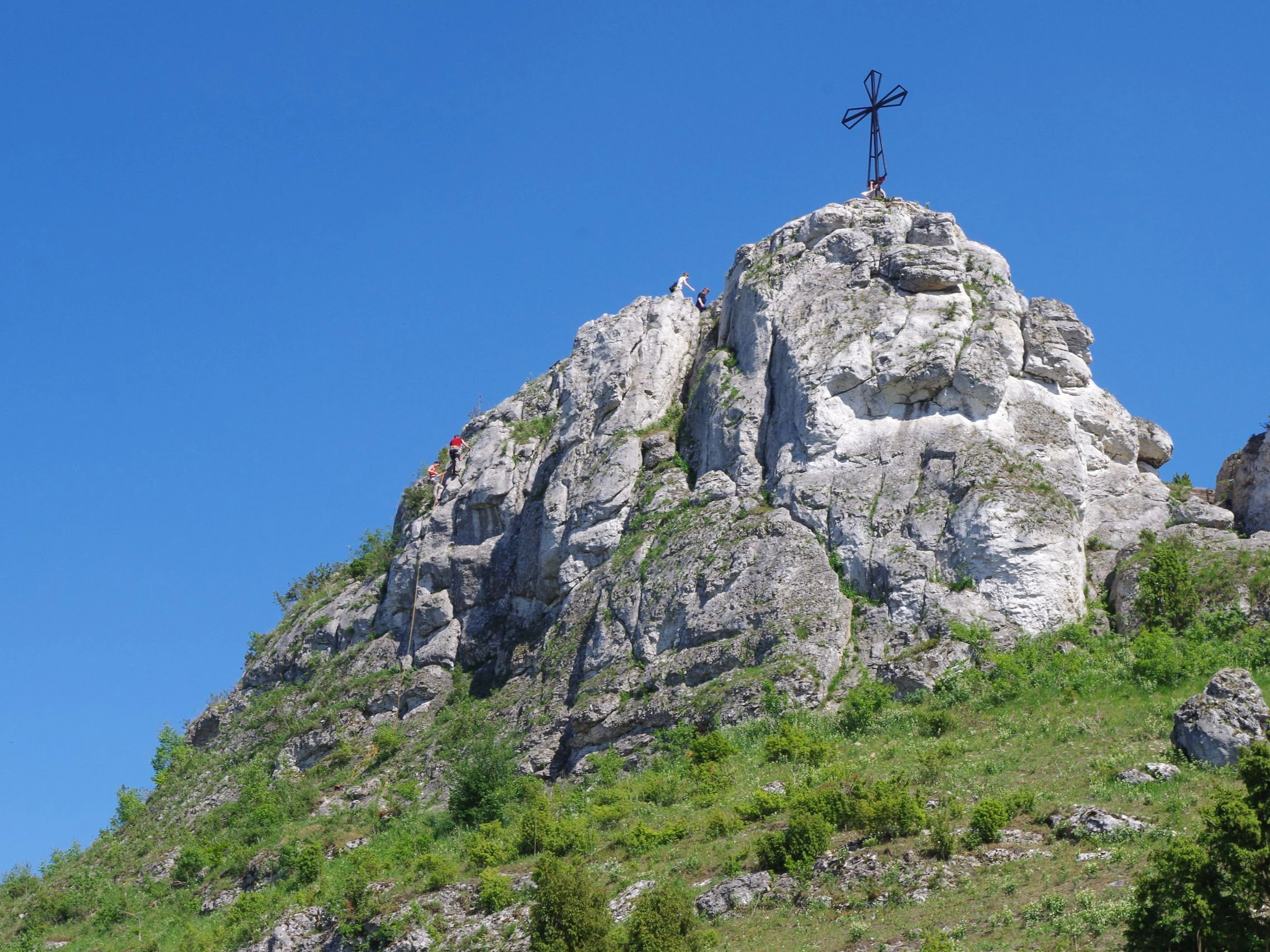
A steep, light-colored limestone rock formation topped with a metal cross under a clear blue sky, with greenery at its base.
The Biaklo limestone rock formation, a landmark within Ostoja Olsztyńsko-Mirowska.

Ostoja Olsztyńsko-Mirowska history and protected-area timeline

Ostoja Olsztyńsko-Mirowska was formally designated on 12 December 2008 as a Polish Natura 2000 Special Area of Conservation under the European Union Habitats Directive. Its identification reflects a recognition of the long-known natural value of the limestone hills and forests surrounding Olsztyn and Mirów, an area already shaped by centuries of pastoral and forestry use.

The wider region had earlier received protective status through the Orlich Gniazd Landscape Park, within which the entire ostoja lies. Two nature reserves, Zielona Góra and Sokole Góry, were also established separately within its boundaries to safeguard the most valuable beech forest stands and the bat-rich cave systems.

The cultural layer of the landscape is significantly older. Medieval castles at Olsztyn, Mirów, and Bobolice were built to control the historic route through the Jura and remain defining landmarks within the protected area. Their continued presence, alongside later 20th- and 21st-century conservation measures, illustrates how the ostoja's identity is rooted in both natural and human history.

Ostoja Olsztyńsko-Mirowska landscape and geographic character

The landscape of Ostoja Olsztyńsko-Mirowska is shaped almost entirely by Late Jurassic limestone. The Częstochowa Upland produces here a classic karst scenery of forested hills, steep rocky slopes, isolated mogotes, and dramatic rock walls. The terrain rises and falls through long ridges and valleys, threaded by the wooded chain of Zielona Góra, Góry Towarne, Sokole Góry, and the Mirowsko-Bobolicka Grzęda.

Numerous rock forms break through the forest canopy, including groups such as the Turnie Kukuczki, the Olsztyńskie Skały, the Biakło outcrop, and the distinctive mushroom-shaped Grzybki on Lipówki. These formations give the area both its scenic drama and its nickname as the home of the Eagles' Nests, a reference to the castles perched on the same rocky spurs.

Below the surface, the same limestone hosts an extensive system of caves and rock shelters (schroniska), some of them well known and others still only partly explored. The combination of open rock, cliff face, sheltered cave, and forested slope produces the topographic complexity that underlies the area's exceptionally varied habitats.
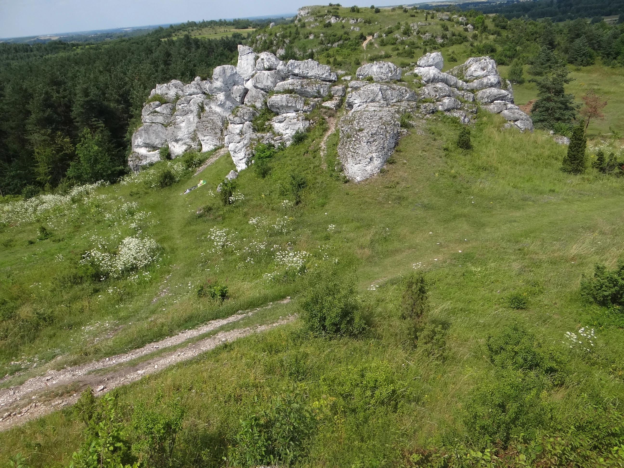
A green grassy hillside featuring large exposed limestone rock formations with a dirt path leading toward them and a forest in the background.
Limestone rock formations at Gory Towarne within the Ostoja Olsztynsko-Mirowska protected area.

Ostoja Olsztyńsko-Mirowska ecosystems, habitats, and plant life

Ecologically, Ostoja Olsztyńsko-Mirowska is remarkable for the close coexistence of forest, grassland, and rock habitats. The forested zones include acidophilus beech forest on poorer soils, fertile lowland and sub-montane beech forests on richer substrates, and warm-loving beech forests of the orchid type on calcareous slopes. Sub-continental and central European oak-hornbeam forests, thermophilous oak woods, and relict patches of upland fir-mixed forest add further structural and floristic variety.

Open habitats form the ecological counterpoint. Inland sandy grasslands, inland dunes with sandy dry grasslands, xerothermic swards of the Festuco-Brometea class, and rock-steppe communities of the Asplenion septentrionalis-Festucion pallentis alliance occupy sunny slopes and rocky ledges. These are succeeded by sub-montane limestone scree communities with Stipion calamagrostis vegetation, and by the specialized plants that colonize calcareous cliff faces belonging to the Potentilletalia caulescentis group.

This habitat mosaic is maintained in part by long-established land use. Traditional grazing helped generate the open swards, while forest reserves preserve the natural beech stands that elsewhere in Poland have largely disappeared. The result is a fine-scale patchwork of microhabitats within a relatively compact protected area.
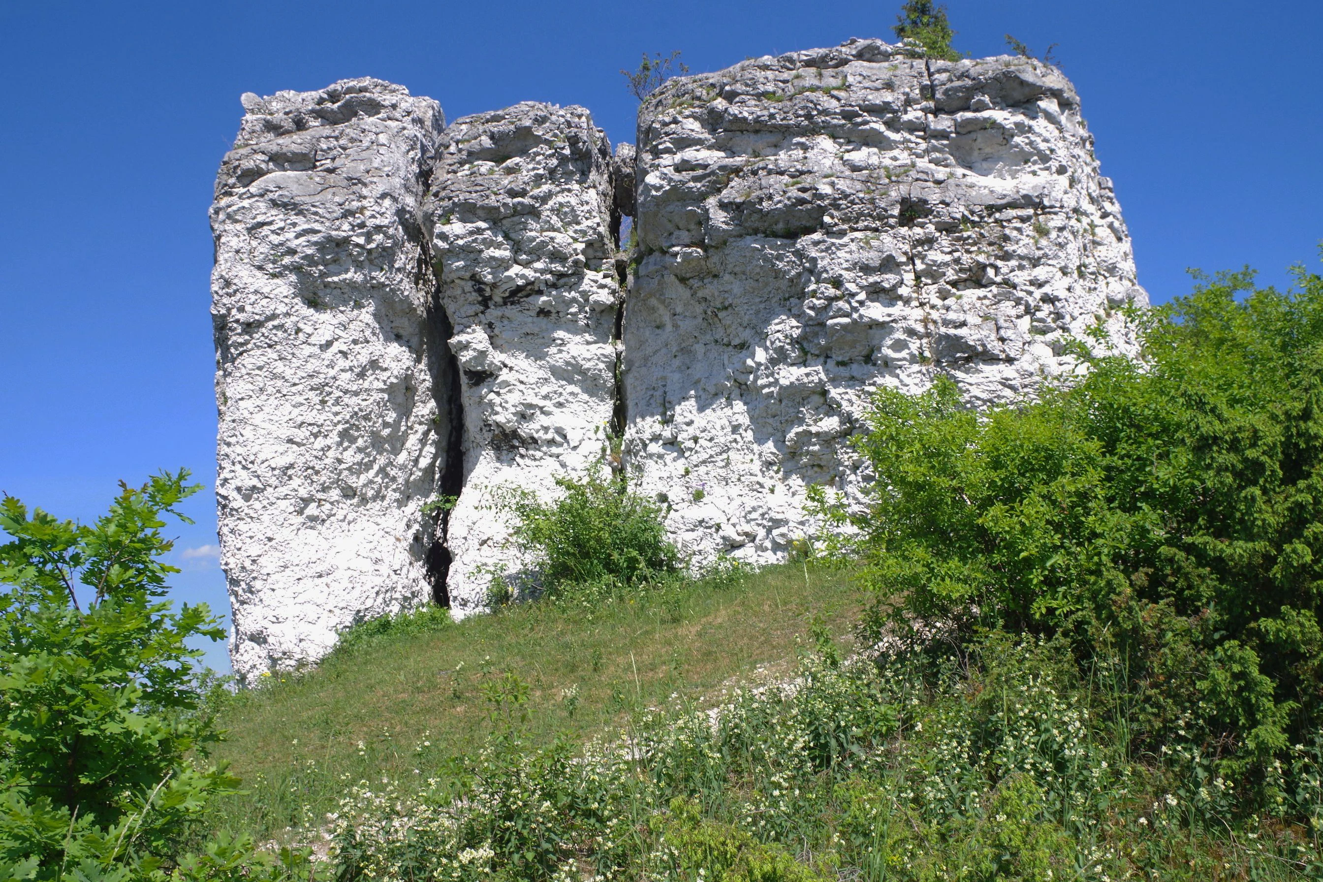
A weathered white limestone rock formation rising from a grassy, sunlit hillside under a clear blue sky.
The Grzybki rock formation on Lipowki hill in Ostoja Olsztynska-Mirowska.

Ostoja Olsztyńsko-Mirowska wildlife and species highlights

The caves and rock shelters of Ostoja Olsztyńsko-Mirowska form one of the most important bat refuges in southern Poland. Several rare and strictly protected species occur here, including the lesser horseshoe bat, Geoffroy's bat, Bechstein's bat, the pond bat, the western barbastelle, and especially the greater mouse-eared bat. A breeding colony of the greater mouse-eared bat in the Sokole Góry reserve, numbering around 750 individuals, is recognized as one of the largest of its kind in the country.

The varied grassland and forest habitats also sustain a diverse invertebrate fauna typical of warm, dry limestone landscapes. Among the protected species highlighted in the site's Natura 2000 register is the scarce large blue butterfly, which depends on specific grassland and host-plant conditions maintained across the area.

Forests, rock faces, and grasslands together provide habitats for many other birds, small mammals, and reptiles typical of the Jura region, even where these are not formally listed among the site's conservation targets. The integrated mosaic thus supports both the headline species of European interest and a broader community characteristic of upland karst landscapes.
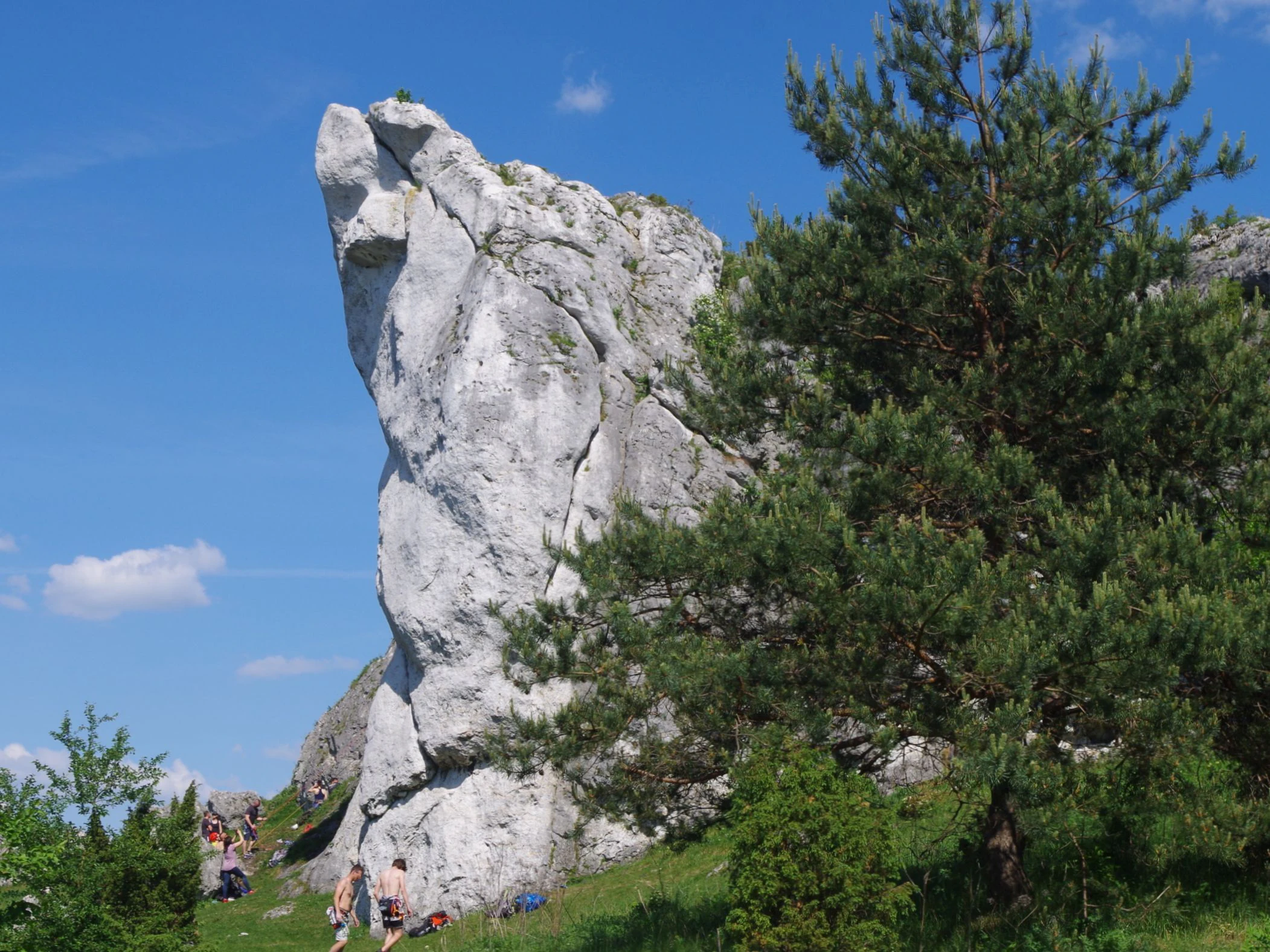
A large, pale limestone rock formation stands prominently against a clear blue sky, partially obscured by a green pine tree, with a few people visible near the base of the rock.
Dziewica rock formation located on Cegielnia hill within Ostoja Olsztyńsko-Mirowska.

Ostoja Olsztyńsko-Mirowska conservation status and protection priorities

Ostoja Olsztyńsko-Mirowska is a central component of Poland's contribution to the European Natura 2000 ecological network. Its selection as a Special Area of Conservation under the Habitats Directive reflects the international importance of its habitats and species, particularly its beech forest types, xerothermic grasslands, calcareous rock communities, and cave-dwelling bat fauna.

At the national level, the area benefits from layered protection. It lies completely within the Orlich Gniazd Landscape Park, which provides regional planning and landscape-scale safeguards. Two nature reserves, Zielona Góra and Sokole Góry, give additional strict protection to the most valuable forest stands and cave systems, while the ostoja itself ensures that habitat types and species of European interest are monitored and managed under a coherent framework.

This combination of designations was instrumental in preserving the natural beech forests of the site. By keeping grazing pressure off the most sensitive wooded slopes and protecting the cave systems that bats depend on, the area's conservation regime supports both forest continuity and the long-term viability of some of Poland's most important bat colonies.

Ostoja Olsztyńsko-Mirowska cultural meaning and human context

The cultural identity of Ostoja Olsztyńsko-Mirowska is inseparable from that of the larger Eagles' Nests region of the Polish Jura. Medieval defensive castles at Olsztyn, Mirów, and Bobolice sit within the protected area, all built on prominent limestone outcrops as part of the historic system guarding the borderland between Silesia and Lesser Poland. Their ruins, and in some cases reconstructions, are prominent features of the landscape.

The area's open hills also bear the long imprint of traditional pastoral use. Centuries of grazing produced the very xerothermic grasslands that today hold some of the ostoja's rarest plants, linking present-day biodiversity conservation directly to inherited rural land-use patterns. Long-distance hiking routes such as the Eagles' Nests Trail and the Jurajski Strongholds Trail run through the area, along with cycling paths, parking areas, and information boards, integrating the site's natural and cultural values into a coherent visitor experience.

Top sights and standout views in Ostoja Olsztyńsko-Mirowska

Ostoja Olsztyńsko-Mirowska's strongest identities are its limestone rock labyrinth, its rich beech and oak forest mosaic, and its nationally important bat caves. The Mogote-studded terrain of Góry Towarne, Zielona Góra, Sokole Góry, and the Mirowsko-Bobolicka Grzęda gives the area a near-mountainous scenic quality unusual for lowland Poland.

Ecologically, the combination of xerothermic grasslands, including rock-steppe communities with endemic Kraków bedstraw, and intact natural beech forests sets the site apart. The bat fauna is a particular highlight, with the greater mouse-eared bat colony in Sokole Góry ranking among the largest in Poland. The castles of Olsztyn, Mirów, and Bobolice add a cultural dimension that ties the whole protected area into the broader heritage of the Eagles' Nests Trail.

Best time to visit Ostoja Olsztyńsko-Mirowska

Spring and early summer are generally the most rewarding seasons for experiencing Ostoja Olsztyńsko-Mirowska. Warmer months bring the xerothermic grasslands to life, when thermophilous flowers and rare steppe species are most visible, while fresh green foliage softens the rocky ridges and makes the views across the Jura especially striking.

Late summer and early autumn offer drier conditions and clearer skies for exploring the rock formations, caves, and viewpoints along the Eagles' Nests Trail, with the forested slopes displaying rich seasonal color. Winter can bring quietness and sharper visibility of the limestone outcrops, though visitors should expect cooler conditions and reduced access to some of the more exposed rock formations.


Monthly climate preview

Long-term representative point measurements for annual weather patterns

Ostoja Olsztyńsko-Mirowska Climate Normals and Temperature Rhythms

Representative coordinate records show measured annual temperature swings and monthly precipitation totals across Ostoja Olsztyńsko-Mirowska from 1991 to 2020. Examining the complete twelve-month climatology profile reveals detailed variations in average minimum and maximum thresholds.
Annual mean8 °C
-4 °C20 °C
Jan-4°
Feb-2°
Mar
Apr
May13°
Jun17°
Jul20°
Aug19°
Sep14°
Oct
Nov
Dec-2°
Warmest month
July

19.6 °C

Coolest month
January

-3.7 °C

Wettest month
July

3 mm/day

Driest month
December

1.4 mm/day

Park location guide

Geography guide, regional context, and park location map for Ostoja Olsztyńsko-Mirowska

Ostoja Olsztyńsko-Mirowska park geography, regions, and map view in Poland

Understand where Ostoja Olsztyńsko-Mirowska sits in Poland through a broader geographic reading of the surrounding landscape, nearby location context, and its mapped position within the national park landscape.

How Ostoja Olsztyńsko-Mirowska fits into Poland

Poland, officially the Republic of Poland, is a Central European country spanning from the Baltic Sea in the north to the Carpathian Mountains in the south. It borders Germany, Czech Republic, Slovakia, Ukraine, Belarus, Lithuania, and Kaliningrad Oblast. The country has a temperate climate, diverse landscapes, and is known for its rich history, cultural heritage, and strong economic position within the EU.

Wider geography shaping Ostoja Olsztyńsko-Mirowska in Poland

Poland occupies 312,696 km2 in Central Europe, extending from the Baltic Sea coast in the north to the Sudetes and Carpathian Mountains in the south. It borders Germany to the west, Czech Republic and Slovakia to the south, Ukraine and Belarus to the east, and Lithuania and Kaliningrad Oblast to the northeast. The landscape includes lowland plains, uplands, and mountain ranges.

Map view of Ostoja Olsztyńsko-Mirowska

Use this park location map to pinpoint Ostoja Olsztyńsko-Mirowska in Poland, understand its exact geographic position, and read its mapped placement within the surrounding landscape more clearly.

Pigeon | © OpenStreetMap contributors

Location context for Ostoja Olsztyńsko-Mirowska

Silesian Voivodeship
Recorded earthquake history

Review the Ostoja Olsztyńsko-Mirowska Earthquake History Archive

Access a curated collection of seismic events recorded in the vicinity of Ostoja Olsztyńsko-Mirowska. This MoriAtlas resource allows for the examination of historical earthquake data, including magnitudes and epicenter proximity, within the broader geographic context of the Silesian Voivodeship.

Ostoja Olsztyńsko-Mirowska Earthquake History

Catalogued events

195 events

Strongest magnitude

Magnitude 4.6

Most recent event

Apr 23, 2018

This history includes earthquakes recorded inside the park or within 50 km of its borders

Visual exploration of limestone formations, beech forests, and karst terrain

Ostoja Olsztyńsko-Mirowska Photos and Protected Landscape Scenery

Photographic documentation reveals the rugged topography, forested ridges, and calcareous rock formations defining the protected environment. Visual inspection of these habitats provides clear insight into the ecological character and geological structure of the region.

A steep, light-colored limestone rock formation topped with a metal cross under a clear blue sky, with greenery at its base.

A group of light-colored, jagged limestone rock formations rising from a lush green forest under a clear blue sky.

A green grassy hillside featuring large exposed limestone rock formations with a dirt path leading toward them and a forest in the background.

A weathered white limestone rock formation rising from a grassy, sunlit hillside under a clear blue sky.

A large, pale limestone rock formation stands prominently against a clear blue sky, partially obscured by a green pine tree, with a few people visible near the base of the rock.

View from inside a small natural cave looking out towards a forested area with limestone boulders near the entrance.

Park atlas

Compare adjacent karst terrain and protected landscapes across the surrounding region

Other Parks and Protected Areas Near Ostoja Olsztyńsko-Mirowska for Regional Exploration

Browse nearby national parks and protected areas that share the limestone ridges, forested hills, and karst topography of the surrounding region. Comparing adjacent conservation landscapes helps trace how regional ecosystems and geological formations extend beyond Ostoja Olsztyńsko-Mirowska.
A soft watercolor painting of a wide, rolling landscape with green hills, patches of trees, and subtle pink ground tones.
Protected areaPoland
0.4 km away#1 closest

North

Przełom Warty koło Mstowa: Mapping the Protected River Corridor and Limestone Geography

A critical geological breakthrough in the Częstochowa Upland.

This protected area features a twelve kilometer river gorge carved by the Warta. The terrain is characterized by dramatic limestone outcrops such as the Brama Mirowska, paired with rich meadow habitats and oak hornbeam forests. Explore the intersection of geology and conservation within this key corridor of the Polish Jura, where river dynamics meet ancient upland landscapes.

Relief
Upland
Climate
Temperate
Scope
Terrestrial
Water
Major water bodies
Protected areaSilesian Voivodeship
5.1 km away#2 closest

Southeast

Ostoja Złotopotocka: Mapping the Protected Habitats and Limestone Geography of Silesian Voivodeship

Natura 2000 protected zone in southern Poland

Ostoja Złotopotocka encompasses a rich mosaic of natural habitats across the Częstochowa Upland. From the calcareous rock faces and deep karst caves to the expansive beechwood forests and inland sand dunes, this area serves as a primary site for ecological conservation. Use this resource to understand the complex terrain, boundary layout, and structural diversity that define this protected landscape within the Polish region.

Area
27.48 km²
Relief
Upland
Climate
Temperate
Access
Access unknown
Nature reserveSilesian Voivodeship
About 13 km away#3 closest

Northeast

Babski Las Nature Reserve: Regional Geography and Protected Forest Landscapes in Poland

Częstochowa Upland woodland and rare fir forest ecosystems

Babski Las Nature Reserve protects a distinct mosaic of forest types within the Silesian Voivodeship. From its rare fir stands to its moisture-dependent alder carrs, this reserve offers a deep look into the ecological diversity of the Częstochowa Upland, providing vital habitat for specialized amphibians, reptiles, and forest-dwelling birds.

Area
1.124 km²
Established
2025
Relief
Lowland
Climate
Temperate
Watercolor painting of pale limestone rock formations with small cave openings and green vegetation on a soft, light background.
Nature reserveSilesian Voivodeship
14 km away#4 closest

Southeast

Ostoja Kroczycka Nature Reserve: Geological Formations and Protected Habitat Mapping

Karst limestone landscapes in the Częstochowa Upland

A core component of the Natura 2000 network, Ostoja Kroczycka concentrates four dramatic limestone ranges into a single conservation landscape. The area combines vertical rock towers, subterranean hibernacula for bats, and fragmented forest patches, serving as a primary site for understanding the geological and ecological mosaic of the Polish upland region.

Area
13.912 km²
Established
2011
Relief
Upland
Climate
Temperate
A watercolor painting showing a soft landscape with green fields, a cluster of trees, and a small lookout tower against a plain white background.
Nature reserveŚląskie
About 23 km away#5 closest

Northwest

Dębowa Góra Nature Reserve: Geographic Profile of an Urban-Adjacent Protected Forest

Preserving ancient mixed woodland in the Śląskie Voivodeship

Located in the town of Kłobuck, Dębowa Góra serves as a critical nature reserve shielding a fragmented but authentic relic of old-growth oak and hornbeam forest. The site occupies the elevated topography of the Wieluńska Upland, providing an important contrast to the surrounding industrial landscape through its ancient trees and protected understory vegetation.

Area
0.054 km²
Established
1953
Relief
Upland
Climate
Temperate
Nature reserveŁódź Voivodeship
About 27 km away#6 closest

Northeast

Rezerwat przyrody Bagno w Ewinie: Peatland Geography and Protected Landscape Context

Nature reserve in Łódź Voivodeship, Poland

Rezerwat przyrody Bagno w Ewinie preserves a compact but essential series of high bog and transitional mire ecosystems. Situated in the gently rolling hills of the Wzgórza Radomszczańskie, this nature reserve showcases specialized flora such as the royal fern and provides a clear look at the structural diversity of central Polish protected lands.

Area
0.208 km²
Established
2024
Relief
Lowland
Climate
Temperate
Nature reserveSilesian Voivodeship
33 km away#7 closest

Southeast

Ostoja Środkowojurajska Nature Reserve: Protected Area Geography and Habitat Mapping

Regional karst terrain and protected beech forest mosaic

Analyze the geographic structure of Ostoja Środkowojurajska, a vital Natura 2000 site in the Silesian Voivodeship. This protected area features a unique concentration of inland dunes, rocky limestone outcrops, and multiple forest types. Explore the site to understand its role in regional conservation and its varied, karst-influenced physical geography.

Area
57.676 km²
Established
2009
Relief
Upland
Climate
Temperate
Nature reserveŁódzkie Voivodeship
About 34 km away#8 closest

Northeast

Dębowiec Nature Reserve: Protected Forest Landscapes and Geography in Łódzkie Voivodeship

Deciduous woodland conservation and regional lowland forest terrain

Spanning over 200 hectares within the Niecka Włoszczowska region, Dębowiec Nature Reserve protects a diverse range of lowland oak-hornbeam and ash-elm riparian forest ecosystems. This important conservation site hosts approximately 355 recorded plant species, serving as a primary reference for the native deciduous woodland character of central Poland.

Area
2.059 km²
Established
1965
Relief
Lowland
Climate
Temperate

Common questions about visiting, size, designation, and location context for Ostoja Olsztyńsko-Mirowska

Ostoja Olsztyńsko-Mirowska FAQs for park facts, access, geography, and protected area context

Find quick answers about Ostoja Olsztyńsko-Mirowska, including protected-area facts, park geography, trail and visitor context, and how the park fits into its surrounding country and regional landscape.
MoriAtlas Explorer

Continue Your Protected Areas Search Across the Global Atlas

Deepen your exploration by continuing the structured search for national parks and protected areas worldwide. Utilize the comprehensive filtering capabilities to compare different conservation landscapes and refine your understanding of global park geography. Discover more about the distribution and characteristics of protected natural areas.

Global natural geography