


Mori Atlas logo
National parkParc national de Taï

Explore the geography of the Mont Niénokoué massif and expansive West African river drainage basins

Parc national de Taï: Mapping the Primary Rainforests and Protected Landscapes of Côte d'Ivoire

Parc national de Taï serves as a critical ecological corridor within the Upper Guinea forest block, preserving one of the last major belts of intact primary tropical rainforest in West Africa. This protected area, located within the District des Montagnes, features a dense, undulating terrain of evergreen canopy, diverse river networks, and the prominent Mont Niénokoué massif. Understanding its geography and hydrological basins is essential for grasping the ecological integrity of this significant protected landscape.

tropical rainforestprimary forestWest AfricaCôte d'IvoireUNESCO World Heritage Sitebiosphere reserve
A flat-design, stylized illustration showing a dense, multi-layered tropical rainforest landscape at sunrise or sunset, featuring various tree shapes and distant hills under a pale sky.

Parc national de Taï

National park

Park overview

Structured park overview, official facts, and landscape profile for Taï National Park

Taï National Park park facts, protected area profile, and essential visitor context

Review the core facts for Taï National Park, including designation, size, terrain, visitor scale, habitats, and operating context in one park-focused overview.

About Taï National Park

Taï National Park represents one of West Africa's most significant surviving tracts of primary tropical rainforest. Spread across the southwestern corner of Côte d'Ivoire near the Liberian and Guinean borders, the park hosts a dense evergreen forest ecosystem shaped by heavy rainfall and a network of permanent rivers. Its location places it within the historical Upper Guinea rainforest belt, an ecosystem that has been drastically reduced across the region, making Taï's protected expanse particularly important for regional biodiversity.

The park is anchored by the Mont Niénokoué massif and extends across a varied topography of hills, valleys, and forested lowlands. Rainfall in the area is consistently high, with annual totals above 1,600 millimeters across the massif and reaching much higher figures toward the coast at towns like Tabou and Grabo. This sustained humidity supports the dense, multilayered canopy typical of ombrophile forest and underpins the productivity and complexity of the park's habitats.

The reserve has gained global recognition for its biodiversity and conservation value. Designations as a UNESCO Biosphere Reserve in 1977 and as a World Heritage Site in 1982 underline its importance at the international level, and its long-running chimpanzee research program has made it one of the most intensively studied primate sites in the world. Beyond research, the park is central to broader debates about deforestation, wildlife trade, and sustainable forest management in West Africa, and is increasingly viewed as a flagship site for understanding how forests and their fauna can be protected under intense regional pressure.

The park's broader setting includes the adjoining N'Zo Partial Fauna Reserve, which extends the protected zone northward, and a surrounding management area designed to buffer the core forest from external impacts. With its combination of intact habitat, rich wildlife, and strong institutional recognition, Taï stands as a cornerstone of forest conservation in Côte d'Ivoire and in West Africa more widely.

Quick facts and research context for Taï National Park

Taï National Park lies in the Montagnes District of southwestern Côte d'Ivoire, near the borders with Liberia and Guinea. It covers a substantial area of primary tropical rainforest centered on the Mont Niénokoué massif and, together with the adjacent N'Zo Partial Fauna Reserve to the north, constitutes one of the largest continuous forest blocks remaining in West Africa. The park has been part of the UNESCO Man and the Biosphere network since 1977 and was inscribed on the World Heritage list in 1982.

The park is recognized as a global stronghold for West African chimpanzees and is also known for its populations of pygmy hippopotamus, forest buffalo, elephants, leopards, and several monkey and duiker species. Its climate is subequatorial, with annual rainfall above 1,600 millimeters across the massif and peaks near Tabou and Grabo, sustaining dense evergreen rainforest and a network of permanent rivers flowing toward the Sassandra, Cavally, and small coastal basins.

Protection and recognition

Documented terrestrial protected area designation history and international recognition sources

Parc National De Tai Protection Status And UNESCO Recognition

Parc national de Taï maintains a terrestrial protection status established in 1982 alongside documented UNESCO World Heritage recognition. Structured records detail the official designation history, management scope, and international framing associated with the protected area.

International recognition

Protection details

Protection scope
Terrestrial
Designated year
1982
Transboundary protection
No
WDPA ID
721
Park context

Deeper park guide and search-rich context for Taï National Park

Taï National Park history, landscape, wildlife, and travel context

Explore Taï National Park through its history, landscape character, ecosystems, wildlife, conservation priorities, cultural context, and seasonal travel timing in a structured park guide built for atlas discovery and search intent.

Why Taï National Park stands out

Taï National Park is best known as one of the last refuges of primary West African rainforest, especially valued for its population of wild chimpanzees that have been the focus of long-running scientific research. The forest is recognized for its exceptional biodiversity, including pygmy hippopotamuses, leopards, forest elephants, buffalo, and a remarkable diversity of primates, birds, and reptiles. The park is also distinguished by its ecological function within the Upper Guinea forest region, a once-vast belt of rainforest now reduced to scattered fragments. Taï stands out because of the size, continuity, and apparent primary nature of its tree cover, as well as the scientific importance of its chimpanzees for understanding primate behavior, ecology, and forest regeneration dynamics in West Africa.
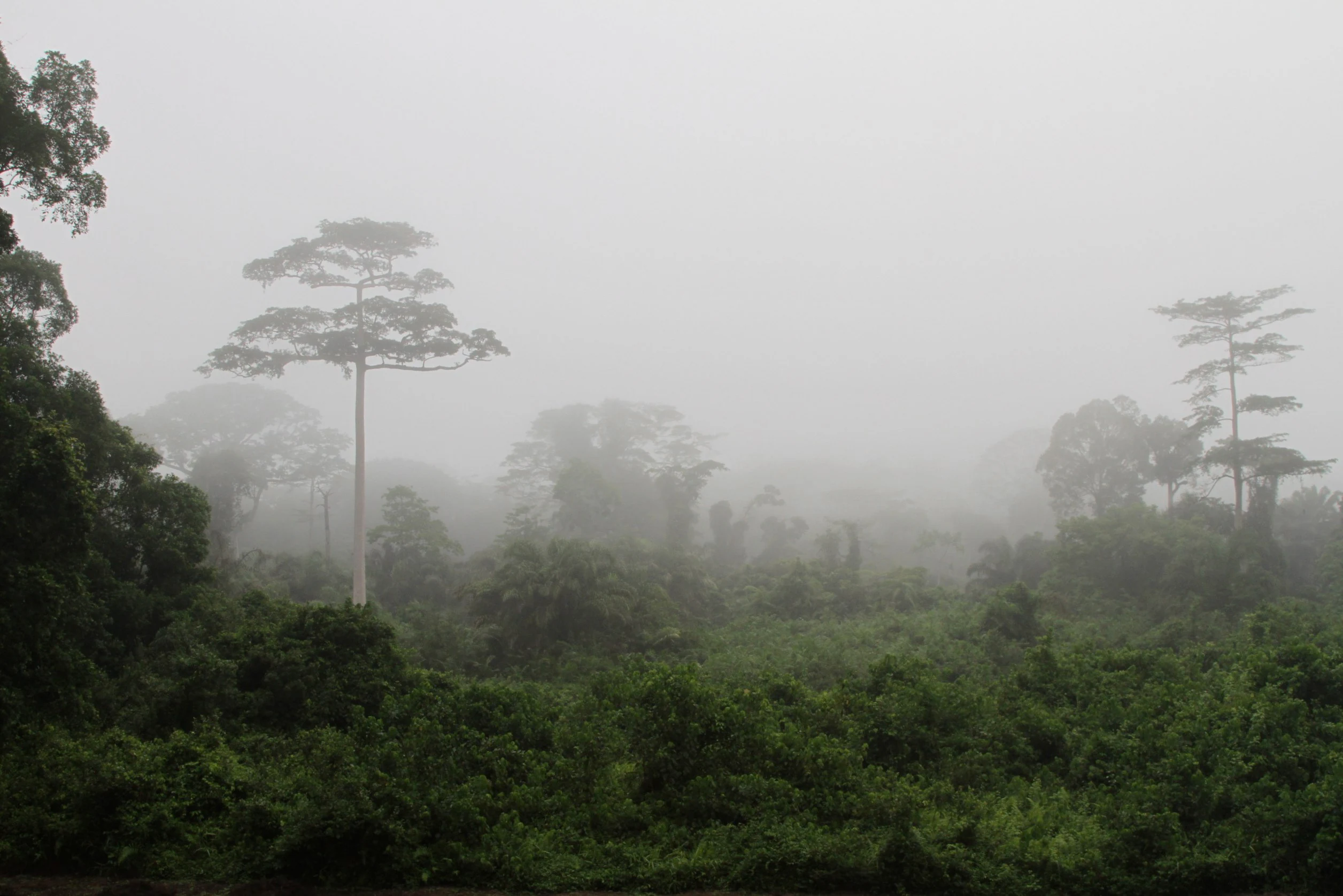
A view of a dense tropical rainforest canopy partially obscured by thick fog, with several tall emergent trees rising above the surrounding lower vegetation.
Misty primary rainforest canopy within Tai National Park, Ivory Coast.

Taï National Park history and protected-area timeline

The history of Taï National Park reflects nearly a century of evolving conservation thinking in Côte d'Ivoire, beginning with colonial-era classifications and culminating in a formally recognized national park during the early independence period. The first formal protection of the area dates to 1926, when a 'refuge park' of the Moyen-Cavally and Bas-Cavally forest region was decreed, covering almost one million hectares. Subsequent designations progressively refined both the boundaries and the protection regime: a special fauna reserve was established following the 1933 International Congress in London, the area was designated a classified forest known as Tai-Hana in 1955, and in 1956 it became a 'total fauna and flora reserve' of about 425,000 hectares.

The modern park emerged in 1972, when a presidential decree formally created the Parc national de Taï with a surface area of approximately 350,000 hectares, drawing on the central and southern parts of the older reserve while creating a separate 'partial fauna reserve' at N'Zo to the north. Adjustments followed in 1973 and 1977, gradually defining the current boundaries, adding a protected peripheral zone, and slightly modifying the southwestern limits along the Moumo River. By 1977 the park also received international recognition as a UNESCO Biosphere Reserve, and in 1982 it was inscribed on the UNESCO World Heritage list as a natural property.

From the late twentieth century onward, the park's administrative history has focused on strengthening management capacity, developing ecotourism centered on the Guiroutou site and Mont Niénokoué, and addressing major threats from poaching and deforestation. Community patrols and conservation programs have become central to its recent trajectory, and in 2025 UNESCO reported a measurable improvement in conservation outcomes, including a notable reduction in poaching levels. Throughout these phases, Taï has remained both a national flagship for forest protection and an internationally recognized natural heritage site.

Taï National Park landscape and geographic character

The landscape of Taï National Park is dominated by dense, undulating evergreen rainforest shaped by heavy rainfall and a dissected topography. The park's central feature is the Mont Niénokoué massif, a forested high point around which the surrounding lowlands and hills fold into a continuous canopy. Hills, valleys, river valleys, and small plateaus combine to create a richly varied but densely vegetated terrain that is difficult to traverse on foot, with thick understory, abundant lianas, and a closed upper canopy.

Geologically, the park lies within a region characterized by flysch-like formations: mica schists with biotite and muscovite on the outer edges, and sericitic, chloritic, and quartz-rich schists and sandstones toward the center. A narrow band of tuffs, metamorphic rhyolites, and amphibolites, known as the 'Buyo-Guessabo' formation, runs along a stretch near the Sassandra River. These bedrock variations influence soil conditions, drainage patterns, and ultimately forest composition across the massif.

Hydrologically, Taï is crossed by numerous permanent streams that drain into both major river basins and several smaller coastal basins. The park's hydrography is shared between the Sassandra basin to the north, the Cavally basin which forms part of the broader regional system, and the basins of smaller coastal rivers such as the San Pedro and Néro. The combination of abundant rainfall, complex terrain, and dense drainage makes watercourses a defining element of the landscape, shaping animal movements, plant distribution, and the deep, moist character of the forest.

Taï National Park ecosystems, habitats, and plant life

The natural environment of Taï National Park reflects the characteristics of an ombrophile, or rain-loving, evergreen forest typical of the wetter parts of the Upper Guinea region. The park lies within a subequatorial, hot and humid climate zone with a relatively short dry season, and the abundance of water throughout the year underpins the luxuriance and continuity of its vegetation. The forest is multistoried, with large emergent trees, a dense main canopy, and a shaded understory enriched by palms, ferns, shrubs, and lianas adapted to low-light conditions.

The park's flora is exceptionally rich for West Africa. Botanical inventories have identified over 1,200 plant species, including a substantial set of regional endemics: dozens of West African endemic species, additional endemics found within Côte d'Ivoire, and a much larger group tied to the broader Upper Guinea phytogeographic region. The vegetation includes a wide range of life forms, from grasses and herbaceous plants through shrubs and woody lianas to large canopy trees of significant commercial value, such as Tarrietia utilis, exploited locally as 'Niangon'. This botanical diversity extends across distinct forest types shaped by soil, drainage, and elevation.

Ecologically, Taï functions as a major biological reservoir in a region where forests have been heavily cleared elsewhere in Côte d'Ivoire. The park's protected status has allowed many species and ecological processes to persist that have disappeared from surrounding landscapes, and its intact vegetation structure provides habitats for an unusually large number of forest-dependent animals. The combination of diverse plant communities, abundant rainfall, and continuous forest cover makes Taï a defining reference site for West African humid forest ecology.

Taï National Park wildlife and species highlights

Wildlife is one of the defining features of Taï National Park, where the combination of large area, primary forest cover, and protected status has allowed many species to persist that are rare or threatened elsewhere in West Africa. The mammal fauna includes forest elephants, forest buffalo, leopards, pygmy hippopotamuses, duikers, and a remarkable diversity of primates. Chimpanzees are among the most emblematic residents and have been the focus of long-term research that has shaped understanding of primate behavior across the continent.

The primate community alone reflects the park's ecological richness, with several West African forest species present west of the Sassandra River, including the white-collared mangabey, the lesser spot-nosed monkey, the Mona monkey, the Diana monkey, and the black-and-white colobus. Other animal groups are equally diverse: bird life reaches more than 230 recorded species, including families such as raptors, kingfishers, and hornbills, while amphibians, reptiles, and a wide array of smaller mammals all contribute to the overall fauna. Some species of mammals, birds, reptiles, and gastropods in the broader protected massif are listed as threatened on the IUCN Red List, and additional species are considered to require conservation measures to remain viable.

Insect and invertebrate groups are also abundant but less fully documented. Studies have identified substantial diversity in dung beetles, dragonflies, fruit flies, ants, termites, and nematodes, hinting at the broader complexity of the forest floor ecosystem. The interdependence of these communities is important: primates and large mammals help to disperse seeds and drive forest regeneration, while predators such as the leopard play a regulatory role, illustrating how the loss or reduction of any one group can have cascading consequences for the wider forest system.

Taï National Park conservation status and protection priorities

Conservation is central to the identity and ongoing management of Taï National Park, recognized internationally as part of the UNESCO World Heritage list and the UNESCO Man and the Biosphere network. Its protected status is intended to ensure the long-term survival of one of the last substantial blocks of primary rainforest in West Africa, as well as the species and ecological processes that depend on it. The park is widely cited as a critical refuge for threatened wildlife in a region where natural forest cover has been severely reduced by agricultural expansion, logging, and infrastructure.

The park is also central to the broader effort to maintain Upper Guinea forest connectivity. By protecting a large and relatively intact forest block and buffering it with the adjacent N'Zo Partial Fauna Reserve and surrounding management zones, Taï serves as a reservoir of biodiversity and genetic resources for the region. This role is considered especially important for the resilience of wildlife populations in the face of habitat fragmentation and climate stress, and for the persistence of ecological functions such as seed dispersal by primates and large mammals.

Major conservation challenges in and around Taï include deforestation, forest fragmentation, and especially poaching, which has grown significantly with the spread of firearms and the expansion of forest roads and tracks. Poaching pressures are particularly damaging because they target species that are critical to forest regeneration, including monkeys and chimpanzees, undermining the long-term viability of the forest itself. Management responses have included the development of monitoring and evaluation units, the establishment of community-based patrols, and a growing emphasis on ecotourism that links local livelihoods to forest protection. By 2025, UNESCO reported that these efforts had produced measurable improvements, including a reported decline in poaching levels and increased community involvement.

Taï National Park cultural meaning and human context

Taï National Park is embedded in a cultural landscape shaped by long-established forest communities in the southwestern part of Côte d'Ivoire. The surrounding region has historically depended on the forest for hunting, gathering, and small-scale agriculture, and the relationship between local populations and the forest has evolved significantly as the area gained formal protection.

The advent of the park brought both restrictions on traditional land uses and new opportunities through employment, ecotourism, and conservation projects. Local communities have increasingly been drawn into park management through roles such as community patrol members, guides, and participants in conservation-linked development programs. The development of the Guiroutou ecotourism site, with its focus on Mont Niénokoué, the Hana River, and habituated chimpanzee groups, has created a focal point where conservation and local cultural engagement intersect.

Although detailed ethnographic information on the park's cultural dimension is limited in the source material, the broader context of West African forest communities, traditional ecological knowledge, and shifting livelihoods remains an important backdrop to the park's conservation story. The role of forest-dependent communities in both shaping and protecting the cultural significance of the Taï landscape continues to be a meaningful element of the park's identity.

Top sights and standout views in Taï National Park

Taï National Park stands out for combining very large area, primary forest status, and rich biodiversity in a region where intact forest is increasingly rare. Among its most striking features are the humid evergreen rainforest dominated by the Mont Niénokoué massif, an exceptionally diverse primate community led by a major population of West African chimpanzees, and a confirmed presence of pygmy hippopotamuses, leopards, forest elephants, and numerous bird species.

Equally distinctive is the park's conservation pedigree, marked by dual international recognition as a UNESCO World Heritage Site and a Biosphere Reserve, and by a long-running scientific research tradition centered on its chimpanzee populations. The combination of intact habitat, water-rich drainage basins, complex geology, and active management makes Taï a flagship site for understanding and protecting West African rainforest ecosystems.

Best time to visit Taï National Park

Taï National Park lies in a subequatorial climate zone characterized by consistently warm temperatures, high humidity, and abundant rainfall throughout much of the year. The dry season, although relatively short compared with more seasonal parts of West Africa, typically offers the most favorable conditions for travel, hiking, and wildlife observation, with drier forest trails and easier access for visitors. During the wetter months, the forest is at its most lush, but trails become more challenging and wildlife viewing may be more difficult, though the park's atmosphere is at its most vividly green and bird activity often peaks.

Because the park is located roughly ten hours by road from Abidjan and can be difficult to access in heavy rains, those interested in visiting generally find the drier periods more practical for travel, while those primarily interested in experiencing the rainforest at its fullest ecological expression may prefer the wetter season, accepting the trade-offs in accessibility and comfort. Local guidance and updated access information from the park office or official portal remain essential for any specific travel planning.

Monthly climate preview

Long-term representative measurements illustrating annual weather rhythms across the protected area

Parc national de Taï Climate Normals, Monthly Temperature and Precipitation Patterns

Historical climatology data reveals measured monthly temperature and precipitation rhythms across the representative coordinate of Parc national de Taï. Detailed twelve-month records provide complete perspective on long-term temperature ranges and precipitation shifts throughout the landscape.
Annual mean25 °C
24 °C27 °C
Jan26°
Feb27°
Mar27°
Apr26°
May26°
Jun25°
Jul24°
Aug24°
Sep25°
Oct25°
Nov26°
Dec26°
Warmest month
February

26.8 °C

Coolest month
July

24.2 °C

Wettest month
June

8.1 mm/day

Driest month
January

0.7 mm/day

Park location guide

Geography guide, regional context, and park location map for Taï National Park

Taï National Park park geography, regions, and map view in Ivory Coast

Understand where Taï National Park sits in Ivory Coast through a broader geographic reading of the surrounding landscape, nearby location context, and its mapped position within the national park landscape.

How Taï National Park fits into Ivory Coast

Ivory Coast, officially the Republic of Côte d'Ivoire, is a West African country with a coastline on the Gulf of Guinea. It gained independence from France in 1960 and is now a presidential republic. The country is a major producer of cocoa and coffee, with Abidjan serving as its largest city and economic hub, while Yamoussoukro is the official capital.

Wider geography shaping Taï National Park in Ivory Coast

Ivory Coast is situated on the southern coast of West Africa along the Gulf of Guinea. It borders Guinea to the northwest, Liberia to the west, Mali to the northwest, Burkina Faso to the northeast, Ghana to the east, and the Atlantic Ocean to the south. The terrain includes coastal plains, interior highlands, and forested regions.

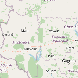
Map view of Taï National Park

Use this park location map to pinpoint Taï National Park in Ivory Coast, understand its exact geographic position, and read its mapped placement within the surrounding landscape more clearly.

Pigeon | © OpenStreetMap contributors

Location context for Taï National Park

District des Montagnes

Explore protected area imagery, dense forest habitats, and terrain characteristics.

Parc national de Taï Photos and Scenery: Visualizing the West African Rainforest

Examine detailed park photography that reveals the dense canopy, undulating hills, and river drainage basins defining Parc national de Taï. Visual research helps interpret the primary tropical forest environment, terrain structure, and ecological scale of this vital West African reserve.

A view of a dense tropical rainforest canopy partially obscured by thick fog, with several tall emergent trees rising above the surrounding lower vegetation.

A chimpanzee with dark fur climbing a tree trunk in a dense rainforest environment.

Park atlas

Discover related rainforest reserves and surrounding West African conservation landscapes

Parks near Parc national de Taï: Exploring Regional Protected Areas

Browsing national parks near Parc national de Taï reveals connected tropical rainforests and vital regional conservation corridors. Comparing adjacent protected areas provides deeper geographic context on the remaining Upper Guinea forest belt.
National parkIvory Coast
Park boundaries overlap#1 closest

West

Taï National Park: A Primary Rainforest Protected Area in Ivory Coast

Explore mapped boundaries and critical primate habitats in West Africa.

Taï National Park in Ivory Coast stands as a monumental protected landscape, comprising the largest contiguous area of primary rainforest remaining in West Africa. Its designation as a national park highlights its critical role in preserving biodiversity and unique geographic features. Users exploring this destination can delve into its mapped terrain, understand its regional landscape context within Ivory Coast, and appreciate its significance as a vital habitat for endangered species and an integral part of the Upper Guinean forest ecosystem.

Area
3,300 km²
Established
1972
IUCN
II
Relief
Upland
National parkGrand Gedeh County
About 37 km away#2 closest

Southwest

Grebo-Krahn National Park Protected Landscape and Geographic Atlas

Southeastern Liberia's vast Upper Guinean forest reserve

Spanning significant portions of Grand Gedeh and River Gee counties, Grebo-Krahn National Park represents a critical, near-continuous rainforest habitat. This protected area provides a look at lowland forest geography, riverine networks, and the high-canopy wilderness that remains a key biodiversity stronghold for the Upper Guinea region.

Area
961.499 km²
Established
2017
Relief
Lowland
Climate
Tropical
Protected areaLiberia
About 37 km away#3 closest

Southwest

Grebo National Forest: Protected Area Map and Regional Geography Exploration

Discover mapped boundaries and landscape context in Liberia.

Grebo National Forest is a designated protected area contributing to the Guinean forest ecosystem of Liberia and West Africa. This detail page provides an atlas-centered view, emphasizing the park's geographic placement, its mapped protected boundaries, and its significance within the broader regional landscape. Users can explore the specific terrain and geographic context that define Grebo National Forest as a conservation area.

IUCN
VI
Nature reserveIvory Coast
About 65 km away#4 closest

East

Forêt classée de Niégré: Mapping the Protected Forest Landscape of Southwestern Ivory Coast

A regional study of forest fragments and Guinean moist forest ecology

Forêt classée de Niégré serves as a focal point for understanding the interplay between protected-area boundaries and agrarian expansion in southwestern Ivory Coast. This geographic profile examines the massif as a remnant of Guinean moist evergreen forest, mapping its transformation from a closed canopy system into a fragmented mosaic that reflects broader regional shifts in land-use and environmental management policy.

Area
925 km²
Established
1937
Relief
Lowland
Climate
Subtropical
National parkMontagnes
About 97 km away#5 closest

North

Parc national du Mont Péko: Mountain Rainforest and Granite Inselberg Geography

Protected mountain massif and watershed within the Montagnes District

Discover the unique mountain landscape of Parc national du Mont Péko. This protected area features dense primary forests, iconic granite inselbergs, and steep terrain that rises above the surrounding Ivorian plains. Use this mapped overview to understand its role in regional conservation and the watershed dynamics of the Sassandra River.

Area
340 km²
Established
1968
IUCN
II
National parkIvory Coast
About 100 km away#6 closest

North

Mont Péko National Park: Ivory Coast National Park with Mapped Boundaries

Explore its protected landscape and regional geography.

Delve into Mont Péko National Park, a designated national park within Ivory Coast, to understand its unique protected landscape. This entry facilitates detailed atlas exploration, focusing on its geographic placement, mapped boundaries, and contribution to the regional natural terrain. Discover the essence of this protected area through its mapped geography and landscape identity.

Area
340 km²
Established
1968
IUCN
II
Relief
Mountain
National parkSinoe County
About 122 km away#7 closest

West

Sapo National Park: Explore Its Protected Landscape and Geographic Identity in Sinoe County

Discover mapped park boundaries and regional context.

Delve into the protected landscape of Sapo National Park, a key national park located in Sinoe County, Liberia. This page provides essential context for understanding its geographic setting, mapped park boundaries, and its significance as a protected natural area. It serves as a foundational entry for exploring Liberia's protected lands within the broader atlas, focusing on landscape identity and regional geographic features.

Area
1,804 km²
Established
1983
IUCN
II
Relief
Mixed relief
National parkNimba County
About 150 km away#8 closest

Northwest

Gio National Forest National Park: A Protected Landscape in Nimba County

Mapping the geographic boundaries and regional context of Gio National Forest.

Gio National Forest National Park serves as a key protected area within Liberia's Nimba County. This destination facilitates detailed exploration of its specific geographic footprint and its contribution to the regional atlas. Users can investigate the park's natural landscape context, mapped terrain, and its role as a protected conservation zone. Understand where this significant natural area fits within the broader geographic framework of West Africa.

Area
327 km²
Established
1960
IUCN
IV
Relief
Upland

Common questions about visiting, size, designation, and location context for Taï National Park

Taï National Park FAQs for park facts, access, geography, and protected area context

Find quick answers about Taï National Park, including protected-area facts, park geography, trail and visitor context, and how the park fits into its surrounding country and regional landscape.
MoriAtlas Explorer

Continue Your Protected Areas Search Across the Global Atlas

Deepen your exploration by continuing the structured search for national parks and protected areas worldwide. Utilize the comprehensive filtering capabilities to compare different conservation landscapes and refine your understanding of global park geography. Discover more about the distribution and characteristics of protected natural areas.

Global natural geography