
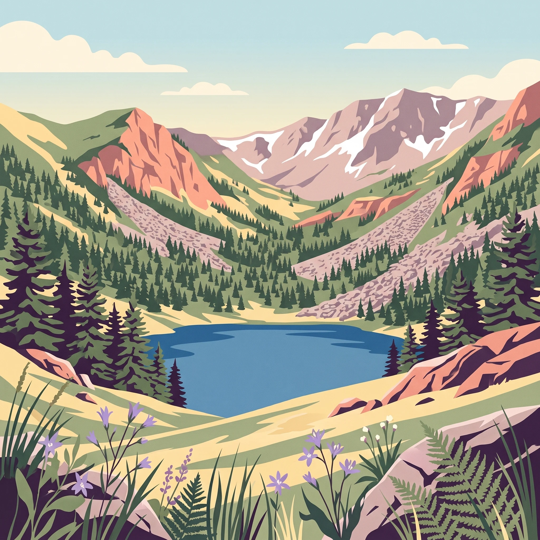
Trip Timing Orientation
When to Visit Pelister National Park: Planning Your Ideal Alpine Escape
Deciding when to visit Pelister National Park involves balancing the region's dramatic alpine topography with a climate that shifts rapidly between intense summer heat and severe winter frost. The best time to visit depends entirely on whether your priority lies in trekking across high-altitude granite landscapes or engaging in winter snow sports on the slopes of the Baba Mountain massif. Because the park spans elevations from 891 meters to 2,601 meters, the conditions you encounter will change significantly depending on your vertical position within the park, making flexibility essential for any itinerary.
The Seasonal Divide in Alpine Terrain
For most travellers, the period from late spring through early autumn offers the most consistent access to the park's extensive network of over 100 kilometers of marked trails. During these months, the primary challenge is not cold, but rather managing the significant temperature swings that characterize the region. While mid-summer daily maximums can reach well into the low-30s Celsius, the high-altitude environments surrounding the glacial lakes remain significantly cooler, even in peak July and August. Travelers aiming for hiking or photography should prioritize these months for the longer daylight hours, which provide a necessary margin of safety for navigating the rugged terrain surrounding the Pelister Eyes.
Navigating Rapid Climate Transitions
Conversely, the winter season transforms the park into a cold-weather destination, defined by sub-zero average minimums that persist from late autumn through early spring. This transition is marked by increased humidity and the inevitable arrival of snow, which dictates the accessibility of the higher reaches of the Baba Mountains. Visitors should view these colder months as a distinct phase of the park's life cycle, one where preparation for sub-freezing temperatures is mandatory rather than optional. The transition periods in spring and autumn are often unpredictable, with potential for rapid weather shifts that can turn mild, sunny days into cold, windy sessions, particularly at higher elevations.
Core Trade-offs for Your Itinerary
Your choice of timing effectively trades off comfort for specific experiences. Visiting during the warmer months favors accessibility, allowing for deeper exploration of the endemic Macedonian pine forests and the unique stone rivers that define the park's geological character. However, these months can also see the highest levels of daily warmth, which may necessitate an early start to avoid the peak heat of the afternoon. In contrast, those seeking a winter escape must balance the appeal of snow-covered landscapes against the reality of shorter daylight, increased wind, and the logistical challenges of winter navigation. By acknowledging that no single month provides ideal conditions for every activity, you can better align your visit with the specific environmental character of the Balkan highlands.
Seasonal Planning
Best Months to Visit Pelister National Park for Different Activities
Peak Alpine Hiking Window: June to September
For travellers primarily focused on exploring the high-altitude trails, the glacial lakes, and the granite stone rivers, the months from June through September offer the most reliable conditions. During this period, the risk of frozen trails at higher elevations diminishes significantly, providing the best chance for full-day excursions. Daytime temperatures reach their annual highs, peaking in July and August with mean values above 22 degrees Celsius, which makes traversing the steeper sections of the Baba Mountain massif less physically taxing than in colder, shoulder-season months. Visitors choosing this window trade the quiet solitude of the cooler months for stable, dry weather and significantly longer daylight hours, which can extend up to nearly 15 hours in June. This extended daylight is particularly advantageous for those planning long-distance treks across the more remote parts of the park.
Transitional Spring and Autumn Explorations: April, May, and October
April and May act as a bridge from the harsh winter to the alpine summer, though they remain temperamental. While lower elevations begin to warm, with average maximum temperatures exceeding 20 degrees Celsius by April, the higher reaches of the park often retain lingering snowpack. This period is ideal for photographers and nature observers interested in the park's floral diversity, as the landscape transitions quickly. However, hikers should be prepared for significant temperature fluctuations between day and night and a higher likelihood of damp conditions compared to the mid-summer peak. October follows a similar logic in reverse, marking the onset of colder, more unpredictable weather. It is a rewarding time for those who enjoy the crisp atmosphere of early autumn, provided they are equipped for rapid shifts in temperature as nights begin to drop toward freezing.
Winter Sports and Cold-Weather Activity: November to March
From November through March, the park undergoes a dramatic shift, with mean temperatures often hovering around or below zero degrees Celsius. This window is primarily reserved for visitors interested in snow-based recreation, such as skiing on the slopes of the Baba Mountain system. Access during these months requires a different set of preparations, as the park environment becomes characterized by sub-zero average minima in January and December and increased humidity. Visitors should expect significantly shorter daylight hours, which drop to just over nine hours in December, limiting the timeframe for outdoor activities. This period is not suitable for standard trail hiking due to ice and snow cover, and travellers should anticipate the necessity of specialized gear and higher levels of planning for safety and movement through the terrain.
Annual Climate Overview
Monthly Temperature, Precipitation, and Daylight in Pelister National Park
Annual Climate Progression and Thermal Trends
Pelister National Park experiences a distinct continental-to-alpine transition that manifests in clear seasonal thermal shifts. Across the annual cycle, temperatures fluctuate significantly, governed largely by the park's varied elevation. Based on climate normals recorded at mid-elevation sample points (approximately 937 meters), the year begins with winter minimums frequently dipping below -10°C in December and January. These periods are characterized by cold, stable air masses that settle into the mountain valleys. As the calendar progresses into spring, a rapid warming phase begins in late March. By May, average daily maximums reach a comfortable 25°C, signalling the transition from frozen terrain to the vibrant growth period associated with alpine meadows.
Summer represents the park's thermal peak, with July and August recording the highest average temperatures of the year. During this interval, daytime maximums often exceed 34°C, creating a stark contrast to the winter lows. Visitors should note that these statistics reflect long-term climate normals rather than localized mountain forecasts. Because the park spans elevations from under 900 meters to over 2,600 meters, conditions on the high-altitude ridges and near the glacial lakes are consistently cooler than the ambient averages recorded at the base, meaning visitors at higher elevations will experience more modest summer warmth and a faster onset of autumn chill.
Precipitation, Humidity, and Seasonal Moisture
Moisture levels in the park follow a trend where the highest precipitation values are often observed during late autumn and early winter, specifically November and December. During these months, the convergence of colder air and higher humidity levels (frequently exceeding 85%) creates frequent precipitation, which often falls as snow at higher altitudes. Conversely, the summer months of July and August represent the driest part of the annual cycle. Despite this reduction in overall precipitation, afternoon convectional storms remain a possibility in high mountain ranges, even during the historically drier months.
Relative humidity levels offer a useful indicator of comfort. Spring and summer months see a marked decrease in humidity, often dropping below 50% in the driest mid-summer period. This lower humidity, coupled with the higher temperatures, results in a drier, more pleasant feel for outdoor activities. By contrast, the high humidity of the winter months contributes to the perceived intensity of the cold, amplifying the feeling of exposure for those venturing into the park during the off-season.
Daylight Availability and Wind Patterns
Daylight hours fluctuate from a minimum of approximately 9.1 hours in December to a peak of nearly 15 hours in June. This extended daylight during the summer months is a critical factor for hikers and climbers, providing the necessary window for long-distance trail traversal and high-altitude excursions. As autumn approaches, the rapid contraction of daylight hours by October and November necessitates earlier starts and more conservative route planning.
Wind patterns across the Baba Mountain massif remain generally consistent throughout the year, though topographical features like glacial cirques and mountain passes can create localized wind amplification. Average wind speeds remain moderate, typically hovering between 2.3 m/s in late summer and peaking slightly above 3.0 m/s in the late winter and early spring months. These measurements are averages; visitors should anticipate that ridgelines and exposed summits will experience significantly higher wind gusts than the averages recorded at lower-elevation weather stations. Always verify local meteorological reports, as these long-term normals are not representative of current weather developments or active storm systems.
Seasonal Transitions
Seasonal Weather Patterns and Climate Transitions in Pelister National Park
Alpine Transition Phases of Pelister
Pelister National Park does not conform to a standard four-season calendar. Instead, its climatic rhythm is defined by a rapid transition between a dominant winter phase and a concentrated, high-altitude summer window. This creates three distinct environmental phases that dictate the character of the mountain landscape and the requirements for visitors.
The Extended Winter and Early Thaw: November to April
This phase covers the longest portion of the year, characterized by persistent cold and high moisture. Beginning in November, temperatures drop significantly, with average minimums frequently falling well below freezing. By January and February, the park experiences the lowest mean temperatures and the highest humidity, as atmospheric moisture levels remain consistently elevated. Visitors during this period encounter a landscape locked in a state of suspended growth. The freezing conditions, which define the geological character of the park's famous stone rivers, also keep high-altitude trails snow-bound and difficult to navigate. This is not a time for casual exploration; the transitional month of April often sees the onset of the thaw, yet higher elevations retain winter-like conditions long after the lower slopes begin to show signs of spring.
The Compressed Growing Season: May to August
Following the final retreat of the mountain snowpack, the park enters its most stable environmental phase. This period is marked by a rapid increase in mean temperatures and a significant decrease in relative humidity, which falls to its lowest annual levels in July and August. May serves as a crucial transition month where the park transforms; alpine meadows wake up and lower-elevation forests shed their winter dormancy. By June, the climate stabilizes into a reliable pattern of warm, dry weather that lasts through late August. This window provides the only consistent period for deep-mountain access, where daylight hours are at their peak and the risk of sudden, moisture-driven visibility shifts is at its lowest. It is during these months that the park's endemic Macedonian pine forests are most accessible, and the mountain's glacial lakes remain free of ice, allowing for the stable conditions required for higher-altitude trekking.
The Autumnal Cooling Transition: September and October
September serves as the final, brief period of stability before the cycle shifts back toward winter. While daytime temperatures remain pleasant, the cooling trend is evident in the drop in average maximums as the month progresses. October represents a volatile shift; relative humidity begins to climb, and precipitation levels start to rise, signaling the return of the moisture-dense air mass that characterizes the winter months. Visitors should note that this transition is often unpredictable, as the first significant cold snaps frequently arrive by the end of October. Unlike the steady warming of late spring, the autumn transition is characterized by fluctuating conditions that can bring rapid changes in temperature and mountain visibility within a single day.
Seasonal Experiences
What Visiting Pelister National Park Is Like Throughout the Year
Navigating the Molika Pine Forests
The endemic Macedonian pine, or molika, defines the visual identity of Pelister National Park. These ancient forests provide the primary setting for the park's mid-elevation trail network. During the late spring and summer months, from June through August, these forests offer a cool, shaded environment that contrasts with the heat of the lower-lying valleys in North Macedonia. The density of the molika canopy creates a consistent, sheltered atmosphere, making these trails accessible for visitors who prefer stable, dry conditions. While autumn brings a dramatic shift in foliage and light, these pine stands remain an evergreen fixture of the park, providing year-round structural interest for hikers and naturalists.
Accessing Glacial Features and High-Altitude Terrain
The park is renowned for its glacial lakes, the Pelister Eyes, which sit at high elevations of approximately 2,200 meters. The experience of visiting these sites is strictly dictated by the seasonal snowpack. In the months of May and early June, these higher reaches often remain partially frozen or blanketed in remnants of winter, which can complicate trekking and obscure the distinctive granite landscape. By July and August, the thaw is typically complete, allowing for clear access to the glacial cirques and the expansive granite stone rivers. These geological formations are best observed when the ground is clear of snow, as the starkness of the stone contrast is obscured during the winter months. Visiting during the height of summer offers the most reliable vantage points for viewing these Pleistocene-era relics.
Seasonal Sports and Winter Infrastructure
Pelister transitions into a winter recreation destination as temperatures drop toward the end of the year. The area around the Kopanki ski center is the focal point for snow-based activities. While high-altitude hiking becomes impractical due to extreme weather and safety risks, the lower and mid-slopes are used for skiing and winter sports from December through March. This period is not defined by exploration or landscape observation, but rather by the availability of snow cover and maintained lift infrastructure. Visitors interested in winter activities should recognize that this period limits access to the broader, more remote hiking circuits that characterize the summer season. Always verify the current status of facilities such as ski lifts and mountain lodges before planning a trip, as these operations are subject to annual variability in snowfall and local maintenance schedules.
Visitor Priorities
Optimizing Your Pelister Visit Based on Activity and Climate Preferences
Balancing Warmth and Alpine Accessibility
For travelers who prioritize mild hiking temperatures and long, stable days, the period between late June and August offers the most reliable conditions. During these months, the daily mean temperatures hover between 19°C and 22°C, providing a comfortable environment for ascending the rugged terrain of the Baba Mountain massif. This window represents the lowest precipitation period of the year, with August recording as little as 1.07 mm of rainfall per day on average, which significantly reduces the risk of storm-driven disruptions during long mountain treks. The compromise for this comfort is the intense solar exposure, as these months coincide with the highest daylight averages, exceeding 14 hours. Hikers should prepare for strong UV intensity at higher elevations and the need to carry sufficient hydration, as the drier landscape can rapidly deplete water reserves during midday peaks.
Targeting Cooler Conditions for Mountain Activity
If your primary goal is to engage in strenuous activities like cycling or extensive trail walking without the fatigue of summer heat, consider the shoulder months of late May or September. In these periods, the average daily maximums drop from the mid-30s seen in July to a more manageable 25°C to 29°C range. These months act as transition phases where the park experiences a noticeable decline in relative humidity, dropping from the damp, cooler spring atmosphere toward the drier late-summer climate. The primary trade-off during these times is the increased variability in weather, particularly in September, as the transition into the autumnal cooling phase begins. Visitors should expect quicker shifts in cloud cover and cooler evenings, requiring layers that may not be necessary during the peak of the July summer season.
Prioritizing Winter Recreation and Snow Stability
Travelers focusing specifically on winter sports or the experience of the frozen alpine environment find the most consistent conditions from January through February. This period aligns with the lowest temperature means, hovering near 0°C to 0.5°C, and the shortest daylight hours, often dipping below 10 hours daily. These months provide the most sustained cold necessary for the maintenance of snow cover at the Kopanki area. The trade-off is the high relative humidity, often exceeding 85%, which can make the cold feel more biting and penetrating. Furthermore, this period involves the shortest daylight windows, limiting the amount of time available for outdoor activity before the sun sets behind the steep, rugged slopes of the massif. Because the park reaches its highest humidity and near-freezing precipitation levels, visitors must weigh the benefit of consistent snow against the shorter days and the need for significant thermal gear to mitigate the high moisture content of the air.
Access and Logistics
Seasonal Access and Practical Planning for Pelister National Park
Navigating Access to the Baba Mountain Massif
Practical planning for Pelister requires an understanding that most movement within the park depends on the transition between cleared transport routes and the extensive network of over 100 kilometers of marked trails. The primary access point for the majority of visitors is the route from Bitola, which connects through the villages of Trnovo and Magarevo. While these entry points remain geographically consistent, physical access to the higher altitudes often fluctuates based on seasonal snow accumulation and local maintenance schedules. You should always verify the current status of park roads and entrance points with the official park authority before planning your departure, as historical access patterns do not guarantee the condition of the routes during your specific travel dates.
Transport and Local Logistics
Public transport options to the park entrance are currently not available. Travelers typically rely on private vehicles or local taxi services to reach the visitor centers or trailheads. If you are arriving from nearby urban centers like Bitola, coordinating with a local taxi service in advance is a standard practice for reaching the park boundary, particularly if your destination involves the more remote trail segments near the Pelister Eyes. Fees for park entry are generally applicable per vehicle, but because administrative rules and pricing can be updated at any time, it is essential to check the most current fee schedules and entry regulations on official park channels before you arrive. Attempting to navigate the mountain range without confirmed information on current vehicle access can lead to significant delays, especially during the shoulder months when weather-induced route changes are more frequent.
Administrative Requirements and Visitor Centers
Information regarding the availability of visitor centers, permit requirements, and specific trail closures is managed directly by the park administration. While the park is recognized for its historical significance and ongoing protection of the molika pine forest, do not assume that all facilities or trail markers are accessible throughout the year. Information found in secondary travel guides often reflects historical arrangements rather than the real-time operational status of the park. Always prioritize checking official bulletins for any restrictions that might affect your planned activities, particularly if you are intending to visit during the transition periods between the primary winter and summer seasons, when ground conditions can rapidly shift.
Safety and Preparation
Seasonal Weather Hazards and Packing for Pelister National Park
Navigating Alpine Weather Variability
Pelister National Park presents significant environmental shifts due to its broad elevation range, which spans from approximately 891 meters to the peaks reaching 2,601 meters. Visitors should expect that conditions at lower elevations, such as the areas near the park entrance or the Kopanki locality, will rarely reflect the reality of the higher alpine zones. During the transition months of April, May, and October, weather at the summit can shift from temperate to freezing within hours. Because these climate normals reflect mid-elevation averages, they provide only a baseline for planning. Travelers should prepare for colder conditions at higher altitudes regardless of the season, and always check the most recent, localized forecasts for the specific mountain peaks rather than relying on regional or low-elevation reports.
Preparing for Temperature Swings and Sun Exposure
Even during the warmest months of July and August, when mean temperatures at mid-elevation can exceed 22 degrees Celsius, exposure to intense alpine sunlight and mountain winds remains a factor. The combination of high altitude and reflective granite surfaces,particularly near the glacial lakes,can lead to rapid skin dehydration and fatigue. Effective preparation involves a layering system that accounts for the high probability of wind at exposed ridgelines. Because humidity levels drop significantly during the summer months, water management is essential for long hikes; however, users should consult official park guidance on potable water sources, as natural springs may vary in accessibility and safety depending on the time of year and recent precipitation.
Seasonal Safety Considerations for Trails
Safety in this environment is heavily tied to the stability of the terrain and the presence of residual snow. During the winter and early spring, from November through April, the freezing temperatures and high relative humidity contribute to ice-prone surfaces and compact snowpack. Hikers in the shoulder seasons should anticipate that the northern faces of the mountain may retain snow long after the lower slopes have cleared. Trails can become difficult to follow when waymarks are obscured by early-season frost or late-season snowmelt. Visitors should prioritize confirming route feasibility with the park authority or local mountaineering organizations. Avoid venturing into remote sections of the park during the shorter daylight hours of December and January without adequate navigation tools and a plan that ensures arrival at a secure location before dusk. If encountering unexpected shifts in weather, the standard protocol is to pivot to established, lower-altitude forest trails rather than continuing toward high-alpine objectives.
Trip Planning
Deciding the Best Time for Your Pelister National Park Visit
Choosing your travel dates for the Baba Mountain massif requires balancing the desire for stable alpine accessibility against the specific environmental conditions of a high-altitude Balkan landscape. The most effective way to determine your window is to define your primary recreational priority, as the mountain environment undergoes a profound transformation between the summer hiking season and the winter period of frozen instability. If your goal is to traverse the high-altitude trails to reach the glacial lakes or the granite stone rivers, the window from June through August provides the most consistent combination of daylight, minimal precipitation, and comfortable thermal conditions. During these months, the risk of encountering remnant snow on high trails is significantly reduced, though you must remain prepared for sudden changes in weather typical of a mountain ecosystem.
For those drawn to the aesthetic of the molika pine forests or the unique mountain atmosphere rather than intense summit objectives, the shoulder periods of late May and September offer a different set of benefits. While these months see increased day-to-day temperature variability and a higher likelihood of transient weather systems, they avoid the thermal peaks of July and August. These periods require more robust layering systems and a greater degree of flexibility in your daily planning. Choosing these months acknowledges that the mountain does not exist in a vacuum, and your comfort will depend on your ability to adjust your route or plans based on localized wind, fog, or precipitation.
Winter visits from December through March are fundamentally different from the rest of the year. This period should be approached not as a hiking trip with snow, but as a commitment to specialized cold-weather recreation. Accessibility to upper elevations becomes highly dependent on current snow depth, avalanche risk, and official warnings. Attempting to apply summer hiking logic to this period is the most common planning error. Instead, treat this time as an opportunity for designated snow-based activities, provided you have the necessary equipment and experience to manage sub-zero temperatures and limited daylight hours.
Ultimately, there is no universal best time for every visitor. The right decision hinges on your comfort with temperature extremes and your intended activity. Once you have identified your primary interest, use this guide to cross-reference that goal with the reality of monthly climate normals. Always remember that these averages are historical markers rather than predictors. Before finalizing your departure, you must verify the latest trail conditions, park access information, and meteorological updates from official authorities to ensure your plans align with the specific reality of the mountain at that time.