Mori Atlas logo
National parkPelister National Park

Discover the distinctive alpine terrain, endemic forests, and geological marvels of this Balkan protected area.

Pelister National Park: North Macedonia's Premier National Park and Protected Landscape

Pelister National Park, established in 1948 within the Municipality of Bitola, stands as North Macedonia's oldest national park and a vital protected landscape. This page offers an atlas-driven exploration of its dramatic alpine terrain, unique glacial formations like the Pelister Eyes, and the iconic stone rivers carved into its granite slopes. Understand the geographic context and protected boundaries of this significant Balkan natural heritage site, home to the endemic Macedonian pine.

National ParkMountain Protected AreaEndemic Species HabitatMacedonian Pine ForestGlacial LakesAlpine Environment
Illustration showing a blue lake nestled among pine trees and mountains with a sunset sky

Pelister National Park

National park

Park overview

Structured park overview, official facts, and landscape profile for Pelister National Park

Pelister National Park park facts, protected area profile, and essential visitor context
Review the core facts for Pelister National Park, including designation, size, terrain, visitor scale, habitats, and operating context in one park-focused overview.

About Pelister National Park

Pelister National Park stands as a landmark of conservation in the Balkans, representing North Macedonia's first and most historically significant protected area. The park is situated in the Baba Mountain massif, a range that forms a natural boundary between the Prespa basin and the Pelagonia plain in southwestern North Macedonia. The name Pelister derives from antiquity, likely originating from ancient Macedonian tribes—the Pelagonci and Linkestidi—who inhabited the plains beneath the mountain. Local legends suggest alternative etymologies, including derivation from "pet lisje" (five leaves) or "beli steni" (white stones), reflecting the mountain's distinctive white granite formations that dominate the landscape. The park encompasses approximately 43% of the Baba Mountain massif, which covers roughly 436 square kilometers and includes several peaks exceeding 2,000 meters, with Pelister itself reaching 2,601 meters. Despite its high mountain setting, the park remains accessible, with the village of Kopanki reachable from Bitola by approximately 15 kilometers of mountain road. The park is not only significant for its natural values but also serves as a leading tourist destination in North Macedonia, operating as a well-known ski resort alongside other national destinations such as Ohrid, Prespa, Dojran, Popova Šapka, and Kruševo.

Quick facts and research context for Pelister National Park

Pelister National Park was established in 1948 and was the first national park in Yugoslavia and remains North Macedonia's oldest protected area. The park was expanded in 2007 from its original 12,500 hectares to the current 17,150 hectares to enhance conservation coverage across the Baba Mountain massif. The park features a well-developed hydrographic network with numerous springs, streams, and two significant glacial lakes. The area is geologically dominated by Pelister granite and green shales from the Ordovician and Palaeozoic periods, with distinctive glacial and periglacial formations including cirques, moraines, and granite block streams. The park serves as a critical watershed divide, with rivers flowing toward both the Adriatic and Aegean seas. Baba Mountain belongs to the western Macedonian geotectonic zone and represents the southernmost part of the Rhodope mountain system.

Park context

Deeper park guide and search-rich context for Pelister National Park

Pelister National Park history, landscape, wildlife, and travel context
Explore Pelister National Park through its history, landscape character, ecosystems, wildlife, conservation priorities, cultural context, and seasonal travel timing in a structured park guide built for atlas discovery and search intent.

Why Pelister National Park stands out

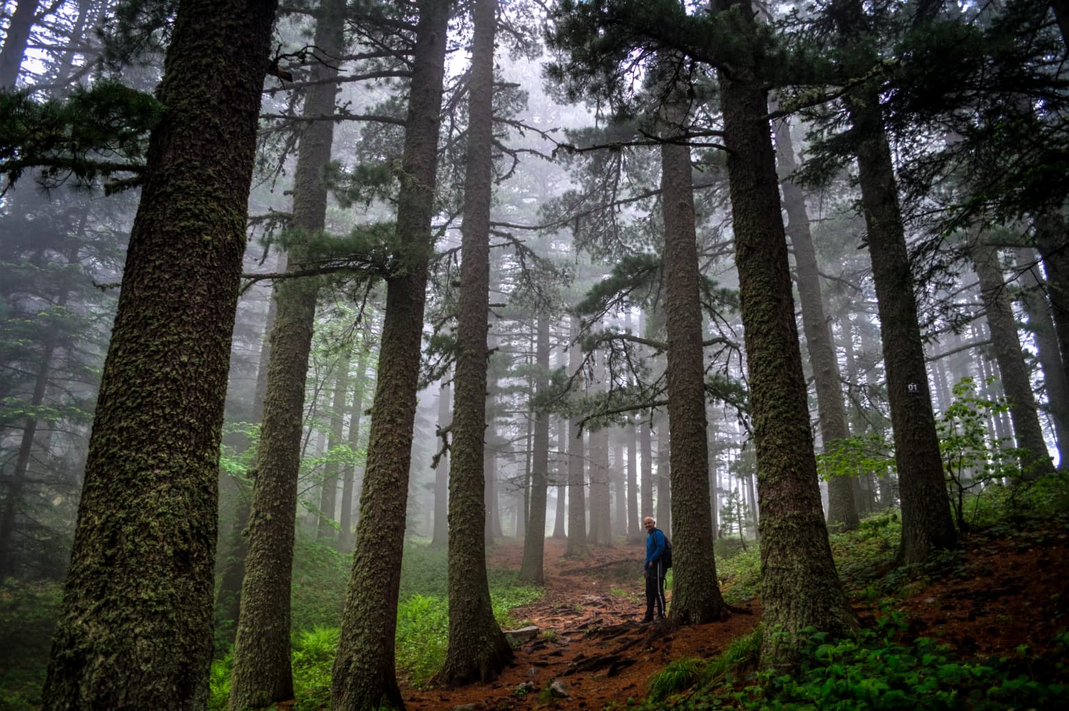
Pelister is best known for its extensive forests of the endemic Macedonian pine (Pinus peuce), locally called molika, which represents one of the best-developed habitats of this rare five-needle pine in the entire Balkans. The park is celebrated for its remarkable plant biodiversity with over 1,050 plant species, including approximately 900 angiosperms, 37 tree species, and 38 shrub species. The Macedonian pine, a Tertiary relic endemic to the central Balkan region, was first scientifically described by the German botanist August Grisebach in 1843 after he discovered it on Pelister. The geological formations known as stone rivers, accumulations of granite blocks created by repeated freezing and thawing during the Pleistocene epoch, are among the park's most distinctive landscapes, with some reaching lengths up to three kilometers.

Panoramic view of Malo Ezero at sunrise with grassy hills and mountain slopes under a gradient sky transitioning from deep blue to purple
Sunrise over Malo Ezero (Small Lake), Pelister National Park

Pelister National Park history and protected-area timeline

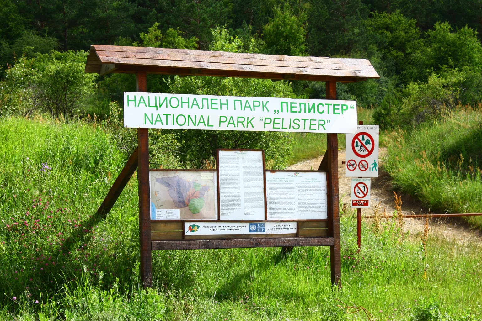
Pelister National Park was established on November 30, 1948, making it Yugoslavia's first national park and North Macedonia's oldest protected area. The initial protected area covered a smaller footprint, which was significantly expanded in 2007 to 14,300 hectares (later cited as 17,150 hectares) to provide enhanced protection for a larger portion of the Baba mountain massif. The earliest recorded mountain climbing activity on Pelister dates to 1836 by Ami Bue, followed by the Austrian botanist August Grisebach in 1839, who later scientifically described the endemic Macedonian pine in 1843. Subsequent notable ascents included those by Edmund Spenser in 1850 and Henrih Bart in 1862. Organized mountaineering began with the establishment of the mountaineering society Pelagonija in 1926, later renamed Pelister. By 1938, two mountain lodges had been constructed: Begova Česma at 1,420 meters and Kopanki at 1,610 meters. Additional infrastructure developed after World War II included mountain lodges at Golemo Ezero and Golema Livada, along with recreational facilities and villas at various locations within the park.

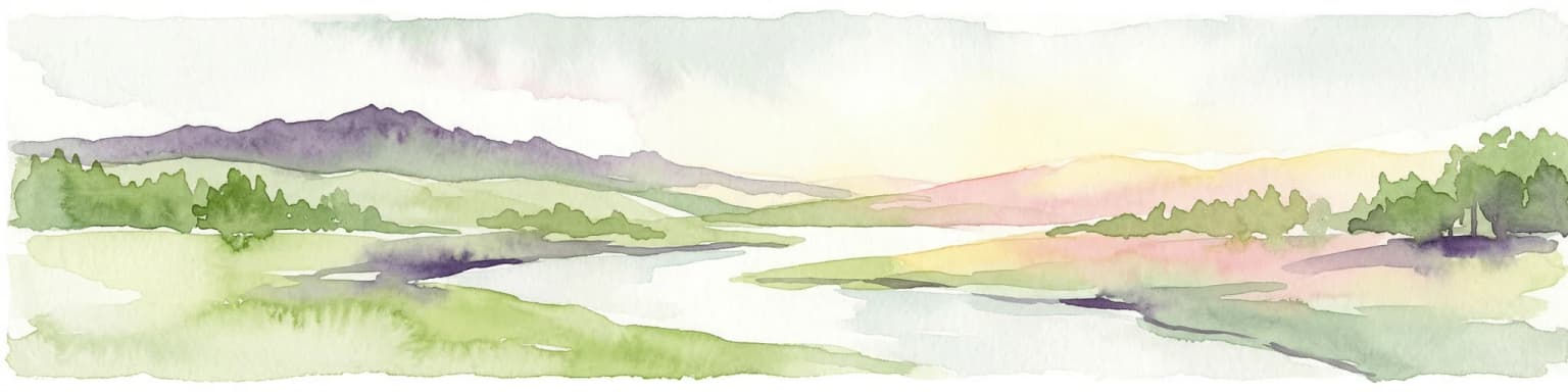
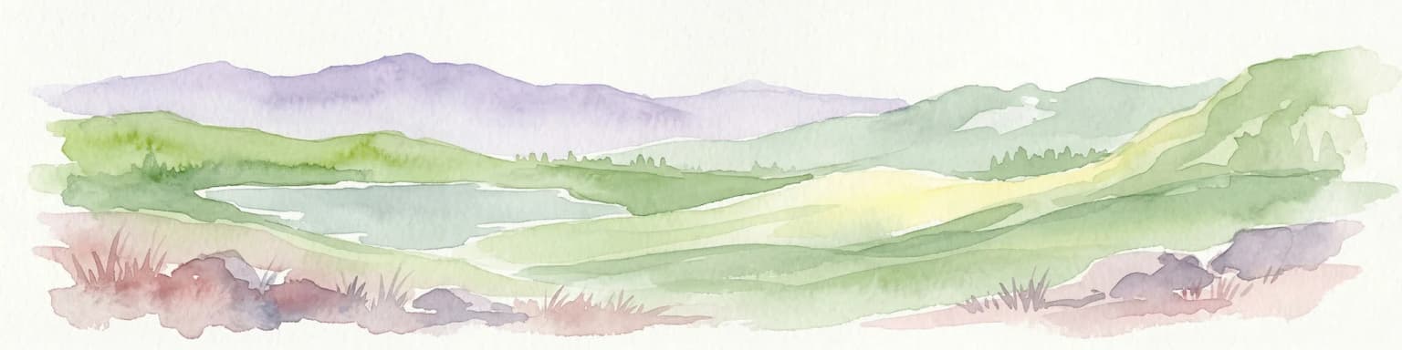
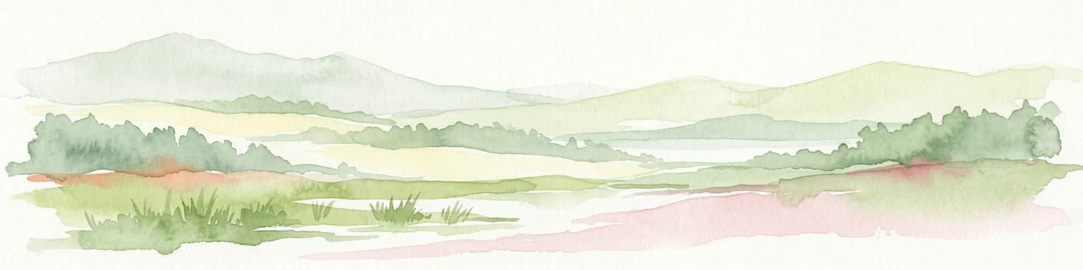
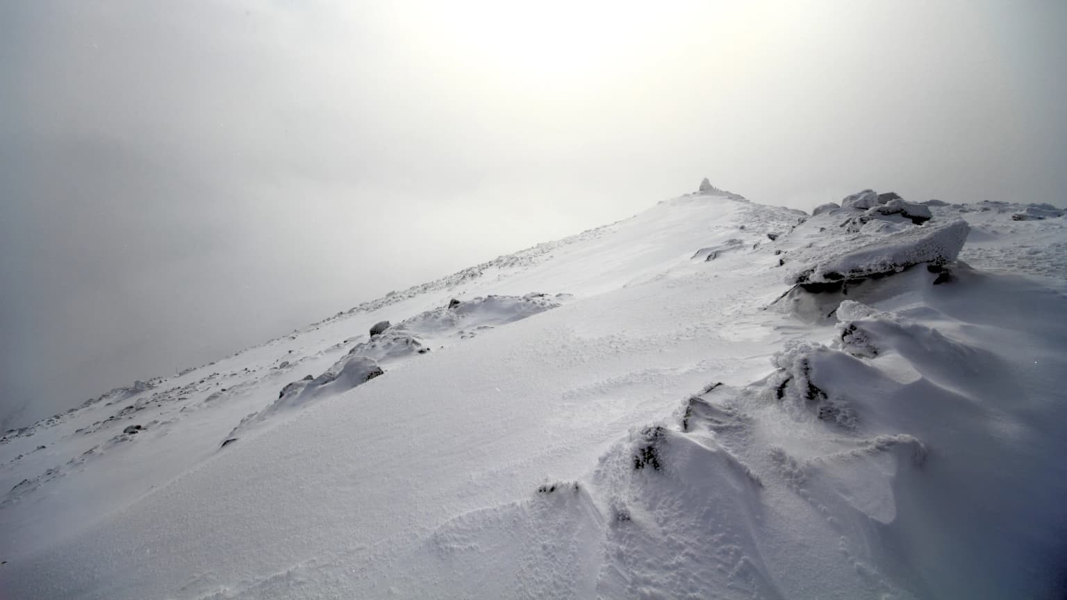
Pelister National Park landscape and geographic character

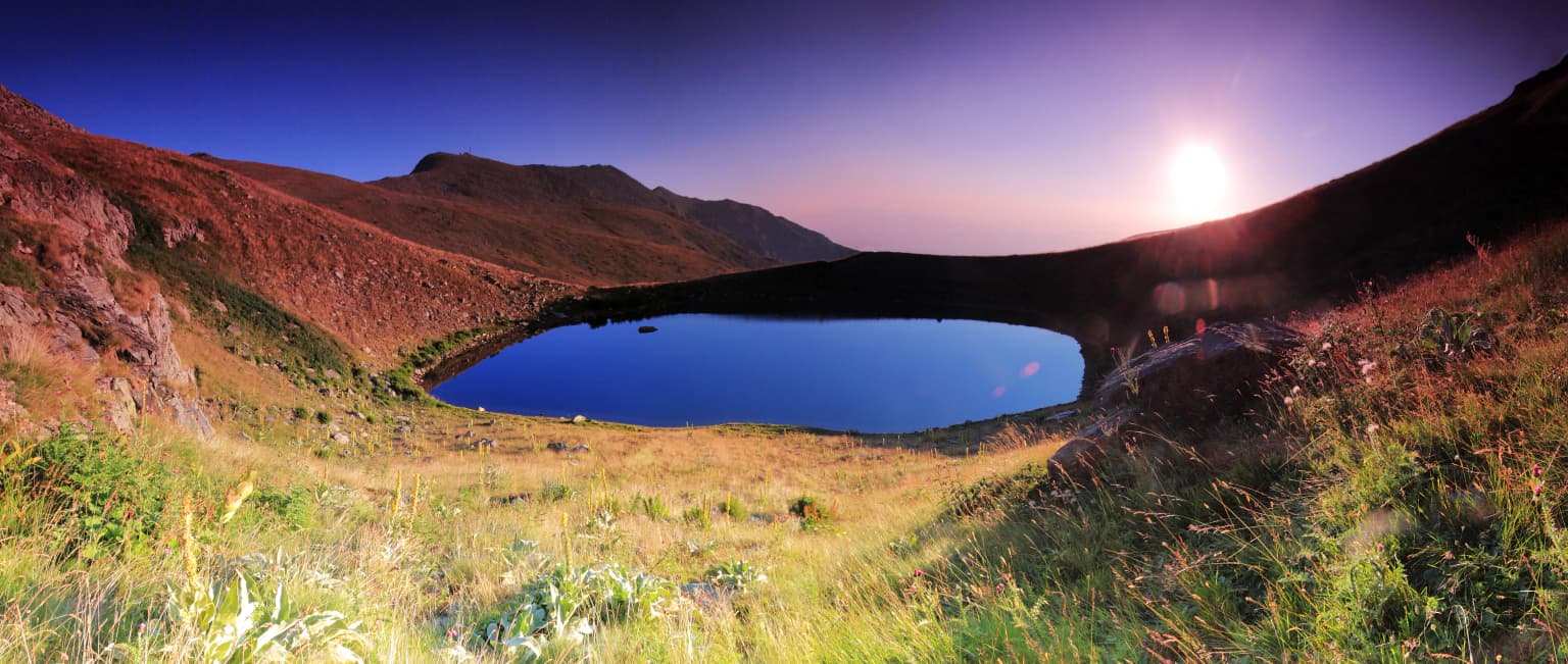
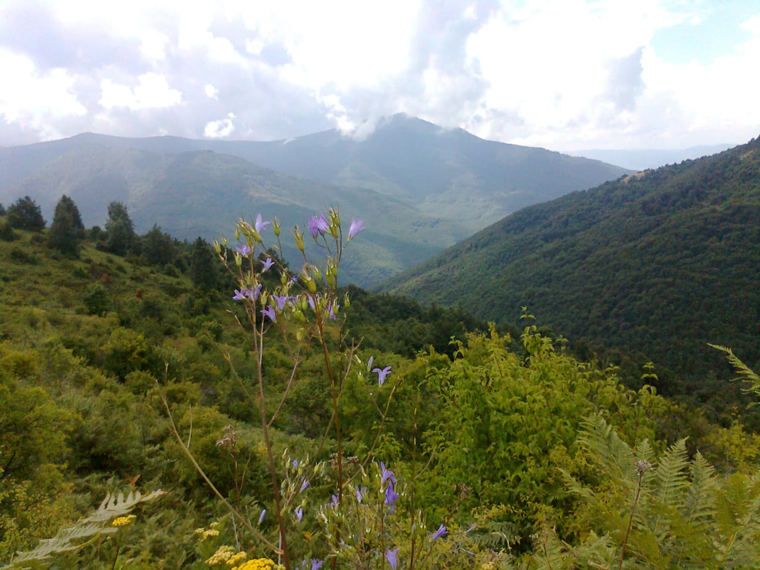
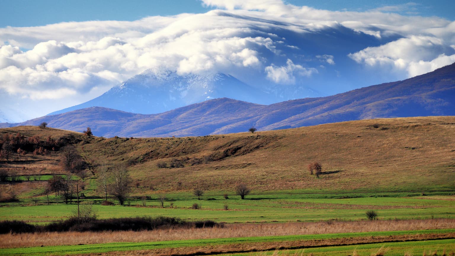
The physical landscape of Pelister National Park is characterized by dramatic alpine terrain with distinctive geological and glacial features. The Baba Mountain massif, the third-highest range in North Macedonia, dominates the park with peaks exceeding 2,000 meters separated by deep valleys. The geological foundation consists primarily of Pelister granite and green shales from the Ordovician and Palaeozoic periods, belonging to the western Macedonian geotectonic zone and representing the southernmost extension of the Rhodope mountain system. The most visually striking landscape features are the stone rivers—locally called kameni reki—massive accumulations of granite blocks and pieces of eruptive rocks including dolerite and gabbro. These formations resulted from repeated freezing and thawing cycles during the Pleistocene epoch and create distinctive rocky streams flowing down mountain slopes, with some extending up to three kilometers in length. Additional glacial landforms include characteristic cirques, moraines, and nivation hollows. The park contains two glacial lakes situated at approximately 2,200 meters elevation, known as Pelister Eyes or Forest Eyes, which add to the alpine character of the landscape.

Tall pine trees in a foggy forest with a person walking on a dirt path
Misty forest trail with a hiker in Pelister National Park

Pelister National Park ecosystems, habitats, and plant life

The ecological character of Pelister National Park is defined by diverse ecosystems spanning forests, alpine grasslands, and freshwater habitats, supporting exceptional biodiversity. The most ecologically significant vegetation type is the extensive Macedonian pine forest, which forms one of the best-developed and most compact habitats of this rare endemic species in the Balkans. The Macedonian pine typically dominates forest communities between elevations of 1,200 and 1,600 meters, though specimens can be found up to 2,500 meters. These trees can reach heights of 30 to 50 meters and typically grow on silicate substrates in fresh, moist, and deep soils, with some individuals exceeding 200 years in age. The park supports over 1,050 plant species, including approximately 900 angiosperms, 37 tree species, and 38 shrub species, organized into 21 distinct plant communities comprising 8 forest and 13 grassland associations. The park represents a classic locality for more than 20 plant species, including two local endemics: the Pelister lady's mantle (Alchemilla peristerica) and Pelister crocus (Crocus pelistericus). The Macedonian pine, as a Tertiary relic and endemic to the central Balkan region, was the primary scientific justification for establishing the park as a protected area.

A mountain landscape with lush green vegetation and purple flowers in the foreground, showing a valley between forested hills under a partly cloudy sky
Flora along the trail to Pelister summit

Pelister National Park wildlife and species highlights

Pelister National Park supports significant wildlife populations across diverse habitats, with several species protected under international conservation agreements. Mammalian fauna includes notable species such as the grey wolf (Canis lupus) and European otter (Lutra lutra), both of which occupy important ecological niches within the park's forest and freshwater ecosystems. The park is particularly significant for birdlife, hosting the bearded vulture (Gypaetus barbatus), a striking raptor that relies on alpine habitats and is recognized as a species of conservation concern in Europe. The aquatic ecosystems support endemic fish populations, including the Pelister trout (Salmo trutta peristericus) and Pelagonia trout (Salmo trutta pelagonicus), both representing distinct evolutionary lineages adapted to the park's cold mountain streams and glacial lakes. The Macedonian source documents additional vertebrate diversity including 10 amphibian species, 15 reptile species, 91 bird species, and 35 mammal species, making the park a significant biodiversity hotspot in the region.

Bilingual entrance sign for National Park 'Pelister' in Macedonian and English with park information panels, surrounded by green grass and trees
Bilingual entrance sign for Pelister National Park in Macedonian and English, set against lush green vegetation

Pelister National Park conservation status and protection priorities

Pelister National Park holds significant conservation importance as North Macedonia's oldest protected area and as a repository of endemic biodiversity. The park's protection was originally justified by the scientific significance of the Macedonian pine, a Tertiary relic species endemic to the central Balkan region that survives in only a few mountain locations. The management framework operates through a hierarchical system involving the Macedonian Ministry of Environment and Physical Planning, a management board, ranger service, and advisory bodies. Despite legislative constraints, park authorities have implemented innovative community co-management approaches, actively involving local communities in conservation while promoting sustainable natural resource use. Research conducted in 2006 documented successful community co-management practices that balance strict national regulations with flexible local governance. The park authority provides essential community services including waste management, free heating fuelwood, and infrastructure improvements, while employment opportunities have been created for locals as rangers and foresters. Sustainable harvesting of non-timber forest products such as blackberries and pine seeds is regulated to maintain ecological integrity.

Pelister National Park cultural meaning and human context

The cultural context of Pelister National Park is rooted in the region's ancient history and local traditions. The name Pelister is believed to originate from antiquity, likely derived from ancient Macedonian tribes—the Pelagonci and Linkestidi—who inhabited the Pelagonia plain directly beneath the Baba Mountain. Local folk traditions offer alternative explanations for the name's origin, including derivation from "pet lisje" meaning "five leaves" in reference to the five-needle structure of the Macedonian pine, or from "beli steni" (white stones) describing the prominent white granite formations visible across the mountain. The mountain has served as a cultural landmark for centuries, with documented climbing activity beginning in the early 19th century. Organized mountaineering culture developed in the 1920s through the establishment of the Pelagonija mountaineering society, later renamed Pelister, establishing a tradition of outdoor recreation that continues today. Villages surrounding the park have developed tourism-oriented economies, transforming homes into accommodations and establishing small enterprises that link economic wellbeing to environmental conservation.

Pelister Mountain in the background with brown and green fields, scattered trees, and a partly cloudy sky
Pelister Mountain viewed from the Pelagonija region with rolling fields and scattered trees under a partly cloudy sky

Top sights and standout views in Pelister National Park

Pelister National Park combines exceptional natural heritage with historical significance as the Balkans' first national park. The park protects one of the world's finest examples of Macedonian pine forest, a Tertiary endemic that represents a living relic of ancient forest ecosystems. The geological formations—particularly the stone rivers—create otherworldly landscapes unique to this latitude. The two glacial lakes known as the Pelister Eyes add alpine beauty and support endemic trout populations. The park offers over 100 kilometers of marked trails for hiking, climbing, cycling, and skiing, making it one of North Macedonia's leading outdoor recreation destinations. With more than 1,050 plant species and significant populations of wolves, otters, and bearded vultures, the park represents a biodiversity hotspot in the central Balkans.

Snow-covered mountain ridge under overcast sky with minimal visibility
Snow-covered ridge in Pelister National Park during winter

Best time to visit Pelister National Park

Pelister National Park offers distinct seasonal experiences throughout the year. The summer months from June through September provide the best conditions for hiking and exploring the park's diverse landscapes, with warm temperatures in the lower elevations and comfortable conditions at higher altitudes. The glacial lakes and alpine zones are most accessible during this period, and the Macedonian pine forests display their full vitality. Winter transforms the park into a ski destination, with the Pelister Giant Slalom event drawing visitors between December and March. Spring and autumn offer quieter visitation periods with different atmospheric qualities—spring brings wildflower displays in the meadows while autumn paints the forests in copper and gold hues. The shoulder seasons may present variable weather conditions but reward visitors with fewer crowds and the opportunity to experience the park's changing character.

Park location guide

Geography guide, regional context, and park location map for Pelister National Park

Pelister National Park park geography, regions, and map view in North Macedonia
Understand where Pelister National Park sits in North Macedonia through a broader geographic reading of the surrounding landscape, nearby location context, and its mapped position within the national park landscape.

How Pelister National Park fits into North Macedonia

North Macedonia is a landlocked country in Southeast Europe, constituting the northern third of the historical region of Macedonia. It gained independence from Yugoslavia in 1991 and operates as a unitary parliamentary republic. The country is known for its diverse ethnic composition, with Macedonians forming the majority and Albanians as a significant minority, along with Turks, Roma, Serbs, and other groups.

Wider geography shaping Pelister National Park in North Macedonia

North Macedonia is located in the central part of the Balkan Peninsula in Southeast Europe. It is landlocked, bordered by Greece to the south, Albania to the west, Bulgaria to the east, Kosovo to the northwest, and Serbia to the north. The terrain varies from mountainous regions to valleys and plains.

Map view of Pelister National Park

Use this park location map to pinpoint Pelister National Park in North Macedonia, understand its exact geographic position, and read its mapped placement within the surrounding landscape more clearly.

Pigeon | © OpenStreetMap contributors

Location context for Pelister National Park

Municipality of Bitola

Discover the visual identity of North Macedonia's oldest protected area, from glacial lakes to unique geological formations.

Pelister National Park Photos: Explore Alpine Landscapes, Stone Rivers, and Molika Forests
Browse imagery of Pelister National Park to understand its dramatic alpine landscapes, distinctive glacial formations, and ancient Macedonian pine forests. Gain visual insight into the park's unique 'stone rivers' geology, rare molika pine habitats, and the serene Pelister Eyes glacial lakes, defining its protected environment.

Panoramic view of Malo Ezero at sunrise with grassy hills and mountain slopes under a gradient sky transitioning from deep blue to purple

Panoramic view of snow-covered mountain peaks and Lake Prespa under a clear blue sky during winter

Tall pine trees in a foggy forest with a person walking on a dirt path

A mountain landscape with lush green vegetation and purple flowers in the foreground, showing a valley between forested hills under a partly cloudy sky

Bilingual entrance sign for National Park 'Pelister' in Macedonian and English with park information panels, surrounded by green grass and trees

Hiker walking on a dirt trail in a mountainous forest area with distant peaks under a blue sky

Pelister Mountain in the background with brown and green fields, scattered trees, and a partly cloudy sky

Snow-covered mountain ridge under overcast sky with minimal visibility

Foggy mountain slope covered with large rocks and boulders, with coniferous trees on the right and misty forest in the background

Park atlas

Explore the Regional Park Geography and Connected Protected Landscapes Around Pelister National Park

Discover Other National Parks and Protected Areas Near Pelister National Park
Browse other national parks and protected areas located in the Balkans region or adjacent to Pelister National Park. This section provides geographic context and enables detailed comparison of diverse alpine environments, endemic forests, and unique geological formations across the broader landscape.
Watercolor painting of a river flowing through a valley with mountains and greenery
National parkKorçë County

Prespa National Park: Protected Landscape and High-Altitude Lakes in Korçë County, Albania

Explore the geography and mapped boundaries of this vital national park.

Prespa National Park, located in Korçë County, Albania, is a protected area characterized by its significant high-altitude tectonic lakes, dramatic mountain landscapes, and vital wetland habitats. This entry provides a structured atlas-style overview of the park's geographic identity, its protected landscape features, and its ecological importance, serving as a key point of reference for understanding this unique Balkan region.

Area
276.13 km²
Established
1999
IUCN
II
Watercolor illustration of mountains, a lake, and rolling hills with grassy vegetation.
National parkElbasan County

Shebenik National Park: Mapped Protected Landscape and Glacial Terrain Atlas

Explore Elbasan County's significant mountain wilderness and protected natural features.

Shebenik National Park is a protected national park in Elbasan County, Albania, notable for its dramatic glacial terrain and extensive ancient forests. This park offers a deep dive into Albania's natural landscape, featuring 14 glacial lakes and serving as vital habitat. Its position within the Balkan Peninsula's geography makes it a key point of reference for understanding protected areas and mountain wilderness within a structured atlas.

Area
345.079 km²
Established
2008
IUCN
II
Relief
Mountain
National park

Mavrovo National Park: North Macedonia's Extensive Protected Alpine Terrain and Wildlife

Mapped geography of Alpine peaks, gorges, and unique endemic species.

Mavrovo National Park, North Macedonia's largest protected area, offers a deep dive into a complex Alpine geography. Dominated by the Šar, Korab, and Bistra mountain systems, the park features towering peaks and the dramatic Radika River gorge. This protected landscape is globally significant for its role in conserving the rare Balkan lynx and harbors endemic tertiary relic plant species like Macedonian pine. Explore the mapped boundaries, glacial lakes, and distinct terrain that define this vital conservation area.

Area
730.88 km²
Established
1949
IUCN
II
Relief
Mountain
Watercolor painting showing mountains, a river, and vegetation
National park

Tomorr Mountain National Park: Sacred Peak & Karst Protected Landscape in Albania

Explore Albania's dramatic mountain geography and protected areas.

Tomorr Mountain National Park offers a unique exploration of southern Albania's dramatic limestone anticline. Dominated by the sacred Mount Tomorr and featuring the spectacular Osum Canyon, this national park provides insight into karst terrain, old-growth forests, and significant biodiversity. Discover its mapped boundaries and regional geographic context within the Pindus Mountains for structured atlas exploration.

Area
271.855 km²
Established
1956
IUCN
II
Relief
Mountain
Watercolor painting of a landscape with green fields, scattered trees, and rolling hills under a light sky
National parkGjirokastër County

Fir of Hotovë-Dangëlli National Park: Ancient Forests & Mountain Wilderness Atlas

Explore a premier protected landscape in Gjirokastër County, Albania.

Fir of Hotovë-Dangëlli National Park stands as a monumental protected area, celebrated for its exceptional old-growth Hotova Fir forests, which are a rare Mediterranean plant relic. This national park in Gjirokastër County offers a detailed look at a vast mountainous terrain, featuring dramatic canyons like Lengarica Canyon, and serving as a critical habitat for diverse wildlife. MoriAtlas provides structured geographic context for this significant landscape, highlighting its mapped boundaries and role as a key component of regional protected area networks.

Area
360.038 km²
Established
2008
IUCN
II
Relief
Mountain
National park

Dajti Mountain National Park: Albania's Accessible Protected Mountain Landscape for Geographic Discovery

Explore the mapped terrain and diverse ecosystems of this significant national park.

Dajti Mountain National Park is a prime example of a protected mountain landscape central to Albania's geography. Situated near Tirana, its rugged karst topography, steep limestone ridges, and varied elevation create distinct ecological zones. This atlas-focused entry details the park's terrain, notable geological features like Pellumbas Cave, and its role as a significant protected area offering rich mapped landscape context.

Area
293.84 km²
Established
1966
IUCN
II
Relief
Mountain
National park

Vikos-Aoös National Park: Deepest Gorge and Protected Mountain Landscape Atlas

Discover protected area boundaries and regional geography in Epirus.

Vikos-Aoös National Park in Greece's Pindus mountains is a premier destination for exploring dramatic natural geography. Best known for the Vikos Gorge, considered the world's deepest canyon relative to its width, the park also features towering alpine peaks like Mount Tymphe, glacial lakes such as Drakolimni, and rich botanical diversity. As a UNESCO Geopark and part of the Natura 2000 network, it safeguards critical habitats, including significant brown bear populations. This park offers a profound look into protected landscapes, offering detailed geographic context and mapped terrain for atlas-based discovery.

Area
126 km²
Established
1973
IUCN
II
Visitors
100K annual
Watercolor illustration of a mountainous landscape with a river, forests, and distant hills
National park

Pindus National Park: A Protected Greek Mountain Wilderness with Ancient Forests

Explore its rugged terrain, biodiversity, and alpine landscape.

MoriAtlas presents Pindus National Park, a significant protected area in Greece known for its dramatic mountainous terrain, deep valleys, and ancient old-growth forests. This page details its geographic context, featuring rugged highland landscapes, serpentine soils, and vital habitats for species like the Eurasian brown bear. Understand its place within the Pindus mountain range and its importance as a mapped wilderness area for conservation.

Area
69.27 km²
Established
1966
Relief
Mountain
Climate
Temperate

Common questions about visiting, size, designation, and location context for Pelister National Park

Pelister National Park FAQs for park facts, access, geography, and protected area context
Find quick answers about Pelister National Park, including protected-area facts, park geography, trail and visitor context, and how the park fits into its surrounding country and regional landscape.
MoriAtlas Explorer

Continue Your Protected Areas Search Across the Global Atlas

Deepen your exploration by continuing the structured search for national parks and protected areas worldwide. Utilize the comprehensive filtering capabilities to compare different conservation landscapes and refine your understanding of global park geography. Discover more about the distribution and characteristics of protected natural areas.

Global natural geography