Mori Atlas logo
National parkTomorr Mountain National Park

Discover the dramatic karst terrain, ancient forests, and geographic significance of this national park.

Tomorr Mountain National Park: Albania's Sacred Limestone Protected Landscape

(Parku Kombëtar Mali i Tomorrit)

Tomorr Mountain National Park represents a core protected area within Albania's natural atlas, centered on the imposing 2,416-meter Tomorr massif. This national park showcases a dramatic limestone and karst landscape, carved by the Osum River into the spectacular Osum Canyon. Its rugged terrain and old-growth forests define a unique geographic identity, making it a vital site for understanding protected areas and regional landscape context.

national parklimestone mountainskarst landscapePindus Mountainsold-growth forestsEuropean beech
Stylized illustration of a mountain landscape with green fields, trees, rocks, and a small structure on a hilltop

Tomorr Mountain National Park

National park

Park overview

Structured park overview, official facts, and landscape profile for Tomorr Mountain National Park

Tomorr Mountain National Park park facts, protected area profile, and essential visitor context
Review the core facts for Tomorr Mountain National Park, including designation, size, terrain, visitor scale, habitats, and operating context in one park-focused overview.

About Tomorr Mountain National Park

Tomorr Mountain National Park protects one of southern Albania's most distinctive and ecologically significant mountain landscapes. The park is centered on the Tomorr massif, an anticline structure composed primarily of limestone that has been shaped by karst processes over millions of years. This geological foundation has created a landscape of dramatic cliffs, sinkholes, caves, and deep river valleys that define the park's character.

The park's elevation gradient from valley floors to the 2,416-meter summit of Mount Tomorr supports a remarkable diversity of habitats and vegetation types. The lower slopes are characterized by Mediterranean woodlands and scrub, while higher elevations transition through deciduous forests dominated by European beech and mixed coniferous forests featuring Bosnian pine. The park's designation as an Important Plant Area reflects the presence of numerous plant species of conservation concern, including great yellow gentian, autumn crocus, and Greek whitebeam.

Mount Tomorr itself holds profound cultural and religious significance that distinguishes this park from many other protected areas in the region. The mountain has been a site of pilgrimage for both Christians and members of the Bektaşi Order for centuries, with shrines, tombs (tyrbe), and religious structures scattered across its slopes. This spiritual dimension adds a layer of cultural heritage to the park's natural values, creating a landscape where human devotion and mountain wilderness intersect.

Quick facts and research context for Tomorr Mountain National Park

Tomorr Mountain National Park lies in southern Albania within the Tomorr massif, a limestone anticline reaching 2,416 meters in elevation. The park occupies portions of Berat County and a small area of Elbasan County, with terrain characterized by karst topography, deep valleys, and forested slopes. It was established in 1956 and operates under the National Agency of Protected Areas. The park falls within the Pindus Mountains mixed forests ecoregion of the Palearctic realm's Mediterranean biome. It has been designated an Important Plant Area of international importance by Plantlife.

Park context

Deeper park guide and search-rich context for Tomorr Mountain National Park

Tomorr Mountain National Park history, landscape, wildlife, and travel context
Explore Tomorr Mountain National Park through its history, landscape character, ecosystems, wildlife, conservation priorities, cultural context, and seasonal travel timing in a structured park guide built for atlas discovery and search intent.

Why Tomorr Mountain National Park stands out

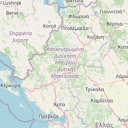
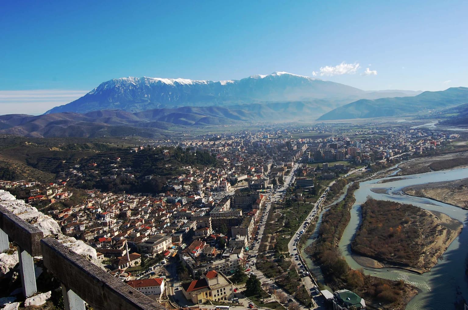
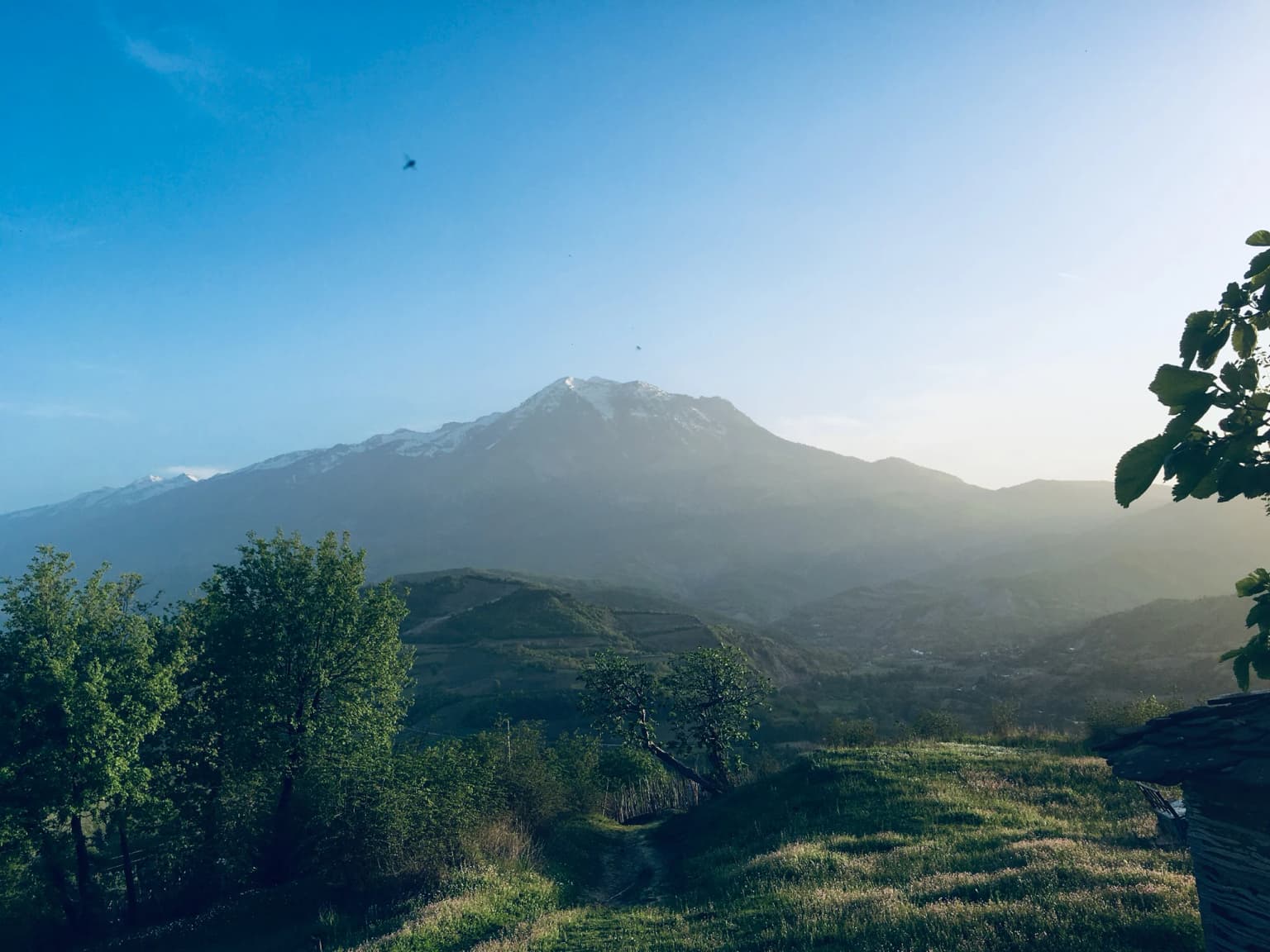
Tomorr Mountain National Park is best known for its imposing limestone and karst mountain landscape dominated by Mount Tomorr, a sacred peak that rises dramatically between the Osum River valley and the Tomorrica valley near the historic city of Berat. The park is distinguished by its dramatic Osum Canyon, where the Osum River has carved a spectacular gorge through the karst terrain. The combination of high-altitude biodiversity, the presence of old-growth forests with species such as European beech and Bosnian pine, and the mountain's dual religious significance as both a Christian pilgrimage site and a Bektaşi sacred place gives this park a unique identity within Albania's protected area network.

Stone viewing platform overlooking the city of Berat with snow-capped Mount Tomorr visible in the distance under a clear blue sky
Panoramic view of Berat, Albania with Mount Tomorr in the background

Tomorr Mountain National Park history and protected-area timeline

Tomorr Mountain National Park was established in 1956, making it one of Albania's older protected areas established during the communist period. The park was created to protect the significant natural values of the Tomorr mountain region, which had long been recognized for its ecological importance and dramatic landscapes.

In 2012, the park underwent a significant expansion that increased its protected territory to better reflect the ecological connectivity of the Tomorr ecosystem. The park's area was formally designated at 27,185.5 hectares through this expansion, with the boundary adjustments intended to incorporate important habitats and ensure more effective conservation of the mountain's biodiversity. Additional adjustments in 2019 expanded the park to include former quarry areas.

The park is now managed by Albania's National Agency of Protected Areas, which oversees conservation activities, visitor management, and protection enforcement within the park boundaries. The establishment of the park provided formal protection for a landscape that had long been valued locally for both its natural beauty and religious significance.

Tomorr Mountain National Park landscape and geographic character

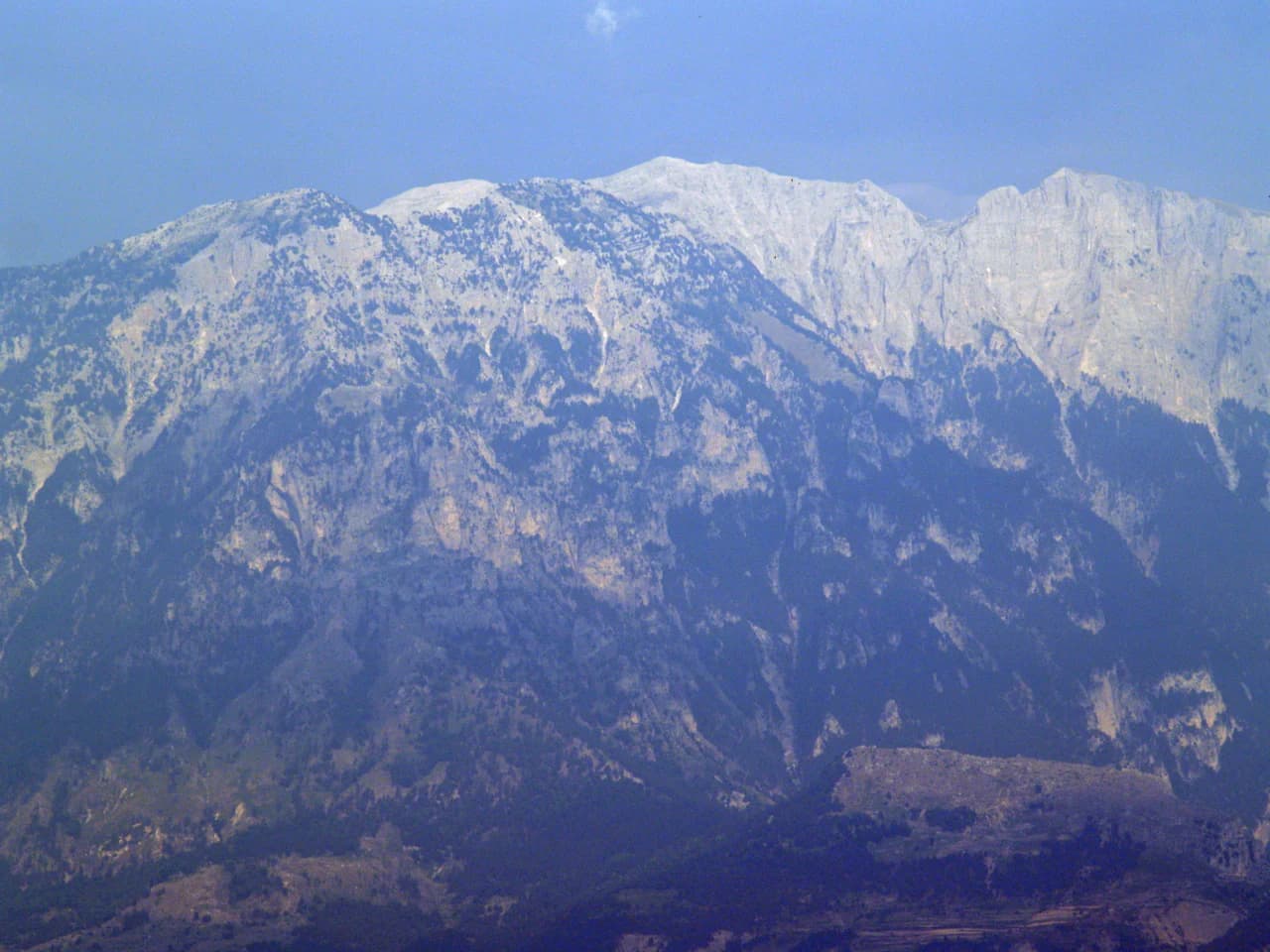
The landscape of Tomorr Mountain National Park is defined by the Tomorr anticline, a geological structure that has created one of southern Albania's most visually striking mountain environments. The limestone bedrock has been extensively eroded by karst processes, resulting in a terrain of rugged cliffs, steep ridges, sinkholes, underground drainage systems, and boulder-strewn slopes.

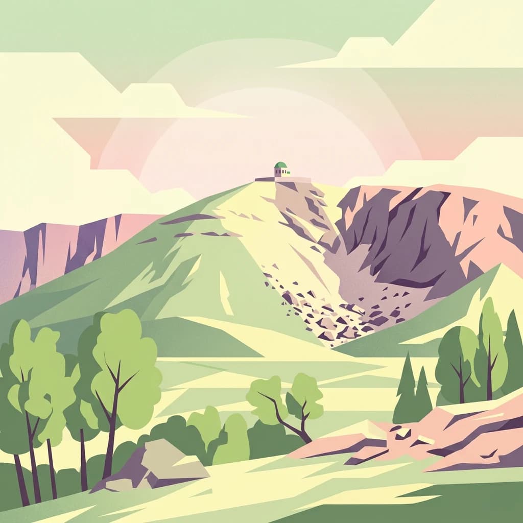
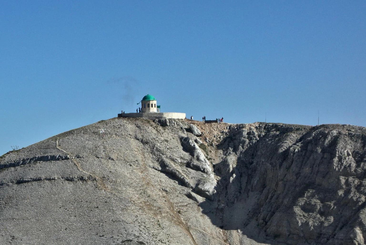
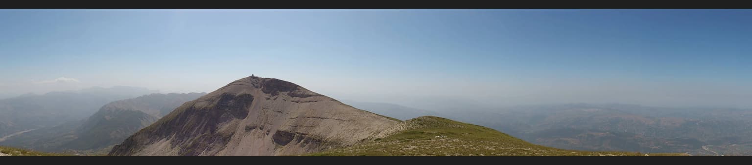
Mount Tomorr rises as the park's dominant feature, its summit reaching 2,416 meters and presenting a distinctive profile that from certain angles resembles a natural fortress or castle—hence the local description of it giving the impression of a giant natural castle. The mountain is flanked by two major river valleys: the Osum Valley to the west and the Tomorrica Valley to the east, both of which have carved deep gorges into the limestone terrain.

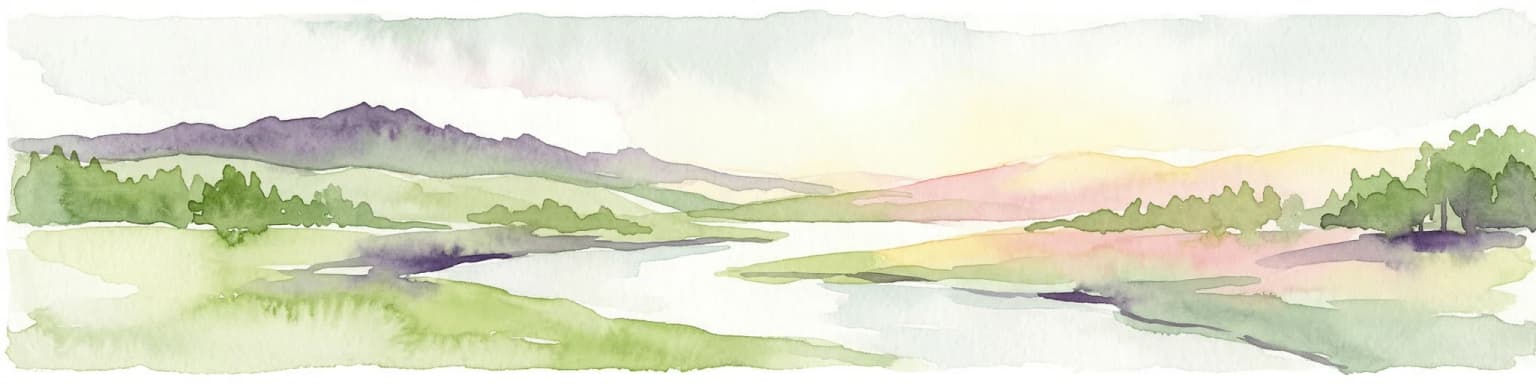
The Osum Canyon represents one of the park's most spectacular natural features, where the Osum River has cut a dramatic gorge through karst limestone, creating sheer walls, waterfalls, and pools that attract both hikers and photographers. The combination of vertical limestone cliffs, forested slopes descending to the river, and the contrast between the canyon depths and the mountain summits creates a landscape of considerable scenic diversity.

Rocky mountain peak with white shrine featuring green dome, small groups of people visible, clear blue sky
Tyrbe (tomb shrine) with green dome atop Mount Tomorr, surrounded by rocky terrain

Tomorr Mountain National Park ecosystems, habitats, and plant life

Tomorr Mountain National Park supports a rich diversity of habitats that reflect its position within the Pindus Mountains mixed forests ecoregion and the Mediterranean biome. The park's varied topography, ranging from valley floors through mid-elevation slopes to alpine zones near the summit, creates conditions for multiple distinct vegetation communities.

The forests of Tomorr National Park are notably diverse, composed of both deciduous and coniferous species. European beech forests dominate the higher elevations, while Bosnian pine occurs on rocky substrates and steeper slopes. Turkish hazel and Greek whitebeam add to the diversity of tree species. The understory and open areas support a remarkable variety of flowering plants including linaria, great yellow gentian, autumn crocus, and numerous centaury species. The park's designation as an Important Plant Area recognizes these botanical values at the international level.

The karst geology influences the park's ecological character through its effect on water availability and soil formation. The limestone terrain supports specialized plant communities adapted to the often shallow soils and periodic drought conditions, while sinkholes and underground drainage channels create microhabitats for moisture-loving species in an otherwise Mediterranean climate setting.

Panoramic view of Tomorr Mountain summit under a clear blue sky, showing the mountain peak and distant ranges
Summit of Tomorr Mountain with clear sky and surrounding mountain ranges

Tomorr Mountain National Park wildlife and species highlights

The wildlife community of Tomorr Mountain National Park reflects the park's position in a biogeographically diverse region where Mediterranean and Central European species overlap. The mammal fauna includes several species characteristic of mountainous forested habitats: wolves maintain populations in the park as apex predators, while foxes, roe deer, and wild boars are more commonly encountered. Wild goats inhabit the steeper rocky sections of the mountain, utilizing the cliff areas as refuge and foraging habitat.

The avifauna of the park is particularly notable, with golden eagles nesting on the cliffs and hunting the open slopes and meadows. The park also supports populations of owls and Eurasian sparrowhawks, representing both nocturnal and diurnal raptors. Smaller mammals including forest dormouse and wood mouse occupy the forest floor and woodland edges, while rabbits provide prey species for the predator community.

The Osum River and its canyon support aquatic and riparian wildlife, though the park's primary wildlife values are associated with the forest and cliff habitats of the mountain itself. The combination of forested slopes, rocky outcrops, and river corridors creates a habitat matrix that supports the diverse mammal and bird communities documented within the park.

Snow-capped Mount Tomorr visible from a grassy hillside with scattered trees under a clear blue sky
Scenic view of Mount Tomorr from Skënderbegas Village

Tomorr Mountain National Park conservation status and protection priorities

Tomorr Mountain National Park is recognized as one of Albania's most important protected areas for maintaining mountainous biodiversity and ecosystem integrity at the national level. The park's conservation significance is underlined by its designation as an Important Plant Area of international importance by Plantlife, reflecting the presence of rare and threatened plant species within its boundaries.

The park's location within the Pindus Mountains mixed forests ecoregion places it within one of Europe's significant biodiversity areas. The combination of forest habitats, karst ecosystems, and the Osum River corridor creates a conservation value that extends beyond the park's boundaries, with the protected area serving as a core zone within a broader ecological network.

Management by Albania's National Agency of Protected Areas includes protection of the park's natural values while balancing the traditional uses that have shaped the landscape over centuries. The challenge of conservation in this park includes maintaining the ecological integrity of the forest communities, protecting water quality in the Osum system, and ensuring that the recreational use of the canyon and mountain areas remains sustainable.

Tomorr Mountain National Park cultural meaning and human context

Tomorr Mountain holds profound religious significance as a sacred mountain in Albania, a dimension that distinguishes this protected area from many other European national parks. The mountain has been a pilgrimage site for centuries, attracting both Christian devotees and members of the Bektaşi Sufi order to its slopes and summits.

Christian traditions associated with the mountain include the Church of the Virgin Mary, which has been a destination for religious pilgrimage, particularly during the Assumption of the Virgin in August. Bektaşi practitioners maintain shrines and tombs (tyrbe) on the mountain, reflecting the order's historical presence in the region and the mountain's status as a sacred site within their spiritual tradition. The coexistence of Christian and Islamic pilgrimage traditions on the same mountain reflects the complex religious history of southern Albania and the region's tradition of interfaith coexistence.

This cultural heritage adds a human dimension to the park's landscape that predates the formal protected area designation and continues to give the mountain significance to local communities. The religious structures and pilgrimage paths form part of the cultural landscape that the park now protects alongside its natural values.

Snow-capped mountain range with rocky terrain under a clear sky
Mount Tomorr viewed from Berta village, Berat County, Albania

Top sights and standout views in Tomorr Mountain National Park

Tomorr Mountain National Park combines dramatic mountain scenery with significant biodiversity and deep cultural heritage. The park's centerpiece is Mount Tomorr, a 2,416-meter limestone peak that dominates the landscape and serves as both a natural landmark and sacred site. The Osum Canyon, with its spectacular gorge carved through karst limestone, offers one of Albania's most impressive natural wonders. The old-growth beech and pine forests shelter a rich plant community recognized internationally through the Important Plant Area designation. The dual religious significance of the mountain—for both Christians and Bektaşi believers—creates a unique cultural landscape where spiritual traditions have shaped the relationship between humans and this mountainous terrain for generations.

Best time to visit Tomorr Mountain National Park

Tomorr Mountain National Park offers distinct experiences across seasons, with each period offering different advantages for visitors. The summer months of June through August bring warm conditions ideal for hiking the mountain trails and exploring the Osum Canyon, though this is also the peak period for pilgrimages to Mount Tomorr, particularly during the Assumption of the Virgin in mid-August. Spring (April through May) brings blooming flowers to the meadows and forests, with comfortable temperatures for moderate hiking and fewer crowds than summer. Autumn offers colorful forest scenery as the beech and other deciduous trees display their fall colors, along with generally mild weather. Winter conditions on the mountain are harsh and access to higher elevations is limited, though the snow-covered peaks present a different kind of dramatic landscape for those interested in winter scenery. The park's natural beauty is described as evident in every season, reflecting how the changing seasons transform the mountain's character.

Park location guide

Geography guide, regional context, and park location map for Tomorr Mountain National Park

Tomorr Mountain National Park park geography, regions, and map view in Albania
Understand where Tomorr Mountain National Park sits in Albania through a broader geographic reading of the surrounding landscape, nearby location context, and its mapped position within the national park landscape.

How Tomorr Mountain National Park fits into Albania

Albania is a unitary parliamentary republic in Southeast Europe, situated on the Balkan Peninsula along the Adriatic and Ionian coastal regions. With a population of approximately 2.4 million people, it borders Montenegro, Kosovo, North Macedonia, and Greece. The country features varied landscapes ranging from the Albanian Alps to fertile coastal plains, with Tirana as its capital and largest city.

Wider geography shaping Tomorr Mountain National Park in Albania

Albania occupies the western part of the Balkan Peninsula in Southeast Europe. The country features a varied terrain with rugged mountain ranges including the Albanian Alps (Accursed Mountains), Korab, Skanderbeg Mountains, Pindus, and Ceraunian Mountains. Fertile lowland plains extend along the Adriatic and Ionian coastal regions. The country borders Montenegro to the northwest, Kosovo to the northeast, North Macedonia to the east, and Greece to the south.

Map view of Tomorr Mountain National Park

Use this park location map to pinpoint Tomorr Mountain National Park in Albania, understand its exact geographic position, and read its mapped placement within the surrounding landscape more clearly.

Pigeon | © OpenStreetMap contributors

Location context for Tomorr Mountain National Park

Berat CountyElbasan County

Examine stunning imagery revealing the dramatic geological formations, diverse habitats, and unique protected-area character of the Tomorr region.

Visual Guide to Tomorr Mountain National Park: Scenery, Terrain, and Protected Habitats
Explore a curated collection of photographs showcasing Tomorr Mountain National Park's dramatic limestone and karst landscapes, featuring the imposing Mount Tomorr and spectacular Osum Canyon. These visuals provide essential context for understanding the park's rugged terrain, diverse mountain habitats, and the distinctive character of this Albanian protected area.

Stone viewing platform overlooking the city of Berat with snow-capped Mount Tomorr visible in the distance under a clear blue sky

Wide view of a deep canyon with steep rock cliffs, a river below, and dense green vegetation on the slopes

Rocky mountain peak with white shrine featuring green dome, small groups of people visible, clear blue sky

Panoramic view of Tomorr Mountain summit under a clear blue sky, showing the mountain peak and distant ranges

Snow-capped Mount Tomorr visible from a grassy hillside with scattered trees under a clear blue sky

A river winding through green and brown agricultural fields with hills and a large mountain in the distance under a clear blue sky

Snow-capped mountain range with rocky terrain under a clear sky

Park atlas

Trace the broader geographic context of Albania's mountain protected areas and compare karst landscapes surrounding Tomorr Mountain National Park.

Explore Nearby National Parks and Protected Areas Beyond Tomorr Mountain National Park's Dramatic Limestone Landscape
Browse a curated selection of national parks and other protected areas situated near Tomorr Mountain National Park, spanning Albania's dramatic mountain terrain and karst formations. This view provides essential geographic context and enables structured comparison of diverse conservation landscapes throughout the surrounding region, enhancing atlas-style park discovery.
Watercolor painting of a landscape with green fields, scattered trees, and rolling hills under a light sky
National parkGjirokastër County

Fir of Hotovë-Dangëlli National Park: Ancient Forests & Mountain Wilderness Atlas

Explore a premier protected landscape in Gjirokastër County, Albania.

Fir of Hotovë-Dangëlli National Park stands as a monumental protected area, celebrated for its exceptional old-growth Hotova Fir forests, which are a rare Mediterranean plant relic. This national park in Gjirokastër County offers a detailed look at a vast mountainous terrain, featuring dramatic canyons like Lengarica Canyon, and serving as a critical habitat for diverse wildlife. MoriAtlas provides structured geographic context for this significant landscape, highlighting its mapped boundaries and role as a key component of regional protected area networks.

Area
360.038 km²
Established
2008
IUCN
II
Relief
Mountain
Watercolor painting showing hills, green fields, a body of water, and vegetation under a soft sky
National park

Divjakë-Karavasta National Park: Albania's Expansive Coastal Wetland and Pelican Breeding Site

Mapping Albania's largest Mediterranean lagoon and its vital bird sanctuaries.

Divjakë-Karavasta National Park is a key protected coastal wetland in western Albania, centered around Karavasta Lagoon, one of the largest in the Mediterranean. This Ramsar site provides critical habitats for numerous bird species, including a globally significant population of the endangered Dalmatian pelican, making it a premier destination for understanding regional wetland geography and protected area dynamics.

Area
222.3 km²
Established
2007
IUCN
II
Relief
Lowland
Watercolor illustration of mountains, a lake, and rolling hills with grassy vegetation.
National parkElbasan County

Shebenik National Park: Mapped Protected Landscape and Glacial Terrain Atlas

Explore Elbasan County's significant mountain wilderness and protected natural features.

Shebenik National Park is a protected national park in Elbasan County, Albania, notable for its dramatic glacial terrain and extensive ancient forests. This park offers a deep dive into Albania's natural landscape, featuring 14 glacial lakes and serving as vital habitat. Its position within the Balkan Peninsula's geography makes it a key point of reference for understanding protected areas and mountain wilderness within a structured atlas.

Area
345.079 km²
Established
2008
IUCN
II
Relief
Mountain
Watercolor painting of a river flowing through a valley with mountains and greenery
National parkKorçë County

Prespa National Park: Protected Landscape and High-Altitude Lakes in Korçë County, Albania

Explore the geography and mapped boundaries of this vital national park.

Prespa National Park, located in Korçë County, Albania, is a protected area characterized by its significant high-altitude tectonic lakes, dramatic mountain landscapes, and vital wetland habitats. This entry provides a structured atlas-style overview of the park's geographic identity, its protected landscape features, and its ecological importance, serving as a key point of reference for understanding this unique Balkan region.

Area
276.13 km²
Established
1999
IUCN
II
National parkVlorë County

Llogara National Park: Vlorë County's Dramatic Ceraunian Mountain Protected Landscape

Explore Albania's rugged national park geography and mapped terrain.

Llogara National Park stands as a vital protected area within Vlorë County, Albania, renowned for its spectacular Ceraunian Mountain topography. This page provides access to detailed geographic information, highlighting the park's unique landscape characteristics, from alpine peaks to coastal vistas. Discover the mapped extent of this national park and its significance within the regional geography, perfect for structured atlas exploration.

Area
17.69 km²
Established
1966
IUCN
II
Relief
Mountain
Watercolor scene featuring a blue lake, green trees, and mountains under a yellow-pink sky
National park

Karaburun-Sazan Marine Park: A National Park with Dramatic Limestone Cliffs and Island Ecosystems

Explore Albania's protected coastline and marine geography.

Karaburun-Sazan Marine Park, Albania's sole national park, offers a profound exploration of a unique protected landscape. This marine protected area combines the rugged Karaburun Peninsula, characterized by high limestone cliffs, with Sazan Island, Albania's largest island, known for its distinct geology and subtropical climate. The park's waters are critical habitats for endangered species, making it a significant site for marine biodiversity and regional geographic study. Discover the mapped boundaries and ecological context of this vital protected area.

Area
124.377 km²
Established
2010
IUCN
II
Relief
Mixed relief
National park

Dajti Mountain National Park: Albania's Accessible Protected Mountain Landscape for Geographic Discovery

Explore the mapped terrain and diverse ecosystems of this significant national park.

Dajti Mountain National Park is a prime example of a protected mountain landscape central to Albania's geography. Situated near Tirana, its rugged karst topography, steep limestone ridges, and varied elevation create distinct ecological zones. This atlas-focused entry details the park's terrain, notable geological features like Pellumbas Cave, and its role as a significant protected area offering rich mapped landscape context.

Area
293.84 km²
Established
1966
IUCN
II
Relief
Mountain
Watercolor painting of a landscape with green trees, rolling hills, and distant mountains under a light sky
National parkMunicipality of Bitola

Pelister National Park: North Macedonia's Oldest National Park and Alpine Protected Landscape

Explore unique glacial features and endemic forests within Municipality of Bitola.

Pelister National Park, a pioneering protected area in North Macedonia, offers a rich tapestry of alpine geography and unique geological formations. This page provides detailed information on the park's landscape, including its dramatic mountain massif within Municipality of Bitola, the rare Macedonian pine forests, the striking 'stone rivers' formed by ancient glacial processes, and the serene Pelister Eyes glacial lakes. Discover the park's mapped boundaries and its significance as a conservation heritage site within the Balkan Peninsula.

Area
171.5 km²
Established
1948
IUCN
II
Visitors
30K annual

Common questions about visiting, size, designation, and location context for Tomorr Mountain National Park

Tomorr Mountain National Park FAQs for park facts, access, geography, and protected area context
Find quick answers about Tomorr Mountain National Park, including protected-area facts, park geography, trail and visitor context, and how the park fits into its surrounding country and regional landscape.
MoriAtlas Explorer

Continue Your Protected Areas Search Across the Global Atlas

Deepen your exploration by continuing the structured search for national parks and protected areas worldwide. Utilize the comprehensive filtering capabilities to compare different conservation landscapes and refine your understanding of global park geography. Discover more about the distribution and characteristics of protected natural areas.

Global natural geography