Mori Atlas logo
National parkDajti Mountain National Park

Discover the rugged karst terrain and diverse mapped ecosystems of this accessible national park near Tirana.

Dajti Mountain National Park: Albania's Premier Protected Mountain Landscape and Geographic Landmark

(Parku Kombëtar Mali i Dajtit)

Dajti Mountain National Park serves as a crucial protected landscape, rising dramatically just east of Tirana, Albania. This national park showcases a rugged, fragmented topography dominated by karst limestone formations, steep ridges, and deep valleys. Its distinct elevation gradient supports a variety of ecosystems, from Mediterranean scrubland to forested slopes and rocky alpine summits, offering a rich tapestry of natural terrain for atlas exploration.

mountain parksIUCN Category IIprotected areasAlbaniaBalcony of Tiranakarst landscape

Dajti Mountain National Park

National park

Park overview

Structured park overview, official facts, and landscape profile for Dajti Mountain National Park

Dajti Mountain National Park park facts, protected area profile, and essential visitor context
Review the core facts for Dajti Mountain National Park, including designation, size, terrain, visitor scale, habitats, and operating context in one park-focused overview.

About Dajti Mountain National Park

Dajti Mountain National Park protects one of Albania's most distinctive mountain landscapes, rising abruptly from the coastal plains near Tirana to form a dramatic backdrop to the capital city. The park encompasses the Dajti massif, a compact but rugged mountain chain comprising several peaks including Dajti proper at 1,613 meters, Priska to the south, Tujani in the central section, and Brari to the north. The extreme fragmentation of the topography, with deep ravines, steep cliffs, and isolated ridges, creates a remarkably varied environment within a relatively limited area.

The park is situated approximately 40 kilometers from the Adriatic Sea and lies adjacent to several other protected areas, including Shtamë Pass Nature Park to the northwest, Kraste-Verjon Protected Landscape to the west, and the Mali me Gropa-Bizë-Martanesh Protected Landscape to the east. This positioning creates a coherent protected landscape network across the mountainous interior of central Albania. The area has long served as a traditional recreation ground for Tirana's population, where generations of city residents have ventured to escape the summer heat and enjoy the mountain's cooler temperatures and natural beauty.

Management of the park involves cooperation between the National Agency of Protected Areas and Tirana Municipality's Parks and Recreation Agency, reflecting both national conservation priorities and local recreation needs. A new tourist information center opened in 2019 near the TV and Radio towers along the SH47 road at Fushe Dajt, supporting visitor services for the growing number of people who visit the park year-round.

Quick facts and research context for Dajti Mountain National Park

Dajti Mountain National Park occupies approximately 28,562 hectares in Tirana County, eastern Albania. The protected area encompasses the Dajti massif including peaks of Priska, Tujani, and Brari, with elevations ranging from around 400 meters to 1,613 meters at the summit. The park falls under shared management between the Albanian Agency of Protected Areas and Tirana Municipality's Parks and Recreation Agency. It holds IUCN Category II designation and has been recognized as an Important Plant Area of international importance. The area is a traditional recreation destination for Tirana residents, featuring the Dajti Ekspres Cable Car and an adventure park.

Park context

Deeper park guide and search-rich context for Dajti Mountain National Park

Dajti Mountain National Park history, landscape, wildlife, and travel context
Explore Dajti Mountain National Park through its history, landscape character, ecosystems, wildlife, conservation priorities, cultural context, and seasonal travel timing in a structured park guide built for atlas discovery and search intent.

Why Dajti Mountain National Park stands out

Dajti Mountain National Park is best known for its dramatic panoramic views over Tirana from the 'Balcony of Tirana' viewpoint, making it a beloved escape for both locals and visitors. The mountain is a distinct geological formation with a rugged, fragmented landscape that supports diverse habitats across its elevation gradient. The park contains significant archaeological and geological attractions including Pellumbas Cave with prehistoric deposits and the dramatic gorge of the Erzen River. Its proximity to Tirana, combined with the cable car access, makes it Albania's most visited mountain recreation area.

Dajti Mountain National Park history and protected-area timeline

Dajti Mountain National Park was originally established in 1966, reflecting Albania's early commitment to nature protection during the communist period. The park was significantly expanded and redesignated in 2006, increasing its protected area to approximately 285 square kilometers to better encompass the ecological diversity and watershed values of the Dajti mountain system. This expansion acknowledged the growing understanding of the park's importance for biodiversity conservation and watershed protection for Tirana's water supply.

The park's history as a recreational destination predates its formal protection, with Tirana residents using the mountain for centuries as a summer retreat and picnic destination. The construction of the Dajti Ekspres Cable Car further cemented the park's role as the primary mountain recreation area for the capital, providing accessible transport to the upper slopes. In recent years, the park has faced challenges from increased visitor pressure and, more significantly, from deforestation and forest fires that have damaged the forest cover, particularly at the higher elevations where fire in 2012, 2017, and 2019 caused visible damage visible from Tirana.

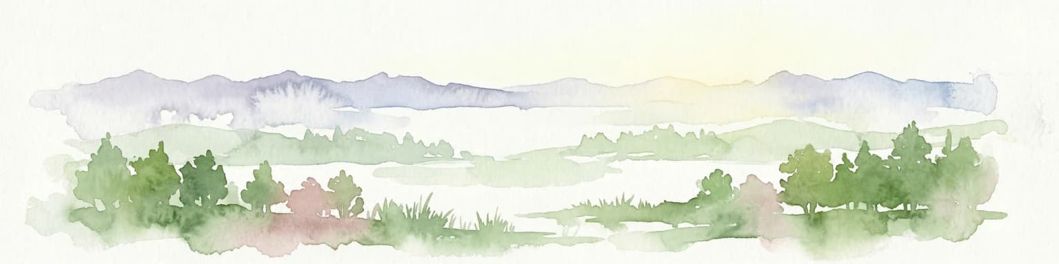
Dajti Mountain National Park landscape and geographic character

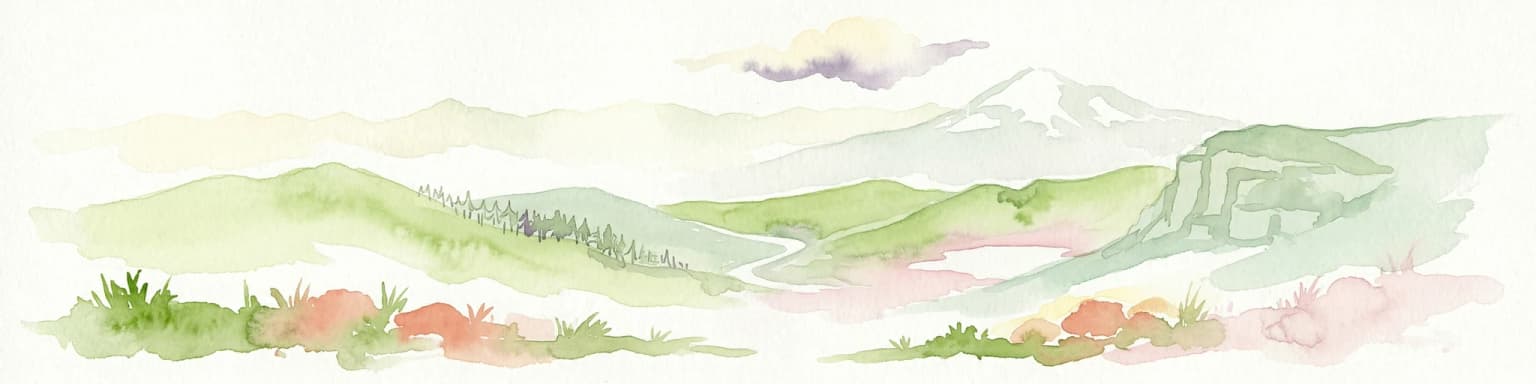
The landscape of Dajti Mountain National Park is defined by its rugged, highly fragmented topography characteristic of karst limestone formations in the Balkans. The Dajti massif rises as an isolated mountain complex, with steep-sided ridges, deep ravines, and exposed rock faces creating a dramatic and visually striking environment. The elevation range from approximately 400 meters at the lower valleys to 1,613 meters at the summit creates distinct landscape zones visible in the vegetation patterns.

The park contains several notable geological and hydrological features that contribute to its landscape character. Lake Bovilla, located to the northeast of the Brari peak, is a major reservoir serving Tirana's water supply, set within a dramatic landscape of steep cliffs and a deep canyon. The Erzen River cuts through the park in a spectacular gorge containing the prehistoric Pellumbas Cave, a significant archaeological site where the river has carved a passage through the limestone. The Shëngjini Waterfalls near Shëngjergj village provide another important water feature within the park boundaries. From the higher summits, the panoramic view encompasses Tirana spread below and the surrounding mountain ranges, a vista that has earned the location its famous name as the 'Balcony of Tirana'.

Dajti Mountain National Park ecosystems, habitats, and plant life

The varied geology and topography of Dajti Mountain National Park support a rich diversity of habitats and vegetation types across the elevational gradient. At lower elevations, the vegetation consists of Mediterranean scrubland and heath, characterized by myrtle and fragaria species typical of the Balkan coastal and inland transition zone. As elevation increases, oak forests dominate between approximately 600 and 1,000 meters, interspersed with beech and maple in the more sheltered valleys and north-facing slopes. Above 1,000 meters, coniferous species appear, transitioning to rocky alpine terrain with minimal vegetation at the highest peaks.

The park has been recognized as an Important Plant Area of international importance by Plantlife, acknowledging the significance of its plant communities and the species they support. The diversity of habitats, from rocky summits through forested slopes to cliff faces and riparian corridors along the Erzen River, creates conditions for remarkable botanical richness within the protected area. The old-growth individuals of European silver fir that appear in the Albanian source, some reported as 200 years old, represent significant natural heritage elements within the park's forest communities.

Dajti Mountain National Park wildlife and species highlights

Dajti Mountain National Park supports populations of several notable mammal species that inhabit the diverse habitats within its boundaries. The park provides habitat for wild boar, Eurasian wolf, red fox, European hare, brown bear, squirrel, and European wildcat. These species represent both large predators and smaller mammals that have adapted to the mountainous terrain and forest environments. The presence of brown bear and wolf indicates the park retains meaningful ecological function as a wildland area, providing connections to larger habitat complexes in the surrounding mountains.

The varied habitats also support bird populations and invertebrate communities associated with the Mediterranean forest and rocky mountain environments. While specific species inventories are limited in the available sources, the combination of forest, scrubland, cliff, and grassland habitats creates conditions for biodiversity across multiple taxonomic groups. The forest structure, with both deciduous and coniferous components at different elevations, provides varied foraging and cover resources for wildlife throughout the year.

Dajti Mountain National Park conservation status and protection priorities

Dajti Mountain National Park holds significant conservation value as an Important Plant Area recognized internationally by Plantlife, acknowledging the importance of its botanical communities. The IUCN Category II designation reflects the park's primary purpose of protecting natural ecosystems while allowing for sustainable recreation and environmental education. The park serves as a critical watershed area, with Lake Bovilla providing a major water supply for Tirana, making watershed protection a key conservation function.

However, the park faces significant conservation challenges, particularly from deforestation and increasingly frequent forest fires. Major fires in 2012, 2017, and 2019 have caused substantial damage to the forest cover, particularly at the higher elevations where the damage is clearly visible from Tirana. The increasing frequency of fires, combined with pressures from the growing number of visitors and surrounding development, presents ongoing management challenges. The difficulty in prosecuting those responsible for intentional fires compounds the challenge of protecting this important natural area so close to a major population center.

Dajti Mountain National Park cultural meaning and human context

Dajti Mountain holds deep cultural significance for Tirana and Albania more broadly, serving as a traditional escape from city life for generations of residents. The mountain's proximity to the capital, just 26 kilometers away, has made it the primary recreational mountain for the city since at least the early twentieth century. Traditional restaurants serving local dishes according to slow food traditions have long operated on the mountain, preserving culinary heritage while serving visitors.

The panoramic view from Dajti's summit, offering a sweeping prospect over Tirana spread below, has earned the mountain its enduring nickname as the 'Balcony of Tirana.' This view represents not just a scenic attraction but a meaningful connection between the urban population and the natural environment, a relationship institutionalized through the park's establishment and ongoing management. The name itself reflects how the mountain functions as both a physical and cultural landmark, a place where city residents experience their relationship with the surrounding landscape.

Top sights and standout views in Dajti Mountain National Park

Dajti Mountain National Park combines dramatic mountain scenery with accessibility from Tirana, making it Albania's most visited mountain protected area. The 'Balcony of Tirana' viewpoint offers spectacular panoramic views over the capital and surrounding mountains from the 1,613-meter summit. The park features significant geological attractions including the prehistoric Pellumbas Cave in the Erzen River gorge, Lake Bovilla with its dramatic cliffs and canyon, and the Shëngjini Waterfalls. The Dajti Ekspres Cable Car provides unique access to the mountain environment, while an adventure park offers recreational activities. The diverse habitats from Mediterranean scrubland through oak-beech forests to alpine peaks support notable biodiversity including brown bears, wolves, and has been recognized as an Important Plant Area.

Best time to visit Dajti Mountain National Park

Dajti Mountain National Park can be visited throughout the year, though each season offers distinctly different experiences. Summer is the traditional peak season when Tirana residents escape the city heat to enjoy the mountain's cooler temperatures, though this period also carries the highest fire risk based on historical incidents. Spring and autumn offer milder conditions with less fire danger and the opportunity to observe seasonal changes in the vegetation and wildlife activity. Winter snow cover at higher elevations creates a different landscape character, though access may be more limited during cold periods. The cable car operates year-round, providing access to the upper slopes regardless of season.

Park location guide

Geography guide, regional context, and park location map for Dajti Mountain National Park

Dajti Mountain National Park park geography, regions, and map view in Albania
Understand where Dajti Mountain National Park sits in Albania through a broader geographic reading of the surrounding landscape, nearby location context, and its mapped position within the national park landscape.

How Dajti Mountain National Park fits into Albania

Albania is a unitary parliamentary republic in Southeast Europe, situated on the Balkan Peninsula along the Adriatic and Ionian coastal regions. With a population of approximately 2.4 million people, it borders Montenegro, Kosovo, North Macedonia, and Greece. The country features varied landscapes ranging from the Albanian Alps to fertile coastal plains, with Tirana as its capital and largest city.

Wider geography shaping Dajti Mountain National Park in Albania

Albania occupies the western part of the Balkan Peninsula in Southeast Europe. The country features a varied terrain with rugged mountain ranges including the Albanian Alps (Accursed Mountains), Korab, Skanderbeg Mountains, Pindus, and Ceraunian Mountains. Fertile lowland plains extend along the Adriatic and Ionian coastal regions. The country borders Montenegro to the northwest, Kosovo to the northeast, North Macedonia to the east, and Greece to the south.

Map view of Dajti Mountain National Park

Use this park location map to pinpoint Dajti Mountain National Park in Albania, understand its exact geographic position, and read its mapped placement within the surrounding landscape more clearly.

Pigeon | © OpenStreetMap contributors

Location context for Dajti Mountain National Park

Tirana County
Park atlas

Compare surrounding mountain parks and protected landscapes, mapping their geographic spread across the Albanian region.

Explore National Parks and Protected Areas Near Dajti Mountain National Park
After exploring Dajti Mountain National Park, discover other national parks and protected areas in central Albania, comparing their mountain terrain and protected landscapes. Map these interconnected protected areas to understand regional biodiversity patterns, unique geographic features, and the wider network of Albanian conservation efforts.
Watercolor illustration of mountains, a lake, and rolling hills with grassy vegetation.
National parkElbasan County

Shebenik National Park: Mapped Protected Landscape and Glacial Terrain Atlas

Explore Elbasan County's significant mountain wilderness and protected natural features.

Shebenik National Park is a protected national park in Elbasan County, Albania, notable for its dramatic glacial terrain and extensive ancient forests. This park offers a deep dive into Albania's natural landscape, featuring 14 glacial lakes and serving as vital habitat. Its position within the Balkan Peninsula's geography makes it a key point of reference for understanding protected areas and mountain wilderness within a structured atlas.

Area
345.079 km²
Established
2008
IUCN
II
Relief
Mountain
Watercolor illustration of rolling green hills and distant mountains under a soft sky
National parkDibër County

Lurë-Dejë Mountain National Park: Mapped Protected Landscape and Glacial Lake Geography

Dibër County's alpine protected area with unique glacial lakes.

Delve into the detailed geographic context and mapped protected area of Lurë-Dejë Mountain National Park, an essential natural landscape in Albania's Dibër County. This park is renowned for its rare chain of twelve glacial lakes, situated at high elevations amidst dramatic alpine terrain. Its protected status ensures the preservation of significant old-growth forest ecosystems, including the critically endangered Balkan pine, contributing to its recognition as an Important Bird and Plant Area. Explore the park's distinctive terrain, from its soaring mountain peaks to its unique alpine meadows, all within a comprehensive geographic atlas framework.

Area
202.42 km²
Established
1966
IUCN
II
Relief
Mountain
Watercolor painting showing hills, green fields, a body of water, and vegetation under a soft sky
National park

Divjakë-Karavasta National Park: Albania's Expansive Coastal Wetland and Pelican Breeding Site

Mapping Albania's largest Mediterranean lagoon and its vital bird sanctuaries.

Divjakë-Karavasta National Park is a key protected coastal wetland in western Albania, centered around Karavasta Lagoon, one of the largest in the Mediterranean. This Ramsar site provides critical habitats for numerous bird species, including a globally significant population of the endangered Dalmatian pelican, making it a premier destination for understanding regional wetland geography and protected area dynamics.

Area
222.3 km²
Established
2007
IUCN
II
Relief
Lowland
National park

Mavrovo National Park: North Macedonia's Extensive Protected Alpine Terrain and Wildlife

Mapped geography of Alpine peaks, gorges, and unique endemic species.

Mavrovo National Park, North Macedonia's largest protected area, offers a deep dive into a complex Alpine geography. Dominated by the Šar, Korab, and Bistra mountain systems, the park features towering peaks and the dramatic Radika River gorge. This protected landscape is globally significant for its role in conserving the rare Balkan lynx and harbors endemic tertiary relic plant species like Macedonian pine. Explore the mapped boundaries, glacial lakes, and distinct terrain that define this vital conservation area.

Area
730.88 km²
Established
1949
IUCN
II
Relief
Mountain
Watercolor painting showing mountains, a river, and vegetation
National park

Tomorr Mountain National Park: Sacred Peak & Karst Protected Landscape in Albania

Explore Albania's dramatic mountain geography and protected areas.

Tomorr Mountain National Park offers a unique exploration of southern Albania's dramatic limestone anticline. Dominated by the sacred Mount Tomorr and featuring the spectacular Osum Canyon, this national park provides insight into karst terrain, old-growth forests, and significant biodiversity. Discover its mapped boundaries and regional geographic context within the Pindus Mountains for structured atlas exploration.

Area
271.855 km²
Established
1956
IUCN
II
Relief
Mountain
Watercolor painting of a river flowing through a valley with mountains and greenery
National parkKorçë County

Prespa National Park: Protected Landscape and High-Altitude Lakes in Korçë County, Albania

Explore the geography and mapped boundaries of this vital national park.

Prespa National Park, located in Korçë County, Albania, is a protected area characterized by its significant high-altitude tectonic lakes, dramatic mountain landscapes, and vital wetland habitats. This entry provides a structured atlas-style overview of the park's geographic identity, its protected landscape features, and its ecological importance, serving as a key point of reference for understanding this unique Balkan region.

Area
276.13 km²
Established
1999
IUCN
II
Watercolor painting of a landscape with green trees, rolling hills, and distant mountains under a light sky
National parkMunicipality of Bitola

Pelister National Park: North Macedonia's Oldest National Park and Alpine Protected Landscape

Explore unique glacial features and endemic forests within Municipality of Bitola.

Pelister National Park, a pioneering protected area in North Macedonia, offers a rich tapestry of alpine geography and unique geological formations. This page provides detailed information on the park's landscape, including its dramatic mountain massif within Municipality of Bitola, the rare Macedonian pine forests, the striking 'stone rivers' formed by ancient glacial processes, and the serene Pelister Eyes glacial lakes. Discover the park's mapped boundaries and its significance as a conservation heritage site within the Balkan Peninsula.

Area
171.5 km²
Established
1948
IUCN
II
Visitors
30K annual
Watercolor painting showing a mountainous landscape with a lake, green hills, and pink flowers
National park

Alps of Albania National Park: Explore Albania's Largest Protected Alpine Wilderness

Dramatic karst, glacial valleys, and high-altitude ecosystems await.

The Alps of Albania National Park offers an expansive view into one of the Balkans' most significant mountain protected areas. This national park encompasses a spectacular landscape characterized by towering limestone peaks, deep glacial valleys carved over millennia, and intricate karst formations like Grunas Canyon. Its pristine wilderness protects diverse high-altitude ecosystems and unique geological features, serving as a key destination for understanding regional geography and protected landscapes.

Area
828.447 km²
Established
2022
IUCN
II
Relief
Mountain

Common questions about visiting, size, designation, and location context for Dajti Mountain National Park

Dajti Mountain National Park FAQs for park facts, access, geography, and protected area context
Find quick answers about Dajti Mountain National Park, including protected-area facts, park geography, trail and visitor context, and how the park fits into its surrounding country and regional landscape.
MoriAtlas Explorer

Continue Your Protected Areas Search Across the Global Atlas

Deepen your exploration by continuing the structured search for national parks and protected areas worldwide. Utilize the comprehensive filtering capabilities to compare different conservation landscapes and refine your understanding of global park geography. Discover more about the distribution and characteristics of protected natural areas.

Global natural geography