Mori Atlas logo
National parkŠar Planina National Park

Discover North Macedonia's dramatic mountain terrain and rich biodiversity at the heart of the Balkans.

Šar Planina National Park: Alpine Wilderness, Glacial Lakes, and Protected Landscape Atlas

Šar Planina National Park represents a significant alpine protected landscape in North Macedonia, safeguarding a vast mountain wilderness defined by its high peaks and glacial lakes. Established in 2021, this national park encompasses the core of the Šar Mountains massif, a high Balkan range known for its dramatic alpine character and geological complexity. With nearly 220 summits exceeding 2,000 meters and 29 permanent glacial lakes, the park offers a unique opportunity for atlas-based exploration of a rugged, high-altitude ecosystem that is crucial for regional biodiversity.

Alpine MountainsGlacial LakesProtected ForestsBalkan LynxNational ParkEastern Europe
Stylized illustration of a mountain valley with a lake surrounded by rocky peaks and green vegetation under a partly cloudy sky

Šar Planina National Park

National park

Park overview

Structured park overview, official facts, and landscape profile for Šar Planina National Park

Šar Planina National Park park facts, protected area profile, and essential visitor context
Review the core facts for Šar Planina National Park, including designation, size, terrain, visitor scale, habitats, and operating context in one park-focused overview.

About Šar Planina National Park

Šar Planina National Park protects one of the most biologically and geologically significant mountain ecosystems in the Balkans. The park was established in 2021 following decades of advocacy for protection, making it one of Europe's youngest national parks. The Šar Mountains form a massive natural wall separating the Polog and Gora regions of North Macedonia, with the range extending from Ljuboten in the north to theVraca mountain in the south, where the park borders Mavrovo National Park. The landscape is characterized by impressive geological diversity, with glacial and fluvial processes having carved deep valleys and narrow gorges through limestone, quartzite, and granitoid rock formations. The park's elevation range, from lower valleys to peaks exceeding 2,700 meters, creates multiple distinct ecological zones supporting diverse habitats. The protected area also holds cultural significance, as traditional mountain villages with their agricultural lands and pastoral practices have shaped the landscape for generations, creating a cultural landscape intertwined with the natural environment.

Quick facts and research context for Šar Planina National Park

Šar Planina National Park spans approximately 627 km² across seven municipalities in northwestern North Macedonia, including Jegunovce, Tearce, Tetovo, Bogovinje, Vrapčište, Gostivar, and Mavrovo i Rostuše. The park encompasses 27 villages with around 17,000 residents and contains the country's highest concentration of high peaks, with Titov Vrv (2,748m) being the tallest. The park features four management zones: strict protection covering 26.56% of the area, active management covering 49.06%, sustainable use covering 22.02%, and a protective buffer around the Popova Šapka ski area covering 2.37%. The protected area is part of the Balkan mixed forests ecoregion within the Palearctic temperate broadleaf and mixed forest biome.

Park context

Deeper park guide and search-rich context for Šar Planina National Park

Šar Planina National Park history, landscape, wildlife, and travel context
Explore Šar Planina National Park through its history, landscape character, ecosystems, wildlife, conservation priorities, cultural context, and seasonal travel timing in a structured park guide built for atlas discovery and search intent.

Why Šar Planina National Park stands out

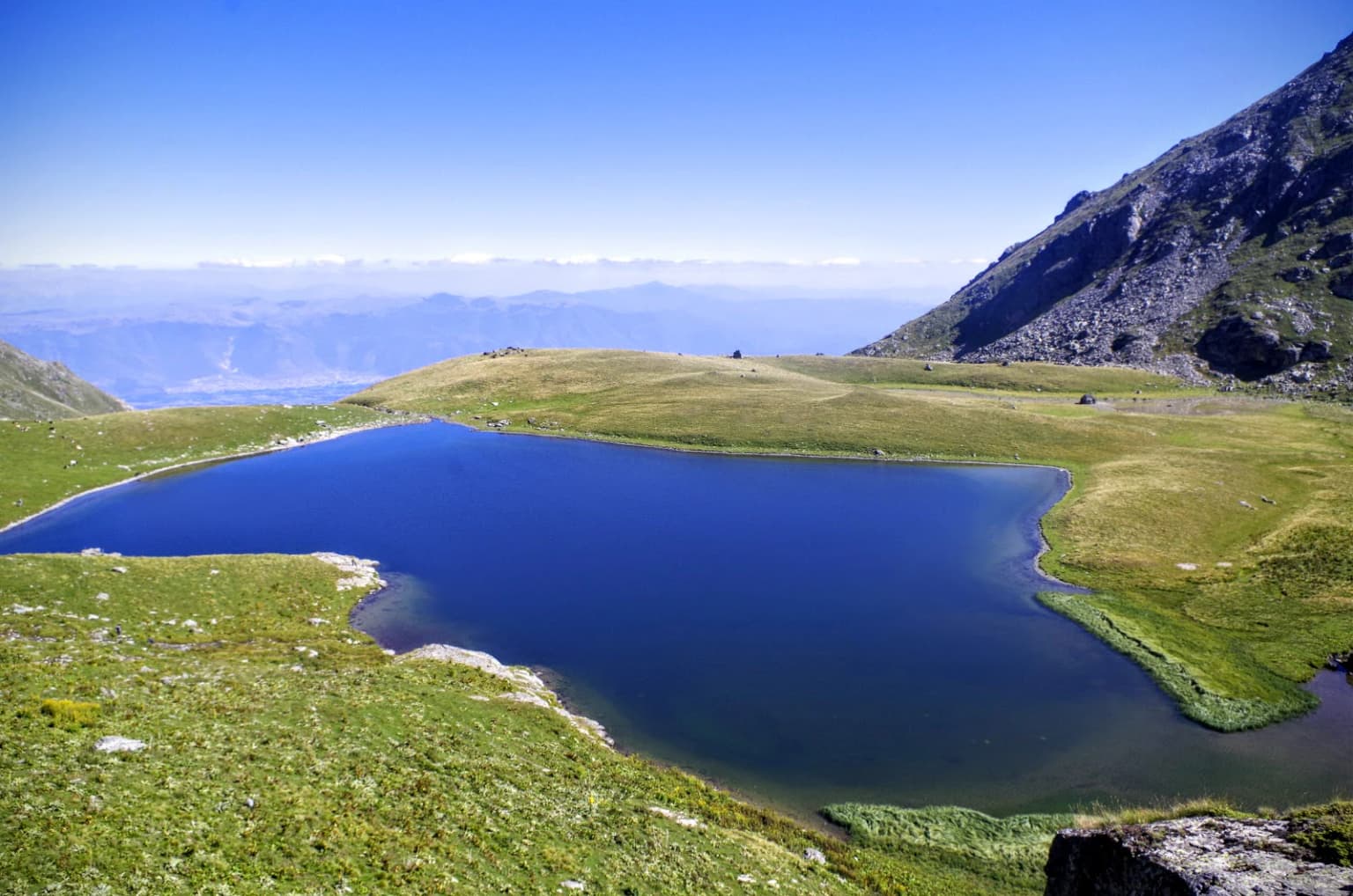
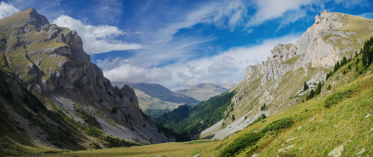
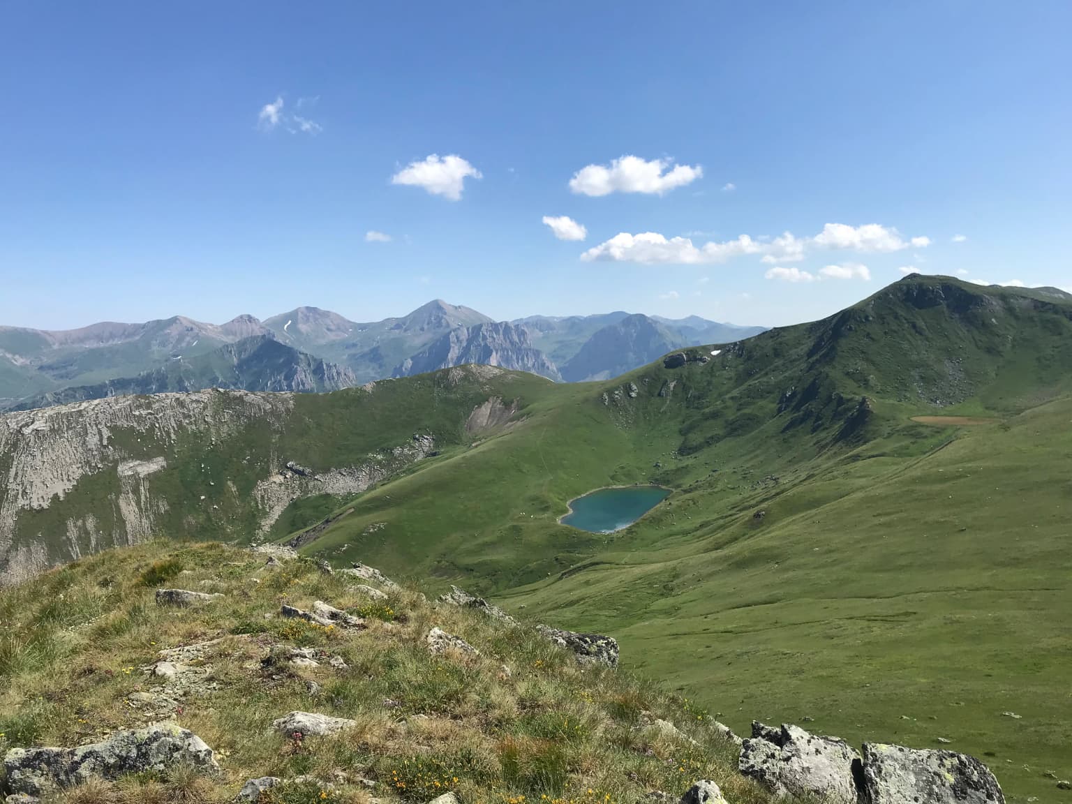
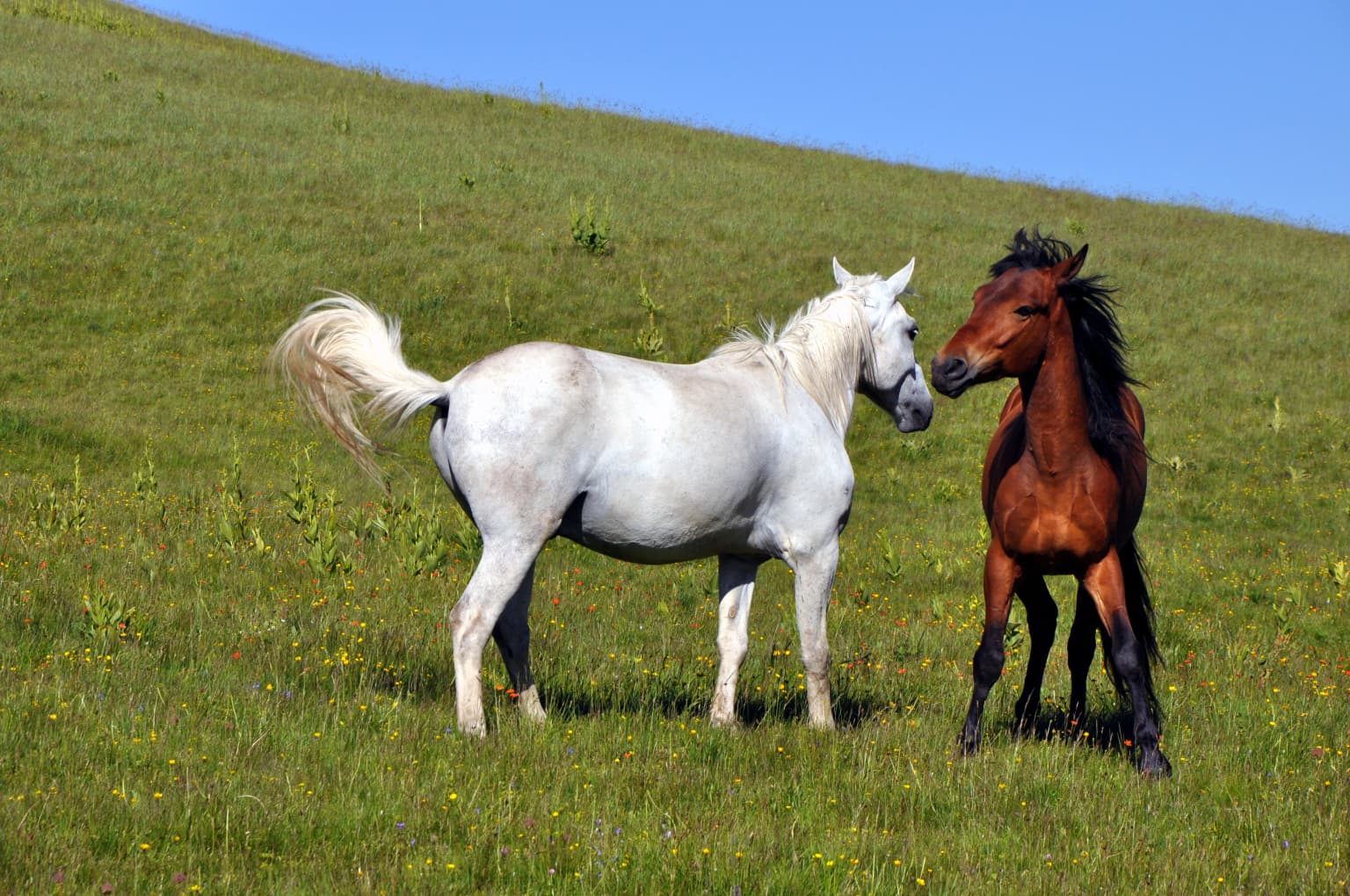
Šar Planina is best known for its dramatic alpine scenery, extensive glacial lake systems, and status as a critical refuge for the endangered Balkan lynx. The mountain range holds the densest concentration of peaks over 2,000 meters in North Macedonia, creating a rugged landscape of sharp ridges, deep valleys, and open alpine meadows. The park's 29 glacial lakes, including Bogovińsko Еzero, Crno Еzero, and Karanikoličko Еzero, are among its most distinctive features, sitting in glacial cirques beneath towering summits. The area is also renowned for the Šarplaninec, a historic shepherd dog breed named after the mountains that has been used for centuries to guard livestock against predators in these high-altitude pastures.

A clear blue glacial lake surrounded by grassy slopes and rocky mountains under a clear blue sky
Glacial Black Lake on Shar Mountain, North Macedonia

Šar Planina National Park history and protected-area timeline

The protection of Šar Planina has a long and complex history. Initial conservation efforts began in 1986, according to the International Union for Conservation of Nature, but the path to national park status took decades. After the breakup of Yugoslavia and North Macedonia's independence, a new initiative to protect the mountain was launched in 1997. However, this proposal was rejected during public hearings in 2000, before even reaching parliamentary consideration—a failure attributed to insufficient involvement of local municipal authorities in the planning phase and the absence of a public awareness campaign that might have built community support. A turning point came in April 2021, when a survey revealed that 82 percent of residents in the Šar Planina area favored national park designation. This groundswell of local support led to the Assembly of North Macedonia approving the declaration on June 30, 2021, with 66 votes in favor. The establishment marked North Macedonia's fourth national park and the first created after independence. In April 2024, the park administration reported that over 400 hectares of forest were burned within the protected area in a single month, highlighting ongoing conservation challenges.

Šar Planina National Park landscape and geographic character

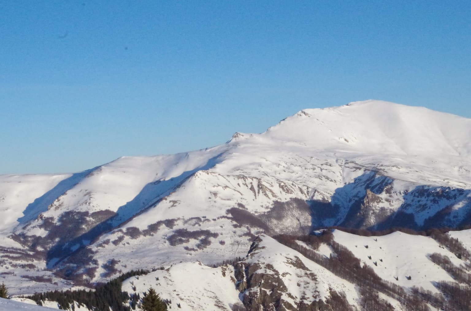
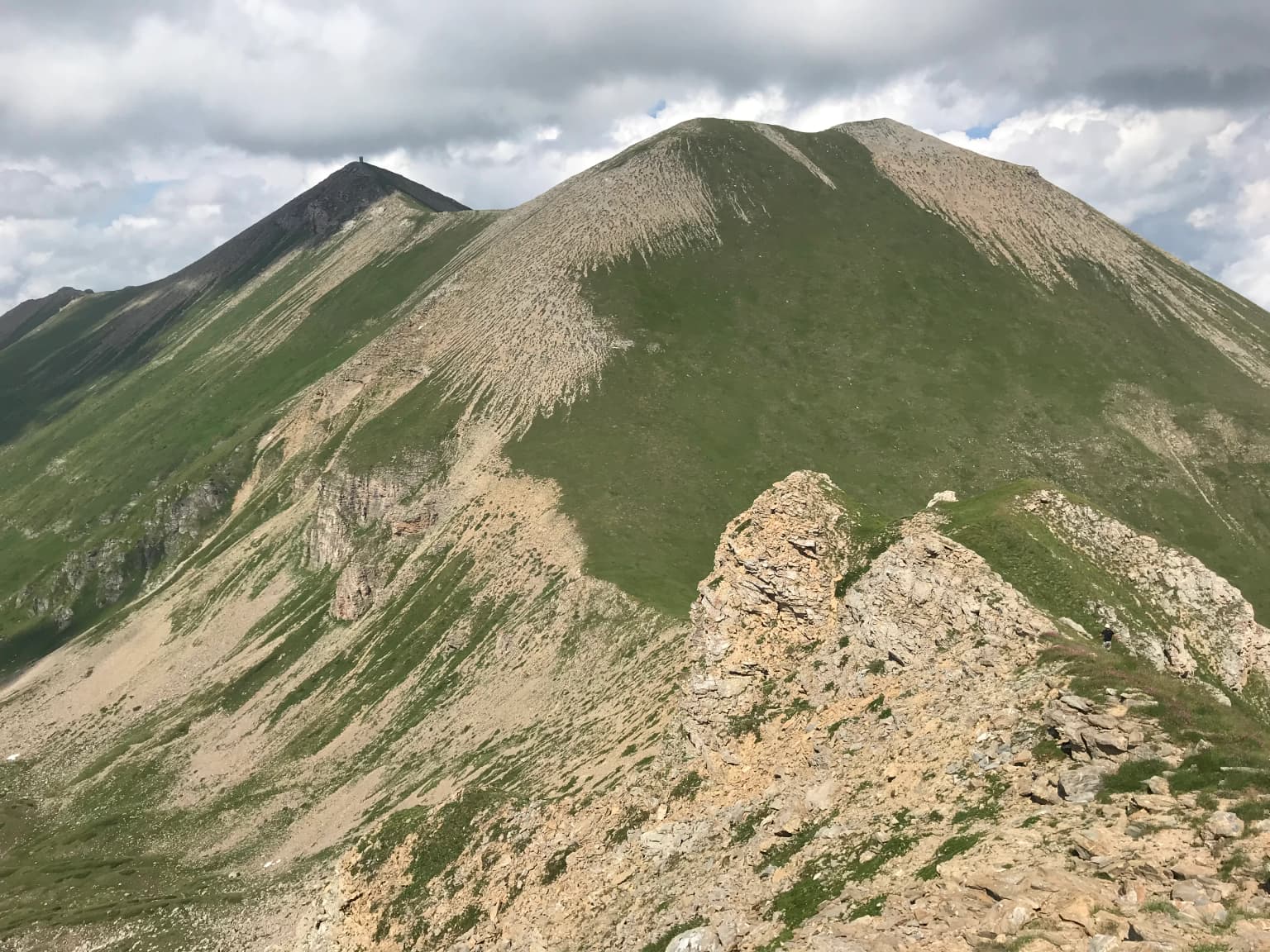
The Šar Planina landscape is defined by its dramatic alpine character and geological complexity. The mountain range is composed primarily of Paleozoic metamorphic rocks with varying resistance, which has influenced the formation of its distinctive relief. Glacial and fluvial erosion has created an area characterized by high valley density and short plateaus intersected by limestone, quartzite, and granitoid ridges. The range features approximately 220 peaks exceeding 2,000 meters, with the highest being Titov Vrv at 2,748 meters, followed by Mali Turčin (2,702m), Bazard (2,700m), and Ljuboten (2,499m). The alpine zone above 2,000 meters features exposed rock, glacial cirques, and permanent snowfields, while lower elevations support forested slopes and alpine meadows. The park contains 29 permanent glacial lakes, the highest concentration in North Macedonia, concentrated in the central and higher regions of the range. Numerous rivers carved by intense vertical erosion have formed narrow canyon segments in the upper reaches, with the mountain's drainage feeding into the Vardar River basin.

Snow-covered mountain peaks in Šar Mountains range with clear blue sky
Snow-covered peaks of Šar Mountains under clear blue sky

Šar Planina National Park ecosystems, habitats, and plant life

The Šar Planina ecosystem exhibits remarkable biodiversity across its elevation gradients. The forest zone features deciduous, broadleaf, coniferous, and mixed forests, with beech, oak, chestnut, maple, and hornbeam dominating the lower slopes below approximately 1,500 meters. Above the deciduous zone, a narrower belt of coniferous forest contains spruce and fir, along with endemic and relict species including the Bosnian pine and Macedonian pine. High-altitude pastures cover approximately 45,000 hectares above the tree line, supporting diverse grassland communities that extend to the highest summits. The region's biodiversity is substantial: 662 diatom species, 1,260 vascular plant species, more than 260 moss species, 500 fungi species, and 160 lichen species have been documented within the park boundaries. The area falls within the Balkan mixed forests ecoregion of the Palearctic temperate broadleaf and mixed forest biome.

Panoramic view of mountain valley with rocky peaks, green slopes, and blue sky with scattered clouds
Panoramic view of Bozovska River valley in Gornja Lešnica, Šar Planina National Park

Šar Planina National Park wildlife and species highlights

Šar Planina supports a rich vertebrate fauna across its diverse habitats. The mammal population includes 51 documented species, with the critically endangered Balkan lynx being the most significant—this elusive predator inhabits the high forest zones, particularly in mixed deciduous forests and rocky areas in the Ruševica gorge. Other notable mammals include the brown bear, wolf, wildcat, otter, wild boar, chamois, roe deer, red fox, and badger, along with several mustelid species. The avifauna is represented by 128 bird species, with particularly important populations of raptors including the golden eagle, bearded vulture, kite, and peregrine falcon. The open high-altitude terrain provides habitat for alpine bird species such as the red-billed chough, yellow-billed chough, alpine chough, alpine accentor, and snow bunting. The park's freshwater systems support five fish species, including the Macedonian trout, while 11 amphibian and 17 reptile species have been recorded, including the globally endangered nose-horned viper which receives strict protection within the park.

Grassy mountain slope with rocky outcrops, a small lake in the valley, and distant mountain peaks under a clear blue sky with scattered clouds
View of Karanikola Lake from Karanikola Summit

Šar Planina National Park conservation status and protection priorities

Šar Planina National Park represents a critical conservation priority for the Balkans and Europe as a whole. The protected area safeguards one of the last strongholds of the Balkan lynx, a subspecies classified as critically endangered with only an estimated 50-100 individuals remaining in the wild, primarily concentrated in these mountainous border regions between North Macedonia, Albania, and Kosovo. The park's four-zone management system balances strict protection of the most sensitive areas with sustainable use of cultural landscapes and development zones around the Popova Šapka ski resort. Beyond species protection, the area preserves important forest ecosystems, glacial lake systems, and geological formations that represent unique examples of Balkan alpine environments. The establishment of this national park fulfills North Macedonia's commitments to expand its protected area network and provides a framework for sustainable management of the mountain's natural resources while supporting local communities.

Šar Planina National Park cultural meaning and human context

The Šar Planina landscape is deeply intertwined with human history and traditional practices that have shaped the region for centuries. Within the park boundaries lie 27 villages with approximately 17,000 residents, whose ancestors have practiced pastoralism and agriculture in these mountain valleys for generations. Traditional high-altitude pastoralism remains important, with summer pastures supporting livestock grazing that has influenced the open alpine meadows visible today. The area is home to diverse communities across its seven municipalities, each contributing to the region's cultural fabric. The Šarplaninec, a distinctive shepherd dog breed named after these mountains, represents a cultural heritage that has spread beyond the region—this robust breed has been used for centuries to protect livestock from wolves and bears in these rugged highlands and has become recognized internationally. The proposed road connection between Tetovo and Prizren through the park, advocated by both North Macedonia and Kosovo governments, reflects ongoing tensions between development pressures and conservation values in this transboundary mountain region.

Two horses, one white and one brown, standing close together in a grassy field under clear blue sky
Two horses grazing in Šar Planina National Park meadows

Top sights and standout views in Šar Planina National Park

Šar Planina National Park offers exceptional alpine wilderness with nearly 220 peaks exceeding 2,000 meters, the highest concentration in North Macedonia. The park protects 29 glacial lakes, the "Šar's Eyes," scattered through dramatic cirques beneath towering summits. The area serves as a crucial refuge for the endangered Balkan lynx, symbol of the park. Titov Vrv, the highest peak at 2,748 meters, dominates a landscape of sharp ridges, deep valleys, and open alpine meadows. Four protection zones manage approximately 627 km² of mountain terrain, balancing strict preservation with sustainable use around the Popova Šapka ski resort. The mountain's geological diversity includes limestone, quartzite, and granitoid formations carved by glacial and fluvial processes. Rich biodiversity spans from deciduous forests through coniferous zones to alpine pastures, supporting 51 mammal species and 128 bird species.

Two prominent mountain peaks with rocky slopes and green vegetation under a partly cloudy sky
View of Small Turk and Titov Vrv peaks in Šar Planina National Park

Best time to visit Šar Planina National Park

The best time to visit Šar Planina depends on intended activities and tolerance for varying conditions. Summer months from June through September offer the most accessible period for hiking and exploration, with warm temperatures in the valleys and alpine meadows in full bloom, though afternoon thunderstorms are common. The ski season at Popova Šapka runs from December through March, making winter suitable for skiing and winter sports. Spring and autumn provide transitional conditions—autumn often brings stable weather and colorful foliage in the lower forests, while spring sees snowmelt feeding the glacial lakes and waterfalls. The high-altitude zones remain cold even in summer, and conditions can change rapidly throughout the year. Those seeking to observe wildlife may find different opportunities across seasons, with larger mammals more active during cooler periods.

Park location guide

Geography guide, regional context, and park location map for Šar Planina National Park

Šar Planina National Park park geography, regions, and map view in North Macedonia
Understand where Šar Planina National Park sits in North Macedonia through a broader geographic reading of the surrounding landscape, nearby location context, and its mapped position within the national park landscape.

How Šar Planina National Park fits into North Macedonia

North Macedonia is a landlocked country in Southeast Europe, constituting the northern third of the historical region of Macedonia. It gained independence from Yugoslavia in 1991 and operates as a unitary parliamentary republic. The country is known for its diverse ethnic composition, with Macedonians forming the majority and Albanians as a significant minority, along with Turks, Roma, Serbs, and other groups.

Wider geography shaping Šar Planina National Park in North Macedonia

North Macedonia is located in the central part of the Balkan Peninsula in Southeast Europe. It is landlocked, bordered by Greece to the south, Albania to the west, Bulgaria to the east, Kosovo to the northwest, and Serbia to the north. The terrain varies from mountainous regions to valleys and plains.

Map view of Šar Planina National Park

Use this park location map to pinpoint Šar Planina National Park in North Macedonia, understand its exact geographic position, and read its mapped placement within the surrounding landscape more clearly.

Pigeon | © OpenStreetMap contributors

Discover the Dramatic Terrain, Glacial Lakes, and Protected Habitats of North Macedonia's Šar Planina

Šar Planina National Park Photos: Explore Alpine Landscapes, Glacial Lakes, and Mountain Scenery
Browse an extensive collection of Šar Planina National Park imagery to understand its dramatic alpine landscapes, high mountain peaks, and distinct glacial lake systems. These protected area views provide essential visual context for the park's diverse habitats, from rugged cirques to dense forest zones, revealing the unique character of North Macedonia's newest national park.

A clear blue glacial lake surrounded by grassy slopes and rocky mountains under a clear blue sky

Snow-covered mountain peak with clear blue sky

Snow-covered mountain peaks in Šar Mountains range with clear blue sky

Panoramic view of mountain valley with rocky peaks, green slopes, and blue sky with scattered clouds

Grassy mountain slope with rocky outcrops, a small lake in the valley, and distant mountain peaks under a clear blue sky with scattered clouds

Grassy and rocky mountain slopes with distant peaks under a clear blue sky

Two horses, one white and one brown, standing close together in a grassy field under clear blue sky

Two prominent mountain peaks with rocky slopes and green vegetation under a partly cloudy sky

Panoramic view of forested hills and mountain peaks under a partly cloudy sky

Wide aerial view of snow-covered mountain peaks with clouds below

Mountain landscape view showing multiple peaks under blue sky with scattered clouds

Grassy terrain with scattered rocks and a rocky cliff face under an overcast sky

Grassy mountain slope with a small lake in the foreground under a partly cloudy sky

A waterfall flows through a rocky mountain valley with sparse trees and autumn-colored vegetation.

Mountain landscape with prominent peak, green valley below, and red speed limit sign in foreground

A river with flowing water surrounded by rocky terrain and dense green forest in a mountainous valley

Park atlas

Trace the regional spread of protected landscapes, comparing adjacent national park geography and Balkan mountain ranges.

Continue Exploring Protected Areas: Discover National Parks Beyond Šar Planina National Park
Browse nearby protected areas and national parks that share geographic features or are situated in the broader region surrounding Šar Planina National Park. Compare diverse protected landscapes and understand the wider network of conservation efforts across similar Balkan mountain ecosystems, extending your atlas-style exploration.
Watercolor painting of rolling mountains with green forests and pastel-colored hills
National parkKosovo

Sharr Mountains National Park: Kosovo's Alpine Protected Landscape and Geographic Atlas

Explore its dramatic peaks and glacial terrain.

Sharr Mountains National Park in Kosovo is a prime example of dramatic alpine topography, featuring jagged peaks, steep glacial valleys, and clear evidence of ancient glacial shaping. This protected area safeguards critical ecosystems, including extensive old-growth forests and diverse alpine meadows, supporting notable wildlife conservation efforts. Its scenic ridgelines, glacial lakes, and mountain streams define the park's natural landscape, offering rich context for atlas-based geographic discovery within the Balkans.

IUCN
II
Relief
Mountain
Scope
Terrestrial
National park

Mavrovo National Park: North Macedonia's Extensive Protected Alpine Terrain and Wildlife

Mapped geography of Alpine peaks, gorges, and unique endemic species.

Mavrovo National Park, North Macedonia's largest protected area, offers a deep dive into a complex Alpine geography. Dominated by the Šar, Korab, and Bistra mountain systems, the park features towering peaks and the dramatic Radika River gorge. This protected landscape is globally significant for its role in conserving the rare Balkan lynx and harbors endemic tertiary relic plant species like Macedonian pine. Explore the mapped boundaries, glacial lakes, and distinct terrain that define this vital conservation area.

Area
730.88 km²
Established
1949
IUCN
II
Relief
Mountain
Watercolor illustration of rolling green hills and distant mountains under a soft sky
National parkDibër County

Lurë-Dejë Mountain National Park: Mapped Protected Landscape and Glacial Lake Geography

Dibër County's alpine protected area with unique glacial lakes.

Delve into the detailed geographic context and mapped protected area of Lurë-Dejë Mountain National Park, an essential natural landscape in Albania's Dibër County. This park is renowned for its rare chain of twelve glacial lakes, situated at high elevations amidst dramatic alpine terrain. Its protected status ensures the preservation of significant old-growth forest ecosystems, including the critically endangered Balkan pine, contributing to its recognition as an Important Bird and Plant Area. Explore the park's distinctive terrain, from its soaring mountain peaks to its unique alpine meadows, all within a comprehensive geographic atlas framework.

Area
202.42 km²
Established
1966
IUCN
II
Relief
Mountain
Watercolor painting of green mountains, forests, and fields under a light sky
National parkKosovo

Bjeshkët e Nemuna National Park: Kosovo's Largest Alpine Protected Landscape

Explore dramatic mountains, glacial lakes, and diverse ecosystems.

Delve into the protected geography of Bjeshkët e Nemuna National Park, Kosovo's expansive national park located in the Accursed Mountains. This atlas entry details its significant alpine terrain, from dense forests to high-altitude meadows, and highlights the presence of glacial lakes like Liqenat. Understand its role as a vital conservation corridor and a key component of the Balkan's natural heritage.

Area
630.28 km²
Established
2012
IUCN
II
Relief
Mountain
Watercolor painting showing a mountainous landscape with a lake, green hills, and pink flowers
National park

Alps of Albania National Park: Explore Albania's Largest Protected Alpine Wilderness

Dramatic karst, glacial valleys, and high-altitude ecosystems await.

The Alps of Albania National Park offers an expansive view into one of the Balkans' most significant mountain protected areas. This national park encompasses a spectacular landscape characterized by towering limestone peaks, deep glacial valleys carved over millennia, and intricate karst formations like Grunas Canyon. Its pristine wilderness protects diverse high-altitude ecosystems and unique geological features, serving as a key destination for understanding regional geography and protected landscapes.

Area
828.447 km²
Established
2022
IUCN
II
Relief
Mountain
Watercolor illustration of mountains, a lake, and rolling hills with grassy vegetation.
National parkElbasan County

Shebenik National Park: Mapped Protected Landscape and Glacial Terrain Atlas

Explore Elbasan County's significant mountain wilderness and protected natural features.

Shebenik National Park is a protected national park in Elbasan County, Albania, notable for its dramatic glacial terrain and extensive ancient forests. This park offers a deep dive into Albania's natural landscape, featuring 14 glacial lakes and serving as vital habitat. Its position within the Balkan Peninsula's geography makes it a key point of reference for understanding protected areas and mountain wilderness within a structured atlas.

Area
345.079 km²
Established
2008
IUCN
II
Relief
Mountain
National park

Dajti Mountain National Park: Albania's Accessible Protected Mountain Landscape for Geographic Discovery

Explore the mapped terrain and diverse ecosystems of this significant national park.

Dajti Mountain National Park is a prime example of a protected mountain landscape central to Albania's geography. Situated near Tirana, its rugged karst topography, steep limestone ridges, and varied elevation create distinct ecological zones. This atlas-focused entry details the park's terrain, notable geological features like Pellumbas Cave, and its role as a significant protected area offering rich mapped landscape context.

Area
293.84 km²
Established
1966
IUCN
II
Relief
Mountain
Watercolor painting of a landscape with green trees, rolling hills, and distant mountains under a light sky
National parkMunicipality of Bitola

Pelister National Park: North Macedonia's Oldest National Park and Alpine Protected Landscape

Explore unique glacial features and endemic forests within Municipality of Bitola.

Pelister National Park, a pioneering protected area in North Macedonia, offers a rich tapestry of alpine geography and unique geological formations. This page provides detailed information on the park's landscape, including its dramatic mountain massif within Municipality of Bitola, the rare Macedonian pine forests, the striking 'stone rivers' formed by ancient glacial processes, and the serene Pelister Eyes glacial lakes. Discover the park's mapped boundaries and its significance as a conservation heritage site within the Balkan Peninsula.

Area
171.5 km²
Established
1948
IUCN
II
Visitors
30K annual

Common questions about visiting, size, designation, and location context for Šar Planina National Park

Šar Planina National Park FAQs for park facts, access, geography, and protected area context
Find quick answers about Šar Planina National Park, including protected-area facts, park geography, trail and visitor context, and how the park fits into its surrounding country and regional landscape.
MoriAtlas Explorer

Continue Your Protected Areas Search Across the Global Atlas

Deepen your exploration by continuing the structured search for national parks and protected areas worldwide. Utilize the comprehensive filtering capabilities to compare different conservation landscapes and refine your understanding of global park geography. Discover more about the distribution and characteristics of protected natural areas.

Global natural geography