Mori Atlas logo
National parkShebenik National Park

Discover the mapped boundaries and rich geography of one of Albania's significant protected mountain areas.

Shebenik National Park: Dramatic Glacial Landscape and Protected Mountain Wilderness in Elbasan County

(Parku Kombëtar i Shebenikut)

Shebenik National Park, located in Elbasan County, Albania, represents a vital protected mountain landscape of approximately 34,500 hectares. This park encompasses the Shebenik and Jabllanica massifs, characterized by striking glacial valleys, 14 high-elevation glacial lakes, and extensive ancient forests. As a key component of the Balkan Peninsula's atlas, Shebenik National Park offers deep insights into dramatic natural terrain, protected land distribution, and its role as critical habitat for rare wildlife, providing a unique focus for geographic discovery.

National ParkAlbaniaGlacial LakesOld-Growth ForestsBalkan LynxEuropean Green Belt
Stylized illustration of a mountainous landscape featuring a waterfall, lake, and dense forest

Shebenik National Park

National park

Park overview

Structured park overview, official facts, and landscape profile for Shebenik National Park

Shebenik National Park park facts, protected area profile, and essential visitor context
Review the core facts for Shebenik National Park, including designation, size, terrain, visitor scale, habitats, and operating context in one park-focused overview.

About Shebenik National Park

Shebenik National Park occupies a significant position in eastern Albania's mountainous border region, forming part of the Southern European Green Belt that spans the former Iron Curtain divide. The park's landscape bears the unmistakable imprint of glacial activity from the last ice age, with u-shaped valleys, cirques, and moraines shaping the terrain around the Shebenik and Jabllanica massifs. The area receives substantial precipitation, with annual rainfall between 1,300 and 1,800 millimeters, creating lush forests and feeding the park's network of glacial lakes and rivers. The park encompasses a remarkable altitudinal range that supports diverse ecosystems, from montane forests through subalpine meadows to alpine zones. Its position along the border creates an important ecological corridor allowing species movement between the Balkan Peninsula's major mountain systems. The park is among Albania's newest protected areas, established in 2008, and represents the country's commitment to preserving its high-nature-value mountain landscapes for future generations.

Quick facts and research context for Shebenik National Park

Shebenik National Park covers 34,507.9 hectares in Elbasan County, eastern Albania, along the North Macedonia border. The park features elevations from 300 to over 2,200 meters, with 14 glacial lakes above 1,500 meters. It contains diverse forests including European beech, silver fir, Bosnian pine, and Macedonian pine, as well as alpine meadows. The park is part of the UNESCO World Heritage-listed Ancient and Primeval Beech Forests of the Carpathians and Other Regions of Europe, and forms a key section of the European Green Belt. Management is handled by the Elbasan Protected Areas Administration based in Librazhd.

Park context

Deeper park guide and search-rich context for Shebenik National Park

Shebenik National Park history, landscape, wildlife, and travel context
Explore Shebenik National Park through its history, landscape character, ecosystems, wildlife, conservation priorities, cultural context, and seasonal travel timing in a structured park guide built for atlas discovery and search intent.

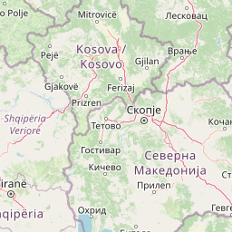
Why Shebenik National Park stands out

Shebenik National Park is best known for its population of the critically endangered Balkan lynx, one of the rarest cats in Europe. The park's dramatic glacial landscape, with its u-shaped valleys, cirque glaciers, and pristine mountain lakes, represents some of the most rugged terrain in Albania. Its ancient beech forests, recognized as part of a UNESCO World Heritage Site, and the presence of other endangered species including brown bears and gray wolves, make it a flagship conservation area for the Balkan Peninsula.

Eurasian lynx with tufted ears and brown fur sitting among green foliage
Eurasian lynx (Lynx lynx) in Shebenik National Park forest habitat

Shebenik National Park history and protected-area timeline

Shebenik National Park was officially established on May 21, 2008, through Government Decision No. 640, designating it as a National Park with high ecotourism values in accordance with international conventions for expanding protected areas. In January 2022, the park was expanded from 33,894.25 hectares to its current extent of 34,507.9 hectares. The park includes the Rajca Nature Reserve within its boundaries, strengthening its conservation framework. Management is provided by the Elbasan Protected Areas Administration, based in the town of Librazhd with a staff of approximately 15 forest specialists and biologists. The establishment of this protected area reflects Albania's broader environmental policy of creating a coherent network of national parks that protect the country's most significant natural landscapes and biodiversity hotspots.

Shebenik National Park landscape and geographic character

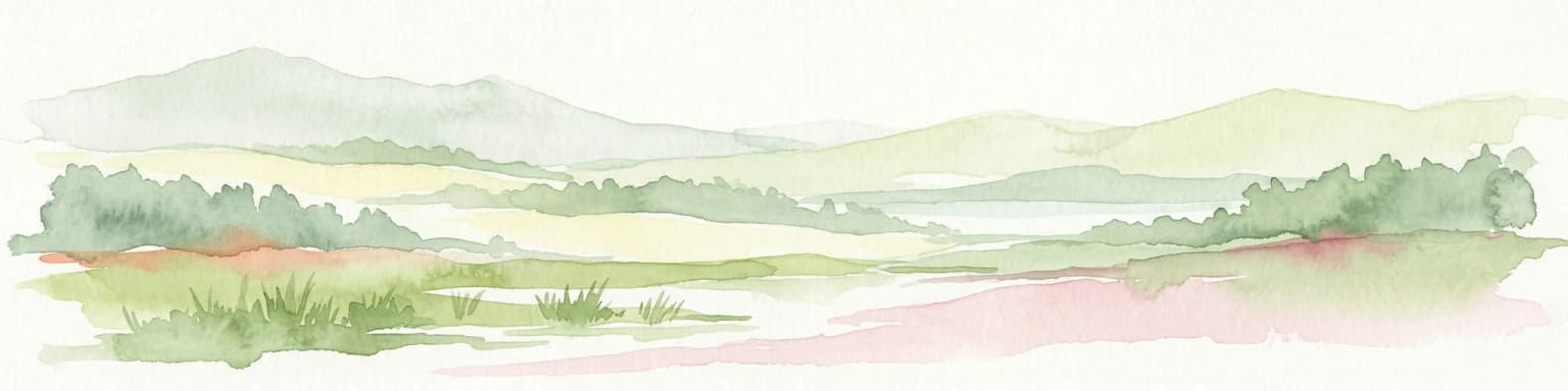
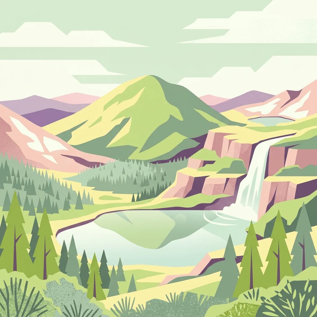
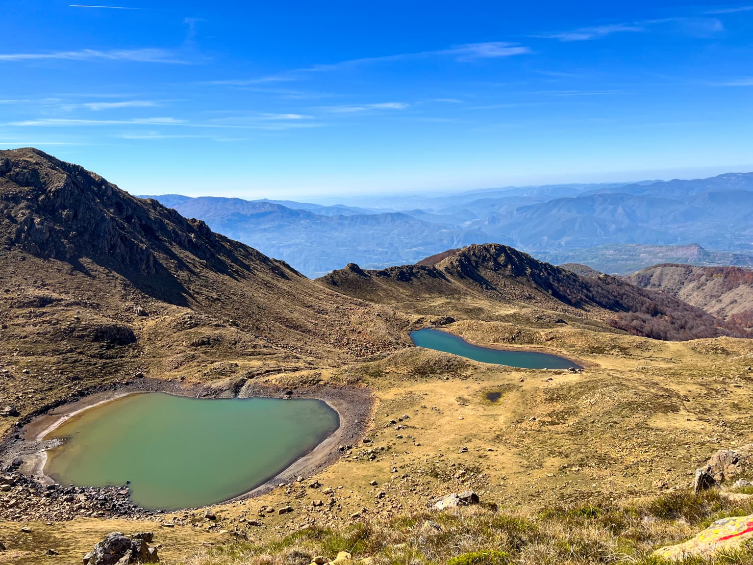
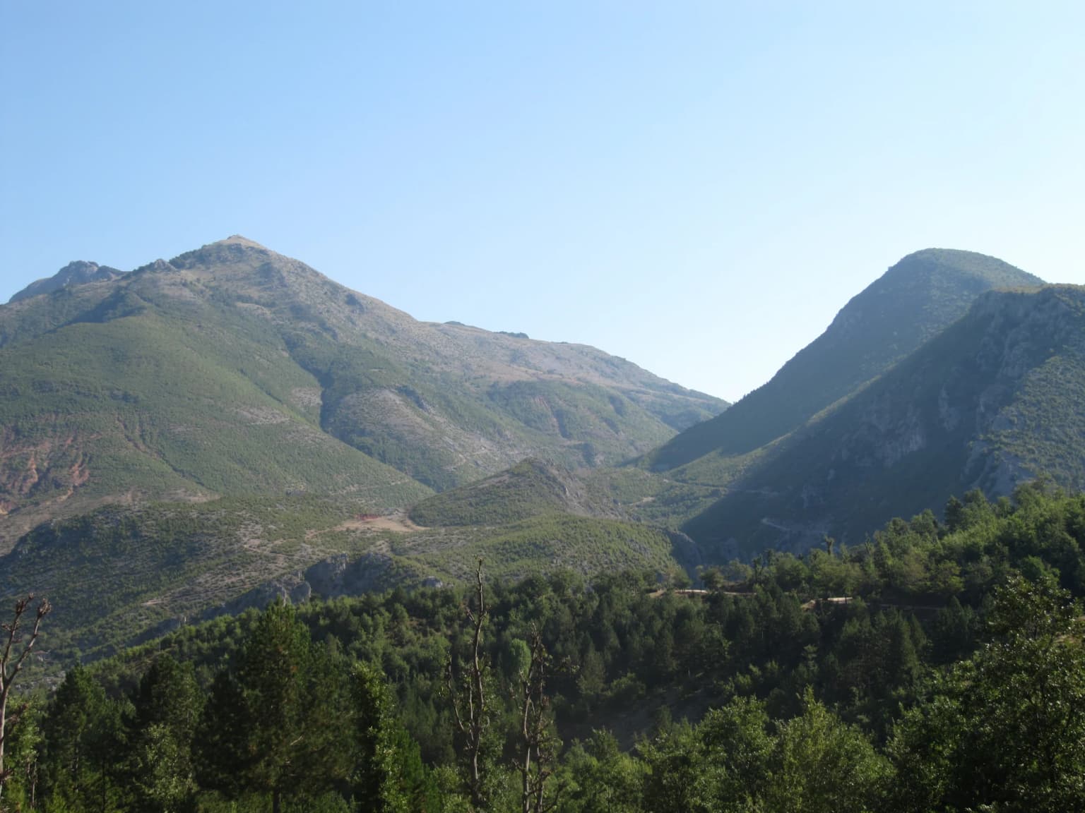
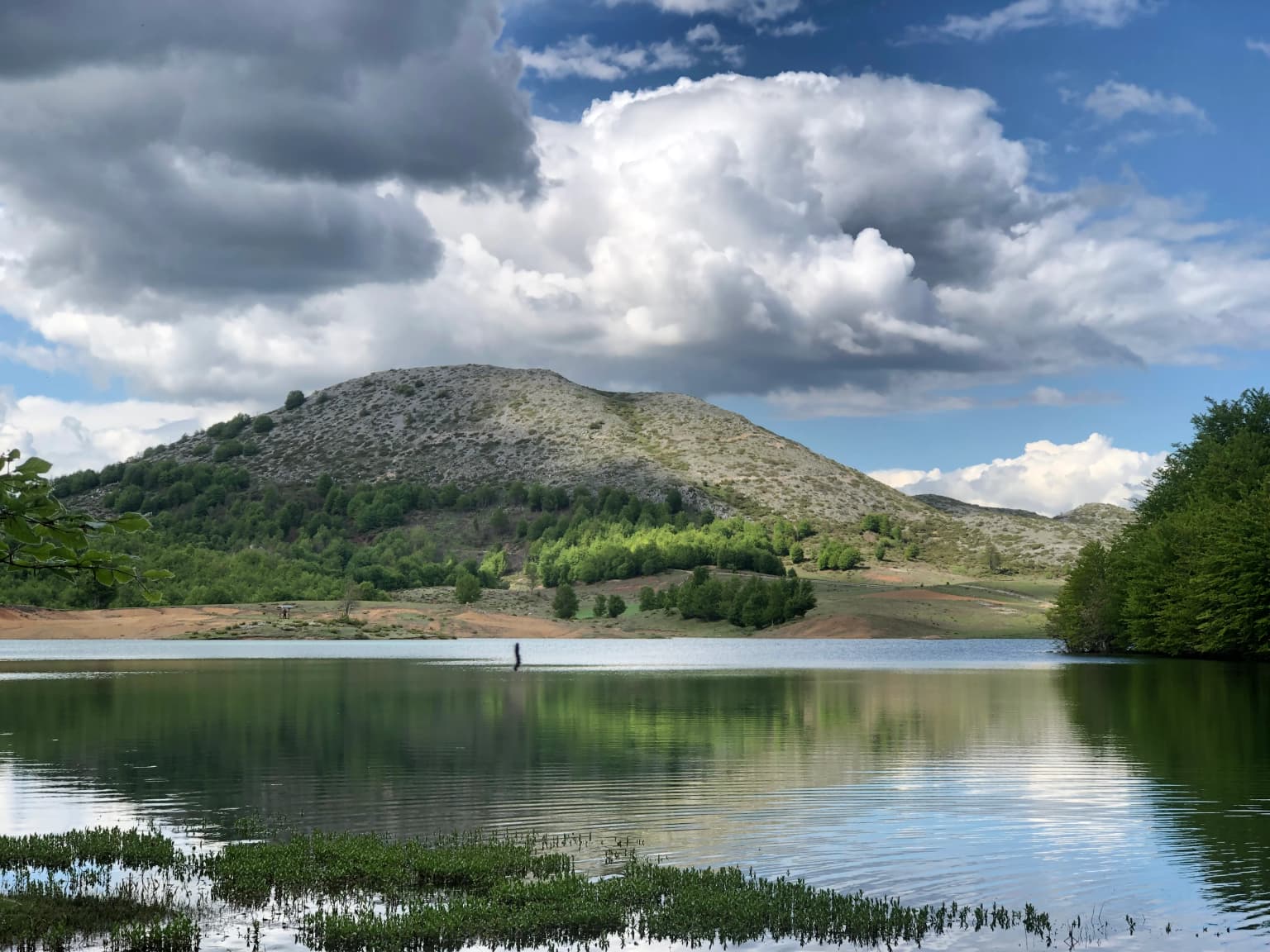
The park's landscape is defined by the dramatic mountainous terrain of the Shebenik and Jabllanica massifs, which rise steeply from the surrounding valleys. These mountains were carved into their present form by the glaciers of the Quaternary glaciation, leaving behind characteristic u-shaped valleys, cirques, and glacial moraines. The park contains 14 glacial lakes, the highest situated between 1,500 and 1,900 meters above sea level, formed in glacial depressions and now supporting unique aquatic ecosystems. Two main rivers, Qarrishte and Bushtrice, each approximately 22 kilometers long, flow through the park. The geology is complex, with the mountains formed during the Variscan orogeny and composed predominantly of ultramafic and metamorphic rocks, though calcareous rocks are common in the southern and southeastern sections. Above the forest belt, carbon and karst bedrock dominates, contributing to the region's fertility. The landscape transitions from dense forested slopes through open meadows and pastures to bare rock and alpine terrain at the highest elevations.

Mountainous landscape with two turquoise lakes surrounded by rocky hills under a clear blue sky
Panoramic view of Dragostunja Lakes within Shebenik-Jabllanicë National Park

Shebenik National Park ecosystems, habitats, and plant life

Phytogeographically, the park falls within the Dinaric Mountains mixed forests and Balkan mixed forests ecoregions of the Palearctic temperate broadleaf and mixed forest realm. The montane ecosystem displays remarkable diversity determined by topography, climate, hydrology, and geology, with altitudinal changes creating distinct vegetation zones. The forest ecosystem covers extensive areas, extending to higher elevations particularly along valleys and watercourses. The forests are characterized by European beech as the dominant deciduous species, with conifers including European silver fir, Bosnian pine, and Macedonian pine interspersed throughout. The ancient beech forests, largely intact due to their inaccessibility, are part of a transboundary UNESCO World Heritage Site encompassing similar forests across Europe. Below the forest canopy, a rich understory develops with species such as manna ash, common hazel, and cade juniper. The park's varied habitats support numerous endemic species of plants, mammals, and fungi.

Mountainous landscape with green forests, hills, and clear blue sky
Mountainous valley with dense forests and rolling hills in the periphery of Shebenik National Park

Shebenik National Park wildlife and species highlights

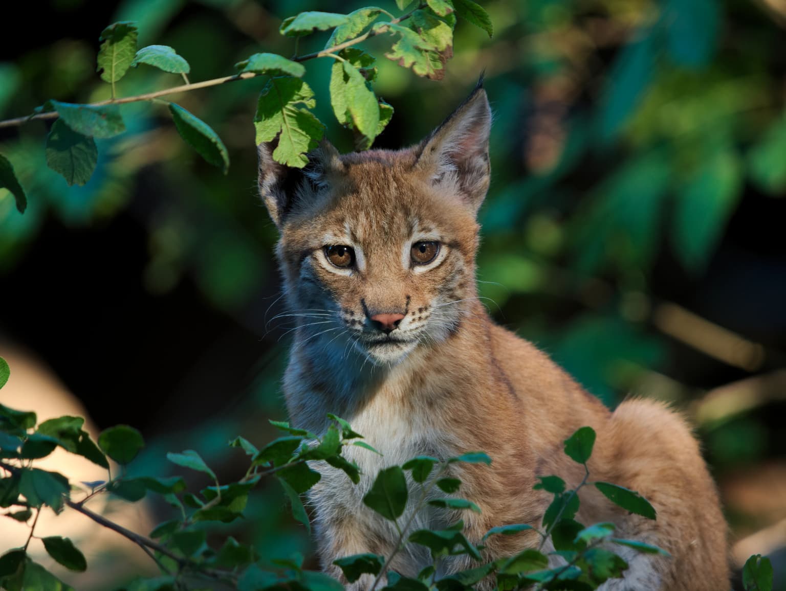
The fauna of Shebenik National Park is varied and largely typical of Southern European mountain ecosystems, with approximately 30 mammal species and over 88 bird species recorded. The park serves as an important ecological corridor for numerous endangered species. Most significantly, it contains one of the primary remaining ranges of the Balkan lynx, a subspecies of the Eurasian lynx and one of the rarest cats in Europe; the first photograph of a live Balkan lynx within the park was captured in April 2011. Other notable mammals include the brown bear, gray wolf, red deer, and roe deer, alongside smaller species such as red fox, least weasel, beech marten, stoat, and European badger. Bats are represented by 18 species. The avifauna includes the golden eagle found in rocky mountain areas, western capercaillie, hazel grouse, short-toed snake eagle, and peregrine falcon. The park also supports 10 amphibian species and 15 reptile species, including Hermann's tortoise, blue-throated keeled lizard, smooth snake, and dice snake.

A serene lake reflecting a mountain and cloudy sky, with vegetation along the shore
Lake of Fushë Studna in Shebenik National Park

Shebenik National Park conservation status and protection priorities

Shebenik National Park holds significant conservation importance at both national and international levels. The park has been designated as IUCN Category II (National Park), reflecting its primary objective of protecting natural ecosystems while allowing sustainable visitor use. Approximately 212,945 hectares of the broader region including the park are part of the UNESCO World Heritage Site of Ancient and Primeval Beech Forests of the Carpathians and Other Regions of Europe, recognizing the outstanding universal value of these old-growth forests. The park also forms a key component of the European Green Belt, the former Iron Curtain now transformed into a network of protected areas serving as refuge for endangered animal and plant species. The Shebenik, Jabllanica, and Rrajcë region has been recognized as an Important Plant Area of international importance by Plantlife. The park provides critical habitat for species that are becoming increasingly rare in Southern Europe, including the Balkan lynx, brown bear, and gray wolf.

Shebenik National Park cultural meaning and human context

The park's territory encompasses six communes (Rrajcë, Lunik, Qendër, Hotolisht, Qukës, and Steblevë) and approximately 12 villages, with the park's influence extending to a population of roughly 15,000 people. Traditional villages such as Llange feature characteristic stone houses and three-story structures, while the church of Koshorisht was built in a cave during the 2nd century BCE. The local communities maintain traditional cultural practices, including distinctive folk costumes and folk songs. Several traditional festivals are celebrated throughout the year, including the Dorezi festival, a major cultural event with traditional activities in natural settings, as well as celebrations in Steblevë, Qarrishtë, Rrajcë, and Lunik. The area has a long history of human settlement, with traditional land use practices shaping the landscape over centuries.

Top sights and standout views in Shebenik National Park

Shebenik National Park offers exceptional wilderness experiences centered on its dramatic glacial landscape and rare wildlife. The 14 glacial lakes, particularly Lake Fushë Studnë at high elevation, represent standout natural features. The ancient beech forests, recognized by UNESCO, provide extraordinary backcountry hiking through some of Europe'soldest trees. The park's significance as a stronghold for the critically endangered Balkan lynx makes it a priority destination for wildlife enthusiasts and researchers. The European Green Belt connection provides context for the park's role in broader continental conservation. Hiking trails marked throughout the park allow exploration of the mountainous terrain, though visitors are encouraged to contact the Librazhd Forest Directorate for guidance and maps.

Best time to visit Shebenik National Park

The park can be visited throughout the warmer months from May through October, when trails are accessible and the alpine meadows are in bloom. Summer months offer the best conditions for hiking and wildlife viewing, though afternoon thunderstorms are common in the mountains. Autumn provides spectacular fall color in the beech forests and offers good opportunities for observing wildlife as animals become more active before winter. The park experiences a continental climate with strong Mediterranean influences, with mean annual temperatures between 7°C and 10°C depending on elevation. Winter conditions are severe at higher elevations, with heavy snowfall making most of the park inaccessible. The shoulder seasons of late spring and early autumn generally offer the best combination of accessible conditions and comfortable temperatures for exploration.

Park location guide

Geography guide, regional context, and park location map for Shebenik National Park

Shebenik National Park park geography, regions, and map view in Albania
Understand where Shebenik National Park sits in Albania through a broader geographic reading of the surrounding landscape, nearby location context, and its mapped position within the national park landscape.

How Shebenik National Park fits into Albania

Albania is a unitary parliamentary republic in Southeast Europe, situated on the Balkan Peninsula along the Adriatic and Ionian coastal regions. With a population of approximately 2.4 million people, it borders Montenegro, Kosovo, North Macedonia, and Greece. The country features varied landscapes ranging from the Albanian Alps to fertile coastal plains, with Tirana as its capital and largest city.

Wider geography shaping Shebenik National Park in Albania

Albania occupies the western part of the Balkan Peninsula in Southeast Europe. The country features a varied terrain with rugged mountain ranges including the Albanian Alps (Accursed Mountains), Korab, Skanderbeg Mountains, Pindus, and Ceraunian Mountains. Fertile lowland plains extend along the Adriatic and Ionian coastal regions. The country borders Montenegro to the northwest, Kosovo to the northeast, North Macedonia to the east, and Greece to the south.

Map view of Shebenik National Park

Use this park location map to pinpoint Shebenik National Park in Albania, understand its exact geographic position, and read its mapped placement within the surrounding landscape more clearly.

Pigeon | © OpenStreetMap contributors

Location context for Shebenik National Park

Elbasan County

Browse comprehensive imagery revealing the park's dramatic glacial valleys, ancient forests, and alpine habitats.

Shebenik National Park Photos: Visual Exploration of Albania's Glacial Landscapes and Mountain Scenery
Visually explore the diverse landscapes of Shebenik National Park, including its dramatic mountain terrain, pristine glacial lakes, and extensive forests of beech, fir, and oak. These images provide essential insights into the park's unique protected-area character, ecological significance, and the habitats supporting species like the Balkan lynx.

Eurasian lynx with tufted ears and brown fur sitting among green foliage

Panoramic landscape of mountainous terrain with green slopes, rocky outcrops, and distant snow-capped peaks under a blue sky with scattered clouds

Mountainous landscape with two turquoise lakes surrounded by rocky hills under a clear blue sky

Mountainous landscape with green forests, hills, and clear blue sky

A serene lake reflecting a mountain and cloudy sky, with vegetation along the shore

Park atlas

Browse mapped protected landscapes, comparing regional park geography across Albania and the surrounding Balkan areas.

Discover Related National Parks and Protected Areas Near Shebenik National Park
Continue your exploration from Shebenik National Park by browsing other national parks and significant protected areas across Albania and the broader Balkan Peninsula. Compare diverse mountain wilderness, glacial lakes, and ancient forests to understand the regional spread of conservation landscapes and shared ecosystems.
National park

Dajti Mountain National Park: Albania's Accessible Protected Mountain Landscape for Geographic Discovery

Explore the mapped terrain and diverse ecosystems of this significant national park.

Dajti Mountain National Park is a prime example of a protected mountain landscape central to Albania's geography. Situated near Tirana, its rugged karst topography, steep limestone ridges, and varied elevation create distinct ecological zones. This atlas-focused entry details the park's terrain, notable geological features like Pellumbas Cave, and its role as a significant protected area offering rich mapped landscape context.

Area
293.84 km²
Established
1966
IUCN
II
Relief
Mountain
Watercolor painting of a river flowing through a valley with mountains and greenery
National parkKorçë County

Prespa National Park: Protected Landscape and High-Altitude Lakes in Korçë County, Albania

Explore the geography and mapped boundaries of this vital national park.

Prespa National Park, located in Korçë County, Albania, is a protected area characterized by its significant high-altitude tectonic lakes, dramatic mountain landscapes, and vital wetland habitats. This entry provides a structured atlas-style overview of the park's geographic identity, its protected landscape features, and its ecological importance, serving as a key point of reference for understanding this unique Balkan region.

Area
276.13 km²
Established
1999
IUCN
II
National park

Mavrovo National Park: North Macedonia's Extensive Protected Alpine Terrain and Wildlife

Mapped geography of Alpine peaks, gorges, and unique endemic species.

Mavrovo National Park, North Macedonia's largest protected area, offers a deep dive into a complex Alpine geography. Dominated by the Šar, Korab, and Bistra mountain systems, the park features towering peaks and the dramatic Radika River gorge. This protected landscape is globally significant for its role in conserving the rare Balkan lynx and harbors endemic tertiary relic plant species like Macedonian pine. Explore the mapped boundaries, glacial lakes, and distinct terrain that define this vital conservation area.

Area
730.88 km²
Established
1949
IUCN
II
Relief
Mountain
Watercolor painting showing mountains, a river, and vegetation
National park

Tomorr Mountain National Park: Sacred Peak & Karst Protected Landscape in Albania

Explore Albania's dramatic mountain geography and protected areas.

Tomorr Mountain National Park offers a unique exploration of southern Albania's dramatic limestone anticline. Dominated by the sacred Mount Tomorr and featuring the spectacular Osum Canyon, this national park provides insight into karst terrain, old-growth forests, and significant biodiversity. Discover its mapped boundaries and regional geographic context within the Pindus Mountains for structured atlas exploration.

Area
271.855 km²
Established
1956
IUCN
II
Relief
Mountain
Watercolor painting of a landscape with green trees, rolling hills, and distant mountains under a light sky
National parkMunicipality of Bitola

Pelister National Park: North Macedonia's Oldest National Park and Alpine Protected Landscape

Explore unique glacial features and endemic forests within Municipality of Bitola.

Pelister National Park, a pioneering protected area in North Macedonia, offers a rich tapestry of alpine geography and unique geological formations. This page provides detailed information on the park's landscape, including its dramatic mountain massif within Municipality of Bitola, the rare Macedonian pine forests, the striking 'stone rivers' formed by ancient glacial processes, and the serene Pelister Eyes glacial lakes. Discover the park's mapped boundaries and its significance as a conservation heritage site within the Balkan Peninsula.

Area
171.5 km²
Established
1948
IUCN
II
Visitors
30K annual
Watercolor illustration of rolling green hills and distant mountains under a soft sky
National parkDibër County

Lurë-Dejë Mountain National Park: Mapped Protected Landscape and Glacial Lake Geography

Dibër County's alpine protected area with unique glacial lakes.

Delve into the detailed geographic context and mapped protected area of Lurë-Dejë Mountain National Park, an essential natural landscape in Albania's Dibër County. This park is renowned for its rare chain of twelve glacial lakes, situated at high elevations amidst dramatic alpine terrain. Its protected status ensures the preservation of significant old-growth forest ecosystems, including the critically endangered Balkan pine, contributing to its recognition as an Important Bird and Plant Area. Explore the park's distinctive terrain, from its soaring mountain peaks to its unique alpine meadows, all within a comprehensive geographic atlas framework.

Area
202.42 km²
Established
1966
IUCN
II
Relief
Mountain
Watercolor painting showing hills, green fields, a body of water, and vegetation under a soft sky
National park

Divjakë-Karavasta National Park: Albania's Expansive Coastal Wetland and Pelican Breeding Site

Mapping Albania's largest Mediterranean lagoon and its vital bird sanctuaries.

Divjakë-Karavasta National Park is a key protected coastal wetland in western Albania, centered around Karavasta Lagoon, one of the largest in the Mediterranean. This Ramsar site provides critical habitats for numerous bird species, including a globally significant population of the endangered Dalmatian pelican, making it a premier destination for understanding regional wetland geography and protected area dynamics.

Area
222.3 km²
Established
2007
IUCN
II
Relief
Lowland
Watercolor painting of a landscape with green fields, scattered trees, and rolling hills under a light sky
National parkGjirokastër County

Fir of Hotovë-Dangëlli National Park: Ancient Forests & Mountain Wilderness Atlas

Explore a premier protected landscape in Gjirokastër County, Albania.

Fir of Hotovë-Dangëlli National Park stands as a monumental protected area, celebrated for its exceptional old-growth Hotova Fir forests, which are a rare Mediterranean plant relic. This national park in Gjirokastër County offers a detailed look at a vast mountainous terrain, featuring dramatic canyons like Lengarica Canyon, and serving as a critical habitat for diverse wildlife. MoriAtlas provides structured geographic context for this significant landscape, highlighting its mapped boundaries and role as a key component of regional protected area networks.

Area
360.038 km²
Established
2008
IUCN
II
Relief
Mountain

Common questions about visiting, size, designation, and location context for Shebenik National Park

Shebenik National Park FAQs for park facts, access, geography, and protected area context
Find quick answers about Shebenik National Park, including protected-area facts, park geography, trail and visitor context, and how the park fits into its surrounding country and regional landscape.
MoriAtlas Explorer

Continue Your Protected Areas Search Across the Global Atlas

Deepen your exploration by continuing the structured search for national parks and protected areas worldwide. Utilize the comprehensive filtering capabilities to compare different conservation landscapes and refine your understanding of global park geography. Discover more about the distribution and characteristics of protected natural areas.

Global natural geography