Mori Atlas logo
National parkPrespa National Park

Discover the mapped boundaries and ecological significance of this vital Albanian national park.

Prespa National Park: A Protected Landscape of High-Altitude Lakes and Mountain Terrain in Korçë County

(Parku Kombëtar i Prespës)

Prespa National Park represents a significant protected area within Albania's southeastern geography, encompassing portions of the Great Prespa and Small Prespa Lakes. Situated in Korçë County, this high-altitude natural sanctuary is renowned for its dramatic mountain terrain, including Mali i Thatë, and extensive wetland ecosystems. The park's unique tectonic lakes, among the highest in Southeast Europe, support critical biodiversity and offer a compelling subject for atlas-based geographic exploration.

Lake ParkTransboundary Protected AreaWetlandsRamsar SiteMountain ForestsPelicans
Illustration showing a lake with an island, surrounded by mountains and forests under a bright sky

Prespa National Park

National park

Park overview

Structured park overview, official facts, and landscape profile for Prespa National Park

Prespa National Park park facts, protected area profile, and essential visitor context
Review the core facts for Prespa National Park, including designation, size, terrain, visitor scale, habitats, and operating context in one park-focused overview.

About Prespa National Park

Prespa National Park represents one of Albania's most ecologically and culturally significant protected areas, spanning the southeastern border region where Albania meets Greece and North Macedonia. The park's core feature is its remarkable lake system—two interconnected tectonic lakes situated at approximately 850 meters elevation, making them the highest major lakes of their kind in the Balkans. Great Prespa Lake, the larger of the two, is shared between all three countries while Small Prespa Lake lies entirely within Albanian and Greek territory, draining into the Great Prespa through a narrow channel.

The park's physical geography encompasses remarkable diversity within a relatively compact area. The mountainous backbone of Mali i Thatë rises dramatically along the park's western boundary, separating the Prespa basin from the even older Lake Ohrid. This limestone mountain supports distinctive sub-alpine and alpine grasslands where the traditional Albanian mountain tea (Sideritis) is cultivated—a cultural practice intertwined with the landscape's identity. The eastern slopes transition into the Galičica mountain range on the North Macedonian side, creating a transboundary mountain landscape that has shaped both ecological processes and human settlement patterns for millennia.

The wetland ecosystem constitutes the park's most internationally significant feature. The extensive reed beds fringing both lakes create a complex aquatic environment supporting extraordinary biodiversity. These wetlands provide critical ecosystem services including water filtration, flood regulation, and carbon sequestration while serving as essential habitat for breeding, feeding, and migrating waterbirds. The lake waters themselves are fed primarily by underground karst springs and tributaries, emerging from the complex geological formations that characterize the broader region—a hydrological system that connects the Prespa basin to Lake Ohrid through subsurface channels passing beneath Mali i Thatë.

Beyond its natural values, Prespa National Park preserves a cultural landscape shaped by continuous human presence from the Neolithic period through classical antiquity and the medieval era. The ancient Via Egnatia passed through the broader region, and the park contains Byzantine churches, cave dwellings, and archaeological sites that document the long history of human interaction with this landscape. This blending of natural and cultural heritage contributes to the park's designation as a cultural landscape worthy of protection under both national and international frameworks.

Quick facts and research context for Prespa National Park

Prespa National Park covers 27,613 hectares in Korçë County, southeastern Albania, at elevations between 849 and 853 meters above sea level. The park protects two interconnected lakes—Great Prespa and Small Prespa—shared with North Macedonia and Greece, forming one of the Balkans' most significant transboundary wetland complexes. Forests dominate 13,500 hectares, while agricultural land accounts for 2,100 hectares and pastures approximately 1,828 hectares. The park falls within the Pindus Mountains mixed forests ecoregion of the Palearctic realm, supporting 1,130 plant species and 174 fungus species, with 60 species classified as rare or endangered. Designated in February 1999, the park serves as a critical ecological corridor connecting to Shebenik-Jabllanicë National Park and was recognized as a Ramsar Wetland in June 2013.

Park context

Deeper park guide and search-rich context for Prespa National Park

Prespa National Park history, landscape, wildlife, and travel context
Explore Prespa National Park through its history, landscape character, ecosystems, wildlife, conservation priorities, cultural context, and seasonal travel timing in a structured park guide built for atlas discovery and search intent.

Why Prespa National Park stands out

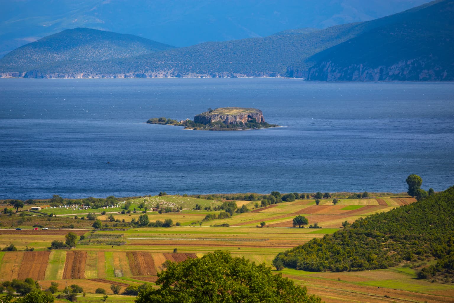
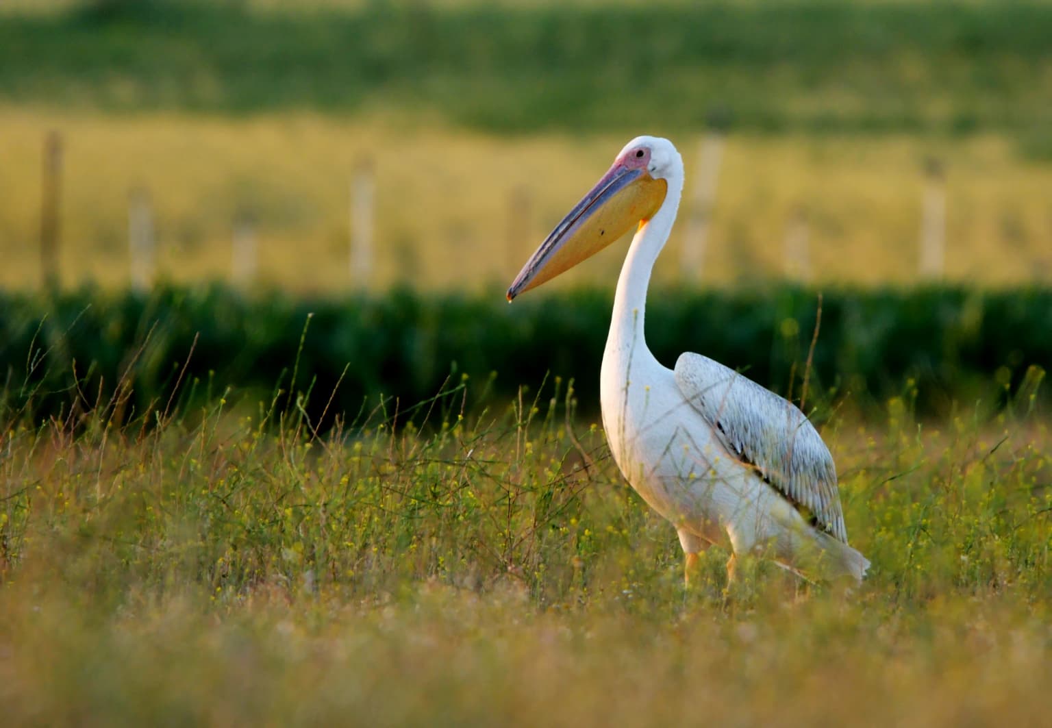
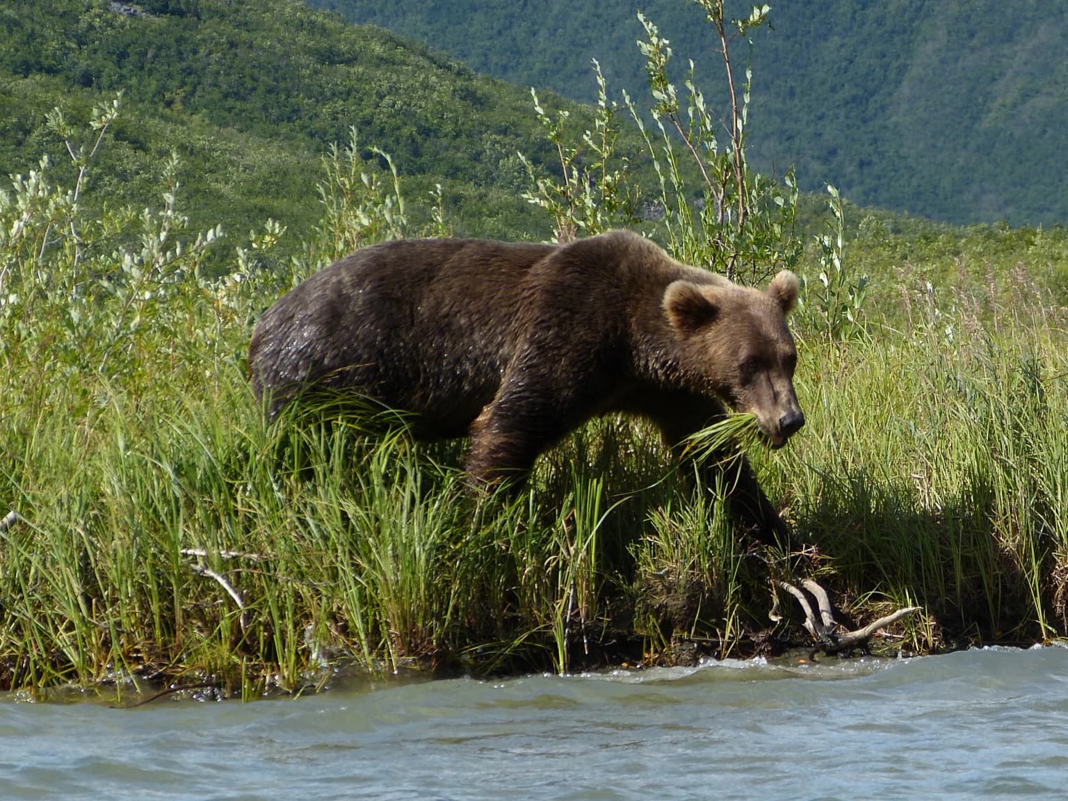
Prespa National Park is especially known for its transboundary lake system at high elevation, which supports exceptional concentrations of waterbird species including globally significant populations of great white pelicans and Dalmatian pelicans during the summer breeding season. The park is one of Europe's most important habitats for brown bears and gray wolves, with the mountainous terrain and dense forests providing crucial refuge for these apex predators. The wetland complex, covering approximately 500 hectares of reed beds, serves as a critical breeding and roosting site for the pygmy cormorant, a globally threatened species, and numerous other waterbird species. The park also encompasses Maligrad Island, a dramatic limestone island dotted with caves in Great Prespa Lake, which supports St. Mary's Church and significant wildlife populations.

Panoramic landscape of Prespa National Park showing Lake Prespa, green mountains, and open valleys under a clear blue sky with scattered clouds
Panoramic view of Prespa National Park featuring Lake Prespa, green mountains, and open valleys under a clear blue sky

Prespa National Park history and protected-area timeline

Prespa National Park was officially designated on February 18, 1999, with the primary purpose of protecting the natural and cultural heritage of the Prespa Lake region in southeastern Albania. The establishment of the park reflected growing recognition of the transboundary significance of the Prespa Lakes ecosystem and the need for coordinated conservation across international borders. The park's creation built upon earlier protection efforts and responded to increasing pressures on the region's natural resources from agricultural development, tourism, and infrastructure expansion.

The park's institutional framework places it under the management of Albania's National Agency of Protected Areas, which coordinates conservation activities with counterparts in Greece and North Macedonia. Since its designation, the park has become integrated into several major international conservation frameworks. It forms part of the European Green Belt, a network of protected areas following the former Iron Curtain across Europe, and has been recognized as a Biosphere Reserve under the UNESCO Man and Biosphere Programme. In June 2013, Albania's section of Great Prespa Lake was designated as a Ramsar Wetland of international importance, formalizing the park's status as a significant global wetland ecosystem.

Transboundary collaboration has been a consistent theme since the park's establishment. In 2000, plans emerged for a tri-national transboundary park spanning all three Prespa parks, though implementation has progressed slowly. More successful has been the Prespa-Ohrid Ecoregion initiative under the Council of Europe, which aims to unify conservation efforts across the broader lake basin including Lake Ohrid and the Prespa Lakes. The Prespa-Ohrid Nature Trust, established in 2015, represents the most significant institutional outcome of this collaborative framework, providing coordinated funding and management support for conservation activities across international boundaries.

Prespa National Park landscape and geographic character

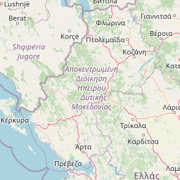
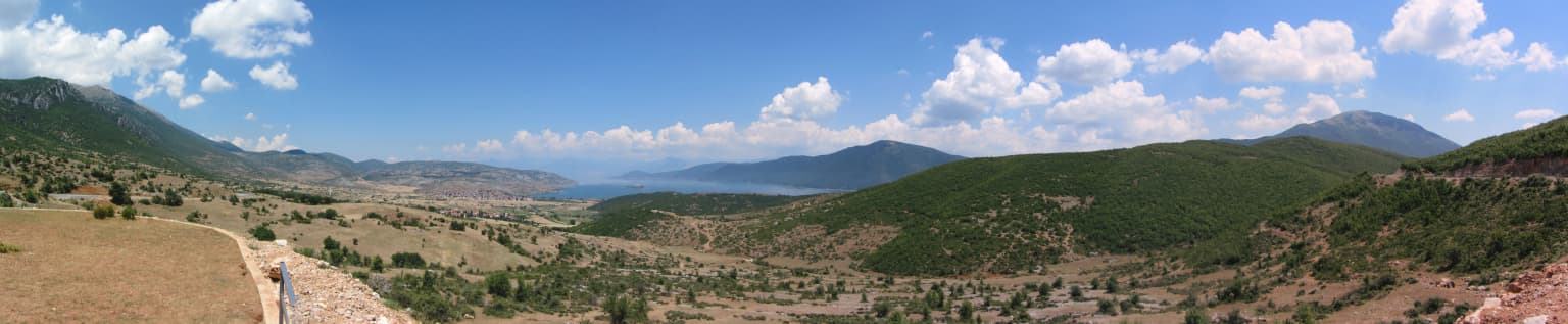
The landscape of Prespa National Park is defined by the intersection of two major terrain elements—the high-altitude lake basin and the surrounding mountain ranges. The Great Prespa and Small Prespa Lakes occupy a structural basin formed by tectonic activity, their surfaces lying at approximately 850 meters above sea level. This elevation positions the lakes among the highest major tectonic lakes in Southeastern Europe, creating a distinct montane character that differentiates them from the broader Mediterranean landscape character typical of the Balkan Peninsula at lower elevations.

The lake basin is surrounded by imposing mountain terrain that frames the aquatic environment. Mali i Thatë (Dry Mountain) rises along the western boundary, a limestone mass that separates the Prespa basin from the even deeper Lake Ohrid to the northwest. The mountain's steep slopes are covered in dense forests transitioning from oak-dominated woodlands at lower elevations through beech forests to sub-alpine and alpine grasslands at the highest elevations. The eastern side of the basin is bounded by the Galičica mountain range in North Macedonia, creating a transboundary mountain landscape that exceeds 2,000 meters in elevation.

Within the lakes themselves, the most prominent landform is Maligrad Island—a dramatic limestone island rising steeply from Great Prespa Lake's waters. The island features sheer cliffs and numerous caves that provide important habitat for wildlife, particularly bat species. The lake margins support extensive reed beds that create a dynamic interface between aquatic and terrestrial environments. Beyond the lakes, the landscape includes agricultural lands in the surrounding valleys, particularly around Small Prespa Lake, as well as extensive pastures and meadows in the higher mountain zones.

Wide view of Lake Prespa with Mali Grad Island in the center, surrounded by water, with agricultural fields and hills in the foreground and mountains in the background
Lake Prespa with Mali Grad Island visible in the distance

Prespa National Park ecosystems, habitats, and plant life

The ecological character of Prespa National Park reflects its position at the biogeographic crossroads between Mediterranean and continental European biomes, combined with the habitat diversity created by its elevational range and lake-wetland-forest matrix. The park falls within the Pindus Mountains mixed forests ecoregion, a terrestrial ecosystem recognized for its high levels of biodiversity and numerous endemic species. The vegetation combines Mediterranean-influenced species at lower elevations with continental Eurasian elements at higher elevations, creating a complex ecological mosaic.

The forest ecosystems represent one of the park's most valuable natural assets, covering approximately 13,500 hectares of the protected area. At lower elevations, oak woodlands predominate, with sessile oak, downy oak, Italian oak, and Austrian oak forming extensive stands. Macedonian oak dominates on drier, rockier slopes. As elevation increases, the oak forests transition to beech-dominated woodlands, particularly on the slopes of Mali i Thatë where European beech forms extensive pure stands together with sycamore maple and Turkish hazel. At higher elevations, mixed beech and fir forests occur, composed of silver fir, Bulgarian fir, and both European and Balkan beech—the latter representing a distinct Balkan endemic species.

The wetland habitats constitute the park's most internationally significant ecological feature. Approximately 500 hectares of the lake surfaces are covered by reed beds, creating extensive emergent vegetation communities that support extraordinary wildlife concentrations. These wetlands function as productive ecological systems providing breeding habitat, feeding grounds, and shelter for numerous species. The lakes themselves can be divided into distinct ecological zones—the pelagic zone covering deep, unvegetated areas, the littoral zone near shore with rooted vegetation, and the riverine zone encompassing channels, floodplains, and associated wetlands that support diverse aquatic communities.

Great White Pelican with yellow beak standing in grassy field with green vegetation background
Great White Pelican standing in a grassy field

Prespa National Park wildlife and species highlights

Prespa National Park supports exceptional wildlife diversity, with particular significance attached to its populations of large mammals and waterbirds. The park represents one of Europe's last strongholds for brown bears and gray wolves, species that have been dramatically reduced across most of their former European range. The dense forests and inaccessible terrain provide crucial refuge for these apex predators, with the park's contiguity to Shebenik-Jabllanicë National Park creating an important ecological corridor that facilitates movement between larger wilderness areas. While the elusive Balkan lynx has not been directly observed within the park, the area is considered to function as an important habitat linkage for this critically endangered felid.

Birds represent the most species-rich class of animals in the park, with more than 270 species recorded including approximately 132 breeding species. The lakes and wetlands support globally significant populations of pelicans—the great white pelican and the Dalmatian pelican, one of the world's largest bird species, both breed and forage in the park's wetland environments during summer months. The pygmy cormorant, a globally threatened waterbird, finds important habitat in the park's reed beds, which provide secure breeding and roosting sites. The diverse bird community also includes numerous raptors, waterfowl, and passerine species associated with the forest, wetland, and alpine habitats.

The park's cave systems support remarkable bat diversity, with more than 25 species recorded—including the long-fingered bat, whose largest European population inhabits the Treni Cave. This cave also serves as a critical hibernaculum for several bat species. The reptile and amphibian communities include 23 and 11 species respectively, featuring the European pond turtle, Hermann's tortoise, and spur-thighed tortoise among the reptiles, while amphibians include fire salamander, marsh frog, and agile frog. The lakes support 23 species of fish, contributing to the aquatic biodiversity that makes this transboundary ecosystem regionally significant.

Brown bear walking through tall green grass near water with mountains in background
Brown bear walking through tall grass near water in Prespa National Park

Prespa National Park conservation status and protection priorities

Prespa National Park holds significant conservation importance at both European and global scales, recognized through multiple international designations that reflect its ecological value. The Ramsar Convention designation of Albania's section of Great Prespa Lake as a Wetland of International Importance, formalized in June 2013, acknowledges the lake's critical role as habitat for waterbird species and its representation of high-altitude lacustrine ecosystems. The park's designation as an Important Bird Area and Important Plant Area further emphasizes its biodiversity significance.

The park's inclusion in the European Green Belt connects it to a network of protected areas spanning much of Europe along the former Iron Curtain, recognizing its role in maintaining ecological connectivity across the continent. As a Biosphere Reserve under the UNESCO Man and Biosphere Programme, the park is integrated into a framework that balances conservation with sustainable development and recognizes the cultural dimensions of the landscape. These designations create international frameworks for conservation cooperation and provide access to technical and financial resources for park management.

The transboundary nature of the Prespa Lakes ecosystem creates both challenges and opportunities for conservation. Water quality, wetland extent, and biodiversity are influenced by activities across international boundaries, requiring coordinated management approaches. The Prespa-Ohrid Nature Trust represents an important institutional mechanism for coordinating conservation activities across the broader basin, though implementing effective transboundary management remains an ongoing challenge. Climate change poses additional conservation concerns, potentially affecting lake water levels, vegetation zones, and the distribution of species adapted to the current environmental conditions.

Prespa National Park cultural meaning and human context

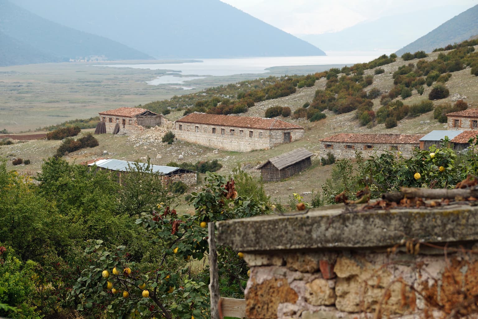
Prespa National Park encompasses a cultural landscape shaped by millennia of human presence, with archaeological evidence documenting habitation extending back to the Neolithic period. The region's strategic position at the crossroads of the Balkans made it significant throughout classical antiquity, with the ancient Via Egnatia—the major Roman road connecting the Adriatic coast to Constantinople—passing nearby and contributing to the area's historical importance. The park territory was inhabited by various Illyrian tribes and later by Ancient Greek communities, with Roman and Byzantine influences also evident in the archaeological record.

The cultural heritage within the park includes numerous Byzantine churches, some dating to the medieval period, that reflect the religious traditions of communities that have lived in the region. The island of Maligrad contains St. Mary's Church, a notable example of Byzantine ecclesiastical architecture in the park. Cave sites throughout the area, including the caves of Zaver and Treni, contain evidence of human occupation and have also developed significance as habitat for wildlife, particularly the bat populations that inhabit them.

Traditional land use practices continue to shape the cultural landscape, particularly the cultivation of mountain tea (Sideritis) on the slopes of Mali i Thatë. This herbal tea production represents a distinctive agricultural tradition specific to the Albanian Prespa region, with the plant growing wild on the limestone rocks of the mountain before being harvested and processed according to traditional methods. The integration of this cultural practice with the natural landscape exemplifies the park's character as a cultural landscape where human activities and natural systems have co-evolved over generations.

Stone buildings of Zagradec village with Small Prespa Lake and mountains in the background
Zagradec village with Small Prespa Lake in the background, Albania

Top sights and standout views in Prespa National Park

Prespa National Park stands as one of the Balkans' premier protected areas, distinguished by its unique combination of high-altitude lake ecosystems, substantial wetland complexes, and mountain forests supporting viable populations of Europe's largest terrestrial predators. The transboundary Prespa Lakes, shared between Albania, Greece, and North Macedonia, form the ecological core of the park and support internationally significant waterbird populations including breeding colonies of Dalmatian pelicans—one of the world's rarest and largest bird species. The wetland reed beds provide crucial habitat for the globally threatened pygmy cormorant and serve as a Ramsar-designated wetland of international importance. The park's designation as part of the European Green Belt and as a UNESCO Biosphere Reserve reflects its conservation significance, while the presence of Mali i Thatë with its traditional mountain tea cultivation adds cultural dimension to the natural values. The cave system of Treni hosts Europe's most important long-fingered bat colony, demonstrating the park's subterranean biodiversity value.

Park location guide

Geography guide, regional context, and park location map for Prespa National Park

Prespa National Park park geography, regions, and map view in Albania
Understand where Prespa National Park sits in Albania through a broader geographic reading of the surrounding landscape, nearby location context, and its mapped position within the national park landscape.

How Prespa National Park fits into Albania

Albania is a unitary parliamentary republic in Southeast Europe, situated on the Balkan Peninsula along the Adriatic and Ionian coastal regions. With a population of approximately 2.4 million people, it borders Montenegro, Kosovo, North Macedonia, and Greece. The country features varied landscapes ranging from the Albanian Alps to fertile coastal plains, with Tirana as its capital and largest city.

Wider geography shaping Prespa National Park in Albania

Albania occupies the western part of the Balkan Peninsula in Southeast Europe. The country features a varied terrain with rugged mountain ranges including the Albanian Alps (Accursed Mountains), Korab, Skanderbeg Mountains, Pindus, and Ceraunian Mountains. Fertile lowland plains extend along the Adriatic and Ionian coastal regions. The country borders Montenegro to the northwest, Kosovo to the northeast, North Macedonia to the east, and Greece to the south.

Map view of Prespa National Park

Use this park location map to pinpoint Prespa National Park in Albania, understand its exact geographic position, and read its mapped placement within the surrounding landscape more clearly.

Pigeon | © OpenStreetMap contributors

Location context for Prespa National Park

Korçë County

A visual guide to the park's dramatic mountain terrain, unique high-altitude lake ecosystems, and extensive wetland habitats for protected species.

Prespa National Park Photos: Visualizing High-Altitude Lake Systems and Mountain Habitats
Gain a deeper understanding of Prespa National Park through its compelling visual imagery, revealing the distinct montane character of its high-altitude lakes and dramatic surrounding mountain terrain. These photographs offer valuable insight into the park's extensive wetland complexes, unique habitats, and the crucial conservation landscapes protecting rare waterbirds, brown bears, and gray wolves.

Panoramic landscape of Prespa National Park showing Lake Prespa, green mountains, and open valleys under a clear blue sky with scattered clouds

Yellow sign for Prespa National Park with Albanian text and logo, stone structure, and Lake Prespa visible in background

Wide view of Lake Prespa with Mali Grad Island in the center, surrounded by water, with agricultural fields and hills in the foreground and mountains in the background

Great White Pelican with yellow beak standing in grassy field with green vegetation background

Brown bear walking through tall green grass near water with mountains in background

Snow-covered landscape with visible patterns, large lake, and mountain range under clear blue sky

Stone buildings of Zagradec village with Small Prespa Lake and mountains in the background

Park atlas

Compare surrounding protected landscapes and transboundary park geography across the Balkans

Explore Other National Parks and Protected Areas Near Prespa National Park
Browse a curated selection of national parks and protected areas geographically connected to Prespa National Park, including significant wetland complexes, high-altitude mountain ranges, and shared lake ecosystems. This contextual view helps trace the regional spread of conservation efforts, comparing diverse protected landscapes across the Balkan Peninsula through an atlas-style lens.
Watercolor painting of a landscape with green trees, rolling hills, and distant mountains under a light sky
National parkMunicipality of Bitola

Pelister National Park: North Macedonia's Oldest National Park and Alpine Protected Landscape

Explore unique glacial features and endemic forests within Municipality of Bitola.

Pelister National Park, a pioneering protected area in North Macedonia, offers a rich tapestry of alpine geography and unique geological formations. This page provides detailed information on the park's landscape, including its dramatic mountain massif within Municipality of Bitola, the rare Macedonian pine forests, the striking 'stone rivers' formed by ancient glacial processes, and the serene Pelister Eyes glacial lakes. Discover the park's mapped boundaries and its significance as a conservation heritage site within the Balkan Peninsula.

Area
171.5 km²
Established
1948
IUCN
II
Visitors
30K annual
Watercolor illustration of mountains, a lake, and rolling hills with grassy vegetation.
National parkElbasan County

Shebenik National Park: Mapped Protected Landscape and Glacial Terrain Atlas

Explore Elbasan County's significant mountain wilderness and protected natural features.

Shebenik National Park is a protected national park in Elbasan County, Albania, notable for its dramatic glacial terrain and extensive ancient forests. This park offers a deep dive into Albania's natural landscape, featuring 14 glacial lakes and serving as vital habitat. Its position within the Balkan Peninsula's geography makes it a key point of reference for understanding protected areas and mountain wilderness within a structured atlas.

Area
345.079 km²
Established
2008
IUCN
II
Relief
Mountain
Watercolor painting of a landscape with green fields, scattered trees, and rolling hills under a light sky
National parkGjirokastër County

Fir of Hotovë-Dangëlli National Park: Ancient Forests & Mountain Wilderness Atlas

Explore a premier protected landscape in Gjirokastër County, Albania.

Fir of Hotovë-Dangëlli National Park stands as a monumental protected area, celebrated for its exceptional old-growth Hotova Fir forests, which are a rare Mediterranean plant relic. This national park in Gjirokastër County offers a detailed look at a vast mountainous terrain, featuring dramatic canyons like Lengarica Canyon, and serving as a critical habitat for diverse wildlife. MoriAtlas provides structured geographic context for this significant landscape, highlighting its mapped boundaries and role as a key component of regional protected area networks.

Area
360.038 km²
Established
2008
IUCN
II
Relief
Mountain
Watercolor painting showing mountains, a river, and vegetation
National park

Tomorr Mountain National Park: Sacred Peak & Karst Protected Landscape in Albania

Explore Albania's dramatic mountain geography and protected areas.

Tomorr Mountain National Park offers a unique exploration of southern Albania's dramatic limestone anticline. Dominated by the sacred Mount Tomorr and featuring the spectacular Osum Canyon, this national park provides insight into karst terrain, old-growth forests, and significant biodiversity. Discover its mapped boundaries and regional geographic context within the Pindus Mountains for structured atlas exploration.

Area
271.855 km²
Established
1956
IUCN
II
Relief
Mountain
National park

Vikos-Aoös National Park: Deepest Gorge and Protected Mountain Landscape Atlas

Discover protected area boundaries and regional geography in Epirus.

Vikos-Aoös National Park in Greece's Pindus mountains is a premier destination for exploring dramatic natural geography. Best known for the Vikos Gorge, considered the world's deepest canyon relative to its width, the park also features towering alpine peaks like Mount Tymphe, glacial lakes such as Drakolimni, and rich botanical diversity. As a UNESCO Geopark and part of the Natura 2000 network, it safeguards critical habitats, including significant brown bear populations. This park offers a profound look into protected landscapes, offering detailed geographic context and mapped terrain for atlas-based discovery.

Area
126 km²
Established
1973
IUCN
II
Visitors
100K annual
Watercolor illustration of a mountainous landscape with a river, forests, and distant hills
National park

Pindus National Park: A Protected Greek Mountain Wilderness with Ancient Forests

Explore its rugged terrain, biodiversity, and alpine landscape.

MoriAtlas presents Pindus National Park, a significant protected area in Greece known for its dramatic mountainous terrain, deep valleys, and ancient old-growth forests. This page details its geographic context, featuring rugged highland landscapes, serpentine soils, and vital habitats for species like the Eurasian brown bear. Understand its place within the Pindus mountain range and its importance as a mapped wilderness area for conservation.

Area
69.27 km²
Established
1966
Relief
Mountain
Climate
Temperate
National park

Mavrovo National Park: North Macedonia's Extensive Protected Alpine Terrain and Wildlife

Mapped geography of Alpine peaks, gorges, and unique endemic species.

Mavrovo National Park, North Macedonia's largest protected area, offers a deep dive into a complex Alpine geography. Dominated by the Šar, Korab, and Bistra mountain systems, the park features towering peaks and the dramatic Radika River gorge. This protected landscape is globally significant for its role in conserving the rare Balkan lynx and harbors endemic tertiary relic plant species like Macedonian pine. Explore the mapped boundaries, glacial lakes, and distinct terrain that define this vital conservation area.

Area
730.88 km²
Established
1949
IUCN
II
Relief
Mountain
National park

Dajti Mountain National Park: Albania's Accessible Protected Mountain Landscape for Geographic Discovery

Explore the mapped terrain and diverse ecosystems of this significant national park.

Dajti Mountain National Park is a prime example of a protected mountain landscape central to Albania's geography. Situated near Tirana, its rugged karst topography, steep limestone ridges, and varied elevation create distinct ecological zones. This atlas-focused entry details the park's terrain, notable geological features like Pellumbas Cave, and its role as a significant protected area offering rich mapped landscape context.

Area
293.84 km²
Established
1966
IUCN
II
Relief
Mountain

Common questions about visiting, size, designation, and location context for Prespa National Park

Prespa National Park FAQs for park facts, access, geography, and protected area context
Find quick answers about Prespa National Park, including protected-area facts, park geography, trail and visitor context, and how the park fits into its surrounding country and regional landscape.
MoriAtlas Explorer

Continue Your Protected Areas Search Across the Global Atlas

Deepen your exploration by continuing the structured search for national parks and protected areas worldwide. Utilize the comprehensive filtering capabilities to compare different conservation landscapes and refine your understanding of global park geography. Discover more about the distribution and characteristics of protected natural areas.

Global natural geography