Mori Atlas logo
Nature reserveRéserve naturelle nationale de la Petite Camargue alsacienne

A vital protected mosaic of reedbeds, alluvial forest, and relict river channels in the Haut-Rhin landscape.

Réserve naturelle nationale de la Petite Camargue alsacienne: Rhine Floodplain Atlas and Park Map

Discover the geographic boundaries and ecological diversity of the Réserve naturelle nationale de la Petite Camargue alsacienne. This protected area in the Haut-Rhin department of Alsace preserves a critical segment of the former Rhine floodplain, featuring a complex terrain of wetlands, orchid-rich grasslands, and river-fed meadows that support distinct riparian habitats.

wetlandsRhine floodplainalluvial forestreedbedsorchid-rich grasslandsbirdwatching

Réserve naturelle nationale de la Petite Camargue alsacienne

Nature reserve

Park overview

Structured park overview, official facts, and landscape profile for Petite Camargue Alsacienne National Nature Reserve

Petite Camargue Alsacienne National Nature Reserve park facts, protected area profile, and essential visitor context

Review the core facts for Petite Camargue Alsacienne National Nature Reserve, including designation, size, terrain, visitor scale, habitats, and operating context in one park-focused overview.

About Petite Camargue Alsacienne National Nature Reserve

The Petite Camargue Alsacienne National Nature Reserve is a protected natural area in Alsace, in the far north-east of France, just a short distance from Basel and the German border. Despite its evocative name, it must not be confused with the much larger Petite Camargue in the Occitanie region near the Mediterranean. The Alsatian reserve refers to a small-scale but ecologically rich analogue: a surviving fragment of the Rhine floodplain that once stretched broadly across the Upper Rhine plain.

The reserve lies within the historic major channel of the Rhine, a landscape profoundly reshaped in the 19th and 20th centuries by river straightening, canalisation, and the construction of the Grand Canal d'Alsace. Within this heavily engineered setting, the Petite Camargue Alsacienne preserves a remarkable diversity of natural habitats in close proximity. Relic river branches, phreatic springs, reedbeds, wet meadows, hay meadows, dry calcareous grasslands, and alluvial forest form a tightly woven ecological mosaic. This mix of wet and dry conditions, on a relatively modest area, gives the site a richness that belies its size.

The reserve was created in 1982 as the first national nature reserve in Alsace, initially covering about 120 hectares. A 2006 decree significantly expanded it to roughly 904 hectares. Today the reserve is also notable for its transboundary character, with marked trails and observation hides built by a cross-border group of French, Swiss, and German volunteers known as Les Bras Cassés. The site combines active conservation management, scientific research, public education, and an unusual industrial heritage linked to the historic imperial fish hatchery of Huningue.

Quick facts and research context for Petite Camargue Alsacienne National Nature Reserve

The Petite Camargue Alsacienne National Nature Reserve is located in the Haut-Rhin department, in the Grand Est region of north-eastern France, within the Sundgau area near Saint-Louis. The site lies in the former major bed of the Rhine and spans several communes, including Saint-Louis, Bartenheim, Kembs, Rosenau, and Village-Neuf.

Classified as a national nature reserve (Réserve naturelle nationale) since 1982, with a major extension in 2006, the reserve covers about 904 hectares, of which roughly 717 hectares are terrestrial and around 187 hectares are aquatic. It is managed by an association that brings together elected officials, financial partners, and ecologists, and it hosts a transboundary research station linked to the University of Basel.

Protection and recognition

Examine the documented conservation framework and management scope established in 2006.

Protection Status and Official Designation History for Réserve naturelle nationale de la Petite Camargue alsacienne

Historical protection records outline the designated framework and management scope established for Réserve naturelle nationale de la Petite Camargue alsacienne since 2006. Structured conservation data details the official status and administrative background associated with this protected area.

Protection details

Protection scope
Mixed
Designated year
2006
Transboundary protection
No
WDPA ID
6250
Park context

Deeper park guide and search-rich context for Petite Camargue Alsacienne National Nature Reserve

Petite Camargue Alsacienne National Nature Reserve history, landscape, wildlife, and travel context

Explore Petite Camargue Alsacienne National Nature Reserve through its history, landscape character, ecosystems, wildlife, conservation priorities, cultural context, and seasonal travel timing in a structured park guide built for atlas discovery and search intent.

Why Petite Camargue Alsacienne National Nature Reserve stands out

The reserve is especially known for its exceptional mosaic of Rhine floodplain habitats preserved in a heavily developed river landscape. Its combination of former Rhine channels, reedbeds, wet meadows, dry orchid-rich grasslands, and alluvial forest makes it a reference site for Upper Rhine floodplain ecology. It is also recognised for its rich avifauna, its populations of amphibians in relict wetland habitats, and its historical identity tied to the 19th-century imperial fish hatchery of Huningue. The presence of a transboundary research station and the use of Highland cattle for habitat management are further distinctive features of the site.
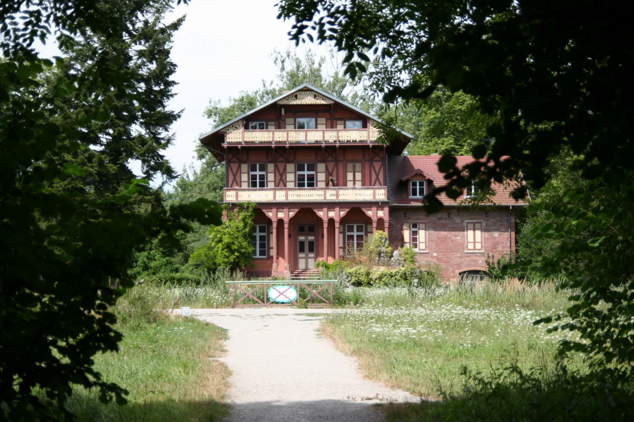
A historic red brick and half-timbered building framed by dark green foliage, featuring a dirt path leading to the entrance.
The historic Imperial Fish Farm building situated within the Petite Camargue alsacienne nature reserve.

Petite Camargue Alsacienne National Nature Reserve history and protected-area timeline

The site carries a distinctive industrial heritage connected to the Rhine. In 1852, under Napoleon III, the imperial fish hatchery of Huningue was constructed on the territory of the future reserve. It was Europe's first industrial fish farm, dedicated to the breeding of salmon and trout. The hatchery was eventually closed, but it was reopened in the 1990s as part of efforts to reintroduce salmon to the Rhine, in a programme known as Saumon 2000.

In parallel, growing awareness of the ecological value of the surviving Rhine floodplain led to formal protection. The reserve was created by decree of the Conseil d'État on 11 June 1982. At that time it was the first national nature reserve in Alsace and covered about 120 hectares. On 27 July 2006, a new decree significantly expanded its perimeter to roughly 904 hectares, integrating additional floodplain habitats.

In 2006, the French Minister for Ecology and Sustainable Development, Nelly Olin, visited the reserve, reflecting its growing national profile. The name Petite Camargue Alsacienne itself is credited to the naturalist L.P. Lutten, a former editor of the regional newspaper L'Alsace. Over time the management structure became more formalised, combining elected officials, financial partners, and ecologists into a dedicated association.

Petite Camargue Alsacienne National Nature Reserve landscape and geographic character

The reserve occupies a flat alluvial plain within the former major bed of the Rhine, near the point where France, Switzerland, and Germany meet. The terrain is shaped almost entirely by the river: relic meanders, former channels, low-lying depressions, and slightly elevated dry ridges all reflect the shifting dynamics of a large lowland river system.

Key hydrological features include the Augraben, the only tributary of the Rhine in the Haut-Rhin department, which crosses the reserve and gives its name to the commune of Rosenau. Other characteristic elements include phreatic springs emerging from the alluvial groundwater, numerous ponds, marshy depressions, and the Île du Rhin, a large island formed between the Rhine and the Grand Canal d'Alsace.

The visual contrast within the reserve is one of its defining qualities. Reedbeds and wet meadows alternate with dry grasslands and patches of alluvial woodland, producing an unusually varied landscape within a relatively small area. This mosaic is intentionally maintained, in part through grazing by Highland cattle imported from Scotland, which help keep open habitats from being overtaken by shrubs and invasive trees.
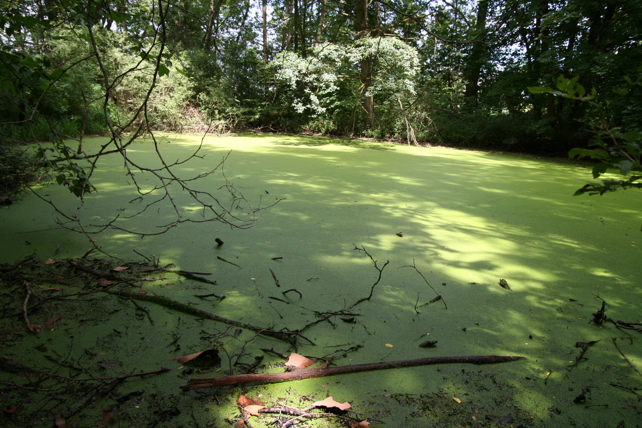
A small pond covered in thick green duckweed or algae, surrounded by a dense forest canopy in the Petite Camargue alsacienne.
A shaded, algae-covered pond in the wetlands of the Petite Camargue alsacienne.

Petite Camargue Alsacienne National Nature Reserve ecosystems, habitats, and plant life

Ecologically, the reserve is a textbook example of a relict floodplain ecosystem. Its habitats include reedbeds (including large stands of reed mace), wet meadows, hay meadows, dry calcareous grasslands rich in orchids, alluvial forests, and open water associated with former river channels and phreatic springs. The compact juxtaposition of these habitats is a direct consequence of the floodplain topography.

The flora is notable for its diversity and conservation significance. Fifteen orchid species have been recorded, and the reserve hosts several nationally protected plants such as Siberian iris and superb pink, alongside regionally protected species including marsh helleborine, Lachenal's water-dropwort, and bladdernut. Black poplar, a species threatened by hybridisation with Italian poplar, is also present. The fungal community is unusually rich, with around 600 recorded species of mushrooms.

The reserve is also a stronghold for wildlife normally associated with dynamic floodplain systems but increasingly rare in the heavily regulated Upper Rhine. Wetland habitats support amphibians, dragonflies, and waterbirds, while dry grasslands harbour distinctive invertebrate communities.
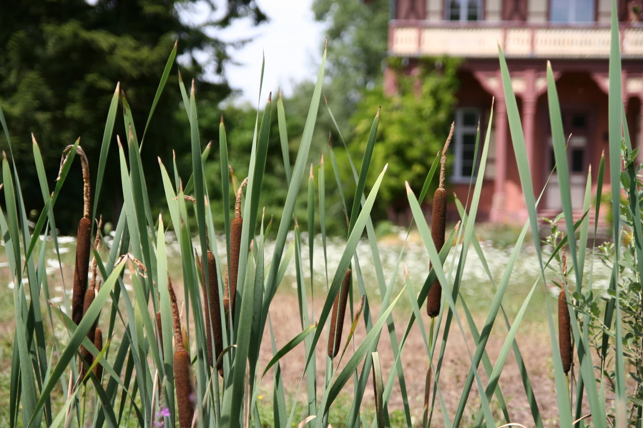
Close-up view of tall green reeds and brown cattail seed heads in the foreground, with a blurred historic house and trees visible in the background.
Cattails in the Petite Camargue alsacienne nature reserve.

Petite Camargue Alsacienne National Nature Reserve wildlife and species highlights

The reserve's wildlife profile reflects its combination of aquatic and terrestrial habitats. A total of 237 vertebrate species have been recorded, including 12 fish species, 174 bird species (of which 76 breed locally), 30 mammal species, 5 reptile species, and 16 amphibian species. Among invertebrates, around 40 dragonfly species and 35 orthopteran (grasshopper and cricket) species have been catalogued.

Birdlife is one of the reserve's strongest attractions. Important species include the common kingfisher, black kite, lesser spotted woodpecker, and the little bittern, a rare and localised heron. Mammals range from the more familiar roe deer, wild boar, and European badger to the much less common hazel dormouse and harvest mouse, as well as several bat species. Wetland amphibians are particularly noteworthy and include the great crested newt, yellow-bellied toad, natterjack toad, European tree frog, and pool frog.

Conservation management also addresses the presence of invasive species, which pose a significant threat to native wildlife. Programmes target giant goldenrod, Canadian goldenrod, black locust, butterfly bush, Japanese knotweed, staghorn sumac, Jerusalem artichoke, and Caucasian hogweed, all of which can alter habitat structure if left uncontrolled.
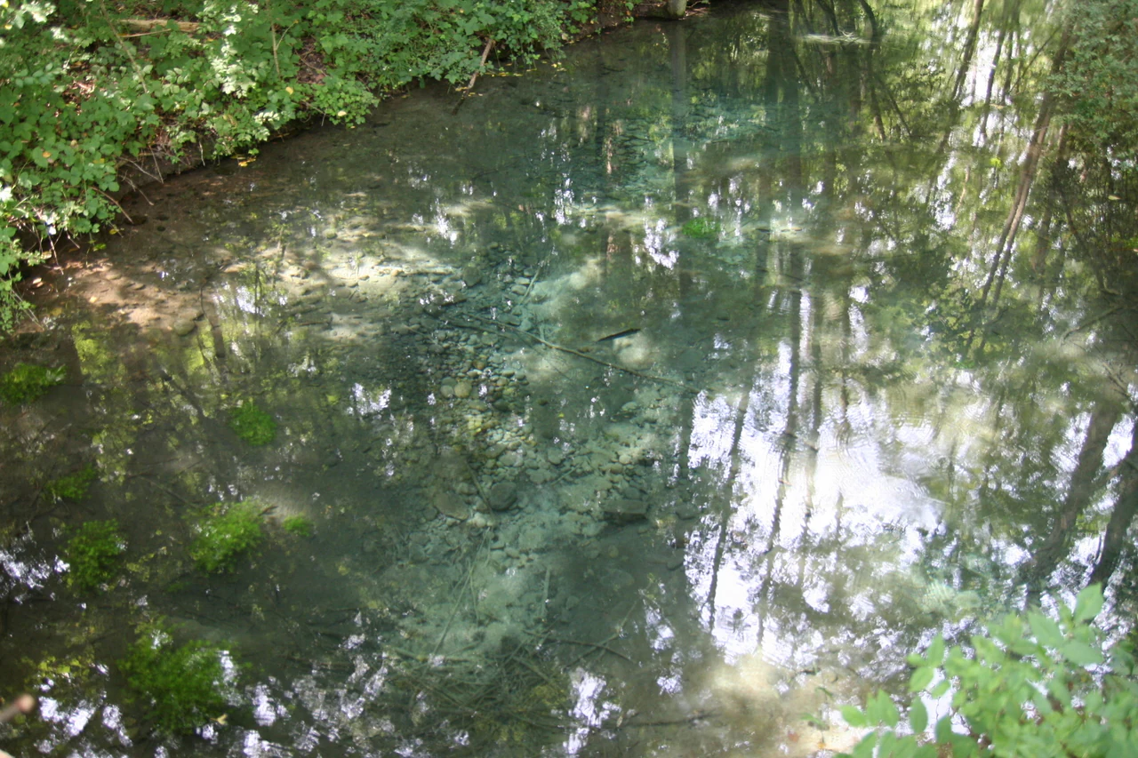
A view looking down into a small, clear spring pool showing underwater vegetation and reflections of the surrounding trees.
Clear groundwater spring in the Petite Camargue alsacienne nature reserve.

Petite Camargue Alsacienne National Nature Reserve conservation status and protection priorities

The Petite Camargue Alsacienne is a national nature reserve protected under French law, with IUCN Category IV designation. Its conservation value lies in the preservation, within an otherwise heavily transformed Upper Rhine plain, of an interconnected mosaic of floodplain habitats that have largely disappeared elsewhere in the region. The site plays a particularly important role for wetland-dependent species, especially amphibians, dragonflies, and waterbirds.

Active management is central to the reserve's conservation strategy. Grazing by Highland cattle is used to maintain open habitats, including orchid-rich dry grasslands, while regular intervention targets invasive plant species that would otherwise close down open communities. Reedbeds and wet meadows are maintained through traditional mowing regimes and hydrological monitoring.

Reintroduction and research programmes add to the reserve's conservation significance. The historic Huningue hatchery has been repurposed to support salmon restoration in the Rhine, and a programme to reintroduce the European pond turtle in the Rhine plain is underway. The reserve is also notable for hosting the only research station located within a metropolitan French national nature reserve, financed by Swiss funds and affiliated with the University of Basel, with a particular focus on the behaviour of the common nightingale.

Petite Camargue Alsacienne National Nature Reserve cultural meaning and human context

The reserve carries an unusual combination of natural and cultural heritage. Its most distinctive cultural feature is the imperial fish hatchery of Huningue, built in 1852 under Napoleon III and once the first industrial fish farm in Europe. This industrial legacy has been reintegrated into the site's modern conservation mission through the Saumon 2000 programme.

The reserve also embodies a strong transboundary culture. Its trail network and observation hides have been built and maintained for decades by a volunteer group called Les Bras Cassés, made up of retirees from France, Switzerland, and Germany. This cross-border cooperation is reflected in the research station affiliated with the University of Basel, in the reserve's educational programmes, and in its visitor facilities, including the Maison de la Réserve and the museums dedicated to the memory of the Rhine and of salmon.
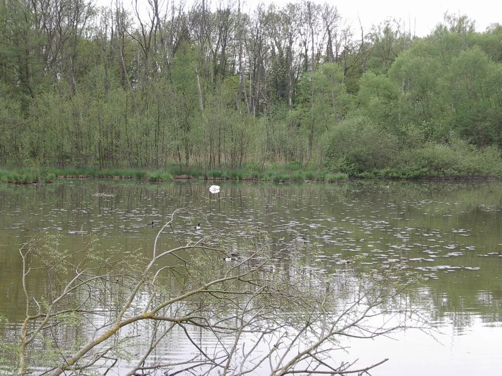
A calm, reflective pond surrounded by lush green trees and shrubs, with a white swan swimming in the distance.
A serene view of a pond within the wetland habitats of the Petite Camargue alsacienne.

Top sights and standout views in Petite Camargue Alsacienne National Nature Reserve

A compact but remarkably diverse Rhine floodplain reserve, the Petite Camargue Alsacienne combines relict river channels, reedbeds, wet meadows, orchid-rich dry grasslands, and alluvial forest within a single protected area near the French-Swiss-German border. It stands out as the first national nature reserve in Alsace and as a rare surviving fragment of a floodplain habitat type that has been largely lost elsewhere along the Upper Rhine.

Distinctive elements include the historic imperial fish hatchery of Huningue, active reintroduction programmes for salmon and the European pond turtle, a Swiss-affiliated research station studying nightingales, and conservation management that uses Highland cattle to maintain open habitats. The site is also a major hub for transboundary cooperation in the Upper Rhine region.

Best time to visit Petite Camargue Alsacienne National Nature Reserve

The reserve is open to the public throughout the year, and its character varies meaningfully with the seasons. Spring and early summer are generally the most rewarding periods for visitors interested in orchids, amphibian activity, and breeding birds, when wet meadows and dry grasslands are at their most biologically active. Reedbeds and open water are also most lively in these months, with dragonflies and waterbirds in evidence.

Autumn brings its own appeal, with migratory birds passing through and softer light across the floodplain landscapes. Winter tends to be quieter but can offer a clearer view of the underlying mosaic of habitats, especially when grazing animals are visible in the dry grasslands. The reserve's Maison de la Réserve generally operates from March to October, although the natural site itself remains accessible year-round.

Monthly climate preview

Long-term representative monthly temperature and precipitation data for structured conservation analysis

Annual Climate Normals and Temperature Patterns for Réserve naturelle nationale de la Petite Camargue alsacienne

Representative coordinates record measured multi-year temperature ranges alongside steady monthly precipitation distribution across Réserve naturelle nationale de la Petite Camargue alsacienne. Comprehensive twelve-month climate profiles supply complete baseline statistics for detailed environmental research within the protected landscape.
Annual mean9 °C
-1 °C18 °C
Jan-1°
Feb
Mar
Apr
May13°
Jun16°
Jul18°
Aug18°
Sep14°
Oct
Nov
Dec
Warmest month
July

18.2 °C

Coolest month
January

-0.6 °C

Wettest month
May

3.7 mm/day

Driest month
February

2.2 mm/day

Park location guide

Geography guide, regional context, and park location map for Petite Camargue Alsacienne National Nature Reserve

Petite Camargue Alsacienne National Nature Reserve park geography, regions, and map view in France

Understand where Petite Camargue Alsacienne National Nature Reserve sits in France through a broader geographic reading of the surrounding landscape, nearby location context, and its mapped position within the national park landscape.

How Petite Camargue Alsacienne National Nature Reserve fits into France

France is a unitary semi-presidential republic and one of the world's largest economies. It borders Belgium, Luxembourg, Germany, Switzerland, Italy, Monaco, Andorra, and Spain, with a maritime border to the United Kingdom. The country is known for its cultural influence, art, cuisine, and political history spanning centuries.

Wider geography shaping Petite Camargue Alsacienne National Nature Reserve in France

France is located in Western Europe. Metropolitan France extends from the Rhine to the Atlantic Ocean and from the Mediterranean Sea to the English Channel and North Sea. The country borders Belgium, Luxembourg, Germany, Switzerland, Italy, Monaco, Andorra, Spain, and has a maritime border with the United Kingdom.

Map view of Petite Camargue Alsacienne National Nature Reserve

Use this park location map to pinpoint Petite Camargue Alsacienne National Nature Reserve in France, understand its exact geographic position, and read its mapped placement within the surrounding landscape more clearly.

Pigeon | © OpenStreetMap contributors

Location context for Petite Camargue Alsacienne National Nature Reserve

Haut-Rhin

Visualizing the rare floodplain habitats, relict river channels, and alluvial forests of Alsace

Réserve naturelle nationale de la Petite Camargue alsacienne Photos and Landscape Views

Visual records reveal the complex mosaic of wetlands, reedbeds, and dry grasslands preserved within the historic Rhine floodplain. Protected-area photography documents the shifting terrain and diverse ecological habitats defining the reserve environment.

A historic red brick and half-timbered building framed by dark green foliage, featuring a dirt path leading to the entrance.

A group of brown Highland cattle graze in a green pasture adjacent to a small wetland area with trees in the background.

A small pond covered in thick green duckweed or algae, surrounded by a dense forest canopy in the Petite Camargue alsacienne.

Close-up view of tall green reeds and brown cattail seed heads in the foreground, with a blurred historic house and trees visible in the background.

A view looking down into a small, clear spring pool showing underwater vegetation and reflections of the surrounding trees.

A group of dark-colored European pond turtles basking in a shallow, grassy wetland pond.

A calm, reflective pond surrounded by lush green trees and shrubs, with a white swan swimming in the distance.

Park atlas

Compare surrounding Rhine floodplain reserves and regional protected landscapes

Parks near Réserve naturelle nationale de la Petite Camargue alsacienne

Browse protected areas and wetland habitats located near Réserve naturelle nationale de la Petite Camargue alsacienne to understand the broader regional ecosystem. Comparing adjacent river valleys and alluvial reserves reveals how lowland conservation networks connect across borders.
Nature reserveGrand Est
About 20 km away#1 closest

West

Réserve naturelle régionale Im'Berg: Mapping a Unique Protected Nature Reserve in France

A rare calcareous grassland habitat in the Grand Est region.

Réserve naturelle régionale Im'Berg preserves a sun-drenched limestone slope in the commune of Tagolsheim. Known as the Buxberg, this protected area guards one of the most significant natural boxwood populations in Europe alongside specialized dry-habitat flora. The reserve functions as an essential geographic reference for studying how steep, calcareous terrain creates isolated, warm microclimates within the broader Alsatian landscape.

Area
0.017 km²
Established
2013
IUCN
IV
A horizontal watercolor painting depicting a landscape with soft rolling hills, green meadows, and wild grasses under a pale sky.
Nature reserveBaden-Württemberg
About 20 km away#2 closest

East

Dinkelberg und Röttler Wald: Geographic Overview of this Baden-Württemberg Nature Reserve

Protected karst landscapes and mature beech forest habitat

Uncover the ecological and physical geography of Dinkelberg und Röttler Wald, a protected area stretching across diverse limestone plateaus and sandstone slopes in Germany. This site offers a valuable look at managed cultural landscapes that bridge the gap between rural meadows and wild forest reserves, providing critical habitat for European bat populations and rare flora across its varied elevational zones.

Area
46.47 km²
Established
2015
Protected landscapeBaden-Württemberg
About 26 km away#3 closest

East

Südwestlicher Dinkelberg Protected Landscape and Dinkelberg Plateau Geography

Karst terrain and forest habitats in Baden-Württemberg

Located in the Lörrach district, Südwestlicher Dinkelberg protects a diverse mix of ravine forests, dry grasslands, and mires. The area preserves essential ecological corridors within the Lörrach-Basel region, showcasing complex geological features such as stream sinks and dry valleys that define the plateau edge.

Area
13.89 km²
Established
2013
IUCN
V
Relief
Upland
A soft watercolor illustration of rolling hills, forested slopes, and meadow vegetation with a light, airy aesthetic.
Nature reserveBaden-Württemberg
About 26 km away#4 closest

Northeast

Belchen Nature Reserve: Exploring the Mountain Geography of the High Black Forest

A diverse protected landscape in Baden-Württemberg

Belchen represents an essential protected area in the southern Black Forest, known for its compressed ecological profile ranging from lowland beech forests to exposed subalpine summits. The site maps a complex mosaic of scree slopes, mires, and rocky habitats that sustain specialized bat species and rare montane flora, offering a detailed perspective on central European highland ecosystems.

Area
29.072 km²
Established
2019
Relief
Mountain
Climate
Temperate
A panoramic watercolor painting depicting a calm wetland or marsh with pink and yellow reeds in the foreground, green trees in the midground, and soft purple mountains in the background.
Nature reserveHaut-Rhin
About 28 km away#5 closest

Northwest

Réserve naturelle régionale des marais et landes du Rothmoos Protected Landscape and Geography

Regional nature reserve in the Haut-Rhin department of Alsace

The Réserve naturelle régionale des marais et landes du Rothmoos encompasses a rare inland saline habitat complex within the Nonnenbruch forest. Its terrain is defined by stable pools created from mining subsidence, transitioning into heathland and oak forests. This protected area stands as an ecological refuge for migratory waterbirds and specialized aquatic species within an industrial-legacy environment.

Area
1.457 km²
Established
1988
IUCN
IV
Relief
Lowland
Nature reserveGrand Est
About 32 km away#6 closest

Northwest

Réserve naturelle régionale de l'Eiblen et l'Illfeld: Alsace Floodplain Protected Area

Geographic context of regional alluvial habitats in Haut-Rhin

Located in the Alsace plain, this nature reserve preserves a rare cross-section of original river floodplain geography. The area provides a critical look at alluvial ecosystems and sediment-rich lowland terrain that defines the historical character of the Upper Rhine plain within France.

Area
0.66 km²
Established
1992
A watercolor painting showing a soft, impressionistic landscape with rolling green hills, forest patches, and pale distant mountains under a light sky.
Protected landscapeBaden-Württemberg
About 33 km away#7 closest

East

Obersäckingen Protected Landscape: Regional Geography and Map Context in Baden-Württemberg

A preserved mosaic of southern Black Forest meadows and mixed woodland habitats

Located in the Waldshut district, the Obersäckingen protected landscape showcases a balanced environmental mosaic of oat-grass meadows, hedgerows, and field copses. This area serves as a key piece of the regional conservation network, closely overlapping with the Murg zum Hochrhein Natura 2000 site to maintain the visual and ecological character of the southern Black Forest countryside.

Area
0.415 km²
Established
2004
IUCN
V
A soft watercolor painting depicting a gentle, rolling landscape with green hills, forests, and abstract meadows against a white background.
Regional parkSolothurn
About 35 km away#8 closest

South

Regionaler Naturpark Thal: Protected Jura Landscapes and Regional Geography in Solothurn

Examining the folded ridges and pastoral terrain of the Swiss Jura

The Regionaler Naturpark Thal encompasses the entire Thal district, presenting a cohesive regional environment defined by the eastern Jura chain. This protected area features a unique mosaic of cattle-grazed heights, biodiversity-rich dry meadows, and dense mixed forests that anchor the Solothurn landscape. The terrain showcases the classic Jura topography of parallel ridges, secluded valleys, and dramatic klus incisions, providing a rich area for understanding regional mountain ecology.

Area
139 km²
Established
2009
Relief
Mountain
Climate
Temperate

Common questions about visiting, size, designation, and location context for Petite Camargue Alsacienne National Nature Reserve

Petite Camargue Alsacienne National Nature Reserve FAQs for park facts, access, geography, and protected area context

Find quick answers about Petite Camargue Alsacienne National Nature Reserve, including protected-area facts, park geography, trail and visitor context, and how the park fits into its surrounding country and regional landscape.
MoriAtlas Explorer

Continue Your Protected Areas Search Across the Global Atlas

Deepen your exploration by continuing the structured search for national parks and protected areas worldwide. Utilize the comprehensive filtering capabilities to compare different conservation landscapes and refine your understanding of global park geography. Discover more about the distribution and characteristics of protected natural areas.

Global natural geography