
Mori Atlas logo
National parkPilanesberg National Park

Mapping the distinctive concentric hills, savanna valleys, and ecological landscape terrain

Pilanesberg National Park: An Ancient Volcanic Ring Complex and Protected Wilderness Area

Pilanesberg National Park in the North West Province of South Africa represents a rare geological formation known as the Pilanesberg Alkaline Ring Complex. This ancient volcanic structure features concentric ridges and valleys that create a complex mosaic of savanna, rocky hills, and water systems. Our geographic data explores these protected boundaries, showcasing how the eroded volcanic landscape supports diverse ecosystems and varied terrain across the park interior.

Big Fivegame reservealkaline ring complexextinct volcanoconcentric hillsbushveld
Digital vector-style illustration of a canyon landscape featuring high rock walls, a cascading waterfall in the distance, a meandering river in the foreground, and a sun in the sky.

Pilanesberg National Park

National park

Park overview

Structured park overview, official facts, and landscape profile for Pilanesberg National Park

Pilanesberg National Park park facts, protected area profile, and essential visitor context

Review the core facts for Pilanesberg National Park, including designation, size, terrain, visitor scale, habitats, and operating context in one park-focused overview.

About Pilanesberg National Park

Pilanesberg National Park occupies a unique position both geographically and historically within South Africa's protected-area system. Geologically, the park is built around the Pilanesberg Alkaline Ring Complex, a vast circular feature formed by ring dikes that once fed an enormous ancient caldera. Erosion over more than a billion years has stripped away the upper volcanic structure, leaving a set of alternating concentric hills and valleys that rise between about 300 and 600 metres above the surrounding bushveld plains. The highest peaks, in the northern section of the park, top out around 1,687 metres, while in the east and south the hills descend in a series of named ridges and outcrops, many crowned with red syenite boulders.

The reserve's landscapes also sit at an ecological crossroads. Pilanesberg lies in the transition zone between the dry Kalahari to the west and the bushveld to the east, so both vegetation systems overlap here. North-facing hill savannas support red bushwillow, while moister south-facing slopes feature hook thorn, wild pear and buffalo thorn. Open pediment grasslands exist on ferricrete-capped flats, while valleys carry sweet thorn, leadwood and tamboti thickets. This mix of habitats supports an unusually broad sweep of wildlife. The park is home to lion, elephant, leopard, cheetah, Cape buffalo, black rhino, white rhino, giraffe, hippo, zebra, brown hyena and more than 360 bird species; the records also include reintroduced Cape wild dogs and Nile crocodiles.

Beyond its natural assets, Pilanesberg stands out because of how it was created. The reserve was assembled between the late 1970s and the early 1980s on land purchased back from farmers, consolidated through negotiations with local communities, and then fenced with around 110 kilometres of game-proof barrier. Operation Genesis, the largest game translocation in the country's history, moved roughly 6,000 animals of 22 species into the reserve in the early 1980s. Although the Pilanesberg is the fourth largest game reserve in South Africa, its relative proximity to Gauteng has made it one of the country's most visited public reserves and a key part of the country's wildlife-tourism landscape.

Quick facts and research context for Pilanesberg National Park

Pilanesberg National Park lies in the Bojanala Municipality of South Africa's North West Province, north of Rustenburg and just south of Sun City. The reserve covers roughly 572 square kilometres of bushveld built around the eroded remains of a 1.2 billion year old alkaline ring volcano, one of the largest complexes of its type in the world. Although it is not in a region where the Big Five historically occurred in large numbers, the park was specifically developed to reintroduce them and now supports lion, leopard, elephant, Cape buffalo and both black and white rhinoceros, alongside more than 360 recorded bird species.

Protection and recognition

Examine terrestrial protection boundaries, management scope, and verified recognition data.

Pilanesberg National Park Protection Status and International Recognition

Pilanesberg National Park maintains a documented terrestrial protection status covering regional conservation boundaries. Verified protection records and formal designation frameworks outline the operational scope for this reserve.

Protection details

Protection scope
Terrestrial
Transboundary protection
No
Park context

Deeper park guide and search-rich context for Pilanesberg National Park

Pilanesberg National Park history, landscape, wildlife, and travel context

Explore Pilanesberg National Park through its history, landscape character, ecosystems, wildlife, conservation priorities, cultural context, and seasonal travel timing in a structured park guide built for atlas discovery and search intent.

Why Pilanesberg National Park stands out

Pilanesberg is best known for combining two very distinctive qualities: an ancient volcanic ring landscape and one of the most accessible Big Five game-viewing experiences in South Africa. Its concentric hills and valleys, formed from the eroded root of the Pilanesberg Alkaline Ring Complex, give the reserve a distinctive circular pattern of ridges and basins that rises well above the surrounding flat bushveld. Layered on top of that geological setting is a heavily managed, reintroduction-driven wildlife population. Pilanesberg is famous for Operation Genesis, the largest game translocation program in South Africa's history, which restocked the park with thousands of animals. The reserve also hosts what is widely described as the highest concentration of brown and spotted hyena of any game park in the world, making its predator scene unusually distinctive.
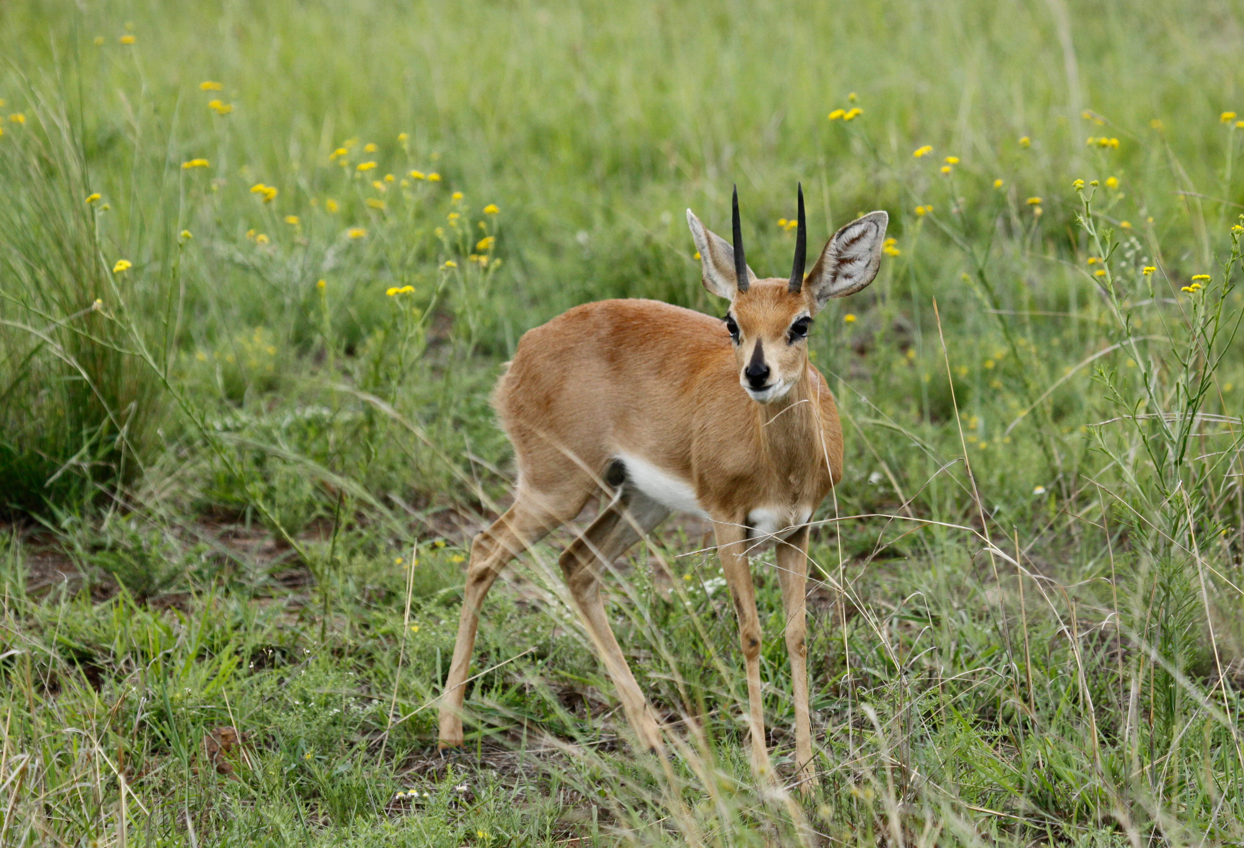
A small brown steenbok with upright pointed horns standing in tall green grass with yellow wildflowers.
A male steenbok standing in the grassy fields of Pilanesberg National Park.

Pilanesberg National Park history and protected-area timeline

The human history of the Pilanesberg stretches back far beyond the reserve's modern boundaries. Humans inhabited the area from the Middle Stone Age, and archaeological sites from both the Stone Age and Iron Age are scattered throughout the park. Iron Age communities, ancestors of the Tswana and Sotho peoples, settled here as cattle farmers and metalworkers, establishing major Tswana towns in the late 18th century. Much of this settlement was destroyed during the Difaqane wars of the 1820s, when Mzilikazi's forces occupied the Pilanesberg and Magaliesberg region. The mountain range takes its name from Chief Pilane of the Kgafela people, who ruled nearby in the 1800s.

During the colonial era, the southern section of today's reserve was carved into Boer-owned farms granted by the South African Republic in the 1860s, while a mission station was established in the northwestern part of the future park at the farm Driefontein. These farms were gradually repurchased in the 1960s, and the area became entangled in the administrative geography of Bophuthatswana, with local communities such as the Bakgatla and Bakubung resettled through negotiated land-swap arrangements. By the late 1970s, a planning committee had been created to convert the entire Pilanesberg mountain area into a single game reserve.

Building on this groundwork, Pilanesberg was formally established as a conservation project in 1979, with the construction of roughly 100 to 110 kilometres of game fence around its perimeter. Operation Genesis, launched in the early 1980s and televised internationally through Wild Kingdom, moved around 6,000 animals of 22 species into the reserve in what remains the largest game translocation in South Africa's history. Although the first park area opened in the early 1980s, ongoing reintroduction work continued through that decade, with additional predator relocations in the early 1990s. The 1990s brought a tourism boom after Nelson Mandela's release, larger predator populations following the introduction of lions and cheetahs, and the reintegration of Bophuthatswana into South Africa in 1994. In May 2004 the park was expanded northward as the first step toward a planned wildlife corridor linking Pilanesberg with the Madikwe Game Reserve.

Pilanesberg National Park landscape and geographic character

Pilanesberg's landscape is defined by the eroded skeleton of an ancient volcano. The Pilanesberg Alkaline Ring Complex expressed itself at the surface through ring dikes that fed a massive caldera roughly 1.2 to 1.25 billion years ago; over time, the upper structure was stripped away and what remains today is an unusual set of concentric hills and valleys forming an almost circular pattern in plan view. This ring structure is one of the largest volcanic complexes of its type in the world and includes rare rock types and minerals that make the area geologically distinctive.

The hills rise abruptly from the surrounding bushveld plain, in places 300 to 600 metres above the lowlands, with the highest elevations concentrated in the north. The peaks Matlhorwe reach around 1,687 and 1,670 metres, while Marutlhare, Ratshwane and the eagle-named Lenong lookout break up the slightly lower northern arc. The eastern hills, including Thaba ya Ditshwene, the mountain of baboons, and ridges such as Nkakane, are scattered between deeper valleys, and the southern reaches carry clusters of named hills such as Madapya, Magare and Masebudule. Red syenite outcrops appear frequently in the southern section, weathering into rounded red-brown boulder fields that lend the terrain a distinctive colour and texture.

Water shapes the mosaic as well. Near the centre of the park sits the large artificial Mankwe Dam, originally built as the Houwater dam by Boer farmers in the 19th century, and there is one perennial river supplemented by freshwater and saline springs that feed smaller dams throughout the reserve. Together, the concentric hills, the open pediment flats between them and the scattered water bodies give Pilanesberg a topographical variety far greater than its bushveld surroundings.
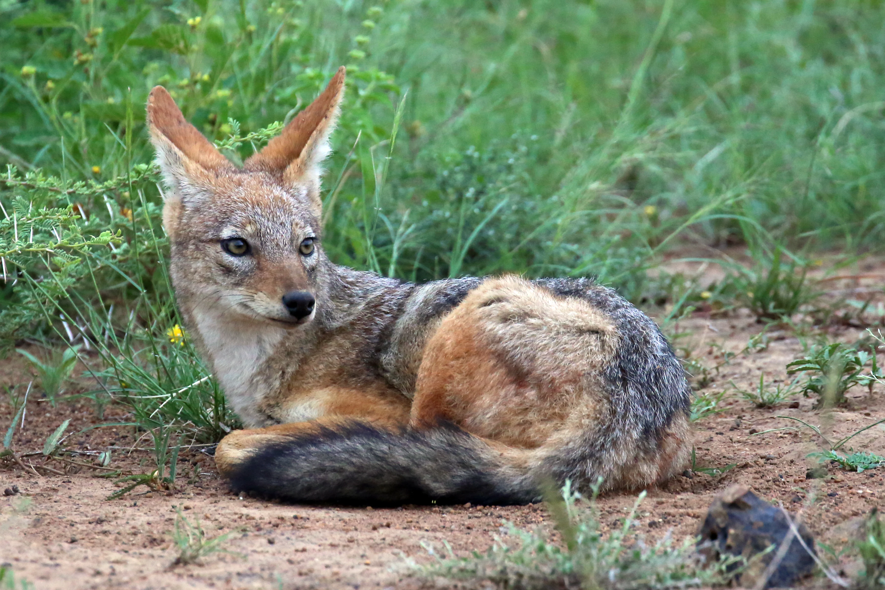
A black-backed jackal resting on the ground in a grassy area with its body turned to the side and head looking towards the left.
A black-backed jackal resting in the grasslands of Pilanesberg National Park.

Pilanesberg National Park ecosystems, habitats, and plant life

Pilanesberg's natural character is shaped by the meeting of two major ecological worlds. Because the reserve sits in the transition zone between the Kalahari and the Lowveld bushveld, both systems meet here, producing overlaps in plant communities, mammal ranges and birdlife. The mosaic of north- and south-facing hill savannas, pediment grasslands, valley savannas, valley thickets and rock outcrop thickets creates fine-grained habitat diversity within a relatively compact reserve.

North-facing slopes are sunnier and drier and carry characteristic stands of red bushwillow, while the cooler, moister south-facing slopes support hook thorn, wild pear, buffalo thorn, and isolated populations of mountain cabbage trees and aloes, both heavy browsers, that have retreated to the highest hills in response to decades of elephant pressure. Pediment flats are kept open by a ferricrete layer that prevents tree growth, creating grassland patches that contrast with the wooded valleys below them. Outcrops of red syenite weather into boulder jumbles that host their own thicket flora, including lavender fever-berry, large-leaved fig and red balloon trees. The result is a park that mixes bushveld, Kalahari sandveld influences, rocky highland thicket and open grassland within the same drainage basins.
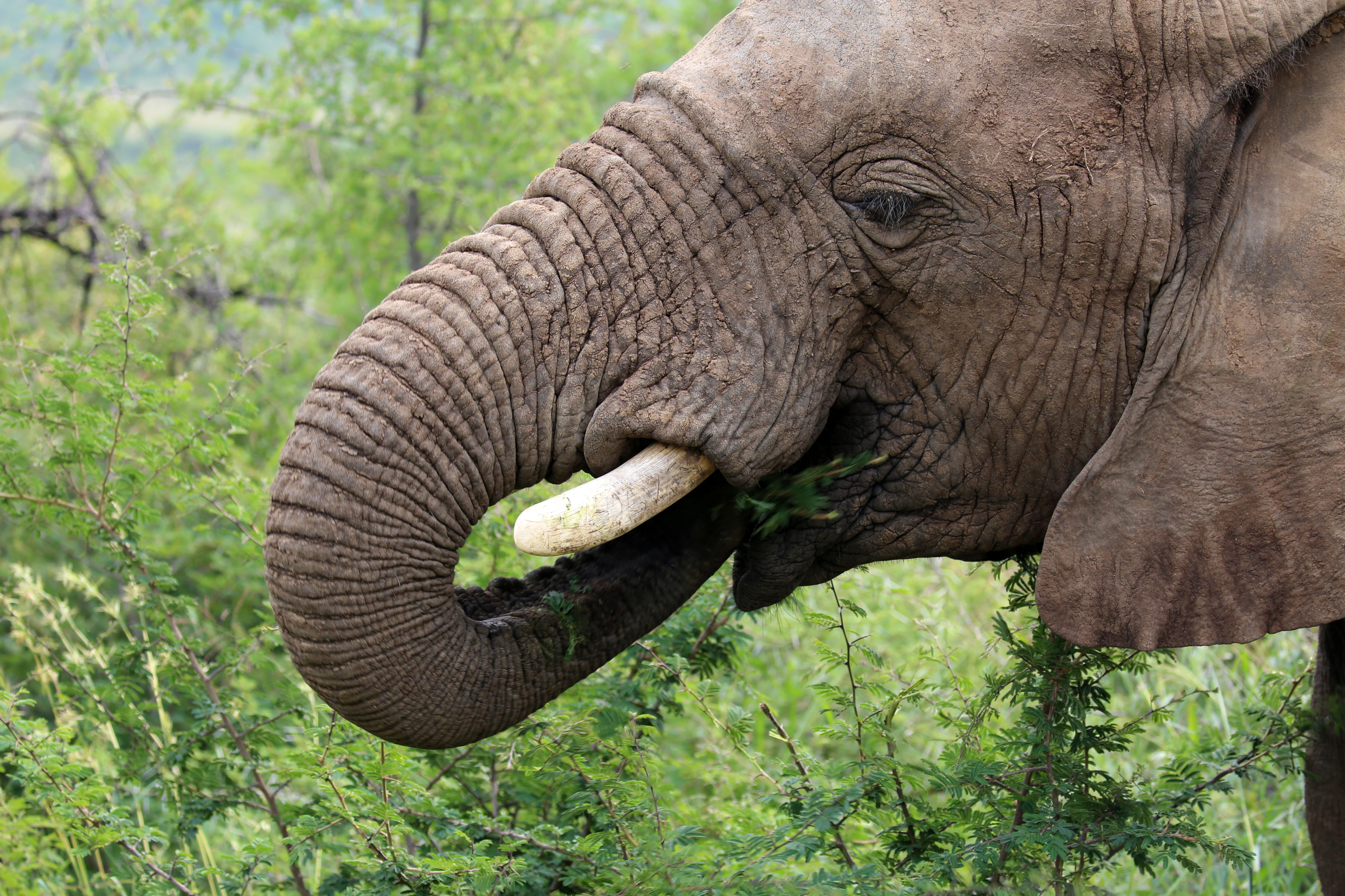
Close-up of an African elephant head and trunk eating green foliage in a brushy landscape.
An African elephant feeding on vegetation in Pilanesberg National Park.

Pilanesberg National Park wildlife and species highlights

Pilanesberg is best known among wildlife watchers for two features: it holds what is often described as the highest concentration of brown hyena of any game park in the world, and it offers the opportunity to see all of the Big Five within driving range of major urban centres. The Big Five were not originally abundant in this part of South Africa; they were introduced through deliberate reintroduction programs that turned the reserve into one of the country's most ambitious rewilding experiments.

Resident large mammal species include lion, leopard, cheetah, African bush elephant, Cape buffalo, southern white rhinoceros and south-western black rhinoceros, together with hippopotamus, giraffe, plains zebra, blue wildebeest, impala, kudu, waterbuck, springbok, tsessebe, red hartebeest, klipspringer, steenbok, common eland and sable antelope. Smaller mammals include chacma baboon, vervet monkey, mohol bushbaby, banded mongoose, caracal and black-backed jackal. Brown hyena are joined by smaller numbers of spotted hyena, and reintroduced Cape wild dogs, once lost to poaching, roam the reserve again. Roughly 60 Nile crocodiles live in the park's dams.

The birdlife is equally rich. More than 360 species have been recorded in Pilanesberg, including resident species and migrants that feed variously on carrion, live prey, seeds, fruit and aquatic organisms. The Manyane Complex in the east hosts a self-guided walking trail and a walk-in aviary housing over 80 indigenous species for environmental education.
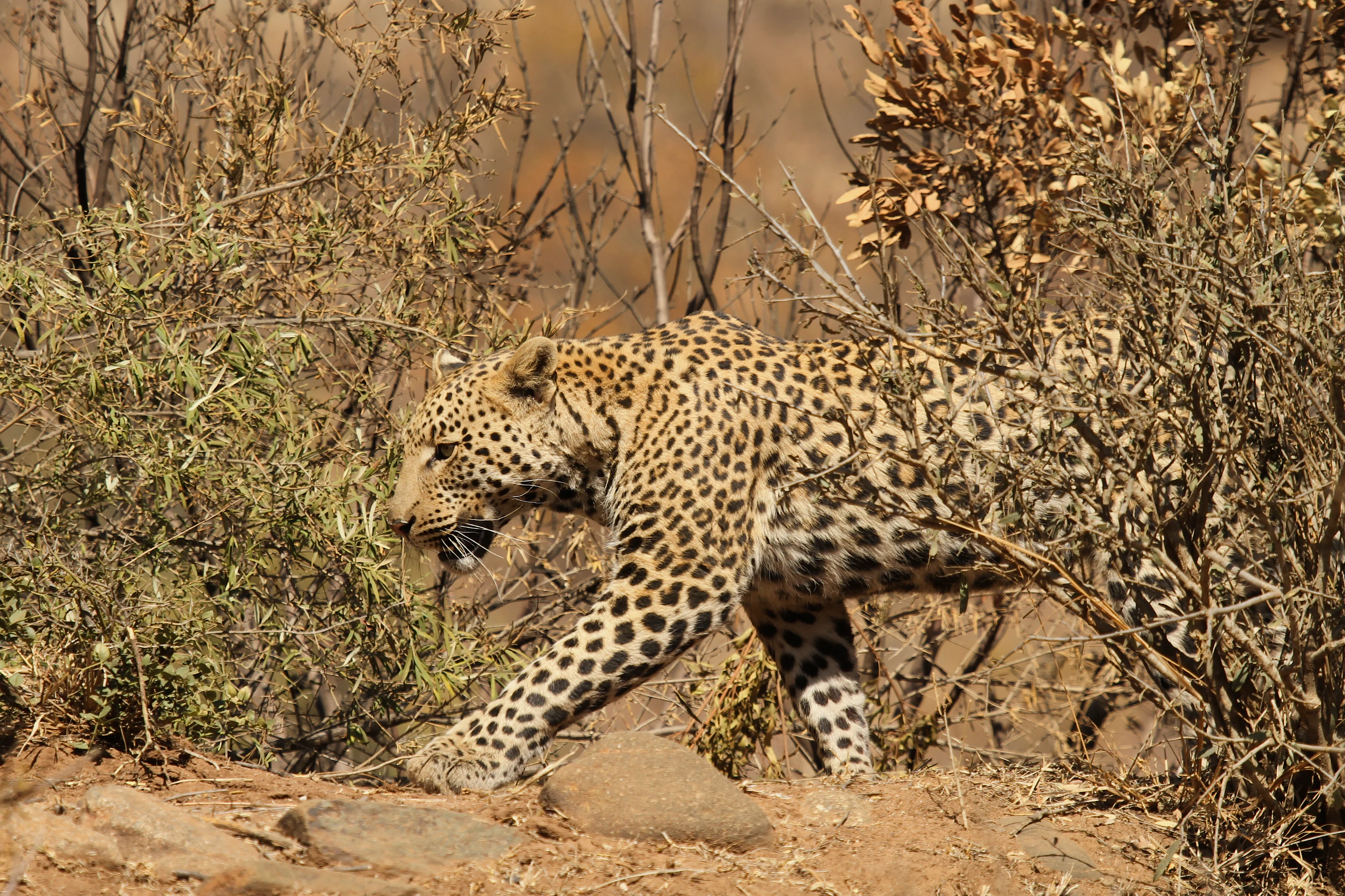
A leopard with spotted fur walking through dry, sparse shrubbery and rocky terrain.
A leopard moving through dry brush in Pilanesberg National Park.

Pilanesberg National Park conservation status and protection priorities

From a conservation standpoint, Pilanesberg matters because it is one of the clearest examples of a large-scale, human-driven African ecosystem reconstruction. Before the reserve's creation, the area was fragmented farmland with human settlements scattered across the hills; today, it supports a sizable, free-roaming population of large southern African mammals in a landscape actively managed for wildlife. Operation Genesis, which relocated around 6,000 animals of 22 species in the early 1980s and remains the largest such translocation in South African history, is by itself a major conservation milestone, and the reserve's predator population has been independently reinforced through later relocations of lions and cheetahs from Namibia.

Pilanesberg also serves as a refuge for species that had been lost from the area, including brown hyena, Cape wild dog and, through careful management, both black and white rhinoceros. The park's 2004 northward expansion is intended to create a wildlife corridor linking it to the Madikwe Game Reserve, increasing long-term ecological connectivity in the region. Its accessibility, close to Gauteng, also gives it a strong educational and outreach role, and it consistently ranks among the most visited public game reserves in South Africa.

Pilanesberg National Park cultural meaning and human context

The Pilanesberg carries a deep and layered human story. It has been inhabited since the Middle Stone Age, and Iron Age communities built settlements whose enclosures still exist in the park. The mountain range is named after Chief Pilane of the Kgafela people, whose dynasty shaped the political landscape of the 19th century, and the area was swept by the Difaqane wars of the 1820s and the broader upheavals that followed.

The modern reserve itself grew out of negotiations between South African authorities and two local communities, the Bakgatla under Chief Tsidimane Pilane and the Bakubung tribe, whose members were resettled from within today's park boundary in exchange for new land holdings. The reserve's name and its institutional identity therefore remain closely bound up with traditional Tswana leadership and the displaced communities whose lands it incorporates, alongside the older Boer-farm history of its southern section.
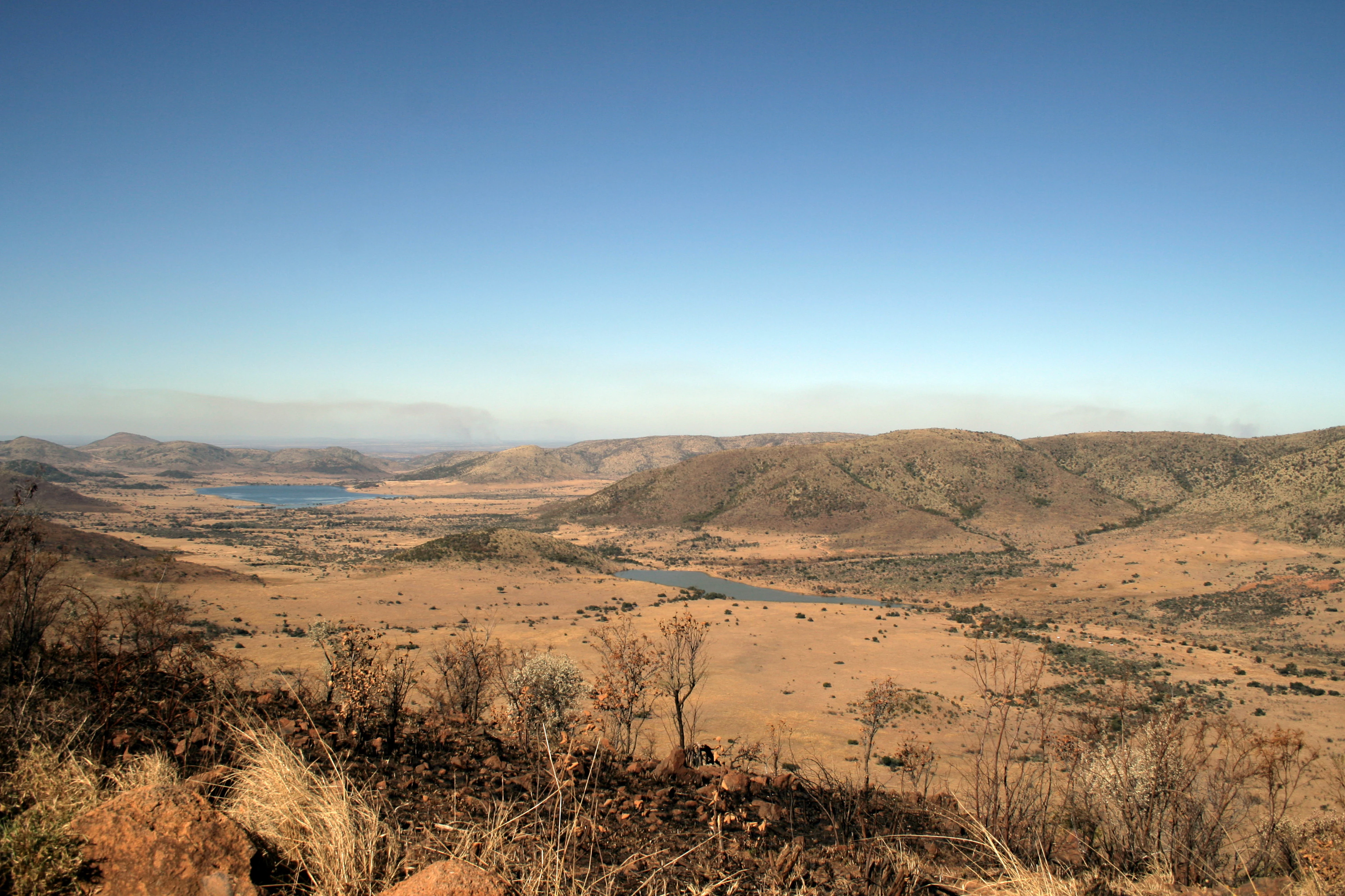
A wide, high-angle landscape shot showing arid, grassy savanna plains and distant water bodies surrounded by low, rolling hills under a clear blue sky.
A wide view of the savanna and lakes from the Lenong lookout point in Pilanesberg National Park.

Top sights and standout views in Pilanesberg National Park

Standout features of Pilanesberg include the dramatic concentric rings of the Pilanesberg Alkaline Ring Complex, with hilltop lookouts such as Lenong offering panoramic views, the large central Mankwe Dam and its bird hides, and the unusual ecological moment where Kalahari and bushveld flora and fauna meet.

For visitors, the park's strongest pulls are its dramatic geology and its high-density Big Five viewing in a setting close to Gauteng. It is also notable for its unusually large brown hyena population, the conservation significance of Operation Genesis, and the ongoing program to link Pilanesberg with the Madikwe Game Reserve through a wildlife corridor to the north.
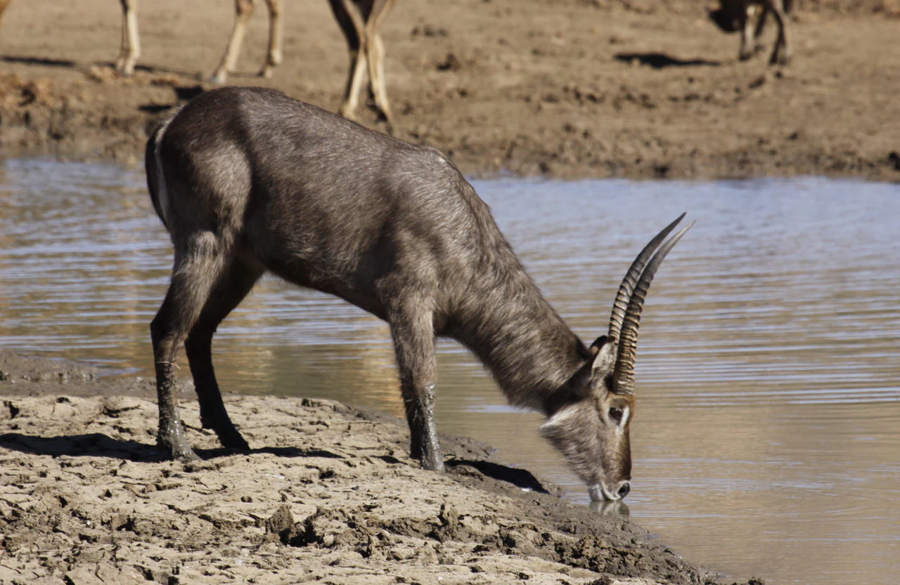
A side profile of a waterbuck standing on a dry, cracked mud bank and drinking from a pool of water.
A waterbuck drinking at a watering hole in Pilanesberg National Park.

Best time to visit Pilanesberg National Park

Park information about seasonality is sparse in the available sources, so specific month-by-month recommendations are not given. In general, the drier winter months in the North West Province tend to make game viewing easier because animals concentrate around water sources such as the Mankwe Dam, while the warmer, wetter summer months bring greener landscapes, more active migrant birdlife and lusher vegetation. Visitors should expect hot summers and cooler, drier winters in this part of the bushveld.

Monthly climate preview

Long-term representative point measurements tracking monthly temperature and precipitation cycles

Pilanesberg National Park Climate Normals, Annual Temperature and Precipitation Rhythm

Pilanesberg National Park exhibits a measured annual rhythm defined by significant monthly variations in mean temperature and daily precipitation totals from representative coordinates. Comprehensive month-by-month climate normals provide deeper analytical context for long-term meteorological patterns across the protected terrain.
Annual mean20 °C
12 °C24 °C
Jan24°
Feb24°
Mar22°
Apr19°
May16°
Jun12°
Jul12°
Aug15°
Sep20°
Oct23°
Nov24°
Dec24°
Warmest month
January

24.4 °C

Coolest month
July

12.2 °C

Wettest month
January

3.9 mm/day

Driest month
July

0.1 mm/day

Park location guide

Geography guide, regional context, and park location map for Pilanesberg National Park

Pilanesberg National Park park geography, regions, and map view in South Africa

Understand where Pilanesberg National Park sits in South Africa through a broader geographic reading of the surrounding landscape, nearby location context, and its mapped position within the national park landscape.

How Pilanesberg National Park fits into South Africa

South Africa is the southernmost country in Africa, spanning 1.22 million km² with a population of over 63 million. The country operates with three capital cities, Pretoria (executive), Cape Town (legislative), and Bloemfontein (judicial), and is renowned for its biodiversity, national parks, and multicultural society.

Wider geography shaping Pilanesberg National Park in South Africa

South Africa occupies the southernmost region of Africa, with coastline along both the Atlantic Ocean to the west and the Indian Ocean to the east. The interior features elevated plateaus including the Highveld, with the Drakensberg escarpment marking the eastern highlands. The country shares borders with Namibia, Botswana, Zimbabwe, Mozambique, Eswatini, and Lesotho.

Map view of Pilanesberg National Park

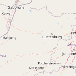
Use this park location map to pinpoint Pilanesberg National Park in South Africa, understand its exact geographic position, and read its mapped placement within the surrounding landscape more clearly.

Pigeon | © OpenStreetMap contributors

Location context for Pilanesberg National Park

North West Province

Visual reference of ancient ring complexes, savanna habitats, and protected terrain.

Pilanesberg National Park Photos and Volcanic Landscape Scenery

Pilanesberg National Park photography captures the eroded skeleton of an ancient volcanic ring complex and its dramatic concentric hills. Visual documentation reveals the rugged rock outcrops, open bushveld savanna, and water bodies defining the protected environment.

A small brown steenbok with upright pointed horns standing in tall green grass with yellow wildflowers.

A Banded Rubber Frog with a smooth dark skin, distinctive pinkish stripes, and spotted patterns on its legs, resting on soil near blades of green grass.

A black-backed jackal resting on the ground in a grassy area with its body turned to the side and head looking towards the left.

Close-up of an African elephant head and trunk eating green foliage in a brushy landscape.

A leopard with spotted fur walking through dry, sparse shrubbery and rocky terrain.

Satellite imagery showing the circular geologic footprint of Pilanesberg National Park in South Africa with its green ridges and valleys set against the surrounding terrain.

A wide, high-angle landscape shot showing arid, grassy savanna plains and distant water bodies surrounded by low, rolling hills under a clear blue sky.

A side profile of a waterbuck standing on a dry, cracked mud bank and drinking from a pool of water.

Three cheetahs sitting in tall grass, one actively feeding with a bloodied face, set against a shadowed, dark forest background.

Three zebras standing in a dry, grassy savanna with rolling mountains visible in the background under an overcast sky.

A lion resting in thick brush and dry vegetation, looking towards the camera.

A wide, calm blue dam with sparse aquatic vegetation in the foreground and rounded, green, volcanic hills rising in the distance under a clear blue sky.

A giraffe standing among a small herd of blue wildebeest on the grassy banks of a dam, with low hills in the background.

Ancient circular stone wall remains constructed from stacked rocks nestled among sparse trees and bushes.

Park atlas

Compare regional park geography, volcanic ring landscapes, and wildlife reserves

Explore Other Parks Near Pilanesberg National Park and Surrounding Protected Areas

Compare Pilanesberg National Park with other protected areas across the surrounding region to evaluate diverse bushveld terrain, savanna habitats, and wildlife reserves. Extending your exploration across nearby national parks reveals broader conservation landscapes and regional topographical variety.
A watercolor painting showing a wide, panoramic view of rolling green and yellow hills, scattered acacia-like trees, and a distant purple mountain range under a light sky.
Nature reserveNorth West
About 46 km away#1 closest

South

Kgaswane Mountain Reserve: Map and Geographic Profile of the Magaliesberg Range

A protected nature reserve in the North West province of South Africa.

Kgaswane Mountain Reserve stands as a pivotal protected landscape within the Magaliesberg Biosphere. This atlas record provides insights into its quartzitic ridges, complex grassland and woodland ecosystems, and status as a Ramsar wetland site, offering a clear view of its geographic and conservation significance.

Area
53 km²
Established
1967
Wildlife reserveNorth West Province
About 75 km away#2 closest

East

Borakalalo Game Reserve: Protected Bushveld and Aquatic Landscapes in North West Province

Mapping a diverse South African wildlife reserve

Borakalalo Game Reserve features a distinct ecological setting within South Africa, combining woodland bushveld with the aquatic ecosystems of Klipvoor Dam. This protected area provides a habitat for varied mammal species and an extensive bird list, set against the backdrop of the interior plateau landscape in North West Province.

Area
130 km²
Relief
Upland
Access
Access unknown
Scope
Terrestrial
A watercolor illustration of rolling green hills, distant mountains, and a pale sky.
Protected landscapeNorth West
About 78 km away#3 closest

Southeast

Magaliesberg Protected Natural Environment: Mapped Geography and Protected Landscape Context

Ancient mountain ridges between Rustenburg and Pretoria

Spanning a long quartzite ribbon, the Magaliesberg Protected Natural Environment represents a sophisticated model of private land conservation. The geography reveals a dramatic elevation gradient where Highveld plateaus meet lower-lying bushveld terrain. This atlas entry details the protected boundaries and the integrated landscape connection between surrounding nature reserves.

Area
343.56 km²
Established
1994
Relief
Mountain
Scope
Terrestrial
Watercolor painting of a river flowing through a hilly, green valley with rocky cliffs on the right.
Biosphere reserveNorth West
About 81 km away#4 closest

Southeast

Magaliesberg Biosphere Reserve: Geographic Overview and Protected Area Landscape Mapping

Ancient mountain ranges in South Africa

The Magaliesberg Biosphere Reserve features a rugged terrain of high ridges and deep kloofs that support a vast array of bird species and vegetation. As a significant conservation area in North West, it preserves geological history alongside critical transitional ecosystems. Discover the mapped boundaries and natural features of this protected region that bridges urban centers and wilderness.

Area
3,578.7 km²
Established
2015
Relief
Mountain
Climate
Subtropical
Nature reserveLimpopo
About 82 km away#5 closest

Northwest

Atherstone Nature Reserve: Mapping the Savannah and Bushveld of Limpopo, South Africa

A collaborative conservation landscape of plains and grasslands

Atherstone Nature Reserve features a distinctive blend of classic bushveld thickets and open Kalahari-influenced grasslands. Situated in Limpopo, the 23,500 hectare protected area serves as a primary hub for large mammal conservation and savannah ecology, offering researchers and atlas enthusiasts a focused look at South Africa’s northern provincial wilderness.

Area
235 km²
Established
1994
Relief
Upland
Climate
Subtropical
Biosphere reserveLimpopo
About 84 km away#6 closest

Northeast

Waterberg Biosphere: A Protected Sandstone Massif in Limpopo Province South Africa

Geology, mapping, and ecological zones of the Waterberg range

The Waterberg Biosphere stands as a major protected region in South Africa, formed by ancient sandstone layers sculpted into mesas and deep gorges. This massif bridges ecological zones from highland savanna to riverine habitats, anchoring a network of game reserves and wilderness areas through its distinctive geological and historical landscape identity.

Area
6,540.33 km²
Established
2001
Relief
Mountain
Climate
Subtropical
National parkLimpopo Province
About 88 km away#7 closest

Northeast

Marakele National Park: National Park Protected Landscape and Geographic Context

Explore its Limpopo Province regional setting and mapped boundaries.

Marakele National Park represents a vital protected national park within the diverse geography of Limpopo Province, South Africa. This entry provides detailed atlas-style information on its protected landscape, focusing on mapped geographic boundaries and its context within the regional natural terrain. It serves as a key resource for understanding the park's specific role as a conservation area and its place within the broader atlas of South African protected lands.

Area
670 km²
Established
1994
Relief
Mountain
Climate
Subtropical
Wildlife reserveLimpopo
About 102 km away#8 closest

Northeast

Mabula Game Reserve: Protected Bushveld and Geographic Landscape Profile

Exploration of the Limpopo bushveld and wildlife habitat boundaries

Mabula Game Reserve provides a detailed look at the bushveld ecosystems of South Africa. Spanning 12,000 hectares in Limpopo, the reserve features a unique blend of rocky ridges, open savanna, and riverine woodlands. Its structural diversity creates a distinct natural corridor that serves as a focal point for understanding regional wildlife distribution and the transition zone between the Waterberg and the northern plains.

Area
120 km²
Scope
Terrestrial

Common questions about visiting, size, designation, and location context for Pilanesberg National Park

Pilanesberg National Park FAQs for park facts, access, geography, and protected area context

Find quick answers about Pilanesberg National Park, including protected-area facts, park geography, trail and visitor context, and how the park fits into its surrounding country and regional landscape.
MoriAtlas Explorer

Continue Your Protected Areas Search Across the Global Atlas

Deepen your exploration by continuing the structured search for national parks and protected areas worldwide. Utilize the comprehensive filtering capabilities to compare different conservation landscapes and refine your understanding of global park geography. Discover more about the distribution and characteristics of protected natural areas.

Global natural geography