
Mori Atlas logo
Wildlife reservePlatte River Wilderness

Tracing the protected river corridor and regenerating forest mosaic across the Wyoming and Colorado borderlands.

Platte River Wilderness: An Atlas of North Platte River Canyons and Mountain Forest Landscapes

Platte River Wilderness represents a protected mountain landscape anchored by the winding North Platte River corridor. This area encompasses deep canyon terrain, conifer forests, and the dramatic rock formations of Northgate Canyon. Following the 2020 Mullen Fire, the region has evolved into a significant mosaic of regenerating forest habitat, providing a critical study of ecological transition and wild river topography within the southern Rocky Mountains.

wilderness areariver canyonNorth Platte Riverconifer forestwhitewater raftingtrout fishing
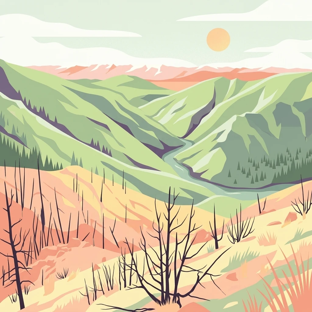
An illustration showing a landscape with a river winding through green hills, with a foreground of burnt-looking skeletal trees, orange grassy terrain, and a pale sun in the sky.

Platte River Wilderness

Wildlife reserve

Park overview

Structured park overview, official facts, and landscape profile for Platte River Wilderness

Platte River Wilderness park facts, protected area profile, and essential visitor context

Review the core facts for Platte River Wilderness, including designation, size, terrain, visitor scale, habitats, and operating context in one park-focused overview.

About Platte River Wilderness

Platte River Wilderness is one of the smaller but scenically rich wilderness areas in the southern Rocky Mountain region, centered on a relatively undisturbed segment of the North Platte River as it crosses the Wyoming-Colorado border. Although it is not a vast reserve, the area packs a striking range of mountain environments into its boundaries, from forested ridges and upland meadows to sheer canyon walls and boulder-strewn river channels.

The wilderness belongs to the Medicine Bow-Routt National Forest, one of the largest forest systems in the Rocky Mountains. The bulk of the wilderness, roughly 22,749 acres, lies in the Wyoming portion managed as Medicine Bow National Forest, while 743 acres extend over the state line into Routt National Forest in Colorado. Since 1995, the two national forests have been administered jointly, giving Platte River Wilderness a unified management framework despite its cross-state geography.

Visitors come to the area for a mix of recreation rather than for a single signature attraction. The river corridor supports rafting through the Northgate Canyon run, fishing for trout in waters considered exceptional by both Wyoming and Colorado wildlife agencies, and dispersed camping along forest stretches. Surrounding trails and forest roads provide access to higher elevations, scenic overlooks, and remote terrain that feels far removed from the nearby town of Rawlins and the interstate corridors to the north.

Forest condition is one of the wilderness's defining modern realities. Before 2020, much of the wilderness was cloaked in mature conifer forest, much of it older stands of pine and spruce characteristic of the southern Rockies. The Mullen Fire, which burned across the broader region that year, consumed almost all of the forested cover within the wilderness. That event dramatically reshaped both the scenery and the ecology of the area, transforming dense forest into a regenerating mosaic that is now a defining feature of the landscape.

Quick facts and research context for Platte River Wilderness

Platte River Wilderness covers about 23,492 acres in Carbon and Albany counties in southern Wyoming, with a small 743-acre extension into Jackson County, Colorado. It lies within the Medicine Bow-Routt National Forest system, with the larger Wyoming portion administered as part of Medicine Bow National Forest. Established as a formal wilderness in 1984, the area is classified as IUCN Category Ib and managed by the U.S. Forest Service.

The wilderness centers on the upper North Platte River, including the whitewater stretch of Northgate Canyon. Both Wyoming and Colorado wildlife agencies recognize the river here as a high-quality trout fishery, supporting recreational fishing alongside rafting, hiking, and hunting. The terrain and elevated river corridor are typical of the transitional mountain country along the Wyoming-Colorado divide.

Protection and recognition

Documented terrestrial protection scope and international designation records

Platte River Wilderness Protection Status and Transboundary Area Overview

Terrestrial protection records for Platte River Wilderness outline the documented conservation scope and transboundary status of the protected landscape. Official management details provide verified reference data regarding the protected area designation and territorial framework.

Protection details

Protection scope
Terrestrial
Transboundary protection
Yes
Park context

Deeper park guide and search-rich context for Platte River Wilderness

Platte River Wilderness history, landscape, wildlife, and travel context

Explore Platte River Wilderness through its history, landscape character, ecosystems, wildlife, conservation priorities, cultural context, and seasonal travel timing in a structured park guide built for atlas discovery and search intent.

Why Platte River Wilderness stands out

Platte River Wilderness is best known for the upper North Platte River, which cuts a winding course of canyon country through forested mountains just south of the Wyoming-Colorado line. The Northgate Canyon stretch is recognized as a serious white-water rafting run, while the river itself is regarded by state fish and wildlife agencies as a blue-ribbon or Gold Medal trout fishery along its length through the wilderness. Equally defining is the area's conifer forest character, dominated by pine and spruce stands typical of the Medicine Bow and Park ranges. The 2020 Mullen Fire burned through nearly the entire forested landscape, transforming dense stands into an open, regenerating mosaic that has, in ecological terms, become the wilderness's most visible modern identity and its most important habitat feature for big game species.
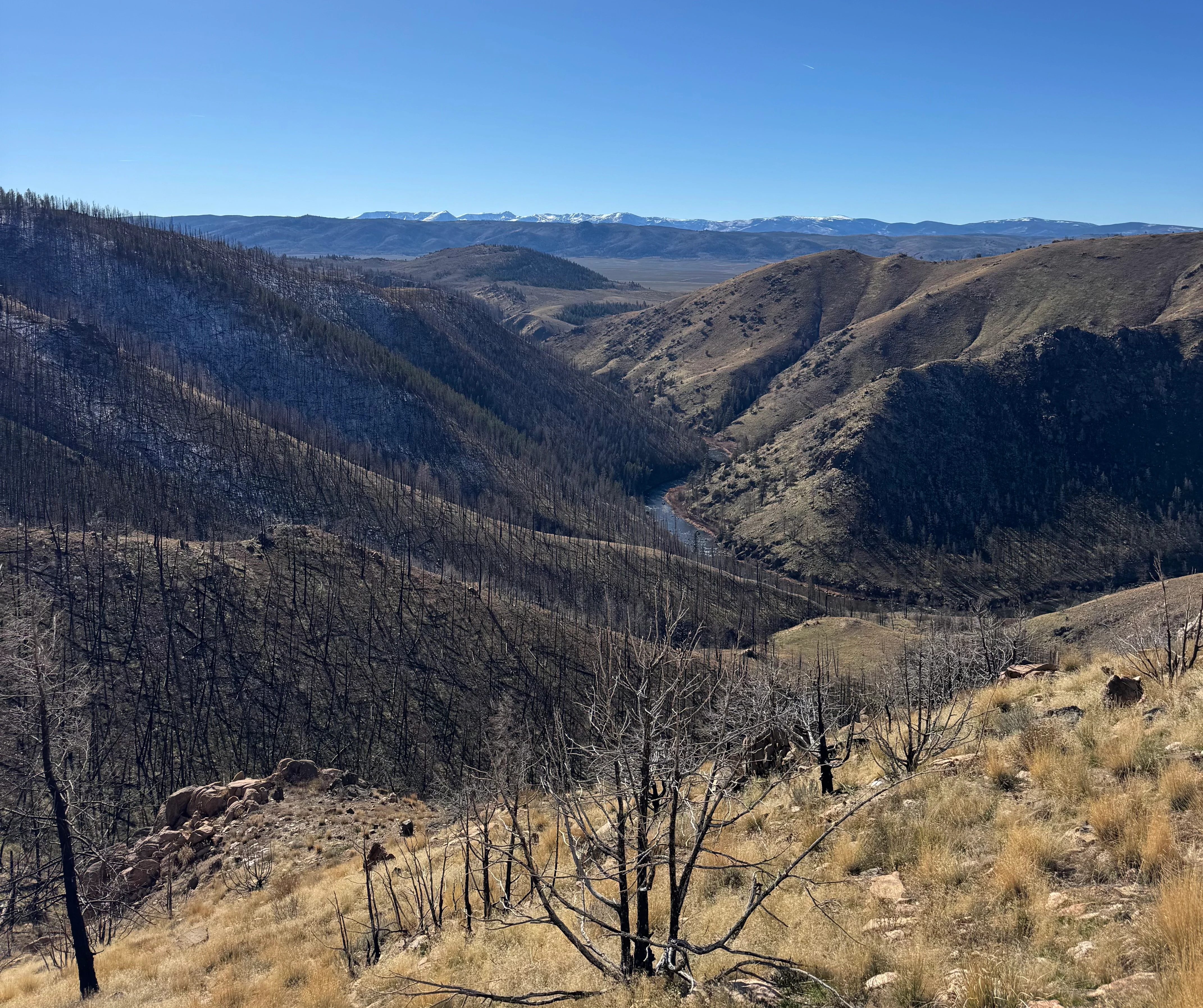
A wide, high-angle landscape shot of a deep river valley featuring slopes covered in charred remains of trees, with a winding river visible below and snow-capped mountains in the distant horizon under a clear blue sky.
A view looking south toward Six Mile Gap, showing the rugged terrain and signs of forest regrowth along the North Platte River.

Platte River Wilderness history and protected-area timeline

Platte River Wilderness has a relatively modern protective history. It received its formal federal wilderness designation in 1984 through the Wyoming Wilderness Act, which set aside a series of backcountry landscapes in southern Wyoming as protected wilderness. The legislation recognized the long-standing wild character of the upper North Platte River corridor and elevated it into the National Wilderness Preservation System.

Even before designation, the land was part of the National Forest system and had long been used for outdoor recreation, hunting, and fishing. The designation added an additional layer of protection, limiting road building, motorized use, and commercial development while preserving the area's primitive character.

In 1995, the U.S. Forest Service administratively combined Medicine Bow National Forest and Routt National Forest into a unified administrative unit, today known as the Medicine Bow-Routt National Forest. As a result, the Platte River Wilderness, which had always straddled both forests, came under a single management structure rather than being split between two separate administrations.

The most consequential event in the wilderness's modern history was the 2020 Mullen Fire, which burned across a large region including most of the forested terrain within the wilderness. The fire dramatically altered the forest landscape, destroying nearly all of the mature conifer stands that once defined the area. Although the burn was ecologically destructive in the short term, the resulting pattern of burned patches and surviving timber created a mosaic of open habitat that has supported increases in elk, mule deer, and bighorn sheep, reshaping the wilderness's ecological profile for the coming decades.

Platte River Wilderness landscape and geographic character

The landscape of Platte River Wilderness is shaped by the upper North Platte River and the surrounding mountain terrain of the southern Rocky Mountains. The river is the dominant geological force here, cutting a winding path through the mountains and carving canyons such as the dramatic Northgate Canyon, a narrow, rocky gorge that is one of the most recognizable landforms in the area.

Surrounding the river corridor, the terrain rises into forested ridges, slopes, and benches typical of the Medicine Bow Range on the Wyoming side and the Park Range foothills on the Colorado side. Elevations vary enough to create distinct micro-landscapes, from the lower river bottoms with their mix of riparian vegetation and exposed rock, to mid-elevation slopes that historically supported dense conifer forest, to the upper benches and saddles with thinner soils and more open ground.

The river itself strongly defines the feel of the wilderness. Its corridor is a long, sinuous ribbon of moving water, flanked in many sections by canyon walls and boulder fields. In other stretches, the valley opens slightly, with forested benches and meadows adjacent to the channel. This contrast between tight canyon and more open valley sections gives the wilderness a varied visual character despite its relatively compact size.

In the wake of the 2020 Mullen Fire, the forested portions of the landscape have been transformed. Where dense pine and spruce stands once cloaked the slopes, the post-fire landscape offers a more open, sun-exposed character, with standing dead trees, regenerating ground cover, and a patchwork of burned and surviving patches. This new visual identity has become one of the defining features of the modern wilderness landscape.

Platte River Wilderness ecosystems, habitats, and plant life

Platte River Wilderness reflects the transitional ecology between the southern Wyoming highlands and the northern Colorado mountain country. Before the Mullen Fire, the area's defining natural characteristic was its extensive conifer cover, dominated by pine and spruce species typical of montane forest zones in this part of the Rockies. These forests supported the full suite of mountain forest ecosystems, from shaded understory environments to more open ridgetop stands.

The North Platte River and its tributaries shape the riparian character of the area. The river corridor includes gravel bars, cobble beds, side channels, and narrow floodplain pockets that support a distinctive band of riverside vegetation quite different from the surrounding forest. These riparian zones are particularly important for wildlife, providing water, shelter, and movement corridors through the broader landscape.

The post-fire environment has fundamentally altered the area's ecology, at least in the short and medium term. The mosaic of burned and surviving forest patches has created a more heterogeneous environment, with a mix of open ground, fallen timber, regenerating shrubs, and remaining forest patches. Over time, this pattern will evolve as conifers regenerate, but in the current period, the wilderness combines elements of recently burned terrain with surviving forest and the unchanged river corridor.

Platte River Wilderness wildlife and species highlights

Wildlife is one of the strongest reasons Platte River Wilderness draws attention, and the area supports a typical southern Rocky Mountain fauna associated with forested mountains, canyon country, and high-quality trout streams. Big game is particularly prominent. Elk, mule deer, and bighorn sheep are the most recognizable species associated with the wilderness, especially in the post-fire landscape where the new mosaic habitats have improved forage and visibility conditions for these animals.

The North Platte River corridor is also a defining feature for aquatic wildlife. Both Wyoming and Colorado state agencies recognize the river's exceptional trout habitat within the wilderness, with trout populations supported by cold, clean water and abundant insect life in the canyon stretches. These waters are considered high-value fisheries for both states.

Beyond big game and trout, the wilderness supports a broader community of mountain wildlife typical of the southern Rockies. Forest and edge habitats, riparian zones, and rocky canyon terrain provide living space for smaller mammals, birds of prey, and a variety of songbird and upland game species that are characteristic of montane environments in this part of Wyoming and Colorado.

Platte River Wilderness conservation status and protection priorities

Platte River Wilderness contributes to conservation in two distinct but complementary ways: through its long-term protection as a designated wilderness, and through the contemporary ecological value of its post-fire mosaic. As a Congressionally designated wilderness within the Medicine Bow-Routt National Forest, it benefits from the strongest land-protection regime available to U.S. national forest lands, with restrictions on road construction, motorized use, and commercial development that help preserve its primitive character.

The wilderness also protects a high-value section of the upper North Platte River, safeguarding both its riparian habitat and its water quality. The recognition of the river by Wyoming and Colorado as a blue-ribbon and Gold Medal trout fishery, respectively, summarizes the ecological importance of the river corridor and the value of maintaining it in a largely undisturbed state.

In a more recent context, the 2020 Mullen Fire has turned the area into an important case study in post-fire landscape ecology. While the burn was destructive, it generated habitat conditions that, in ecological terms, are favorable to several important big game species, including elk, mule deer, and bighorn sheep. This has reinforced the wilderness's role as both a protected landscape and a living laboratory for understanding how southern Rocky Mountain ecosystems respond to large-scale disturbance.

Platte River Wilderness cultural meaning and human context

Platte River Wilderness lies in a region that has historically supported ranching, small-scale mining, and forest use associated with the Medicine Bow and Park ranges. Nearby communities such as Rawlins reflect the broader cultural identity of southern Wyoming, where livestock grazing, outdoor recreation, and resource industries have long coexisted. The wilderness itself is not a culturally defined landscape in the way some heritage parks are, but its setting is closely tied to the working forest and ranch landscapes of the surrounding region.

Top sights and standout views in Platte River Wilderness

Platte River Wilderness stands out for the contrast between its rugged North Platte River corridor and its surrounding forested mountains, anchored by the whitewater passage of Northgate Canyon and waters that are formally recognized by both Wyoming and Colorado as among the highest-quality trout streams in their respective states. The wilderness's compact footprint makes it unusually rich in concentrated river, canyon, and forest scenery for its size.

Equally notable is the area's modern post-fire character. The 2020 Mullen Fire burned through nearly the entire conifer forest, leaving behind a regenerating mosaic landscape that now supports thriving populations of elk, mule deer, and bighorn sheep. This combination of wild canyon rivers, transitional mountain forests, and a recovering, mosaic-shaped landscape gives the wilderness a distinctive profile among southern Rocky Mountain protected areas.

Best time to visit Platte River Wilderness

Platte River Wilderness is most accessible and most pleasant to visit during the typical mountain recreation season of late spring through early fall. Late spring and early summer bring active river conditions, fresh snowmelt flows, and cooler temperatures suited to hiking, rafting, and fishing, while the long daylight hours of summer support extended trips into the canyon terrain.

Late summer and early fall are often the most stable periods for visiting, with lower water levels that may affect rafting but typically favorable weather for trail-based activities. Hunters and anglers often favor fall for elk, deer, and trout activity, while shoulder-season visits in spring and fall offer quieter conditions and shifting scenery along the river corridor.

Monthly climate preview

Long-term representative temperature and precipitation patterns across twelve months

Platte River Wilderness Climate Normals and Monthly Weather Records in Wyoming

Platte River Wilderness records a measured annual temperature and precipitation rhythm across thirty years of NASA data from a representative coordinate. Accessing the complete monthly climate normals reveals detailed temperature ranges and precipitation rates for this protected area.
Annual mean2 °C
-10 °C17 °C
Jan-10°
Feb-9°
Mar-5°
Apr
May
Jun12°
Jul17°
Aug15°
Sep10°
Oct
Nov-4°
Dec-10°
Warmest month
July

16.6 °C

Coolest month
January

-10.2 °C

Wettest month
April

2.5 mm/day

Driest month
August

1.3 mm/day

Park location guide

Geography guide, regional context, and park location map for Platte River Wilderness

Platte River Wilderness park geography, regions, and map view in United States of America

Understand where Platte River Wilderness sits in United States of America through a broader geographic reading of the surrounding landscape, nearby location context, and its mapped position within the national park landscape.

How Platte River Wilderness fits into United States of America

The United States of America is a federal presidential republic and one of the world's largest countries by area and population. It consists of 50 states across a vast territory spanning multiple time zones, with its capital in Washington, D.C. and largest city in New York City. The nation has a diverse economy, influential political system, and significant cultural and military presence globally.

Wider geography shaping Platte River Wilderness in United States of America

The United States occupies a vast territory in North America, bordered by Canada to the north and Mexico to the south. The 48 contiguous states stretch from the Atlantic to the Pacific Ocean, while Alaska occupies the northwestern region and Hawaii is an archipelago in the Pacific. The country encompasses diverse terrain including the Rocky Mountains, Appalachian Mountains, Great Plains, and extensive river systems.

Map view of Platte River Wilderness

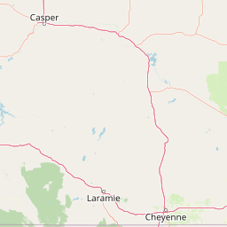
Use this park location map to pinpoint Platte River Wilderness in United States of America, understand its exact geographic position, and read its mapped placement within the surrounding landscape more clearly.

Pigeon | © OpenStreetMap contributors

Location context for Platte River Wilderness

ColoradoWyoming
Recorded earthquake history

Browse the Historical Earthquake Catalogue for Platte River Wilderness

Investigate the history of recorded seismic events in the vicinity of Platte River Wilderness. This collection provides an accessible overview of seismic activity patterns, including magnitude and epicentre data for the North Platte River region, allowing for a better understanding of the local geographic context through MoriAtlas data.

Platte River Wilderness Earthquake History

Catalogued events

11 events

Strongest magnitude

Magnitude 3.9

Most recent event

Sep 14, 2024

This history includes earthquakes recorded inside the park or within 50 km of its borders

Visualizing the protected landscapes, canyon terrain, and conifer forest regeneration

Platte River Wilderness Photos: Exploring River Canyons and Mountain Scenery

Examine high-resolution photography documenting the rugged river corridors, dramatic rock gorges, and regenerating forest habitats of Platte River Wilderness. Visual archives reveal the unique topography and post-fire ecological transition shaping this protected mountain sanctuary.

A wide, high-angle landscape shot of a deep river valley featuring slopes covered in charred remains of trees, with a winding river visible below and snow-capped mountains in the distant horizon under a clear blue sky.

Park atlas

Compare adjacent river corridors and protected forest terrain across the southern Rocky Mountains

Explore Parks Near Platte River Wilderness and Surrounding Protected Mountain Landscapes

Continue browsing other national parks and protected areas located near Platte River Wilderness in Wyoming and Colorado. Compare regional mountain terrain, river canyons, and conifer forest ecosystems to understand the broader geography of the surrounding borderland.
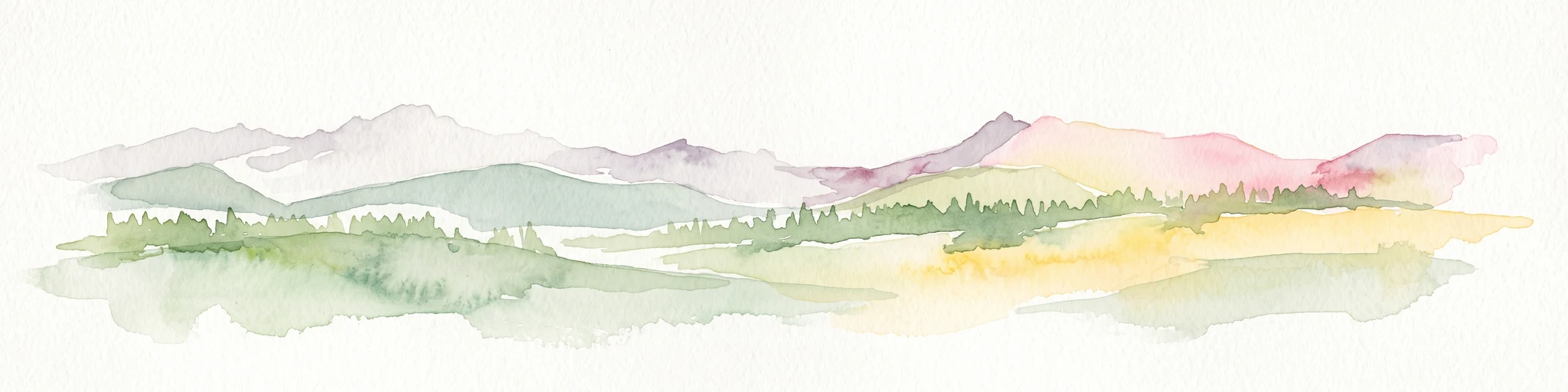
A horizontal watercolor painting showing a range of purple and reddish-toned mountains in the distance, behind rolling green fields and a pale pinkish waterway in the foreground.
Protected landscapeColorado
12 km away#1 closest

Southeast

Roosevelt National Forest: Mapping Wilderness and Protected Landscapes in Northern Colorado

Regional geography, river corridors, and alpine mountain terrain

Roosevelt National Forest encompasses a significant protected landscape across Larimer, Boulder, Gilpin, and Jefferson counties. The forest features a complex terrain of deep canyons, forested plateaus, and protected wilderness areas that form a scenic buffer along the eastern side of the Continental Divide and Rocky Mountain National Park.

Area
3,293.33 km²
Established
1902
Relief
Mountain
Climate
Subpolar
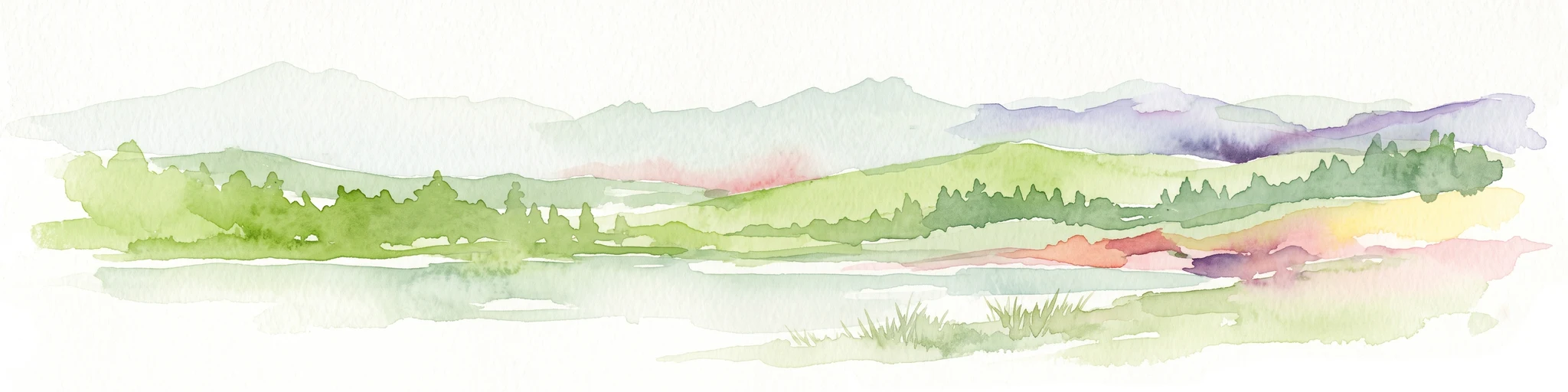
A watercolor illustration of a mountain range with soft, pastel-colored peaks in the background and a green treeline in the foreground.
Wildlife reserveColorado
22 km away#2 closest

Southwest

Mount Zirkel Wilderness: Protected Mountain Geography and Forested Landscape Overview

A study of high elevation terrain in the Colorado Rocky Mountains.

Mount Zirkel Wilderness stands as a primary protected area within the Colorado Rocky Mountains. The landscape is defined by the Encampment River headwaters, glaciated alpine basins, and the characteristic ribbon forests formed by extreme snowfall. This analysis explores the metamorphic bedrock and forest composition across the high ridges near the Continental Divide, providing a clear view of the park boundaries and regional environmental features.

Area
647.23 km²
Established
1980
IUCN
Ib
Relief
Mountain
Wildlife reserveWyoming
25 km away#3 closest

West

Encampment River Wilderness: Protected River Canyon Geography and Mapped Terrain

A focused wilderness landscape in the Medicine Bow National Forest

The Encampment River Wilderness preserves a unique, roadless canyon corridor in south central Wyoming. By protecting the river drainage, it maintains a critical forest ecosystem defined by steep slopes and riparian habitats within the broader Medicine Bow National Forest mountain range.

Area
40.97 km²
Established
1984
IUCN
Ib
Relief
Mountain
Protected areaWyoming
35 km away#4 closest

West

Huston Park Wilderness: Atlas Exploration of Wyoming Protected Mountain Terrain

Examining the high-country forest and alpine geography of the Medicine Bow region.

Huston Park Wilderness serves as a protected sanctuary for the coniferous forests and rocky ridges of central Wyoming. This atlas entry provides geographic insights into its 30,000 acres of subalpine wilderness, tracing how its mountain terrain remains preserved within the Medicine Bow National Forest without human development.

Area
123.79 km²
Established
1984
IUCN
Ib
Relief
Mountain
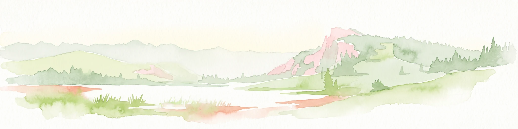
A horizontal watercolor painting showing a soft mountain range in the distance, a midground forest, and a foreground area suggesting marshy ground or a meadow.
Wildlife reserveColorado
67 km away#5 closest

Southeast

Never Summer Wilderness: Protected Mountain Geography and Alpine Terrain in Colorado

High-altitude wilderness along the Continental Divide

Spanning over 21,000 acres, the Never Summer Wilderness defines a critical segment of the Colorado Rockies. This protected area features a jagged skyline of 12,000-foot summits, extensive alpine tundra, and the remarkable old-growth spruce and fir forests of Bowen Gulch. Use these maps to understand its role as a vital headwater landscape and its position as a sanctuary for alpine wildlife and ecosystems.

Area
85.3 km²
Established
1980
IUCN
Ib
Relief
Mountain
National parkColorado
68 km away#6 closest

Southeast

Rocky Mountain National Park: National Park Protected Landscape in Colorado

Explore its mapped boundaries and regional geographic context.

Rocky Mountain National Park is a designated National Park within Colorado, crucial for understanding the distribution and geographic context of protected areas in the United States. This detail page provides an atlas-oriented perspective, emphasizing the park's mapped boundaries and its place within the natural landscape of the region. It is designed to facilitate a clear understanding of the park's protected status and its contribution to the atlas of natural landscapes, offering factual insights for geographic discovery.

Area
1,074.28 km²
Established
1915
IUCN
II
Visitors
4.2M annual
Protected landscapeGrand County
91 km away#7 closest

Southeast

Arapaho National Recreation Area: Geographic Profile and Protected Landscape Context

High-country mountain reservoirs and forested mountain terrain

The Arapaho National Recreation Area defines a unique intersection of montane forest and water-based geography in Grand County, Colorado. As the home to the Great Lakes of Colorado, this protected landscape provides a critical connection point between the Colorado River headwaters and the Continental Divide. Examine the park's terrain, reservoir distribution, and its role as a forested gateway to the neighboring mountain regions.

Area
124.2 km²
Established
1978
Relief
Mountain
Climate
Alpine
A watercolor painting of a mountain landscape featuring a small lake, grassy slopes, and conifer trees with a prominent rocky peak in the distance.
Wildlife reserveColorado
101 km away#8 closest

Southeast

Indian Peaks Wilderness: Alpine Geography and Front Range Protected Landscapes

Mapping high country summits and glacial basins in Colorado

Indian Peaks Wilderness stands as a signature wildlife reserve along the Colorado Continental Divide. This atlas entry focuses on its complex system of thirteen-thousand-foot peaks, relict glaciers, and interconnected alpine lakes that define the Front Range. Gain insight into the protected boundaries and glacial geomorphology that characterize this high-country landscape near the Denver metropolitan region.

Area
310.44 km²
Established
1978
IUCN
Ib
Relief
Mountain

Common questions about visiting, size, designation, and location context for Platte River Wilderness

Platte River Wilderness FAQs for park facts, access, geography, and protected area context

Find quick answers about Platte River Wilderness, including protected-area facts, park geography, trail and visitor context, and how the park fits into its surrounding country and regional landscape.
MoriAtlas Explorer

Continue Your Protected Areas Search Across the Global Atlas

Deepen your exploration by continuing the structured search for national parks and protected areas worldwide. Utilize the comprehensive filtering capabilities to compare different conservation landscapes and refine your understanding of global park geography. Discover more about the distribution and characteristics of protected natural areas.

Global natural geography