
Mori Atlas logo
Wildlife reservePole Creek Wilderness

Analyzing the rugged basalt plateaus and remote canyon systems of the Owyhee high desert wilderness.

Pole Creek Wilderness: Exploring the Volcanic Canyon Landscapes and Protected Geography of Idaho

Pole Creek Wilderness encompasses a dramatic landscape of sheer-walled rhyolite and basalt canyons in the remote southwestern corner of Idaho. This protected area features deep gorges carved into volcanic plateaus, creating an undisturbed high-desert environment within the northern Basin and Range ecoregion. The terrain is defined by the sharp contrast between open, sagebrush-covered tablelands and the sudden, steep vertical drops of the inner canyon systems.

wilderness areaBureau of Land Managementrhyolite canyonsbasalt plateausOwyhee Desertsagebrush steppe
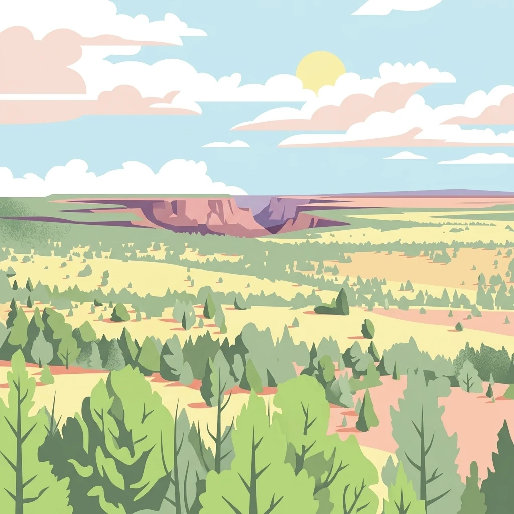
A stylized illustration of a canyon landscape with sagebrush, sparse pine trees, and flat desert plateaus under a bright sky with soft clouds.

Pole Creek Wilderness

Wildlife reserve

Park overview

Structured park overview, official facts, and landscape profile for Pole Creek Wilderness

Pole Creek Wilderness park facts, protected area profile, and essential visitor context

Review the core facts for Pole Creek Wilderness, including designation, size, terrain, visitor scale, habitats, and operating context in one park-focused overview.

About Pole Creek Wilderness

The Pole Creek Wilderness is a small but scenically remarkable wilderness area in the arid southwest corner of Idaho. Although it is modest in size compared to neighboring BLM wilderness units, it captures some of the most striking volcanic canyon scenery anywhere in the American West, with canyons carved by water into layered rhyolite and basalt that drop well over 800 feet below the plateau.

The wilderness lies at the intersection of two major geographic stories. On the surface, it is part of the Owyhee Desert, a dry, sagebrush-dominated landscape shaped by Basin and Range faulting and characterized by wide, flat plateaus separated by deep canyons. Hydrologically, however, the drainage belongs to the Snake River system, eventually reaching the Columbia River, which is why its creeks have produced notable rapids that draw whitewater paddlers.

Because the area contains no designated trails, the Pole Creek Wilderness is experienced primarily through route-finding across open plateau and through canyon descent, making it a destination for experienced backcountry users rather than casual visitors. Together with its neighbors in the Owyhee Canyonlands Wilderness Areas, it stands as one of the largest swaths of newly designated wilderness in Idaho in modern conservation history, preserving an intact example of the northern Basin and Range ecoregion.

Quick facts and research context for Pole Creek Wilderness

The Pole Creek Wilderness is a Bureau of Land Management wilderness area in Owyhee County, southwestern Idaho, established in 2009 as part of the Omnibus Public Land Management Act. It covers roughly 12,533 acres of high volcanic plateau and canyon country on the edge of the Owyhee Desert within the northern Basin and Range ecoregion.

Although small relative to neighboring Owyhee Canyonlands units, it shares the same dramatic landscape of rhyolite and basalt and is recognized for canyons over 800 feet deep and for notable whitewater through its drainage. It is managed by the federal Bureau of Land Management as a wilderness under the highest level of protection for its category.

Protection and recognition

Terrestrial protection scope and official conservation designations

Pole Creek Wilderness Protection Status and International Recognition Data

Pole Creek Wilderness maintains a recorded terrestrial protection scope within the official protected area records. Public conservation tracking details cover the established management status and formal recognition parameters without external programmatic additions.

Protection details

Protection scope
Terrestrial
Transboundary protection
No
Park context

Deeper park guide and search-rich context for Pole Creek Wilderness

Pole Creek Wilderness history, landscape, wildlife, and travel context

Explore Pole Creek Wilderness through its history, landscape character, ecosystems, wildlife, conservation priorities, cultural context, and seasonal travel timing in a structured park guide built for atlas discovery and search intent.

Why Pole Creek Wilderness stands out

The Pole Creek Wilderness is best known for its dramatic sheer-walled canyons cut into rhyolite and basalt plateaus, widely cited as among the deepest and most concentrated volcanic canyon country in the western United States. These canyons, which drop more than 800 feet, define the wilderness experience and give it a distinctly canyonland character even though the surrounding surface is shallow, sagebrush-covered plateau. Whitewater flowing through the Pole Creek drainage is the second defining feature, attracting paddlers who value the rugged, trail-free setting. Combined with its position inside the Owyhee Desert ecosystem, the wilderness is recognized as a compact showcase of remote high-desert canyonland country.
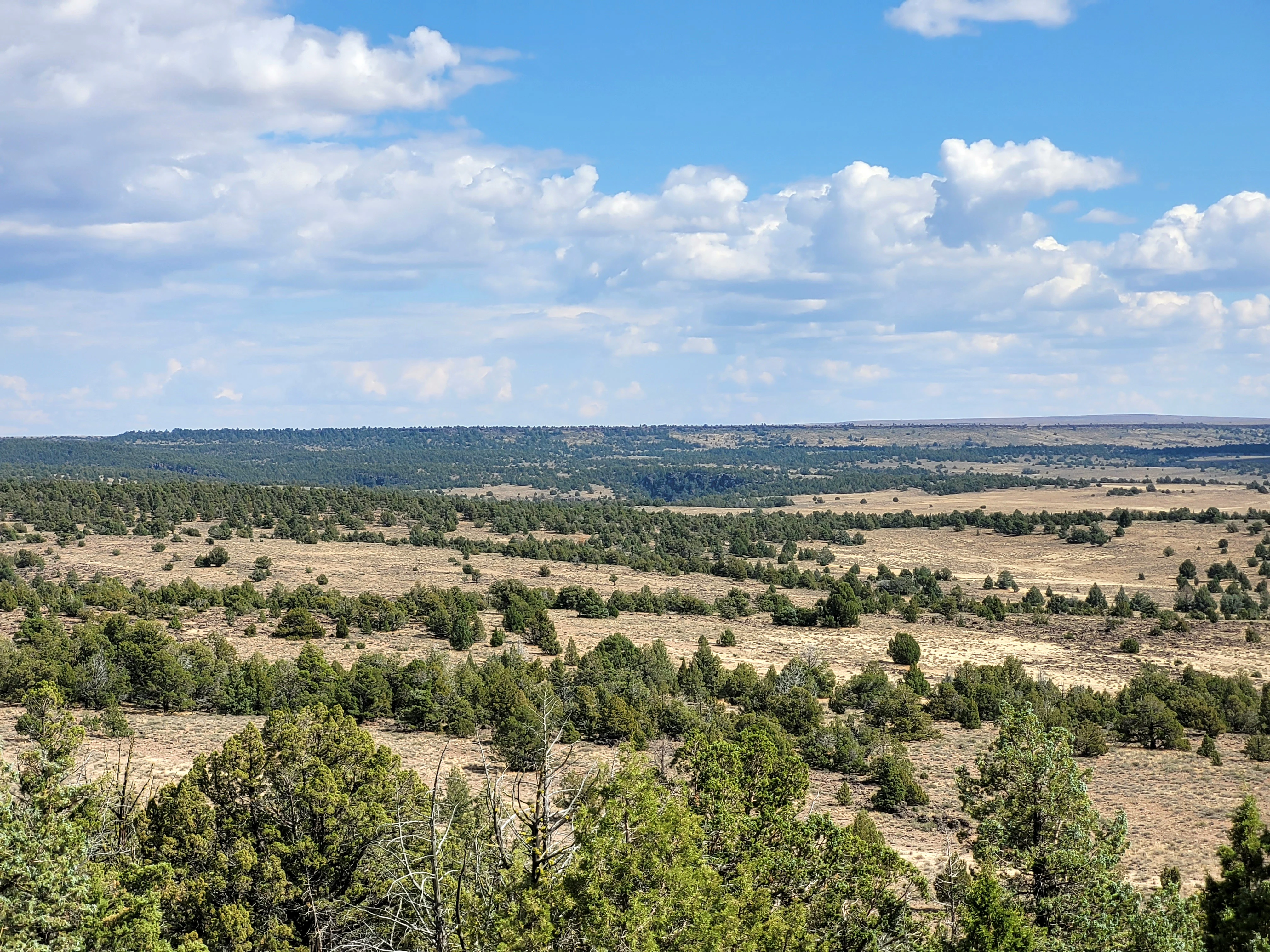
A wide, eye-level landscape shot of a dry, open plateau with scattered juniper trees and sagebrush, stretching toward a distant horizon under a blue sky with scattered clouds.
A wide view of the sagebrush plateau and scattered woodland in the Pole Creek Wilderness.

Pole Creek Wilderness history and protected-area timeline

The Pole Creek Wilderness has a short but meaningful modern administrative history. It was officially designated as wilderness in 2009 through the Omnibus Public Land Management Act, a major federal land management law that simultaneously established five additional southwestern Idaho wilderness areas in Owyhee County, together known as the Owyhee Canyonlands Wilderness Areas.

The neighboring units created in the same act, including Big Jacks Creek Wilderness, Bruneau–Jarbidge Rivers Wilderness, Little Jacks Creek Wilderness, North Fork Owyhee Wilderness, and Owyhee River Wilderness, collectively added more than 517,000 acres of congressional wilderness to Idaho. Pole Creek became the smallest of that group, but it sits at the heart of the same remote plateau landscape and was recognized as a distinct ecological and scenic unit.

Management responsibility for the wilderness falls to the Bureau of Land Management, which administers it under the strict protections that apply to designated wilderness areas, including limits on motorized use, infrastructure, and development. Its 2009 designation also represented the most significant expansion of protected wilderness in Idaho in modern times, embedding Pole Creek in a larger Owyhee Canyonlands conservation framework.

Pole Creek Wilderness landscape and geographic character

The landscape of the Pole Creek Wilderness is dominated by high, flat volcanic plateaus cut by deeply incised canyons. The underlying geology is rhyolite and basalt, layered volcanic rocks that erode into sheer vertical walls, leaving wide tablelands above and tight, dramatic gorges below. Canyons within the wilderness reach depths of more than 800 feet, producing some of the most visually concentrated sheer-walled volcanic canyon terrain in the western United States.

Above the canyon rims, the terrain opens into sagebrush steppe and grassland plateaus with sparse vegetation and long sightlines that emphasize the depth of the gorges. The contrast between the open, seemingly endless plateau surface and the sudden drop of canyon walls is one of the defining physical characteristics of the area.

The drainage system carving through these rocks sends seasonal runoff through the canyon bottoms, where narrow, rocky channels produce whitewater rapids. Because no maintained trails cross the area, the landscape appears largely undisturbed, with natural canyon morphology, native plant cover, and undeveloped wilderness character preserved across both high plateau and canyon environments.

Pole Creek Wilderness ecosystems, habitats, and plant life

Ecologically, the Pole Creek Wilderness sits within the Owyhee Desert, a high-elevation arid landscape that belongs to the northern Basin and Range ecoregion. While the surface environment is dry and treeless, the watershed is part of the Snake River drainage bound for the Columbia River, giving the area a dual identity as both desert plateau and tributary canyon system.

Vegetation across the wilderness is dominated by sagebrush communities and native bunchgrasses typical of the Great Basin and northern Basin and Range deserts. These shrublands support pollinator networks and a range of drought-adapted native plants, including species considered rare within the broader region. The canyon microclimates, sheltered from wind and holding moisture longer than rim plateaus, allow pockets of distinct plant communities to persist below the rim, alongside riparian vegetation in the creek bottoms.

The plateau environment is harsh, with thin soils, limited rainfall, and strong temperature swings, while the canyons offer comparatively milder conditions and greater habitat diversity. Together, the elevation structure and canyon topography create a layered ecological mosaic within a relatively small protected area.

Pole Creek Wilderness wildlife and species highlights

Wildlife in the Pole Creek Wilderness reflects the species mix typical of the Owyhee Desert and broader northern Basin and Range country. Large mammals such as mule deer, pronghorn, and bighorn sheep range across the wide sagebrush plateaus and along canyon walls where escape terrain provides protection from predators and harsh weather.

The wilderness is also important habitat for sagebrush-dependent birdlife, including sage grouse, which rely on the open shrublands for breeding and seasonal cover. Raptors such as hawks, eagles, and falcons hunt across the canyons and plateaus, taking advantage of thermals along cliff walls and the abundance of small mammal prey in the sagebrush understory. Songbirds, including shrubsteppe specialists, fill the rim and canyon-edge habitats during the breeding season.

The combination of large mammal migration routes, predator populations, and sagebrush obligate species gives the Pole Creek Wilderness meaningful wildlife significance, especially as part of a connected network of wilderness and undeveloped lands across the larger Owyhee Canyonlands.

Pole Creek Wilderness conservation status and protection priorities

From a conservation standpoint, the Pole Creek Wilderness protects an important example of high-desert canyonland ecosystem within the northern Basin and Range ecoregion. Its designation as wilderness under the Omnibus Public Land Management Act of 2009 placed it under the strongest level of protection short of national park status, restricting roads, motorized use, and development to preserve its undeveloped character.

The wilderness safeguards habitat for sensitive sagebrush-dependent species such as sage grouse and pronghorn, while also protecting large mammal range and raptor nesting habitat along sheer cliff faces. Its canyon systems and rhyolite and basalt outcrops shelter rare plant communities that are vulnerable to disturbance from roads, grazing infrastructure, and off-road use.

By being designated together with other Owyhee Canyonlands wilderness areas, Pole Creek also contributes to a larger landscape-scale conservation outcome, preserving ecological connectivity across more than half a million acres of new congressional wilderness in southwestern Idaho. This collective designation was one of the most significant expansions of the National Wilderness Preservation System in the state in modern times.

Pole Creek Wilderness cultural meaning and human context

The Pole Creek Wilderness sits in a remote corner of southwestern Idaho where ranching and small-scale livestock use have historically shaped the landscape outside its boundaries, while the canyons and plateaus themselves have remained largely undeveloped. The Owyhee region has long carried an identity tied to hard, dry terrain, long vistas, and self-reliant travel on foot or horseback.

The lack of designated trails reflects both the area's wilderness status and the broader cultural character of the Owyhee high desert, which has traditionally demanded route-finding skills rather than marked paths. Indigenous presence in the broader Owyhee region long predates modern settlement, with the area's rivers, springs, and canyon systems providing natural travel corridors and resources for earlier inhabitants.

Today, the primary cultural associations with Pole Creek are tied to wildland recreation and conservation, with paddlers, hunters, and backcountry enthusiasts forming the main human connections to the landscape. The wilderness stands as a quiet cultural symbol of the regional identity of southwestern Idaho.

Top sights and standout views in Pole Creek Wilderness

The standout features of the Pole Creek Wilderness center on its deep, sheer-walled volcanic canyons and its wild whitewater character. Canyons dropping more than 800 feet through rhyolite and basalt have earned the broader Owyhee region a reputation as one of the most concentrated canyonland landscapes in the western United States, and Pole Creek sits at the heart of this scenery.

Equally important is its trail-free, undeveloped character, reinforced by wilderness status that limits infrastructure and motorized access. Combined with its position within the sagebrush steppe of the Owyhee Desert, the wilderness offers a compact but powerful experience of remote northern Basin and Range country.
Monthly climate preview

Long term average temperature and precipitation rhythms across twelve recorded intervals

Pole Creek Wilderness Climate Normals and Measured Annual Weather Patterns

Representative coordinates record distinct annual shifts between subzero winter lows and warm summer maximums alongside measured monthly precipitation levels. Reviewing complete monthly climate normals illuminates detailed temperature swings and precipitation distributions across the protected landscape.
Annual mean9 °C
-3 °C23 °C
Jan-3°
Feb-1°
Mar
Apr
May12°
Jun17°
Jul23°
Aug22°
Sep16°
Oct
Nov
Dec-3°
Warmest month
July

23 °C

Coolest month
December

-2.9 °C

Wettest month
December

1.6 mm/day

Driest month
August

0.3 mm/day

Park location guide

Geography guide, regional context, and park location map for Pole Creek Wilderness

Pole Creek Wilderness park geography, regions, and map view in United States of America

Understand where Pole Creek Wilderness sits in United States of America through a broader geographic reading of the surrounding landscape, nearby location context, and its mapped position within the national park landscape.

How Pole Creek Wilderness fits into United States of America

The United States of America is a federal presidential republic and one of the world's largest countries by area and population. It consists of 50 states across a vast territory spanning multiple time zones, with its capital in Washington, D.C. and largest city in New York City. The nation has a diverse economy, influential political system, and significant cultural and military presence globally.

Wider geography shaping Pole Creek Wilderness in United States of America

The United States occupies a vast territory in North America, bordered by Canada to the north and Mexico to the south. The 48 contiguous states stretch from the Atlantic to the Pacific Ocean, while Alaska occupies the northwestern region and Hawaii is an archipelago in the Pacific. The country encompasses diverse terrain including the Rocky Mountains, Appalachian Mountains, Great Plains, and extensive river systems.

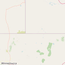
Map view of Pole Creek Wilderness

Use this park location map to pinpoint Pole Creek Wilderness in United States of America, understand its exact geographic position, and read its mapped placement within the surrounding landscape more clearly.

Pigeon | © OpenStreetMap contributors

Location context for Pole Creek Wilderness

Idaho

Visualizing the rugged volcanic plateaus, sheer basalt walls, and high desert terrain of southwestern Idaho

Pole Creek Wilderness Photos and Volcanic Canyon Scenery

Visual documentation of Pole Creek Wilderness reveals deep, sheer-walled canyons cut into rhyolite and basalt plateaus across the high desert. Examining these protected-area photographs helps observers understand the rugged terrain, sparse sagebrush steppe, and undisturbed canyon morphology of the Owyhee region.

A wide, eye-level landscape shot of a dry, open plateau with scattered juniper trees and sagebrush, stretching toward a distant horizon under a blue sky with scattered clouds.

Park atlas

Compare adjacent volcanic plateaus, desert canyons, and regional wilderness areas.

Exploring Parks Near Pole Creek Wilderness and Surrounding Protected Landscapes

Browsing other protected areas near Pole Creek Wilderness reveals connected volcanic canyon terrain and remote northern Basin and Range ecosystems. Extending the geographic comparison highlights broader regional wilderness networks and similar sagebrush plateau landscapes.
A watercolor painting showing a wide view of a desert canyon landscape with layered plateaus and earthy tones.
Wildlife reserveIdaho
About 29 km away#1 closest

Northeast

Little Jacks Creek Wilderness: Mapping Idaho Canyon Country and Protected Landscapes

Basalt plateau and stream-cut gorge geography

Little Jacks Creek Wilderness protects a significant high-desert landscape in Idaho characterized by deep canyons and sagebrush-covered plateaus. As part of the Owyhee Canyonlands, this wildlife reserve highlights the geologic interplay of dark basalt and red rhyolite cliffs, providing a stable, undisturbed terrain for geographic and ecological study.

Area
206.1 km²
Established
2009
IUCN
Ib
Relief
Upland
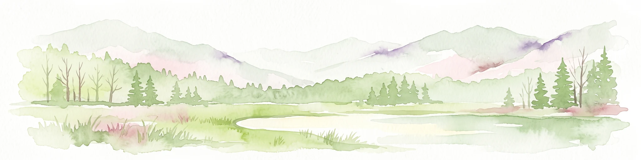
A watercolor painting showing soft green hills, distant pink-hued mountains, and a pale blue lake in a serene, stylized landscape.
Protected landscapeNevada
About 73 km away#2 closest

South

Humboldt, Toiyabe National Forest: Protected Landscape and Regional Mountain Geography

A vast network of Nevada mountain ranges and alpine wilderness

Humboldt, Toiyabe National Forest serves as a defining public land entity across Nevada and eastern California. As the largest national forest in the contiguous United States, it preserves a striking collection of isolated mountain ranges, including the Ruby Mountains and the rugged Jarbidge wilderness, within a broader basin-and-range landscape. Examine the boundaries and terrain that characterize this complex, high-desert ecosystem.

Area
25,454 km²
Established
1908
Relief
Mountain
Access
Easy access
Wildlife reserveNevada
About 116 km away#3 closest

Southeast

Jarbidge Wilderness: Protected Mountain Terrain and Geographic Map Context in Nevada

High-altitude wilderness geography and canyon landscapes

Located in the remote Jarbidge Mountains, this wilderness area transitions from arid sagebrush steppe to dense subalpine forests and dramatic river canyons. The region preserves headwater streams and over a dozen significant summits, offering a complex look at the natural topography of the northern Great Basin in Nevada.

Area
457.97 km²
Established
1964
IUCN
Ib
Relief
Mountain
Watercolor painting of a calm lake surrounded by forested shores and distant mountains, depicted in soft pastel tones.
Protected landscapeIdaho
About 145 km away#4 closest

Northeast

Sawtooth National Forest: Geographic Overview and Protected Mountain Boundaries

Central Idaho mountain systems and wilderness corridors

Spanning over two million acres, Sawtooth National Forest defines the heart of the Rocky Mountains in Idaho. This protected landscape contains a complex network of glacial basins, alpine lakes, and varied ecosystems ranging from arid sagebrush foothills to high-altitude peaks. Explore the internal boundaries, drainage systems, and structural geography of this significant wilderness area.

Area
8,540.52 km²
Established
1905
Visitors
1.2M annual
Relief
Mountain
Watercolor painting of a tranquil lake surrounded by green forests and soft mountain ridgelines against a white background.
Protected landscapeIdaho
About 181 km away#5 closest

Northeast

Sawtooth National Recreation Area: Mapping the Protected Landscape of Central Idaho

A vast mountain wilderness of granite peaks and glacier-carved lakes.

The Sawtooth National Recreation Area encompasses a quintessential northern Rocky Mountain terrain defined by the dramatic Sawtooth, White Cloud, and Boulder ranges. This protected landscape preserves over 700,000 acres of high-elevation wilderness, ranging from jagged granite arêtes to the broad, U-shaped Sawtooth Valley, serving as a critical hydrologic anchor for the rivers of the American West.

Area
2,957.7 km²
Established
1972
Relief
Mountain
Climate
Alpine
Protected landscapeIdaho
About 211 km away#6 closest

North

Payette National Forest: Geographic Overview of Idaho's Rugged Mountain Wilderness

Protected granite landscapes and glacial basin geography

Encompassing a vast portion of central Idaho, Payette National Forest represents a significant protected wilderness corridor. The forest geography transitions from granite-based alpine peaks and deep river gorges to dense coniferous slopes, providing essential habitat and extensive trail connectivity throughout the Northern Rockies.

Area
9,419.55 km²
Established
1944
Relief
Mountain
Access
Access unknown
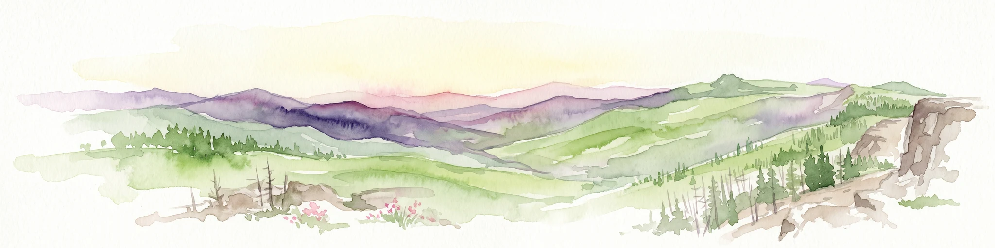
A horizontal watercolor painting showing a panoramic view of layered green and purple mountains under a pale sky, with coniferous trees in the foreground.
Protected landscapeOregon
About 221 km away#7 closest

Northwest

Malheur National Forest: Exploring Oregon's Vast Protected Mountain and Desert Landscape

A geographic study of the Blue Mountains and high desert terrain

Spanning over 1.4 million acres, Malheur National Forest represents a complex protected landscape in eastern Oregon. Its geography is defined by a central spine of the Strawberry Mountains, creating a transition zone between arid high desert ecosystems and dense coniferous forests. Known for large wilderness areas and extensive old growth stands, this forest serves as a vital point for understanding the interplay between topographic elevation and regional climate in the Pacific Northwest.

Area
5,929.81 km²
Established
1908
Visitors
242K annual
Relief
Mountain
Soft watercolor illustration of a rolling mountain landscape with a forested foreground and faded, distant peaks.
Protected landscapeIdaho
About 222 km away#8 closest

Northeast

Salmon, Challis National Forest: Geography and Protected Land Map in Central Idaho

Extensive alpine ridges and wild river corridors

Spanning over 4.2 million acres, Salmon, Challis National Forest is a foundational protected landscape in Idaho. This area includes the highest peaks in the state, such as Borah Peak, and holds the majority of the Frank Church, River of No Return Wilderness. Utilize this atlas resource to examine the intricate mountain topography, expansive river systems, and the contiguous wild corridors that define this significant portion of the northern Rockies.

Area
17,142.2 km²
Established
1908
Relief
Mountain
Climate
Temperate

Common questions about visiting, size, designation, and location context for Pole Creek Wilderness

Pole Creek Wilderness FAQs for park facts, access, geography, and protected area context

Find quick answers about Pole Creek Wilderness, including protected-area facts, park geography, trail and visitor context, and how the park fits into its surrounding country and regional landscape.
MoriAtlas Explorer

Continue Your Protected Areas Search Across the Global Atlas

Deepen your exploration by continuing the structured search for national parks and protected areas worldwide. Utilize the comprehensive filtering capabilities to compare different conservation landscapes and refine your understanding of global park geography. Discover more about the distribution and characteristics of protected natural areas.

Global natural geography