
Mori Atlas logo
Nature reservePrameniště Teplé

Mapping the ecological mosaic of wetlands, ponds, and woodland at the Teplá River source.

Prameniště Teplé Nature Reserve: A Protected Springhead Landscape in Karlovarský kraj

(Přírodní rezervace Prameniště Teplé)

Prameniště Teplé represents a vital protected area within the Karlovarský kraj region, serving as the headwaters for the Teplá River. This nature reserve features a compact, ecologically rich terrain defined by spring-fed ponds, saturated meadows, and transitions between spruce and alder woodland. Through its protected boundaries, the area sustains rare wetland flora and specialized invertebrate populations, offering a focused study of Bohemian springhead habitats.

wetlandspringheadwet meadowsfens and miresspruce forestalder woodland
Vector illustration featuring a winding river flowing through a valley toward a tall waterfall, framed by stylized pine and birch trees with mountains in the background under a soft sun.

Prameniště Teplé

Nature reserve

Park overview

Structured park overview, official facts, and landscape profile for Prameniště Teplé

Prameniště Teplé park facts, protected area profile, and essential visitor context

Review the core facts for Prameniště Teplé, including designation, size, terrain, visitor scale, habitats, and operating context in one park-focused overview.

About Prameniště Teplé

Prameniště Teplé lies in the rolling terrain of western Bohemia, within the Karlovarský kraj close to the renowned spa town of Mariánské Lázně. Although it sits not far from urban surroundings, the reserve preserves an unexpectedly quiet and moisture-rich landscape that contrasts with the surrounding forested slopes of the Slavkovský les region. Its location, only a few kilometers from the center of Mariánské Lázně, gives it a dual character: a natural enclave close to a well-known cultural landscape.

The protected area is defined by the shallow source basin of the Teplá River. Within this basin, the elevation is modest, and the terrain forms part of the upper catchment where the river gathers from multiple spring arms. This small geographical context is central to the reserve's identity, because it determines both the hydrology and the ecological communities that thrive here. Wet, ground-water-influenced substrates, combined with a transitional position between open and wooded terrain, create a mosaic of habitats that is unusual in such a compact area.

These conditions produce a layered landscape: open water in the ponds and channels, herbaceous wet meadows in the better-drained transitions, mires and boggy patches where saturation is persistent, and park-like wooded fringes that mark the gradual movement from wetland to forest. The reserve is managed under the wider Slavkovský les Protected Landscape Area framework, which gives it both administrative backing and integration with regional conservation priorities in the westernmost Czech Republic.

For visitors with a sensibility for wetland ecology, Prameniště Teplé offers an instructive example of how springhead landscapes function: how water emerges, spreads, and conditions the surrounding plant communities. Although the reserve is relatively small, its value lies in the concentration of habitat diversity and the presence of specialized, sometimes rare, plant and animal species tied closely to these conditions.

Quick facts and research context for Prameniště Teplé

Prameniště Teplé is a nature reserve in the Karlovarský kraj of the Czech Republic, located in the Cheb district near the village of Zádub-Závišín and roughly three kilometers from the center of Mariánské Lázně. It was declared in 1993 and covers a relatively small area at an elevation of around 750 meters above sea level.

The reserve protects the spring basin of the Teplá River, including a shallow source depression with small ponds, waterlogged meadows, marshes, and park-like stands of spruce and alder. Management falls under AOPK ČR through the Slavkovský les Protected Landscape Area, and the site is classified as an IUCN Category IV habitat and species management area.

Protection and recognition

Examine the verified conservation framework and terrestrial designation data for Prameniště Teplé.

Prameniště Teplé Protection Status and Documented Territorial Scope

Prameniště Teplé holds a documented terrestrial protection scope within the global conservation framework. Detailed records track the official designation history, management parameters, and verified international recognition sources associated with the landscape.

Protection details

Protection scope
Terrestrial
Transboundary protection
No
Park context

Deeper park guide and search-rich context for Prameniště Teplé

Prameniště Teplé history, landscape, wildlife, and travel context

Explore Prameniště Teplé through its history, landscape character, ecosystems, wildlife, conservation priorities, cultural context, and seasonal travel timing in a structured park guide built for atlas discovery and search intent.

Why Prameniště Teplé stands out

Prameniště Teplé is best known for its spring-fed wetland mosaic, which combines small ponds, wet meadows, mires, and park-like woodland at one of the source arms of the Teplá River. The reserve has gained recognition for harboring rare wetland plants together with specialized invertebrates and a small but ecologically meaningful assemblage of forest and wetland birds. Its combination of botanical richness in calcareous-influenced wet habitats and insect fauna of conservation interest makes it a representative site for the springhead wetlands of western Bohemia. Rather than offering large-scale scenic drama, the reserve's identity is built around the interplay of spring waters, fen-like meadows, and the wooded edges that frame them.
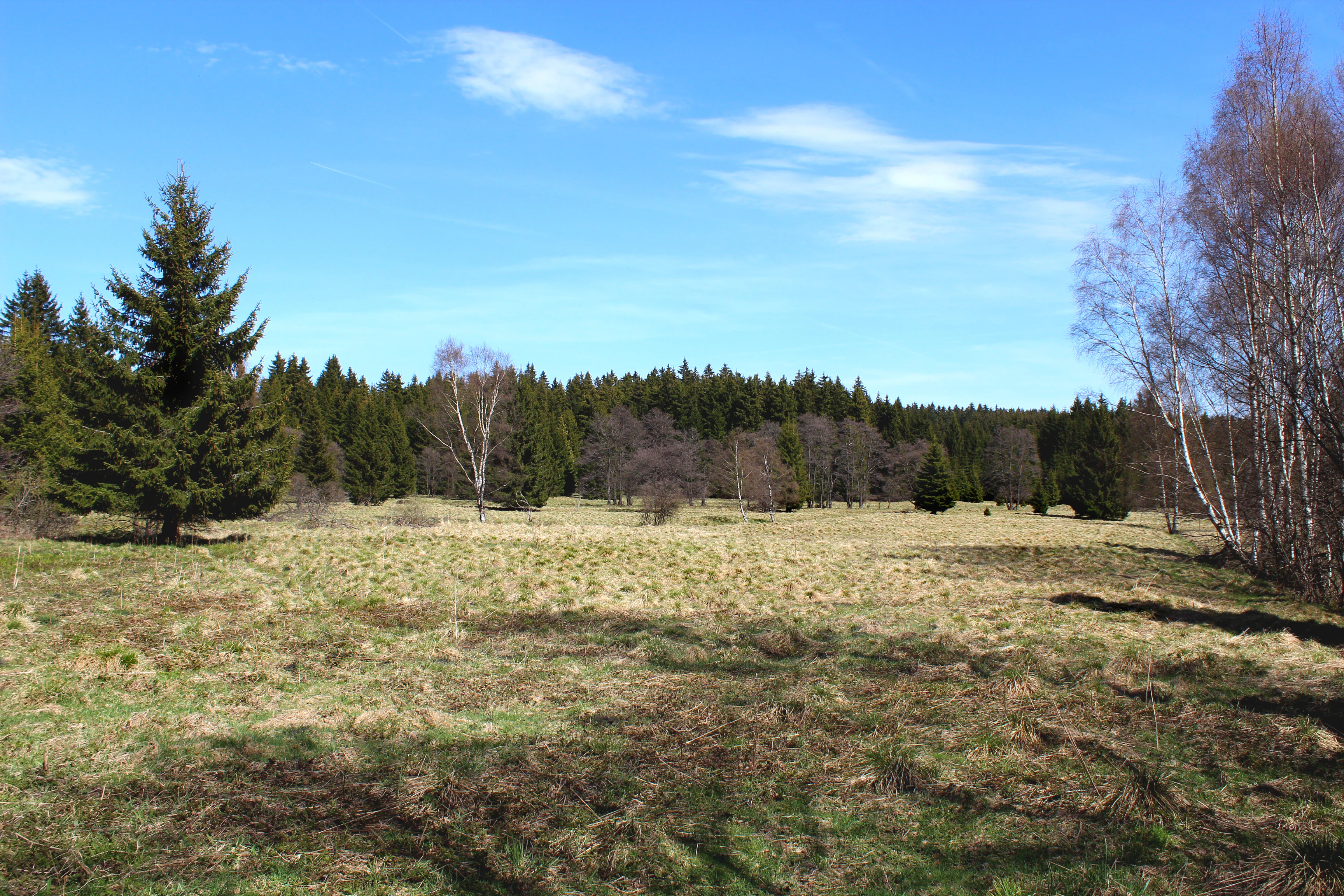
A wide view of a sunlit, grassy meadow bordered by evergreen and deciduous trees under a clear blue sky.
The central basin of the Prameniště Teplé nature reserve, characterized by meadow and forest landscapes.

Prameniště Teplé history and protected-area timeline

Prameniště Teplé was officially established as a nature reserve on 24 March 1993. Its designation came as part of a broader Czech effort, during the early 1990s, to formalize protection for ecologically sensitive sites that had often been informally appreciated for their natural value but lacked dedicated statutory protection.

The reserve was created specifically to protect the spring basin of the Teplá River, recognizing that the headwater zone, with its mosaic of ponds, wet meadows, and damp woodland, was both ecologically distinctive and vulnerable. Its management was entrusted to AOPK ČR, the Agency for Nature Conservation and Landscape Protection of the Czech Republic, which administers the site through the administrative structure of the Slavkovský les Protected Landscape Area.

Since its establishment, the reserve has remained a focused, narrowly defined protected area rather than evolving in scope or boundaries. Its institutional history is therefore one of steady, continuing conservation of a relatively small but ecologically meaningful site within the framework of a larger protected landscape.

Prameniště Teplé landscape and geographic character

The landscape of Prameniště Teplé is shaped almost entirely by water emerging from underground sources. The reserve occupies a shallow basin where the Teplá River begins, with terrain that is gently contoured rather than steep. Its elevation is at the lower foothills level, giving visitors an impression of an enclosed, calm landscape rather than the dramatic relief typical of higher Czech protected areas.

A defining feature is the trio of small ponds clustered within the central part of the reserve. These ponds act as visible focal points in the landscape, collecting water from the springs and feeding the beginning of the Teplá River. Around them, the terrain slopes so slightly that water spreads laterally, producing visible boggy patches and a network of wet channels. Birch trees grow near some of these channels, adding vertical structure to an otherwise low, open setting.

Encircling the wet core of the reserve are park-like stands of spruce and alder. The spruce forests mark the firmer ground at the edges of the basin, while alder trees occupy the wetter transitions between meadow and forest. The result is a soft-edged landscape mosaic in which water is visually and ecologically the dominant feature, with the surrounding woodland acting as a contrast and a buffer. Near the boundaries of the reserve, spruce-dominated forest asserts itself more strongly, completing the transition from open wetland to upland forest.
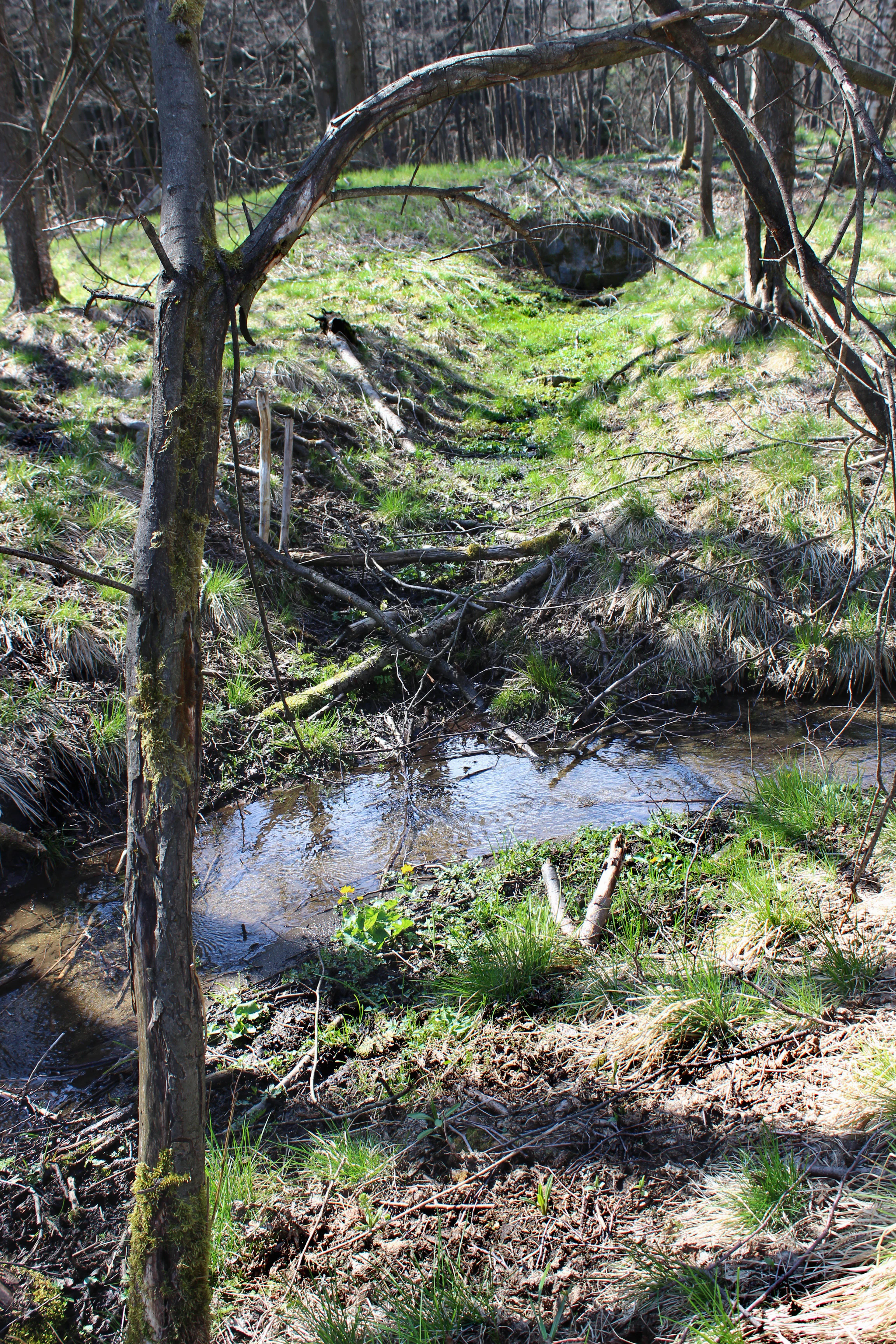
A small, narrow stream flowing through a shallow, grassy woodland area with scattered fallen branches and trees.
The headwaters of the Teplá River within the Prameniště Teplé nature reserve.

Prameniště Teplé ecosystems, habitats, and plant life

Ecologically, Prameniště Teplé represents a textbook example of a springhead wetland complex in central Europe. The reserve's habitats are organized along a moisture gradient, beginning with the open water of its small ponds and the immediate saturated margins around them, moving outward into herbaceous wet meadows and bog-like communities, and finally merging into the damp forest edges that frame the basin.

The plant communities within the reserve are notably species-rich for such a compact area. Wet meadows include characteristic herbs such as globe-flower (Trollius altissimus) and bog bean (Menyanthes trifoliata), alongside sedges and cottongrass species typical of long-saturated ground. Orchids also feature, with marsh helleborine (Epipactis palustris) and the spotted orchid (Dactylorhiza fuchsii) adding seasonal interest. In the moister, more acidic transitions, cranberry (Oxycoccus palustris) and several specialized sedges appear, indicating the presence of boggy microhabitats.

The wooded component of the reserve is no less characteristic. The combination of spruce, representing the broader regional forest context, with alder, characteristic of wet woodland margins, produces a structurally varied forest edge. Daphne mezereum appears in the transitions, signaling a woodland understory shaped by moisture and traditional management patterns. Together, the flora reflects an intact sequence of habitats developed around persistent groundwater discharge rather than disturbance-driven processes.
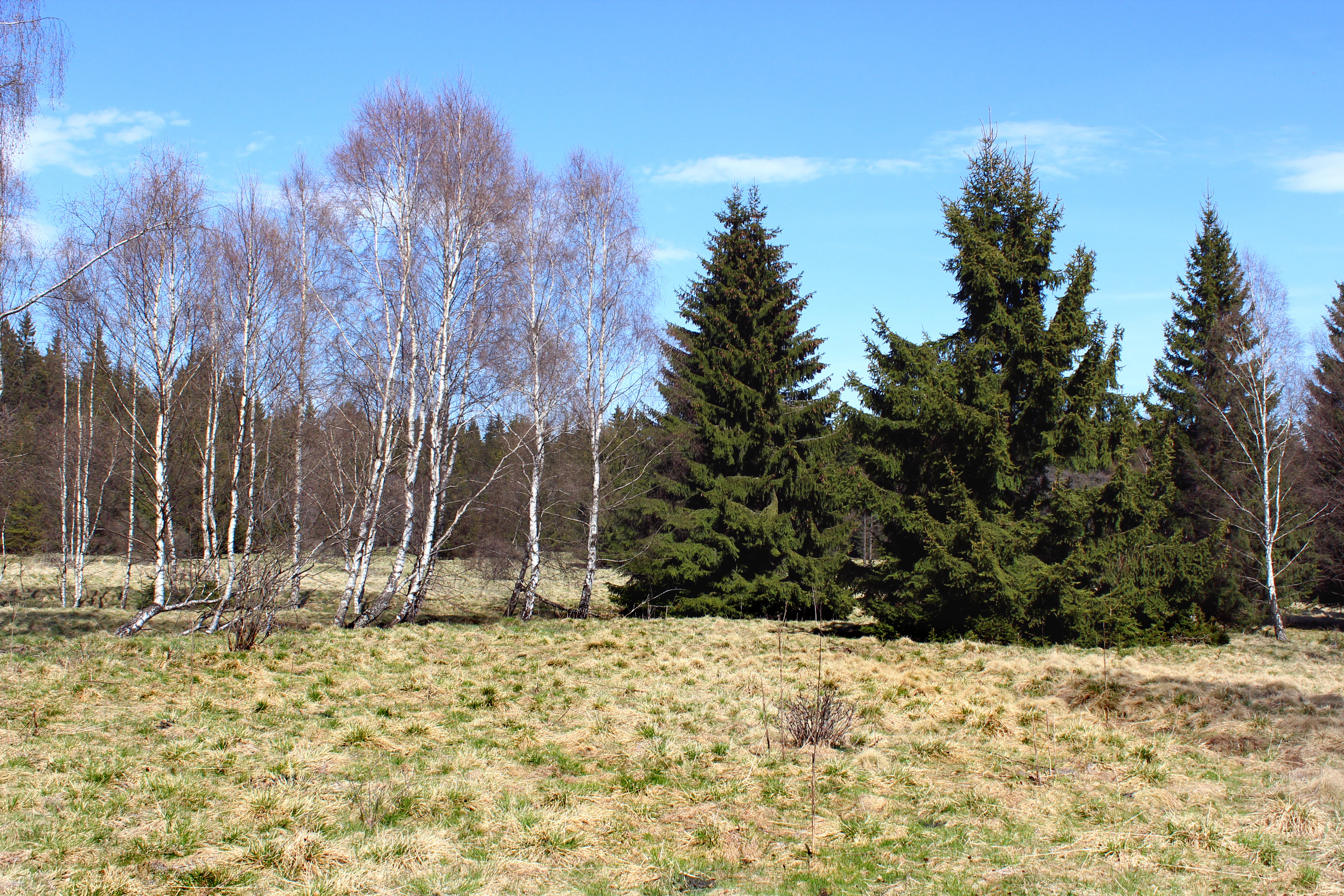
A meadow landscape with a group of bare birch trees on the left and dense green spruce trees on the right under a clear blue sky.
A mix of bare birch trees and coniferous evergreens in the Prameniště Teplé nature reserve.

Prameniště Teplé wildlife and species highlights

The wildlife interest of Prameniště Teplé is concentrated in invertebrates and a small but notable community of birds, both of which are closely tied to the mosaic of wet meadows, mires, and damp woodlands.

Among butterflies, the reserve supports species associated with damp meadows and their host plants, including the scarce fritillary (Euphydryas aurinia) and a related species in the Melitaea group. These butterflies depend on undisturbed wet meadow habitats, making them both ecologically interesting and useful indicators of habitat quality.

The beetle fauna of the reserve is unusually rich and has attracted conservation attention. Multiple beetle families are represented, including leaf beetles (Chrysomelidae), seed beetles (Bruchidae), and weevils (Curculionidae), several of which are listed on the national Red List as critically endangered or endangered. These species are particularly associated with wetland margins, mosses, and the specialized plant communities of the reserve.

Birdlife, while not the primary focus of the site, contributes meaningfully to its character. Species such as the black stork (Ciconia nigra) and the boreal owl (Aegolius funereus) have been recorded, along with the great grey shrike (Lanius excubitor), indicating a mixture of wetland-associated and forest-inhabiting species. Their presence underscores the value of the reserve's combination of open wet habitats and surrounding mature woodland.
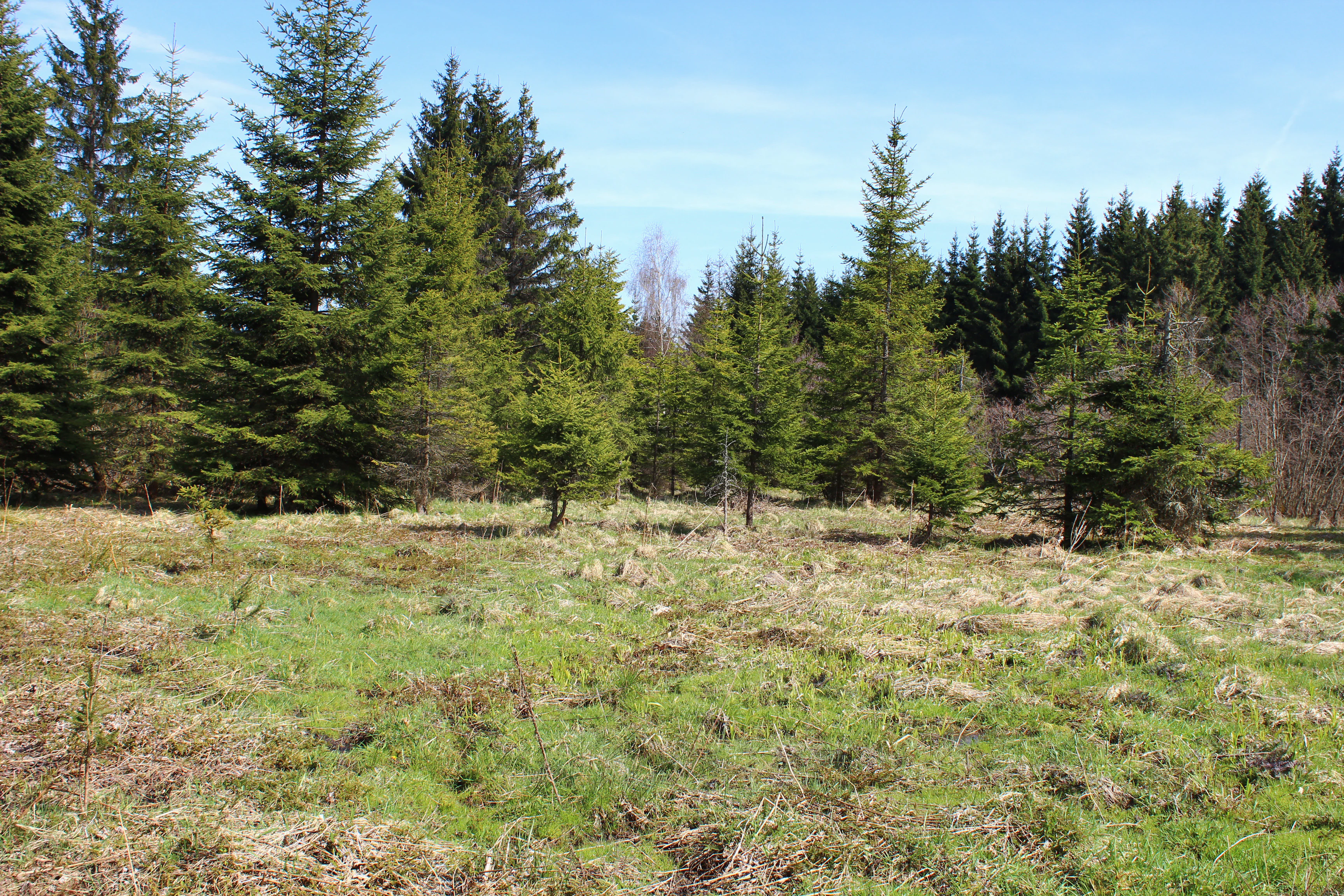
A meadow landscape with patches of green and dry grass, scattered small spruce trees, and a dense forest line in the background under a blue sky.
A grassy meadow bordered by coniferous trees at the Prameniště Teplé nature reserve.

Prameniště Teplé conservation status and protection priorities

The conservation significance of Prameniště Teplé rests on its role in protecting an intact springhead wetland system at the source of the Teplá River. The reserve preserves not only individual species but entire habitat complexes that have become increasingly rare in central Europe as wet meadows and spring-fed mires have been lost to drainage, agricultural intensification, and forestry conversion.

By maintaining the hydrological integrity of the spring zone, the reserve protects the ecological processes that sustain its plant and animal communities. This includes the seasonal saturation patterns that support fen vegetation, the groundwater conditions that sustain boggy patches, and the structural continuity between open wetland and wet woodland. These processes are difficult or impossible to restore once disrupted, which gives the reserve's proactive protection long-term value.

Prameniště Teplé is also important within the wider Slavkovský les Protected Landscape Area, contributing to a network of protected sites that together safeguard the region's characteristic landscapes. Its small size is offset by the high concentration of ecological value per hectare, particularly for invertebrates and specialized wetland plants. In this sense, the reserve serves as both a stand-alone conservation site and a representative component of regional biodiversity protection in western Bohemia.

Prameniště Teplé cultural meaning and human context

The cultural context of Prameniště Teplé is shaped by its proximity to Mariánské Lázně, one of the Czech Republic's most prominent historic spa towns. The relationship between Mariánské Lázně and the surrounding landscape has long been defined by the perception of natural healing resources, with the area's mineral springs and associated water systems forming part of the town's identity. The Teplá River and its source area contribute, if less visibly, to this broader hydrological heritage of the region.

Traditional land use in the wider area has historically involved meadow management, light grazing, and the careful handling of spring zones. These practices influenced the composition of the wet meadows and the open character of the basin, while the wooded edges reflect the long-standing importance of small-scale forestry in Bohemian rural landscapes. The reserve's present-day character thus carries traces of this layered human relationship with the land, in which natural value and traditional rural use coexisted.

While the reserve itself is not a site of major monuments or historic events, its setting within a region long associated with spa culture, gentle pastoral landscapes, and forested uplands lends it a quiet regional significance. It represents one of the many small natural sites that collectively define the environmental identity of western Bohemia.

Top sights and standout views in Prameniště Teplé

Prameniště Teplé's strongest qualities are its concentration of spring-fed wetland habitats within a compact area and the unusual ecological diversity that this produces. The reserve is notable for its combination of ponds, wet meadows, boggy patches, and park-like spruce-alder woodland edges, all arranged around the original source of the Teplá River.

Equally distinctive is the richness of its invertebrate fauna, particularly among beetles, where multiple species of conservation concern occur in a very limited area. This makes the reserve valuable not only as a botanical site but also as a stronghold for specialized wetland insects, complementing a flora that includes orchids, globeflowers, and a variety of sedges typical of long-saturated habitats.

Best time to visit Prameniště Teplé

The reserve's character changes with the seasons in ways that reflect its wetland identity. Late spring and early summer are particularly rewarding for botanical interest, as wet meadows come into full bloom and orchids such as marsh helleborine and spotted orchid become visible. This is also a productive period for observing butterflies, whose adults depend on the flowering of meadow plants.

Summer brings the densest vegetation and the most intense insect activity, with butterflies, beetles, and other invertebrates at their most conspicuous. Autumn tends to lower visitor pressure and offers calmer conditions for appreciating the quiet, moisture-rich atmosphere of the reserve, while late autumn and winter reveal the structural landscape of ponds, channels, and bare deciduous trees against the surrounding evergreens. The reserve is small and ecologically sensitive, so visits are best undertaken respectfully and during daylight hours when visibility and wildlife observation are easiest.


Monthly climate preview

Long-term monthly temperature and precipitation data patterns for Prameniště Teplé

Prameniště Teplé Climate Normals and Representative Temperature Rhythms

Representative coordinates record measured multi-year temperature shifts alongside consistent monthly precipitation rates across the landscape. Examining the complete twelve-month record clarifies long-term climate normals for Prameniště Teplé in greater detail.
Annual mean7 °C
-3 °C18 °C
Jan-3°
Feb-2°
Mar
Apr
May12°
Jun16°
Jul18°
Aug18°
Sep13°
Oct
Nov
Dec-2°
Warmest month
July

17.8 °C

Coolest month
January

-3.1 °C

Wettest month
July

2.7 mm/day

Driest month
April

1.4 mm/day

Park location guide

Geography guide, regional context, and park location map for Prameniště Teplé

Prameniště Teplé park geography, regions, and map view in Czechia

Understand where Prameniště Teplé sits in Czechia through a broader geographic reading of the surrounding landscape, nearby location context, and its mapped position within the national park landscape.

How Prameniště Teplé fits into Czechia

Czech Republic is a landlocked Central European country with a population of approximately 10.9 million people. The nation was established as an independent state on January 1, 1993, following the dissolution of Czechoslovakia. Its capital and largest city is Prague, with other major urban centers including Brno, Ostrava, Plzeň, and Liberec.

Wider geography shaping Prameniště Teplé in Czechia

The Czech Republic is a landlocked country in Central Europe. It is bordered by Germany to the west, Austria to the south, Poland to the northeast, and Slovakia to the southeast. The landscape is predominantly hilly, with the territory covering 78,871 square kilometers.

Map view of Prameniště Teplé

Use this park location map to pinpoint Prameniště Teplé in Czechia, understand its exact geographic position, and read its mapped placement within the surrounding landscape more clearly.

Pigeon | © OpenStreetMap contributors

Location context for Prameniště Teplé

Karlovarský kraj

Explore photographic records of spring-fed pools, wet meadows, and forest woodland edges.

Prameniště Teplé Photos and Scenery: Visualizing Wetland Landscapes

Visual documentation captures the springhead terrain, shallow basins, and saturated meadows that define the protected landscape. Examining these field photographs reveals the wetland mosaic and spruce-alder habitats central to the Teplá River source.

A wide view of a sunlit, grassy meadow bordered by evergreen and deciduous trees under a clear blue sky.

A small, calm pond reflecting the surrounding leafless trees and blue sky, with a forest edge in the background.

A small, narrow stream flowing through a shallow, grassy woodland area with scattered fallen branches and trees.

A meadow landscape with a group of bare birch trees on the left and dense green spruce trees on the right under a clear blue sky.

A meadow landscape with patches of green and dry grass, scattered small spruce trees, and a dense forest line in the background under a blue sky.

Park atlas

Compare regional wetland reserves and connected conservation landscapes nearby

Explore Protected Areas and Parks Near Prameniště Teplé in Western Bohemia

Browse adjacent protected areas and regional nature reserves surrounding the springhead basin of Prameniště Teplé. Extending the geographic review reveals connected wetland habitats and broader conservation zones across the western Czech landscape.
Natural monumentKarlovarský kraj
About 5 km away#1 closest

South

Milhostovské mofety: Geological Atlas of Natural Monuments in Karlovarský kraj

Cold mofette gas vents and wetland floodplain habitat.

Milhostovské mofety is a specialized natural monument protecting a cluster of carbon dioxide mofettes in the Cheb District. This site offers insight into regional post-volcanic phenomena, featuring shallow craters, alder carr landscapes, and amphibolite bedrock structures that illustrate the unique geological character of the Slavkov Forest territory.

Area
0.002 km²
Established
1993
IUCN
III
Relief
Lowland
Natural monumentKarlovy Vary District
About 11 km away#2 closest

Northeast

Velikonoční rybník Natural Monument: Protected Wetland and Amphibian Habitat Geography

A core conservation site within the Slavkov Forest landscape

Velikonoční rybník stands as a noteworthy natural monument in the Karlovy Vary District, protecting essential wetland ecosystems. This small yet vital reservoir provides a specialized habitat for endangered amphibians and dragonflies, serving as a landmark of regional conservation efforts and ecological mapping within the Slavkov Forest region.

Area
0.018 km²
Established
2014
IUCN
IV
Relief
Upland
A stylized vector-style illustration showing a man and a child standing on the grassy bank of a pond, watching a swimmer in the middle of the water, with a waterfall and forest in the background.
Natural monumentKarlovarský kraj
About 14 km away#3 closest

North

Na Vážkách Natural Monument: Mapping Protected Forest Landscapes in Karlovarský kraj

A rare oligotrophic pond and wetland habitat in Western Bohemia.

Na Vážkách provides a unique example of small-scale landscape protection, featuring clear, sandy-bottomed waters within the broader forest mosaic of Karlovarský kraj. Designated in 2017, this natural monument is recognized for its significant dragonfly populations and its role in preserving historical aquatic water systems.

Area
0.026 km²
Established
2017
IUCN
III
Relief
Upland
Natural monumentKarlovarský kraj
About 24 km away#4 closest

Northeast

Viklan Natural Monument: A Geological Landmark in the Karlovarský kraj Landscape

Exploring the historic balancing granite boulder and surrounding pastoral terrain

Viklan functions as a compact yet iconic natural monument, shielding a prominent 3.5 meter granite boulder from modern disturbance. Set amidst the rolling, short-grass pastures of the Karlovarský kraj, the site serves as a vital point for geological mapping and historical study, documenting both natural weathering processes and long-standing regional folklore tied to this unusual stone formation.

Established
1979
IUCN
III
Relief
Upland
Access
Easy access
Protected landscapeBavaria
About 28 km away#5 closest

Southwest

Naturpark Nördlicher Oberpfälzer Wald: Protected Landscape and Regional Geography Map

Forested upland terrain and volcanic geology in Bavaria

Explore the structured geography of Naturpark Nördlicher Oberpfälzer Wald, a massive protected region in Bavaria. This detailed profile highlights the park's characteristic ridge and valley terrain, volcanic basalt landmarks, and its role as a vital ecological belt along the international border.

Area
1,380 km²
Water
Minor water
Nature reserveKarlovarský kraj
About 36 km away#6 closest

West

Pomezní rybník Nature Reserve: Geographic Overview and Protected Wetland Boundaries

Borderland wetland ecology in the Karlovarský kraj region

Pomezní rybník represents a small but significant nature reserve known for its unique location where the state boundary bisects the central pond. The reserve provides a concentrated habitat for wetland species, featuring a rare botanical assemblage and transitional terrain between the lowland basin and highland slopes of the western Czech Republic.

Area
0.017 km²
Established
1990
Relief
Lowland
Scope
Terrestrial
Watercolor painting of columnar basalt formations surrounded by a pine forest and soft, layered hills in the background.
Natural monumentKarlovarský kraj
About 37 km away#7 closest

North

Rotava Natural Monument: Geological Landforms and Basalt Outcrops in the Karlovarský kraj Region

Protected volcanic terrain and rare botanical habitats in the Czech Republic

Rotava Natural Monument showcases remarkable vertical basalt columns formed by ancient volcanic activity. Located in the Karlovarský kraj region, this site provides a dense, concentrated look at columnar jointing and the specific meadow flora that thrives in its mineral-rich, acidic soil conditions, serving as a landmark for regional geological study.

Area
0.003 km²
Established
1978
IUCN
IV
Relief
Mountain
A horizontal watercolor illustration depicting a soft, green, mountain landscape with hills, conifers, and a waterlogged meadow.
Natural monumentKarlovy Vary Region
About 41 km away#8 closest

North

Rudenská luční prameniště Natural Monument: Protected Mountain Wetland Atlas

Karlovy Vary Region Ore Mountains landscape mapping

Rudenská luční prameniště is a protected mountain wetland in the Ore Mountains, defined by a distinct mosaic of spring fens, peat deposits, and mountain meadows. Its geographic layout, spanning twenty three hectares across sloping terrain, creates a vital drainage system for the local landscape. By examining this protected site, you can better understand the unique hydrological and botanical features that distinguish these rare mountain mire complexes from the surrounding highland forests.

Area
0.232 km²
Established
2020
IUCN
IV
Relief
Mountain

Common questions about visiting, size, designation, and location context for Prameniště Teplé

Prameniště Teplé FAQs for park facts, access, geography, and protected area context

Find quick answers about Prameniště Teplé, including protected-area facts, park geography, trail and visitor context, and how the park fits into its surrounding country and regional landscape.
MoriAtlas Explorer

Continue Your Protected Areas Search Across the Global Atlas

Deepen your exploration by continuing the structured search for national parks and protected areas worldwide. Utilize the comprehensive filtering capabilities to compare different conservation landscapes and refine your understanding of global park geography. Discover more about the distribution and characteristics of protected natural areas.

Global natural geography